Residential district west of the Ville Haute
Belair, meadowland that ended up named after a villa
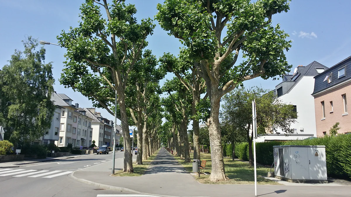
Belair is a residential district in the west of Luxembourg City, covering 171.8 hectares with 12,815 residents on 31-12-2023. It was meadows until the 1950s and took its official name in 1956 from a house built in 1923. It has St Pius X church, whose 69 m tower leans slightly, and the Josy Barthel stadium, where the Gëlle Fra was found.
Belair has no guidebook sight, but it has stories. I'd walk through it on the way to Merl park, stopping at the Maison Bel Air and St Pius X, and tell whoever's with me about the Gëlle Fra hidden under the stands.

Before you go
What I would keep in mind
-
01 Most beautiful
The tower that leans
The 69 m tower of St Pius X, opened in 1957, leans a touch. To avoid adding strain, the big bell was hung lower, and the golden sphere on top holds the wishes residents wrote down before the opening.
-
02 My tip
The house that named the district
At 97 Avenue Gaston Diderich, the architect Mathias Martin's house bore the words «Maison Bel Air 1923». The name passed to the street and then the whole area. Two statues, Mercury and Venus, stand in its front garden.
-
03 Most beautiful
Where the Gëlle Fra resurfaced
Under the stands of the old national stadium, the Josy Barthel, the golden statue from the Monument of Remembrance was found in 1981, hidden since the war. It's back on Place de la Constitution.
Gëlle Fra
Belair is a place to live rather than to visit, and the city sums it up as residential, close to Merl park and full of playgrounds. But walk through it and there are three stories I’d tell anyone, a house that named the district, a tower that leans and a statue hidden under a grandstand.
From buttercup meadows to a French-sounding suburb
Before the building boom of the 1950s, only cows grazed here, says the tourist office. The old name, Duvenvelt or Daubenfeldt, came from a buttercup-like plant of meadow and marsh, and survives in the Dauwelswee, the street from Boulevard Grande-Duchesse Charlotte to Merl cemetery. In 1887 the area was called Neu-Merl and had 87 inhabitants.
Today’s name comes from the architect Mathias Martin’s house at 97 Avenue Gaston Diderich, which bore «Maison Bel Air 1923» on its front. It passed to the street and, in 1956, to the whole district. In the front garden stand two statues, Mercury, for trade and industry, and Venus.
What is there to see?
St Pius X church, opened in 1957, has a 69-metre tower that leans slightly. To keep it stable, the great bell was hung lower down. Before the opening, residents wrote their dreams and wishes on slips of paper that now rest in the golden sphere at the top.
Nearby are the Villa Leclerc, at number 54 on the same avenue, and the Franciscan convent of 1919-1921. Place de France, 4,854 m², gathers shops and restaurants, and Merl park starts at the district’s edge. I cover it in Merl. To the north, Rollingergrund, which the city counts as Belair-Nord, reaches as far as the Bambësch woods.
To sleep close to everything, search places to stay in Luxembourg on Booking.com and filter by area before price.
The Gëlle Fra’s hiding place
Belair’s best-known building is the Josy Barthel, the former national stadium. Under its stands, in 1981, the golden statue from the Monument of Remembrance turned up, hidden there to save it from the Nazis. Restored, it went back to Place de la Constitution in 1985, and for me it’s the best tale in the district, a plain sports ground that once hid the country’s best-known symbol. The full story is in Gëlle Fra.
Getting there
Belair begins a few minutes’ walk from the Luxembourg old town, between Route d’Arlon to the north, Route de Longwy to the south and Avenue Guillaume. City buses run through it and, like all public transport in the country, they’re free. I’d walk, heading on to Merl park, and give the district an hour at most, enough for the leaning tower of St Pius X, a look at Maison Bel Air and a coffee on Place de France.
To sleep close to everything, search places to stay in Luxembourg on Expedia and filter by area before price.
If you are short on time, see the best tours in Luxembourg and pick one that fits your day.
Where the bus does not go, a car does: compare car hire in Luxembourg before you arrive rather than at the desk.
If you still need a way in, check the best ticket deals to Luxembourg from where you are.
What's in Belair
| Place | What it is | Detail |
|---|---|---|
| St Pius X church | Parish church | 69 m tower; opened 1957 |
| Maison Bel Air | Mathias Martin's house | 97 Av. Gaston Diderich; 1923 |
| Josy Barthel stadium | Former national stadium | Six-lane running track |
| Franciscan convent | Convent | 1919-1921 |
| Place de France | Square with shops | 4,854 m² |
Sources: City of Luxembourg district page and LCTO, checked on 29-09-2026.
Test yourself
True or false?
0/3 Pick before you peek.
-
Belair took its name from a house.
See the answer
True. From Mathias Martin's house, with «Maison Bel Air 1923» on the front, according to the tourist office.
-
In 1887 Belair already had thousands of residents.
See the answer
False. It was called Neu-Merl and had 87 inhabitants, according to the city. It grew mostly from the 1950s.
-
The Gëlle Fra was found under the stands of a stadium in Belair.
See the answer
True. It had been hidden under the stands of the Josy Barthel stadium and was found in 1981.
Map
Where Belair is
The thick dashed line is the border with Belgium, France and Germany, and the fine ones divide the twelve cantons. The Éislek lies to the north and the Moselle to the east. Every number opens its guide.
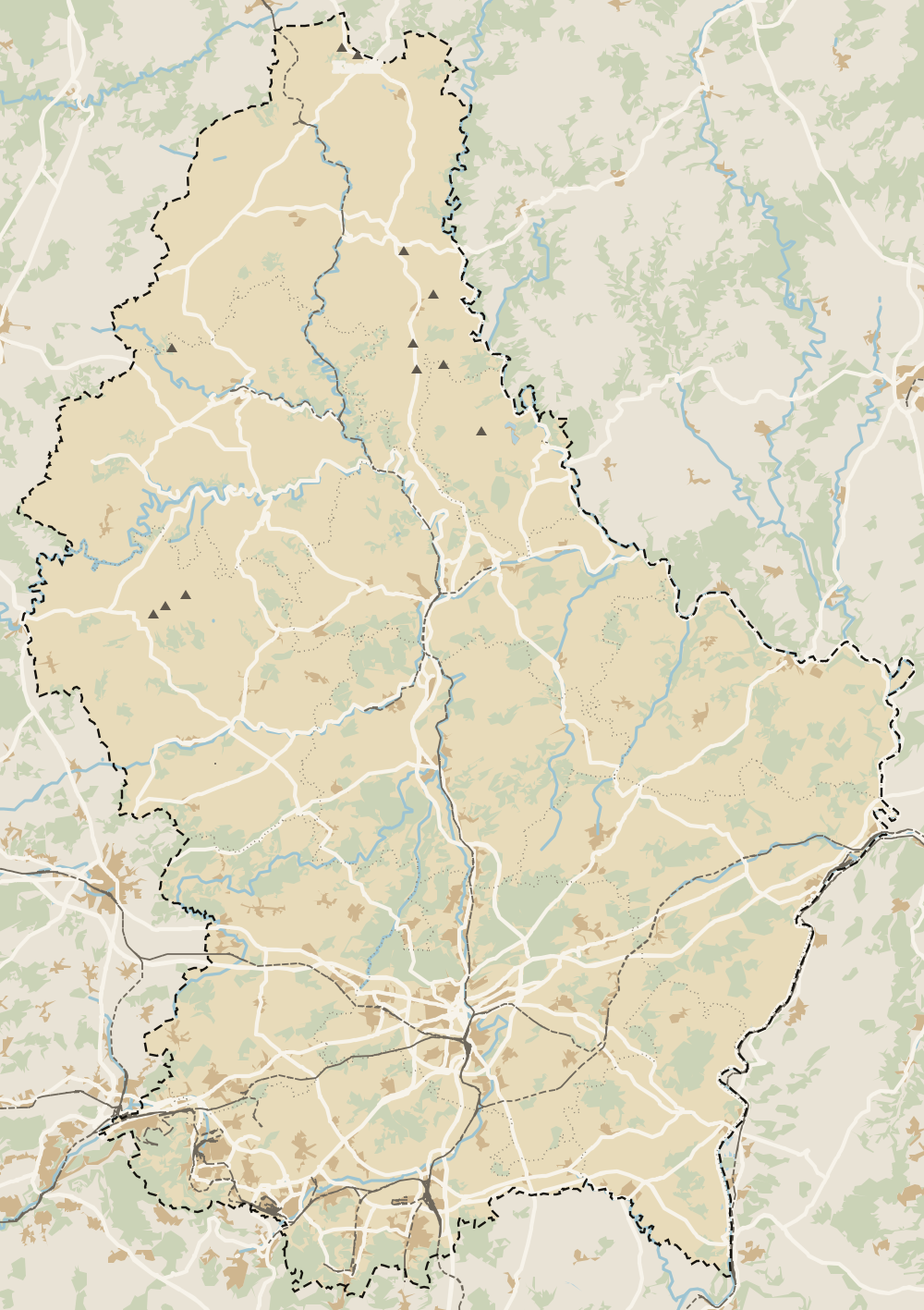 1Ville Haute 2Luxembourg City 3Grund 4Pfaffenthal 5Clausen 6Kirchberg 7Gare 8Hamm 9Luxembourg fortress 10Limpertsberg 11Pulvermühl 12Bonnevoie 13Hollerich 14Gasperich 15Belair 16Merl 17Cents 18Neudorf 19Weimerskirch 20Beggen 21Eich 22Dommeldange 23Mühlenbach 24Pétrusse Valley 25Rollingergrund 26Cessange 27Rham Plateau 28Tram and Bus Museum
 Map data © OpenStreetMap contributors (ODbL)
- 1Ville HauteA district of Luxembourg City
- 2Luxembourg CityCapital of the Grand Duchy
- 3GrundLuxembourg City district on the Alzette
- 4PfaffenthalLuxembourg City district in the Alzette valley
- 5ClausenLuxembourg City district in the Alzette valley
- 6KirchbergLuxembourg City's European and business district
- 7GareLuxembourg City district south of the Pétrusse
- 8HammDistrict on the eastern side of Luxembourg City
- 9Luxembourg fortressUNESCO World Heritage since 1994
- 10LimpertsbergLuxembourg City district north of the Ville Haute
- 11PulvermühlLuxembourg City's smallest district
- 12BonnevoieBonnevoie-Nord / Verlorenkost and Bonnevoie-Sud
- 13HollerichLuxembourg City district west of the Gare
- 14GasperichDistrict in the south of Luxembourg City
- 15BelairResidential district west of the Ville Haute
- 16MerlResidential district on the capital's west side
- 17CentsResidential district east of the city centre
- 18NeudorfAlzette valley district below Kirchberg
- 19WeimerskirchNorthern district on the Alzette valley slope
- 20BeggenDistrict at the northern tip of the capital
- 21EichNorthern district in the Alzette valley
- 22DommeldangeNorthern district with a village centre
- 23MühlenbachNorthern district on the edge of the Bambësch
- 24Pétrusse ValleyPark and walk between the old town and the Gare
- 25RollingergrundNorth-west district, including Belair-Nord
- 26CessangeSouth-west district of the capital
- 27Rham PlateauLuxembourg City fortifications
- 28Tram and Bus MuseumMuseum in Hollerich
0 of 425 Luxembourg guides
Your next stamp
- Place de la Constitution
- Merl
- Weiler-la-Tour
- Neudorf
- Bettembourg
- Koerich
- Mersch
- Ville Haute
- A Possen Museum
- American Cemetery
- Ansembourg
- Ansembourg Castles
- Asselborn
- Bascharage
- Beaufort castles
- Belval
- Belval blast furnaces
- Berg Castle
- Bernard-Massard cellars
- Bourglinster Castle
- Bourscheid Castle
- Brandenbourg
- Brandenbourg Castle
- Caves St Martin
- Christmas
- Clervaux Castle
- Echternach
- Echternach Abbey
- Ehnen
- Ehnen Wine Museum
- Esch-sur-Alzette
- Esch-sur-Sûre Castle
- European Museum Schengen
- Fond-de-Gras
- General Patton Museum
- German war cemetery
- Haff Réimech
- Hohllay
- Hollenfels Castle
- Hosingen
- Kautenbach
- Kneiff
- Koerich Castle
- Larochette Castle
- Lasauvage
- Mersch Castle
- Military History Museum
- Moersdorf
- Mondorf Domaine Thermal
- Munsbach Castle
- National Mining Museum
- Parc Merveilleux
- Park Sënnesräich
- Places to visit
- Remich
- Rindschleiden
- Schiessentümpel
- Septfontaines Castle
- Slate Museum
- Stolzembourg
- Tudor Museum
- Useldange Castle
- Valley of the Seven Castles
- Vianden
- Vianden Castle
- Wasserbillig Aquarium
- Weiswampach lakes
- Wiltz Castle
- Ahn
- Berdorf
- Bourscheid-Plage
- Butterfly garden
- Clervaux
- Differdange
- Echternach lake
- Grevenmacher
- Heringer Millen
- Hollenfels
- Luxembourg City
- Luxembourg Science Center
- Meysembourg Castle
- Mullerthal
- National Day
- National Resistance Museum
- Perekop
- Remerschen
- Schoenfels Castle
- The Family of Man
- Things to do
- Upper Sûre Lake
- Vianden chairlift
- Wasserbillig
- Clervaux Abbey
- Echternach Roman villa
- Éislek
- Insenborn
- Kallektuffquell
- Machtum
- Most beautiful places
- Our Nature Park
- Pétange
- Pettingen Castle
- Schueberfouer
- Schwebsingen
- Victor Hugo House
- Waldbillig
- Dudelange
- Kuelscheier
- Lultzhausen
- Moselle Valley
- Octave
- Prettiest villages
- Sanem
- Schengen
- Wellenstein
- Wiltz
- Wolfsschlucht
- Beaufort
- Bech-Kleinmacher
- Éimaischen
- Gaalgebierg
- Guttland
- Marnach
- Mondorf-les-Bains
- Putscheid
- Schifflange
- UNESCO World Heritage
- Carnival
- Consdorf
- Ellergronn
- Käerjeng
- Kayl
- Map
- Minett
- Munshausen
- Tandel
- Bech
- Buergbrennen
- Esch-sur-Sûre
- Rumelange
- Where is Luxembourg
- Is it a country?
- Lac de la Haute-Sûre (commune)
- Rosport-Mompach
- Wormeldange
- Larochette
- Mondercange
- Regions
- Bock Casemates
- Cantons
- Dancing procession
- Diekirch
- Fischbach
- Garnich
- Moselle wine route
- Ettelbruck
- Grund
- Heffingen
- Kehlen
- Lintgen
- Moselle river cruises
- Pétrusse Casemates
- Towns and villages
- Chemin de la Corniche
- Erpeldange-sur-Sûre
- Junglinster
- Kopstal
- Lorentzweiler
- Nommern
- Pfaffenthal
- Population
- Bissen
- Clausen
- Grand Ducal Palace
- Schieren
- Size
- Vallée de l'Ernz
- Feulen
- Kirchberg
- Languages
- Notre-Dame Cathedral
- Reisdorf
- Steinfort
- Bettendorf
- Habscht
- St Michael's Church
- Helperknapp
- Luxembourgish
- Place Guillaume II
- Name
- Place d'Armes
- History
- Grand Duke
- Colmar-Berg
- Flaxweiler
- Gare
- Hamm
- Kirchberg funicular
- Luxembourg fortress
- Mamer
- Mertert
- Minett Trail
- Mullerthal Trail
- Neumünster Abbey
- Parc Hosingen
- Pfaffenthal lift
- Political system
- Redange
- The Passerelle
- Wine festivals
- Winseler
- Beckerich
- Biwer
- EU institutions
- Goesdorf
- Limpertsberg
- Mudam
- Natur Musée
- Pulvermühl
- Stadtbredimus
- Troisvierges
- Wenzel walk
- Bonnevoie
- Bous-Waldbredimus
- Ell
- Flag
- Kiischpelt
- Manternach
- Philharmonie
- Vauban circuit
- Weiswampach
- Betzdorf
- Boulaide
- Dräi Eechelen Museum
- Facts
- Hollerich
- Lenningen
- Useldange
- Wincrange
- Bourscheid
- Dalheim
- Gasperich
- Public holidays
- Red Bridge
- Saeul
- Second World War
- Vichten
- Battle of the Bulge
- Préizerdaul
- Cents
- EU and Schengen
- Groussbus-Wal
- Entry requirements
- Rambrouch
- Currency and payments
- Mertzig
- Weimerskirch
- Adolphe Bridge
- Beggen
- Escapardenne
- How to get there
- International March of Diekirch
- MNHA (National Museum)
- Rock climbing
- Sandweiler
- Bridges
- Eich
- Flights
- Golf
- Hesperange
- Lëtzebuerg City Museum
- Canoeing and kayaking
- Dommeldange
- Luxembourg airport
- Strassen
- Villa Vauban
- Airport to city centre
- Bertrange
- Casino Luxembourg
- Mühlenbach
- Swimming pools
- From Brussels
- Pétrusse Valley
- Rollingergrund
- Walferdange
- Cessange
- Day trip from Brussels
- Municipal Park
- Steinsel
- Free walking tours
- From Paris
- Niederanven
- From Frankfurt
- Schuttrange
- Sightseeing train and bus
- By train
- Contern
- By coach
- Driving
- Luxembourg in one day
- Pretzel Sunday
- Rham Plateau
- Tour de Luxembourg
- Candlemas (Liichtmëssdag)
- Car hire
- Luxembourg in two days
- Saint-Esprit Plateau
- Luxembourg in three days
- Melusina statue
- Parking
- St Nicholas Day (Kleeschen)
- Fête de la Musique
- Luxembourg in four days
- Museums in Luxembourg
- Petrol
- Place de Clairefontaine
- A week in Luxembourg
- Getting around
- Luxembourg Marathon
- Tram and Bus Museum
- Free public transport
- Parks in Luxembourg City
- Road trip
- Belgium and Luxembourg
- Tram
- Buses
- Viewpoints
- Trains
- Luxembourg station
- Cycling
- LuxembourgPass
- Prices and budget
- On a budget
- Free things to do
- Mobile and roaming
- Healthcare
- Safety
- Scams
- Tourist information
- Packing list
- Swimming lakes
- With a dog
- Markets
- Tipping
- Shopping
- What to buy
- Shopping centres
- With kids
- For couples
- Playgrounds
- Adventure parks
- Nightlife
- Castles
- Theatres and concert venues
- Leudelange
- Nature parks
- Where to stay
- City-centre hotels
- Hiking
- Nature reserves
- Reckange-sur-Mess
- Hotels near the station
- Roeser
- Frisange
- Hotels in Kirchberg
- Airport hotels
- Dippach
- Hotels in Vianden
- Hotels in Echternach
- Hotels in Clervaux
- Hotels in Mondorf-les-Bains
- Hotels in Esch-sur-Alzette
- Hotels on the Moselle
- Mullerthal hotels
- Upper Sûre lake hotels
- Hotels in Diekirch and Ettelbruck
- Cheap hotels
- Luxury hotels
- Boutique hotels
- Spa hotels
- Family hotels
- Apartments
- Weather
- Youth hostels
- Best time to visit
- Campsites
- Holiday cottages
- In winter
- Castle hotels
- In spring
- Day trips
- In summer
- Around Luxembourg
- In autumn
- Ice skating
- Trier day trip
- Metz day trip
- Arlon day trip
- In January
- In February
- In March
- In April
- In May
- In June
- In July
- In August
- In September
- Food
- In October
- In November
- Where to eat
- In December
- Michelin restaurants
- Cheap eats
- Judd mat Gaardebounen
- Bouneschlupp
- Gromperekichelcher
- Kniddelen
- Quetschentaart
- Rieslingspaschtéit
- Events
- Wine
- Crémant
- Beer
Frequently asked questions
What is Belair in Luxembourg?
One of the capital's 24 official districts, west of the Ville Haute. It covers 171.8 hectares and had 12,815 residents on 31-12-2023. It's residential and borders Merl park.
Why is it called Belair?
After the architect Mathias Martin's house, which had «Maison Bel Air 1923» on its facade. The name spread to the street and then to the district, which adopted it officially in 1956.
Where was the Gëlle Fra found?
Under the stands of the old Josy Barthel national stadium in Belair, where it had been hidden to save it from the Nazis. It turned up in 1981 and went back to Place de la Constitution in 1985.
Does the Belair church tower lean?
Slightly, according to the tourist office. It's 69 metres tall, and the big bell was hung lower than planned so as not to destabilise it.
How do I get to Belair?
On foot from the Ville Haute in a few minutes, or on city buses. It lies between Route d'Arlon and Route de Longwy. Public transport is free.
By
Tourism graduate with a master’s in Tourism Management and Planning from the University of Málaga, who has travelled across Europe. He writes every guide from official sources and his own judgement.
Published on . Facts checked on .
Some links in this guide are affiliate links: if you book through them, the site earns a commission at no extra cost to you. Affiliate disclosure