The coastal region
The Montenegro coast, bay by bay and beach by beach
Montenegro's coastline is 293.5 km long according to MONSTAT, shared between six municipalities: Herceg Novi, Kotor, Tivat, Budva, Bar and Ulcinj. They had 163,672 residents in the 2023 census and 2,210,630 tourist arrivals in 2024, almost 85 % of the national total. The Bay of Kotor sits at the top; long beaches run south to Albania.
In 30 seconds
Full read: 3 min
- 293.5 km of coast across six municipalities, from Herceg Novi in the north-west to Ulcinj by Albania.
- The Bay of Kotor holds the UNESCO towns; Budva, Bar and Ulcinj have the long beaches.
- 2,210,630 tourist arrivals in 2024, almost 85 % of Montenegro's total.
- Tivat airport is 8 km from Kotor and 21 km from Budva.
Treat the coast as two holidays. The Bay of Kotor is stone towns, boats and history; Budva southwards is beaches. If you only have a long weekend, I'd stay in the bay and give Budva an evening.

Before you go
What I would keep in mind
-
01 Getting there
Tivat airport sits right in the middle
The airport operator puts Kotor 8 km and Budva 21 km from Tivat, so both halves of the coast are under half an hour from the runway.
Tivat -
02 Most beautiful
The bay is the part I'd never cut
Kotor and Perast sit inside the UNESCO site inscribed in 1979, and the bay has 105.7 km of shoreline to explore by road or boat.
the Bay of Kotor -
03 My tip
Budva gets a third of all visitors
In 2024 Budva had 848,515 arrivals, more than Herceg Novi, Kotor and Tivat put together. For a quieter August, look north to Herceg Novi or south to Ulcinj.
-
04 Money
Budget for a nightly tourist tax
Kotor and Herceg Novi both charge €1 per adult per night, €0.50 for 12 to 18-year-olds and nothing for under-12s, on top of the room rate.
Herceg Novi -
05 Getting there
The coast is one of three regions
Montenegro covers 13,883 km² and had 623,633 people at the 2023 census. The coast takes most of the visitors, but the whole country, centre and north included, is on the Montenegro guide home page.
Montenegro travel guide -
06 Getting there
The coast on the map
The coast is one of three statistical regions, with 293.5 km of shoreline. The map shows how it fits with the centre and the north.
map of Montenegro
What I would book
Montenegro squeezes a remarkable amount into a short stretch of sea. MONSTAT measures the coastline at 293.5 km, and along it you get a sheltered bay under peaks of nearly 1,500 m, two walled towns, islands with churches on them and Velika plaža, which the official tourism website bills as the longest beach on the Adriatic. Here’s how it breaks down and how I’d use it.
Two coasts in one
Statistically, the coast is six municipalities, namely Herceg Novi, Kotor, Tivat, Budva, Bar and Ulcinj. It isn’t a county with its own council, just MONSTAT’s grouping, but it’s the useful way to think about it because this is where Montenegro’s tourism lives. Of the 2,606,854 tourist arrivals recorded in 2024, 2,210,630 were here.
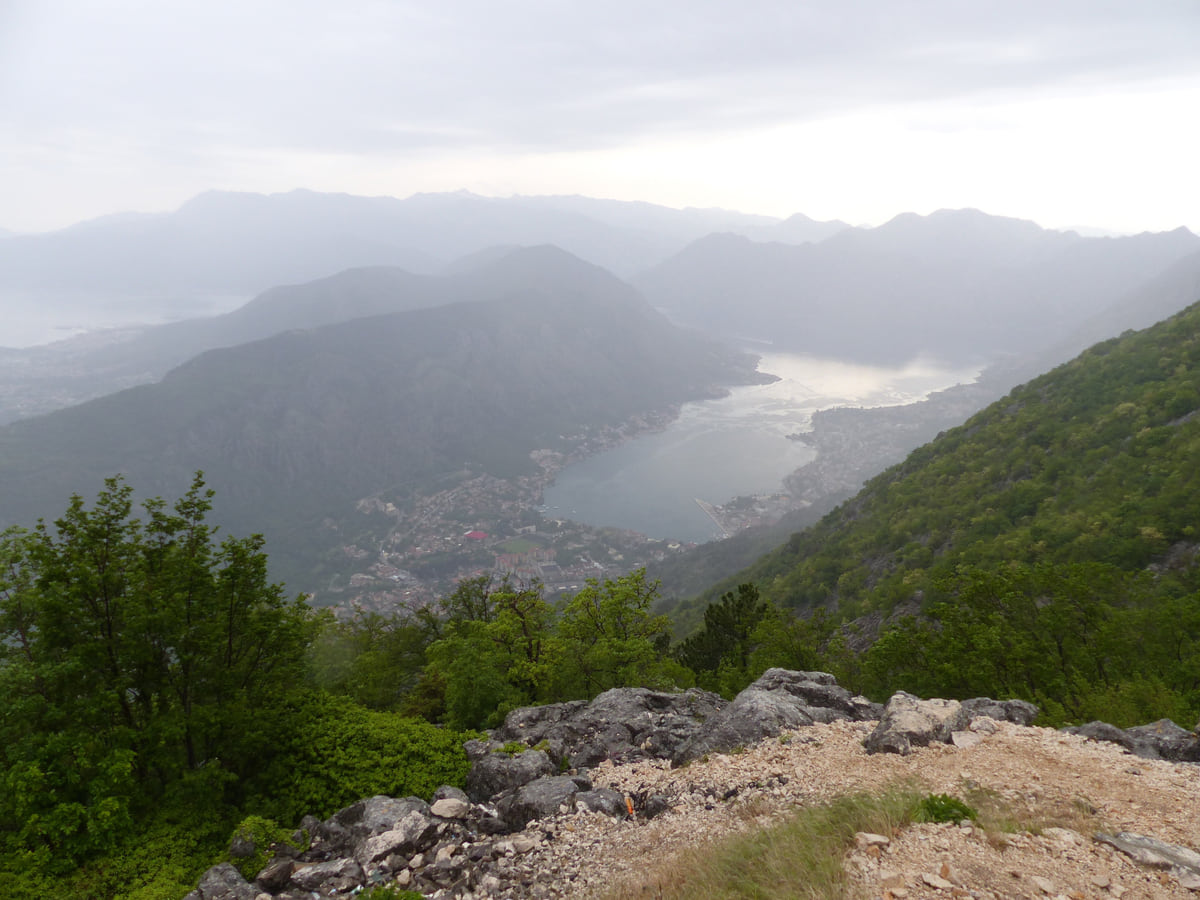
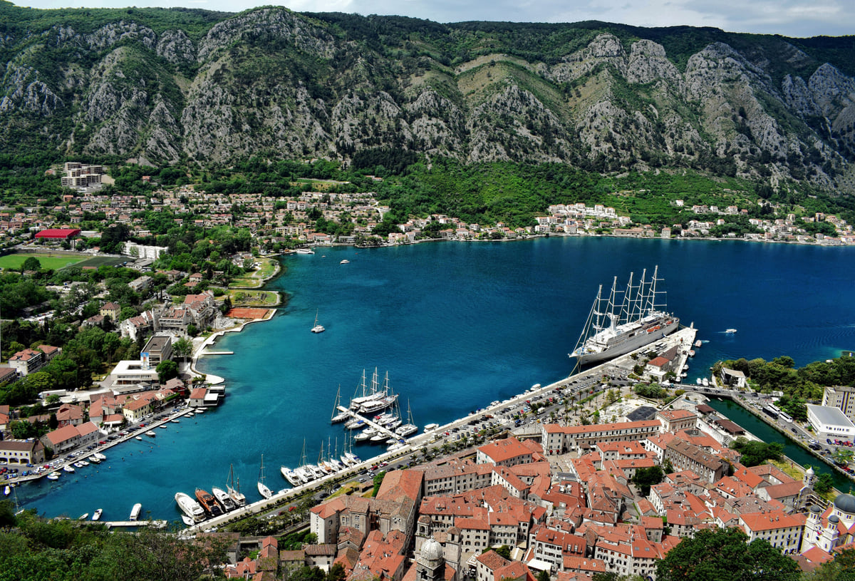
On the ground, it splits neatly in two. The northern half is the Bay of Kotor, an 87.3 km² inlet with 105.7 km of shoreline and a maximum depth of 68 m, shared between Herceg Novi, Kotor and Tivat. The southern half faces the open Adriatic, with Budva, Bar and Ulcinj strung along a straighter coast of beaches and promenades.
The bay end
UNESCO inscribed the Natural and Culturo-Historical Region of Kotor in 1979, covering 14,600 ha of the inner bay, and in 2017 the walled town joined the separate listing for Venetian defences. That puts Kotor and Perast at the heart of any trip. UNESCO is frank that new building along the shore threatens the landscape, and in places you can see why.
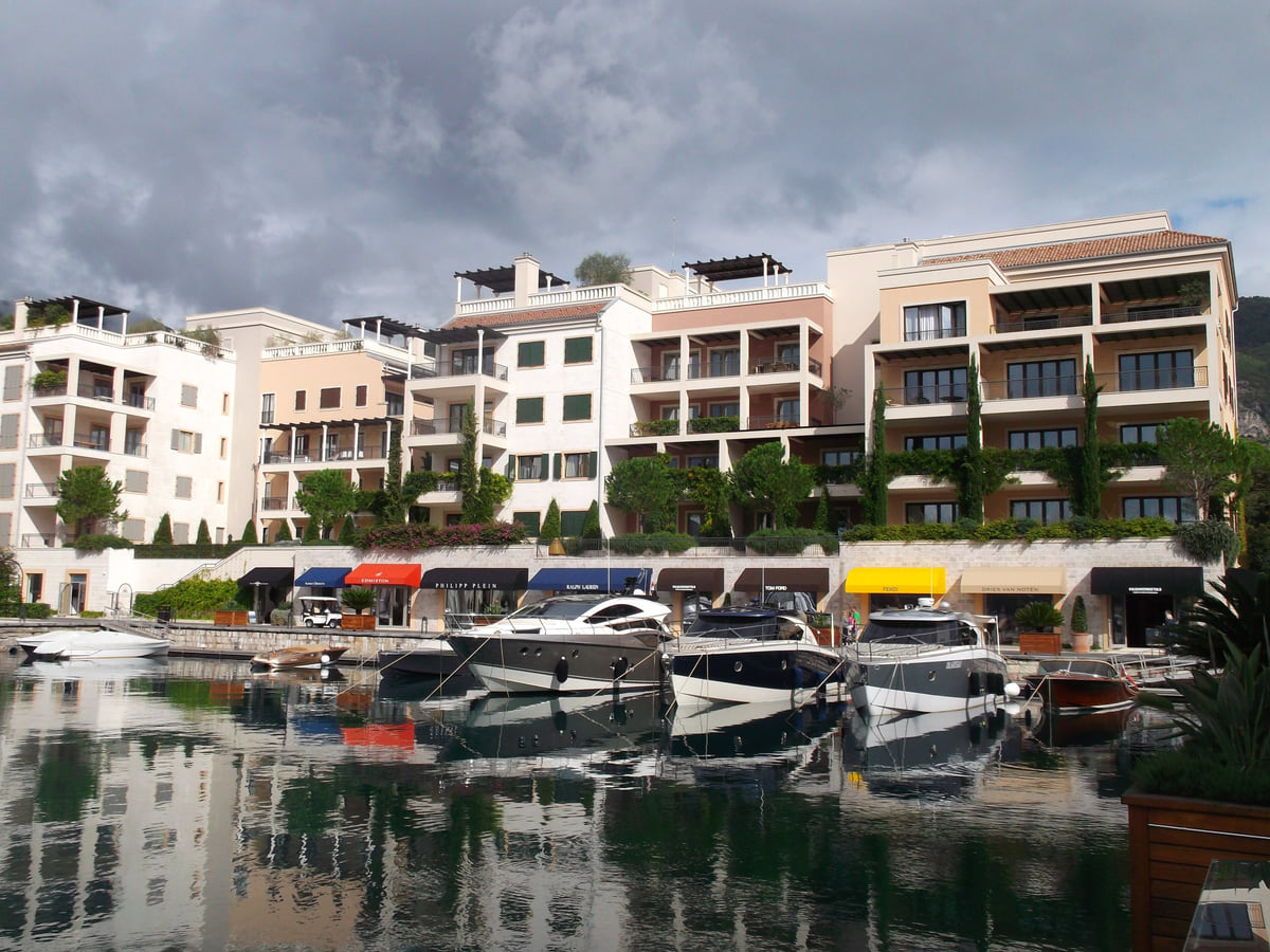
Herceg Novi guards the mouth of the bay with its stepped old town and three fortresses, while Tivat sits in the middle with the airport and the superyacht marina. A short car ferry crosses the Verige strait between Kamenari and Lepetane; the official 2026 fare is €5 a car, €2.50 a motorbike and nothing for a bicycle.
Once your dates are set, check which hotels are still free in Kotor before prices climb.
The beach end
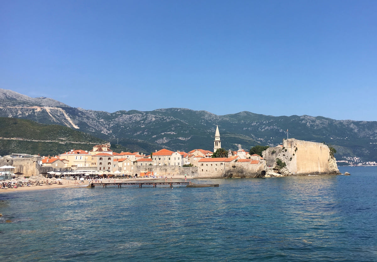
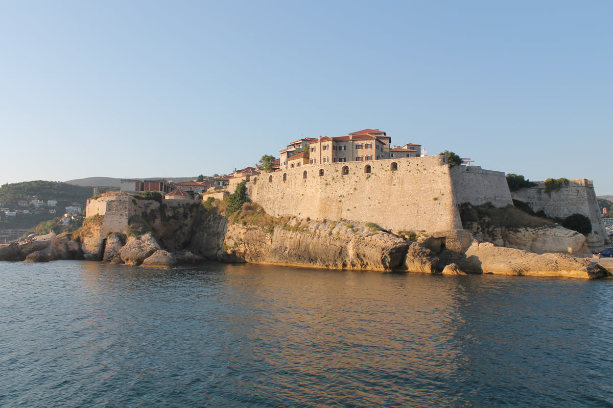
Budva is the busiest municipality in the country, with 848,515 arrivals in 2024, about a third of the total. It has a walled old town, Sveti Nikola island offshore and, further south, Sveti Stefan and Petrovac. Bar is the largest coastal municipality at 504 km², with the ruins of Stari Bar and a slice of Lake Skadar inside its boundary. Ulcinj finishes the coast with the 13 km Velika plaža and the river island of Ada Bojana on the Albanian border.
Getting there from the UK
Tivat airport is the obvious gateway, on the bay itself. The National Tourism Organisation reported Jet2 starting Stansted to Tivat in April 2024 and Birmingham a month later; check the current timetable before you plan around them. Podgorica is the other Montenegrin airport, and Dubrovnik, 71 km from Kotor, is a common back door from Croatia. Remember the border, too. Montenegro isn’t in Schengen, so you’ll queue for passport control coming from Dubrovnik, and days spent here don’t count towards your 90 Schengen days.
If you would rather have a local show you round, book a guided tour in Kotor and choose by the reviews.
Money on the coast
The euro is the currency here, even though Montenegro isn’t in the EU, so there’s nothing to change if you’ve brought euros. What does vary is the nightly tourist tax, set by each municipality. Kotor and Herceg Novi both publish a rate of one euro per adult per night, half that for teenagers from 12 to 18 and nothing for younger children, and your host collects it with the bill. Hotels register you with the authorities on arrival; in a private flat, the rules put that job on you, within 24 hours.
Weather on the coast
The 2024 figures from the Institute of Hydrometeorology show a July average of 28.1 °C at Herceg Novi and 27.5 °C at Bar, with only one or two wet days that month. Across the year, though, it’s a wet coast. Herceg Novi had 1,969.5 l/m² of rain in 2024, most of it in November and December. Kotor, Tivat and Budva have no station of their own in the published tables; I explain how to read the nearest ones in Montenegro weather.
Once your dates are set, check which hotels are still free in Kotor before prices climb.
How I’d split a week
Three nights in the bay and three further south is the balance I’d aim for. With only three days, stay in the bay, take a boat to Perast’s islands and see Budva in an evening. Visitors from the UK made 111,844 arrivals across the country in 2024, so you won’t be alone, but outside July and August the coast slows right down.
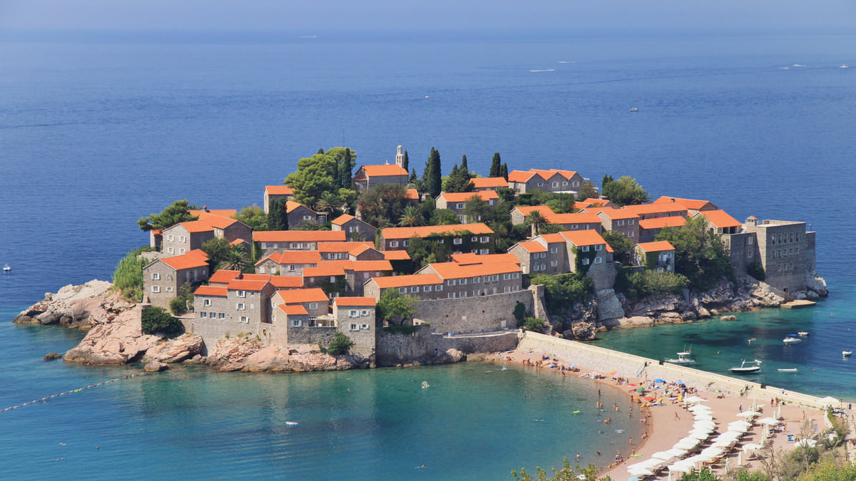
Sveti Stefan joined to the shore by a sandy isthmus, its stone houses and red roofs ringed by turquoise water
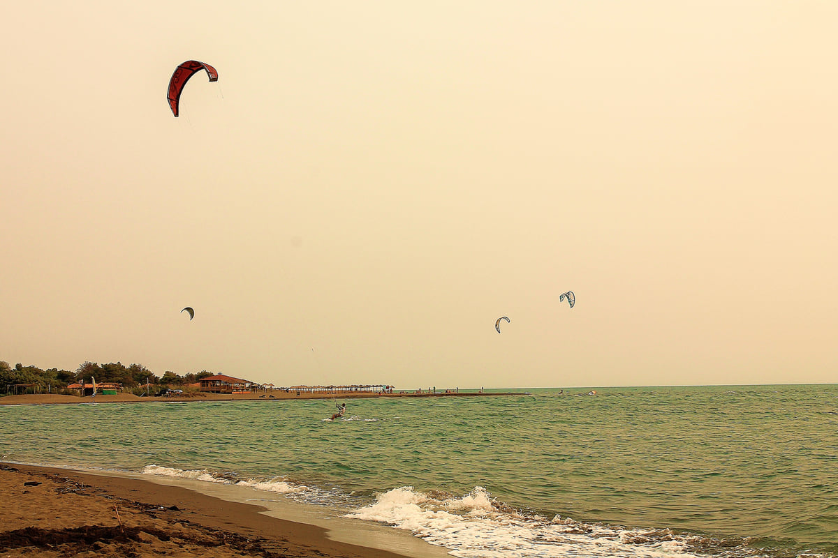
Kitesurf kites over the sea at Velika Plaža in Ulcinj, with gentle waves breaking on the sandy shore
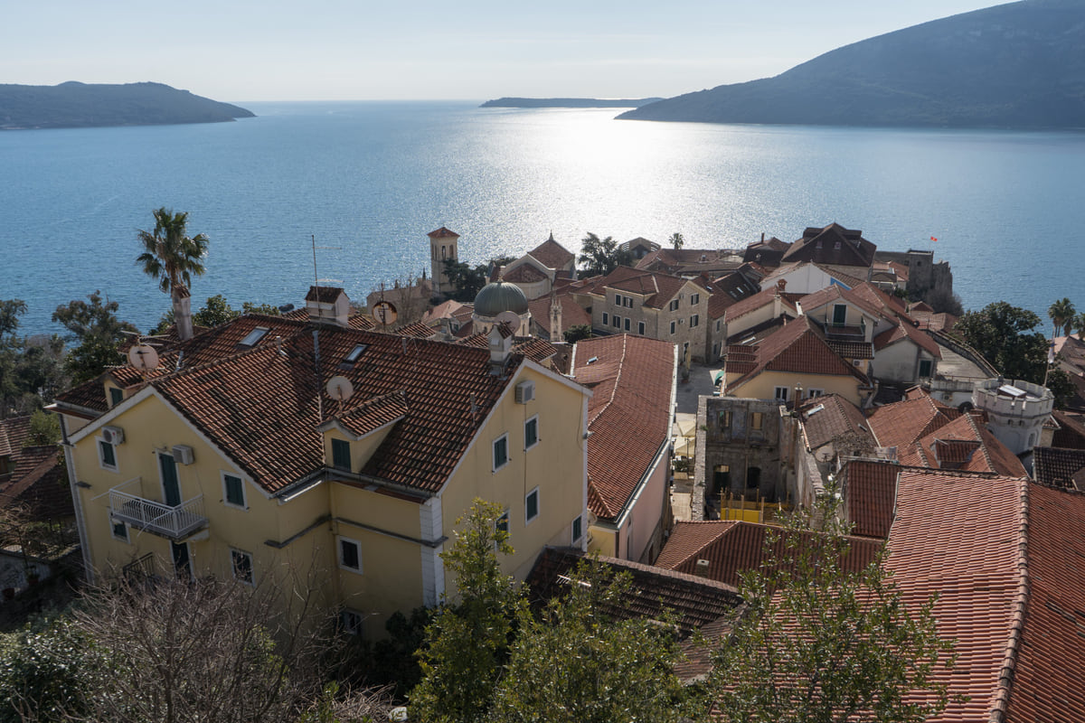
Old-town rooftops of Herceg Novi from the Kanli Kula fortress, with palm trees and the mouth of the Bay of Kotor behind
The six coastal municipalities
| Municipality | Residents 2023 | Area | Arrivals 2024 | Overnight stays 2024 |
|---|---|---|---|---|
| Herceg Novi | 30,824 | 234 km² | 362,514 | 2,852,004 |
| Kotor | 22,746 | 336 km² | 277,063 | 1,364,785 |
| Tivat | 16,338 | 47 km² | 158,550 | 1,320,043 |
| Budva | 27,445 | 122 km² | 848,515 | 5,412,910 |
| Bar | 45,812 | 504 km² | 246,100 | 2,097,940 |
| Ulcinj | 20,507 | 261 km² | 317,888 | 1,572,353 |
MONSTAT: 2023 census (final results), 2025 yearbook and 2024 tourist arrivals survey.
Driving times from Tivat airport
| To | Distance | Time |
|---|---|---|
| Tivat town | 4 km | 5 min |
| Kotor | 8 km | 12 min |
| Budva | 21 km | 27 min |
| Bar | 60 km | 1 h 19 min |
Airports of Montenegro, Tivat airport page.
Test yourself
True or false?
0/3 Pick before you peek.
-
Tivat is the smallest municipality on the coast.
See the answer
True. At 47 km², according to MONSTAT. Bar is the largest, at 504 km².
-
Most of Montenegro's tourists stay inland.
See the answer
False. The six coastal municipalities had 2,210,630 of the 2,606,854 arrivals recorded in 2024.
-
The Bay of Kotor has more than 100 km of shoreline.
See the answer
True. The National Tourism Organisation gives 105.7 km of coast for an 87.3 km² bay.
- Coastline (MONSTAT)
- 293.5 km
- Coastal municipalities
- 6
- Tourist arrivals in 2024
- 2,210,630
- Velika plaža, the longest beach
- 13 km
What to see
What to see in Montenegro's coast
0 of 278 Montenegro guides
Your next stamp
- Beaches
- Velika plaža
- Ulcinj
- Montenegro and the Balkans
- Map
- Kolašin
- Tivat
- Aman Sveti Stefan
- Budva Old Town
- Haj-Nehaj
- Kotor
- Lučice Beach
- Peaks of the Balkans
- Porto Montenegro
- Sea Dance Festival
- Splendid Conference & Spa Resort
- Stari Bar
- Ulcinj Old Town
- Bay of Kotor
- Budva Riviera
- Heroj submarine
- Iberostar Bellevue
- Independence Day
- Old olive tree of Mirovica
- Ada Bojana
- Beaches in Budva
- Eurostars Queen of Montenegro
- Herceg Novi
- Kotor Old Town
- Mount Rumija
- Igalo
- Kotor city walls
- Mogren Beach
- Montenegro Beach Resort
- Svač
- Vrmac
- Hiking
- Jaz Beach
- Kanli kula
- Luštica peninsula
- St Tryphon Cathedral
- Ulcinj salt pans
- Forte Mare
- Gornja Lastva
- Maritime Museum, Kotor
- Slovenska Beach
- Drobni Pijesak Beach
- Kotor viewpoints
- Mamula
- Žanjic beach
- Kotor cruise port
- Orjen
- Plavi horizonti beach
- Sveti Nikola Island
- Blue Cave
- Restaurants in Budva
- Restaurants in Kotor
- Canyoning
- Hotels
- Perast
- Sutomore
- Sveti Stefan
- Čanj
- Luxury hotels
- Our Lady of the Rocks
- Pržno
- Things to do
- Activities
- All-inclusive hotels
- Bar Riviera
- Bečići
- Hotel Palma
- St George island
- Dobrota
- Hladna uvala
- Most beautiful places
- Petrovac
- Crvena stijena
- Prčanj
- Prettiest villages
- Cycling
- Risan
- UNESCO sites
- Heritage Grand Perast
- Hyatt Regency Kotor Bay
- Where is it?
- Regions
- Cities
- Beaches in Bar
- Budva
- Central Montenegro
- Hotels in Budva
- Hotels in Kotor
- Iberostar Waves Herceg Novi
- Kitesurfing
- The name
- Beaches in Ulcinj
- Flag
- Hotels in Perast
- Palmon Bay Hotel & Spa
- Podgorica
- Cathedral of the Resurrection
- One&Only Portonovi
- Population
- Sandy beaches
- Azul Beach Resort Montenegro
- Naturist beaches
- Size
- Stara Varoš
- Doclea
- Language
- Mimosa Festival
- Medun
- Religion
- Zipline
- Currency
- Museums in Podgorica
- Dajbabe Monastery
- EU membership
- History
- Restaurants in Podgorica
- Hotels in Podgorica
- Public holidays
- Avala Resort & Villas
- Bar
- Beaches in Kotor
- Birdwatching
- Hotels in Ulcinj
- Kotor carnival
- Time zone
- Tivat beaches
- Tuzi
- Boka Night
- Dukley Hotel & Resort
- Facts
- Hotels in Tivat
- Zeta
- Caves
- Herceg Novi beaches
- National parks
- Šipčanik
- Hotels in Herceg Novi
- Monasteries
- Fortresses
- Fly fishing
- Museums
- Canyons and waterfalls
- Lakes
- Mountains
- Montenegro and Croatia
- Boat trips
- Cetinje
- Montenegro and Albania
- Nightlife
- Weather
- Best time to visit
- Cetinje Monastery
- Kayaking
- How to get there
- In summer
- King Nikola's Palace
- Sailing
- Biljarda
- Flights
- In winter
- Airports
- Museums in Cetinje
- New Year's Eve
- Lovćen
- Paragliding
- Tivat Airport
- Njegoš Mausoleum
- Podgorica Airport
- Dubrovnik to Kotor
- Kotor serpentine
- Belgrade to Montenegro
- Njeguši
- Ferry to Italy
- Njeguši prosciutto
- Border crossings
- In January
- Lipa Cave
- Where to stay
- In February
- Kamenari-Lepetane ferry
- Pavlova strana
- Getting around
- In March
- Rijeka Crnojevića
- In April
- Trains
- Buses
- In May
- Car hire
- In June
- Driving
- In July
- In August
- Taxis
- Distances
- In September
- In October
- Road trip
- Food
- In November
- Lake Skadar
- Scenic drives
- In December
- Kotor cable car
- Virpazar
- Where to eat
- Budva to Kotor
- Godinje
- Wine
- Podgorica to Kotor
- Vranjina
- Besac fortress
- Prices and budget
- On a budget
- Žabljak Crnojevića
- Danilovgrad
- Entry requirements
- Ostrog Monastery
- Tourist registration
- Customs
- Nikšić
- Crvena Stijena cave
- Safety
- Events
- Healthcare
- Northern Montenegro
- Mobile and roaming
- Žabljak
- Durmitor
- Plugs
- Black Lake
- With kids
- Bobotov Kuk
- Holidays
- Day trips
- Stećci tombstones
- Hotels in Žabljak
- Three-day itinerary
- Five-day itinerary
- Skiing in Montenegro
- One-week itinerary
- Skiing in Žabljak
- Šavnik
- Ten-day itinerary
- Nevidio Canyon
- Tara Canyon
- Tara rafting
- Đurđevića Tara Bridge
- Plužine
- Lake Piva
- Piva Monastery
- Mojkovac
- Brskovo
- Pljevlja
- Husein Pasha Mosque
- Hotels in Kolašin
- Skiing in Kolašin
- Biogradska Gora National Park
- Komovi
- Morača Monastery
- Morača Canyon
- Bijelo Polje
- Đalovića Cave
- Berane
- Andrijevica
- Petnjica
- Rožaje
- Plav
- Lake Plav
- Gusinje
- Vusanje
- Prokletije National Park
Frequently asked questions
Which towns are on the Montenegro coast?
Six municipalities make up MONSTAT's coastal region: Herceg Novi, Kotor, Tivat, Budva, Bar and Ulcinj. Inside them sit smaller resorts such as Perast, Sveti Stefan, Bečići, Petrovac and Sutomore.
How long is Montenegro's coastline?
293.5 km, according to MONSTAT's 2025 yearbook. The National Tourism Organisation counts 117 beaches adding up to 52 km of that.
What is the best part of the Montenegro coast?
For scenery and history, the Bay of Kotor, with Kotor and Perast inside the UNESCO area. For beach holidays, the open coast from Budva south, which ends with the 13 km Velika plaža at Ulcinj.
Which airport is closest to the Montenegrin coast?
Tivat, which sits on the bay itself, 8 km from Kotor and 21 km from Budva. Podgorica and Dubrovnik are the alternatives; Kotor is 71 km from Dubrovnik airport.
Is the Montenegro coast busy in summer?
Very, especially Budva, which had 848,515 tourist arrivals in 2024. The bay and the far south around Ulcinj spread the crowds a little more thinly.
How warm is the coast in July?
In July 2024 the average was 28.1 °C at Herceg Novi and 27.5 °C at Bar, with one or two rainy days in the whole month.
By
Tourism graduate with a master’s in Tourism Management and Planning from the University of Málaga, who has travelled across Europe. He writes every guide from official sources and his own judgement.
Published on . Facts checked on .
Sources
Some links in this guide are affiliate links: if you book through them, the site earns a commission at no extra cost to you. Affiliate disclosure
Photos: Wolfgang Sauber (CC BY-SA 4.0); Marcin Konsek (CC BY-SA 4.0); Mjuzikxhankej (CC BY-SA 3.0); Alexkom000 (CC BY 4.0), via Wikimedia Commons.