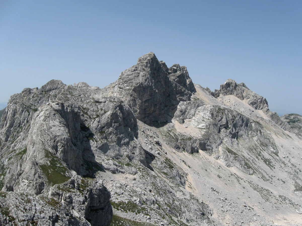
Peaks, trails and viewpoints
Montenegro's mountains, from Prokletije to Orjen
Montenegro's highest mountains are in Durmitor and Prokletije. MONSTAT's table gives 2,522 m to both Bobotov Kuk and Maja Rozit, while the National Parks give 2,534 m to Zla Kolata, on the Albanian border. Next come the Komovi at 2,487 m, then lower massifs such as Bjelasica, Lovćen and Orjen.
In 30 seconds
Full read: 2 min
- Zla Kolata, 2,534 m, is the country's highest point according to the National Parks.
- MONSTAT's table ties Bobotov Kuk and Maja Rozit at 2,522 m.
- There are 3,000 km of trails, about 1,480 km waymarked.
- Crossing into Albania or Kosovo on foot requires a border police application.
For a first taste of Montenegro's mountains, I'd start with Durmitor, based in Žabljak with well-marked trails. Prokletije I'd keep for a second trip, or for walkers who already have the legs and the experience.

Before you go
What I would keep in mind
-
01 Most beautiful
Two summits tied at 2,522 m
In MONSTAT's table, Durmitor's Bobotov Kuk and Prokletije's Maja Rozit share the same height. Sources disagree on Bobotov Kuk, so I call it roughly 2,520 m.
Bobotov Kuk -
02 Most beautiful
Prokletije, 20-plus peaks over 2,500 m
The National Tourism Organisation counts more than 20 summits above 2,500 m in the park, which borders Albania and Kosovo.
Prokletije -
03 My tip
Crossing a mountain border takes paperwork
For routes into Albania or Kosovo away from official crossings, you need to apply to the border police, with a form, a passport copy and fees of €2 and €3.
Montenegro's border crossings -
04 To save money
3,000 km of trails
The National Tourism Organisation counts 3,000 km of trails, about 1,480 km waymarked and about 800 km inside the national parks, where entry costs €3 to €5.
Montenegro's national parks
What I would book
Montenegro carries the mountains in its very name, and it makes sense the moment you head inland. There are massifs above 2,500 m in a country of 13,883 km², and the official figures can’t even agree on which peak is highest. Here’s what each source says, and which mountains I’d pick depending on what you’re after.
The highest point, depending on who measures
There’s a small muddle over figures here that I’d rather explain than hide. In MONSTAT’s list, which only includes summits over 1,800 m, Bobotov Kuk (Durmitor) and Maja Rozit (Prokletije) share first place, both on 2,522 m. But that table leaves out Zla Kolata, which the National Parks and the National Tourism Organisation give as the country’s highest at 2,534 m. And for Bobotov Kuk, the National Tourism Organisation says 2,523 m and UNESCO 2,525 m. I settle on ‘roughly 2,520 m’ for Bobotov Kuk and treat Zla Kolata as the top according to the National Parks. The ascent is covered in Bobotov Kuk.
Durmitor, the benchmark range
The best known and the easiest to organise. UNESCO counts around fifty summits over 2,000 m, and the park authority looks after about 150 km of paths, with lookouts such as Sedlena greda at 2,227 m. You base yourself in Žabljak, and the park is covered in Durmitor.
Once your dates are set, check which hotels are still free in Žabljak before prices climb.
Prokletije, a border made of rock
The wildest of them. The National Tourism Organisation counts more than 20 summits above 2,500 m and describes it as a natural frontier with Albania and Kosovo. Of the park’s routes, the one I’d choose is the 10.2 km loop from Grbaja over Volušnica and Popadija, a long half day. Any route that leaves Montenegro away from an official crossing needs a request to the border police on the other side, plus a passport copy and two small fees. It’s all in Prokletije National Park.
Komovi and Bjelasica
Between the two giants, the Komovi have Kom Kučki at 2,487 m and Kom Vasojevićki at 2,460 m, according to MONSTAT, with a trail from Trešnjevik via the Vranjak shepherds’ hut listed by the Kolašin Tourism Organisation. Further north, Bjelasica wraps around Biogradska Gora, with viewpoints such as Crna glava at 2,139 m and Zekova glava at 2,117 m. The Komovi have their own page in the Komovi.
If you would rather have a local show you round, book a guided tour in Žabljak and choose by the reviews.
Mountains above the sea
On the coast, the mountains drop almost into the water. Lovćen, topped by Štirovnik at 1,749 m, looms over Kotor and Cetinje. Orjen, 1,895 m according to MONSTAT, rises above Herceg Novi and has its own nature park, covered in Mount Orjen. And Rumija, above Bar, is the mountain up which the cross of St John Vladimir is carried every year in procession.
Before you set off walking
Across the country there are some 3,000 km of paths according to the National Tourism Organisation, of which roughly 1,480 km are signposted. Routes by level are gathered in hiking in Montenegro. gov.uk warns of walkers getting lost after leaving marked paths, notes that altitude sickness is possible in places and reminds you that the emergency number is 112. I’d add the usual, start early and don’t underestimate the time it takes to get down.
Once your dates are set, check which hotels are still free in Žabljak before prices climb.
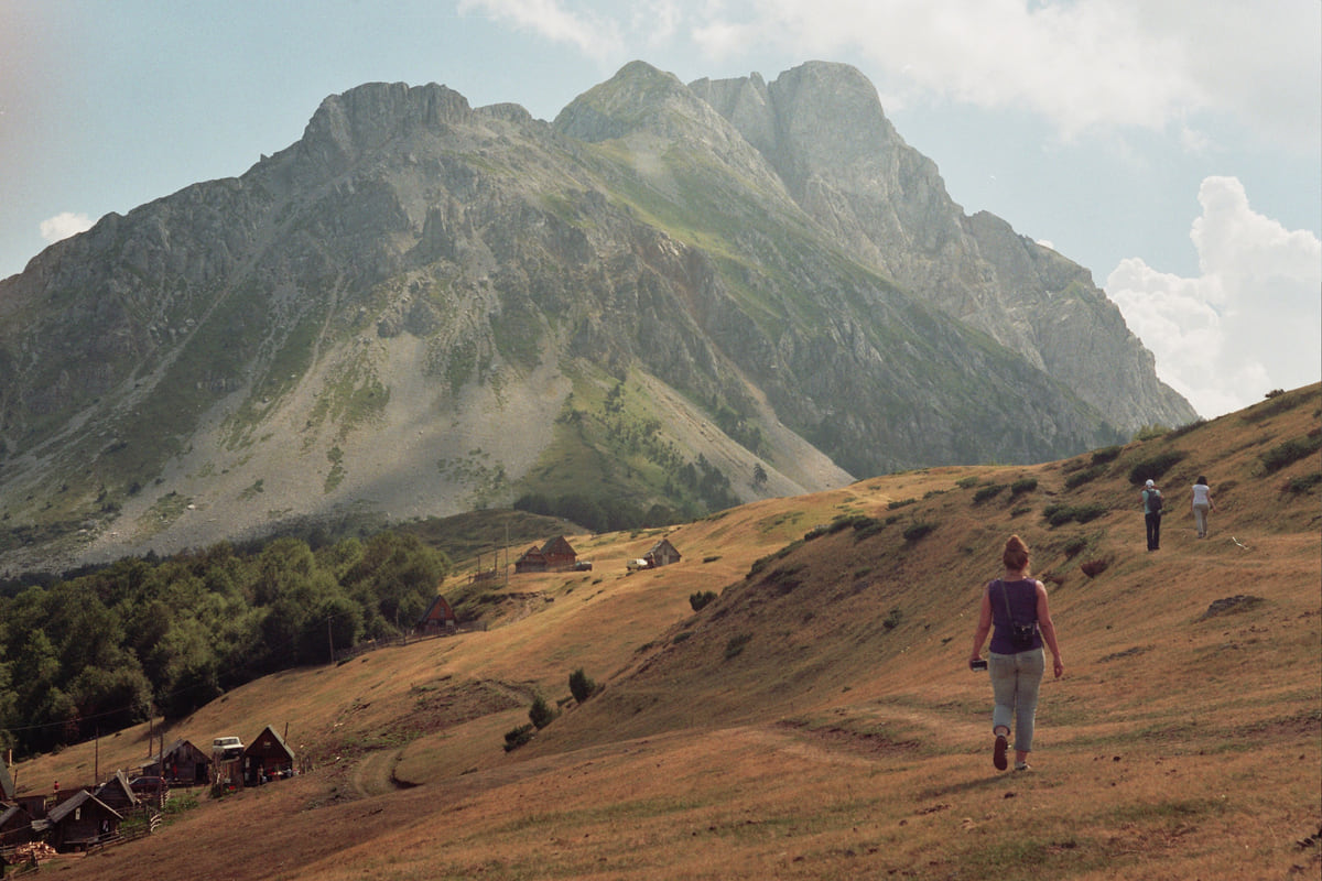
A trail across the Štavna meadows towards the Komovi peaks, with small hikers in front of the great rock massif
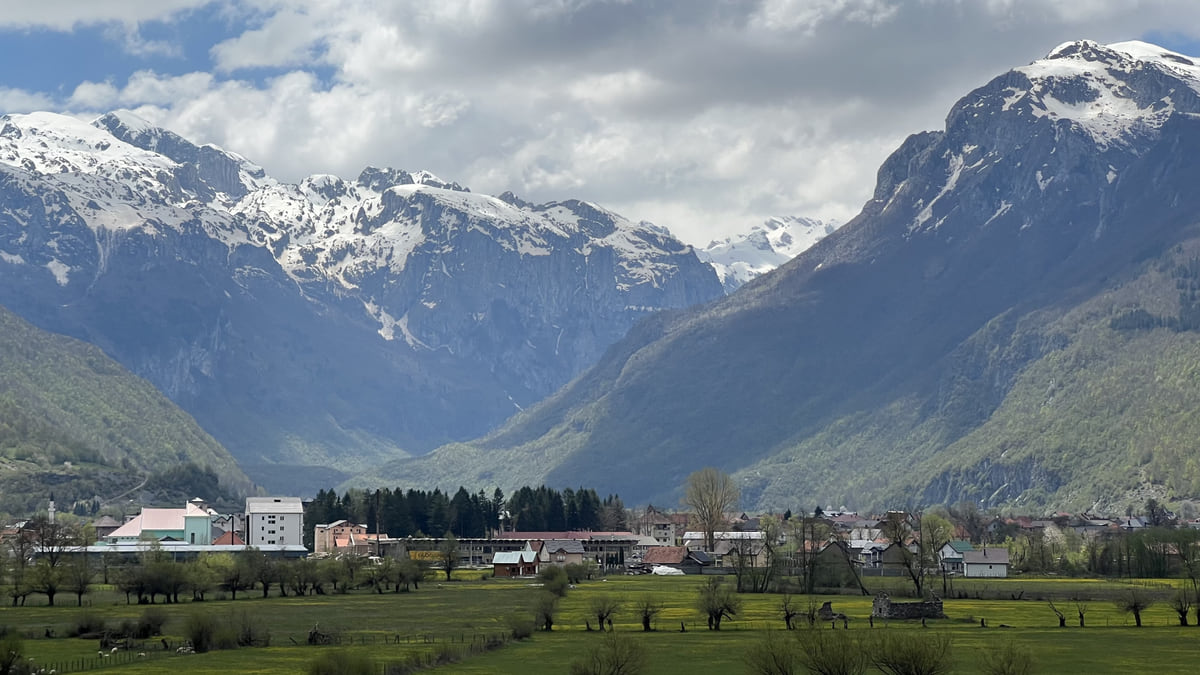
The Gusinje valley with its houses at the foot of the Prokletije mountains, still snow-capped in spring
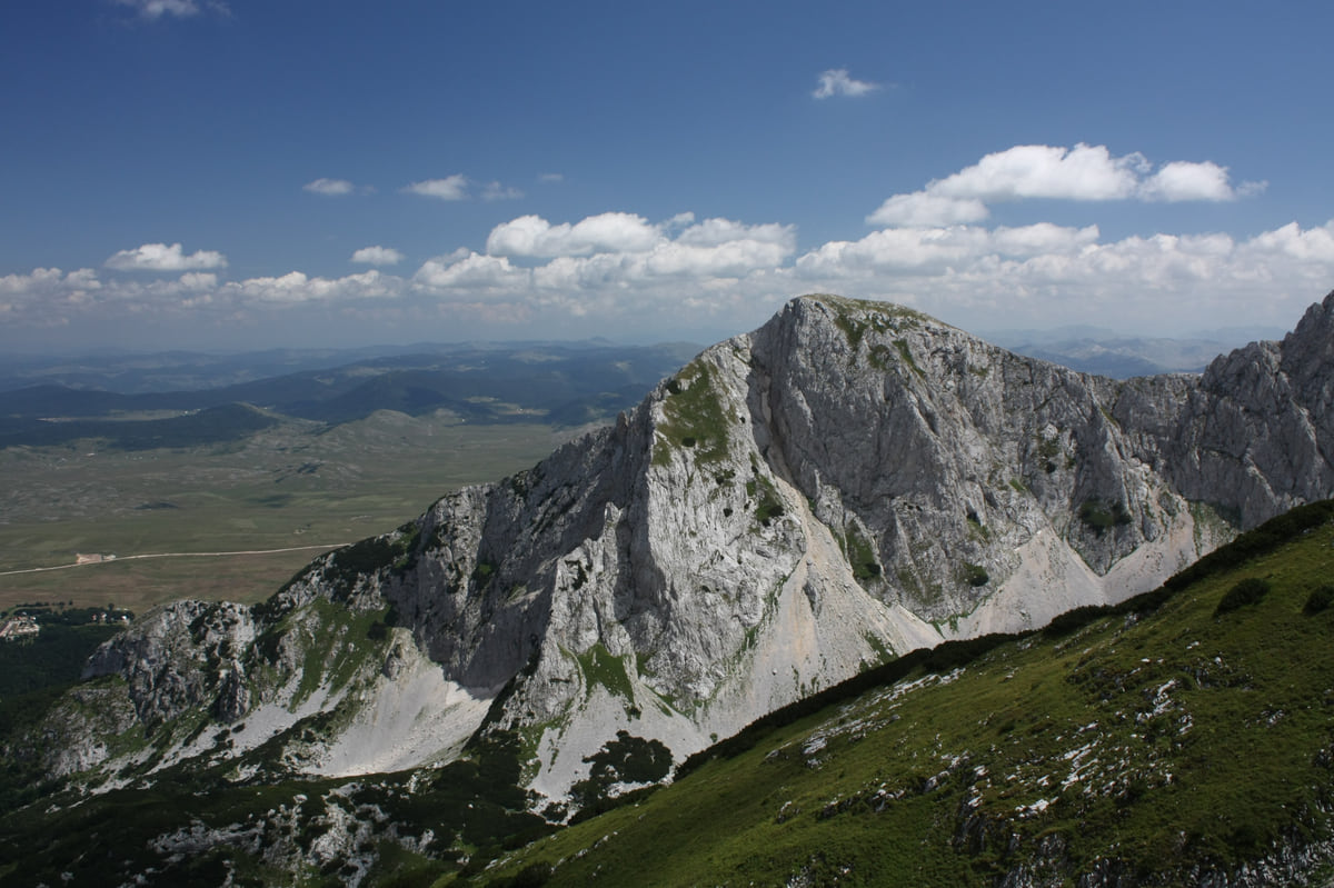
Savin Kuk in Durmitor, with its pale rock face and green meadows in the foreground under a cloudy sky
Highest peaks with an official source
| Peak | Range | Height | Source |
|---|---|---|---|
| Zla Kolata | Prokletije | 2,534 m | National Parks |
| Dobra Kolata | Prokletije | 2,528 m | National Parks |
| Rosni vrh | Prokletije | 2,525 m | National Parks |
| Bobotov Kuk | Durmitor | 2,522 m | MONSTAT |
| Maja Rozit | Prokletije | 2,522 m | MONSTAT |
| Kom Kučki | Komovi | 2,487 m | MONSTAT |
| Kom Vasojevićki | Komovi | 2,460 m | MONSTAT |
| Šljeme | Durmitor | 2,445 m | MONSTAT |
| Hajla | Rožaje | 2,403 m | MONSTAT |
| Crna glava | Bjelasica | 2,139 m | National Parks |
| Orjen | Herceg Novi | 1,895 m | MONSTAT |
| Štirovnik | Lovćen | 1,749 m | National Tourism Organisation |
Sources disagree on Bobotov Kuk (2,522 m from MONSTAT, 2,523 m from the National Tourism Organisation and 2,525 m from UNESCO). Zla Kolata isn't in MONSTAT's table. Checked on 10-10-2026.
Test yourself
True or false?
0/3 Pick before you peek.
-
All official sources give Bobotov Kuk the same height.
See the answer
False. MONSTAT gives 2,522 m, the National Tourism Organisation 2,523 m and UNESCO 2,525 m.
-
Prokletije has more than 20 peaks above 2,500 m.
See the answer
True. That's what the National Tourism Organisation states on its park page.
-
Orjen rises above 2,000 m.
See the answer
False. MONSTAT gives it 1,895 m, so it falls a little short of 2,000.
- Zla Kolata, per the National Parks
- 2,534 m
- Bobotov Kuk in MONSTAT's table
- 2,522 m
- Durmitor peaks over 2,000 m, roughly
- 50
- Mountain trails
- 3,000 km
0 of 278 Montenegro guides
Your next stamp
- Hiking
- Northern Montenegro
- Size
- Most beautiful places
- Komovi
- Prokletije National Park
- Bobotov Kuk
- Peaks of the Balkans
- Aman Sveti Stefan
- Budva Old Town
- Haj-Nehaj
- Kotor
- Lučice Beach
- Montenegro's coast
- Porto Montenegro
- Sea Dance Festival
- Splendid Conference & Spa Resort
- Stari Bar
- Ulcinj Old Town
- Bay of Kotor
- Budva Riviera
- Heroj submarine
- Iberostar Bellevue
- Independence Day
- Old olive tree of Mirovica
- Tivat
- Velika plaža
- Ada Bojana
- Beaches in Budva
- Eurostars Queen of Montenegro
- Herceg Novi
- Kotor Old Town
- Mount Rumija
- Igalo
- Kotor city walls
- Mogren Beach
- Montenegro Beach Resort
- Svač
- Vrmac
- Jaz Beach
- Kanli kula
- Luštica peninsula
- St Tryphon Cathedral
- Ulcinj salt pans
- Forte Mare
- Gornja Lastva
- Maritime Museum, Kotor
- Slovenska Beach
- Drobni Pijesak Beach
- Kotor viewpoints
- Mamula
- Žanjic beach
- Kotor cruise port
- Orjen
- Plavi horizonti beach
- Sveti Nikola Island
- Blue Cave
- Restaurants in Budva
- Restaurants in Kotor
- Canyoning
- Hotels
- Perast
- Sutomore
- Sveti Stefan
- Čanj
- Luxury hotels
- Our Lady of the Rocks
- Pržno
- Things to do
- Activities
- All-inclusive hotels
- Bar Riviera
- Bečići
- Hotel Palma
- St George island
- Dobrota
- Hladna uvala
- Petrovac
- Crvena stijena
- Prčanj
- Prettiest villages
- Cycling
- Risan
- UNESCO sites
- Heritage Grand Perast
- Map
- Hyatt Regency Kotor Bay
- Where is it?
- Regions
- Cities
- Beaches in Bar
- Budva
- Central Montenegro
- Hotels in Budva
- Hotels in Kotor
- Iberostar Waves Herceg Novi
- Kitesurfing
- The name
- Beaches in Ulcinj
- Flag
- Hotels in Perast
- Palmon Bay Hotel & Spa
- Podgorica
- Cathedral of the Resurrection
- One&Only Portonovi
- Population
- Sandy beaches
- Azul Beach Resort Montenegro
- Naturist beaches
- Stara Varoš
- Doclea
- Language
- Mimosa Festival
- Medun
- Religion
- Zipline
- Currency
- Museums in Podgorica
- Dajbabe Monastery
- EU membership
- History
- Restaurants in Podgorica
- Hotels in Podgorica
- Public holidays
- Avala Resort & Villas
- Bar
- Beaches in Kotor
- Birdwatching
- Hotels in Ulcinj
- Kotor carnival
- Time zone
- Tivat beaches
- Tuzi
- Boka Night
- Dukley Hotel & Resort
- Facts
- Hotels in Tivat
- Zeta
- Caves
- Herceg Novi beaches
- National parks
- Šipčanik
- Hotels in Herceg Novi
- Monasteries
- Fortresses
- Fly fishing
- Museums
- Canyons and waterfalls
- Lakes
- Montenegro and Croatia
- Beaches
- Boat trips
- Cetinje
- Montenegro and Albania
- Nightlife
- Ulcinj
- Weather
- Best time to visit
- Cetinje Monastery
- Kayaking
- Montenegro and the Balkans
- How to get there
- In summer
- King Nikola's Palace
- Sailing
- Biljarda
- Flights
- In winter
- Airports
- Museums in Cetinje
- New Year's Eve
- Lovćen
- Paragliding
- Tivat Airport
- Njegoš Mausoleum
- Podgorica Airport
- Dubrovnik to Kotor
- Kotor serpentine
- Belgrade to Montenegro
- Njeguši
- Ferry to Italy
- Njeguši prosciutto
- Border crossings
- In January
- Lipa Cave
- Where to stay
- In February
- Kamenari-Lepetane ferry
- Pavlova strana
- Getting around
- In March
- Rijeka Crnojevića
- In April
- Trains
- Buses
- In May
- Car hire
- In June
- Driving
- In July
- In August
- Taxis
- Distances
- In September
- In October
- Road trip
- Food
- In November
- Lake Skadar
- Scenic drives
- In December
- Kotor cable car
- Virpazar
- Where to eat
- Budva to Kotor
- Godinje
- Wine
- Podgorica to Kotor
- Vranjina
- Besac fortress
- Prices and budget
- On a budget
- Žabljak Crnojevića
- Danilovgrad
- Entry requirements
- Ostrog Monastery
- Tourist registration
- Customs
- Nikšić
- Crvena Stijena cave
- Safety
- Events
- Healthcare
- Mobile and roaming
- Žabljak
- Durmitor
- Plugs
- Black Lake
- With kids
- Holidays
- Day trips
- Stećci tombstones
- Hotels in Žabljak
- Three-day itinerary
- Five-day itinerary
- Skiing in Montenegro
- One-week itinerary
- Skiing in Žabljak
- Šavnik
- Ten-day itinerary
- Nevidio Canyon
- Tara Canyon
- Tara rafting
- Đurđevića Tara Bridge
- Plužine
- Lake Piva
- Piva Monastery
- Mojkovac
- Brskovo
- Pljevlja
- Husein Pasha Mosque
- Kolašin
- Hotels in Kolašin
- Skiing in Kolašin
- Biogradska Gora National Park
- Morača Monastery
- Morača Canyon
- Bijelo Polje
- Đalovića Cave
- Berane
- Andrijevica
- Petnjica
- Rožaje
- Plav
- Lake Plav
- Gusinje
- Vusanje
Frequently asked questions
What is the highest mountain in Montenegro?
It depends on the source. The National Parks and the National Tourism Organisation give Zla Kolata, 2,534 m, in Prokletije. MONSTAT's table, which doesn't include it, puts Bobotov Kuk and Maja Rozit joint first at 2,522 m.
What mountain ranges are in Montenegro?
The highest are Durmitor, Prokletije and the Komovi, all above 2,400 m. Lower ranges include Bjelasica, Lovćen above Kotor, Orjen above Herceg Novi and Rumija above Bar.
Can you climb Bobotov Kuk?
Yes, it's on one of the National Parks' recommended trails, from Sedlo via Zeleni vir to Bobotov Kuk. It's a proper mountain day, and gov.uk advises leaving your route with someone and keeping your phone charged.
Why is it called the Black Mountain?
Crna Gora, the local name, means 'black mountain', and Montenegro says the same. Which mountain it refers to has no official explanation I can quote.
Is altitude sickness a risk in Montenegro?
gov.uk mentions it as possible in some parts of the country. With peaks above 2,500 m, take the climb slowly and stay well hydrated.
By
Tourism graduate with a master’s in Tourism Management and Planning from the University of Málaga, who has travelled across Europe. He writes every guide from official sources and his own judgement.
Published on . Facts checked on .
Sources
Some links in this guide are affiliate links: if you book through them, the site earns a commission at no extra cost to you. Affiliate disclosure
Photos: Goran.Smith2 (CC BY-SA 3.0); Vuk Pajković (CC BY-SA 4.0); Planeti (CC BY-SA 4.0); Mercy (CC BY-SA 3.0), via Wikimedia Commons.