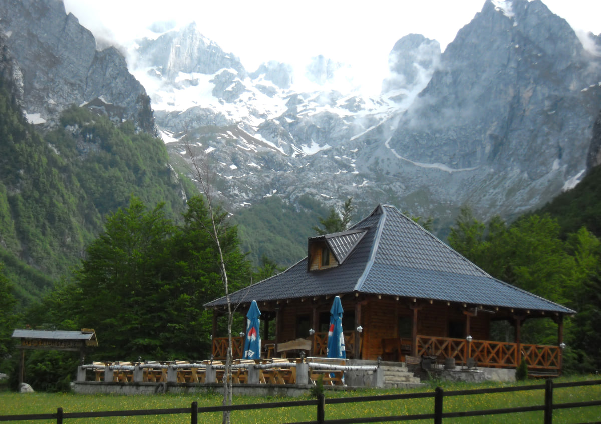
Plav, Gusinje and Prokletije National Park
Peaks of the Balkans, the Montenegrin section through Prokletije
Peaks of the Balkans is a hiking route linking Montenegro, Albania and Kosovo through the Prokletije mountains. In Montenegro it passes through Plav, Gusinje and the national park, and crossing the border on foot means getting authorisation from the border police beforehand, with a form, a passport copy and two fees of €2 and €3 per person.
In 30 seconds
Full read: 3 min
- Peaks of the Balkans links Montenegro, Albania and Kosovo through the Prokletije mountains.
- In Montenegro it runs through Plav, Gusinje and Prokletije National Park.
- Crossing the border in the mountains needs authorisation from the border police.
- You apply with a form, a passport copy and fees of €2 and €3 per person.
- Summer is the season; take a guide unless you're very experienced.
I'd apply for the border authorisation well ahead and carry a printed copy, as no lead time is published. Unless you're very experienced in the mountains, I'd do this section with a licensed guide; Prokletije holds late snow and there's little to go on if you lose the path.

Before you go
What I would keep in mind
-
01 My tip
Apply to both countries
The official annex says you apply to the police of the country you're entering, while the general page says the one you're leaving; to be safe, I'd apply to both.
Montenegro's border crossings -
02 Money
Two fees per person
The application costs €2 and the authorisation €3 per person, under the procedure published by the national tourist board.
-
03 Getting there
Plav, where the routes start
According to the national tourist board, most routes into Prokletije set off from Plav, beside its lake.
Plav -
04 Most beautiful
Lake Hridsko
The Lake of Happiness, as it's known, is an hour's walk from Babino Polje and a good way to get a feel for Prokletije before the trek.
Prokletije -
05 My tip
Pack a fly rod
Plav and the Ljuča river are fly-fishing water too; the season opens between 1 April and 15 May, depending on how much snow is left in Prokletije.
fly fishing in Montenegro
What I would book
Peaks of the Balkans is one of those routes people plan whole trips around. It links Montenegro, Albania and Kosovo through the Prokletije mountains, the Accursed Mountains, and in Montenegro it crosses the municipalities of Plav and Gusinje. The national tourist board mentions it as the challenging trail waiting in the massif, alongside the Via Dinarica. Here I cover the Montenegrin section and, above all, the paperwork for crossing the border, which is what raises the most questions. The stages and distances come from the trail’s own website.
The terrain
Prokletije forms Montenegro’s natural border with Albania and Kosovo, at the southern end of the Dinaric Alps. It has upwards of twenty peaks over 2,500 m, according to the national tourist board, including the country’s highest, Zla Kolata, which the national park puts at 2,534 m. The peaks rise above two valleys, Grbaja and Ropojana, with lakes, waterfalls and prehistoric rock carvings. It’s proper high-mountain country, with big climbs and quiet paths outside summer.
Ten stages and 192 km
The trail’s website gives 192 km in ten stages, walked in 10 to 13 days depending on fitness. It’s a loop, so you can start in Theth (Albania), Plav or Peja (Kosovo), and it runs from 670 m near Çerem to 2,290 m on the saddle between Dobërdol and Milishevc. It’s rated easy to moderate, yet you need to be fit and properly equipped, and the waymarked route crosses empty uplands, which is why the trail’s own website advises walking it with a group or a guide.
The Montenegrin section is three and a half stages. From Kuçishtë (Kosovo) you drop to Babino Polje in 15.8 km, topping out at 2,276 m. Babino Polje to Plav, via Lake Hrid and Bajrovica katun, is 20.3 km and 7 to 8 hours. The toughest is Plav to Vusanje, 27.4 km and 10 to 11 hours, climbing Bor peak at 2,106 m, which the site suggests splitting with a night at Kolenovica katun. And Vusanje to Theth, heading into Albania, is 21.4 km and about 8 hours. With only three or four days, I’d walk Babino Polje to Vusanje, which stays inside Montenegro and needs no border permit.
If you are staying the night, see the best hotel deals in Plav for your dates: the well-placed rooms go fast.
Plav and Gusinje, the bases
The tourist board says most routes into Prokletije start from Plav, beside Lake Plav. Gusinje, a few kilometres on, is the gateway to the valleys, and the park’s visitor centre can tell you about mountain routes and put you in touch with local guides. Entry to Prokletije National Park costs €3 per person per day, and a park guide costs €40 for four hours or €80 for eight.
The border crossing permit
This is the part you can’t improvise. The national tourist board publishes the procedure for routes that cross the border away from official crossing points, and Prokletije is on its list along with Hajla, Ljubišnja, Kamena Gora, Maglić and Orjen. Applications go to the border police, for one person or a whole group, delivered by hand, post or fax. You fill in the “Request” form, add a passport copy, and each walker pays €2 to apply and €3 once it’s granted. You get the reply by post or collect it in person.
There’s one wrinkle worth knowing. The annex says the application goes to the police of the country you’re entering, while the general page refers to the country you’re leaving. I’d send it to both, so you’re not left at the border without a permit. No lead time is published, so I wouldn’t leave it to the last week. If you’re continuing into Albania or Kosovo, check their own entry rules too, which each country sets. Montenegro sits outside Schengen, so nights on its side of the trail don’t use up your Schengen allowance. The official road crossings and what’s needed at each are in my guide to border crossings in Montenegro.
So you do not lose the morning at the ticket office, browse tickets and tours in Plav on GetYourGuide.
When to go and how to prepare
The national tourist board gives summer as the best time for trekking in Prokletije, and warns that snow can still catch you out then. It recommends going with others and a licensed guide, and trek organisers include accommodation, a licensed guide and transport. Bring proper boots, layers and your documents, since you’ll be crossing borders. In an emergency, dial 112. If you’d like a taster first, Lake Hridsko is an hour’s walk from Babino Polje. And if you’ve brought a bike, the park suggests pedalling between Gusinje and Ropojana, 23 km in all with the return, and there are more routes in my guide to cycling in Montenegro.
If you are staying the night, see the best hotel deals in Plav for your dates: the well-placed rooms go fast.
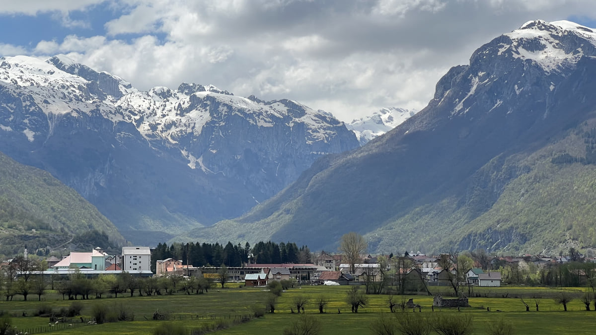
The Gusinje valley with its houses at the foot of the Prokletije mountains, still snow-capped in spring
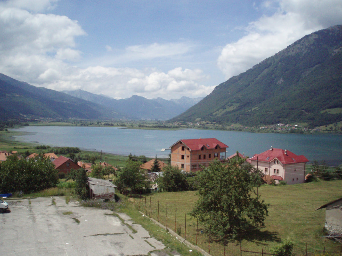
Lake Plav between green mountains, with red-roofed houses on the shore and clouds over the valley
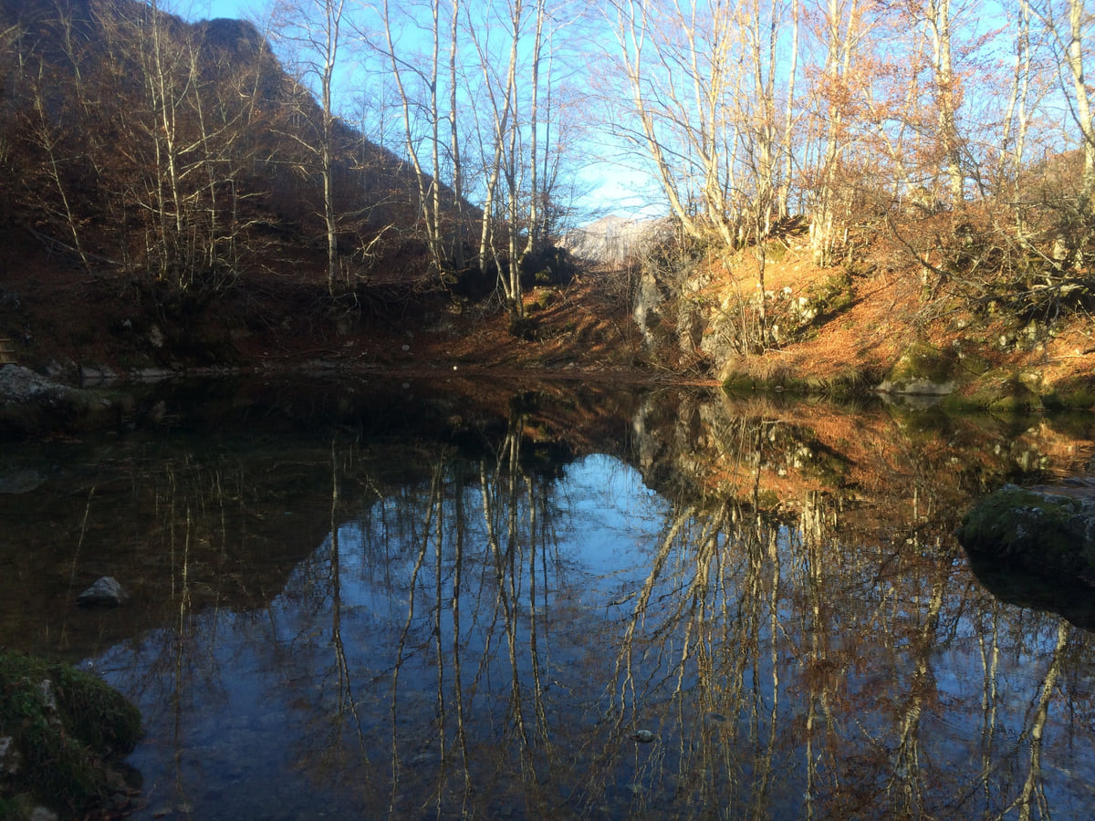
The Oko Skakavice spring near Vusanje in Prokletije, its still water reflecting bare trees in autumn
The ten stages of the Peaks of the Balkans
| Stage | Country | Distance | Time |
|---|---|---|---|
| Theth-Valbona | Albania | 13.9 km | 7 hrs |
| Valbona-Çerem | Albania | 19.8 km | 7 hrs |
| Çerem-Dobërdol | Albania | 15.6 km | 6 hrs |
| Dobërdol-Milishevc | Albania and Kosovo | 18.2 km | 8-9 hrs |
| Milishevc-Reka e Allagës | Kosovo | 16.2 km | 8-9 hrs |
| Reka e Allagës-Kuçishtë | Kosovo | 23.3 km | 8-9 hrs |
| Kuçishtë-Babino Polje | Kosovo and Montenegro | 15.8 km | 7-8 hrs |
| Babino Polje-Plav, via Lake Hrid | Montenegro | 20.3 km | 7-8 hrs |
| Plav-Vusanje, via Grebaja | Montenegro | 27.4 km | 10-11 hrs |
| Vusanje-Theth | Montenegro and Albania | 21.4 km | 8 hrs |
The trail's own website (peaksofthebalkans.com), stage pages in the archive.org copy of 02-02-2023; the live site blocks automated reading. 192 km in all, between 670 and 2,290 m.
Test yourself
True or false?
0/3 Pick before you peek.
-
You can cross into Albania on the Peaks of the Balkans without any paperwork.
See the answer
False. Crossing away from the official border posts needs prior authorisation from the border police.
-
The application and the authorisation each carry a fee per person.
See the answer
True. It's €2 for the application and €3 for the authorisation, under the official procedure.
-
There's never any snow in Prokletije in midsummer.
See the answer
False. The national tourist board warns that you can come across snow even in summer.
0 of 278 Montenegro guides
Your next stamp
- Montenegro and Albania
- Montenegro and the Balkans
- Border crossings
- Gusinje
- Mountains
- Prokletije National Park
- Where is it?
- Aman Sveti Stefan
- Budva Old Town
- Haj-Nehaj
- Kotor
- Lučice Beach
- Montenegro's coast
- Porto Montenegro
- Sea Dance Festival
- Splendid Conference & Spa Resort
- Stari Bar
- Ulcinj Old Town
- Bay of Kotor
- Budva Riviera
- Heroj submarine
- Iberostar Bellevue
- Independence Day
- Old olive tree of Mirovica
- Tivat
- Velika plaža
- Ada Bojana
- Beaches in Budva
- Eurostars Queen of Montenegro
- Herceg Novi
- Kotor Old Town
- Mount Rumija
- Igalo
- Kotor city walls
- Mogren Beach
- Montenegro Beach Resort
- Svač
- Vrmac
- Hiking
- Jaz Beach
- Kanli kula
- Luštica peninsula
- St Tryphon Cathedral
- Ulcinj salt pans
- Forte Mare
- Gornja Lastva
- Maritime Museum, Kotor
- Slovenska Beach
- Drobni Pijesak Beach
- Kotor viewpoints
- Mamula
- Žanjic beach
- Kotor cruise port
- Orjen
- Plavi horizonti beach
- Sveti Nikola Island
- Blue Cave
- Restaurants in Budva
- Restaurants in Kotor
- Canyoning
- Hotels
- Perast
- Sutomore
- Sveti Stefan
- Čanj
- Luxury hotels
- Our Lady of the Rocks
- Pržno
- Things to do
- Activities
- All-inclusive hotels
- Bar Riviera
- Bečići
- Hotel Palma
- St George island
- Dobrota
- Hladna uvala
- Most beautiful places
- Petrovac
- Crvena stijena
- Prčanj
- Prettiest villages
- Cycling
- Risan
- UNESCO sites
- Heritage Grand Perast
- Map
- Hyatt Regency Kotor Bay
- Regions
- Cities
- Beaches in Bar
- Budva
- Central Montenegro
- Hotels in Budva
- Hotels in Kotor
- Iberostar Waves Herceg Novi
- Kitesurfing
- The name
- Beaches in Ulcinj
- Flag
- Hotels in Perast
- Palmon Bay Hotel & Spa
- Podgorica
- Cathedral of the Resurrection
- One&Only Portonovi
- Population
- Sandy beaches
- Azul Beach Resort Montenegro
- Naturist beaches
- Size
- Stara Varoš
- Doclea
- Language
- Mimosa Festival
- Medun
- Religion
- Zipline
- Currency
- Museums in Podgorica
- Dajbabe Monastery
- EU membership
- History
- Restaurants in Podgorica
- Hotels in Podgorica
- Public holidays
- Avala Resort & Villas
- Bar
- Beaches in Kotor
- Birdwatching
- Hotels in Ulcinj
- Kotor carnival
- Time zone
- Tivat beaches
- Tuzi
- Boka Night
- Dukley Hotel & Resort
- Facts
- Hotels in Tivat
- Zeta
- Caves
- Herceg Novi beaches
- National parks
- Šipčanik
- Hotels in Herceg Novi
- Monasteries
- Fortresses
- Fly fishing
- Museums
- Canyons and waterfalls
- Lakes
- Montenegro and Croatia
- Beaches
- Boat trips
- Cetinje
- Nightlife
- Ulcinj
- Weather
- Best time to visit
- Cetinje Monastery
- Kayaking
- How to get there
- In summer
- King Nikola's Palace
- Sailing
- Biljarda
- Flights
- In winter
- Airports
- Museums in Cetinje
- New Year's Eve
- Lovćen
- Paragliding
- Tivat Airport
- Njegoš Mausoleum
- Podgorica Airport
- Dubrovnik to Kotor
- Kotor serpentine
- Belgrade to Montenegro
- Njeguši
- Ferry to Italy
- Njeguši prosciutto
- In January
- Lipa Cave
- Where to stay
- In February
- Kamenari-Lepetane ferry
- Pavlova strana
- Getting around
- In March
- Rijeka Crnojevića
- In April
- Trains
- Buses
- In May
- Car hire
- In June
- Driving
- In July
- In August
- Taxis
- Distances
- In September
- In October
- Road trip
- Food
- In November
- Lake Skadar
- Scenic drives
- In December
- Kotor cable car
- Virpazar
- Where to eat
- Budva to Kotor
- Godinje
- Wine
- Podgorica to Kotor
- Vranjina
- Besac fortress
- Prices and budget
- On a budget
- Žabljak Crnojevića
- Danilovgrad
- Entry requirements
- Ostrog Monastery
- Tourist registration
- Customs
- Nikšić
- Crvena Stijena cave
- Safety
- Events
- Healthcare
- Northern Montenegro
- Mobile and roaming
- Žabljak
- Durmitor
- Plugs
- Black Lake
- With kids
- Bobotov Kuk
- Holidays
- Day trips
- Stećci tombstones
- Hotels in Žabljak
- Three-day itinerary
- Five-day itinerary
- Skiing in Montenegro
- One-week itinerary
- Skiing in Žabljak
- Šavnik
- Ten-day itinerary
- Nevidio Canyon
- Tara Canyon
- Tara rafting
- Đurđevića Tara Bridge
- Plužine
- Lake Piva
- Piva Monastery
- Mojkovac
- Brskovo
- Pljevlja
- Husein Pasha Mosque
- Kolašin
- Hotels in Kolašin
- Skiing in Kolašin
- Biogradska Gora National Park
- Komovi
- Morača Monastery
- Morača Canyon
- Bijelo Polje
- Đalovića Cave
- Berane
- Andrijevica
- Petnjica
- Rožaje
- Plav
- Lake Plav
- Vusanje
Frequently asked questions
What is Peaks of the Balkans?
A cross-border hiking route through the Prokletije mountains linking Montenegro, Albania and Kosovo. Montenegro's national tourist board describes it as a challenging trail.
Do you need a permit for Peaks of the Balkans?
Yes, to cross the border away from official crossing points. You apply to the border police with the "Request" form, a passport copy and two fees of €2 and €3 per person, individually or as a group.
How far in advance should you apply for the border permit?
The national tourist board doesn't publish a lead time. I'd allow several weeks, as the authorisation is delivered by post or in person.
When is the best time to hike Peaks of the Balkans?
Summer, which the tourist board gives as the best time for trekking in Prokletije, though it warns you may still find snow even then.
How long is the Peaks of the Balkans trail?
192 km in ten stages, according to the trail's website, walked in 10 to 13 days. Stages run from 13.9 to 27.4 km, the longest being the Montenegrin one from Plav to Vusanje.
Where does Peaks of the Balkans start in Montenegro?
Around Plav and Gusinje, in Prokletije National Park. The tourist board says most Prokletije routes begin in Plav.
By
Tourism graduate with a master’s in Tourism Management and Planning from the University of Málaga, who has travelled across Europe. He writes every guide from official sources and his own judgement.
Published on . Facts checked on .
Sources
- Montenegro National Tourist Organisation, hiking and trekking
- Montenegro National Tourist Organisation, conditions for entering Montenegro
- Montenegro National Tourist Organisation, procedure for crossing outside border posts
- Montenegro National Tourist Organisation, Prokletije National Park
- Peaks of the Balkans, trail description (archive.org copy of 02-02-2023)
- National Parks of Montenegro, Prokletije
Some links in this guide are affiliate links: if you book through them, the site earns a commission at no extra cost to you. Affiliate disclosure
Photos: Sigismund von Dobschütz (CC BY-SA 3.0); Planeti (CC BY-SA 4.0); Chlämens (Public domain); KpokeJlJla (CC BY-SA 4.0), via Wikimedia Commons.