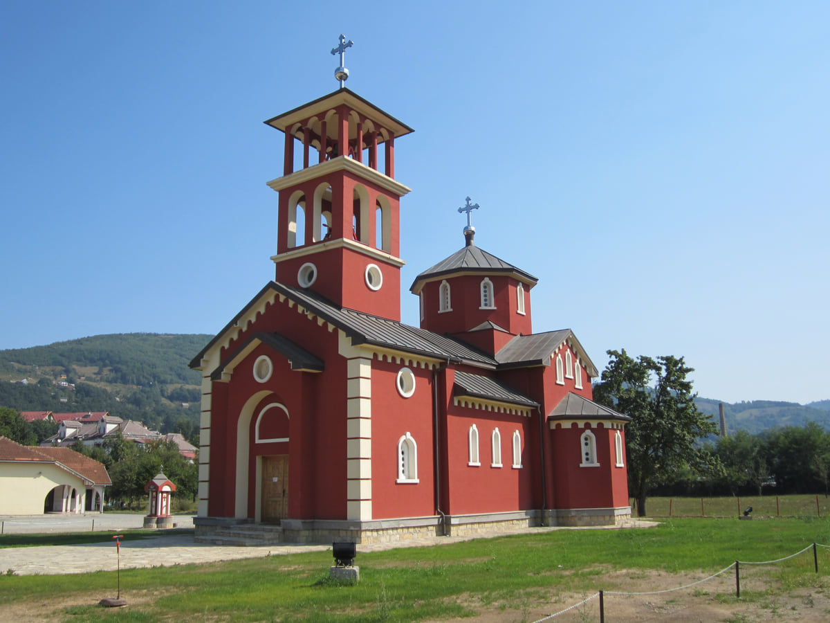
Northern Montenegro, the Tara valley
Mojkovac, the Tara valley town between two national parks
Mojkovac is the seat of a municipality of 6,728 people (2023) in the Tara valley, at 853 metres, between Bjelasica, Sinjajevina and the Prošćenje mountains and between the Biogradska Gora and Durmitor national parks. It's a stop on the Bar to Belgrade railway and has the medieval mine of Brskovo, the Crna Poda pine forest and Lake Zabojsko, 70 km from Žabljak.
In 30 seconds
Full read: 2 min
- Mojkovac sits at 853 metres in the Tara valley, between Biogradska Gora and Durmitor.
- It's a stop on the Bar to Belgrade railway, about 1 hr 45 from Podgorica.
- The municipality holds Crna Poda, Lake Zabojsko and the medieval mining town of Brskovo.
- It had 6,728 residents in 2023 and logged 6,354 tourist arrivals in 2024.
Mojkovac isn't pretty, it's useful. I'd use it as a cheap, rail-connected base for the Tara, Biogradska Gora and Sinjajevina and, if I fly-fished, for the stretch of the Tara right on its doorstep.

Before you go
What I would keep in mind
-
01 Getting there
By train from Podgorica
Mojkovac is a stop on the Bar to Belgrade line. On ZPCG's timetable checked on 11 October 2026, the 06:21 from Podgorica arrives at 08:08 and the 17:40 at 19:23.
-
02 Most beautiful
Lake Zabojsko on Sinjajevina
At 1,477 metres, 19 metres deep and clear to 8 metres down, Lake Zabojsko lies inside Durmitor National Park, according to the Mojkovac tourist board.
-
03 My tip
Fly fishing on the doorstep
The tourist board describes an 8 km fly-fishing zone on the Tara, from Biogradska Gora down to Mojkovac, holding grayling, trout and Danube salmon.
-
04 Worth the splurge
Paragliding all year
According to the Mojkovac tourist board, the weather allows paragliding all year round, flying tandem with professional pilots.
What I would book
Mojkovac sits in a cracking spot and doesn’t make as much of it as it could. The town lies at 853 metres in the Tara valley, between Bjelasica, Sinjajevina and the Prošćenje mountains, and between two national parks, Biogradska Gora and Durmitor. It has a railway station, a medieval history of silver mining and a stretch of the Tara well known to fly fishers. I’d call it the north’s most underrated base.
From Brskovo’s silver to the battle of 1916
The Mojkovac tourist board traces the area’s story back to the Middle Ages. The mine at Brskovo opened in the 13th century, worked by Saxon miners, and silver coins were struck there. Tradition holds that the name Mojkovac comes from King Uroš I’s words, «my minted coin», although the same source notes other explanations, such as the surname Mojković.
The best-remembered episode came much later. On 6 and 7 January 1916, in the middle of the First World War, the Montenegrin army under Serdar Janko Vukotić defeated a larger Austro-Hungarian force here. There are memorials to the fallen by the bridge over the Tara and at Bojna Njiva. The present municipality was formed in 1955 by merging Polja and Mojkovac.
The Tara, Crna Poda and Lake Zabojsko
The Tara runs through the municipality, and downstream, between Bistrica and Dobrilovina, the Tara Canyon begins. That’s where Crna Poda grows, 20 hectares of black pine with trees of around 400 years, and just below it Đavolje lazi, where the river narrows to 2 or 3 metres. The tourist board also points to Tmajevac, where the Ravnjak joins the Tara and the municipality’s share of Durmitor National Park begins.
Up on Sinjajevina, at 1,477 metres, Lake Zabojsko is 19 metres deep with water clear to 8 metres, according to the same source, reached by a dirt track from the village of Dobrilovina. Sinjajevina, it says, is the largest pasture in the Balkans, with 120,000 hectares of grazing.
To sleep close to everything, search places to stay in Mojkovac on Expedia and filter by area before price.
Fishing, paragliding and mountains
For fly fishers, Mojkovac is a destination in its own right. The tourist board describes an 8 km zone on the Tara, from the edge of Biogradska Gora to the town, with grayling, trout and Danube salmon, and good fish below the old bridge at the entrance to town. It also offers tandem paragliding all year, cycling, jeep, quad and horse trips, and notes that the Žarski ski area is under construction.
Biogradska Gora National Park is close by, upstream, and the remains of Brskovo lie within its protection zone on the slopes of Bjelasica.
Getting there and around
Mojkovac is on the Bar to Belgrade railway. On ZPCG’s timetable checked on 11 October 2026 there are four trains a day from Podgorica, taking between 1 hr 34 and 1 hr 51, and the night train runs on to Belgrade. By road, the tourist board gives 70 km to Žabljak and about 100 km to Podgorica airport, and the road to Durmitor crosses the Đurđevića Tara Bridge. Collecting a hire car at the airport, it’s a straightforward drive north, keeping right on the mountain roads.
If you are short on time, see the best tours in Mojkovac and pick one that fits your day.
To sleep close to everything, search places to stay in Mojkovac on Booking.com and filter by area before price.
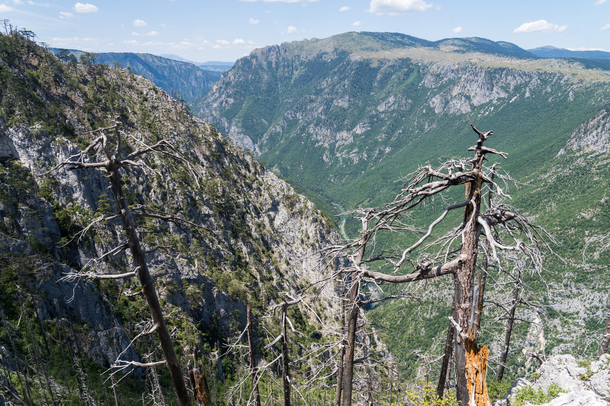
The Tara River canyon from a lookout, with forested walls dropping to the valley floor and dead trees in the foreground
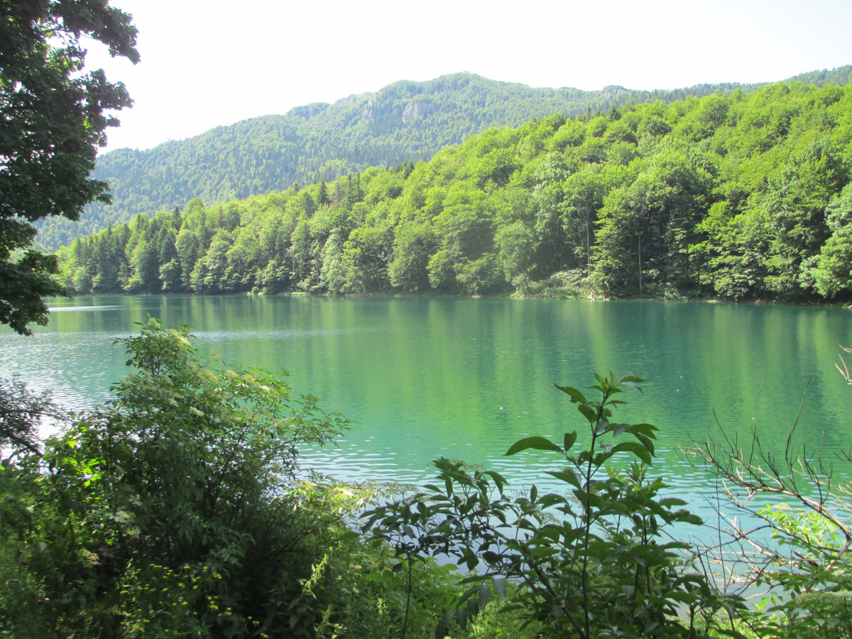
Lake Biograd, with green water, surrounded by the forest of Biogradska Gora National Park on a summer day
Trains from Podgorica to Mojkovac
| Train | Leaves Podgorica | Arrives Mojkovac | Continues to |
|---|---|---|---|
| 6100 | 06:21 | 08:08 | Bijelo Polje |
| 6102 | 17:40 | 19:23 | Bijelo Polje |
| 6104 | 19:48 | 21:39 | Bijelo Polje |
| 432 | 21:20 | 22:54 | Belgrade |
Source: ZPCG timetable checked on 11 October 2026. The published fares don't cover the Mojkovac leg; check at the station.
Mojkovac in figures
| Measure | Value |
|---|---|
| Municipal population (2023) | 6,728 |
| Area | 359 km² |
| Settlements | 15 |
| Tourist arrivals (2024) | 6,354 |
| Overnight stays (2024) | 17,139 |
Source: MONSTAT (2023 census, 2025 yearbook and 2024 tourism).
Test yourself
True or false?
0/3 Pick before you peek.
-
Coins were minted at Brskovo, near Mojkovac, in the Middle Ages.
See the answer
True. The Mojkovac tourist board says silver coins similar to Venetian grossi were struck there.
-
Mojkovac has no railway.
See the answer
False. It's a stop on the Bar to Belgrade line, roughly 1 hr 45 from Podgorica on ZPCG's timetable.
-
Today's Mojkovac municipality dates from 1955.
See the answer
True. According to its tourist board, it was formed in 1955 by merging the municipalities of Polja and Mojkovac.
- Altitude of the town
- 853 m
- Fly-fishing zone on the Tara
- 8 km
- Year of the battle of Mojkovac
- 1916
- By road to Žabljak
- 70 km
Map
Where Mojkovac is
The Adriatic coast runs from Herceg Novi to Ulcinj; the centre holds Podgorica, Cetinje and Lake Skadar, and the north, Durmitor and the Tara Canyon. Every number opens its guide.
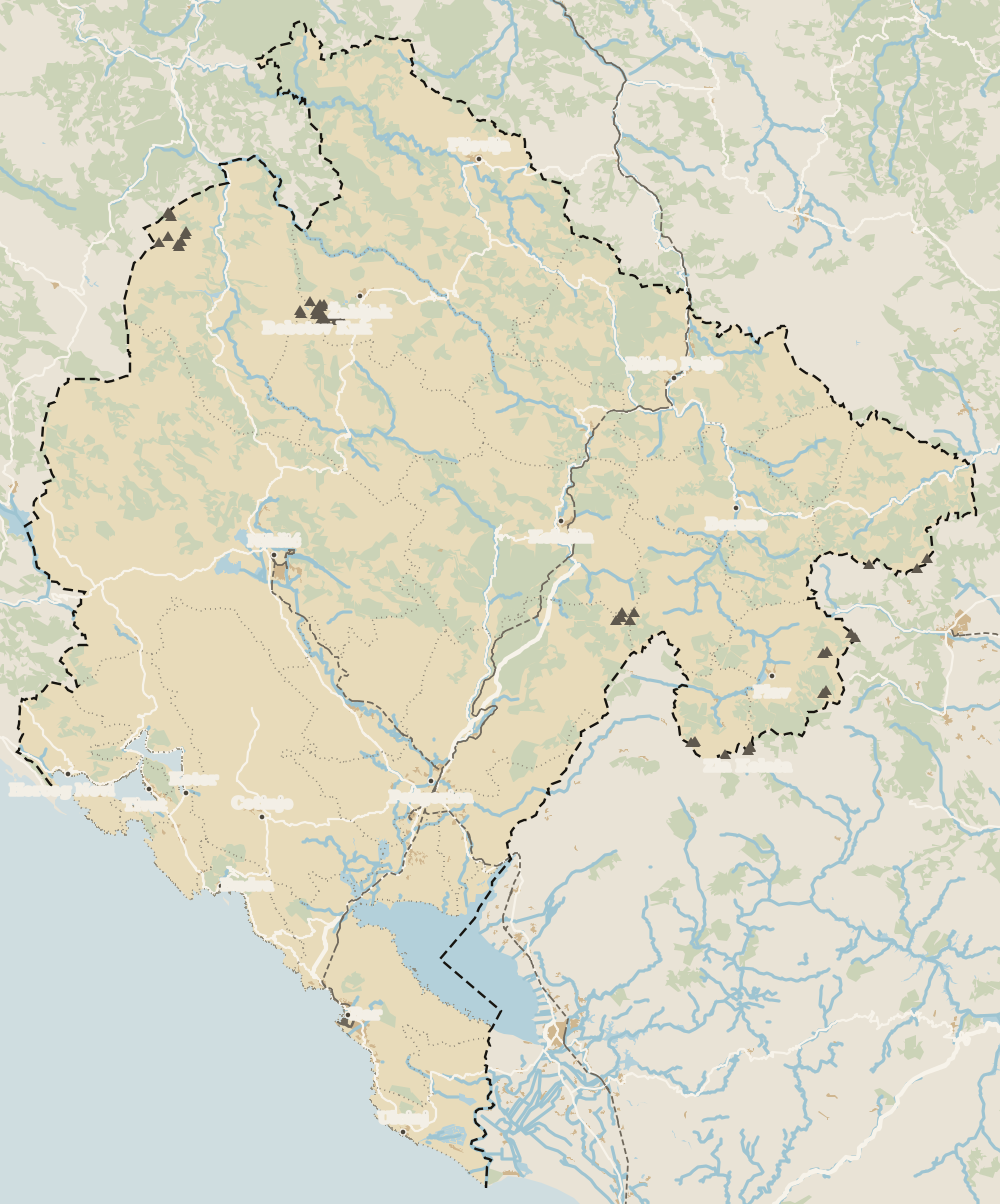 1Northern Montenegro 2Žabljak 3Šavnik 4Tara Canyon 5Plužine 6Mojkovac 7Pljevlja 8Kolašin 9Bijelo Polje 10Berane 11Andrijevica 12Petnjica 13Rožaje 14Plav 15Gusinje
 Map data © OpenStreetMap contributors (ODbL)
- 1Northern MontenegroMontenegro's northern region
- 2ŽabljakNorthern Montenegro, Žabljak municipality
- 3ŠavnikNorthern Montenegro, south of Durmitor
- 4Tara CanyonDurmitor National Park, northern Montenegro
- 5PlužineNorthern Montenegro, the Piva area
- 6MojkovacNorthern Montenegro, the Tara valley
- 7PljevljaTown in northern Montenegro
- 8KolašinNorthern Montenegro, Bjelasica
- 9Bijelo PoljeNorthern Montenegro, Lim valley
- 10BeraneNorthern Montenegro, Lim valley
- 11AndrijevicaNorthern Montenegro, upper Lim
- 12PetnjicaNorthern Montenegro, Bihor
- 13RožajeNorthern Montenegro, Ibar valley
- 14PlavNorthern Montenegro, upper Lim
- 15GusinjeNorthern Montenegro, Prokletije
What to see
What to see in Mojkovac
0 of 278 Montenegro guides
Your next stamp
- Brskovo
- Zipline
- Black Lake
- Kolašin
- Žabljak
- Đurđevića Tara Bridge
- Northern Montenegro
- Tara Canyon
- Aman Sveti Stefan
- Budva Old Town
- Haj-Nehaj
- Kotor
- Lučice Beach
- Montenegro's coast
- Peaks of the Balkans
- Porto Montenegro
- Sea Dance Festival
- Splendid Conference & Spa Resort
- Stari Bar
- Ulcinj Old Town
- Bay of Kotor
- Budva Riviera
- Heroj submarine
- Iberostar Bellevue
- Independence Day
- Old olive tree of Mirovica
- Tivat
- Velika plaža
- Ada Bojana
- Beaches in Budva
- Eurostars Queen of Montenegro
- Herceg Novi
- Kotor Old Town
- Mount Rumija
- Igalo
- Kotor city walls
- Mogren Beach
- Montenegro Beach Resort
- Svač
- Vrmac
- Hiking
- Jaz Beach
- Kanli kula
- Luštica peninsula
- St Tryphon Cathedral
- Ulcinj salt pans
- Forte Mare
- Gornja Lastva
- Maritime Museum, Kotor
- Slovenska Beach
- Drobni Pijesak Beach
- Kotor viewpoints
- Mamula
- Žanjic beach
- Kotor cruise port
- Orjen
- Plavi horizonti beach
- Sveti Nikola Island
- Blue Cave
- Restaurants in Budva
- Restaurants in Kotor
- Canyoning
- Hotels
- Perast
- Sutomore
- Sveti Stefan
- Čanj
- Luxury hotels
- Our Lady of the Rocks
- Pržno
- Things to do
- Activities
- All-inclusive hotels
- Bar Riviera
- Bečići
- Hotel Palma
- St George island
- Dobrota
- Hladna uvala
- Most beautiful places
- Petrovac
- Crvena stijena
- Prčanj
- Prettiest villages
- Cycling
- Risan
- UNESCO sites
- Heritage Grand Perast
- Map
- Hyatt Regency Kotor Bay
- Where is it?
- Regions
- Cities
- Beaches in Bar
- Budva
- Central Montenegro
- Hotels in Budva
- Hotels in Kotor
- Iberostar Waves Herceg Novi
- Kitesurfing
- The name
- Beaches in Ulcinj
- Flag
- Hotels in Perast
- Palmon Bay Hotel & Spa
- Podgorica
- Cathedral of the Resurrection
- One&Only Portonovi
- Population
- Sandy beaches
- Azul Beach Resort Montenegro
- Naturist beaches
- Size
- Stara Varoš
- Doclea
- Language
- Mimosa Festival
- Medun
- Religion
- Currency
- Museums in Podgorica
- Dajbabe Monastery
- EU membership
- History
- Restaurants in Podgorica
- Hotels in Podgorica
- Public holidays
- Avala Resort & Villas
- Bar
- Beaches in Kotor
- Birdwatching
- Hotels in Ulcinj
- Kotor carnival
- Time zone
- Tivat beaches
- Tuzi
- Boka Night
- Dukley Hotel & Resort
- Facts
- Hotels in Tivat
- Zeta
- Caves
- Herceg Novi beaches
- National parks
- Šipčanik
- Hotels in Herceg Novi
- Monasteries
- Fortresses
- Fly fishing
- Museums
- Canyons and waterfalls
- Lakes
- Mountains
- Montenegro and Croatia
- Beaches
- Boat trips
- Cetinje
- Montenegro and Albania
- Nightlife
- Ulcinj
- Weather
- Best time to visit
- Cetinje Monastery
- Kayaking
- Montenegro and the Balkans
- How to get there
- In summer
- King Nikola's Palace
- Sailing
- Biljarda
- Flights
- In winter
- Airports
- Museums in Cetinje
- New Year's Eve
- Lovćen
- Paragliding
- Tivat Airport
- Njegoš Mausoleum
- Podgorica Airport
- Dubrovnik to Kotor
- Kotor serpentine
- Belgrade to Montenegro
- Njeguši
- Ferry to Italy
- Njeguši prosciutto
- Border crossings
- In January
- Lipa Cave
- Where to stay
- In February
- Kamenari-Lepetane ferry
- Pavlova strana
- Getting around
- In March
- Rijeka Crnojevića
- In April
- Trains
- Buses
- In May
- Car hire
- In June
- Driving
- In July
- In August
- Taxis
- Distances
- In September
- In October
- Road trip
- Food
- In November
- Lake Skadar
- Scenic drives
- In December
- Kotor cable car
- Virpazar
- Where to eat
- Budva to Kotor
- Godinje
- Wine
- Podgorica to Kotor
- Vranjina
- Besac fortress
- Prices and budget
- On a budget
- Žabljak Crnojevića
- Danilovgrad
- Entry requirements
- Ostrog Monastery
- Tourist registration
- Customs
- Nikšić
- Crvena Stijena cave
- Safety
- Events
- Healthcare
- Mobile and roaming
- Durmitor
- Plugs
- With kids
- Bobotov Kuk
- Holidays
- Day trips
- Stećci tombstones
- Hotels in Žabljak
- Three-day itinerary
- Five-day itinerary
- Skiing in Montenegro
- One-week itinerary
- Skiing in Žabljak
- Šavnik
- Ten-day itinerary
- Nevidio Canyon
- Tara rafting
- Plužine
- Lake Piva
- Piva Monastery
- Pljevlja
- Husein Pasha Mosque
- Hotels in Kolašin
- Skiing in Kolašin
- Biogradska Gora National Park
- Komovi
- Morača Monastery
- Morača Canyon
- Bijelo Polje
- Đalovića Cave
- Berane
- Andrijevica
- Petnjica
- Rožaje
- Plav
- Lake Plav
- Gusinje
- Vusanje
- Prokletije National Park
Frequently asked questions
What is there to see in Mojkovac?
The Tara valley with Crna Poda and Đavolje lazi, Lake Zabojsko on Sinjajevina, the remains of the mining town of Brskovo, the battle of Mojkovac memorial and, a few kilometres away, Biogradska Gora National Park.
How do I get to Mojkovac?
By train on the Bar to Belgrade line, about 1 hr 45 from Podgorica on ZPCG's timetable, or by road. Podgorica airport is about 100 km away, according to the tourist board.
Where does the name Mojkovac come from?
Tradition credits King Uroš I, said to have exclaimed «my minted coin» at the money struck in Brskovo, according to the Mojkovac tourist board, which also records other explanations.
What was the battle of Mojkovac?
On 6 and 7 January 1916 the Montenegrin army under Serdar Janko Vukotić defeated a larger Austro-Hungarian force here, according to the Mojkovac tourist board.
How many people live in Mojkovac?
The municipality had 6,728 residents at the 2023 census and the town itself 2,506, according to MONSTAT.
By
Tourism graduate with a master’s in Tourism Management and Planning from the University of Málaga, who has travelled across Europe. He writes every guide from official sources and his own judgement.
Published on . Facts checked on .
Sources
Some links in this guide are affiliate links: if you book through them, the site earns a commission at no extra cost to you. Affiliate disclosure
Photos: Pythonax (CC BY-SA 3.0); Alexkom000 (CC BY 4.0); Avi1111 dr. avishai teicher (CC BY-SA 4.0), via Wikimedia Commons.