The territory in official figures
How big Montenegro is: area, coast, mountains and lakes
Montenegro covers 13,883 km², roughly 5,360 square miles, according to MONSTAT's 2025 yearbook, which notes the figure may change while the land registry is completed. It has 293.5 km of Adriatic coast, 716.02 km of land border, and its largest municipality, Nikšić, covers 2,087 km².
In 30 seconds
Full read: 2 min
- Montenegro covers 13,883 km², about 5,360 square miles, according to MONSTAT.
- It has 293.5 km of coast and 716.02 km of land border.
- The largest municipality is Nikšić (2,087 km²) and the smallest Tivat (47 km²).
- The highest peaks rise above 2,500 m.
What these figures taught me is that the size is misleading. 13,883 km² doesn't sound like much, but with peaks over 2,500 m and mountain roads, I'd plan every journey in hours rather than miles.

Before you go
What I would keep in mind
-
01 My tip
A figure still under review
MONSTAT gives 13,883 km² and warns that it may change while the land registry is finished. If a website quotes something else, this is the official number.
-
02 Most beautiful
293.5 km of coast and 117 beaches
The coastline measures 293.5 km according to MONSTAT, and the National Tourism Organisation counts 117 beaches adding up to 52 km, the longest being Ulcinj's Velika plaža at 13 km.
-
03 My tip
The lake that belongs to no one
Montenegro's share of Lake Skadar isn't assigned to any municipality in the official area table. That's why the 25 municipalities only add up to about 13,659 km².
Montenegro's lakes -
04 Most beautiful
Two peaks tied at 2,522 m
In MONSTAT's table, Bobotov Kuk (Durmitor) and Maja Rozit (Prokletije) both reach 2,522 m. The National Parks give Zla Kolata, on the border, 2,534 m.
Montenegro's mountains -
05 Most beautiful
A lake that changes size
Lake Skadar grows from about 370 km² in summer to 540 in winter. It's one of the oddities I've gathered in Montenegro facts.
Montenegro facts
What I would book
When someone asks me how big Montenegro is, I give the figure and then add a caveat straight away. It’s 13,883 km² according to MONSTAT, a small country, but so mountainous that its size on the map tells you very little about how long it takes to get around. Here are all the official figures for the territory and what they mean for a trip.
13,883 km², with the number still under review
The official area comes from MONSTAT’s 2025 yearbook, which draws on data from the Real Estate Administration. The statistics office itself notes the figure may change while the land registry is completed. If you read a different number elsewhere, stick with this one, since it’s the one the state publishes. Converted, it’s about 5,360 square miles.
There’s a quirk too. Add up the 25 municipalities and you don’t reach 13,883 but about 13,659 km². The difference is Montenegro’s share of Lake Skadar, which in MONSTAT’s table belongs to no municipality. The lakes and reservoirs, with their figures, are in Montenegro’s lakes.
Coast, borders and extremes
The coastline measures 293.5 km, and the Bay of Kotor alone takes up 87.3 km² of water, with 105.7 km of shore and up to 68 m of depth, according to the National Tourism Organisation. The land border totals 716.02 km with five countries, the longest with Bosnia and Herzegovina and the shortest with Croatia. The four extreme points and the full outline are in the map of Montenegro.
Once your dates are set, check which hotels are still free in Podgorica before prices climb.
Mountains over 2,500 m
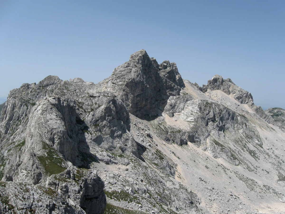
This is why the country feels bigger than it is. MONSTAT’s table of peaks, which only lists those above 1,800 m, has two summits tied for first at 2,522 m, Durmitor’s Bobotov Kuk and Prokletije’s Maja Rozit, with Kom Kučki third at 2,487 m. The National Parks give 2,534 m to Zla Kolata, on the Prokletije border, which isn’t in that table. There’s no single agreed height for Bobotov Kuk, so I call it roughly 2,520 m. The ranges, one by one, are in Montenegro’s mountains.
Rivers and municipalities
The Tara is the longest river within the country, with 141 km of its 146.4 km in Montenegro, and the Lim runs 123 km of its 220 here. Among municipalities, Nikšić is the largest at 2,087 km² and Tivat the smallest at 47 km². Podgorica, the capital, covers 997 km², and the north as a whole takes up more than half the country, as I explain in the regions of Montenegro.
If you would rather have a local show you round, book a guided tour in Podgorica and choose by the reviews.
What it means for your trip
The area tells you everything is close, and the mountains tell you nothing is quick. From Podgorica airport, Tivat is 88 km away, yet Airports of Montenegro reckons on 1 hour 55 minutes by car. So when I plan, I count hours rather than miles, and I’d suggest placing the whole country first with where Montenegro is.
Once your dates are set, check which hotels are still free in Podgorica before prices climb.
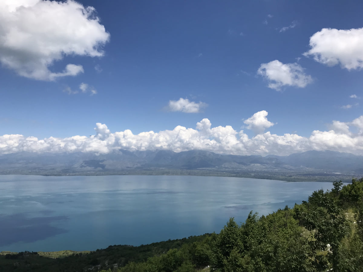
Lake Skadar from the Montenegrin shore, its blue water stretching to the mountains with white clouds on the horizon
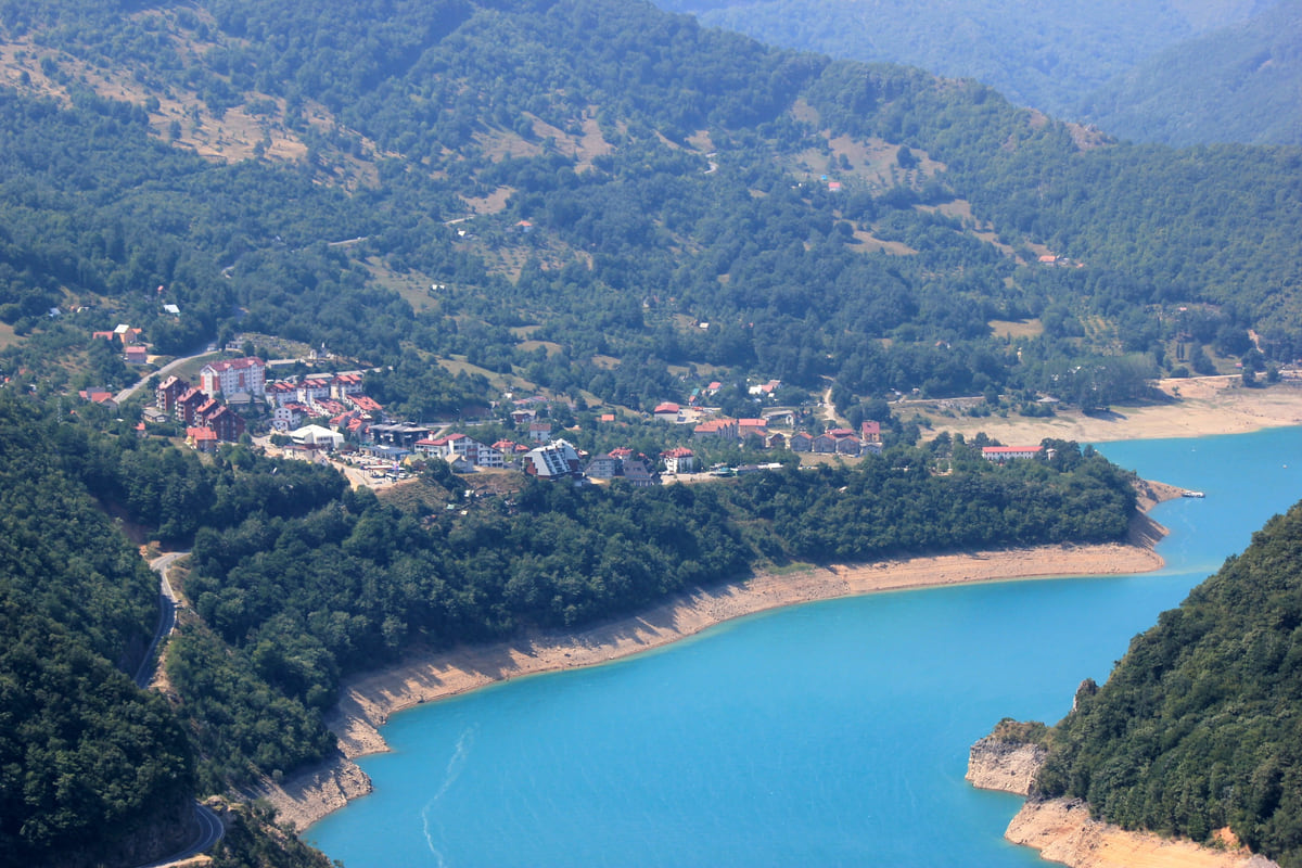
Plužine on the shore of Lake Piva, with houses on the hillside and turquoise water between wooded mountains
Montenegro's territory in figures
| Measure | Figure | Source |
|---|---|---|
| Area | 13,883 km² | MONSTAT |
| Coastline | 293.5 km | MONSTAT |
| Land border | 716.02 km | MONSTAT |
| Bay of Kotor | 87.3 km², 105.7 km of shoreline | National Tourism Organisation |
| Lake Skadar | 369.7 km² | MONSTAT |
| Piva reservoir | 112.5 km² | MONSTAT |
| Longest river within the country | Tara, 141 km | MONSTAT |
| Settlements | 1,462 | MONSTAT |
MONSTAT, Statistical Yearbook 2025, geography chapter, using Real Estate Administration data. Square-mile conversion is mine. Checked on 10-10-2026.
Test yourself
True or false?
0/3 Pick before you peek.
-
Montenegro covers more than 20,000 km².
See the answer
False. It covers 13,883 km² according to MONSTAT's 2025 yearbook.
-
The municipalities don't add up to the country's total area.
See the answer
True. Montenegro's share of Lake Skadar isn't assigned to any municipality in MONSTAT's table.
-
Tivat is the smallest municipality in Montenegro.
See the answer
True. It covers 47 km² according to MONSTAT. The largest, Nikšić, covers 2,087 km².
- Official area
- 13,883 km²
- Coastline
- 293.5 km
- Land border
- 716 km
- Bobotov Kuk in MONSTAT's table
- 2,522 m
0 of 278 Montenegro guides
Your next stamp
- Map
- Montenegro and the Balkans
- Where is it?
- Mountains
- Aman Sveti Stefan
- Budva Old Town
- Haj-Nehaj
- Kotor
- Lučice Beach
- Montenegro's coast
- Peaks of the Balkans
- Porto Montenegro
- Sea Dance Festival
- Splendid Conference & Spa Resort
- Stari Bar
- Ulcinj Old Town
- Bay of Kotor
- Budva Riviera
- Heroj submarine
- Iberostar Bellevue
- Independence Day
- Old olive tree of Mirovica
- Tivat
- Velika plaža
- Ada Bojana
- Beaches in Budva
- Eurostars Queen of Montenegro
- Herceg Novi
- Kotor Old Town
- Mount Rumija
- Igalo
- Kotor city walls
- Mogren Beach
- Montenegro Beach Resort
- Svač
- Vrmac
- Hiking
- Jaz Beach
- Kanli kula
- Luštica peninsula
- St Tryphon Cathedral
- Ulcinj salt pans
- Forte Mare
- Gornja Lastva
- Maritime Museum, Kotor
- Slovenska Beach
- Drobni Pijesak Beach
- Kotor viewpoints
- Mamula
- Žanjic beach
- Kotor cruise port
- Orjen
- Plavi horizonti beach
- Sveti Nikola Island
- Blue Cave
- Restaurants in Budva
- Restaurants in Kotor
- Canyoning
- Hotels
- Perast
- Sutomore
- Sveti Stefan
- Čanj
- Luxury hotels
- Our Lady of the Rocks
- Pržno
- Things to do
- Activities
- All-inclusive hotels
- Bar Riviera
- Bečići
- Hotel Palma
- St George island
- Dobrota
- Hladna uvala
- Most beautiful places
- Petrovac
- Crvena stijena
- Prčanj
- Prettiest villages
- Cycling
- Risan
- UNESCO sites
- Heritage Grand Perast
- Hyatt Regency Kotor Bay
- Regions
- Cities
- Beaches in Bar
- Budva
- Central Montenegro
- Hotels in Budva
- Hotels in Kotor
- Iberostar Waves Herceg Novi
- Kitesurfing
- The name
- Beaches in Ulcinj
- Flag
- Hotels in Perast
- Palmon Bay Hotel & Spa
- Podgorica
- Cathedral of the Resurrection
- One&Only Portonovi
- Population
- Sandy beaches
- Azul Beach Resort Montenegro
- Naturist beaches
- Stara Varoš
- Doclea
- Language
- Mimosa Festival
- Medun
- Religion
- Zipline
- Currency
- Museums in Podgorica
- Dajbabe Monastery
- EU membership
- History
- Restaurants in Podgorica
- Hotels in Podgorica
- Public holidays
- Avala Resort & Villas
- Bar
- Beaches in Kotor
- Birdwatching
- Hotels in Ulcinj
- Kotor carnival
- Time zone
- Tivat beaches
- Tuzi
- Boka Night
- Dukley Hotel & Resort
- Facts
- Hotels in Tivat
- Zeta
- Caves
- Herceg Novi beaches
- National parks
- Šipčanik
- Hotels in Herceg Novi
- Monasteries
- Fortresses
- Fly fishing
- Museums
- Canyons and waterfalls
- Lakes
- Montenegro and Croatia
- Beaches
- Boat trips
- Cetinje
- Montenegro and Albania
- Nightlife
- Ulcinj
- Weather
- Best time to visit
- Cetinje Monastery
- Kayaking
- How to get there
- In summer
- King Nikola's Palace
- Sailing
- Biljarda
- Flights
- In winter
- Airports
- Museums in Cetinje
- New Year's Eve
- Lovćen
- Paragliding
- Tivat Airport
- Njegoš Mausoleum
- Podgorica Airport
- Dubrovnik to Kotor
- Kotor serpentine
- Belgrade to Montenegro
- Njeguši
- Ferry to Italy
- Njeguši prosciutto
- Border crossings
- In January
- Lipa Cave
- Where to stay
- In February
- Kamenari-Lepetane ferry
- Pavlova strana
- Getting around
- In March
- Rijeka Crnojevića
- In April
- Trains
- Buses
- In May
- Car hire
- In June
- Driving
- In July
- In August
- Taxis
- Distances
- In September
- In October
- Road trip
- Food
- In November
- Lake Skadar
- Scenic drives
- In December
- Kotor cable car
- Virpazar
- Where to eat
- Budva to Kotor
- Godinje
- Wine
- Podgorica to Kotor
- Vranjina
- Besac fortress
- Prices and budget
- On a budget
- Žabljak Crnojevića
- Danilovgrad
- Entry requirements
- Ostrog Monastery
- Tourist registration
- Customs
- Nikšić
- Crvena Stijena cave
- Safety
- Events
- Healthcare
- Northern Montenegro
- Mobile and roaming
- Žabljak
- Durmitor
- Plugs
- Black Lake
- With kids
- Bobotov Kuk
- Holidays
- Day trips
- Stećci tombstones
- Hotels in Žabljak
- Three-day itinerary
- Five-day itinerary
- Skiing in Montenegro
- One-week itinerary
- Skiing in Žabljak
- Šavnik
- Ten-day itinerary
- Nevidio Canyon
- Tara Canyon
- Tara rafting
- Đurđevića Tara Bridge
- Plužine
- Lake Piva
- Piva Monastery
- Mojkovac
- Brskovo
- Pljevlja
- Husein Pasha Mosque
- Kolašin
- Hotels in Kolašin
- Skiing in Kolašin
- Biogradska Gora National Park
- Komovi
- Morača Monastery
- Morača Canyon
- Bijelo Polje
- Đalovića Cave
- Berane
- Andrijevica
- Petnjica
- Rožaje
- Plav
- Lake Plav
- Gusinje
- Vusanje
- Prokletije National Park
Frequently asked questions
How big is Montenegro in km²?
13,883 km² according to MONSTAT, based on Real Estate Administration data. The statistics office notes that the figure may change while the land registry is completed.
How many square miles is Montenegro?
About 5,360 square miles, converting MONSTAT's official 13,883 km². It's a small country, but a very mountainous one.
How long is Montenegro's coastline?
293.5 km according to MONSTAT. The National Tourism Organisation counts 117 beaches totalling 52 km, the longest being Velika plaža in Ulcinj at 13 km.
What is the largest municipality in Montenegro?
Nikšić, at 2,087 km². The smallest is Tivat, at just 47 km², on the Bay of Kotor.
What is the highest mountain in Montenegro?
It depends on the source. MONSTAT's table gives 2,522 m to both Bobotov Kuk and Maja Rozit, while the National Parks give 2,534 m to Zla Kolata in Prokletije, which isn't in that table.
By
Tourism graduate with a master’s in Tourism Management and Planning from the University of Málaga, who has travelled across Europe. He writes every guide from official sources and his own judgement.
Published on . Facts checked on .
Sources
Some links in this guide are affiliate links: if you book through them, the site earns a commission at no extra cost to you. Affiliate disclosure
Photos: Goran.Smith2 (CC BY-SA 3.0); 井上子木 (CC BY-SA 4.0); Julian Nyča (CC BY-SA 4.0), via Wikimedia Commons.