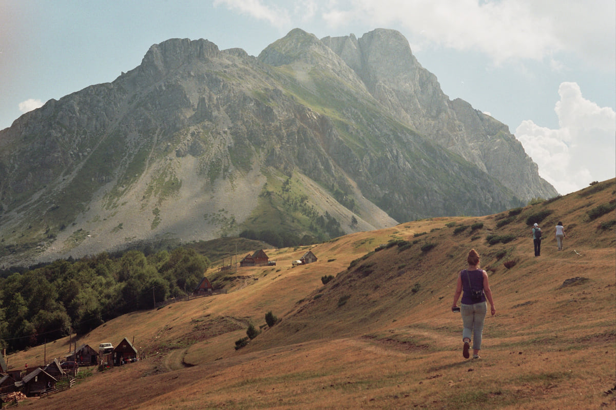
Mountains of northern Montenegro
Komovi, the three Koms between Bjelasica and Prokletije
The Komovi are a 40 km massif between the Tara and Lim rivers, with the Prokletije to the south and Bjelasica to the north. Above a plateau averaging 1,900 metres rise three summits, Kom Kučki (2,487 m), Ljevorečki (2,469 m) and Vasojevićki (2,460 m). All three are climbed from the Štavna plateau, and Vasojevićki is the most approachable.
In 30 seconds
Full read: 2 min
- The Komovi have three summits above 2,400 metres, Kučki, Ljevorečki and Vasojevićki.
- All three are climbed from the Štavna plateau.
- Vasojevićki is the most approachable and Kučki the hardest, with an exposed ridge.
- There are eco katuns on the plateau and a circular route that skips the summits.
On a first visit I'd climb Kom Vasojevićki, the most approachable, and spend the night in an eco katun on Štavna. I'd leave Kom Kučki to experienced walkers on a calm day, because its summit ridge is unforgiving.

Before you go
What I would keep in mind
-
01 My tip
Vasojevićki, the most approachable
The Kolašin tourist board says Kom Vasojevićki draws plenty of walkers thanks to its looks and easy approach. There's a concrete pyramid on the summit.
-
02 Watch out
The Kom Kučki ridge
The tourist board describes a final ridge 50 to 60 metres long and 1 to 1.5 metres wide, with loose rock and drops on both sides. Not in bad weather or strong wind.
-
03 Worth the splurge
A night in an eco katun
Eko katun Štavna has wooden cabins on the trailhead plateau itself, according to the tourist board, and the Martinović eco katun sits at 1,702 metres on the circular route.
-
04 Most beautiful
Round the Komovi without a summit
A circular route loops the massif without climbing a peak, with about 750 metres of ascent, passing Crni izvor, the source of the Crnja river, and the Carine katun.
What I would book
The Komovi are the mountains you keep seeing from all over Bjelasica, three rocky peaks rising above a high pasture. The Kolašin tourist board calls them one of the most impressive massifs in the Dinaric Alps, running 40 km between the Tara and the Lim, with the Prokletije to the south. For me they’re the best mountain in Montenegro if you want a proper summit without the logistics of the Prokletije.
Three Koms and a plateau
Above a plateau averaging around 1,900 metres stand Kom Kučki, 2,487 metres according to MONSTAT, Ljevorečki, 2,469 according to the tourist board, and Vasojevićki, 2,460. The tourist board links the massif’s history to the katun life of the Vasojevići and Kuči, who lend their names to two of the summits. The national tourist board presents Andrijevica as the starting point for climbers, and mentions there what it calls Europe’s highest place of worship.
The massif doesn’t belong to a single municipality. According to OpenStreetMap, Kom Kučki falls within Podgorica and Vasojevićki within Andrijevica, while it’s Kolašin tourist board that publishes the most detailed route descriptions.
Kom Vasojevićki, the first summit to try
Every climb starts on the Štavna plateau. For Vasojevićki, the path leaves the last katun huts, crosses a long scree slope and thin pine wood and climbs a grassy slope to the Verina previja saddle at about 2,260 metres. Then comes an exposed stretch beneath a rock face over a hundred metres high, followed by easy grass to a broad summit topped by a concrete pyramid. The tourist board warns you to keep away from the right-hand edge, which drops several hundred metres.
To sleep close to everything, search places to stay in Kolašin on Expedia and filter by area before price.
Kom Kučki and Ljevorečki, for the experienced
Kučki is a different proposition. The path shares the first 1.8 km, passes the Jankova voda spring and crosses the largest scree in the Komovi, about 350 metres, to a 2,171 metre saddle. Then comes a 3 to 4 metre rock step, more scree and the summit ridge, 50 to 60 metres long and 1 to 1.5 metres wide, with loose rock and sheer drops on both sides. The tourist board rates it as one of the most dangerous passages in Montenegro’s mountains.
Ljevorečki has just one route to the top, with a final section that needs hands. The board suggests leaving your rucksack and at least one pole behind first.
Round the Komovi, and where to sleep
If summits don’t appeal, a circular route loops the massif with about 750 metres of ascent. It passes the Ljuban plateau, Crni izvor, where the Crnja river rises, a shelf at 2,107 metres below Rogamski vrh and the Carine katun at 1,870 metres. From the Kolašin side, a 16.1 km section of the CT-1 mountain transversal links the Trešnjevik pass with the Vranjak katun.
For a bed, Eko katun Štavna has wooden cabins on the plateau and the Martinović eco katun sits at 1,702 metres. The national tourist board also suggests trying homemade yoghurt with blueberries and wild strawberries at a katun. Before you go, see the guide to Biogradska Gora National Park, on the far side of Bjelasica, and the one on the Prokletije, the neighbouring range to the south.
To sleep close to everything, search places to stay in Kolašin on Booking.com and filter by area before price.
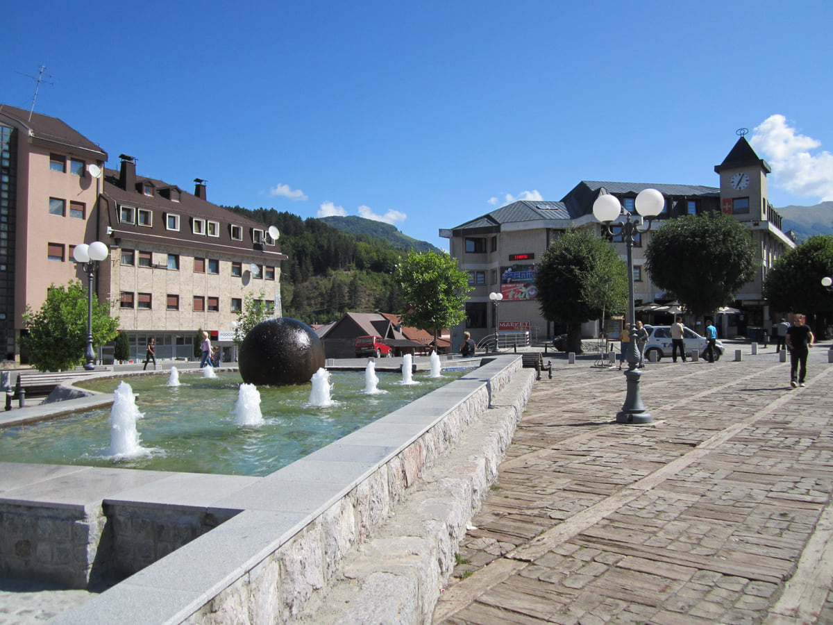
The main square in Kolašin with a fountain, a large stone sphere and mountain-style buildings under a clear sky
The three Komovi summits
| Summit | Height | What the climb is like |
|---|---|---|
| Kom Kučki | 2,487 m | The hardest, with an exposed 50-60 m summit ridge and loose rock |
| Kom Ljevorečki | 2,469 m | Demanding, with a final section that needs hands |
| Kom Vasojevićki | 2,460 m | The most approachable, via the Verina previja saddle at about 2,260 m |
Sources: MONSTAT (heights of Kučki and Vasojevićki) and Kolašin Tourist Board (Ljevorečki and route descriptions), checked on 11 October 2026.
Test yourself
True or false?
0/3 Pick before you peek.
-
All three Koms are higher than 2,400 metres.
See the answer
True. Kučki is 2,487 m, Ljevorečki 2,469 m and Vasojevićki 2,460 m.
-
Kom Kučki is the easiest climb in the massif.
See the answer
False. It's the hardest, because of its exposed summit ridge. The tourist board picks out Vasojevićki as the easiest to approach.
-
The Crnja river rises in the Komovi.
See the answer
True. The circular route passes Crni izvor, below Rogamski vrh, which the tourist board identifies as the source of the Crnja.
- Height of Kom Kučki
- 2,487 m
- Length of the massif
- 40 km
- Average height of the plateau
- 1,900 m
- Ascent on the circular route
- 750 m
Map
Where Komovi is
The Adriatic coast runs from Herceg Novi to Ulcinj; the centre holds Podgorica, Cetinje and Lake Skadar, and the north, Durmitor and the Tara Canyon. Every number opens its guide.
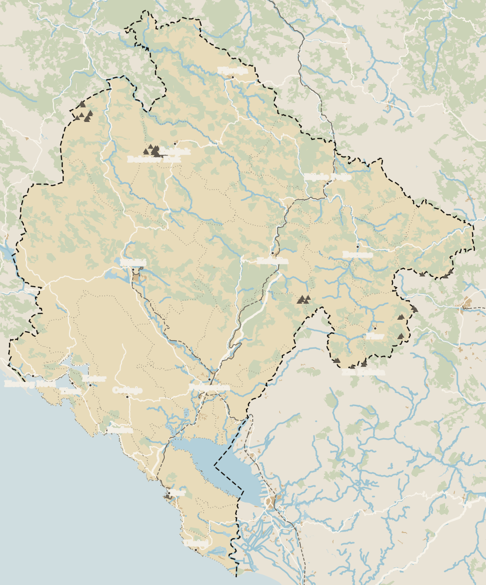 1Kolašin 2Biogradska Gora National Park 3Komovi 4Morača Monastery
 Map data © OpenStreetMap contributors (ODbL)
0 of 278 Montenegro guides
Your next stamp
- Mountains
- Andrijevica
- Prokletije National Park
- Peaks of the Balkans
- Kolašin
- Most beautiful places
- Plav
- Aman Sveti Stefan
- Budva Old Town
- Haj-Nehaj
- Kotor
- Lučice Beach
- Montenegro's coast
- Porto Montenegro
- Sea Dance Festival
- Splendid Conference & Spa Resort
- Stari Bar
- Ulcinj Old Town
- Bay of Kotor
- Budva Riviera
- Heroj submarine
- Iberostar Bellevue
- Independence Day
- Old olive tree of Mirovica
- Tivat
- Velika plaža
- Ada Bojana
- Beaches in Budva
- Eurostars Queen of Montenegro
- Herceg Novi
- Kotor Old Town
- Mount Rumija
- Igalo
- Kotor city walls
- Mogren Beach
- Montenegro Beach Resort
- Svač
- Vrmac
- Hiking
- Jaz Beach
- Kanli kula
- Luštica peninsula
- St Tryphon Cathedral
- Ulcinj salt pans
- Forte Mare
- Gornja Lastva
- Maritime Museum, Kotor
- Slovenska Beach
- Drobni Pijesak Beach
- Kotor viewpoints
- Mamula
- Žanjic beach
- Kotor cruise port
- Orjen
- Plavi horizonti beach
- Sveti Nikola Island
- Blue Cave
- Restaurants in Budva
- Restaurants in Kotor
- Canyoning
- Hotels
- Perast
- Sutomore
- Sveti Stefan
- Čanj
- Luxury hotels
- Our Lady of the Rocks
- Pržno
- Things to do
- Activities
- All-inclusive hotels
- Bar Riviera
- Bečići
- Hotel Palma
- St George island
- Dobrota
- Hladna uvala
- Petrovac
- Crvena stijena
- Prčanj
- Prettiest villages
- Cycling
- Risan
- UNESCO sites
- Heritage Grand Perast
- Map
- Hyatt Regency Kotor Bay
- Where is it?
- Regions
- Cities
- Beaches in Bar
- Budva
- Central Montenegro
- Hotels in Budva
- Hotels in Kotor
- Iberostar Waves Herceg Novi
- Kitesurfing
- The name
- Beaches in Ulcinj
- Flag
- Hotels in Perast
- Palmon Bay Hotel & Spa
- Podgorica
- Cathedral of the Resurrection
- One&Only Portonovi
- Population
- Sandy beaches
- Azul Beach Resort Montenegro
- Naturist beaches
- Size
- Stara Varoš
- Doclea
- Language
- Mimosa Festival
- Medun
- Religion
- Zipline
- Currency
- Museums in Podgorica
- Dajbabe Monastery
- EU membership
- History
- Restaurants in Podgorica
- Hotels in Podgorica
- Public holidays
- Avala Resort & Villas
- Bar
- Beaches in Kotor
- Birdwatching
- Hotels in Ulcinj
- Kotor carnival
- Time zone
- Tivat beaches
- Tuzi
- Boka Night
- Dukley Hotel & Resort
- Facts
- Hotels in Tivat
- Zeta
- Caves
- Herceg Novi beaches
- National parks
- Šipčanik
- Hotels in Herceg Novi
- Monasteries
- Fortresses
- Fly fishing
- Museums
- Canyons and waterfalls
- Lakes
- Montenegro and Croatia
- Beaches
- Boat trips
- Cetinje
- Montenegro and Albania
- Nightlife
- Ulcinj
- Weather
- Best time to visit
- Cetinje Monastery
- Kayaking
- Montenegro and the Balkans
- How to get there
- In summer
- King Nikola's Palace
- Sailing
- Biljarda
- Flights
- In winter
- Airports
- Museums in Cetinje
- New Year's Eve
- Lovćen
- Paragliding
- Tivat Airport
- Njegoš Mausoleum
- Podgorica Airport
- Dubrovnik to Kotor
- Kotor serpentine
- Belgrade to Montenegro
- Njeguši
- Ferry to Italy
- Njeguši prosciutto
- Border crossings
- In January
- Lipa Cave
- Where to stay
- In February
- Kamenari-Lepetane ferry
- Pavlova strana
- Getting around
- In March
- Rijeka Crnojevića
- In April
- Trains
- Buses
- In May
- Car hire
- In June
- Driving
- In July
- In August
- Taxis
- Distances
- In September
- In October
- Road trip
- Food
- In November
- Lake Skadar
- Scenic drives
- In December
- Kotor cable car
- Virpazar
- Where to eat
- Budva to Kotor
- Godinje
- Wine
- Podgorica to Kotor
- Vranjina
- Besac fortress
- Prices and budget
- On a budget
- Žabljak Crnojevića
- Danilovgrad
- Entry requirements
- Ostrog Monastery
- Tourist registration
- Customs
- Nikšić
- Crvena Stijena cave
- Safety
- Events
- Healthcare
- Northern Montenegro
- Mobile and roaming
- Žabljak
- Durmitor
- Plugs
- Black Lake
- With kids
- Bobotov Kuk
- Holidays
- Day trips
- Stećci tombstones
- Hotels in Žabljak
- Three-day itinerary
- Five-day itinerary
- Skiing in Montenegro
- One-week itinerary
- Skiing in Žabljak
- Šavnik
- Ten-day itinerary
- Nevidio Canyon
- Tara Canyon
- Tara rafting
- Đurđevića Tara Bridge
- Plužine
- Lake Piva
- Piva Monastery
- Mojkovac
- Brskovo
- Pljevlja
- Husein Pasha Mosque
- Hotels in Kolašin
- Skiing in Kolašin
- Biogradska Gora National Park
- Morača Monastery
- Morača Canyon
- Bijelo Polje
- Đalovića Cave
- Berane
- Petnjica
- Rožaje
- Lake Plav
- Gusinje
- Vusanje
Frequently asked questions
What is the highest peak in the Komovi?
Kom Kučki, at 2,487 metres according to MONSTAT. Next come Kom Ljevorečki, 2,469 m according to the Kolašin tourist board, and Kom Vasojevićki, 2,460 m.
Where do you start climbing the Komovi?
From the Štavna plateau. The first 1.2 to 1.8 km are shared by all three summit routes before they split, according to the Kolašin tourist board.
Is Kom Kučki dangerous?
The tourist board rates it among the country's most demanding climbs because of a 50 to 60 metre summit ridge with loose rock. In good weather, with care, it's passable, but it's not for beginners.
Which municipality are the Komovi in?
The massif straddles several. According to OpenStreetMap, Kom Kučki falls within Podgorica and Vasojevićki within Andrijevica, while the Kolašin tourist board promotes the routes from Kolašin.
Where can I stay in the Komovi?
Eko katun Štavna has wooden cabins on the plateau itself, and the Martinović eco katun is at 1,702 metres, according to the Kolašin tourist board.
By
Tourism graduate with a master’s in Tourism Management and Planning from the University of Málaga, who has travelled across Europe. He writes every guide from official sources and his own judgement.
Published on . Facts checked on .
Sources
Some links in this guide are affiliate links: if you book through them, the site earns a commission at no extra cost to you. Affiliate disclosure
Photos: Vuk Pajković (CC BY-SA 4.0); Pythonax (CC BY-SA 3.0), via Wikimedia Commons.