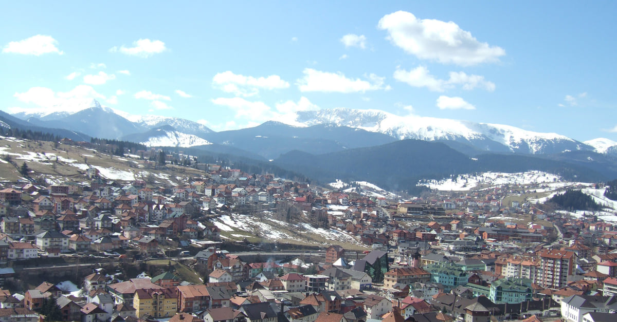
Northern Montenegro, Ibar valley
Rožaje, the Ibar valley mountain town where three borders meet
Rožaje is a mountain town at 1,006 metres in the Ibar valley, where Montenegro, Serbia and Kosovo meet. Its municipality has 23,184 people (2023) and is the only one in the north whose population grew between 2011 and 2023. It's ringed by Hajla, at 2,403 metres, with a small ski area 8 km away, and the Ganića kula tower is its oldest building.
In 30 seconds
Full read: 4 min
- Rožaje sits at 1,006 metres in the Ibar valley, next to Serbia and Kosovo.
- Its municipality has 23,184 people and grew slightly between 2011 and 2023.
- Hajla, at 2,403 metres, has a small ski area 8 km from town.
- Ganića kula is its oldest building and now houses the local museum.
Rožaje is for people who want mountains without the crowds and are curious about a town with strong Ottoman roots. I'd come in summer to climb Hajla with a guide from one of the local clubs, or in winter for what the tourist board calls the region's cheapest lift pass. And I wouldn't leave without trying tufahija.

Before you go
What I would keep in mind
-
01 To save money
The region's cheapest lift pass
The national tourist board says Hajla ski area, 8 km from Rožaje, has the cheapest lift pass in the region. It doesn't give the price, so check on the spot.
-
02 Most beautiful
Hajla, a 2,403 metre botanical garden
The tourist board calls Hajla a true botanical garden among the mountains. According to the municipality, its ridge marks the boundary with the Rugova area of Kosovo.
-
03 My tip
Ottoman-style sweets
The board recommends tufahija, tulumba, urmašica and baklava, plus good-value local crafts such as rugs, tapestries, cradles, fiddles and embroidered scarves.
-
04 Getting there
The Kula crossing into Kosovo
The national tourist board lists Kula as the road crossing between Montenegro and Kosovo. From Berane, the road passes the Lokve ski area on the way up.
Berane
What I would book
Rožaje is the northern town that least fits the idea of Montenegro as a beach country. It stands at 1,006 metres in the Ibar valley, in the corner where Montenegro, Serbia and Kosovo meet, and the municipality pitches it as a mountain town known for its scenery, heritage and hospitality. For me it has two clear draws, the Hajla massif and a strongly Ottoman-flavoured culture, which the tourist board sums up as an “oriental spirit” and which shows in the food, the crafts and the buildings.
A town ringed by 2,000-metre peaks
The municipality covers 431 km² according to MONSTAT. Towards Kosovo it’s walled in by Štedim, at 2,272 metres, Rusolija, at 2,381, and Žljeb, at 2,352. To the south-west the boundary with the Rugova area follows the Hajla ridge, topping out at 2,403 metres, and towards Berane the valley is closed by Smiljevica, Skrivena and Kacuber. Jablanica, Montenegro’s easternmost point according to MONSTAT, lies within the municipality.
The national tourist board describes Hajla as a botanical garden among the mountains and the surrounding hills as rich in medicinal herbs, mushrooms, blueberries, rosehips, juniper, wild strawberries and blackberries. The Ibar runs through town and cuts a canyon with a big rock for free climbing and water for kayaking, according to the same source.
A crossroads town
The municipality dates the settlement to the 7th century and lists little-explored Illyrian, Roman and medieval sites, among them the Illyrian settlement on Brezovačko brdo, Gradina on Mount Krstača, Bačevac, Sastanci in Bašča, Otaševo brdo and Gospođin vrh at Biševo. The Ottomans took Bihor and Rožaje in 1455, and the current name is recorded from 1585. One story ties it to two horn-shaped limestone pillars near Ganića kula, another to the town’s role as a cattle market.
The town grew around two cores, a fortress that no longer exists and Ganića kula, restored, which the tourist board counts among its oldest buildings and which is now the local museum. In the 18th and 19th centuries it was a trading and craft centre with livestock fairs. The municipality quotes a saying of the time, “if Istanbul burned, Rožaje would rebuild it”, and stresses its reputation for taking people in, from Bosnian refugees in the 19th century to those from Bosnia and Herzegovina in 1992 and 1993 and from Kosovo in 1999. Rožaje became part of Montenegro in 1913.
On Gospođin vrh mountain stands a church the municipality credits to Helen of Anjou, wife of King Uroš I. The Cultural Centre, founded in 1991, runs the “Zlatna pahulja” children’s song festival and has a folk ensemble with more than 200 members.
If you are staying the night, see the best hotel deals in Rožaje for your dates: the well-placed rooms go fast.
Eleven months of winter
The municipality’s averages explain the place. The annual mean is 6.3°C, January -4.5 and July 15.5. The first snow falls on average on 16 November and the last on 1 May, and it lies in town from December to March and on Hajla and Štedim until the end of May. There’s a story of an Ottoman soldier who got home to Istanbul and said he’d spent eleven months in Rožaje still waiting for summer.
So I’d come in July or August for walking, the months with the most clear days according to the municipality, or in the depths of winter for skiing. The tourist board gives June to the end of October as the hiking season on Hajla, and the town’s mountaineering clubs have professional guides.
Skiing on Hajla
Hajla ski area is 8 km from Rožaje, with easy access from Berane. It has a 1,019 metre run, an anchor drag lift handling 840 skiers an hour and a children’s lift, equipment hire and repair, the Košuta restaurant 150 metres from the piste and parking for 200. The board boasts that it has the region’s cheapest lift pass but doesn’t give the figure. It’s a place for a day with children or for beginners, not a ski week, which in Montenegro means Kolašin or Žabljak. The other small resort nearby is Lokve, outside Berane.
So you do not lose the morning at the ticket office, browse tickets and tours in Rožaje on GetYourGuide.
Food, crafts and getting here
The board recommends Ottoman-style sweets, tufahija, tulumba, urmašica and baklava, and good-value crafts, with rugs and tapestries like those of Petnjica, cradles, fiddles, embroidered scarves, woven hemp clothing and spindles. In 2024 the municipality logged 2,793 arrivals and 20,845 overnight stays according to MONSTAT, more than seven nights per visitor, which points to long stays rather than passing trade.
The Kula crossing, on the Rožaje road, is the one the tourist board lists for Kosovo. If you’re planning a mountain route that crosses the border away from official crossings, Hajla is one of the routes that need advance permission from the border police, as I explain in the guide to the Prokletije.
By coach, Rožaje is a long way from everything. For 21 October 2026, busticket4.me, where the country’s bus stations send you for times, listed two departures from Podgorica, at 15:55 and 18:00, taking about four hours for €13, and four from Berane to Rožaje, 35 to 45 minutes for €3 to €4.50. If you’re coming to ski on Hajla, I’d drive.
If you are staying the night, see the best hotel deals in Rožaje for your dates: the well-placed rooms go fast.
Rožaje's climate
| Measure | Figure |
|---|---|
| Average annual temperature | 6.3°C |
| Coldest month (January average) | -4.5°C |
| Warmest month (July average) | 15.5°C |
| Annual rainfall | About 900 mm |
| Wettest month | May, 111.3 mm |
| Driest month | August, 49.4 mm |
| Average first and last snowfall | 16 November and 1 May |
Source: Municipality of Rožaje, climate page, checked on 12 October 2026. These are the municipality's long-run averages, not readings for a specific year from the hydrometeorological institute.
Hajla ski area
| Detail | Figure |
|---|---|
| Distance | 8 km from Rožaje, easy to reach from Berane |
| Piste | 1,019 m |
| Lifts | Anchor drag lift (840 skiers an hour) and a children's lift |
| Facilities | Equipment hire and repair, Košuta restaurant 150 m away, parking for 200 |
Source: national tourist board ski pages, checked on 12 October 2026. No official prices or season dates.
Test yourself
True or false?
0/3 Pick before you peek.
-
Montenegro's easternmost point is in Rožaje municipality.
See the answer
True. MONSTAT places the country's eastern extreme at Jablanica, in Rožaje.
-
Rožaje lost population between the 2011 and 2023 censuses.
See the answer
False. It went from 22,964 to 23,184 according to MONSTAT, while almost all the north was shrinking.
-
There's a street in Belgrade named after Rožaje.
See the answer
True. According to the municipality, soldiers who retreated through here at the end of 1915 named a Belgrade street 'Rožajska' in thanks.
- Altitude of the town
- 1,006 m
- Summit of Hajla
- 2,403 m
- Municipal population in 2023
- 23,184
- Average annual temperature
- 6.3°C
Map
Where Rožaje is
The Adriatic coast runs from Herceg Novi to Ulcinj; the centre holds Podgorica, Cetinje and Lake Skadar, and the north, Durmitor and the Tara Canyon. Every number opens its guide.
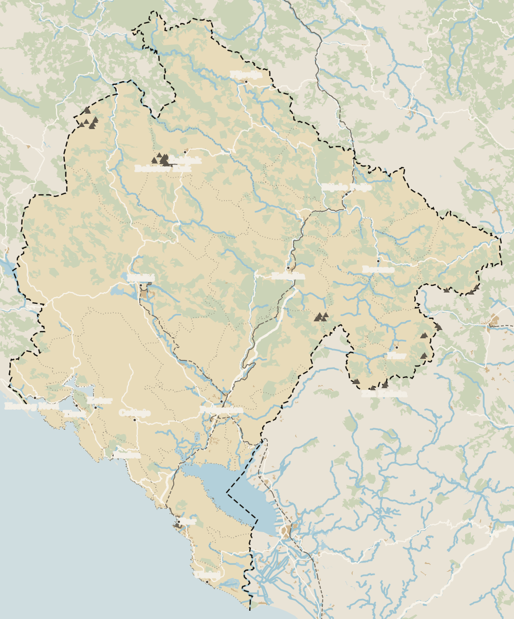 1Northern Montenegro 2Žabljak 3Šavnik 4Tara Canyon 5Plužine 6Mojkovac 7Pljevlja 8Kolašin 9Bijelo Polje 10Berane 11Andrijevica 12Petnjica 13Rožaje 14Plav 15Gusinje
 Map data © OpenStreetMap contributors (ODbL)
- 1Northern MontenegroMontenegro's northern region
- 2ŽabljakNorthern Montenegro, Žabljak municipality
- 3ŠavnikNorthern Montenegro, south of Durmitor
- 4Tara CanyonDurmitor National Park, northern Montenegro
- 5PlužineNorthern Montenegro, the Piva area
- 6MojkovacNorthern Montenegro, the Tara valley
- 7PljevljaTown in northern Montenegro
- 8KolašinNorthern Montenegro, Bjelasica
- 9Bijelo PoljeNorthern Montenegro, Lim valley
- 10BeraneNorthern Montenegro, Lim valley
- 11AndrijevicaNorthern Montenegro, upper Lim
- 12PetnjicaNorthern Montenegro, Bihor
- 13RožajeNorthern Montenegro, Ibar valley
- 14PlavNorthern Montenegro, upper Lim
- 15GusinjeNorthern Montenegro, Prokletije
0 of 278 Montenegro guides
Your next stamp
- Kolašin
- Skiing in Montenegro
- Berane
- Border crossings
- Gusinje
- Northern Montenegro
- Vusanje
- Hiking
- Aman Sveti Stefan
- Budva Old Town
- Haj-Nehaj
- Kotor
- Lučice Beach
- Montenegro's coast
- Peaks of the Balkans
- Porto Montenegro
- Sea Dance Festival
- Splendid Conference & Spa Resort
- Stari Bar
- Ulcinj Old Town
- Bay of Kotor
- Budva Riviera
- Heroj submarine
- Iberostar Bellevue
- Independence Day
- Old olive tree of Mirovica
- Tivat
- Velika plaža
- Ada Bojana
- Beaches in Budva
- Eurostars Queen of Montenegro
- Herceg Novi
- Kotor Old Town
- Mount Rumija
- Igalo
- Kotor city walls
- Mogren Beach
- Montenegro Beach Resort
- Svač
- Vrmac
- Jaz Beach
- Kanli kula
- Luštica peninsula
- St Tryphon Cathedral
- Ulcinj salt pans
- Forte Mare
- Gornja Lastva
- Maritime Museum, Kotor
- Slovenska Beach
- Drobni Pijesak Beach
- Kotor viewpoints
- Mamula
- Žanjic beach
- Kotor cruise port
- Orjen
- Plavi horizonti beach
- Sveti Nikola Island
- Blue Cave
- Restaurants in Budva
- Restaurants in Kotor
- Canyoning
- Hotels
- Perast
- Sutomore
- Sveti Stefan
- Čanj
- Luxury hotels
- Our Lady of the Rocks
- Pržno
- Things to do
- Activities
- All-inclusive hotels
- Bar Riviera
- Bečići
- Hotel Palma
- St George island
- Dobrota
- Hladna uvala
- Most beautiful places
- Petrovac
- Crvena stijena
- Prčanj
- Prettiest villages
- Cycling
- Risan
- UNESCO sites
- Heritage Grand Perast
- Map
- Hyatt Regency Kotor Bay
- Where is it?
- Regions
- Cities
- Beaches in Bar
- Budva
- Central Montenegro
- Hotels in Budva
- Hotels in Kotor
- Iberostar Waves Herceg Novi
- Kitesurfing
- The name
- Beaches in Ulcinj
- Flag
- Hotels in Perast
- Palmon Bay Hotel & Spa
- Podgorica
- Cathedral of the Resurrection
- One&Only Portonovi
- Population
- Sandy beaches
- Azul Beach Resort Montenegro
- Naturist beaches
- Size
- Stara Varoš
- Doclea
- Language
- Mimosa Festival
- Medun
- Religion
- Zipline
- Currency
- Museums in Podgorica
- Dajbabe Monastery
- EU membership
- History
- Restaurants in Podgorica
- Hotels in Podgorica
- Public holidays
- Avala Resort & Villas
- Bar
- Beaches in Kotor
- Birdwatching
- Hotels in Ulcinj
- Kotor carnival
- Time zone
- Tivat beaches
- Tuzi
- Boka Night
- Dukley Hotel & Resort
- Facts
- Hotels in Tivat
- Zeta
- Caves
- Herceg Novi beaches
- National parks
- Šipčanik
- Hotels in Herceg Novi
- Monasteries
- Fortresses
- Fly fishing
- Museums
- Canyons and waterfalls
- Lakes
- Mountains
- Montenegro and Croatia
- Beaches
- Boat trips
- Cetinje
- Montenegro and Albania
- Nightlife
- Ulcinj
- Weather
- Best time to visit
- Cetinje Monastery
- Kayaking
- Montenegro and the Balkans
- How to get there
- In summer
- King Nikola's Palace
- Sailing
- Biljarda
- Flights
- In winter
- Airports
- Museums in Cetinje
- New Year's Eve
- Lovćen
- Paragliding
- Tivat Airport
- Njegoš Mausoleum
- Podgorica Airport
- Dubrovnik to Kotor
- Kotor serpentine
- Belgrade to Montenegro
- Njeguši
- Ferry to Italy
- Njeguši prosciutto
- In January
- Lipa Cave
- Where to stay
- In February
- Kamenari-Lepetane ferry
- Pavlova strana
- Getting around
- In March
- Rijeka Crnojevića
- In April
- Trains
- Buses
- In May
- Car hire
- In June
- Driving
- In July
- In August
- Taxis
- Distances
- In September
- In October
- Road trip
- Food
- In November
- Lake Skadar
- Scenic drives
- In December
- Kotor cable car
- Virpazar
- Where to eat
- Budva to Kotor
- Godinje
- Wine
- Podgorica to Kotor
- Vranjina
- Besac fortress
- Prices and budget
- On a budget
- Žabljak Crnojevića
- Danilovgrad
- Entry requirements
- Ostrog Monastery
- Tourist registration
- Customs
- Nikšić
- Crvena Stijena cave
- Safety
- Events
- Healthcare
- Mobile and roaming
- Žabljak
- Durmitor
- Plugs
- Black Lake
- With kids
- Bobotov Kuk
- Holidays
- Day trips
- Stećci tombstones
- Hotels in Žabljak
- Three-day itinerary
- Five-day itinerary
- One-week itinerary
- Skiing in Žabljak
- Šavnik
- Ten-day itinerary
- Nevidio Canyon
- Tara Canyon
- Tara rafting
- Đurđevića Tara Bridge
- Plužine
- Lake Piva
- Piva Monastery
- Mojkovac
- Brskovo
- Pljevlja
- Husein Pasha Mosque
- Hotels in Kolašin
- Skiing in Kolašin
- Biogradska Gora National Park
- Komovi
- Morača Monastery
- Morača Canyon
- Bijelo Polje
- Đalovića Cave
- Andrijevica
- Petnjica
- Plav
- Lake Plav
- Prokletije National Park
Frequently asked questions
What is there to do in Rožaje?
See Ganića kula, now the local museum, walk the Ibar valley and canyon, ski or hike on Hajla and visit sites such as Brezovačko brdo and Gospođin vrh. It's also a good base for understanding the culture of Bihor.
Where is Rožaje?
In Montenegro's far north-east, in the Ibar valley next to Serbia and Kosovo. MONSTAT puts the country's easternmost point, Jablanica, inside the municipality.
What is Rožaje like in winter?
Long and cold. According to the municipality, the January average is -4.5°C, the first snow falls on average on 16 November, and snow lies in town from December to March and on Hajla until the end of May.
What is the population of Rožaje?
The municipality had 23,184 people in the 2023 census, slightly up on 22,964 in 2011, according to MONSTAT. The town itself had 5,303.
Can you ski in Rožaje?
Yes, at Hajla, 8 km away, with a 1,019 metre run, an anchor drag lift and a children's lift. The national tourist board says it has the cheapest lift pass in the region.
How do you get from Rožaje to Kosovo?
By road through the Kula border crossing, which the national tourist board lists as the crossing with Kosovo. Montenegro isn't in Schengen, so days here don't count towards your 90.
By
Tourism graduate with a master’s in Tourism Management and Planning from the University of Málaga, who has travelled across Europe. He writes every guide from official sources and his own judgement.
Published on . Facts checked on .
Sources
Some links in this guide are affiliate links: if you book through them, the site earns a commission at no extra cost to you. Affiliate disclosure
Photos: Cako (CC BY-SA 2.5), via Wikimedia Commons.