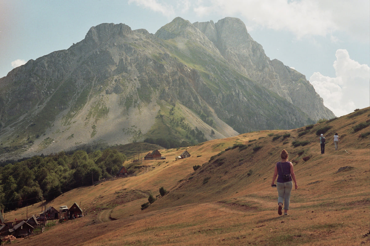
Northern Montenegro, upper Lim
Andrijevica, the Lim valley town below the Komovi
Andrijevica is one of Montenegro's smallest municipalities, with 3,910 people in 2023, in the Lim valley between the Komovi, Bjelasica and the Prokletije, on the Albanian border. The national tourist board pitches it as the starting point for the Komovi, with eco katuns and the Church of St Elijah at Carine, 1,800 metres up.
In 30 seconds
Full read: 2 min
- Andrijevica has 3,910 people in the Lim valley, on the Albanian border.
- It's the national tourist board's suggested base for the Komovi.
- St Elijah's church at Carine stands at 1,800 metres.
- Municipality Day is 17 July.
Andrijevica isn't a destination in its own right, it's a base. I'd sleep here one night, get up to the Štavna pastures early and try the Komovi via Vasojevićki, the most approachable of the three. With a spare day, the Lim valley up to Plav is one of the loveliest drives in the north.

Before you go
What I would keep in mind
-
01 Most beautiful
St Elijah's at Carine, 1,800 metres up
The national tourist board bills it as the highest place of worship in Europe and suggests getting there just before dawn.
-
02 Worth the splurge
A night at Štavna
The national tourist board places the Štavna ethno village in Andrijevica, at the foot of the Komovi, where the routes to all three summits begin.
Komovi -
03 My tip
Trout and kačamak
The tourist board recommends fresh trout with lemon, kačamak, a thick porridge of potato or maize cooked with cheese, and katun yoghurt with blueberries and wild strawberries.
-
04 Getting there
Between Berane and Plav
Andrijevica sits on the Lim valley road from Berane up to Plav. The Lim Regatta, from Plav to Prijepolje, passes through too.
Berane
What I would book
Andrijevica is a small town on a terrace above the Lim in the north-east, and its appeal is what surrounds it. The municipality describes it as ringed by three massifs, the Komovi, Bjelasica and the Prokletije, with Albania on the doorstep. For me it’s the best way into the Komovi, the most rewarding massif in the north for a big summit day that doesn’t need Prokletije-style planning.
A young town in an old valley
The municipality is keen to stress that Andrijevica is young, since the present town only took shape in the mid-19th century. Its name comes from the “Andrijevna” church, built in the 13th century by Andrija, prince of Hum, at Međurečje, old Andrijevica. It was burnt and rebuilt several times until its final destruction in 1765, and from 1853 a settlement grew up around it. By 1882 it had 20 houses.
The valley is far older than the town. The municipality mentions Neolithic traces, a Roman cemetery with a well-preserved gravestone at Zabrđe below Mount Žoljevica, and the hill of Grace, 1 km away, where a medieval fort guarded the meeting of the Lim and the Zlorečica. The Polimlje Museum excavated Namastir, at Košutići, in 2005 and 2008, uncovering a church of 9.20 by 5.40 metres from the 10th or 11th century.
Andrijevica lost its municipal status on 15 April 1960, when its land went to Berane and other neighbours, and got it back in 1991. Municipality Day is 17 July. Today it has 3,910 people, down from 5,071 in 2011, and at the 2026 Municipality Day the council president named young people leaving as its biggest problem.
The Komovi and the church at Carine
The national tourist board treats the town as base camp for the Komovi, whose three tops all clear 2,400 metres. Routes start on the Štavna plateau, where the board places the ethno village of the same name, and OpenStreetMap’s boundaries put 2,460 metre Kom Vasojevićki within Andrijevica.
The oddity here is St Elijah’s church at Carine, at 1,800 metres, which the board bills as the highest place of worship in Europe. None of the other official sources I read compares it with other mountain churches, so I’ll leave the claim with the board. It recommends arriving just before dawn, and I’d take that advice, as dawn is when you’ll get the church and the massif in low light with nobody else around.
To sleep close to everything, search places to stay in Andrijevica on Expedia and filter by area before price.
What to eat and when to come
The board mentions fresh trout with lemon, kačamak, a thick porridge of potato or maize cooked with cheese, and homemade yoghurt with blueberries and wild strawberries up at the katuns, plus village football tournaments and dances in summer. With 1,964 arrivals and 5,826 overnight stays in 2024, according to MONSTAT, crowds aren’t a risk.
I’d come between June and the end of October, the walking season the board gives for the Komovi and the other northern massifs. Andrijevica lies on the Lim valley road between Berane and Plav, and in late May it watches the Lim Regatta float down from Lake Plav. For the rest of the valley, from Petnjica to the Prokletije, each town has its own page.
If you are short on time, see the best tours in Andrijevica and pick one that fits your day.
To sleep close to everything, search places to stay in Andrijevica on Booking.com and filter by area before price.
Andrijevica in figures
| Figure | Value | Source |
|---|---|---|
| Municipal population, 2023 | 3,910 | MONSTAT |
| Municipal population, 2011 | 5,071 | MONSTAT |
| Area | 330 km² (the municipality says 340) | MONSTAT |
| Settlements | 25 | MONSTAT |
| Tourist arrivals, 2024 | 1,964 | MONSTAT |
| Overnight stays, 2024 | 5,826 | MONSTAT |
Checked on 12 October 2026. Andrijevica town has 988 people, Prisoja 566 and Trešnjevo 367.
Test yourself
True or false?
0/3 Pick before you peek.
-
Andrijevica lost its municipal status in 1960 and regained it in 1991.
See the answer
True. According to the municipality, its territory was handed to its neighbours on 15 April 1960 and its council was re-formed in 1991.
-
Andrijevica is a walled medieval town.
See the answer
False. The municipality describes it as a fairly young town that began to grow in the mid-19th century.
-
OpenStreetMap places Kom Vasojevićki within Andrijevica municipality.
See the answer
True. The municipal boundaries in OpenStreetMap put the summit inside Andrijevica.
- Municipal population in 2023
- 3,910
- Altitude of the Carine church
- 1,800 m
- Kom Vasojevićki
- 2,460 m
- Year it became a municipality again
- 1991
Map
Where Andrijevica is
The Adriatic coast runs from Herceg Novi to Ulcinj; the centre holds Podgorica, Cetinje and Lake Skadar, and the north, Durmitor and the Tara Canyon. Every number opens its guide.
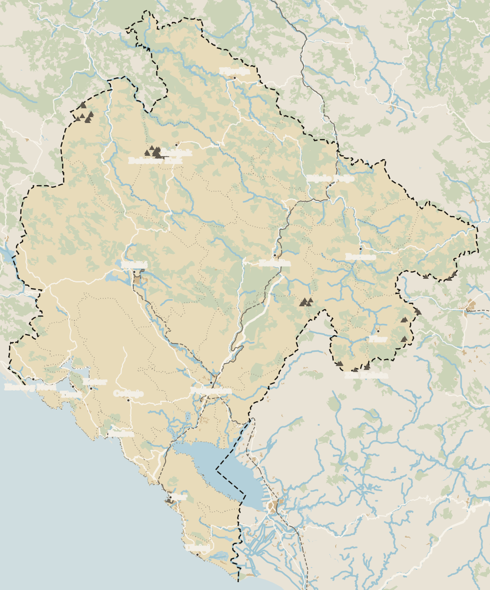 1Northern Montenegro 2Žabljak 3Šavnik 4Tara Canyon 5Plužine 6Mojkovac 7Pljevlja 8Kolašin 9Bijelo Polje 10Berane 11Andrijevica 12Petnjica 13Rožaje 14Plav 15Gusinje
 Map data © OpenStreetMap contributors (ODbL)
- 1Northern MontenegroMontenegro's northern region
- 2ŽabljakNorthern Montenegro, Žabljak municipality
- 3ŠavnikNorthern Montenegro, south of Durmitor
- 4Tara CanyonDurmitor National Park, northern Montenegro
- 5PlužineNorthern Montenegro, the Piva area
- 6MojkovacNorthern Montenegro, the Tara valley
- 7PljevljaTown in northern Montenegro
- 8KolašinNorthern Montenegro, Bjelasica
- 9Bijelo PoljeNorthern Montenegro, Lim valley
- 10BeraneNorthern Montenegro, Lim valley
- 11AndrijevicaNorthern Montenegro, upper Lim
- 12PetnjicaNorthern Montenegro, Bihor
- 13RožajeNorthern Montenegro, Ibar valley
- 14PlavNorthern Montenegro, upper Lim
- 15GusinjeNorthern Montenegro, Prokletije
0 of 278 Montenegro guides
Your next stamp
- Komovi
- Berane
- Prettiest villages
- Plav
- Tuzi
- Morača Canyon
- Mountains
- Aman Sveti Stefan
- Budva Old Town
- Haj-Nehaj
- Kotor
- Lučice Beach
- Montenegro's coast
- Peaks of the Balkans
- Porto Montenegro
- Sea Dance Festival
- Splendid Conference & Spa Resort
- Stari Bar
- Ulcinj Old Town
- Bay of Kotor
- Budva Riviera
- Heroj submarine
- Iberostar Bellevue
- Independence Day
- Old olive tree of Mirovica
- Tivat
- Velika plaža
- Ada Bojana
- Beaches in Budva
- Eurostars Queen of Montenegro
- Herceg Novi
- Kotor Old Town
- Mount Rumija
- Igalo
- Kotor city walls
- Mogren Beach
- Montenegro Beach Resort
- Svač
- Vrmac
- Hiking
- Jaz Beach
- Kanli kula
- Luštica peninsula
- St Tryphon Cathedral
- Ulcinj salt pans
- Forte Mare
- Gornja Lastva
- Maritime Museum, Kotor
- Slovenska Beach
- Drobni Pijesak Beach
- Kotor viewpoints
- Mamula
- Žanjic beach
- Kotor cruise port
- Orjen
- Plavi horizonti beach
- Sveti Nikola Island
- Blue Cave
- Restaurants in Budva
- Restaurants in Kotor
- Canyoning
- Hotels
- Perast
- Sutomore
- Sveti Stefan
- Čanj
- Luxury hotels
- Our Lady of the Rocks
- Pržno
- Things to do
- Activities
- All-inclusive hotels
- Bar Riviera
- Bečići
- Hotel Palma
- St George island
- Dobrota
- Hladna uvala
- Most beautiful places
- Petrovac
- Crvena stijena
- Prčanj
- Cycling
- Risan
- UNESCO sites
- Heritage Grand Perast
- Map
- Hyatt Regency Kotor Bay
- Where is it?
- Regions
- Cities
- Beaches in Bar
- Budva
- Central Montenegro
- Hotels in Budva
- Hotels in Kotor
- Iberostar Waves Herceg Novi
- Kitesurfing
- The name
- Beaches in Ulcinj
- Flag
- Hotels in Perast
- Palmon Bay Hotel & Spa
- Podgorica
- Cathedral of the Resurrection
- One&Only Portonovi
- Population
- Sandy beaches
- Azul Beach Resort Montenegro
- Naturist beaches
- Size
- Stara Varoš
- Doclea
- Language
- Mimosa Festival
- Medun
- Religion
- Zipline
- Currency
- Museums in Podgorica
- Dajbabe Monastery
- EU membership
- History
- Restaurants in Podgorica
- Hotels in Podgorica
- Public holidays
- Avala Resort & Villas
- Bar
- Beaches in Kotor
- Birdwatching
- Hotels in Ulcinj
- Kotor carnival
- Time zone
- Tivat beaches
- Boka Night
- Dukley Hotel & Resort
- Facts
- Hotels in Tivat
- Zeta
- Caves
- Herceg Novi beaches
- National parks
- Šipčanik
- Hotels in Herceg Novi
- Monasteries
- Fortresses
- Fly fishing
- Museums
- Canyons and waterfalls
- Lakes
- Montenegro and Croatia
- Beaches
- Boat trips
- Cetinje
- Montenegro and Albania
- Nightlife
- Ulcinj
- Weather
- Best time to visit
- Cetinje Monastery
- Kayaking
- Montenegro and the Balkans
- How to get there
- In summer
- King Nikola's Palace
- Sailing
- Biljarda
- Flights
- In winter
- Airports
- Museums in Cetinje
- New Year's Eve
- Lovćen
- Paragliding
- Tivat Airport
- Njegoš Mausoleum
- Podgorica Airport
- Dubrovnik to Kotor
- Kotor serpentine
- Belgrade to Montenegro
- Njeguši
- Ferry to Italy
- Njeguši prosciutto
- Border crossings
- In January
- Lipa Cave
- Where to stay
- In February
- Kamenari-Lepetane ferry
- Pavlova strana
- Getting around
- In March
- Rijeka Crnojevića
- In April
- Trains
- Buses
- In May
- Car hire
- In June
- Driving
- In July
- In August
- Taxis
- Distances
- In September
- In October
- Road trip
- Food
- In November
- Lake Skadar
- Scenic drives
- In December
- Kotor cable car
- Virpazar
- Where to eat
- Budva to Kotor
- Godinje
- Wine
- Podgorica to Kotor
- Vranjina
- Besac fortress
- Prices and budget
- On a budget
- Žabljak Crnojevića
- Danilovgrad
- Entry requirements
- Ostrog Monastery
- Tourist registration
- Customs
- Nikšić
- Crvena Stijena cave
- Safety
- Events
- Healthcare
- Northern Montenegro
- Mobile and roaming
- Žabljak
- Durmitor
- Plugs
- Black Lake
- With kids
- Bobotov Kuk
- Holidays
- Day trips
- Stećci tombstones
- Hotels in Žabljak
- Three-day itinerary
- Five-day itinerary
- Skiing in Montenegro
- One-week itinerary
- Skiing in Žabljak
- Šavnik
- Ten-day itinerary
- Nevidio Canyon
- Tara Canyon
- Tara rafting
- Đurđevića Tara Bridge
- Plužine
- Lake Piva
- Piva Monastery
- Mojkovac
- Brskovo
- Pljevlja
- Husein Pasha Mosque
- Kolašin
- Hotels in Kolašin
- Skiing in Kolašin
- Biogradska Gora National Park
- Morača Monastery
- Bijelo Polje
- Đalovića Cave
- Petnjica
- Rožaje
- Lake Plav
- Gusinje
- Vusanje
- Prokletije National Park
Frequently asked questions
Where is Andrijevica?
In north-east Montenegro, in the Lim valley between Berane and Plav. The municipality borders Albania and is ringed by the Komovi, Bjelasica and the Prokletije.
What is there to do in Andrijevica?
Walk in the Komovi and stay in a katun, see St Elijah's church at Carine at 1,800 metres, fish the Lim and, if archaeology is your thing, visit Namastir, the site of a small 10th or 11th century church.
How do you climb the Komovi from Andrijevica?
The routes start on the Štavna plateau, where the ethno village of the same name stands. Kom Vasojevićki, at 2,460 metres, is the most approachable of the three summits.
Where does the name Andrijevica come from?
According to the municipality, from the 'Andrijevna' church built by Andrija, prince of Hum, in the 13th century. The town grew up around it from the mid-19th century.
How many people live in Andrijevica?
The municipality had 3,910 people in the 2023 census according to MONSTAT, and Andrijevica town 988.
By
Tourism graduate with a master’s in Tourism Management and Planning from the University of Málaga, who has travelled across Europe. He writes every guide from official sources and his own judgement.
Published on . Facts checked on .
Sources
Some links in this guide are affiliate links: if you book through them, the site earns a commission at no extra cost to you. Affiliate disclosure
Photos: Vuk Pajković (CC BY-SA 4.0), via Wikimedia Commons.