Durmitor National Park
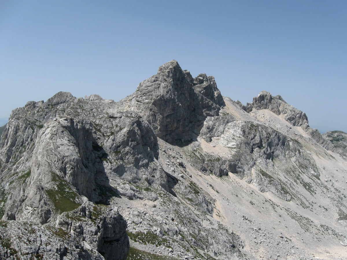
Bobotov Kuk, the highest summit in Durmitor
Bobotov Kuk is the highest summit in Durmitor, at about 2,520 metres (2,522 according to MONSTAT, 2,523 according to National Parks and 2,525 according to UNESCO). The Žabljak tourist board calls it the highest peak lying wholly inside Montenegro. The climbing season runs from June to October, snow permitting, and the final sections are steep and exposed.
In 30 seconds
Full read: 2 min
- Bobotov Kuk is the highest summit in Durmitor, at about 2,520 metres.
- It's the highest peak wholly inside Montenegro, according to the Žabljak tourist board.
- It's climbed from June to October from Žabljak, Sedlo, Dobri do or the Škrka hut.
- The last sections are steep and exposed and the weather changes quickly.
Bobotov Kuk isn't a long stroll, it's high mountain terrain with an exposed finish. Without mountain experience I'd book a park guide and set off very early from Sedlo, on the Žabljak to Trsa road, which is the route the park itself recommends.

Before you go
What I would keep in mind
-
01 My tip
Sedlo, the roadside start
Two of the routes published by the Žabljak tourist board start at the Sedlo saddle, on the Žabljak to Trsa road, and climb via Zeleni vir to the top.
-
02 Worth the splurge
A park guide for €80
National Parks offers a guide at €40 for four hours or €80 for eight. For a summit like this, the full day is the sensible choice.
Durmitor National Park -
03 Most beautiful
The view down to the Škrka lakes
From the top you see the whole massif and, to the south, the Škrka valley with its two glacial lakes, the Big and the Little, according to the Žabljak tourist board.
-
04 Watch out
June snow catches people out
The tourist board warns that snow and ice can linger on the upper sections during the season and that the weather turns quickly. Pack warm layers even if it's hot in the valley.
What I would book
Bobotov Kuk is the goal for almost everyone who turns up in Durmitor with walking boots. It’s the highest summit in the massif and, according to the Žabljak tourist board, the highest peak lying entirely inside Montenegro. But be clear from the start that this isn’t a Sunday ramble. It’s a full high-mountain day with a steep, exposed finish, in a range where the weather turns quickly.
How high it really is
There isn’t one agreed figure. MONSTAT gives 2,522 metres, National Parks and the Žabljak tourist board 2,523, and UNESCO, in its entry for Durmitor National Park, 2,525. I’d rather say about 2,520 and not argue over three metres. Plužine municipality adds a nice detail, that its boundary with Žabljak runs right over the summit. What is clear is where it stands in the national pecking order. Montenegro’s highest summit is Zla Kolata, 2,534 metres according to National Parks, but that’s in Prokletije, right on the Albanian border.
The name, according to the tradition the tourist board records, comes from the Bobota, a family or clan of herders who grazed their animals here, and an older name, Ćirova pećina, goes back to a legend about a hunter called Ćiro. The first recorded ascent is credited to the Austrian geographer Oscar Baumann in 1883. Together with Bezimeni vrh and Đevojka it forms the group known as Soa Nebeska.
The routes up
The Žabljak tourist board publishes seven itineraries, set out in the table. Two start in Žabljak itself and go via the Black Lake, Lokvice and Valoviti do. Two more start at the Sedlo saddle, on the Žabljak to Trsa road, and climb past Uvita greda and Zeleni vir. Another two leave from Dobri do, one of them with an unmarked stretch around Surutka. The last starts at the Škrka hut. They all finish the same way, via Velika Previja and the Škrčki pogled viewpoint.
National Parks specifically recommends the Sedlo route via Zeleni vir. Neither source gives distances or timings, so I’d plan on the whole day and leave at dawn.
Once your dates are set, check which hotels are still free in Žabljak before prices climb.
When to go and what to take
The season runs from June to October, depending on snow, weather and the state of the path, and the tourist board warns that snow and ice can stay on the higher sections throughout. The last stretch is steep and exposed. You’ll want proper boots, warm layers, water and food for the day, and the discipline to turn back if the sky closes in.
If you’ve no mountain experience, National Parks offers a guide for €40 for half a day or €80 for a full one. To sleep closer, the Škrka hut sits by the two lakes in that valley, opens in summer and expects you to bring a sleeping bag.
The view from the summit
From the summit you look over the whole of Durmitor. The tourist board lists Rbatina, Obla glava, Međed, Savin Kuk, Šljeme, Bandijerna and Zupci, and to the south Đevojka, Šareni pasovi and Prutaš, with the Škrka valley and its two lakes below. On clear days the view reaches mountains in neighbouring countries. For me it’s the best reward northern Montenegro offers anyone on foot.
If you would rather have a local show you round, book a guided tour in Bobotov Kuk and choose by the reviews.
Once your dates are set, check which hotels are still free in Žabljak before prices climb.
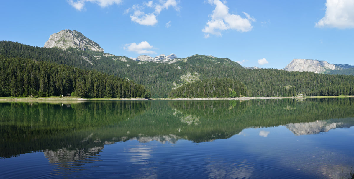
The Black Lake in Durmitor near Žabljak, ringed by conifer forest, with the mountain reflected in the still water
Routes to Bobotov Kuk, according to the Žabljak tourist board
| Start | Route |
|---|---|
| Žabljak | Black Lake, Jakšića mlin, Inđini dolovi, Lokvice, Prla, Biljegov do, Valoviti do, Velika Previja, Škrčki pogled |
| Žabljak (variant) | Black Lake, Lokvice, Korita, ice cave, Biljegov do, Valoviti do, Velika Previja |
| Sedlo | Uvita greda, Suvi tavani, Surutka, Zeleni vir, Velika Previja |
| Sedlo (variant) | Uvita greda, Suvi tavani, Trojni prevoj, Zeleni vir, Velika Previja |
| Dobri do | Urdeni do, Mliječni do, Zeleni vir, Velika Previja |
| Dobri do (variant) | Ravne police, Vjetrena brda, Surutka, Zeleni vir; the Surutka stretch is unmarked |
| Škrka | Samar, Zeleni vir, Velika Previja, Škrčki pogled |
Source: Žabljak Tourist Board, Bobotov Kuk page, checked on 11 October 2026. It publishes no distances or timings.
Test yourself
True or false?
0/3 Pick before you peek.
-
There are three different official heights for Bobotov Kuk.
See the answer
True. MONSTAT gives 2,522 metres, National Parks 2,523 and UNESCO 2,525, which is why about 2,520 metres is the honest figure.
-
Bobotov Kuk is named after a saint.
See the answer
False. According to the tradition recorded by the Žabljak tourist board, it's named after the Bobota, a family of herders who grazed their animals here.
-
The first recorded ascent was in the 19th century.
See the answer
True. The tourist board credits the Austrian geographer Oscar Baumann, in 1883.
- Height according to MONSTAT
- 2,522 m
- First recorded ascent
- 1883
- Routes published by the tourist board
- 7
Map
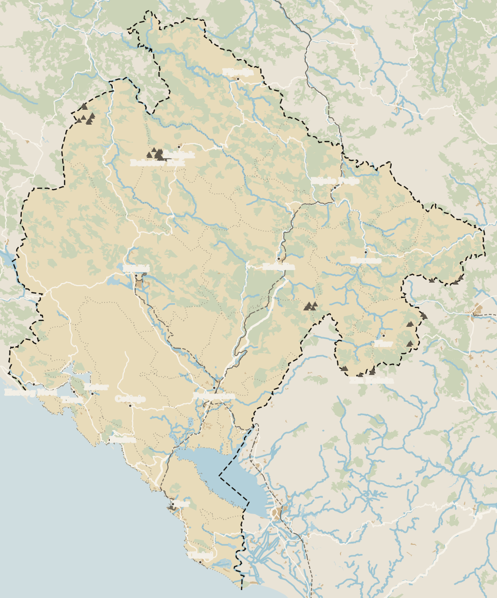
Where Bobotov Kuk is
The Adriatic coast runs from Herceg Novi to Ulcinj; the centre holds Podgorica, Cetinje and Lake Skadar, and the north, Durmitor and the Tara Canyon. Every number opens its guide.
0 of 278 Montenegro guides
Your next stamp
- Žabljak
- Mountains
- Black Lake
- Durmitor
- One-week itinerary
- Hiking
- Cycling
- Aman Sveti Stefan
- Budva Old Town
- Haj-Nehaj
- Kotor
- Lučice Beach
- Montenegro's coast
- Peaks of the Balkans
- Porto Montenegro
- Sea Dance Festival
- Splendid Conference & Spa Resort
- Stari Bar
- Ulcinj Old Town
- Bay of Kotor
- Budva Riviera
- Heroj submarine
- Iberostar Bellevue
- Independence Day
- Old olive tree of Mirovica
- Tivat
- Velika plaža
- Ada Bojana
- Beaches in Budva
- Eurostars Queen of Montenegro
- Herceg Novi
- Kotor Old Town
- Mount Rumija
- Igalo
- Kotor city walls
- Mogren Beach
- Montenegro Beach Resort
- Svač
- Vrmac
- Jaz Beach
- Kanli kula
- Luštica peninsula
- St Tryphon Cathedral
- Ulcinj salt pans
- Forte Mare
- Gornja Lastva
- Maritime Museum, Kotor
- Slovenska Beach
- Drobni Pijesak Beach
- Kotor viewpoints
- Mamula
- Žanjic beach
- Kotor cruise port
- Orjen
- Plavi horizonti beach
- Sveti Nikola Island
- Blue Cave
- Restaurants in Budva
- Restaurants in Kotor
- Canyoning
- Hotels
- Perast
- Sutomore
- Sveti Stefan
- Čanj
- Luxury hotels
- Our Lady of the Rocks
- Pržno
- Things to do
- Activities
- All-inclusive hotels
- Bar Riviera
- Bečići
- Hotel Palma
- St George island
- Dobrota
- Hladna uvala
- Most beautiful places
- Petrovac
- Crvena stijena
- Prčanj
- Prettiest villages
- Risan
- UNESCO sites
- Heritage Grand Perast
- Map
- Hyatt Regency Kotor Bay
- Where is it?
- Regions
- Cities
- Beaches in Bar
- Budva
- Central Montenegro
- Hotels in Budva
- Hotels in Kotor
- Iberostar Waves Herceg Novi
- Kitesurfing
- The name
- Beaches in Ulcinj
- Flag
- Hotels in Perast
- Palmon Bay Hotel & Spa
- Podgorica
- Cathedral of the Resurrection
- One&Only Portonovi
- Population
- Sandy beaches
- Azul Beach Resort Montenegro
- Naturist beaches
- Size
- Stara Varoš
- Doclea
- Language
- Mimosa Festival
- Medun
- Religion
- Zipline
- Currency
- Museums in Podgorica
- Dajbabe Monastery
- EU membership
- History
- Restaurants in Podgorica
- Hotels in Podgorica
- Public holidays
- Avala Resort & Villas
- Bar
- Beaches in Kotor
- Birdwatching
- Hotels in Ulcinj
- Kotor carnival
- Time zone
- Tivat beaches
- Tuzi
- Boka Night
- Dukley Hotel & Resort
- Facts
- Hotels in Tivat
- Zeta
- Caves
- Herceg Novi beaches
- National parks
- Šipčanik
- Hotels in Herceg Novi
- Monasteries
- Fortresses
- Fly fishing
- Museums
- Canyons and waterfalls
- Lakes
- Montenegro and Croatia
- Beaches
- Boat trips
- Cetinje
- Montenegro and Albania
- Nightlife
- Ulcinj
- Weather
- Best time to visit
- Cetinje Monastery
- Kayaking
- Montenegro and the Balkans
- How to get there
- In summer
- King Nikola's Palace
- Sailing
- Biljarda
- Flights
- In winter
- Airports
- Museums in Cetinje
- New Year's Eve
- Lovćen
- Paragliding
- Tivat Airport
- Njegoš Mausoleum
- Podgorica Airport
- Dubrovnik to Kotor
- Kotor serpentine
- Belgrade to Montenegro
- Njeguši
- Ferry to Italy
- Njeguši prosciutto
- Border crossings
- In January
- Lipa Cave
- Where to stay
- In February
- Kamenari-Lepetane ferry
- Pavlova strana
- Getting around
- In March
- Rijeka Crnojevića
- In April
- Trains
- Buses
- In May
- Car hire
- In June
- Driving
- In July
- In August
- Taxis
- Distances
- In September
- In October
- Road trip
- Food
- In November
- Lake Skadar
- Scenic drives
- In December
- Kotor cable car
- Virpazar
- Where to eat
- Budva to Kotor
- Godinje
- Wine
- Podgorica to Kotor
- Vranjina
- Besac fortress
- Prices and budget
- On a budget
- Žabljak Crnojevića
- Danilovgrad
- Entry requirements
- Ostrog Monastery
- Tourist registration
- Customs
- Nikšić
- Crvena Stijena cave
- Safety
- Events
- Healthcare
- Northern Montenegro
- Mobile and roaming
- Plugs
- With kids
- Holidays
- Day trips
- Stećci tombstones
- Hotels in Žabljak
- Three-day itinerary
- Five-day itinerary
- Skiing in Montenegro
- Skiing in Žabljak
- Šavnik
- Ten-day itinerary
- Nevidio Canyon
- Tara Canyon
- Tara rafting
- Đurđevića Tara Bridge
- Plužine
- Lake Piva
- Piva Monastery
- Mojkovac
- Brskovo
- Pljevlja
- Husein Pasha Mosque
- Kolašin
- Hotels in Kolašin
- Skiing in Kolašin
- Biogradska Gora National Park
- Komovi
- Morača Monastery
- Morača Canyon
- Bijelo Polje
- Đalovića Cave
- Berane
- Andrijevica
- Petnjica
- Rožaje
- Plav
- Lake Plav
- Gusinje
- Vusanje
- Prokletije National Park
Frequently asked questions
How high is Bobotov Kuk?
About 2,520 metres. MONSTAT gives 2,522, National Parks and the Žabljak tourist board 2,523, and UNESCO 2,525. It's the highest summit in Durmitor.
Can you hike Bobotov Kuk from Žabljak?
Yes. The tourist board publishes two routes from Žabljak via the Black Lake, Lokvice and Valoviti do, as well as routes from the Sedlo saddle and from Dobri do. They all finish via Velika Previja and Škrčki pogled.
Is Bobotov Kuk the highest mountain in Montenegro?
It's the highest lying entirely within the country, according to the Žabljak tourist board. Zla Kolata, in Prokletije on the Albanian border, reaches 2,534 metres according to National Parks.
When is the best time to climb Bobotov Kuk?
June to October, depending on snow, weather and the state of the path, says the Žabljak tourist board, which warns that snow can remain on the upper sections.
How hard is the Bobotov Kuk hike?
It's a serious high-mountain day. The final sections are steep and exposed and the weather changes fast, according to the tourist board. You need to be fit, wear proper boots and, if you're inexperienced, go with a guide.
By
Tourism graduate with a master’s in Tourism Management and Planning from the University of Málaga, who has travelled across Europe. He writes every guide from official sources and his own judgement.
Published on . Facts checked on .
Sources
Some links in this guide are affiliate links: if you book through them, the site earns a commission at no extra cost to you. Affiliate disclosure
Photos: Goran.Smith2 (CC BY-SA 3.0); Ingo Mehling (CC BY-SA 4.0), via Wikimedia Commons.