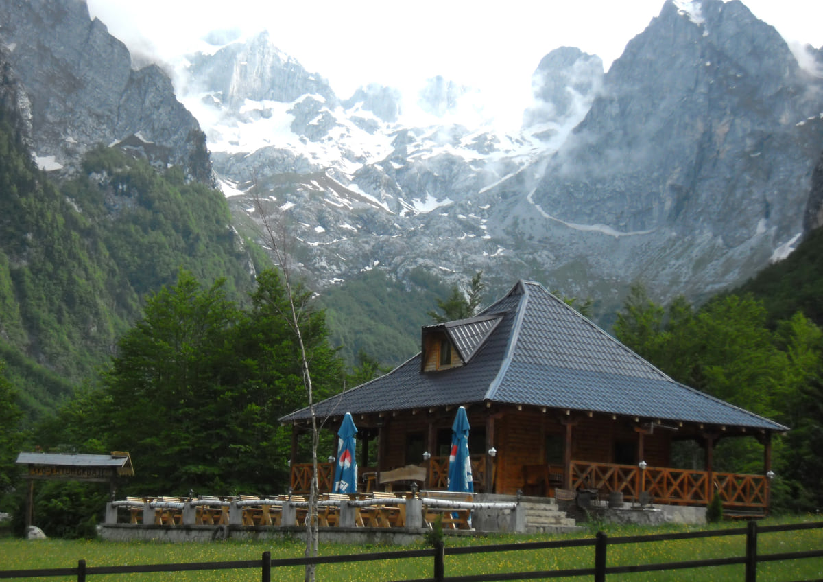
National park, northern Montenegro
The Prokletije, Montenegro's Accursed Mountains
The Prokletije are Montenegro's youngest national park, created in 2009 in Plav and Gusinje municipalities on the borders with Albania and Kosovo. They include Zla Kolata, 2,534 metres according to National Parks, more than twenty summits over 2,500 metres according to the national tourist board, the Grbaja and Ropojana valleys, glacial lakes such as Lake Hrid, and a €3 daily entry ticket.
In 30 seconds
Full read: 3 min
- The Prokletije have been a national park since 2009, in Plav and Gusinje, on the Albanian and Kosovo borders.
- Zla Kolata, at 2,534 metres according to National Parks, is the highest summit.
- Entry costs €3 a day and a guide €40 for four hours.
- Crossing the border on the mountain needs advance permission from the police.
The Prokletije demand time and respect. I'd give them at least three days from a base in Plav, start with the easy path to Lake Hrid and the Grbaja and Ropojana valleys, and only then tackle Zla Kolata, with a guide if you lack high-mountain experience. If your route crosses into Albania or Kosovo on the mountain, apply for the border permit well ahead.

Before you go
What I would keep in mind
-
01 To save money
A €3 day ticket
National Parks' entry ticket covers the visitor centre and the educational paths. A guide costs €40 for 4 hours or €80 for 8, and bike hire is €3 an hour.
-
02 Most beautiful
The Lake of Happiness
The national tourist board's name for Lake Hrid, where tradition says your wish comes true. National Parks describes an easy 3.1 km path of about an hour from the Plav side.
Plav -
03 Worth the splurge
Zla Kolata, the roof of Montenegro
National Parks gives it 2,534 metres and places it on Bjelič, above the Ropojana valley, alongside Dobra Kolata (2,528 m) and Rosni vrh (2,525 m).
Vusanje -
04 Watch out
Crossing the border without a permit
Routes into Albania or Kosovo away from official crossings need an application to the border police of the country you're entering, with fees of €2 and €3 per person.
-
05 My tip
The Grbaja circuit
Grbaja-Volušnica-Popadija-Grbaja, 10.2 km, moderate, about 5½ hours, passes the prehistoric Magna Mater slab and two summits above 2,050 metres.
Gusinje -
06 Getting there
Prokletije on a longer trip
Prokletije is a long way from the coast, which is why it goes in the second half of my ten-day itinerary, after Durmitor and Biogradska Gora.
Montenegro in ten days
What I would book
The Prokletije are Montenegro’s toughest and wildest mountains, and the name gives fair warning. The national tourist board explains that it roughly means “the damned”, a nod to inaccessible summits, mysterious lakes and sheer cliffs, though it also calls the range the Alps of southern Europe. This is the country’s youngest national park, created in 2009 in Plav and Gusinje municipalities, and its ridges divide Montenegro from Albania and Kosovo where the Dinaric Alps run out in the south. If I could only do one big mountain trip in Montenegro, this would be it.
Summits above 2,500 metres
The board’s park page mentions more than twenty summits over 2,500 metres, while its hiking page talks of 77 peaks above 2,000 metres in Plav and Gusinje, three of them above 2,500. The two don’t tally and there’s no complete official list, so I give each as published. The highest is Zla Kolata, put at 2,534 metres by both National Parks and the board, on Bjelič above the Ropojana valley, alongside Dobra Kolata (2,528) and Rosni vrh (2,525). MONSTAT leaves it out of its table, which names Maja Rozit, at 2,522 metres, as the highest point in the Prokletije.
Above the Grbaja valley rise the Karanfili, with climbing and mountaineering, and paths lead to Volušnica, Popadija and Talijanka. I’m leaving out the park’s area, the one official number I came across is doubtful, and I’d rather wait for confirmation.
The Grbaja and Ropojana valleys
National Parks sums up the park as two valleys. Grbaja, at 1,100 metres according to Gusinje Tourist Board, is the start of the Grbaja-Volušnica-Popadija-Grbaja circuit, 10.2 km, moderate and about five and a half hours, which leaves from the Karanfil mountain hut, climbs Popadija (2,056 m) and Talijanka (2,057 m) and passes the prehistoric Magna Mater slab. Ropojana, which you enter via Vusanje, has Lake Ropojana, the Oko Skakavice spring, the Grlja canyon, waterfalls and prehistoric rock art.
National Parks also points to rock carvings on Vezirova brada and near Grbaja, and to listed monuments in the villages around the park, such as the Old Mosque and Redžepagić Tower in Plav, Holy Trinity church at Brezojevica and the Vizier’s Mosque in Gusinje.
To sleep close to everything, search places to stay in Plav on Expedia and filter by area before price.
The high lakes, from Hrid to Abdija
The best known is Lake Hrid, at 1,970 metres according to Plav Tourist Board, which the national board calls the Lake of Happiness because tradition says a wish made on its shore will be granted, and you can see trinkets visitors have tossed in over the years glinting on the bottom. National Parks describes a linear 3.1 km path from the Plav side, easy and about an hour, and a longer loop from Babino polje via the Bajrović katun, the Bjelaja border post, Tromeđa and the Ćafa Bogićes saddle.
Higher still is Lake Abdija, at 2,054 metres, which Plav Tourist Board calls the highest lake in Montenegro, reached by an 18 km route rated hard and taking around ten hours. Down in the valley, Lake Plav is the big glacial lake.
Prices, season and the border
Entry costs €3 per person per day and covers the visitor centre and educational paths. A guide costs €40 for four hours and €80 for a whole day, a bike costs €3 per hour or €8 per day, and you can hire snowshoes, poles and tents. The visitor centre gives route information and contacts for local guides, according to the national board.
Hiking is possible from June until late October, and the board points out that snow patches can survive into high summer. A third of the Peaks of the Balkans, the 192 km trail through Montenegro, Albania and Kosovo, crosses the park. If a route crosses the border away from official crossings, whether in the Prokletije, on Hajla near Rožaje or elsewhere, permission comes from the border police on the side you’re walking into; you send their form with a passport copy and pay €2 plus €3 a head. The board gives no lead time, so I’d apply weeks ahead. Montenegro isn’t in Schengen, but Albania and Kosovo have their own entry rules, so check gov.uk before you go.
To sleep close to everything, search places to stay in Plav on Booking.com and filter by area before price.
Mountain food
National Parks describes a mountain kitchen of kačamak, gotovac and cicvara, cheese, jardum and whey, lamb and beef, cured meats and pies filled with cheese, meat or greens. In winter people drink raso, the brine from fermented cabbage, and the woods are full of blueberries, strawberries, raspberries and juniper. The national board suggests trying wild garlic, one of more than 1,700 plant species in the park.
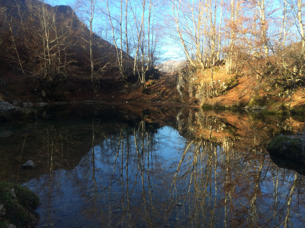
The Oko Skakavice spring near Vusanje in Prokletije, its still water reflecting bare trees in autumn
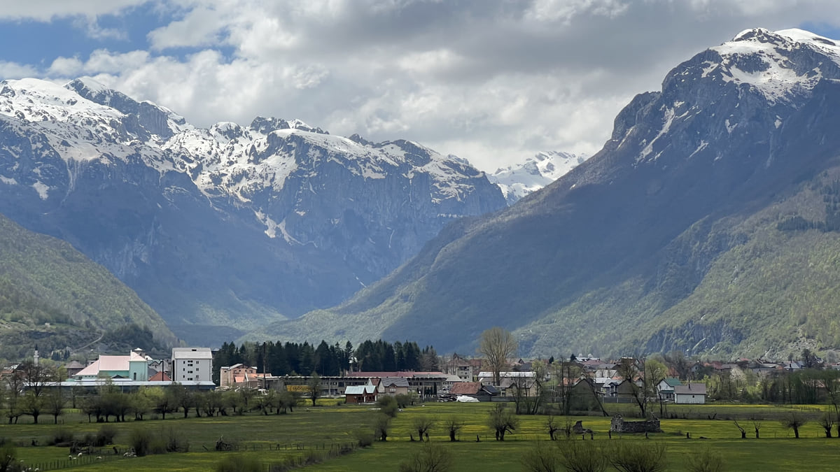
The Gusinje valley with its houses at the foot of the Prokletije mountains, still snow-capped in spring
Prokletije National Park charges
| Item | Price |
|---|---|
| Entry (visitor centre and educational paths) | €3 per person per day |
| Guide | €40 (4 h) or €80 (8 h) |
| Bike hire | €3 an hour or €8 a day |
| Tent hire | €8 a day |
| Snowshoes / walking poles | €4 / €3 a day |
| Tent pitch / equipped campsite | €3 / €20 a day |
| Campfire at a designated spot, wood included | €5 a day |
| Parking (motorbike, car, 4x4, minibus, coach) | €0.50, €1, €2, €3 and €5 an hour |
Source: National Parks of Montenegro, Prokletije price list, checked on 12 October 2026.
Walking routes in the park
| Route | Distance | Difficulty and time |
|---|---|---|
| Path to Lake Hrid (linear, from the Plav side) | 3.1 km | Easy, 1 hour |
| Grbaja-Volušnica-Popadija-Grbaja (circular) | 10.2 km | Moderate, 5 h 30 |
| Babino polje-Bajrović katun-Lake Hrid-Bjelaja-Tromeđa-Ćafa Bogićes-Babino polje | No data | Recommended by the park |
| Putačama Hrida (Plav Tourist Board, 2026) | 12 km | Moderate to hard, about 10 hours, 638 m of ascent |
Sources: National Parks of Montenegro (active holidays) and Plav Tourist Board, checked on 12 October 2026.
Test yourself
True or false?
0/3 Pick before you peek.
-
The Prokletije are Montenegro's oldest national park.
See the answer
False. They're the youngest, created in 2009, according to the national tourist board.
-
Zla Kolata tops MONSTAT's table of summits.
See the answer
False. MONSTAT leaves it out; National Parks and the tourist board give it 2,534 metres.
-
The entry ticket includes the visitor centre.
See the answer
True. The €3 ticket covers the visitor centre and the educational paths.
- Zla Kolata
- 2,534 m
- Year the park was created
- 2009
- Entry per person per day
- €3
- Plant species, per the tourist board
- 1,700
Map
Where Prokletije National Park is
The Adriatic coast runs from Herceg Novi to Ulcinj; the centre holds Podgorica, Cetinje and Lake Skadar, and the north, Durmitor and the Tara Canyon. Every number opens its guide.
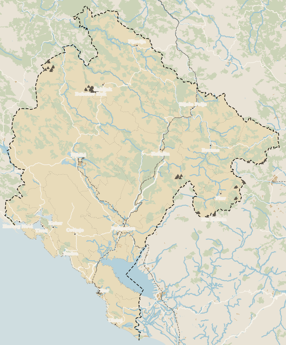
0 of 278 Montenegro guides
Your next stamp
- Hiking
- Mountains
- National parks
- Gusinje
- Peaks of the Balkans
- Ten-day itinerary
- Plav
- Kolašin
- Aman Sveti Stefan
- Budva Old Town
- Haj-Nehaj
- Kotor
- Lučice Beach
- Montenegro's coast
- Porto Montenegro
- Sea Dance Festival
- Splendid Conference & Spa Resort
- Stari Bar
- Ulcinj Old Town
- Bay of Kotor
- Budva Riviera
- Heroj submarine
- Iberostar Bellevue
- Independence Day
- Old olive tree of Mirovica
- Tivat
- Velika plaža
- Ada Bojana
- Beaches in Budva
- Eurostars Queen of Montenegro
- Herceg Novi
- Kotor Old Town
- Mount Rumija
- Igalo
- Kotor city walls
- Mogren Beach
- Montenegro Beach Resort
- Svač
- Vrmac
- Jaz Beach
- Kanli kula
- Luštica peninsula
- St Tryphon Cathedral
- Ulcinj salt pans
- Forte Mare
- Gornja Lastva
- Maritime Museum, Kotor
- Slovenska Beach
- Drobni Pijesak Beach
- Kotor viewpoints
- Mamula
- Žanjic beach
- Kotor cruise port
- Orjen
- Plavi horizonti beach
- Sveti Nikola Island
- Blue Cave
- Restaurants in Budva
- Restaurants in Kotor
- Canyoning
- Hotels
- Perast
- Sutomore
- Sveti Stefan
- Čanj
- Luxury hotels
- Our Lady of the Rocks
- Pržno
- Things to do
- Activities
- All-inclusive hotels
- Bar Riviera
- Bečići
- Hotel Palma
- St George island
- Dobrota
- Hladna uvala
- Most beautiful places
- Petrovac
- Crvena stijena
- Prčanj
- Prettiest villages
- Cycling
- Risan
- UNESCO sites
- Heritage Grand Perast
- Map
- Hyatt Regency Kotor Bay
- Where is it?
- Regions
- Cities
- Beaches in Bar
- Budva
- Central Montenegro
- Hotels in Budva
- Hotels in Kotor
- Iberostar Waves Herceg Novi
- Kitesurfing
- The name
- Beaches in Ulcinj
- Flag
- Hotels in Perast
- Palmon Bay Hotel & Spa
- Podgorica
- Cathedral of the Resurrection
- One&Only Portonovi
- Population
- Sandy beaches
- Azul Beach Resort Montenegro
- Naturist beaches
- Size
- Stara Varoš
- Doclea
- Language
- Mimosa Festival
- Medun
- Religion
- Zipline
- Currency
- Museums in Podgorica
- Dajbabe Monastery
- EU membership
- History
- Restaurants in Podgorica
- Hotels in Podgorica
- Public holidays
- Avala Resort & Villas
- Bar
- Beaches in Kotor
- Birdwatching
- Hotels in Ulcinj
- Kotor carnival
- Time zone
- Tivat beaches
- Tuzi
- Boka Night
- Dukley Hotel & Resort
- Facts
- Hotels in Tivat
- Zeta
- Caves
- Herceg Novi beaches
- Šipčanik
- Hotels in Herceg Novi
- Monasteries
- Fortresses
- Fly fishing
- Museums
- Canyons and waterfalls
- Lakes
- Montenegro and Croatia
- Beaches
- Boat trips
- Cetinje
- Montenegro and Albania
- Nightlife
- Ulcinj
- Weather
- Best time to visit
- Cetinje Monastery
- Kayaking
- Montenegro and the Balkans
- How to get there
- In summer
- King Nikola's Palace
- Sailing
- Biljarda
- Flights
- In winter
- Airports
- Museums in Cetinje
- New Year's Eve
- Lovćen
- Paragliding
- Tivat Airport
- Njegoš Mausoleum
- Podgorica Airport
- Dubrovnik to Kotor
- Kotor serpentine
- Belgrade to Montenegro
- Njeguši
- Ferry to Italy
- Njeguši prosciutto
- Border crossings
- In January
- Lipa Cave
- Where to stay
- In February
- Kamenari-Lepetane ferry
- Pavlova strana
- Getting around
- In March
- Rijeka Crnojevića
- In April
- Trains
- Buses
- In May
- Car hire
- In June
- Driving
- In July
- In August
- Taxis
- Distances
- In September
- In October
- Road trip
- Food
- In November
- Lake Skadar
- Scenic drives
- In December
- Kotor cable car
- Virpazar
- Where to eat
- Budva to Kotor
- Godinje
- Wine
- Podgorica to Kotor
- Vranjina
- Besac fortress
- Prices and budget
- On a budget
- Žabljak Crnojevića
- Danilovgrad
- Entry requirements
- Ostrog Monastery
- Tourist registration
- Customs
- Nikšić
- Crvena Stijena cave
- Safety
- Events
- Healthcare
- Northern Montenegro
- Mobile and roaming
- Žabljak
- Durmitor
- Plugs
- Black Lake
- With kids
- Bobotov Kuk
- Holidays
- Day trips
- Stećci tombstones
- Hotels in Žabljak
- Three-day itinerary
- Five-day itinerary
- Skiing in Montenegro
- One-week itinerary
- Skiing in Žabljak
- Šavnik
- Nevidio Canyon
- Tara Canyon
- Tara rafting
- Đurđevića Tara Bridge
- Plužine
- Lake Piva
- Piva Monastery
- Mojkovac
- Brskovo
- Pljevlja
- Husein Pasha Mosque
- Hotels in Kolašin
- Skiing in Kolašin
- Biogradska Gora National Park
- Komovi
- Morača Monastery
- Morača Canyon
- Bijelo Polje
- Đalovića Cave
- Berane
- Andrijevica
- Petnjica
- Rožaje
- Lake Plav
- Vusanje
Frequently asked questions
Where is Prokletije National Park?
In Montenegro's far south-east, in Plav and Gusinje municipalities. The range forms the natural border with Albania and Kosovo at the southern end of the Dinaric Alps.
How much does Prokletije National Park cost?
€3 per person per day, including the visitor centre and educational paths, according to National Parks. A guide costs €40 for 4 hours or €80 for 8.
Why are they called the Accursed Mountains?
Prokletije roughly means 'the damned'. The national tourist board says the name reflects inaccessible summits, mysterious lakes and sheer cliffs, though it also calls them the Alps of southern Europe.
What is the highest peak in the Prokletije in Montenegro?
Zla Kolata, at 2,534 metres according to National Parks and the national tourist board, on the Albanian border. MONSTAT leaves it out of its summit table, where Maja Rozit, at 2,522 metres, tops the Prokletije.
When is the best time to hike in the Prokletije?
The national tourist board gives June to the end of October and warns you may meet snow even in summer. Plav Tourist Board says snow lingers on the tops until June.
Where is Hrid Lake in Montenegro?
In the Prokletije above Plav, at 1,970 metres according to Plav Tourist Board. National Parks describes an easy 3.1 km path of about an hour from the Plav side.
Can you hike from the Prokletije into Albania?
Yes, but away from official crossings you must apply in advance to the border police of the country you're entering, with a form, a copy of your passport and fees of €2 and €3 per person.
By
Tourism graduate with a master’s in Tourism Management and Planning from the University of Málaga, who has travelled across Europe. He writes every guide from official sources and his own judgement.
Published on . Facts checked on .
Sources
- National Parks of Montenegro, Prokletije price list
- National Parks of Montenegro, Prokletije active holidays
- National Parks of Montenegro, Prokletije culture
- National Tourism Organisation, Prokletije National Park
- National Tourism Organisation, Hiking and trekking
- Plav Tourist Board, Peaks of the Balkans
Some links in this guide are affiliate links: if you book through them, the site earns a commission at no extra cost to you. Affiliate disclosure
Photos: Sigismund von Dobschütz (CC BY-SA 3.0); KpokeJlJla (CC BY-SA 4.0); Planeti (CC BY-SA 4.0), via Wikimedia Commons.