How to read the map
Kosovo on the map, region by region
On the map, Kosovo is a landlocked 10,905 km² patch of the central Balkans, with Albania to the south-west, North Macedonia to the south, Montenegro to the west and Serbia to the north and east. It's split into 38 municipalities grouped into seven statistical regions, and its highest mountains run along the western and southern edges.
For planning, I'd cut the map in half. The west, from Peja to Prizren, is mountains, monasteries and Ottoman old towns; the east is Pristina and its surroundings. Pick one base in each half rather than moving every night.

Before you go
What I would keep in mind
-
01 My tip
Seven regions that govern nothing
The Pristina, Mitrovica, Peja, Prizren, Ferizaj, Gjilan and Gjakova regions exist for statistics. The Constitution makes the municipality the unit of local self-government.
regions of Kosovo -
02 Getting there
Read the north differently
Zvečan, Zubin Potok, Leposavić and North Mitrovica are the municipalities gov.uk flags for a risk of protests. On the map they're the strip across the top.
is Kosovo safe -
03 Most beautiful
Mountains draw the border
The Sharr range to the south-west and Bjeshkët e Nemuna to the west, home to 2,656-metre Gjeravica. Both are national parks and take up much of the edge of the territory.
mountains in Kosovo
Reading a map of Kosovo is easier with a few pointers. There’s no coast, the high mountains keep to the western and southern edges, and the lines inside mark municipalities rather than self-governing counties. Here’s how I read it when planning a trip. If you just want to know which part of Europe it’s in, see where is Kosovo.
The outline and the four neighbours
The Kosovo Agency of Statistics (ASK) puts the area at 10,905 km². Trace the OpenStreetMap border and you meet Albania on the south-western side, North Macedonia along the south, Montenegro to the west and Serbia wrapping round the north and east. The Serbian crossings carry a catch no map shows. According to gov.uk, anyone entering Kosovo another way can’t leave for Serbia through those crossings without an earlier Serbian entry stamp, which I explain in crossing from Serbia.
Seven regions and 38 municipalities
The internal lines are the 38 municipalities, which the Constitution defines as the units of local self-government. ASK groups them into seven regions for its tourism statistics, but doesn’t publish which municipality goes where, so I use the OpenStreetMap split. The Pristina region is the most populous, with 511,307 people counted in 2024, and Peja, with three municipalities, the least. What each region offers is in regions of Kosovo, and the full list with Albanian and Serbian names is in municipalities of Kosovo.
To sleep close to everything, search places to stay in Prizren on Expedia and filter by area before price.
Where the mountains are
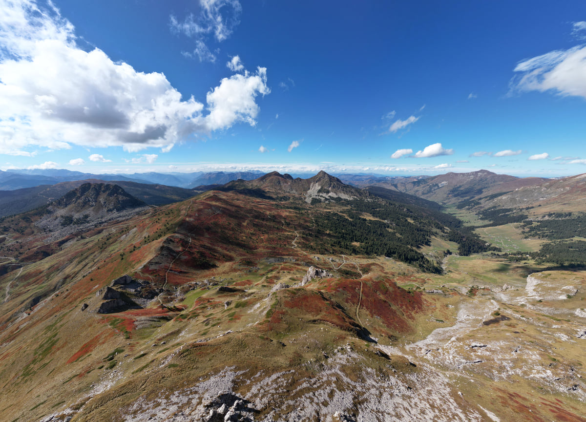
On a relief map, the high ground wraps the west and south. To the west, by Montenegro and Albania, is Bjeshkët e Nemuna (Prokletije), a national park since 2012 covering 62,488 ha. To the south-west, by North Macedonia and Albania, are the Sharr Mountains, a national park since 1986. The top of it all is Gjeravica, given as 2,656 metres by the Spanish foreign ministry. Gov.uk names the mountains between Kosovo, Albania and Montenegro as one of the areas with old landmines, so mark it on any walking map.
Rivers, lakes and towns
The rivers with the longest course inside Kosovo, according to ASK, are the White Drin (112 km), the Sitnica (110) and the Ibar (85), which runs through Mitrovica. The largest lake is Gazivoda, 9.1 km², in the north. The big towns split between the east, with Pristina, Gjilan and Ferizaj, and the west, with Prizren, Peja and Gjakova. I compare them, with populations, in cities in Kosovo.
If you are short on time, see the best tours in Prizren and pick one that fits your day.
What I use the map for
Two things. Choosing a base, because the west holds most of what I like best, and avoiding mountain roads after dark, which gov.uk rates as fair to poor with a risk of landslides. If you’re driving in from the UK or hiring a car, that second point matters more than any distance chart, and it’s the reason I plan shorter days than the map suggests.
To sleep close to everything, search places to stay in Prizren on Booking.com and filter by area before price.
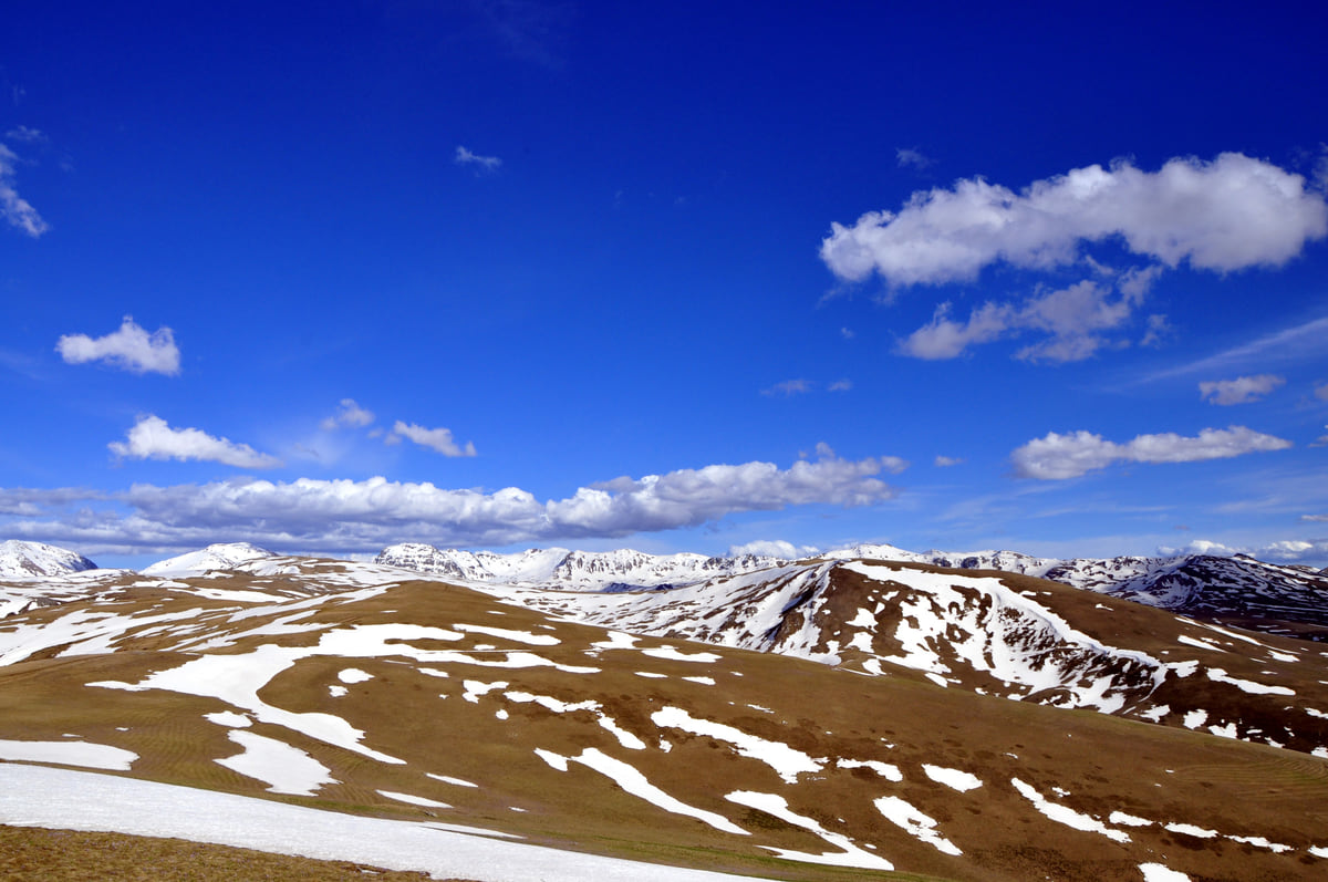
The Sharr mountains seen from Kosovo, with golden pasture, snowfields on the summits and white clouds overhead
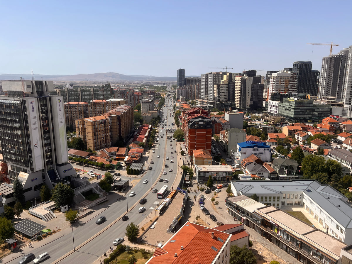
Pristina from the cathedral tower, looking down Bill Clinton Boulevard to tower blocks and green hills beyond
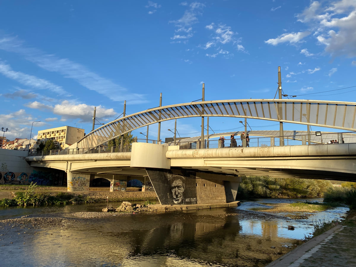
The bridge over the Ibar river in Mitrovica, with its white steel arch and houses on the far bank
The seven regions on the map
| Region | Municipalities | Census population 2024 |
|---|---|---|
| Pristina | 8 (Prishtinë, Drenas, Fushë Kosovë, Graçanicë, Lipjan, Novobërdë, Obiliq, Podujevë) | 511,307 |
| Prizren | 5 (Prizren, Dragash, Malishevë, Mamushë, Suharekë) | 271,386 |
| Ferizaj | 5 (Ferizaj, Hani i Elezit, Kaçanik, Shtërpcë, Shtime) | 180,583 |
| Mitrovica | 7 (Mitrovicë, Mitrovicë e Veriut, Leposaviq, Skënderaj, Vushtrri, Zubin Potok, Zveçan) | 173,642 |
| Gjakova | 4 (Gjakovë, Deçan, Junik, Rahovec) | 152,216 |
| Gjilan | 6 (Gjilan, Kamenicë, Kllokot, Partesh, Ranillug, Viti) | 150,176 |
| Peja | 3 (Pejë, Istog, Klinë) | 146,256 |
Municipalities by region from OpenStreetMap (the statistics agency doesn't publish the split); population is my sum of ASK's municipal figures. Mitrovica, using ASK's estimate for the north, totals 190,591.
Main rivers and lakes
| Name | Figure | Source |
|---|---|---|
| White Drin (Drini i Bardhë) | 112 km inside Kosovo | ASK |
| Sitnica | 110 km | ASK |
| Ibar (Ibri) | 85 km | ASK |
| Lake Gazivoda | 9.1 km² | ASK |
| Lake Radoniq | 5.96 km² | ASK |
Test yourself
True or false?
0/3 Pick before you peek.
-
Kosovo has a coastline.
See the answer
False. It doesn't. Albania, North Macedonia, Montenegro and Serbia surround it, according to the OpenStreetMap boundary.
-
Kosovo's seven regions each have their own government.
See the answer
False. They're statistical regions. Article 12 of the Constitution makes the municipality the unit of local self-government.
-
The White Drin is the river with the longest stretch inside Kosovo.
See the answer
True. The statistics agency gives it 112 km inside Kosovo, ahead of the Sitnica at 110 and the Ibar at 85.
Map
Kosovo, from Prizren to Mitrovica
The Bjeshkët e Nemuna mountains close off the west and the Sharr the south; in the middle lies the Pristina plain. Every number opens its guide.
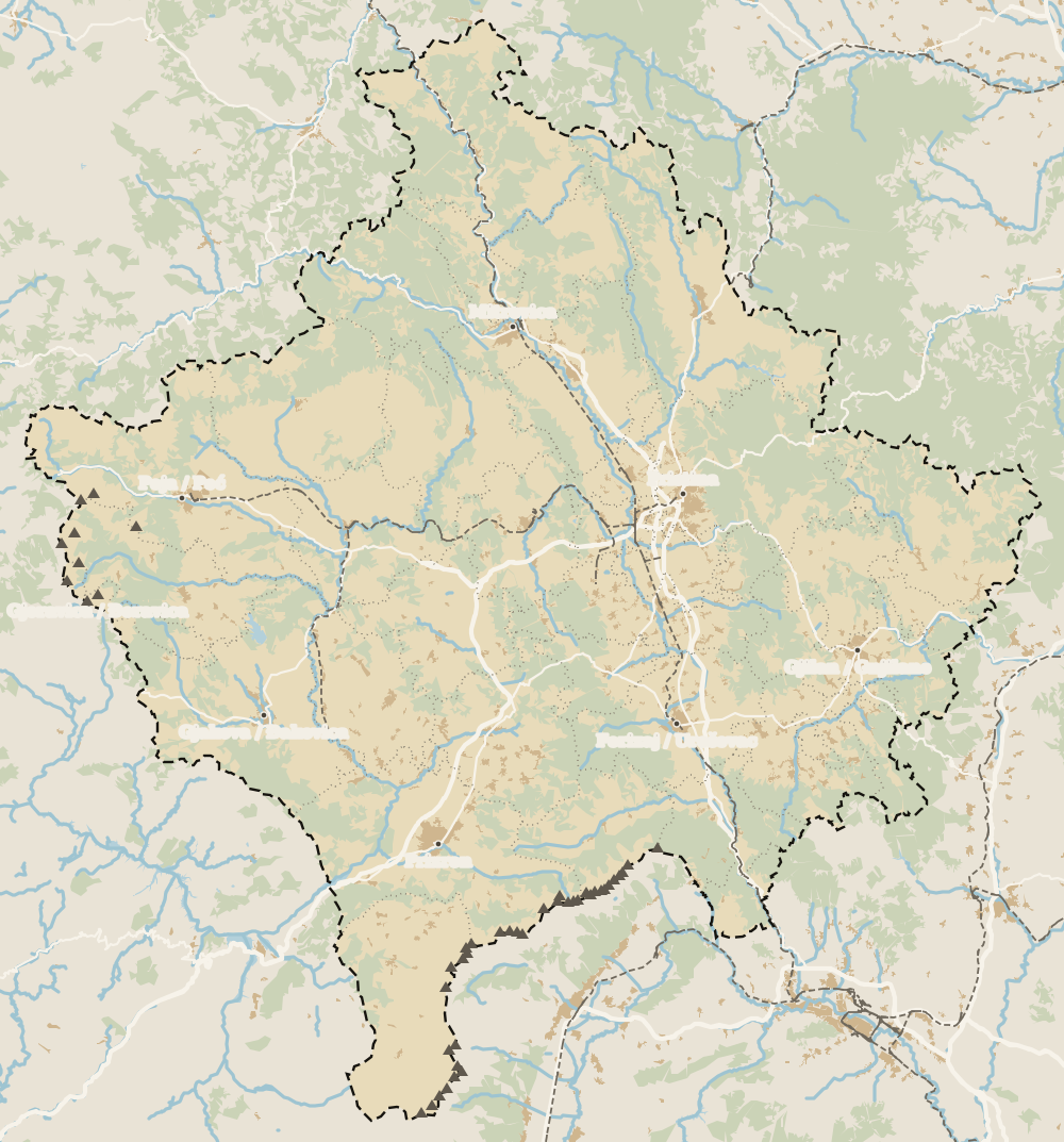 1Pristina region 2Mitrovica Region 3Gjakova 4Mitrovica 5Pristina 6Prizren 7Fushë Kosovë 8Vushtrri 9Podujeva 10Peja 11Prizren region 12Ferizaj region 13Ferizaj 14Peja region 15Gjakova region 16Gjilan region 17Gjilan
 Map data © OpenStreetMap contributors (ODbL)
- 1Pristina regionOne of Kosovo's seven statistical regions
- 2Mitrovica RegionOne of Kosovo's seven statistical regions
- 3GjakovaTown in western Kosovo
- 4MitrovicaNorthern Kosovo's main town, on the River Ibar
- 5PristinaCapital of Kosovo under its Constitution
- 6PrizrenKosovo's second town
- 7Fushë KosovëPristina region, 63,949 people in 2024
- 8VushtrriTown in the Mitrovica region
- 9PodujevaPristina region, 70,975 people in 2024
- 10PejaTown in the Peja region
- 11Prizren regionOne of Kosovo's seven regions
- 12Ferizaj regionSouthern Kosovo, next to North Macedonia
- 13FerizajFerizaj (Uroševac), regional centre
- 14Peja regionOne of Kosovo's seven statistical regions
- 15Gjakova regionOne of Kosovo's seven statistical regions
- 16Gjilan regionEastern Kosovo, the Binačka Morava valley
- 17GjilanGjilan (Gnjilane), Gjilan region
0 of 208 Kosovo guides
Your next stamp
- Regions
- Municipalities
- Prizren region
- National parks in Kosovo
- Where is Kosovo
- Peja region
- Gjakova Grand Bazaar
- Gjeravica
- Places to visit
- Pristina region
- Visoki Dečani Monastery
- Bjeshkët e Nemuna National Park
- Hadum Mosque
- Mitrovica Region
- Things to do
- Most beautiful places
- Sheh Danjolli tekke
- Prettiest villages
- Tailors' Bridge
- Rugova Canyon
- UNESCO sites
- Gjakova
- Cities
- Gračanica Monastery
- Mitrovica
- Patriarchate of Peć
- Pristina
- Prizren
- Rugova via ferrata
- Fushë Kosovë
- Population
- Vushtrri
- Podujeva
- Radavc Cave
- Size
- Bajrakli Mosque
- Devič Monastery
- Gazimestan
- Ibar Bridge
- Is it a country?
- Istog
- One day in Pristina
- Peja
- Ulpiana
- Vushtrri Stone Bridge
- Gadime Cave
- Klina
- Name
- Vushtrri Fortress
- Deçan
- Flag
- Isa Boletini Complex
- Novo Brdo Fortress
- History
- Junik
- Lake Batllava
- Zvečan Fortress
- Banjska Monastery
- Ferizaj region
- Languages
- Rahovec
- Ferizaj
- Religion
- Sokolica Monastery
- Currency
- Lake Gazivoda
- Štrpce
- Brezovica
- EU membership
- Entry requirements
- Skiing in Kosovo
- Kaçanik
- Serbian border
- Gračanica
- Guesthouses in Rugova
- Hotels in Peja
- Kaçanik fortress
- Newborn monument
- North Mitrovica
- One day in Prizren
- Peja bazaar
- Public holidays
- Velika Hoča
- Facts
- Gjakova region
- Hani i Elezit
- Hotels in Gjakova
- National Library
- Obiliq
- Zočište Monastery
- Drenas
- Mother Teresa Cathedral
- Shtime
- Skënderaj
- Lipjan
- Mother Teresa Boulevard
- Zvečan
- Kosovo Museum
- Leposavić
- Novo Brdo
- Emin Gjiku Ethnological Museum
- Janjevo
- Zubin Potok
- Imperial Mosque
- Pristina Clock Tower
- Pristina Old Bazaar
- Great Hammam of Pristina
- Bogë
- Germia Park
- Getting there
- Lake Radoniq
- Prizren Fortress
- Bear Sanctuary Prishtina
- Drelaj
- Flights
- Sinan Pasha Mosque
- Hotels in Pristina
- Pristina airport
- Prizren stone bridge
- Buses
- Grand Hotel Pristina
- Our Lady of Ljeviš
- Prizren hammam
- Swiss Diamond Hotel
- Tirana to Pristina
- League of Prizren
- Restaurants in Pristina
- Skopje to Pristina
- Belgrade to Pristina
- Prizren Archaeological Museum
- Balkans itinerary
- St George's Cathedral
- Church of the Holy Saviour
- Getting around
- Holy Archangels Monastery
- Trains
- Car hire
- Day trips
- Marash
- Driving
- Sharr National Park
- Taxis
- Distances
- Prevalla
- Dragash
- Road trip
- Brod
- Prices and budget
- On a budget
- Restelica
- Free things to do
- Mirusha waterfalls
- Malisheva
- Safety
- Mamusha
- Scams
- Healthcare
- Nightlife
- Suhareka
- Mobile and roaming
- Mountains in Kosovo
- Mushtisht
- Hiking in Kosovo
- Korisha
- Packing list
- DokuFest
- Peaks of the Balkans
- With kids
- Holidays
- Hotels in Prizren
- Kosovo lakes
- 3 days
- Caves and waterfalls
- Restaurants in Prizren
- 5 days
- One week
- Gjilan region
- Kosovo food
- Sunny Hill Festival
- Gjilan
- Rahovec wine
- Atik Mosque, Gjilan
- Kosovo beer
- Draganac Monastery
- Where to eat in Kosovo
- Kamenica
- Where to stay in Kosovo
- Kllokot
- Weather in Kosovo
- Best time to visit Kosovo
- Partesh
- Kosovo in winter
- Ranillug
- Kosovo in spring
- Viti
- Kosovo in summer
- Letnica
- Binač Monastery
- Kosovo in autumn
- Events in Kosovo
- Independence Day
- Kosovo monasteries
- Mosques in Kosovo
- Kullas in Kosovo
- Castles in Kosovo
- Museums in Kosovo
- Bazaars in Kosovo
Frequently asked questions
Where is Kosovo on the map of Europe?
In the middle of the Balkan peninsula, with no coastline, between Albania, North Macedonia, Montenegro and Serbia. The where is Kosovo guide goes into more detail.
Is Kosovo on a map of the Balkans?
Yes, it sits at the centre of the Balkans, bordered by four other Balkan countries. If you're planning a wider trip, my Balkans itinerary shows how the borders affect the order of countries.
Where is Pristina on the map?
In the east of Kosovo, in the region named after it. It's the largest city, with 143,469 people at the 2024 census.
How many regions does Kosovo have?
Seven statistical regions, Pristina, Mitrovica, Peja, Prizren, Ferizaj, Gjilan and Gjakova, grouping the 38 municipalities. They have no government of their own.
Which mountains are on the Kosovo map?
The Sharr Mountains in the south-west and Bjeshkët e Nemuna (Prokletije) in the west, both national parks. The highest peak is Gjeravica, 2,656 metres according to the Spanish foreign ministry.
By
Tourism graduate with a master’s in Tourism Management and Planning from the University of Málaga, who has travelled across Europe. He writes every guide from official sources and his own judgement.
Published on . Facts checked on .
Sources
Some links in this guide are affiliate links: if you book through them, the site earns a commission at no extra cost to you. Affiliate disclosure
Photos: SUHEJLO (CC BY 4.0); Aljabakphoto (CC BY-SA 4.0); Bdx (CC0); GentiBehramaj (CC BY-SA 4.0), via Wikimedia Commons.