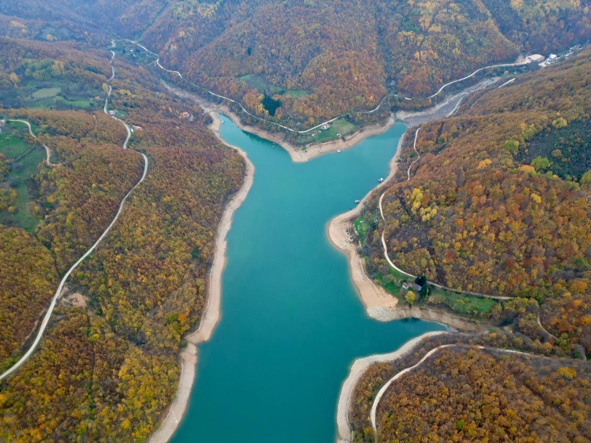
Fresh water in a landlocked territory
Kosovo's lakes, from reservoir to glacial cirque
The four lakes in Kosovo's official statistics (ASK) are all reservoirs. Gazivoda covers 9.1 km², Radoniq 5.96, Batllava 3.27 and Badovc 2.57. The natural ones are up in the mountains, such as Liqenat and Drelaj in Rugova, above 1,800 m, and the glacial tarns around Gjeravica and in the Sharr Mountains.
In 30 seconds
Full read: 2 min
- The four lakes in Kosovo's official statistics are all reservoirs.
- The largest is Gazivoda, at 9.1 km², followed by Radoniq, Batllava and Badovc.
- Natural lakes are in the mountains, in Rugova, around Gjeravica and in the Sharr.
- Liqenat and Drelaj are about two hours' walk from Kuqishtë.
If you only have a day for lakes, head up to Rugova and walk to Liqenat and Drelaj. The reservoirs are fine for a coffee by the water or a drive, but the scenery you will remember is in the mountains.

Before you go
What I would keep in mind
-
01 Most beautiful
Liqenat, a pine-fringed tarn at 1,860 m
It is small, roughly 40 m by 60 with a maximum depth of 7 m, and you reach it on an easy two-hour walk from Kuqishtë, according to Peja's tourism website.
Drelaj -
02 My tip
Drelaj is best in spring
Drelaj lake fills with rain and snowmelt, so the same website suggests going in spring, when there is most water in it.
hiking in Kosovo -
03 Getting there
Radoniq, Gjakova's water supply
A 1980s reservoir that, according to the archived government tourism portal, supplies some 214,000 people in Gjakova and Rahovec.
Lake Radoniq -
04 Most beautiful
Glacial lakes in the Sharr
Livadhishte, at 2,173 m, measures 230 by 120 m and is 7 m deep, the largest in the park according to its directorate.
Sharr Mountains National Park
What I would book
Kosovo has no coast and no big postcard lake, which is worth knowing before you go looking for a freshwater beach. What it does have is large reservoirs down on the plain and small, cold, lovely lakes up in the mountains. They are two different days out, and the second wins for me every time.
The big four are reservoirs
The Kosovo Agency of Statistics (ASK) publishes a table of the main lakes and their area, and all four are man-made. The government tourism portal, which survives only as a 2022 copy on archive.org, explains what each one is for.
The largest is Gazivoda Lake (Ujmani in Albanian), 9.1 km² in the ASK table, a reservoir on the Ibar in the north; the portal adds that part of it lies outside Kosovo. Next comes Lake Radoniq, 5.96 km², built in the 1980s near Gjakova, which according to the portal supplies some 214,000 people in Gjakova and Rahovec and irrigates 10,500 hectares.
Batllava and Badovc, Pristina’s water
The other two sit within easy reach of the capital. Batlava Lake, 3.27 km², dates from the 1970s and supplies Pristina; OpenStreetMap places it in Podujeva municipality. Badovc, 2.57 km², is a reservoir on the Gračanica river about 5 km from the city, according to the same portal. If you are based in Pristina, they are your quickest trip to the water.
Once your dates are set, check which hotels are still free in Rugova before prices climb.
Rugova, the lakes I would pick
The easiest mountain lakes are in Rugova, inside Bjeshkët e Nemuna National Park. Peja’s tourism website, which I rely on only as a secondary source, suggests setting off from the Kuqishtë lake area at 1,680 m and walking about two hours on an easy path through pine woods to Liqenat, at 1,860 m and some 40 by 60 m across, and on to the lake at Drelaj, at about 1,800 m. Drelaj fills with rain and snowmelt, which is why the website recommends it in spring. The same site says visitors come all year round, and of everything on this page it is the walk I would happily do without a guide, because it is short and well trodden.
Glacial lakes on the high ground
Higher still lie the lakes the glaciers left behind. The 2003 study that underpinned Bjeshkët e Nemuna park counts ten glacial lakes in the cirques around Gjeravica and the source of the Bistrica e Kozhnjerit river. In the south, the Sharr National Park directorate names Livadhishte, at 2,173 m, 230 by 120 m and 7 m deep, as the park’s largest, and describes Jazhinca, 120 by 90 m and 11 m deep. These are high-mountain tarns, and the ones by Gjeravica sit in the border belt where the FCDO flags old landmines and asks you to stick to main paths, so I would save them for a guided route.
Once your dates are set, check which hotels are still free in Rugova before prices climb.
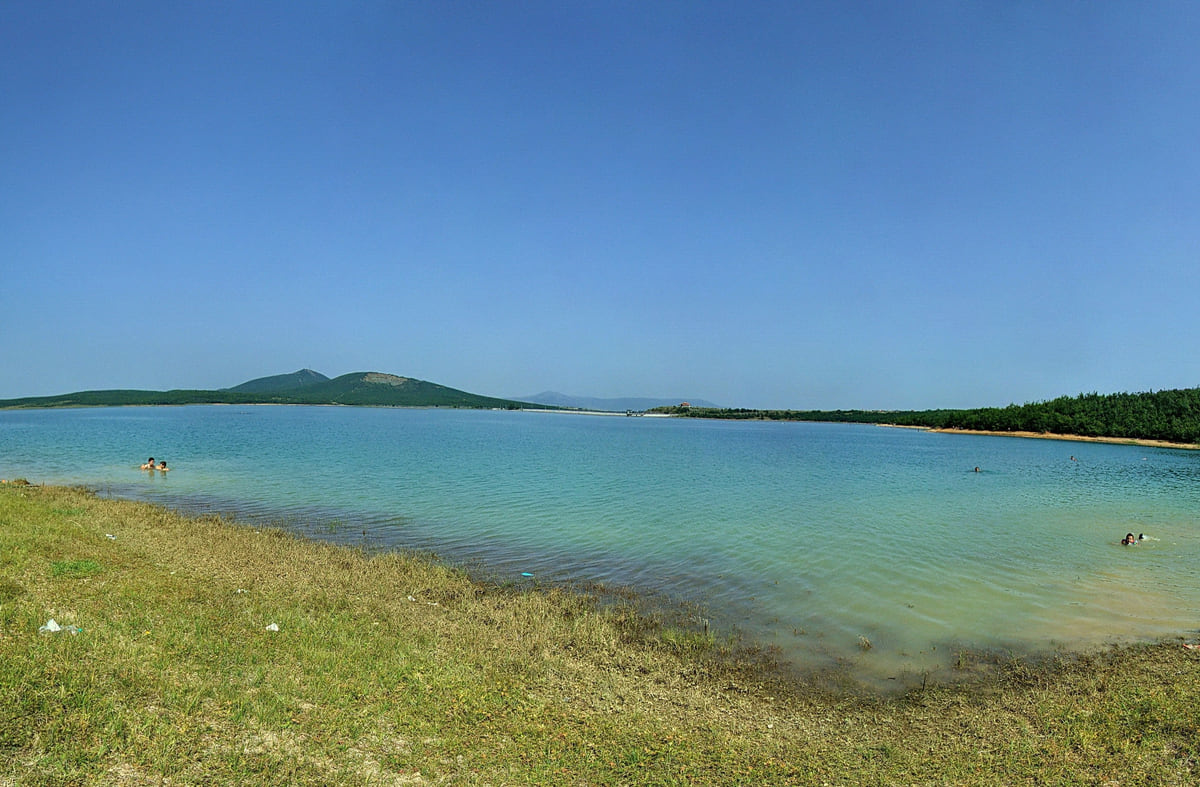
The shore of Lake Radoniq with grass in the foreground, pale blue water and low hills beyond under a clear sky
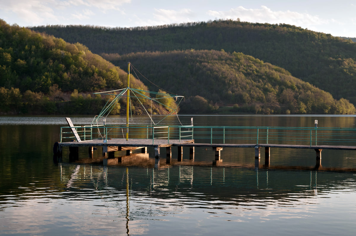
A wooden jetty on Lake Batlava, with calm water and forested hills rising behind it on a bright day
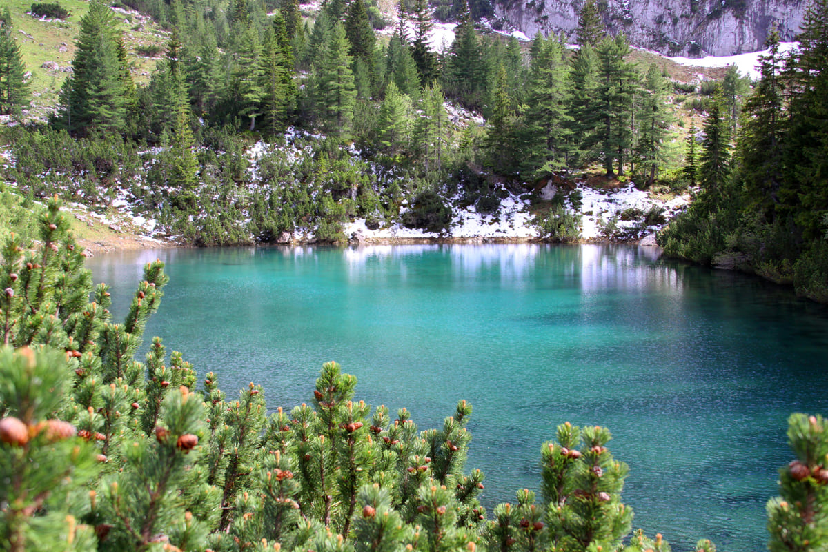
Drelaj lake in the Rugova mountains, with turquoise water, pine trees all around and patches of snow on the far shore
The lakes in the official statistics
| Lake | Area | What it is | Source |
|---|---|---|---|
| Gazivoda (Ujmani) | 9.1 km² | Reservoir on the Ibar, in the north | ASK; archived tourism portal |
| Radoniq | 5.96 km² | 1980s reservoir near Gjakova | ASK; archived tourism portal |
| Batllava | 3.27 km² | 1970s reservoir, water for Pristina | ASK; archived tourism portal |
| Badovc | 2.57 km² | Reservoir on the Gračanica river, about 5 km from Pristina | ASK; archived tourism portal |
Areas from the Kosovo Agency of Statistics (ASK) table of main lakes. Everything else from the government tourism portal's 2022 copy on archive.org.
Mountain lakes with published figures
| Lake | Altitude | Size | Source |
|---|---|---|---|
| Kuqishtë | 1,680 m | No data | pejatourism.org |
| Liqenat | 1,860 m | 40 x 60 m, up to 7 m deep | pejatourism.org |
| Drelaj | About 1,800 m | No data | pejatourism.org |
| Livadhishte (Sharr) | 2,173 m | 230 x 120 m, 7 m deep | AMMK |
| Jazhinca (Sharr) | No data | 120 x 90 m, 11 m deep | AMMK |
pejatourism.org is Peja's tourism website, with no named publisher (secondary source). AMMK is Kosovo's environmental protection agency.
Test yourself
True or false?
0/3 Pick before you peek.
-
Kosovo's largest lake is a natural mountain lake.
See the answer
False. It is Gazivoda, a 9.1 km² reservoir according to the Kosovo Agency of Statistics.
-
Liqenat lake lies above 1,800 metres.
See the answer
True. Peja's tourism website puts it at 1,860 m in the Rugova mountains.
-
The cirques around Gjeravica hold glacial lakes.
See the answer
True. The 2003 study for Bjeshkët e Nemuna park counts ten glacial lakes in them.
- Gazivoda, the largest (ASK)
- 9.1 km²
- Reservoirs in the official table
- 4
- Liqenat lake
- 1,860 m
- Glacial lakes by Gjeravica
- 10
0 of 208 Kosovo guides
Your next stamp
- Lake Batllava
- Lake Radoniq
- Lake Gazivoda
- Most beautiful places
- Places to visit
- Skiing in Kosovo
- Caves and waterfalls
- One week
- Gjakova Grand Bazaar
- Gjeravica
- Pristina region
- Visoki Dečani Monastery
- Bjeshkët e Nemuna National Park
- Hadum Mosque
- Mitrovica Region
- Things to do
- Sheh Danjolli tekke
- Prettiest villages
- Tailors' Bridge
- Rugova Canyon
- UNESCO sites
- Gjakova
- Map
- Where is Kosovo
- Regions
- Municipalities
- Cities
- Gračanica Monastery
- Mitrovica
- Patriarchate of Peć
- Pristina
- Prizren
- Rugova via ferrata
- Fushë Kosovë
- Population
- Vushtrri
- Podujeva
- Radavc Cave
- Size
- Bajrakli Mosque
- Devič Monastery
- Gazimestan
- Ibar Bridge
- Is it a country?
- Istog
- One day in Pristina
- Peja
- Prizren region
- Ulpiana
- Vushtrri Stone Bridge
- Gadime Cave
- Klina
- Name
- Vushtrri Fortress
- Deçan
- Flag
- Isa Boletini Complex
- Novo Brdo Fortress
- History
- Junik
- Zvečan Fortress
- Banjska Monastery
- Ferizaj region
- Languages
- Rahovec
- Ferizaj
- Religion
- Sokolica Monastery
- Currency
- Štrpce
- Brezovica
- EU membership
- Entry requirements
- Kaçanik
- Serbian border
- Gračanica
- Guesthouses in Rugova
- Hotels in Peja
- Kaçanik fortress
- Newborn monument
- North Mitrovica
- One day in Prizren
- Peja bazaar
- Peja region
- Public holidays
- Velika Hoča
- Facts
- Gjakova region
- Hani i Elezit
- Hotels in Gjakova
- National Library
- Obiliq
- Zočište Monastery
- Drenas
- Mother Teresa Cathedral
- Shtime
- Skënderaj
- Lipjan
- Mother Teresa Boulevard
- Zvečan
- Kosovo Museum
- Leposavić
- Novo Brdo
- Emin Gjiku Ethnological Museum
- Janjevo
- Zubin Potok
- Imperial Mosque
- Pristina Clock Tower
- Pristina Old Bazaar
- Great Hammam of Pristina
- Bogë
- Germia Park
- Getting there
- Prizren Fortress
- Bear Sanctuary Prishtina
- Drelaj
- Flights
- Sinan Pasha Mosque
- Hotels in Pristina
- Pristina airport
- Prizren stone bridge
- Buses
- Grand Hotel Pristina
- Our Lady of Ljeviš
- Prizren hammam
- Swiss Diamond Hotel
- Tirana to Pristina
- League of Prizren
- Restaurants in Pristina
- Skopje to Pristina
- Belgrade to Pristina
- Prizren Archaeological Museum
- Balkans itinerary
- St George's Cathedral
- Church of the Holy Saviour
- Getting around
- Holy Archangels Monastery
- Trains
- Car hire
- Day trips
- Marash
- Driving
- Sharr National Park
- Taxis
- Distances
- Prevalla
- Dragash
- Road trip
- Brod
- Prices and budget
- On a budget
- Restelica
- Free things to do
- Mirusha waterfalls
- Malisheva
- Safety
- Mamusha
- Scams
- Healthcare
- National parks in Kosovo
- Nightlife
- Suhareka
- Mobile and roaming
- Mountains in Kosovo
- Mushtisht
- Hiking in Kosovo
- Korisha
- Packing list
- DokuFest
- Peaks of the Balkans
- With kids
- Holidays
- Hotels in Prizren
- 3 days
- Restaurants in Prizren
- 5 days
- Gjilan region
- Kosovo food
- Sunny Hill Festival
- Gjilan
- Rahovec wine
- Atik Mosque, Gjilan
- Kosovo beer
- Draganac Monastery
- Where to eat in Kosovo
- Kamenica
- Where to stay in Kosovo
- Kllokot
- Weather in Kosovo
- Best time to visit Kosovo
- Partesh
- Kosovo in winter
- Ranillug
- Kosovo in spring
- Viti
- Kosovo in summer
- Letnica
- Binač Monastery
- Kosovo in autumn
- Events in Kosovo
- Independence Day
- Kosovo monasteries
- Mosques in Kosovo
- Kullas in Kosovo
- Castles in Kosovo
- Museums in Kosovo
- Bazaars in Kosovo
Frequently asked questions
What is the biggest lake in Kosovo?
Gazivoda, at 9.1 km² according to the Kosovo Agency of Statistics. It is a reservoir on the Ibar in the north, and the archived government tourism portal adds that part of it lies outside Kosovo.
Are there natural lakes in Kosovo?
Yes, in the mountains. The easiest are Liqenat and Drelaj in Rugova, and there are glacial lakes in the cirques around Gjeravica and in the Sharr Mountains. The four large lakes in the official statistics are reservoirs.
Is Batlava Lake worth a visit from Pristina?
As a short escape, yes. It is a 1970s reservoir that supplies Pristina, and OpenStreetMap places it in Podujeva municipality. Badovc, about 5 km from the city, is the other one nearby.
How do you get to the Rugova lakes?
Drive up the Rugova Canyon to the Kuqishtë area, then walk for about two hours on an easy path, according to Peja's tourism website.
Can you swim in Kosovo's lakes?
I found no official rule published on swimming in them. Several are drinking-water reservoirs, so I would ask locally before getting in.
By
Tourism graduate with a master’s in Tourism Management and Planning from the University of Málaga, who has travelled across Europe. He writes every guide from official sources and his own judgement.
Published on . Facts checked on .
Sources
Some links in this guide are affiliate links: if you book through them, the site earns a commission at no extra cost to you. Affiliate disclosure
Photos: SUHEJLO (CC BY 4.0); Shkumbin Saneja (CC BY 2.0); Otaulant (CC BY-SA 3.0); Snownjeri (CC BY-SA 3.0), via Wikimedia Commons.