Kaçanik (Kačanik), Ferizaj region
Kaçanik, the fortress town on the road to Skopje
Kaçanik (in Serbian, Kačanik) is a municipality in southern Kosovo, on the road from Ferizaj to North Macedonia, with 27,716 people in 2024. The heritage database lists Kaçanik fortress, 16th century, in the town itself, and a late antique fort at Llanishtë. It contributes 1,560 ha to Sharr National Park, including Luboten, at 2,499 m.
In 30 seconds
Full read: 2 min
- Kaçanik is a southern Kosovo municipality on the road to North Macedonia, with 27,716 people in 2024.
- Its fortress, 16th century according to the heritage database, stands in the town itself.
- It has 1,560 ha of Sharr National Park, including Luboten, at 2,499 m.
- OpenStreetMap marks a railway station in the town.
Kaçanik is the stop I'd make driving between Pristina and Skopje. Half an hour to see the fortress in the centre and move on, or a full day if Luboten's mountain country appeals and you go prepared.

Before you go
What I would keep in mind
-
01 Most beautiful
A fortress inside the town
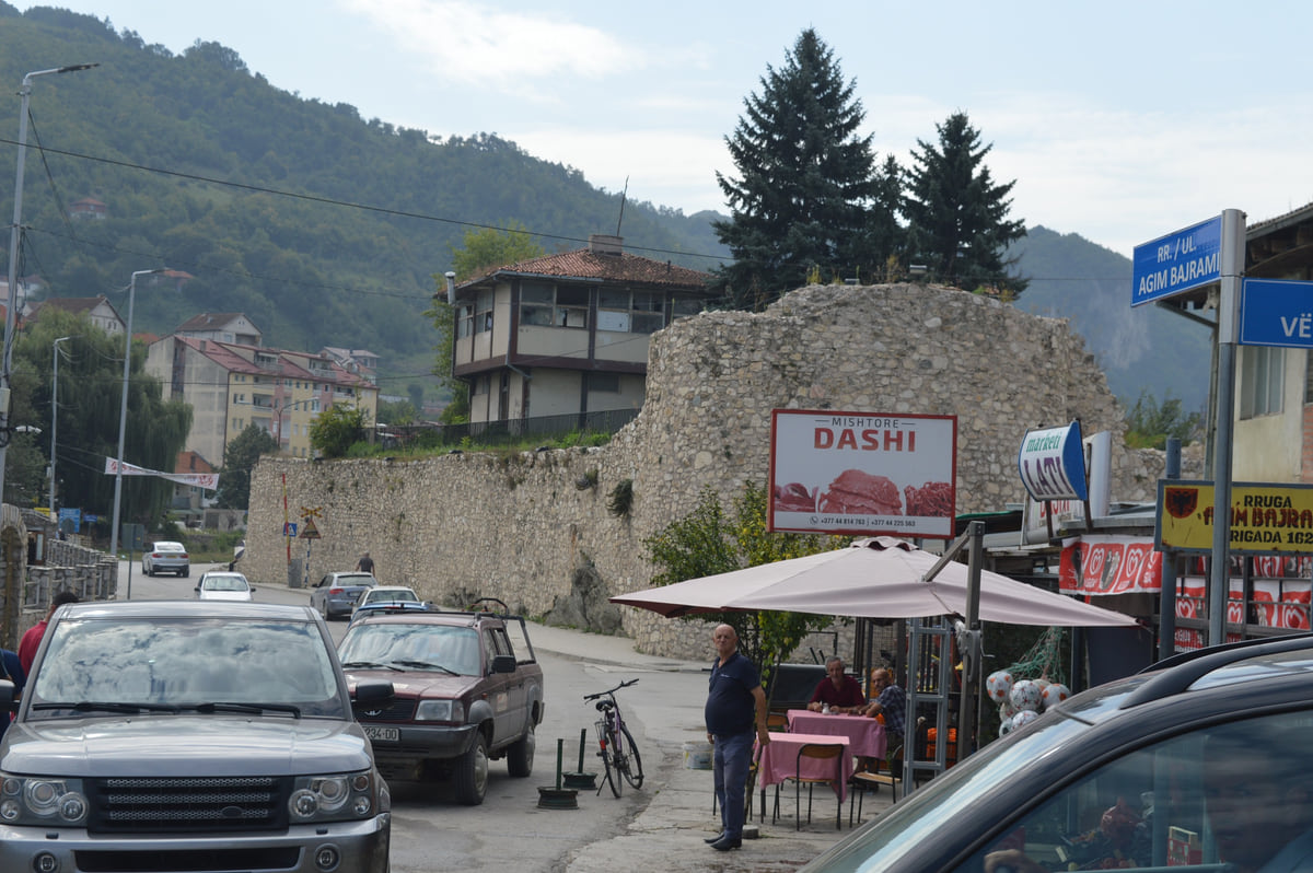
Kaçanik fortress, 16th century according to the heritage database, has its walls right beside the streets of the centre, as photos on Commons show.
Kaçanik fortress -
02 Getting there
Three rail stops in the municipality
OpenStreetMap marks Kaçanik station and halts at Kaçanik i Vjetër and Stagovë, on the line towards North Macedonia.
trains in Kosovo -
03 Most beautiful
Luboten, the Sharr's limestone summit
The park proposes a 201-hectare reserve on Luboten, at 2,499 m, one of the two proposed reserves on limestone, with endemic high mountain plants.
Sharr Mountains National Park
Drive between Pristina and Skopje and Kaçanik is one of the last towns in Kosovo before the border. Most people sail past. I’d pull in, if only for thirty minutes, because it offers something few Kosovan towns can show you without barely leaving the car, a fortress in the middle of town.
The municipality
OpenStreetMap places Kaçanik (in Serbian, Kačanik) in the Ferizaj region. Its municipality had 27,716 people in the 2024 census, around 5,700 fewer than in 2011, spread across 31 settlements. Kaçanik town had 8,276, followed by Kaçanik i Vjetër (2,576), one of the few that has grown, then Begracë, Biqec, Vatë and Bob.
The fortress in the centre
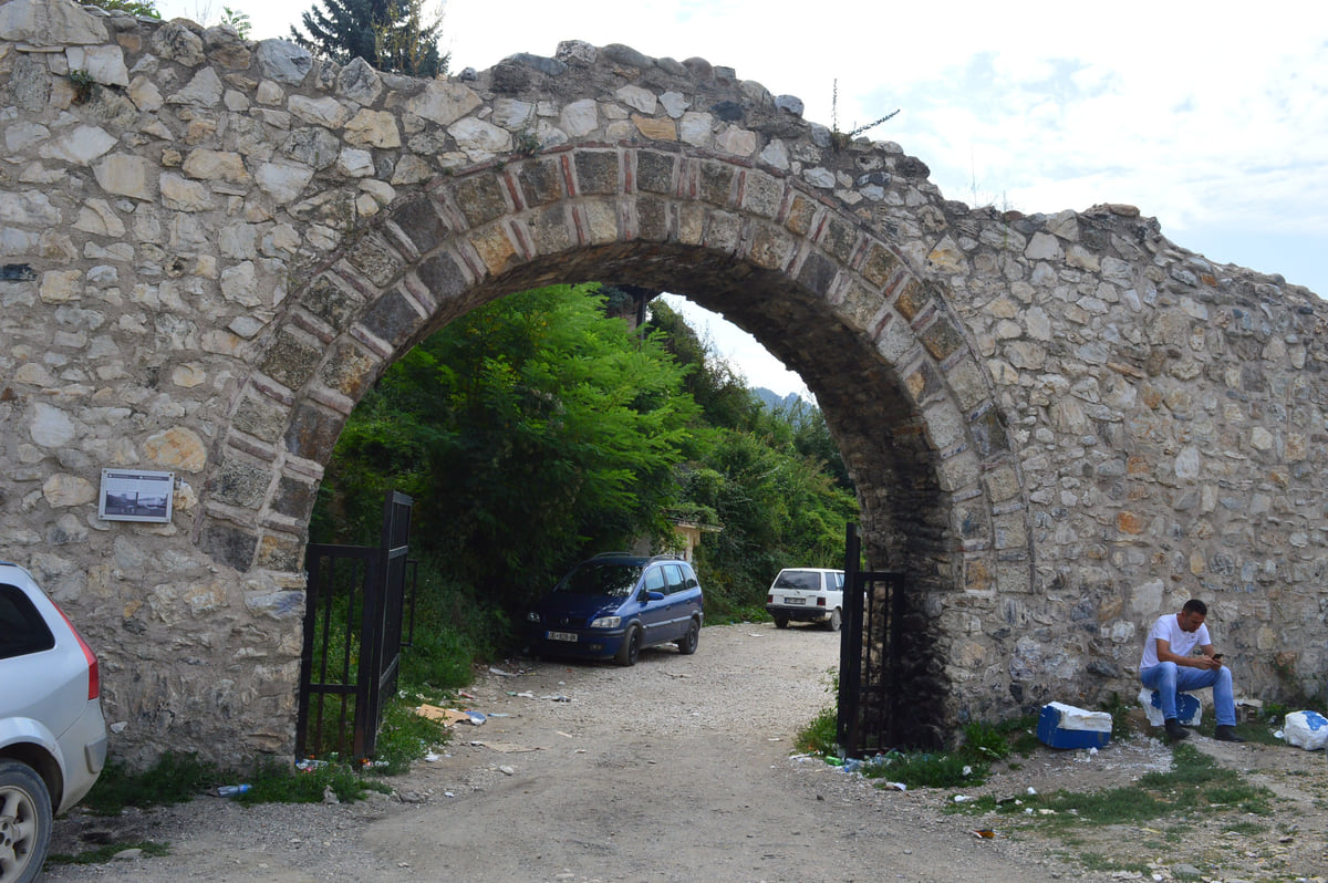
The thing that makes you pull over is Kaçanik fortress. Kosovo’s heritage register (DTK) classes it as an archaeological site from the Late Middle Ages, 16th century, on the 2014 provisional protection list, though the record also shows permanent protection back in 1967. Photos on Commons show its walls and a round tower beside the town’s streets, with cars parked in front, and a stone archway leading inside, which is the photo on this page.
A second, much older fort appears in the register too, a late antique one at Vranjak, above the village of Llanishtë. And two more sites, the Rufki Braha tower house at Stagovë, 20th century, and a 1st-century Roman site at Paldenicë, which the record files under Kaçanik even though ASK places that settlement in Hani i Elezit.
If you are staying the night, see the best hotel deals in Ferizaj for your dates: the well-placed rooms go fast.
Luboten’s mountain country
Kaçanik is also one of the four gateways to Sharr National Park. According to the park directorate, 1,560 of its hectares, 4%, lie in this municipality. Its natural values paper proposes a 201-hectare strict reserve on Luboten, at 2,499 m, high mountain ground on limestone with endemic plants and glacial relics. The paper describes only one other proposed reserve on limestone, Kopilica in Prizren, which is why Luboten’s flora stands out within the park.
The same paper marks the Dubrava pastures, in Kaçanik, as a zone for mountain tourism and day trips. No official walking routes are published, so for Luboten I’d go with someone who knows the area or with plenty of experience of my own, much as you would on an unwaymarked Scottish hill.
Getting there
OpenStreetMap marks a railway station at Kaçanik and two further halts in the municipality, Kaçanik i Vjetër and Stagovë, on the line from Ferizaj towards North Macedonia. The operator, Trainkos, shows no legible timetable on its site, so confirm times before relying on the train. More on trains in Kosovo.
By car, Kaçanik is on the road to the Hani i Elezit crossing. The FCDO expects waits at the North Macedonian border in the summer months and at festive times, so if you’re crossing, stop here first rather than on the way back.
So you do not lose the morning at the ticket office, browse tickets and tours in Ferizaj on GetYourGuide.
If you are staying the night, see the best hotel deals in Ferizaj for your dates: the well-placed rooms go fast.
Kaçanik's most populous settlements
| Settlement | 2024 | 2011 |
|---|---|---|
| Kaçanik | 8,276 | 10,393 |
| Kaçanik i Vjetër | 2,576 | 1,940 |
| Begracë | 1,904 | 2,116 |
| Biqec | 1,454 | 1,696 |
| Vatë | 1,399 | 1,675 |
| Bob | 1,377 | 1,796 |
Source: ASK, 2024 census by settlement.
Kaçanik heritage in the Ministry of Culture database
| Site | Settlement | Period |
|---|---|---|
| Kaçanik fortress | Kaçanik | Late Middle Ages, 16th century |
| Llanishtë fort | Llanishtë (Vranjak) | Late Antiquity |
| Rufki Braha tower house | Stagovë | Modern, 20th century |
| Roman site | Paldenicë (Hani i Elezit) | Roman, 1st century |
Source: DTK. The Paldenicë site is filed under Kaçanik municipality although ASK places that settlement in Hani i Elezit.
Test yourself
True or false?
0/3 Pick before you peek.
-
Kaçanik fortress dates from the 16th century.
See the answer
True. The Ministry of Culture heritage database dates it to the Late Middle Ages, 16th century.
-
Kaçanik has gained population since 2011.
See the answer
False. The municipality fell from 33,409 to 27,716 people, according to ASK.
-
Luboten lies inside Sharr National Park.
See the answer
True. The park directorate includes it among its proposed reserves, in Kaçanik municipality.
Map
Where Kaçanik is
The Bjeshkët e Nemuna mountains close off the west and the Sharr the south; in the middle lies the Pristina plain. Every number opens its guide.
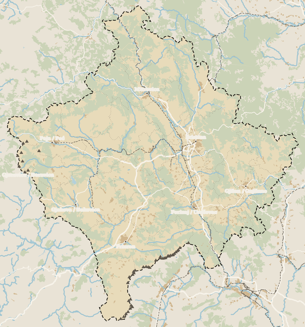 1Ferizaj region 2Ferizaj 3Štrpce 4Kaçanik 5Hani i Elezit 6Shtime
 Map data © OpenStreetMap contributors (ODbL)
What to see
What to see in Kaçanik
0 of 208 Kosovo guides
Your next stamp
- Kaçanik fortress
- Ferizaj region
- Zvečan Fortress
- Fushë Kosovë
- Prizren
- Castles in Kosovo
- Deçan
- Zvečan
- Gjakova Grand Bazaar
- Gjeravica
- Places to visit
- Pristina region
- Visoki Dečani Monastery
- Bjeshkët e Nemuna National Park
- Hadum Mosque
- Mitrovica Region
- Things to do
- Most beautiful places
- Sheh Danjolli tekke
- Prettiest villages
- Tailors' Bridge
- Rugova Canyon
- UNESCO sites
- Gjakova
- Map
- Where is Kosovo
- Regions
- Municipalities
- Cities
- Gračanica Monastery
- Mitrovica
- Patriarchate of Peć
- Pristina
- Rugova via ferrata
- Population
- Vushtrri
- Podujeva
- Radavc Cave
- Size
- Bajrakli Mosque
- Devič Monastery
- Gazimestan
- Ibar Bridge
- Is it a country?
- Istog
- One day in Pristina
- Peja
- Prizren region
- Ulpiana
- Vushtrri Stone Bridge
- Gadime Cave
- Klina
- Name
- Vushtrri Fortress
- Flag
- Isa Boletini Complex
- Novo Brdo Fortress
- History
- Junik
- Lake Batllava
- Banjska Monastery
- Languages
- Rahovec
- Ferizaj
- Religion
- Sokolica Monastery
- Currency
- Lake Gazivoda
- Štrpce
- Brezovica
- EU membership
- Entry requirements
- Skiing in Kosovo
- Serbian border
- Gračanica
- Guesthouses in Rugova
- Hotels in Peja
- Newborn monument
- North Mitrovica
- One day in Prizren
- Peja bazaar
- Peja region
- Public holidays
- Velika Hoča
- Facts
- Gjakova region
- Hani i Elezit
- Hotels in Gjakova
- National Library
- Obiliq
- Zočište Monastery
- Drenas
- Mother Teresa Cathedral
- Shtime
- Skënderaj
- Lipjan
- Mother Teresa Boulevard
- Kosovo Museum
- Leposavić
- Novo Brdo
- Emin Gjiku Ethnological Museum
- Janjevo
- Zubin Potok
- Imperial Mosque
- Pristina Clock Tower
- Pristina Old Bazaar
- Great Hammam of Pristina
- Bogë
- Germia Park
- Getting there
- Lake Radoniq
- Prizren Fortress
- Bear Sanctuary Prishtina
- Drelaj
- Flights
- Sinan Pasha Mosque
- Hotels in Pristina
- Pristina airport
- Prizren stone bridge
- Buses
- Grand Hotel Pristina
- Our Lady of Ljeviš
- Prizren hammam
- Swiss Diamond Hotel
- Tirana to Pristina
- League of Prizren
- Restaurants in Pristina
- Skopje to Pristina
- Belgrade to Pristina
- Prizren Archaeological Museum
- Balkans itinerary
- St George's Cathedral
- Church of the Holy Saviour
- Getting around
- Holy Archangels Monastery
- Trains
- Car hire
- Day trips
- Marash
- Driving
- Sharr National Park
- Taxis
- Distances
- Prevalla
- Dragash
- Road trip
- Brod
- Prices and budget
- On a budget
- Restelica
- Free things to do
- Mirusha waterfalls
- Malisheva
- Safety
- Mamusha
- Scams
- Healthcare
- National parks in Kosovo
- Nightlife
- Suhareka
- Mobile and roaming
- Mountains in Kosovo
- Mushtisht
- Hiking in Kosovo
- Korisha
- Packing list
- DokuFest
- Peaks of the Balkans
- With kids
- Holidays
- Hotels in Prizren
- Kosovo lakes
- 3 days
- Caves and waterfalls
- Restaurants in Prizren
- 5 days
- One week
- Gjilan region
- Kosovo food
- Sunny Hill Festival
- Gjilan
- Rahovec wine
- Atik Mosque, Gjilan
- Kosovo beer
- Draganac Monastery
- Where to eat in Kosovo
- Kamenica
- Where to stay in Kosovo
- Kllokot
- Weather in Kosovo
- Best time to visit Kosovo
- Partesh
- Kosovo in winter
- Ranillug
- Kosovo in spring
- Viti
- Kosovo in summer
- Letnica
- Binač Monastery
- Kosovo in autumn
- Events in Kosovo
- Independence Day
- Kosovo monasteries
- Mosques in Kosovo
- Kullas in Kosovo
- Museums in Kosovo
- Bazaars in Kosovo
Frequently asked questions
Where is Kacanik in Kosovo?
In the south, in the Ferizaj region, between Ferizaj and the border with North Macedonia, according to OpenStreetMap.
What is there to see in Kaçanik?
The 16th-century Kaçanik fortress in the town centre and, if you like the mountains, Luboten, inside Sharr National Park.
How many people live in Kaçanik?
The municipality had 27,716 people in ASK's 2024 census, down from 33,409 in 2011. Kaçanik town had 8,276.
Can I get to Kaçanik by train?
OpenStreetMap marks a station at Kaçanik on the line towards North Macedonia. Timetables come from Trainkos, so check them before travelling.
Are Kaçanik and Kačanik the same place?
Yes. Kaçanik is the Albanian form and Kačanik the Serbian form of the same municipality.
By
Tourism graduate with a master’s in Tourism Management and Planning from the University of Málaga, who has travelled across Europe. He writes every guide from official sources and his own judgement.
Published on . Facts checked on .
Sources
Some links in this guide are affiliate links: if you book through them, the site earns a commission at no extra cost to you. Affiliate disclosure
Photos: Fjolle Ramadani (CC BY-SA 4.0), via Wikimedia Commons.