Walking Kosovo's mountains
Hiking in Kosovo, from Rugova to the border summits
Hiking in Kosovo centres on the Accursed Mountains (Bjeshkët e Nemuna), with Peja and Rugova as a base, and on the Sharr Mountains. Peja's tourism website describes day routes of up to about 20 km and regional ones of up to a week. The FCDO asks walkers to keep to main paths on the Albanian and Montenegrin borders because of old landmines.
In 30 seconds
Full read: 2 min
- The best routes are in the Accursed Mountains, based in Peja and Rugova.
- The Rugova lakes walk is easy, about two hours from Kuqishtë.
- The FCDO warns of landmines on the western border and asks you to keep to main paths.
- The emergency number is 112.
My rule for Kosovo has two parts. Waymarked, well-trodden routes on your own, such as the Rugova lakes walk; anything that touches the border or high ground without a clear path, with a local guide.

Before you go
What I would keep in mind
-
01 Most beautiful
The Rugova lakes walk
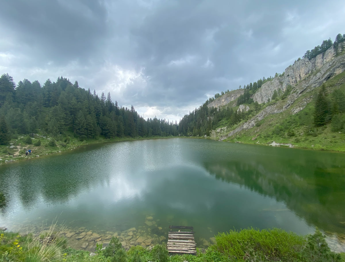
From Kuqishtë, at about 1,680 m, an easy two hours or so through pine woods brings you to the Liqenat and Drelaj lakes, according to Peja's tourism website.
Drelaj -
02 My tip
Summits on foot from Peja
Peja's tourism website says peaks such as Çfërla, Vjellaku and Hasan's peak can be climbed on foot straight from the town centre.
Peja -
03 My tip
Landmines, the warning to heed
The FCDO flags landmines along the Albanian border, at the Duljë pass and on the tri-border range, and asks you to tell the police or KFOR if you see anything suspicious.
mountains in Kosovo -
04 Worth the splurge
A three-country traverse
The Peaks of the Balkans trail crosses Kosovo, Albania and Montenegro. I cover it separately, with the little the official sources say.
Peaks of the Balkans
What I would book
Kosovo rarely makes the lists of hiking destinations, and I suspect that is down to a lack of information rather than a lack of mountains. What you do need here is a bit more care than in the Alps, for one specific reason I explain below.
Where to walk
The main area is Bjeshkët e Nemuna, the Accursed Mountains, in the west. Peja’s tourism website, whose publisher is not named and which I therefore treat as secondary, presents the town as Kosovo’s mountaineering capital and recalls that the first mountain society, called Gjeravica, was founded there in 1928. It describes three levels of route, from local day walks of up to about 20 km, through regional routes of up to a week linking the western municipalities to cross-border ones into Albania and Montenegro.
What I like most is that you do not need a car to start. According to the same website, peaks such as Çfërla, Vjellaku, Hasan’s peak and Kopranik can be climbed on foot straight from central Peja. For everything else, the Rugova Canyon road takes you up to the mountain villages. What there is to do beyond walking, from the Rugova via ferratas to DokuFest in Prizren, is gathered in things to do in Kosovo.
The walk I would do first
The Rugova lakes. You set off by Kuqishtë lake, at 1,680 m, and after roughly two hours of gentle climbing through pine woods and bilberries you reach the Liqenat and Drelaj lakes above 1,800 m. It is the best way to get the feel of Kosovo’s mountains without committing to serious terrain.
Peja’s website also mentions ten rural routes through the municipality’s villages, five across the plain and five up in the mountains, linked to homes offering meals and rooms, all of it from an EU-funded cross-border project with Montenegro that, according to the same website, upgraded 40 rural homes and opened 18 trails crossing the border.
If you are staying the night, see the best hotel deals in Rugova for your dates: the well-placed rooms go fast.
Landmines, the warning that matters
Here is the reason for that extra care. The FCDO explains that landmines and unexploded ordnance from the 1999 conflict remain, that the main risk areas are the Albanian border, the Duljë pass and the mountains between Kosovo, Albania and Montenegro, and that most of them lie on high, overgrown ground. It wants you on main roads and tracks, and asks you to tell the police or KFOR if you see anything suspicious.
In practice, waymarked and busy routes such as the lakes walk are safe. Border summits such as Gjeravica, or any traverse over ground without a clear path, I would do with a local guide.
Health, fire and emergencies
The FCDO adds three more warnings for the mountains. Wildfires from April to October, with no fires outside marked areas; altitude sickness on high ground; and Crimean-Congo haemorrhagic fever, carried by ticks, in rural areas in summer, especially around Malishevë. The number for all emergencies is 112.
Bear in mind that a GHIC is worthless here, so insurance with mountain walking cover is a must. If you are after something multi-day, Peaks of the Balkans covers what can be said from sources, and the context for each range is on mountains in Kosovo.
If you are staying the night, see the best hotel deals in Rugova for your dates: the well-placed rooms go fast.
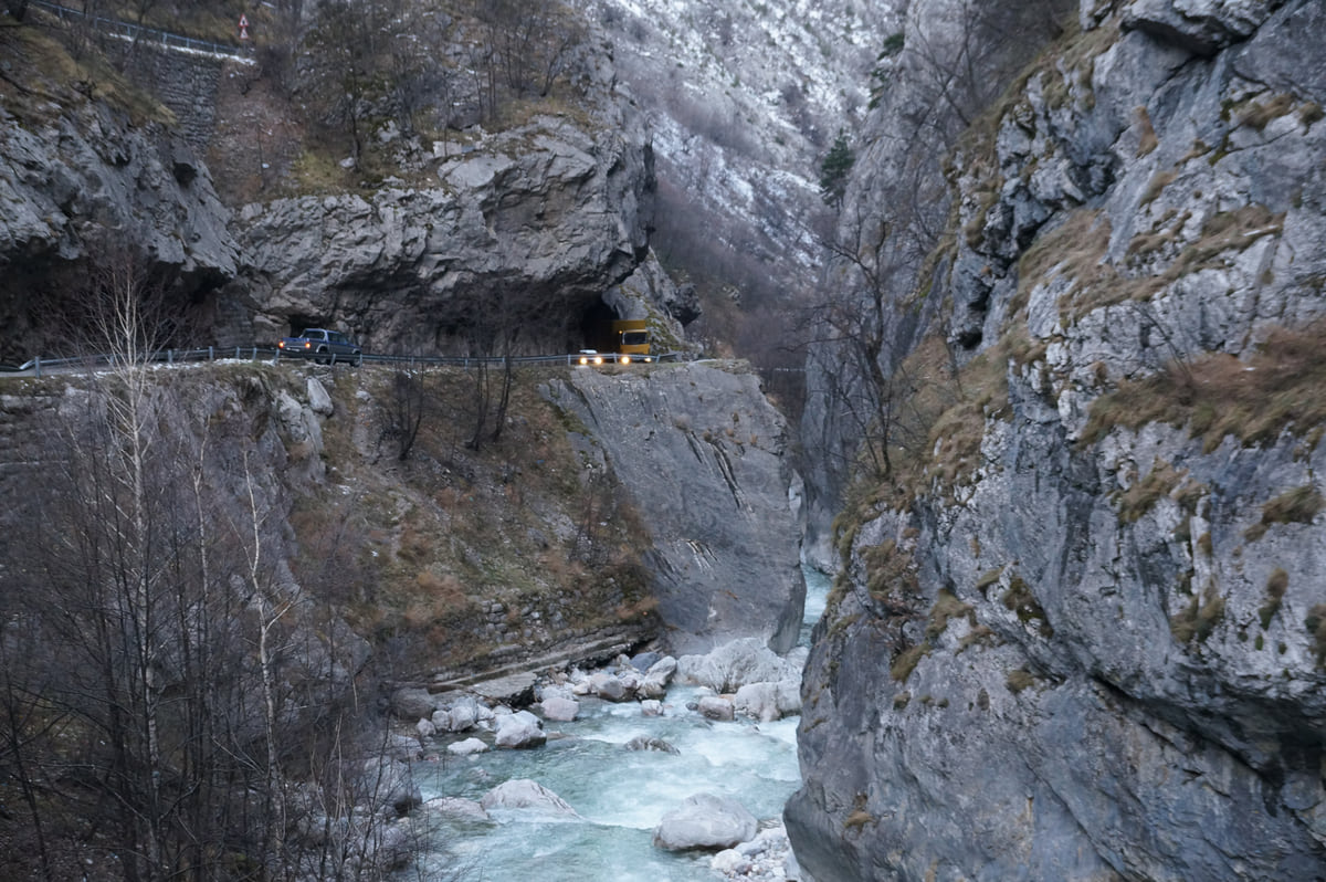
The Lumbardhi river of Peja rushing along the bottom of the Rugova Canyon, between grey rock walls and greenery
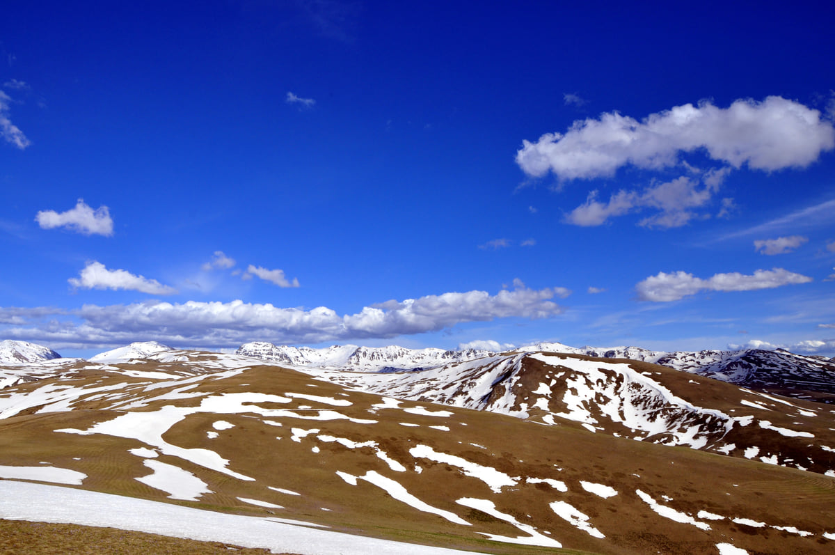
The Sharr mountains seen from Kosovo, with golden pasture, snowfields on the summits and white clouds overhead
Types of route from Peja
| Type | Length | What it is |
|---|---|---|
| Local | One day, up to about 20 km | Routes in the Peja hills and Rugova |
| Regional | Up to a week | Links the western municipalities |
| Cross-border | Several days | Peaks of the Balkans and Via Dinarica, into Albania and Montenegro |
| Rural routes | Half a day to a day | Ten routes through Peja villages, half in the lowlands and half up in the hills |
Secondary source: pejatourism.org (hiking and rural tourism), checked on 10-10-2026. The site does not state who runs it.
Risks flagged by the FCDO
| Risk | Where or when | What to do |
|---|---|---|
| Old landmines and ordnance | Albanian border, Duljë pass, tri-border mountains | Keep to main roads and paths |
| Wildfires | April to October, in dry spells | No fires outside marked areas |
| Altitude sickness | Mountain areas | Climb steadily and know the symptoms |
| Crimean-Congo haemorrhagic fever | Summer, rural areas, especially around Malishevë | Protect yourself against ticks |
Source: FCDO travel advice for Kosovo (safety, regional risks and health).
Test yourself
True or false?
0/3 Pick before you peek.
-
The FCDO advises leaving paths to avoid areas with landmines.
See the answer
False. The opposite. It asks you to keep to main roads and paths in risk areas.
-
112 covers all emergencies in Kosovo.
See the answer
True. The FCDO gives 112 as the number for all emergencies.
-
The Rugova lakes walk takes several days.
See the answer
False. Peja's tourism website describes it as an easy walk of about two hours from Kuqishtë.
- Kuqishtë to the Rugova lakes
- 2 h
- Day routes (pejatourism.org)
- 20 km
- Emergencies
- 112
- Kosovo's first mountaineering club
- 1928
What to see
What to see in Hiking in Kosovo
0 of 208 Kosovo guides
Your next stamp
- Rugova via ferrata
- Mountains in Kosovo
- One week
- Things to do
- Peaks of the Balkans
- Drelaj
- Gjeravica
- Gjakova Grand Bazaar
- Places to visit
- Pristina region
- Visoki Dečani Monastery
- Bjeshkët e Nemuna National Park
- Hadum Mosque
- Mitrovica Region
- Most beautiful places
- Sheh Danjolli tekke
- Prettiest villages
- Tailors' Bridge
- Rugova Canyon
- UNESCO sites
- Gjakova
- Map
- Where is Kosovo
- Regions
- Municipalities
- Cities
- Gračanica Monastery
- Mitrovica
- Patriarchate of Peć
- Pristina
- Prizren
- Fushë Kosovë
- Population
- Vushtrri
- Podujeva
- Radavc Cave
- Size
- Bajrakli Mosque
- Devič Monastery
- Gazimestan
- Ibar Bridge
- Is it a country?
- Istog
- One day in Pristina
- Peja
- Prizren region
- Ulpiana
- Vushtrri Stone Bridge
- Gadime Cave
- Klina
- Name
- Vushtrri Fortress
- Deçan
- Flag
- Isa Boletini Complex
- Novo Brdo Fortress
- History
- Junik
- Lake Batllava
- Zvečan Fortress
- Banjska Monastery
- Ferizaj region
- Languages
- Rahovec
- Ferizaj
- Religion
- Sokolica Monastery
- Currency
- Lake Gazivoda
- Štrpce
- Brezovica
- EU membership
- Entry requirements
- Skiing in Kosovo
- Kaçanik
- Serbian border
- Gračanica
- Guesthouses in Rugova
- Hotels in Peja
- Kaçanik fortress
- Newborn monument
- North Mitrovica
- One day in Prizren
- Peja bazaar
- Peja region
- Public holidays
- Velika Hoča
- Facts
- Gjakova region
- Hani i Elezit
- Hotels in Gjakova
- National Library
- Obiliq
- Zočište Monastery
- Drenas
- Mother Teresa Cathedral
- Shtime
- Skënderaj
- Lipjan
- Mother Teresa Boulevard
- Zvečan
- Kosovo Museum
- Leposavić
- Novo Brdo
- Emin Gjiku Ethnological Museum
- Janjevo
- Zubin Potok
- Imperial Mosque
- Pristina Clock Tower
- Pristina Old Bazaar
- Great Hammam of Pristina
- Bogë
- Germia Park
- Getting there
- Lake Radoniq
- Prizren Fortress
- Bear Sanctuary Prishtina
- Flights
- Sinan Pasha Mosque
- Hotels in Pristina
- Pristina airport
- Prizren stone bridge
- Buses
- Grand Hotel Pristina
- Our Lady of Ljeviš
- Prizren hammam
- Swiss Diamond Hotel
- Tirana to Pristina
- League of Prizren
- Restaurants in Pristina
- Skopje to Pristina
- Belgrade to Pristina
- Prizren Archaeological Museum
- Balkans itinerary
- St George's Cathedral
- Church of the Holy Saviour
- Getting around
- Holy Archangels Monastery
- Trains
- Car hire
- Day trips
- Marash
- Driving
- Sharr National Park
- Taxis
- Distances
- Prevalla
- Dragash
- Road trip
- Brod
- Prices and budget
- On a budget
- Restelica
- Free things to do
- Mirusha waterfalls
- Malisheva
- Safety
- Mamusha
- Scams
- Healthcare
- National parks in Kosovo
- Nightlife
- Suhareka
- Mobile and roaming
- Mushtisht
- Korisha
- Packing list
- DokuFest
- With kids
- Holidays
- Hotels in Prizren
- Kosovo lakes
- 3 days
- Caves and waterfalls
- Restaurants in Prizren
- 5 days
- Gjilan region
- Kosovo food
- Sunny Hill Festival
- Gjilan
- Rahovec wine
- Atik Mosque, Gjilan
- Kosovo beer
- Draganac Monastery
- Where to eat in Kosovo
- Kamenica
- Where to stay in Kosovo
- Kllokot
- Weather in Kosovo
- Best time to visit Kosovo
- Partesh
- Kosovo in winter
- Ranillug
- Kosovo in spring
- Viti
- Kosovo in summer
- Letnica
- Binač Monastery
- Kosovo in autumn
- Events in Kosovo
- Independence Day
- Kosovo monasteries
- Mosques in Kosovo
- Kullas in Kosovo
- Castles in Kosovo
- Museums in Kosovo
- Bazaars in Kosovo
Frequently asked questions
Is Kosovo good for hiking?
Yes, especially in the Accursed Mountains, with Peja and Rugova as a base, and in the Sharr Mountains. Peja's tourism website describes both day routes and multi-day ones.
Is hiking in Kosovo safe?
On waymarked routes, yes. The FCDO warns of old landmines along the Albanian border and on the tri-border mountains and asks you not to leave main paths.
What is the best walk to start with?
The Rugova lakes walk from Kuqishtë, which Peja's tourism website describes as easy and about two hours to the Liqenat and Drelaj lakes.
Do I need a guide for trekking in Kosovo?
Not for waymarked, popular routes. For border summits, multi-day traverses or ground without a clear path, I would always hire one.
What number do I call in a mountain emergency?
112, which the FCDO gives as the number for all emergencies in Kosovo. For the police, 192 from a mobile.
When is the best time for hiking in Kosovo?
There is no official calendar. On high ground, summer is the obvious choice; the FCDO warns of wildfires from April to October and of Crimean-Congo fever in rural areas in summer.
By
Tourism graduate with a master’s in Tourism Management and Planning from the University of Málaga, who has travelled across Europe. He writes every guide from official sources and his own judgement.
Published on . Facts checked on .
Sources
Some links in this guide are affiliate links: if you book through them, the site earns a commission at no extra cost to you. Affiliate disclosure
Photos: Flyingpotatow (CC BY-SA 4.0); Albinfo (CC BY 4.0); Aljabakphoto (CC BY-SA 4.0), via Wikimedia Commons.