Mitrovica, between Mitrovicë and Mitrovicë e Veriut
The Ibar bridge in Mitrovica, told through the official sources
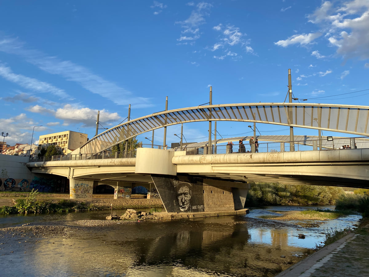
The Ibar bridge (Ura e Ibrit in Albanian, Most na Ibru in Serbian) crosses the River Ibar in Mitrovica, linking Mitrovicë municipality to the south with Mitrovicë e Veriut to the north. The Ibar runs for 85 km within Kosovo. The FCDO flags a risk of protests in the parts of Mitrovica north of the river and advises avoiding gatherings.
In 30 seconds
Full read: 2 min
- The Ibar bridge links Mitrovicë municipality to the south with Mitrovicë e Veriut to the north.
- The Ibar runs 85 km within Kosovo, third longest in the Statistics Agency's table.
- The FCDO flags a risk of protests north of the river; no official crossing rules are published.
I don't give it a mark because it isn't a listed monument, it's a place worth understanding. I'd look at it by day, with no crowds nearby and that morning's FCDO update read, and I'd put the camera away if police or soldiers are about.

Before you go
What I would keep in mind
-
01 Getting there
Mitrovica, the town it joins
The town has 33,628 people, and its officially listed heritage sits in the southern centre and on the outskirts, from the 18th-century hammam to Stan Tërg.
Mitrovica -
02 My tip
The north bank is another municipality
Once across you're in Mitrovicë e Veriut, with its own population figures and specific FCDO advice.
North Mitrovica -
03 My tip
Mind the camera
The FCDO warns that photographing police or military installations, personnel or vehicles may lead to difficulties with the authorities.
-
04 Getting there
Isa Boletini, about 4 km away
To the north, just inside Zvečan, the Isa Boletini kulla complex is a museum and shares a Special Zone with Sokolica monastery.
Isa Boletini memorial
Some places people look up for what they are, and others for what they stand for. The Ibar bridge belongs to the second kind, which is exactly why I stick to facts and sources here. I won’t tell you who’s right about anything; I’ll explain the structure, its location and the actual wording of the two governments that advise British and Spanish travellers.
What it is and where
OpenStreetMap records it under both names, Ura e Ibrit in Albanian and Most na Ibru in Serbian, and puts it at 42.8913, 20.8660. It crosses the River Ibar in Mitrovica and joins two separate municipalities. To the south is Mitrovicë, with 64,742 people in 2024; to the north is North Mitrovica, the municipality of Mitrovicë e Veriut, with 2,326 counted and 7,920 on the Statistics Agency’s estimate.
When the OSCE profiled Mitrovicë in 2018, it defined the municipality by where it sits relative to the Ibar, on the south bank. That’s the cleanest way to grasp the town, with the river as the dividing line.
The Ibar in numbers
The Kosovo Agency of Statistics gives the Ibar (Ibri in Albanian) 85 km within the territory, third longest in its table after the White Drin at 112 and the Sitnica at 110. Beyond that, neither the Agency nor the Ministry of Culture publishes anything on the bridge itself, no build date and no measurements, and I’m not going to plug that gap with what blogs or newspapers say.
Once your dates are set, check which hotels are still free in Pristina before prices climb.
The official advice, boiled down
The Foreign Office names the places where protests are a risk, three northern municipalities plus Mitrovica’s north bank, and notes that some have turned violent. It accepts that the north has calmed since 2024, yet stresses that it’s a delicate area where trouble can flare almost without notice. Its advice comes down to three things, stay alert, follow the local news and keep clear of demonstrations.
Spain’s foreign ministry, which covers Kosovo inside its advice for Serbia, goes further, asking travellers to take extreme care and mentioning frequent road blocks and demonstrations in the Serb-majority northern municipalities.
How I’d approach it
With all that in mind, my rule is simple. See the bridge by day, with no gathering anywhere near and the FCDO advice checked that same morning, because that’s what changes. I’ve found no official publication on opening times or crossing arrangements, so I won’t give you any. And keep the camera discreet, since the FCDO reminds visitors that photographing police or military installations, staff or vehicles can cause trouble. If anything does go wrong, 112 covers ambulance, fire and police across Kosovo, according to the FCDO.
Heading north, Zvečan fortress lies a couple of kilometres off in a straight line, with the Isa Boletini complex about 4 km. I set out the rest of the north in the Mitrovica region guide.
If you would rather have a local show you round, book a guided tour in Ibar Bridge and choose by the reviews.
Once your dates are set, check which hotels are still free in Pristina before prices climb.
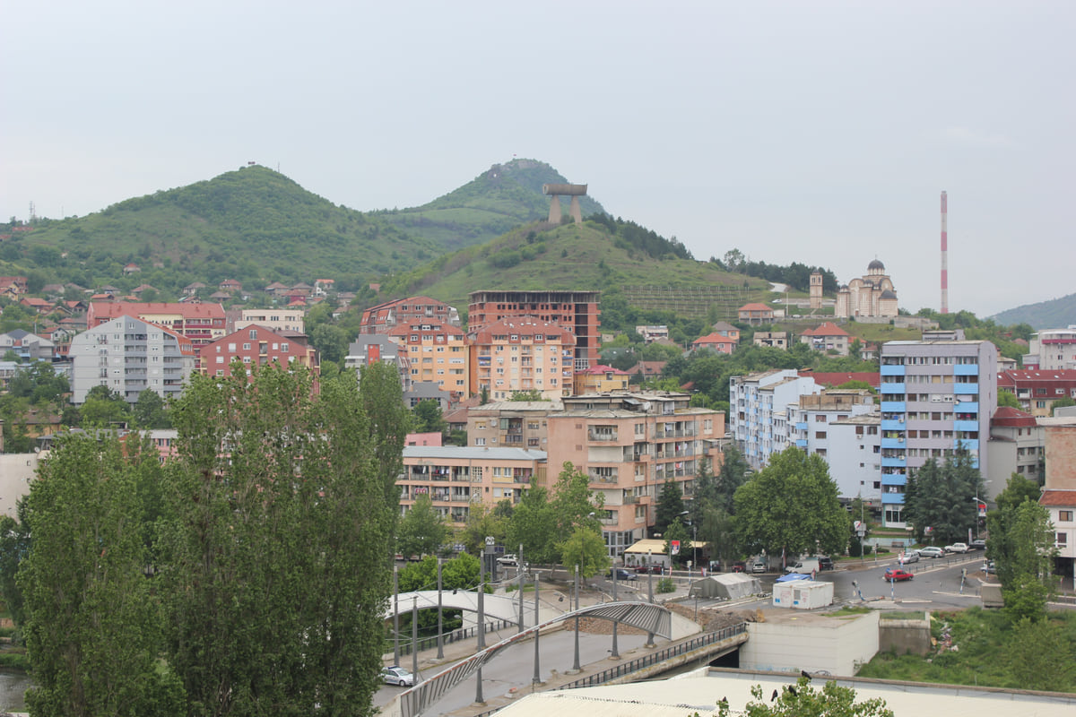
The northern part of Mitrovica seen from above, with the footbridge over the Ibar, blocks of flats and green hills behind
The Ibar bridge in figures
| Detail | Value |
|---|---|
| Name in Albanian / Serbian | Ura e Ibrit / Most na Ibru |
| River | Ibar (Ibri), 85 km within Kosovo |
| Municipality to the south | Mitrovicë (64,742 people in 2024) |
| Municipality to the north | Mitrovicë e Veriut (2,326 counted; 7,920 estimated) |
| Coordinates | 42.8913, 20.8660 |
| Opening times or crossing rules | No official publication found |
OpenStreetMap (name and coordinates, checked on 11 October 2026), Kosovo Agency of Statistics (rivers and population) and the FCDO (advice updated 23 September 2026).
Test yourself
True or false?
0/3 Pick before you peek.
-
The Ibar is Kosovo's longest river.
See the answer
False. At 85 km within Kosovo it's third in the Statistics Agency's table, behind the White Drin and the Sitnica.
-
North of the bridge lies the municipality of Mitrovicë e Veriut.
See the answer
True. It's a separate municipality from Mitrovicë, with its own figures from the Kosovo Agency of Statistics.
-
The FCDO says photographing police or military installations can cause problems.
See the answer
True. It's in the laws and cultural differences section of its advice and applies across Kosovo.
Map
Where Ibar Bridge is
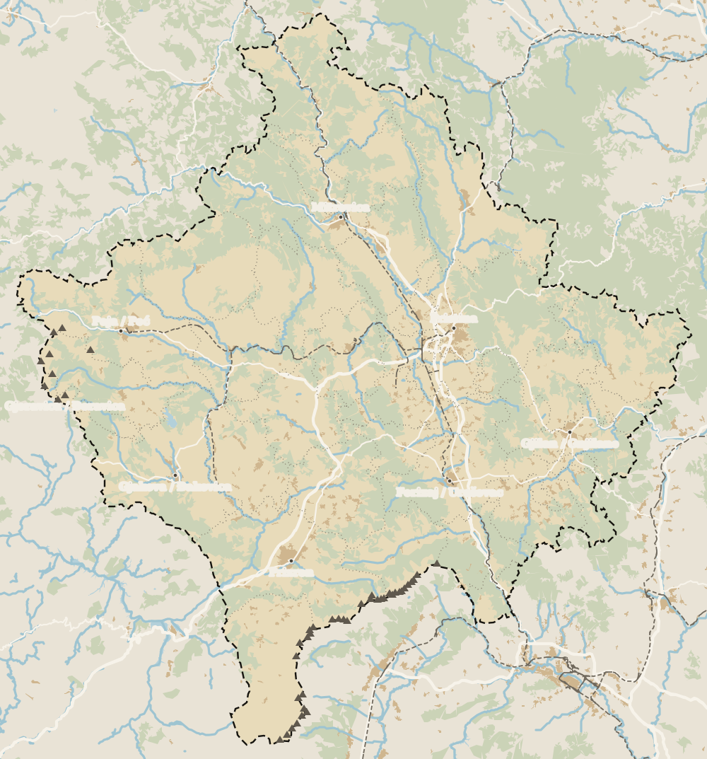
The Bjeshkët e Nemuna mountains close off the west and the Sharr the south; in the middle lies the Pristina plain. Every number opens its guide.
0 of 208 Kosovo guides
Your next stamp
- North Mitrovica
- Mitrovica
- Mitrovica Region
- Trains
- Facts
- Map
- Rugova via ferrata
- Prizren
- Gjakova Grand Bazaar
- Gjeravica
- Places to visit
- Pristina region
- Visoki Dečani Monastery
- Bjeshkët e Nemuna National Park
- Hadum Mosque
- Things to do
- Most beautiful places
- Sheh Danjolli tekke
- Prettiest villages
- Tailors' Bridge
- Rugova Canyon
- UNESCO sites
- Gjakova
- Where is Kosovo
- Regions
- Municipalities
- Cities
- Gračanica Monastery
- Patriarchate of Peć
- Pristina
- Fushë Kosovë
- Population
- Vushtrri
- Podujeva
- Radavc Cave
- Size
- Bajrakli Mosque
- Devič Monastery
- Gazimestan
- Is it a country?
- Istog
- One day in Pristina
- Peja
- Prizren region
- Ulpiana
- Vushtrri Stone Bridge
- Gadime Cave
- Klina
- Name
- Vushtrri Fortress
- Deçan
- Flag
- Isa Boletini Complex
- Novo Brdo Fortress
- History
- Junik
- Lake Batllava
- Zvečan Fortress
- Banjska Monastery
- Ferizaj region
- Languages
- Rahovec
- Ferizaj
- Religion
- Sokolica Monastery
- Currency
- Lake Gazivoda
- Štrpce
- Brezovica
- EU membership
- Entry requirements
- Skiing in Kosovo
- Kaçanik
- Serbian border
- Gračanica
- Guesthouses in Rugova
- Hotels in Peja
- Kaçanik fortress
- Newborn monument
- One day in Prizren
- Peja bazaar
- Peja region
- Public holidays
- Velika Hoča
- Gjakova region
- Hani i Elezit
- Hotels in Gjakova
- National Library
- Obiliq
- Zočište Monastery
- Drenas
- Mother Teresa Cathedral
- Shtime
- Skënderaj
- Lipjan
- Mother Teresa Boulevard
- Zvečan
- Kosovo Museum
- Leposavić
- Novo Brdo
- Emin Gjiku Ethnological Museum
- Janjevo
- Zubin Potok
- Imperial Mosque
- Pristina Clock Tower
- Pristina Old Bazaar
- Great Hammam of Pristina
- Bogë
- Germia Park
- Getting there
- Lake Radoniq
- Prizren Fortress
- Bear Sanctuary Prishtina
- Drelaj
- Flights
- Sinan Pasha Mosque
- Hotels in Pristina
- Pristina airport
- Prizren stone bridge
- Buses
- Grand Hotel Pristina
- Our Lady of Ljeviš
- Prizren hammam
- Swiss Diamond Hotel
- Tirana to Pristina
- League of Prizren
- Restaurants in Pristina
- Skopje to Pristina
- Belgrade to Pristina
- Prizren Archaeological Museum
- Balkans itinerary
- St George's Cathedral
- Church of the Holy Saviour
- Getting around
- Holy Archangels Monastery
- Car hire
- Day trips
- Marash
- Driving
- Sharr National Park
- Taxis
- Distances
- Prevalla
- Dragash
- Road trip
- Brod
- Prices and budget
- On a budget
- Restelica
- Free things to do
- Mirusha waterfalls
- Malisheva
- Safety
- Mamusha
- Scams
- Healthcare
- National parks in Kosovo
- Nightlife
- Suhareka
- Mobile and roaming
- Mountains in Kosovo
- Mushtisht
- Hiking in Kosovo
- Korisha
- Packing list
- DokuFest
- Peaks of the Balkans
- With kids
- Holidays
- Hotels in Prizren
- Kosovo lakes
- 3 days
- Caves and waterfalls
- Restaurants in Prizren
- 5 days
- One week
- Gjilan region
- Kosovo food
- Sunny Hill Festival
- Gjilan
- Rahovec wine
- Atik Mosque, Gjilan
- Kosovo beer
- Draganac Monastery
- Where to eat in Kosovo
- Kamenica
- Where to stay in Kosovo
- Kllokot
- Weather in Kosovo
- Best time to visit Kosovo
- Partesh
- Kosovo in winter
- Ranillug
- Kosovo in spring
- Viti
- Kosovo in summer
- Letnica
- Binač Monastery
- Kosovo in autumn
- Events in Kosovo
- Independence Day
- Kosovo monasteries
- Mosques in Kosovo
- Kullas in Kosovo
- Castles in Kosovo
- Museums in Kosovo
- Bazaars in Kosovo
Frequently asked questions
Where is the Mitrovica bridge?
In the town of Mitrovica, northern Kosovo, over the River Ibar. OpenStreetMap places it at 42.8913, 20.8660, between Mitrovicë municipality to the south and Mitrovicë e Veriut to the north.
Can you walk across the Mitrovica bridge?
I haven't found any published official rule on crossing. The FCDO flags a risk of protests in the parts of Mitrovica north of the river and advises steering clear of gatherings, so check its advice on the day.
How long is the Ibar river in Kosovo?
85 km within Kosovo, according to the Statistics Agency. It's third in its table, after the White Drin (112 km) and the Sitnica (110 km).
What does Ura e Ibrit mean?
It's Albanian for "Ibar bridge"; in Serbian it's Most na Ibru. OpenStreetMap carries both names for the same bridge.
What is near the Ibar bridge?
Mitrovica's centre to the south, with its 18th-century hammam. To the north, Zvečan fortress about 2 km away as the crow flies, and the Isa Boletini complex and Sokolica monastery about 4 km away.
By
Tourism graduate with a master’s in Tourism Management and Planning from the University of Málaga, who has travelled across Europe. He writes every guide from official sources and his own judgement.
Published on . Facts checked on .
Sources
Some links in this guide are affiliate links: if you book through them, the site earns a commission at no extra cost to you. Affiliate disclosure
Photos: GentiBehramaj (CC BY-SA 4.0); AgronBeqiri (CC BY-SA 3.0), via Wikimedia Commons.