Municipality in the Gjakova region
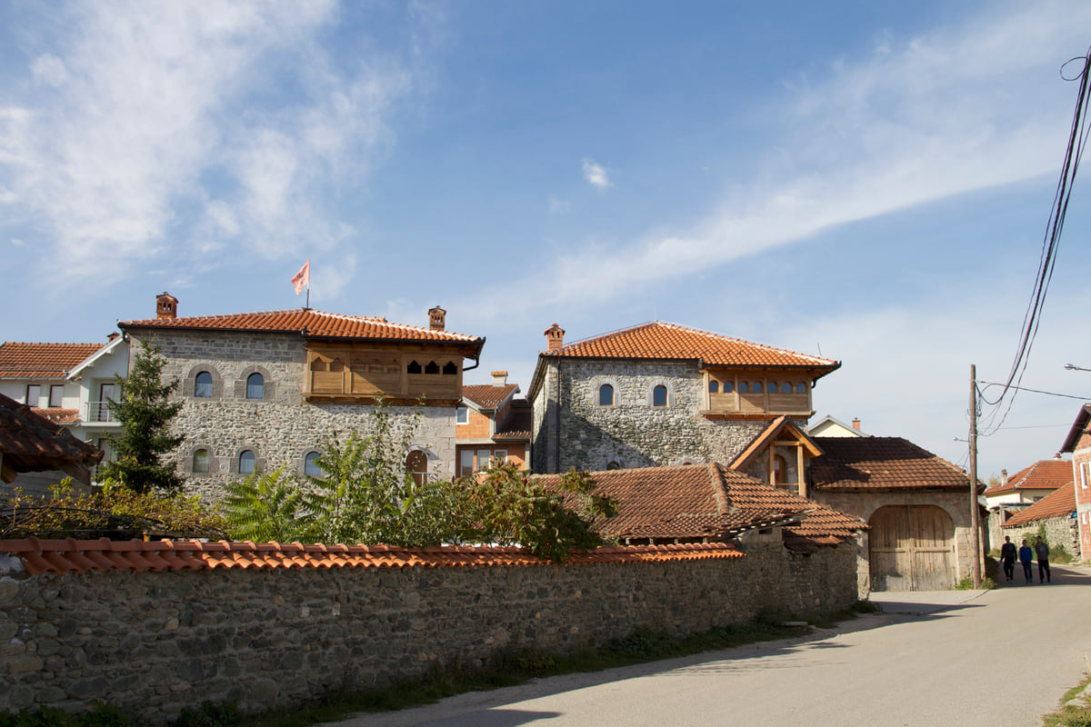
Junik, a village of kullas on the edge of the national park
Junik is a municipality in western Kosovo by the Albanian border, with 3,943 residents in 2024 and just three settlements, according to ASK. Part of its land is Bjeshkët e Nemuna National Park, and it keeps stone kullas listed by the Culture Ministry, such as Brahim Hoxha's, known as the Oda e Junikut. On OpenStreetMap, Gjeravica falls within its boundary.
In 30 seconds
Full read: 2 min
- Junik is a municipality of 3,943 people on the Albanian border.
- Its mountains belong to Bjeshkët e Nemuna National Park.
- It keeps kullas such as the 18th-century Oda e Junikut.
- Gjeravica, Kosovo's highest peak, is within its boundary on OpenStreetMap.
Junik is for people who have already seen Dečani and want something less known. Give a morning to the kullas in the centre and, if you are heading into the mountains, go with a guide.

Before you go
What I would keep in mind
-
01 Most beautiful
The Oda e Junikut
Brahim Hoxha's kulla is a fortified tower house that its official record links to gatherings of the area's clans, including one in May 1912.
kullas in Kosovo -
02 Worth the splurge
Kosovo's highest summit
Gjeravica, 2,656 m according to the Spanish Foreign Ministry, lies within Junik's boundary on OpenStreetMap. It is a high-mountain climb, not a stroll.
Gjeravica -
03 My tip
Landmines near the border
The FCDO places old landmines along the Albanian border and asks you to keep to main routes. Junik sits right in that strip.
hiking in Kosovo
What I would book
Junik is small in every respect except the mountain behind it. With under 4,000 people and three settlements it is one of Kosovo’s smallest municipalities, yet on OpenStreetMap the highest summit in the territory lies within its boundary. And in between, a village of stone kullas that few people visit.
A tiny municipality
ASK, the Kosovo Agency of Statistics, counted 3,943 people in Junik in 2024, against 6,084 in 2011. Almost all live in Junik village, 3,925; Gjocaj had 18 and Jasiq none. OpenStreetMap places it in the Gjakova region, between Deçan and the town of Gjakova, hard against the Albanian border. Peja’s tourism website, which I treat as secondary, mentions the Qafë Morinë crossing as a way in from Albania that leads through Junik towards Deçan and Peja.
The 2012 park law counts Junik among its five municipalities and runs the boundary just west of the village, so the mountains fall within Bjeshkët e Nemuna National Park.
The kullas, the reason to come
Two Junik kullas appear in the DTK. The better known is Brahim Hoxha’s, called the Oda e Junikut locally. Its record describes it as a fortified family house, places it in the Hoxha quarter and says it belonged to Imer Hoxha in the 18th century. It also says the building hosted gatherings of the area’s clans, where justice was dispensed under customary law, and that an assembly was held there from 21 to 25 May 1912. It has had provisional protection since 2012.
The other is Jah Imeri’s, from the early 19th century, near the mosque in the Hoxhaj quarter. It has three storeys, built of stone with lime mortar and chestnut timber, with a stone gallery jutting out on two sides and a wall almost a metre thick. For me it is the clearest example of why these houses were home and fortress at once. I explain more of them in kullas in Kosovo.
No official source gives visiting hours or terms. Their records describe them as family houses, so normally you see them from outside.
To sleep close to everything, search places to stay in Gjakova on Expedia and filter by area before price.
The mountain and its warnings
On OpenStreetMap, Gjeravica lies within Junik’s boundary. The Spanish Foreign Ministry gives it 2,656 m. It is high mountain terrain close to the border, and the FCDO is clear. Old mines remain by the Albanian border and on the summits shared with Montenegro, and the advice is never to leave the main roads and paths. If you are climbing, take a local guide, and check your travel insurance covers it, since the GHIC is not valid in Kosovo.
How to visit
Junik takes a morning from Gjakova or Peja by car. I would pair it with Visoki Dečani Monastery in the next municipality and head back to town to sleep, since there is no official accommodation data for Junik itself. With Velika Hoča, Bogë and Drelaj, it’s one of my prettiest villages in Kosovo.
To sleep close to everything, search places to stay in Gjakova on Booking.com and filter by area before price.
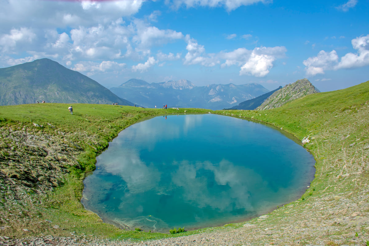
A round blue mountain lake set in the high pastures above Junik, with peaks in the background
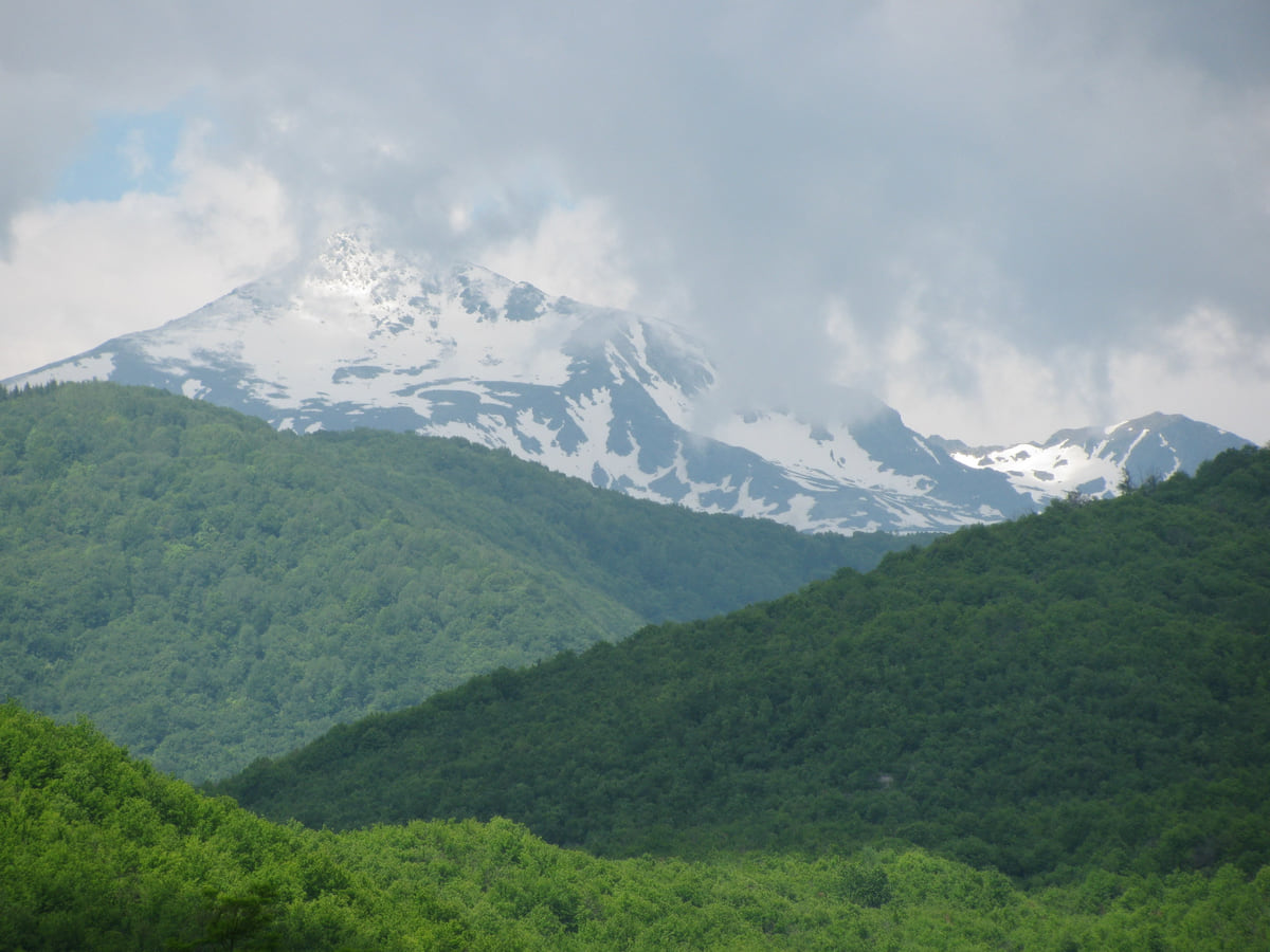
Snow-capped Gjeravica peering through the clouds above green slopes of forest and pasture in the Albanian Alps
Junik at a glance
| Item | Figure | Source |
|---|---|---|
| Municipal population, 2024 | 3,943 | ASK |
| Municipal population, 2011 | 6,084 | ASK |
| Settlements | Junik (3,925), Gjocaj (18) and Jasiq (0) | ASK |
| National park | Its mountains are in Bjeshkët e Nemuna | Law 04/L-086 |
| Summit within its boundary | Gjeravica, 2,656 m | OSM and Spanish Foreign Ministry |
ASK is the Kosovo Agency of Statistics; population by settlement is for 2024.
Junik's kullas in the Culture Ministry database
| Kulla | Period | Protection |
|---|---|---|
| Brahim Hoxha kulla (Oda e Junikut) | 18th century | Provisional since 2012 |
| Jah Imeri kulla | Early 19th century | Permanent (1982) and provisional (2011) |
Source: DTK, records 8686 and 8687. Visiting hours: no official figure.
Test yourself
True or false?
0/3 Pick before you peek.
-
Junik has only three settlements.
See the answer
True. ASK counts three, Junik, Gjocaj and Jasiq, and almost everyone lives in the first.
-
Junik lies outside any national park.
See the answer
False. Law 04/L-086 of 2012 lists it among the five municipalities of Bjeshkët e Nemuna National Park.
-
The Jah Imeri kulla has walls almost a metre thick.
See the answer
True. Its Culture Ministry record describes a massive wall of almost a metre, built for living and defence alike.
- Residents in 2024 (ASK)
- 3,943
- Settlements
- 3
- Gjeravica (Spanish Foreign Ministry)
- 2,656 m
Map
Where Junik is
The Bjeshkët e Nemuna mountains close off the west and the Sharr the south; in the middle lies the Pristina plain. Every number opens its guide.
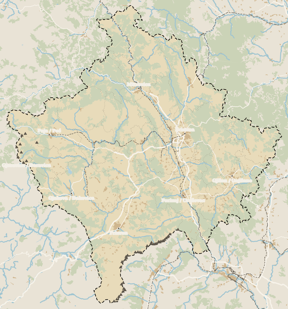 1Gjakova 2Deçan 3Junik 4Rahovec 5Gjakova region 6Lake Radoniq
 Map data © OpenStreetMap contributors (ODbL)
0 of 208 Kosovo guides
Your next stamp
- Gjeravica
- Kullas in Kosovo
- Prettiest villages
- Gjakova region
- Cities
- Deçan
- Mountains in Kosovo
- Regions
- Gjakova Grand Bazaar
- Places to visit
- Pristina region
- Visoki Dečani Monastery
- Bjeshkët e Nemuna National Park
- Hadum Mosque
- Mitrovica Region
- Things to do
- Most beautiful places
- Sheh Danjolli tekke
- Tailors' Bridge
- Rugova Canyon
- UNESCO sites
- Gjakova
- Map
- Where is Kosovo
- Municipalities
- Gračanica Monastery
- Mitrovica
- Patriarchate of Peć
- Pristina
- Prizren
- Rugova via ferrata
- Fushë Kosovë
- Population
- Vushtrri
- Podujeva
- Radavc Cave
- Size
- Bajrakli Mosque
- Devič Monastery
- Gazimestan
- Ibar Bridge
- Is it a country?
- Istog
- One day in Pristina
- Peja
- Prizren region
- Ulpiana
- Vushtrri Stone Bridge
- Gadime Cave
- Klina
- Name
- Vushtrri Fortress
- Flag
- Isa Boletini Complex
- Novo Brdo Fortress
- History
- Lake Batllava
- Zvečan Fortress
- Banjska Monastery
- Ferizaj region
- Languages
- Rahovec
- Ferizaj
- Religion
- Sokolica Monastery
- Currency
- Lake Gazivoda
- Štrpce
- Brezovica
- EU membership
- Entry requirements
- Skiing in Kosovo
- Kaçanik
- Serbian border
- Gračanica
- Guesthouses in Rugova
- Hotels in Peja
- Kaçanik fortress
- Newborn monument
- North Mitrovica
- One day in Prizren
- Peja bazaar
- Peja region
- Public holidays
- Velika Hoča
- Facts
- Hani i Elezit
- Hotels in Gjakova
- National Library
- Obiliq
- Zočište Monastery
- Drenas
- Mother Teresa Cathedral
- Shtime
- Skënderaj
- Lipjan
- Mother Teresa Boulevard
- Zvečan
- Kosovo Museum
- Leposavić
- Novo Brdo
- Emin Gjiku Ethnological Museum
- Janjevo
- Zubin Potok
- Imperial Mosque
- Pristina Clock Tower
- Pristina Old Bazaar
- Great Hammam of Pristina
- Bogë
- Germia Park
- Getting there
- Lake Radoniq
- Prizren Fortress
- Bear Sanctuary Prishtina
- Drelaj
- Flights
- Sinan Pasha Mosque
- Hotels in Pristina
- Pristina airport
- Prizren stone bridge
- Buses
- Grand Hotel Pristina
- Our Lady of Ljeviš
- Prizren hammam
- Swiss Diamond Hotel
- Tirana to Pristina
- League of Prizren
- Restaurants in Pristina
- Skopje to Pristina
- Belgrade to Pristina
- Prizren Archaeological Museum
- Balkans itinerary
- St George's Cathedral
- Church of the Holy Saviour
- Getting around
- Holy Archangels Monastery
- Trains
- Car hire
- Day trips
- Marash
- Driving
- Sharr National Park
- Taxis
- Distances
- Prevalla
- Dragash
- Road trip
- Brod
- Prices and budget
- On a budget
- Restelica
- Free things to do
- Mirusha waterfalls
- Malisheva
- Safety
- Mamusha
- Scams
- Healthcare
- National parks in Kosovo
- Nightlife
- Suhareka
- Mobile and roaming
- Mushtisht
- Hiking in Kosovo
- Korisha
- Packing list
- DokuFest
- Peaks of the Balkans
- With kids
- Holidays
- Hotels in Prizren
- Kosovo lakes
- 3 days
- Caves and waterfalls
- Restaurants in Prizren
- 5 days
- One week
- Gjilan region
- Kosovo food
- Sunny Hill Festival
- Gjilan
- Rahovec wine
- Atik Mosque, Gjilan
- Kosovo beer
- Draganac Monastery
- Where to eat in Kosovo
- Kamenica
- Where to stay in Kosovo
- Kllokot
- Weather in Kosovo
- Best time to visit Kosovo
- Partesh
- Kosovo in winter
- Ranillug
- Kosovo in spring
- Viti
- Kosovo in summer
- Letnica
- Binač Monastery
- Kosovo in autumn
- Events in Kosovo
- Independence Day
- Kosovo monasteries
- Mosques in Kosovo
- Castles in Kosovo
- Museums in Kosovo
- Bazaars in Kosovo
Frequently asked questions
Where is Junik in Kosovo?
In western Kosovo, between Deçan and Gjakova, at the foot of the mountains and close to the Albanian border. According to OpenStreetMap it belongs to the Gjakova region.
What is there to see in Junik?
The stone kullas in the centre, above all Brahim Hoxha's, known as the Oda e Junikut, and Jah Imeri's, plus the mountains of Bjeshkët e Nemuna National Park.
What is the population of Junik?
3,943 in 2024 according to ASK, nearly all in Junik village itself, which has 3,925. In 2011 the municipality had 6,084.
Can you climb Gjeravica from Junik?
On OpenStreetMap the summit lies within Junik's boundary. I have no official source for the route, and the FCDO warns of landmines in the border mountains, so I would go with a local guide.
What is a kulla?
A stone tower house of several storeys with thick walls, used both as a home and for defence. Jah Imeri's has walls almost a metre thick, according to its record.
By
Tourism graduate with a master’s in Tourism Management and Planning from the University of Málaga, who has travelled across Europe. He writes every guide from official sources and his own judgement.
Published on . Facts checked on .
Sources
Some links in this guide are affiliate links: if you book through them, the site earns a commission at no extra cost to you. Affiliate disclosure
Photos: Sali Shoshi (CC BY-SA 4.0); Atdhebuja (CC BY-SA 4.0); Faton Haxhiavdyli (CC BY-SA 3.0), via Wikimedia Commons.