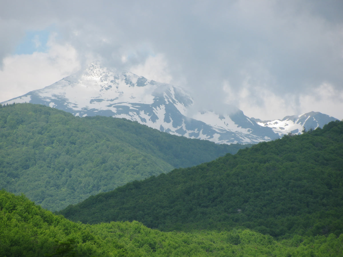
The territory in numbers
The size of Kosovo, from the plains to Gjeravica
Kosovo covers 10,905 km², according to the Kosovo Agency of Statistics (ASK), a little more than the whole island of Cyprus (9,253 km²) and about four times Luxembourg. It has 147 people per km². Its two national parks add up to over 1,000 km², and its highest point is Gjeravica, at 2,656 metres.
Small doesn't mean quick to cross. Gov.uk rates the roads as fair to poor and advises against driving at night, so I'd plan days around mountain roads rather than kilometres.

Before you go
What I would keep in mind
-
01 My tip
Bigger than Cyprus
At 10,905 km², Kosovo is larger than the island of Cyprus, which the Spanish foreign ministry and Eurostat put at 9,253, and roughly four times Luxembourg, at 2,586 km² according to its statistics office.
Kosovo map -
02 Most beautiful
Nearly a tenth is national park
Sharr covers 39,000 ha under its 1986 law and Bjeshkët e Nemuna 62,488 ha under the 2012 law. Together that's about 1,015 km², roughly 9% of the territory.
most beautiful places in Kosovo -
03 Getting there
Short distances, slow roads
As the crow flies, Prizren is 61 km from Pristina and Peja 72, using OpenStreetMap coordinates. By road it's always further.
distances in Kosovo
Kosovo is small, but not as small as people tend to assume. The Kosovo Agency of Statistics (ASK) puts it at 10,905 km² using 2024 data, a fraction under the 10,908 it gave in 2011. Here I put that in context against places you probably know, and against the space taken up by its mountains, rivers and lakes, which is what really shapes a trip.
What to compare it with
Kosovo is a little larger than the island of Cyprus, which the Spanish foreign ministry and Eurostat put at 9,253 km², and roughly four times the size of Luxembourg, which its statistics office, STATEC, gives as 2,586 km². With 1,585,566 people counted in 2024, that works out at 147 per km². Because I cover Europe from the smallest destination upwards, Kosovo is also the biggest on this site so far. The internal lines, the 38 municipalities, are on the Kosovo map.
A lot of mountain for the space
What makes Kosovo feel bigger on the ground is the relief. The two national parks in Kosovo, Sharr with 39,000 ha under its 1986 law and Bjeshkët e Nemuna with 62,488 ha under the 2012 law, add up to around 1,015 km², close to 9% of the territory. OpenStreetMap shows 45 peaks of 2,400 metres or more inside the boundary, and the loftiest, Gjeravica, reaches 2,656 according to the Spanish foreign ministry. I cover them in Kosovo mountains.
To sleep close to everything, search places to stay in Peja on Expedia and filter by area before price.
How the parks divide up
The Environmental Protection Agency breaks Sharr down by municipality. Prizren contributes 19,500 ha, half of it; Shtërpcë 15,210 (39%); Suharekë 2,730 (7%); and Kaçanik 1,560 (4%). Bjeshkët e Nemuna spreads across Gjakovë, Junik, Deçan, Pejë and Istog, according to its law, though it doesn’t give each municipality’s share. Junik is the smallest of the five, with 3,943 people and only three settlements.
Rivers and lakes in numbers
ASK publishes how many kilometres each river runs inside Kosovo. The longest is the White Drin at 112 km, followed by the Sitnica (110), the Ibar (85), the Binačka Morava (67) and the Lumbardhi of Peja (56). The main lakes are small, led by Gazivoda at 9.1 km², with Radoniq, Batllava and Badoc behind. Where each one is, and which are worth a visit, is in Kosovo lakes.
If you are short on time, see the best tours in Peja and pick one that fits your day.
What the area doesn’t tell you
A territory of 10,905 km² looks like something you could cover in a couple of days, and you can’t. In gov.uk’s words, road standards vary from fair to poor, and they deteriorate in rural areas and after bad weather, with a landslide risk in hilly and mountainous areas, and advises against driving at night. I’d plan stages in hours rather than kilometres. In a straight line, Prizren is 61 km from Pristina and Peja 72, but by road it’s further, as I set out in distances in Kosovo.
To sleep close to everything, search places to stay in Peja on Booking.com and filter by area before price.
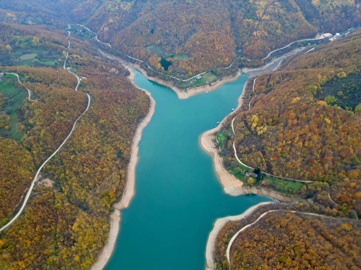
Lake Gazivoda (Ujmani) from the air, an arm of turquoise water winding between slopes of autumn woodland
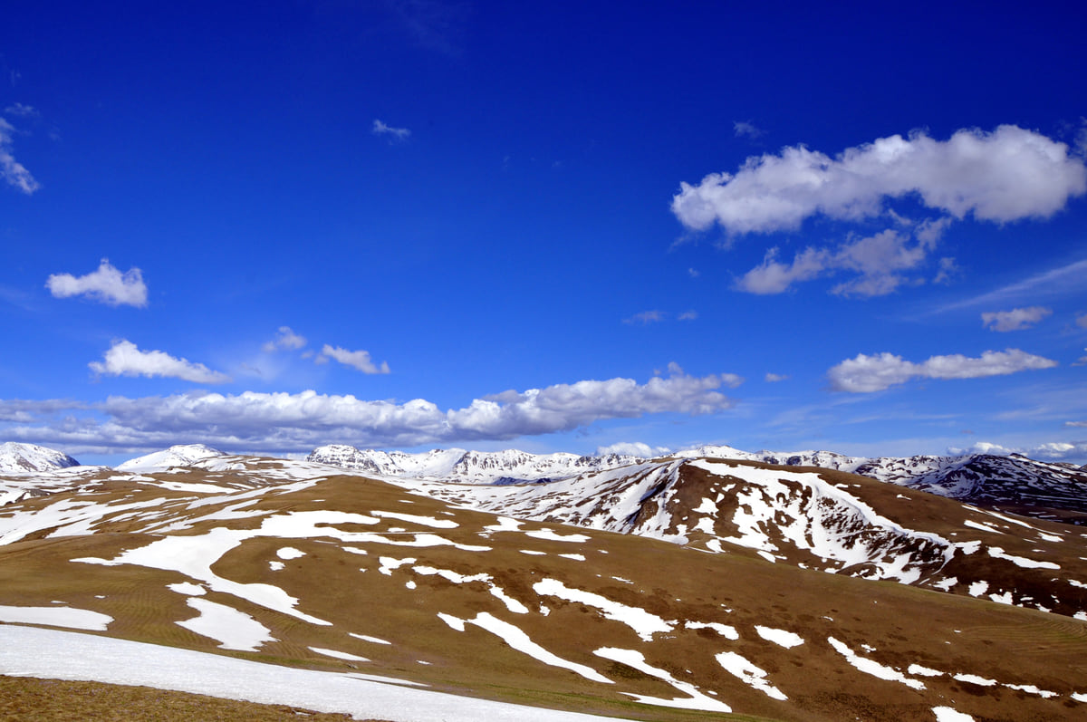
The Sharr mountains seen from Kosovo, with golden pasture, snowfields on the summits and white clouds overhead
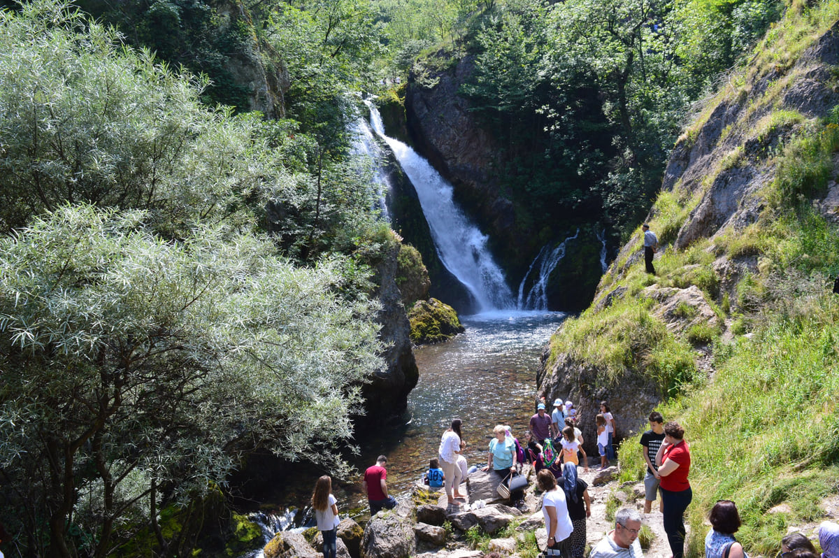
Water from the source of the White Drin at Radavc falling down the rock among trees, with visitors below
Kosovo's territory in figures
| Fact | Figure | Source |
|---|---|---|
| Area in 2024 | 10,905 km² | ASK |
| Area in 2011 | 10,908 km² | ASK |
| Density in 2024 | 147 people per km² | ASK |
| Bjeshkët e Nemuna National Park | 62,488 ha | Law 04/L-086 |
| Sharr National Park | 39,000 ha (1986 law) | AMMK |
| Gjeravica | 2,656 m | Spanish foreign ministry |
| Peaks of 2,400 m or more | 45 | OpenStreetMap |
Main rivers and lakes
| Name | Figure |
|---|---|
| White Drin | 112 km inside Kosovo |
| Sitnica | 110 km |
| Ibar | 85 km |
| Binačka Morava | 67 km |
| Lumbardhi of Peja | 56 km |
| Lake Gazivoda | 9.1 km² |
| Lake Radoniq | 5.96 km² |
| Lake Batllava | 3.27 km² |
| Lake Badoc | 2.57 km² |
Source: ASK, geographical data. River lengths are the stretch inside Kosovo.
Test yourself
True or false?
0/3 Pick before you peek.
-
Kosovo is smaller than Cyprus.
See the answer
False. It's slightly bigger. Kosovo covers 10,905 km² and the island of Cyprus 9,253, according to the Spanish foreign ministry and Eurostat.
-
The White Drin runs for more than 100 km inside Kosovo.
See the answer
True. The statistics agency gives it 112 km inside Kosovo, the longest in its river table.
-
Bjeshkët e Nemuna is Kosovo's largest national park.
See the answer
True. Its 2012 law gives it 62,488 ha, against the 39,000 ha the 1986 law gave Sharr.
0 of 208 Kosovo guides
Your next stamp
- Map
- National parks in Kosovo
- Getting around
- Gjeravica
- Sharr National Park
- Where is Kosovo
- Gjakova Grand Bazaar
- Places to visit
- Pristina region
- Visoki Dečani Monastery
- Bjeshkët e Nemuna National Park
- Hadum Mosque
- Mitrovica Region
- Things to do
- Most beautiful places
- Sheh Danjolli tekke
- Prettiest villages
- Tailors' Bridge
- Rugova Canyon
- UNESCO sites
- Gjakova
- Regions
- Municipalities
- Cities
- Gračanica Monastery
- Mitrovica
- Patriarchate of Peć
- Pristina
- Prizren
- Rugova via ferrata
- Fushë Kosovë
- Population
- Vushtrri
- Podujeva
- Radavc Cave
- Bajrakli Mosque
- Devič Monastery
- Gazimestan
- Ibar Bridge
- Is it a country?
- Istog
- One day in Pristina
- Peja
- Prizren region
- Ulpiana
- Vushtrri Stone Bridge
- Gadime Cave
- Klina
- Name
- Vushtrri Fortress
- Deçan
- Flag
- Isa Boletini Complex
- Novo Brdo Fortress
- History
- Junik
- Lake Batllava
- Zvečan Fortress
- Banjska Monastery
- Ferizaj region
- Languages
- Rahovec
- Ferizaj
- Religion
- Sokolica Monastery
- Currency
- Lake Gazivoda
- Štrpce
- Brezovica
- EU membership
- Entry requirements
- Skiing in Kosovo
- Kaçanik
- Serbian border
- Gračanica
- Guesthouses in Rugova
- Hotels in Peja
- Kaçanik fortress
- Newborn monument
- North Mitrovica
- One day in Prizren
- Peja bazaar
- Peja region
- Public holidays
- Velika Hoča
- Facts
- Gjakova region
- Hani i Elezit
- Hotels in Gjakova
- National Library
- Obiliq
- Zočište Monastery
- Drenas
- Mother Teresa Cathedral
- Shtime
- Skënderaj
- Lipjan
- Mother Teresa Boulevard
- Zvečan
- Kosovo Museum
- Leposavić
- Novo Brdo
- Emin Gjiku Ethnological Museum
- Janjevo
- Zubin Potok
- Imperial Mosque
- Pristina Clock Tower
- Pristina Old Bazaar
- Great Hammam of Pristina
- Bogë
- Germia Park
- Getting there
- Lake Radoniq
- Prizren Fortress
- Bear Sanctuary Prishtina
- Drelaj
- Flights
- Sinan Pasha Mosque
- Hotels in Pristina
- Pristina airport
- Prizren stone bridge
- Buses
- Grand Hotel Pristina
- Our Lady of Ljeviš
- Prizren hammam
- Swiss Diamond Hotel
- Tirana to Pristina
- League of Prizren
- Restaurants in Pristina
- Skopje to Pristina
- Belgrade to Pristina
- Prizren Archaeological Museum
- Balkans itinerary
- St George's Cathedral
- Church of the Holy Saviour
- Holy Archangels Monastery
- Trains
- Car hire
- Day trips
- Marash
- Driving
- Taxis
- Distances
- Prevalla
- Dragash
- Road trip
- Brod
- Prices and budget
- On a budget
- Restelica
- Free things to do
- Mirusha waterfalls
- Malisheva
- Safety
- Mamusha
- Scams
- Healthcare
- Nightlife
- Suhareka
- Mobile and roaming
- Mountains in Kosovo
- Mushtisht
- Hiking in Kosovo
- Korisha
- Packing list
- DokuFest
- Peaks of the Balkans
- With kids
- Holidays
- Hotels in Prizren
- Kosovo lakes
- 3 days
- Caves and waterfalls
- Restaurants in Prizren
- 5 days
- One week
- Gjilan region
- Kosovo food
- Sunny Hill Festival
- Gjilan
- Rahovec wine
- Atik Mosque, Gjilan
- Kosovo beer
- Draganac Monastery
- Where to eat in Kosovo
- Kamenica
- Where to stay in Kosovo
- Kllokot
- Weather in Kosovo
- Best time to visit Kosovo
- Partesh
- Kosovo in winter
- Ranillug
- Kosovo in spring
- Viti
- Kosovo in summer
- Letnica
- Binač Monastery
- Kosovo in autumn
- Events in Kosovo
- Independence Day
- Kosovo monasteries
- Mosques in Kosovo
- Kullas in Kosovo
- Castles in Kosovo
- Museums in Kosovo
- Bazaars in Kosovo
Frequently asked questions
How big is Kosovo in square kilometres?
10,905 km² according to the Kosovo Agency of Statistics, using 2024 data. In 2011 the same agency gave 10,908 km².
Is Kosovo bigger than Cyprus?
Yes, slightly. Kosovo covers 10,905 km² and the whole island of Cyprus 9,253, according to the Spanish foreign ministry and Eurostat.
What is Kosovo's population density?
147 people per km² in 2024, according to the statistics agency, based on 1,585,566 people counted.
What is the highest point in Kosovo?
Gjeravica, at 2,656 metres according to the Spanish foreign ministry's country file, in the Bjeshkët e Nemuna range in the west.
What is the longest river in Kosovo?
By length inside Kosovo, the White Drin, at 112 km according to the statistics agency, followed by the Sitnica at 110.
By
Tourism graduate with a master’s in Tourism Management and Planning from the University of Málaga, who has travelled across Europe. He writes every guide from official sources and his own judgement.
Published on . Facts checked on .
Sources
Some links in this guide are affiliate links: if you book through them, the site earns a commission at no extra cost to you. Affiliate disclosure
Photos: Faton Haxhiavdyli (CC BY-SA 3.0); SUHEJLO (CC BY 4.0); Aljabakphoto (CC BY-SA 4.0); Fjolle Ramadani (CC BY-SA 4.0), via Wikimedia Commons.