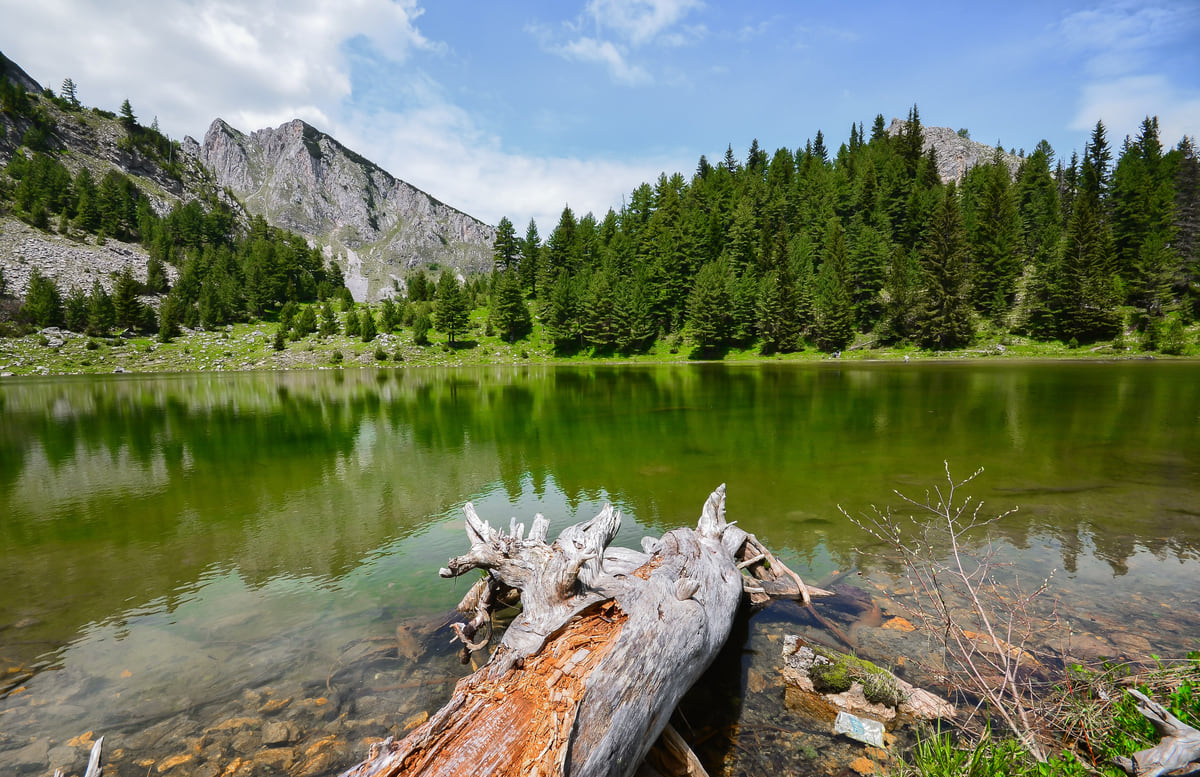
National park since 2012
Bjeshkët e Nemuna, Kosovo's great mountain park
Bjeshkët e Nemuna National Park (Prokletije in Serbian, usually the Accursed Mountains in English) protects 62,488 hectares of mountains in western Kosovo, spread over Gjakova, Junik, Deçan, Peja and Istog. Law 04/L-086 of 13 December 2012 created it, split it into three protection zones and placed its management in Peja.
In 30 seconds
Full read: 3 min
- Bjeshkët e Nemuna is a 62,488 ha national park in western Kosovo.
- Law 04/L-086 of 2012 created it, and it is managed from Peja.
- It has three protection zones and a 50 m buffer.
- It includes Gjeravica, at 2,656 m, and the Rugova lakes.
Go in through the Rugova Canyon and spend at least one night up there. For the border summits, a local guide is non-negotiable; it is not about fitness but about landmines and navigation.

Before you go
What I would keep in mind
-
01 Most beautiful
Lakes above 1,800 m
Liqenat and Drelaj, in Rugova, sit at about 1,800-1,860 m and take roughly two hours on foot from Kuqishtë, according to Peja's tourism website.
Drelaj -
02 Worth the splurge
The way in is a canyon
The law creating the park mentions the Rugova Canyon road when tracing its boundary. It is the natural entrance from Peja.
Rugova Canyon -
03 My tip
Landmines on the tri-border
The FCDO warns of old landmines on the tri-border ridges with Albania and Montenegro and asks walkers not to stray from the main routes.
hiking in Kosovo -
04 Most beautiful
The roof of Kosovo
Gjeravica, 2,656 m according to the Spanish Foreign Ministry, rises within the park, in Junik municipality on OpenStreetMap.
Gjeravica
What I would book
If I had to explain in one sentence why western Kosovo deserves more than a day, I would say Bjeshkët e Nemuna. It is the territory’s great mountain range, the wall you see behind Peja, Deçan and Gjakova, and it has been a national park since 2012.
What the law protects
Law 04/L-086, passed on 13 December 2012, makes this part of the range a national park for its forests and ecosystems, its many endemic and relict species and its geological, hydrological and landscape value, and recognises its scientific, educational, cultural and tourism interest too. It fixes the area at 62,488 hectares, shared between the municipalities of Gjakova, Junik, Deçan, Peja and Istog.
The boundary the law draws reads almost like a route. It starts in the south by the Qafë Morinë pass, at 1,385 m, climbs north above the villages, runs north-west of Visoki Dečani Monastery, crosses Peja’s river on the Rugova Canyon road, skirts Radavc by the source of the White Drin and the road to Montenegro, and closes on the border to the north.
Three zones and a buffer
Article 3 divides the park into zones. The first is under strict protection, for the most valuable areas and rare or threatened species. The second, of active management, allows ecotourism, traditional farming and compatible activities. The third, of sustainable use, takes in villages, pastures and tourism, always under the park plan. Around it runs a 50 m buffer. The precise layout is set by the spatial plan, which I could not consult.
Management falls to a directorate based in Peja, under the Kosovo Environmental Protection Agency (AMMK). Its page says it acts against illegal logging, hunting, fishing, building and land grabs, and handles fire prevention. For you, that means the park is no place for wild camping wherever you fancy, or for lighting fires.
To sleep close to everything, search places to stay in Rugova on Expedia and filter by area before price.
What is inside
The most visited part is Rugova, in Peja municipality. Here you find the villages of Drelaj and Bogë, the guesthouses, the via ferrata routes and the Liqenat and Drelaj lakes, at about 1,800-1,860 m, which Peja’s tourism website suggests walking to in roughly two hours from Kuqishtë. The same website, a secondary source, gives heights for peaks such as Guri i Kuq (2,522 m), Çfërla (2,461 m) and Hajla (2,403 m). The Peaks of the Balkans also runs through these mountains, the trail linking Kosovo with Albania and Montenegro, which according to that same website can be started in Peja.
Further south, in Junik and Deçan, the park climbs towards Gjeravica, given as 2,656 m in the Spanish Foreign Ministry’s profile, Kosovo’s highest summit. The boundary passes just west of Junik village and north-west of the monastery, so the high ground of both municipalities lies inside.
Bears, lynx and old glaciers
The study the Kosovo Institute for Nature Protection wrote in 2003 to make the case for the park, which the environment agency still publishes alongside the law, helps you read the landscape. It describes a range about 50 km from north to south and no more than 26 km across, rising almost sheer from the Dukagjin plain, and splits it into three groups divided by the Peja and Deçan river valleys. Gjeravica belongs to the southern group, with Marjashi (2,530 m) and Maja e Ropës (2,505 m) close by.
The same study explains that glaciers shaped the relief, the largest some 25 km long in the Peja river basin, and that the cirques around Gjeravica still hold ten glacial lakes. For wildlife it lists 37 mammal and 148 bird species, among them lynx, brown bear, chamois, eastern imperial eagle and golden eagle. Don’t count on spotting them from the path. Knowing they are up there is enough for me to tread a little more carefully.
To sleep close to everything, search places to stay in Rugova on Booking.com and filter by area before price.
Before you go
The FCDO is very specific about this area. It flags old landmines along the Albanian border and on the high ground where Kosovo meets Albania and Montenegro, wants you on the main roads and tracks, and mentions the April to October wildfire season and landslips after heavy weather. My rule is simple. On Rugova’s waymarked trails, go on your own; for the border summits or a multi-day traverse, take a local guide. And because the GHIC counts for nothing here, check that your policy includes hill walking.
I found no entry fee or opening hours, and access is by public roads. Routes in more detail are on hiking in Kosovo, and the comparison with the other national park, the Sharr Mountains, on national parks in Kosovo.
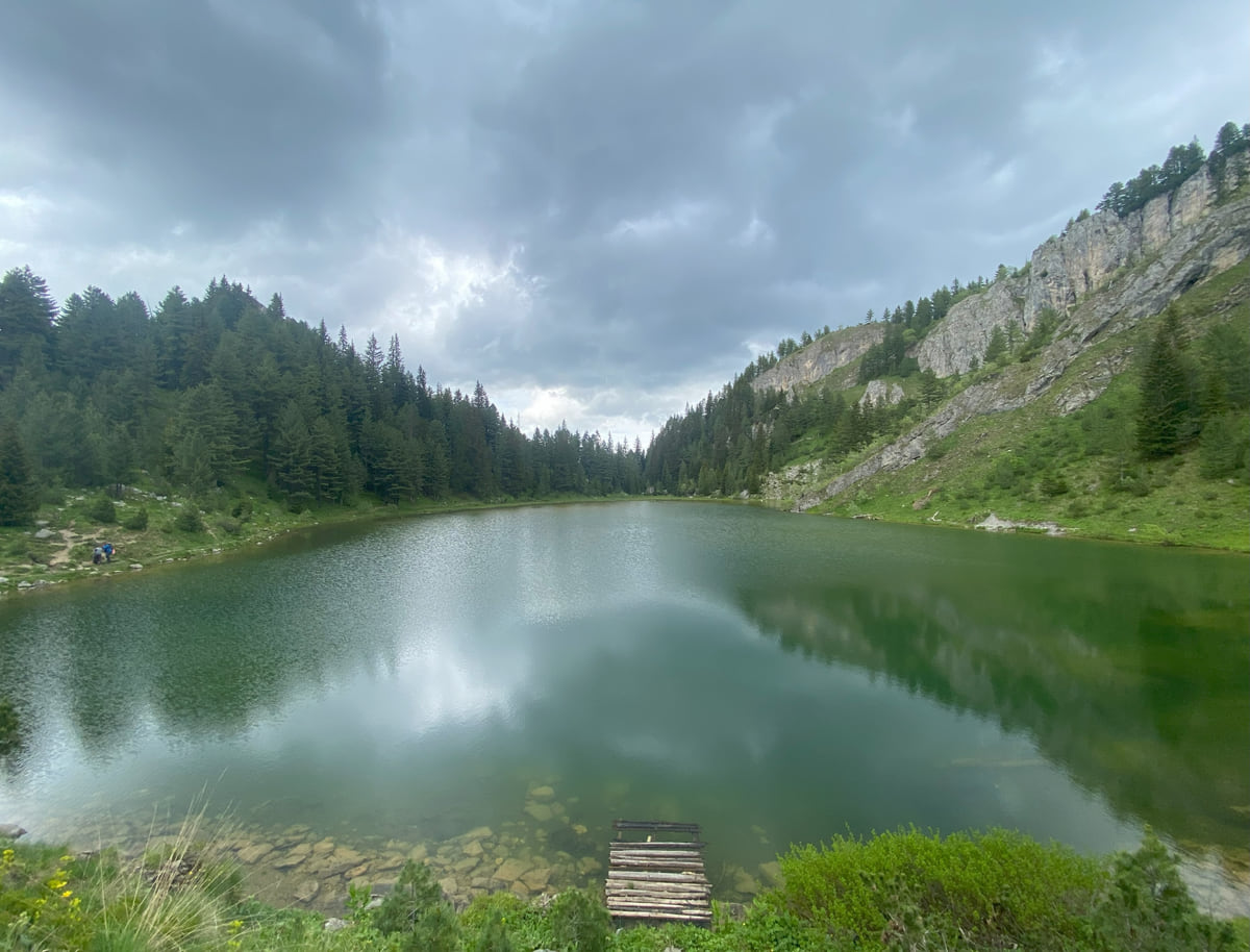
The Bjeshkët e Nemuna mountains around the lake at Kuqishtë, with forest on the slopes and low cloud
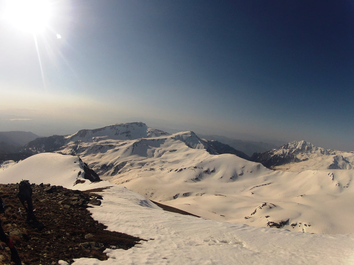
The snow-covered ridges at the summit of Gjeravica, the highest peak in Kosovo, backlit under a clear sky
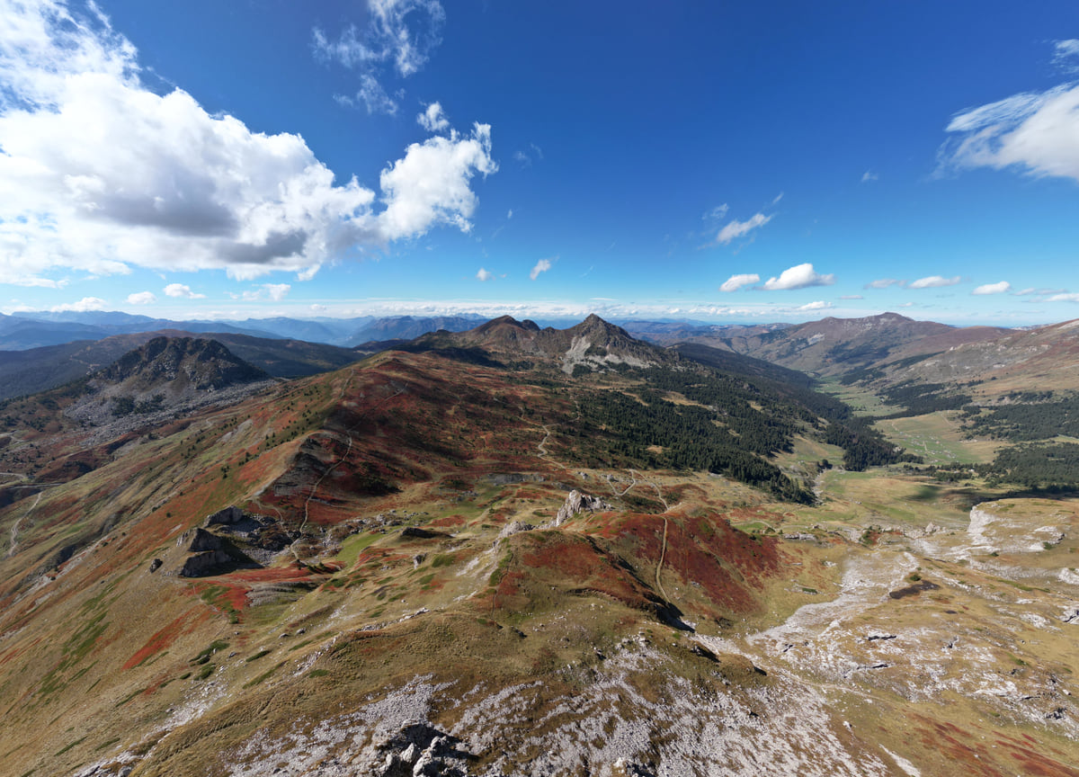
The ridges of Bjeshkët e Nemuna seen from the air, at the point where Kosovo, Albania and Montenegro meet
The park's protection zones
| Zone | What it protects | What is allowed |
|---|---|---|
| First | The most valuable areas, rare and threatened species | Strict protection |
| Second, active management | Ecosystems and landscape | Ecotourism, traditional farming and compatible activities |
| Third, sustainable use | Villages, pastures and inhabited areas | Building, recreation, tourism and grazing, under the park plan |
| Buffer | 50 m band around the boundary | Preventing harm to the park |
Source: Law 04/L-086 on Bjeshkët e Nemuna National Park, art. 3. The exact layout is set by the park's spatial plan.
Some peaks in and around the park
| Peak | Height | Source |
|---|---|---|
| Gjeravica | 2,656 m | Spanish Foreign Ministry (Serbia country profile) |
| Guri i Kuq | 2,522 m | pejatourism.org |
| Çfërla | 2,461 m | pejatourism.org |
| Hajla | 2,403 m | pejatourism.org and Visit Kosovo |
| Rusolia | 2,381 m | pejatourism.org |
pejatourism.org is Peja's tourism website, with no named publisher (secondary source). Visit Kosovo is cited from its archive.org copy.
Test yourself
True or false?
0/3 Pick before you peek.
-
Bjeshkët e Nemuna National Park is larger than the Sharr Mountains park.
See the answer
True. It covers 62,488 ha under its 2012 law; Sharr covers 39,000 ha under the 1986 law that created it.
-
The park lies entirely within Peja municipality.
See the answer
False. The law spreads it across five municipalities, Gjakova, Junik, Deçan, Peja and Istog.
-
The park law sets a 50-metre band around the boundary.
See the answer
True. Article 3 creates a 50 m buffer zone to prevent harm to the park.
- Area (Law 04/L-086)
- 62,488 ha
- Municipalities
- 5
- Year of the law
- 2012
- Gjeravica, the highest peak
- 2,656 m
Map
Where Bjeshkët e Nemuna National Park is
The Bjeshkët e Nemuna mountains close off the west and the Sharr the south; in the middle lies the Pristina plain. Every number opens its guide.
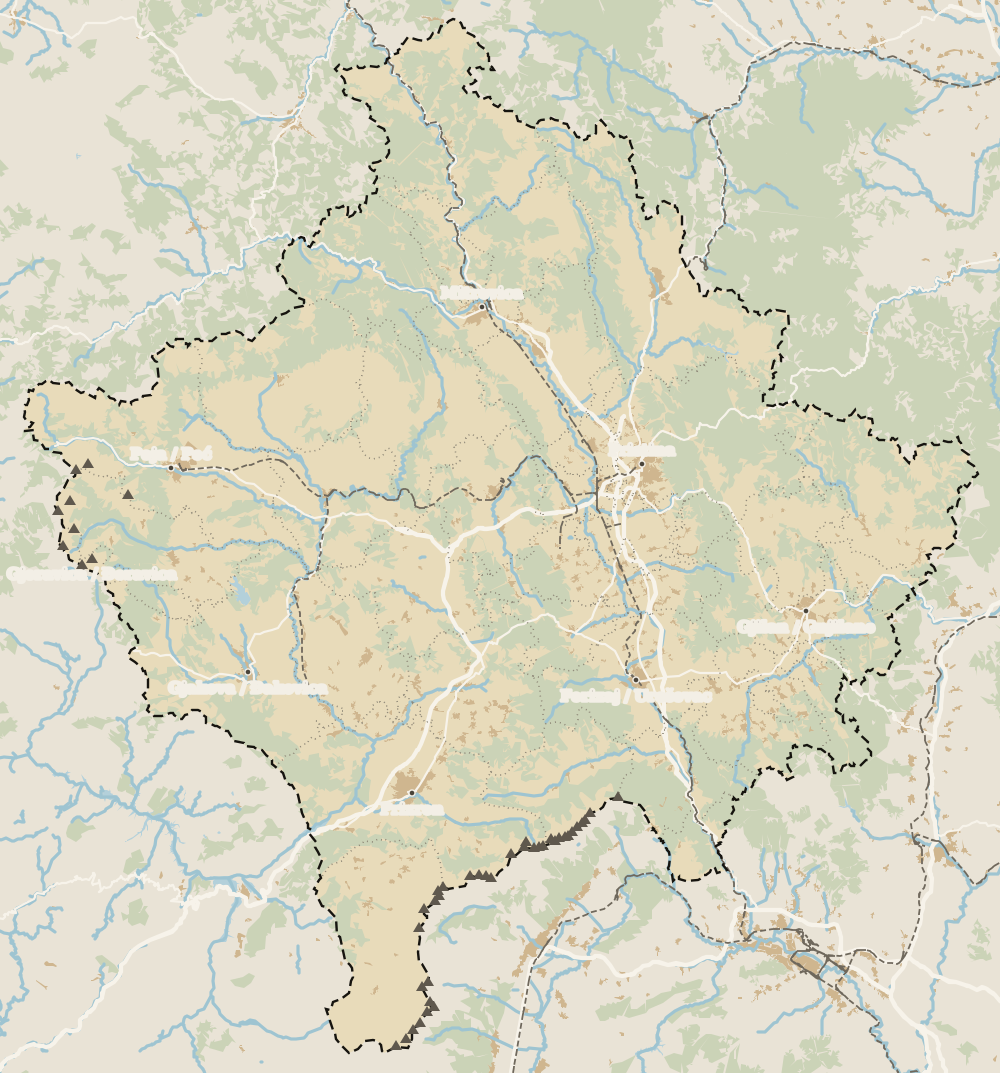 1Bjeshkët e Nemuna National Park 2Istog 3Peja 4Klina 5Peja region
 Map data © OpenStreetMap contributors (ODbL)
What to see
What to see in Bjeshkët e Nemuna National Park
0 of 208 Kosovo guides
Your next stamp
- National parks in Kosovo
- Mountains in Kosovo
- Gjeravica
- Sharr National Park
- Places to visit
- Map
- Peja
- Most beautiful places
- Gjakova Grand Bazaar
- Pristina region
- Visoki Dečani Monastery
- Hadum Mosque
- Mitrovica Region
- Things to do
- Sheh Danjolli tekke
- Prettiest villages
- Tailors' Bridge
- Rugova Canyon
- UNESCO sites
- Gjakova
- Where is Kosovo
- Regions
- Municipalities
- Cities
- Gračanica Monastery
- Mitrovica
- Patriarchate of Peć
- Pristina
- Prizren
- Rugova via ferrata
- Fushë Kosovë
- Population
- Vushtrri
- Podujeva
- Radavc Cave
- Size
- Bajrakli Mosque
- Devič Monastery
- Gazimestan
- Ibar Bridge
- Is it a country?
- Istog
- One day in Pristina
- Prizren region
- Ulpiana
- Vushtrri Stone Bridge
- Gadime Cave
- Klina
- Name
- Vushtrri Fortress
- Deçan
- Flag
- Isa Boletini Complex
- Novo Brdo Fortress
- History
- Junik
- Lake Batllava
- Zvečan Fortress
- Banjska Monastery
- Ferizaj region
- Languages
- Rahovec
- Ferizaj
- Religion
- Sokolica Monastery
- Currency
- Lake Gazivoda
- Štrpce
- Brezovica
- EU membership
- Entry requirements
- Skiing in Kosovo
- Kaçanik
- Serbian border
- Gračanica
- Guesthouses in Rugova
- Hotels in Peja
- Kaçanik fortress
- Newborn monument
- North Mitrovica
- One day in Prizren
- Peja bazaar
- Peja region
- Public holidays
- Velika Hoča
- Facts
- Gjakova region
- Hani i Elezit
- Hotels in Gjakova
- National Library
- Obiliq
- Zočište Monastery
- Drenas
- Mother Teresa Cathedral
- Shtime
- Skënderaj
- Lipjan
- Mother Teresa Boulevard
- Zvečan
- Kosovo Museum
- Leposavić
- Novo Brdo
- Emin Gjiku Ethnological Museum
- Janjevo
- Zubin Potok
- Imperial Mosque
- Pristina Clock Tower
- Pristina Old Bazaar
- Great Hammam of Pristina
- Bogë
- Germia Park
- Getting there
- Lake Radoniq
- Prizren Fortress
- Bear Sanctuary Prishtina
- Drelaj
- Flights
- Sinan Pasha Mosque
- Hotels in Pristina
- Pristina airport
- Prizren stone bridge
- Buses
- Grand Hotel Pristina
- Our Lady of Ljeviš
- Prizren hammam
- Swiss Diamond Hotel
- Tirana to Pristina
- League of Prizren
- Restaurants in Pristina
- Skopje to Pristina
- Belgrade to Pristina
- Prizren Archaeological Museum
- Balkans itinerary
- St George's Cathedral
- Church of the Holy Saviour
- Getting around
- Holy Archangels Monastery
- Trains
- Car hire
- Day trips
- Marash
- Driving
- Taxis
- Distances
- Prevalla
- Dragash
- Road trip
- Brod
- Prices and budget
- On a budget
- Restelica
- Free things to do
- Mirusha waterfalls
- Malisheva
- Safety
- Mamusha
- Scams
- Healthcare
- Nightlife
- Suhareka
- Mobile and roaming
- Mushtisht
- Hiking in Kosovo
- Korisha
- Packing list
- DokuFest
- Peaks of the Balkans
- With kids
- Holidays
- Hotels in Prizren
- Kosovo lakes
- 3 days
- Caves and waterfalls
- Restaurants in Prizren
- 5 days
- One week
- Gjilan region
- Kosovo food
- Sunny Hill Festival
- Gjilan
- Rahovec wine
- Atik Mosque, Gjilan
- Kosovo beer
- Draganac Monastery
- Where to eat in Kosovo
- Kamenica
- Where to stay in Kosovo
- Kllokot
- Weather in Kosovo
- Best time to visit Kosovo
- Partesh
- Kosovo in winter
- Ranillug
- Kosovo in spring
- Viti
- Kosovo in summer
- Letnica
- Binač Monastery
- Kosovo in autumn
- Events in Kosovo
- Independence Day
- Kosovo monasteries
- Mosques in Kosovo
- Kullas in Kosovo
- Castles in Kosovo
- Museums in Kosovo
- Bazaars in Kosovo
Frequently asked questions
Where is Bjeshkët e Nemuna National Park?
In western Kosovo, on the borders with Albania and Montenegro. It covers parts of Gjakova, Junik, Deçan, Peja and Istog, according to the law that created it in 2012.
Are Bjeshkët e Nemuna and the Accursed Mountains the same?
Yes. Bjeshkët e Nemuna is the Albanian name of the range called Prokletije in Serbian and usually the Accursed Mountains in English. Kosovo's environment agency uses the English name too.
How big is the park?
62,488 hectares, under Article 2 of Law 04/L-086. That is well over the size of Kosovo's other national park, the Sharr Mountains, at 39,000 ha.
Do you pay to enter Bjeshkët e Nemuna National Park?
I found no entry fee published by the environment agency or in the law. You pay for activities, guides and accommodation, in euros.
What is banned inside the park?
The park directorate acts against illegal logging, hunting, fishing, building and land grabs, and handles fire prevention. In the strict protection zone, the law allows no use at all.
Is hiking in the Accursed Mountains in Kosovo safe?
On waymarked trails, yes. The FCDO warns of old landmines on the tri-border mountains and of wildfires from April to October; off-path and on the border summits, take a guide, and remember your GHIC is not valid in Kosovo.
By
Tourism graduate with a master’s in Tourism Management and Planning from the University of Málaga, who has travelled across Europe. He writes every guide from official sources and his own judgement.
Published on . Facts checked on .
Sources
- Law 04/L-086 on Bjeshkët e Nemuna National Park (AMMK)
- AMMK, Bjeshkët e Nemuna National Park Directorate
- Spanish Foreign Ministry, Serbia country profile (Gjeravica)
- Kosovo Institute for Nature Protection, park study (2003, AMMK)
- pejatourism.org, mountain routes (secondary source)
- FCDO, regional risks in Kosovo
Some links in this guide are affiliate links: if you book through them, the site earns a commission at no extra cost to you. Affiliate disclosure
Photos: Gashi Bujar (CC BY-SA 4.0); Flyingpotatow (CC BY-SA 4.0); Nentor oseku (CC BY-SA 3.0); SUHEJLO (CC BY 4.0), via Wikimedia Commons.