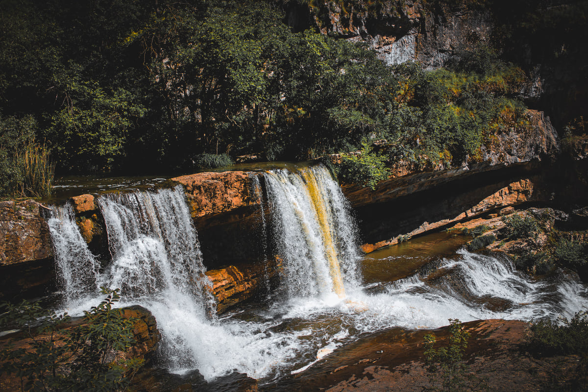
Ujëvarat e Mirushës, natural monument
Mirusha waterfalls, a canyon of stepped pools in central Kosovo
The Mirusha waterfalls (Ujëvarat e Mirushës) are a natural monument of special importance declared by the Government of Kosovo on 23 May 2012, covering 598.4 ha across Klina, Malisheva and Rahovec. The Mirusha river forms 12 waterfalls and 16 pools along 650 m of canyon. The tallest drop is 21 m and the last pool, the easy one to reach, measures 55 by 45 m.
In 30 seconds
Full read: 3 min
- The Mirusha waterfalls have been a natural monument of special importance since 23 May 2012.
- The river forms 12 falls and 16 pools along 650 m of canyon, the tallest drop 21 m.
- The monument covers 598.4 ha across Klina, Malisheva and Rahovec.
- Only the last pool is easy to reach, according to the 2013 official plan.
I'd go to Mirusha for the last pool and its waterfall, which are the accessible part and the reason to make the trip. Scrambling up the canyon pool by pool I'd leave to experienced people, because the official plan itself says access beyond the end is very difficult.

Before you go
What I would keep in mind
-
01 Most beautiful
The last pool, the big and easy one
The monument's plan describes pool 16 as the largest, 55 by 45 m and over 5 m deep, and the only one any visitor can reach easily.
caves and waterfalls in Kosovo -
02 My tip
Shared by three municipalities
The monument covers land in Klina, Malisheva and Rahovec. The village it's named after, Mirushë, belongs to Malisheva and had 691 people in 2024.
Malisheva -
03 My tip
Ticks in summer
The FCDO says Crimean Congo Haemorrhagic Fever is endemic in Kosovo, with most cases around Malisheva. Wear long trousers out in the countryside.
healthcare in Kosovo -
04 Getting there
Next to the Klina to Gjakova road
According to the 2013 plan, the M9.1 national road from Klina to Gjakova runs along the monument's western edge, with the Peja to Prizren railway alongside.
Klina
Kosovo has no coastline, so in summer people go looking for water wherever it is. Mirusha is probably the best-known natural spot in the middle of Kosovo, and with good reason. A small river that, at the end of its course, cuts into a canyon and drops in steps from pool to pool. That’s why it’s among my most beautiful places in Kosovo.
A monument with its own plan
What sets Mirusha apart is that an official document describes it in detail. The Institute for Spatial Planning, part of the Ministry of Environment, published the monument’s spatial plan in 2013. It records that the Government of Kosovo declared Mirusha a natural monument of special importance on 23 May 2012, covering 598.4 ha, and that it’s managed by Kosovo’s Environmental Protection Agency (AMMK), the same body that runs Gadime Cave.
The protection goes back further. In 1975 Rahovec and Klina municipalities declared it a special nature reserve of about 190 ha, and in the early 1980s they upgraded it to a regional nature park. Today the monument takes in land from three municipalities, Klina, Malisheva and Rahovec. The village it’s named after, Mirushë, belongs to Malisheva and had 691 people in 2024, according to ASK.
How many waterfalls are there?
Twelve waterfalls and sixteen pools, all within roughly 650 m, according to the plan. The pools fall into three groups. The upper ones, 1 to 8, start small and shallow. The middle ones, 9 to 12, sit deeper between rock walls. The lower ones, 13 to 16, are the biggest and most accessible.
The figures in the document are precise. The tallest drop, 21 m, falls between pools 8 and 9. The deepest pool is number 10, at 9 m. The longest is number 8, at 56 m. And the largest is the last, number 16, 55 by 45 m and over 5 m deep. The plan also picks out the 8 m fall between pools 15 and 16 as the most impressive, for the way the water drops straight down. That’s reason enough for me.
To sleep close to everything, search places to stay in Prizren on Expedia and filter by area before price.
What you can realistically see
Here’s the important caveat. The 2013 plan admits there were no footpaths inside the monument and that, apart from the last pool and its waterfall, reaching the others was very difficult, almost impossible. I have no later official source saying that’s changed, so I’m passing it on as written. My plan would be the last pool, taken slowly, without trying to scramble up the canyon without experience or kit. Think of it less like a Yorkshire Dales walk with a path to every force and more like a gorge you admire from its mouth.
The document also mentions caves in the canyon walls and plant life that includes endemic species. I take that as a good reason to stay on the beaten track.
Getting there
According to the plan, the M9.1 national road between Klina and Gjakova runs along the monument’s western edge, with the Peja to Prizren railway beside it, and vehicle access down to the canyon was on unsurfaced tracks. There are no official bus timetables for the site, so I’d drive from Prizren or Peja, on the right, and do it as a day trip. For Kosovo’s other falls and caves, see caves and waterfalls in Kosovo.
If you are short on time, see the best tours in Mirusha waterfalls and pick one that fits your day.
Before you go
Ticks spread Crimean Congo Haemorrhagic Fever in Kosovo, where British travel advice calls it endemic and places most cases around Malisheva, Mirushë’s own municipality. I’d wear long trousers and repellent and check myself afterwards, especially in summer. The same advice warns of wildfires from April to October. As for swimming in the pools, no official source regulates or recommends it, and with pools up to 9 m deep I’d be careful. Your GHIC won’t help here, so make sure your travel insurance is in order. More health advice is on healthcare in Kosovo.
To sleep close to everything, search places to stay in Prizren on Booking.com and filter by area before price.
The canyon in numbers, from the official plan
| Item | Value |
|---|---|
| Stretch with falls and pools | 650 m |
| Waterfalls | 12 |
| Pools | 16, in three groups (1-8, 9-12, 13-16) |
| Tallest drop | 21 m, between pools 8 and 9 |
| Deepest pool | No. 10, 9 m |
| Longest pool | No. 8, 56 m |
| Largest pool | No. 16, 55 x 45 m, 2,250 m² |
| Altitude of the monument | 340-600 m |
Source: Institute for Spatial Planning (Ministry of Environment), spatial plan for the natural monument, 2013. Opening times and prices: no official data as of 10 October 2026.
How Mirusha came to be protected
| Year | Decision |
|---|---|
| 1975 | Klina and Rahovec protect it as a special nature reserve, about 190 ha |
| 1982-1983 | The two municipal assemblies upgrade it to a regional nature park |
| 2012 | The Government of Kosovo declares it a natural monument of special importance, 598.4 ha |
Source: the monument's spatial plan (2013) and AMMK, which manages it.
Test yourself
True or false?
0/3 Pick before you peek.
-
The Mirusha waterfalls lie within a single municipality.
See the answer
False. The official plan divides the natural monument between Klina, Malisheva and Rahovec.
-
Mirusha's tallest drop is more than 20 metres.
See the answer
True. The fall between pools 8 and 9 is 21 m, according to the 2013 spatial plan.
-
Mirusha was first protected in 2012.
See the answer
False. Klina and Rahovec protected it as a special nature reserve as early as 1975. In 2012 the Government declared it a natural monument.
- Waterfalls
- 12
- Pools along 650 m of canyon
- 16
- The tallest drop
- 21 m
Map
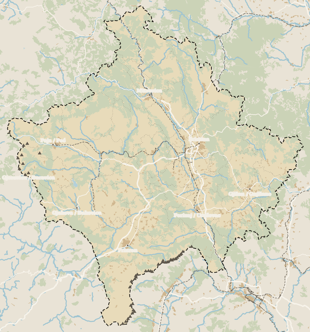
Where Mirusha waterfalls is
The Bjeshkët e Nemuna mountains close off the west and the Sharr the south; in the middle lies the Pristina plain. Every number opens its guide.
0 of 208 Kosovo guides
Your next stamp
- Malisheva
- Caves and waterfalls
- Most beautiful places
- Klina
- Bjeshkët e Nemuna National Park
- Gjeravica
- Places to visit
- Sharr National Park
- Gjakova Grand Bazaar
- Pristina region
- Visoki Dečani Monastery
- Hadum Mosque
- Mitrovica Region
- Things to do
- Sheh Danjolli tekke
- Prettiest villages
- Tailors' Bridge
- Rugova Canyon
- UNESCO sites
- Gjakova
- Map
- Where is Kosovo
- Regions
- Municipalities
- Cities
- Gračanica Monastery
- Mitrovica
- Patriarchate of Peć
- Pristina
- Prizren
- Rugova via ferrata
- Fushë Kosovë
- Population
- Vushtrri
- Podujeva
- Radavc Cave
- Size
- Bajrakli Mosque
- Devič Monastery
- Gazimestan
- Ibar Bridge
- Is it a country?
- Istog
- One day in Pristina
- Peja
- Prizren region
- Ulpiana
- Vushtrri Stone Bridge
- Gadime Cave
- Name
- Vushtrri Fortress
- Deçan
- Flag
- Isa Boletini Complex
- Novo Brdo Fortress
- History
- Junik
- Lake Batllava
- Zvečan Fortress
- Banjska Monastery
- Ferizaj region
- Languages
- Rahovec
- Ferizaj
- Religion
- Sokolica Monastery
- Currency
- Lake Gazivoda
- Štrpce
- Brezovica
- EU membership
- Entry requirements
- Skiing in Kosovo
- Kaçanik
- Serbian border
- Gračanica
- Guesthouses in Rugova
- Hotels in Peja
- Kaçanik fortress
- Newborn monument
- North Mitrovica
- One day in Prizren
- Peja bazaar
- Peja region
- Public holidays
- Velika Hoča
- Facts
- Gjakova region
- Hani i Elezit
- Hotels in Gjakova
- National Library
- Obiliq
- Zočište Monastery
- Drenas
- Mother Teresa Cathedral
- Shtime
- Skënderaj
- Lipjan
- Mother Teresa Boulevard
- Zvečan
- Kosovo Museum
- Leposavić
- Novo Brdo
- Emin Gjiku Ethnological Museum
- Janjevo
- Zubin Potok
- Imperial Mosque
- Pristina Clock Tower
- Pristina Old Bazaar
- Great Hammam of Pristina
- Bogë
- Germia Park
- Getting there
- Lake Radoniq
- Prizren Fortress
- Bear Sanctuary Prishtina
- Drelaj
- Flights
- Sinan Pasha Mosque
- Hotels in Pristina
- Pristina airport
- Prizren stone bridge
- Buses
- Grand Hotel Pristina
- Our Lady of Ljeviš
- Prizren hammam
- Swiss Diamond Hotel
- Tirana to Pristina
- League of Prizren
- Restaurants in Pristina
- Skopje to Pristina
- Belgrade to Pristina
- Prizren Archaeological Museum
- Balkans itinerary
- St George's Cathedral
- Church of the Holy Saviour
- Getting around
- Holy Archangels Monastery
- Trains
- Car hire
- Day trips
- Marash
- Driving
- Taxis
- Distances
- Prevalla
- Dragash
- Road trip
- Brod
- Prices and budget
- On a budget
- Restelica
- Free things to do
- Safety
- Mamusha
- Scams
- Healthcare
- National parks in Kosovo
- Nightlife
- Suhareka
- Mobile and roaming
- Mountains in Kosovo
- Mushtisht
- Hiking in Kosovo
- Korisha
- Packing list
- DokuFest
- Peaks of the Balkans
- With kids
- Holidays
- Hotels in Prizren
- Kosovo lakes
- 3 days
- Restaurants in Prizren
- 5 days
- One week
- Gjilan region
- Kosovo food
- Sunny Hill Festival
- Gjilan
- Rahovec wine
- Atik Mosque, Gjilan
- Kosovo beer
- Draganac Monastery
- Where to eat in Kosovo
- Kamenica
- Where to stay in Kosovo
- Kllokot
- Weather in Kosovo
- Best time to visit Kosovo
- Partesh
- Kosovo in winter
- Ranillug
- Kosovo in spring
- Viti
- Kosovo in summer
- Letnica
- Binač Monastery
- Kosovo in autumn
- Events in Kosovo
- Independence Day
- Kosovo monasteries
- Mosques in Kosovo
- Kullas in Kosovo
- Castles in Kosovo
- Museums in Kosovo
- Bazaars in Kosovo
Frequently asked questions
Where are the Mirusha waterfalls?
In central Kosovo, in the final canyon of the Mirusha river before it joins the White Drin. The natural monument covers land in Klina, Malisheva and Rahovec, about 65 km from Pristina according to the official plan.
How many waterfalls are there at Mirusha?
Twelve waterfalls and sixteen pools, according to the monument's 2013 spatial plan. They all sit along a stretch of canyon about 650 m long.
Do most people only visit the first pools?
Most visitors reach the bottom end, because the official plan says only the last pool and its waterfall are easy to get to. Reaching the others is described as very difficult, almost impossible, without paths.
What is the tallest waterfall at Mirusha?
The one between pools 8 and 9, at 21 m, according to the official plan. The same document singles out the 8 m fall between pools 15 and 16 as the most striking.
Who looks after the Mirusha waterfalls?
The Directorate for Natural Monuments of Special Importance at Kosovo's Environmental Protection Agency (AMMK), which also manages Gadime Cave.
Is there an entry fee at Mirusha?
No price or opening hours are published by an official source as of 10 October 2026.
By
Tourism graduate with a master’s in Tourism Management and Planning from the University of Málaga, who has travelled across Europe. He writes every guide from official sources and his own judgement.
Published on . Facts checked on .
Sources
Some links in this guide are affiliate links: if you book through them, the site earns a commission at no extra cost to you. Affiliate disclosure
Photos: Berishasinan (CC0), via Wikimedia Commons.