The outdoors around Peja
The Rugova Canyon, the stone gateway to the Accursed Mountains
The Rugova Canyon (Gryka e Rugovës) is the gorge that carries the Lumbardhi river down from the mountains to Peja in western Kosovo. It starts about 2 km from the town centre and runs for about 12 km, according to Peja's tourism website. The law creating Bjeshkët e Nemuna National Park cites the canyon road in its boundary, and the road climbs on to Bogë and Kuqishtë.
In 30 seconds
Full read: 3 min
- The Rugova Canyon is the gorge of the Lumbardhi river just outside Peja.
- It starts about 2 km from the centre and runs for about 12 km, according to Peja's tourism website.
- It leads into Bjeshkët e Nemuna National Park, 62,488 hectares of protected mountains.
- It has via ferrata routes, a Tibetan bridge and the Gryka e Madhe cave.
Don't just drive through it on the way to the lakes. Stop in the first few kilometres, walk down to the river and look up; you understand this canyon on foot, not through a windscreen. And be back in Peja before dark.

Before you go
What I would keep in mind
-
01 Worth the splurge
Five via ferrata routes above the river
Peja's tourism website lists five via ferrata routes in the canyon, from the Ari, Kosovo's first in 2010, to the Peja 360, opened in 2023.
via ferrata in the Rugova Canyon -
02 Most beautiful
Mountain lakes at the end of the road
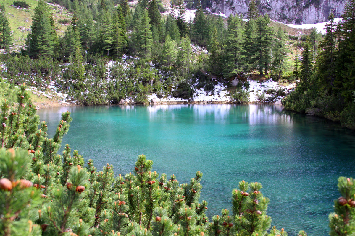
Follow the canyon road to the Kuqishtë area and walk on from there to the Liqenat and Drelaj lakes, as Peja's tourism website describes.
Drelaj -
03 My tip
A huge cave in the canyon wall
The Gryka e Madhe cave in the canyon is explored in organised groups only. Peja's tourism website speaks of 16 km of passages surveyed so far.
caves and waterfalls in Kosovo -
04 My tip
Stay on the path
The FCDO warns of old landmines in the mountains between Kosovo, Albania and Montenegro and asks you to keep to main routes. On the border peaks, go with a guide.
hiking in Kosovo
What I would book
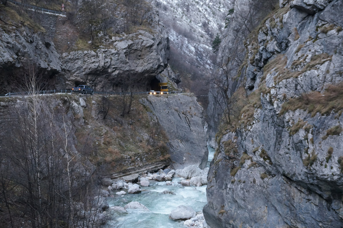
There are not many towns in Europe where you leave the centre, round a bend and find yourself inside a limestone canyon. Peja is one. The Rugova Canyon starts more or less on its outskirts, and for me it is the main reason to stay in Peja rather than just pass through.
What exactly is the Rugova Canyon?
It is the gorge the Lumbardhi river follows from the mountains down to the town. Inside the territory, the Lumbardhi of Peja runs for 56 km, according to ASK, the statistics agency. Peja’s tourism website, which does not say who runs it and which I therefore cite as a secondary source, puts the canyon at about 12 km long, starting about 2 km from the centre, with rock walls up to roughly 1,000 m. It also says the canyon has been protected as a natural monument since 1988.
The firmest official reference is a different one. Law 04/L-086 of 2012, which created Bjeshkët e Nemuna National Park, mentions the canyon road when it sets out the park boundary. In other words, the canyon is the corridor into 62,488 hectares of protected mountains shared by Gjakova, Junik, Deçan, Peja and Istog. On British maps you will usually see the range as the Accursed Mountains.
What you see along the way
The road from Peja towards Kuqishtë, shown on OpenStreetMap as Pejë-Kuqishtë (Rugovë), hugs the river and passes through a tunnel cut into the rock. The first few kilometres are the most dramatic, with the walls closing in and the water below.
Peja’s tourism website singles out an arched stone bridge at km 5, which features on the municipal coat of arms and on the label of the town’s beer, and a 40 m Tibetan bridge across the canyon that serves as the starting point for several via ferrata routes. For cavers, the same website describes Gryka e Madhe, about 8 km from town, with more than 16 km of passages surveyed, visited only in organised groups with some experience.
At the very mouth of the canyon sits the Patriarchate of Peć. If you only have one afternoon, put the two together.
If you are staying the night, see the best hotel deals in Peja for your dates: the well-placed rooms go fast.
Via ferrata, climbing and caves
Rugova is where Kosovo’s adventure activities are concentrated. Peja’s tourism website describes five via ferrata routes in Rugova, the first opened in 2010, and a visitor centre at the canyon entrance that hires out gear and bikes and arranges guides. There is rock climbing on the canyon walls too, which is exactly what the wall shot further down shows.
My advice is simple. If you have never done a via ferrata, book a guide and start on a moderate route; if you have, the Marimangat, with its Tibetan bridge, is the one I would go for.
How far up should you go?
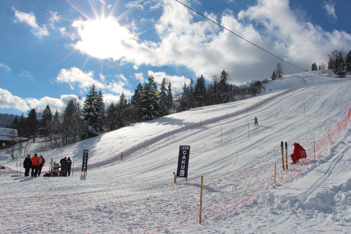
The canyon is the way in, not the destination. The road carries on to the Rugova villages, such as Bogë, which Peja’s tourism website says has a ski run and lift, Drelaj and Kuqishtë, and from there routes head off to the mountain lakes. The government tourism portal, in its 2021 archive.org copy, names Hajla, at 2,403 m, as Rugova’s highest peak and mentions the Qafa e Qyqes viewpoint over the town.
If you want to sleep up there, I cover it in guesthouses in Rugova. I would do at least one night, because the canyon at dawn, with no traffic, is a different place from the canyon at midday.
If you are staying the night, see the best hotel deals in Peja for your dates: the well-placed rooms go fast.
Things to bear in mind
Three pieces of FCDO advice apply squarely here. First, avoid driving at night, all the more on a mountain road of tunnels and bends. Second, wildfires are common from April to October, and landslides follow bad weather. Third, there are old landmines up on the borders with Albania and Montenegro, where the FCDO asks you to keep to main routes. That is not an issue in the canyon itself; on the border peaks above, it is, which is why I’d go with a local guide.
Entry is free and there are no opening hours, since it is a public road. You pay for activities and guides, and I could not check their prices against an official source. Bring euros in cash; the FCDO suggests using ATMs inside banks.
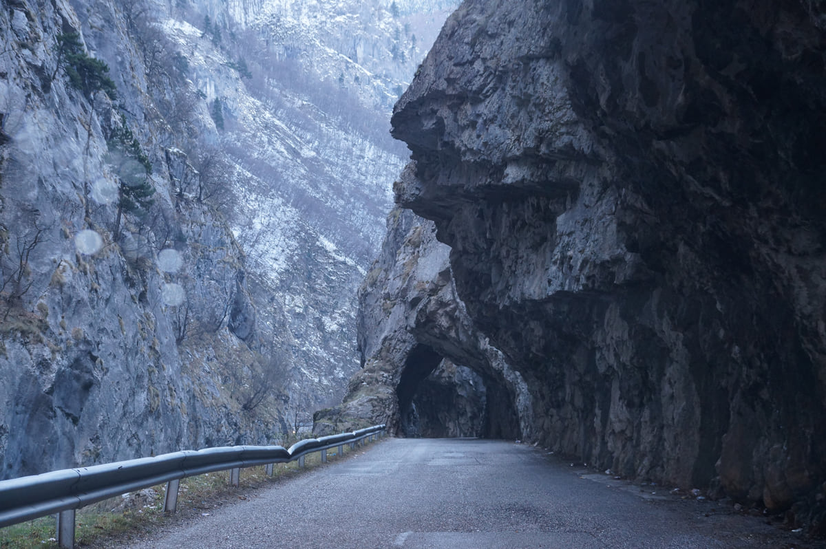
The Rugova Canyon road running into a tunnel cut through the rock, between sheer limestone walls
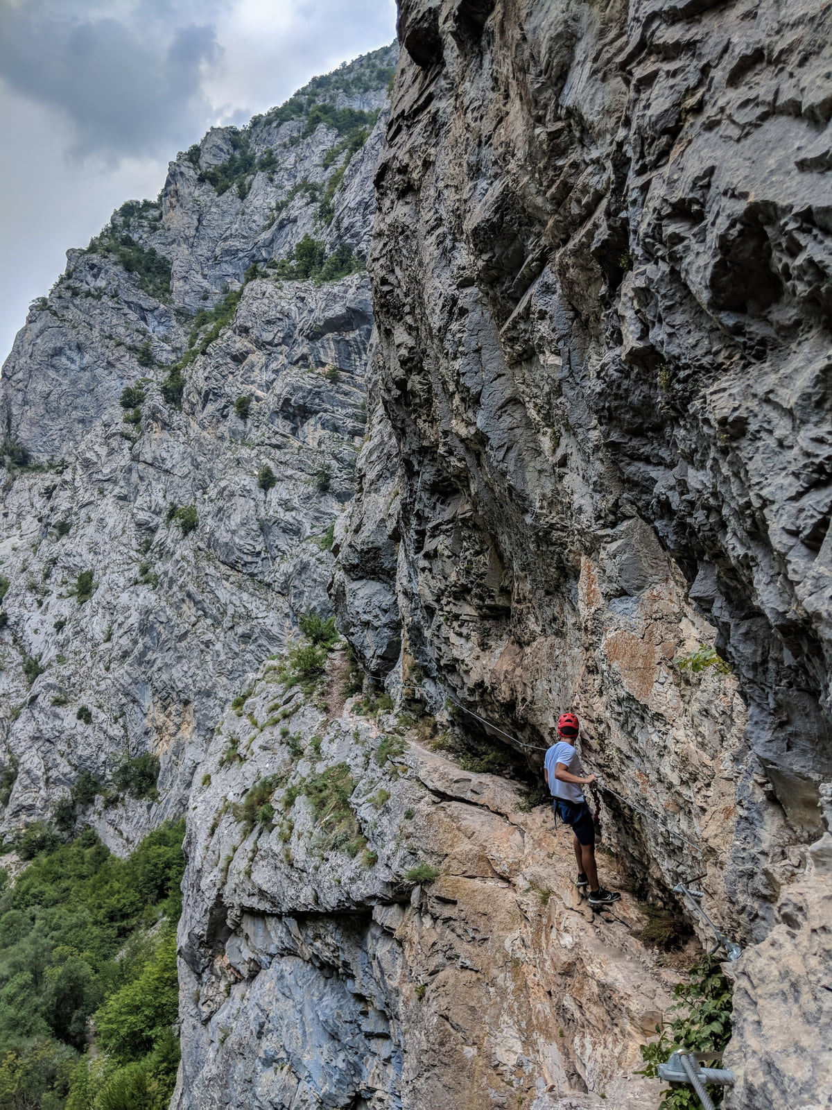
A climber on the limestone face of the Rugova Canyon, tiny against the vertical rock dotted with scrub
The canyon in figures
| Item | Figure | Source |
|---|---|---|
| River | Lumbardhi of Peja, 56 km inside Kosovo | ASK |
| Start from central Peja | About 2 km | pejatourism.org |
| Length of the canyon | About 12 km | pejatourism.org |
| Height of the walls | Up to about 1,000 m | pejatourism.org |
| Protection | Natural monument since 1988 | pejatourism.org |
| National park | Bjeshkët e Nemuna, 62,488 ha | Law 04/L-086 |
pejatourism.org is a Peja tourism website that does not say who publishes it; its figures are a secondary source. ASK is the Kosovo Agency of Statistics.
Along the canyon
| Place | What it is | Source |
|---|---|---|
| Arched stone bridge | At km 5 of the road, a protected monument | pejatourism.org |
| Tibetan bridge | 40 m suspension bridge, start of several via ferrata routes | pejatourism.org |
| Gryka e Madhe | Cave for organised groups | pejatourism.org |
| Visitor centre | At the canyon entrance; gear hire and guides | pejatourism.org |
Data from Peja's tourism website (secondary source), consulted 10 October 2026.
Test yourself
True or false?
0/3 Pick before you peek.
-
The river that carved the Rugova Canyon is the White Drin.
See the answer
False. It is the Lumbardhi of Peja, 56 km long inside Kosovo according to ASK. The White Drin rises at Radavc, north of town, according to Peja's tourism website.
-
The law on Bjeshkët e Nemuna National Park mentions the Rugova Canyon.
See the answer
True. Law 04/L-086 refers to the canyon road («Grykë të Rugovës») when describing the park boundary.
-
Kosovo's first via ferrata opened in the Rugova Canyon.
See the answer
True. According to Peja's tourism website (a secondary source), the Ari route of 2010 was the first in Kosovo.
- Length of the canyon (pejatourism.org)
- 12 km
- Lumbardhi river inside Kosovo (ASK)
- 56 km
- Via ferrata routes (pejatourism.org)
- 5
- Height of Hajla, Rugova's top peak
- 2,403 m
Map
Where Rugova Canyon is
The Bjeshkët e Nemuna mountains close off the west and the Sharr the south; in the middle lies the Pristina plain. Every number opens its guide.
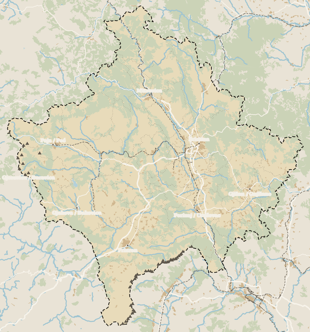 1Rugova Canyon 2Patriarchate of Peć 3Radavc Cave 4Bajrakli Mosque 5Peja 6Peja bazaar
 Map data © OpenStreetMap contributors (ODbL)
What to see
What to see in Rugova Canyon
0 of 208 Kosovo guides
Your next stamp
- Rugova via ferrata
- Peja
- 5 days
- Peja region
- Hiking in Kosovo
- Most beautiful places
- Bogë
- Patriarchate of Peć
- Gjakova Grand Bazaar
- Gjeravica
- Places to visit
- Pristina region
- Visoki Dečani Monastery
- Bjeshkët e Nemuna National Park
- Hadum Mosque
- Mitrovica Region
- Things to do
- Sheh Danjolli tekke
- Prettiest villages
- Tailors' Bridge
- UNESCO sites
- Gjakova
- Map
- Where is Kosovo
- Regions
- Municipalities
- Cities
- Gračanica Monastery
- Mitrovica
- Pristina
- Prizren
- Fushë Kosovë
- Population
- Vushtrri
- Podujeva
- Radavc Cave
- Size
- Bajrakli Mosque
- Devič Monastery
- Gazimestan
- Ibar Bridge
- Is it a country?
- Istog
- One day in Pristina
- Prizren region
- Ulpiana
- Vushtrri Stone Bridge
- Gadime Cave
- Klina
- Name
- Vushtrri Fortress
- Deçan
- Flag
- Isa Boletini Complex
- Novo Brdo Fortress
- History
- Junik
- Lake Batllava
- Zvečan Fortress
- Banjska Monastery
- Ferizaj region
- Languages
- Rahovec
- Ferizaj
- Religion
- Sokolica Monastery
- Currency
- Lake Gazivoda
- Štrpce
- Brezovica
- EU membership
- Entry requirements
- Skiing in Kosovo
- Kaçanik
- Serbian border
- Gračanica
- Guesthouses in Rugova
- Hotels in Peja
- Kaçanik fortress
- Newborn monument
- North Mitrovica
- One day in Prizren
- Peja bazaar
- Public holidays
- Velika Hoča
- Facts
- Gjakova region
- Hani i Elezit
- Hotels in Gjakova
- National Library
- Obiliq
- Zočište Monastery
- Drenas
- Mother Teresa Cathedral
- Shtime
- Skënderaj
- Lipjan
- Mother Teresa Boulevard
- Zvečan
- Kosovo Museum
- Leposavić
- Novo Brdo
- Emin Gjiku Ethnological Museum
- Janjevo
- Zubin Potok
- Imperial Mosque
- Pristina Clock Tower
- Pristina Old Bazaar
- Great Hammam of Pristina
- Germia Park
- Getting there
- Lake Radoniq
- Prizren Fortress
- Bear Sanctuary Prishtina
- Drelaj
- Flights
- Sinan Pasha Mosque
- Hotels in Pristina
- Pristina airport
- Prizren stone bridge
- Buses
- Grand Hotel Pristina
- Our Lady of Ljeviš
- Prizren hammam
- Swiss Diamond Hotel
- Tirana to Pristina
- League of Prizren
- Restaurants in Pristina
- Skopje to Pristina
- Belgrade to Pristina
- Prizren Archaeological Museum
- Balkans itinerary
- St George's Cathedral
- Church of the Holy Saviour
- Getting around
- Holy Archangels Monastery
- Trains
- Car hire
- Day trips
- Marash
- Driving
- Sharr National Park
- Taxis
- Distances
- Prevalla
- Dragash
- Road trip
- Brod
- Prices and budget
- On a budget
- Restelica
- Free things to do
- Mirusha waterfalls
- Malisheva
- Safety
- Mamusha
- Scams
- Healthcare
- National parks in Kosovo
- Nightlife
- Suhareka
- Mobile and roaming
- Mountains in Kosovo
- Mushtisht
- Korisha
- Packing list
- DokuFest
- Peaks of the Balkans
- With kids
- Holidays
- Hotels in Prizren
- Kosovo lakes
- 3 days
- Caves and waterfalls
- Restaurants in Prizren
- One week
- Gjilan region
- Kosovo food
- Sunny Hill Festival
- Gjilan
- Rahovec wine
- Atik Mosque, Gjilan
- Kosovo beer
- Draganac Monastery
- Where to eat in Kosovo
- Kamenica
- Where to stay in Kosovo
- Kllokot
- Weather in Kosovo
- Best time to visit Kosovo
- Partesh
- Kosovo in winter
- Ranillug
- Kosovo in spring
- Viti
- Kosovo in summer
- Letnica
- Binač Monastery
- Kosovo in autumn
- Events in Kosovo
- Independence Day
- Kosovo monasteries
- Mosques in Kosovo
- Kullas in Kosovo
- Castles in Kosovo
- Museums in Kosovo
- Bazaars in Kosovo
Frequently asked questions
Where is the Rugova Canyon?
Just west of Peja in western Kosovo. It begins about 2 km from the town centre, according to Peja's tourism website, and climbs into the Bjeshkët e Nemuna mountains on the Montenegrin border.
How long is the Rugova Canyon?
About 12 km, with walls of up to about 1,000 m, according to pejatourism.org, a Peja tourism website I cite as a secondary source. The Lumbardhi river that runs through it is 56 km long inside Kosovo, according to ASK.
Is there an entrance fee for the Rugova Canyon?
No. It is a public road from Peja to the Rugova villages. You pay for activities such as the via ferrata or a guide, and for whatever you eat and drink.
Can you hike the Rugova Canyon?
You can walk sections along the road and river and use it as the start of longer routes into the national park. For anything near the border peaks, the FCDO's landmine warning means going with a local guide and staying on marked paths.
Can I get to the Rugova Canyon without a car?
The first stretch is close to central Peja, so a taxi or even a walk will do. To go on to Bogë or the lakes, a car or an organised trip gives you far more freedom.
What is the Rugova Canyon viewpoint?
The government tourism portal, in its archived 2021 version, mentions Qafa e Qyqes in Rugova as the spot from which the whole of Peja can be seen. I have no current official details on access, so check locally.
By
Tourism graduate with a master’s in Tourism Management and Planning from the University of Málaga, who has travelled across Europe. He writes every guide from official sources and his own judgement.
Published on . Facts checked on .
Sources
Some links in this guide are affiliate links: if you book through them, the site earns a commission at no extra cost to you. Affiliate disclosure
Photos: Albinfo (CC BY 4.0); Albinfo (CC BY 4.0); Granit Temaj (CC BY-SA 4.0), via Wikimedia Commons.