Boka Kotorska
The Bay of Kotor, village by village
The Bay of Kotor (Boka Kotorska) is an 87.3 km² inlet of the Adriatic with 105.7 km of shoreline, shared by the municipalities of Herceg Novi, Kotor and Tivat. Its inner half, with Kotor and Perast, has been UNESCO-listed since 1979. You see it by car along the shore road, by boat from May to November, or both, using the €5 Kamenari ferry.
In 30 seconds
Full read: 3 min
- An 87.3 km² inlet with 105.7 km of shoreline and a maximum depth of 68 m.
- The inner bay, with Kotor and Perast, has been on the UNESCO list since 1979.
- Split between Herceg Novi, Kotor and Tivat, linked by the Kamenari car ferry.
- Boat trips run from May to November, according to the National Tourism Organisation.
Give the bay one day on the road and one on the water. From the car you get the villages and the waterfront; from a boat you finally see how the mountains close round it, and the two views barely feel like the same place.

Before you go
What I would keep in mind
-
01 Most beautiful
The church that sits on the water
Our Lady of the Rocks stands on a man-made islet, built up by sinking stones and old ships round a reef. It's the picture everyone takes home.
Our Lady of the Rocks -
02 Getting there
The car ferry saves the long way round
The Kamenari to Lepetane ferry crosses the Verige strait. The official 2026 fares are €5 a car, €2.50 a motorbike and nothing for a bicycle.
-
03 To save money
Shared boats are the cheap way in
The National Tourism Organisation puts the bay's party catamaran at around €30 a head, and says group trips are reasonably priced compared with chartering.
boat trips in Montenegro -
04 My tip
It isn't a fjord, whatever the brochure says
Kotor's tourist board calls the bay a submerged river canyon and says the southernmost-fjord label is a common mistake.
-
05 My tip
The bay in three days
One day for Kotor and its walls, one for Perast and Lovćen and one for Budva and Sveti Stefan, 9 km beyond Budva. That's how I'd split a short first visit.
Montenegro in three days -
06 Most beautiful
World Heritage since 1979
The natural and cultural region of Kotor was the country's first UNESCO listing. There are now four, with Durmitor and the stećci.
UNESCO sites in Montenegro
What I would book
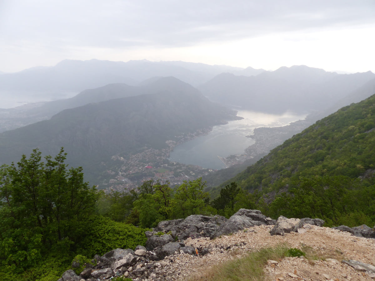
Most photos of Montenegro you’ve seen are of this bay. It’s a closed-in arm of the sea with mountains dropping almost straight into it, stone villages along the water and two small islands with churches in the middle. What people rarely explain is how to get round it without spending the day in a queue on the shore road. Here’s how I’d do it.
Two basins and a narrow strait
UNESCO describes the inscribed area as two linked basins enclosed by mountains close to 1,500 m high, joined to the outer gulf by a narrow channel. That channel is the Verige strait. On the inside sit Kotor, Perast and Risan; on the outside, Tivat and Herceg Novi. The National Tourism Organisation measures the bay at 87.3 km², with a 105.7 km shore and water down to 68 m at its deepest.
You’ll read time and again that it’s Europe’s southernmost fjord. Kotor’s own tourist board puts that straight, calling it a submerged river canyon. Geology aside, what matters for a visitor is that the water is nearly always calm and the mountains are always right above you.
What UNESCO protects, and what worries it
The property inscribed in 1979 covers 14,600 ha of the inner bay, with a further 36,491 ha of buffer zone around it. An earthquake that same year damaged many of its monuments, and the bay sat on the In Danger list until 2003. UNESCO still names building and urban sprawl along the shore as the main threat. You’ll notice it in places, and it’s one reason I’d rather spend my money in a small village house than in a new block by the main road.
If you are staying the night, see the best hotel deals in Perast for your dates: the well-placed rooms go fast.
The inner shore
At the far end is Kotor with its walled old town. Heading north along the water you reach Dobrota, the most populous settlement in the municipality, lined with captains’ houses and known for a lacework the National Tourism Organisation treats as intangible heritage. Across the water are Prčanj and Stoliv, quieter and greener.
Further round comes Perast, the baroque village with Our Lady of the Rocks and St George’s island offshore, and in the tightest corner, Risan, with its Roman mosaics. Beyond that the road runs past Morinj and Kostanjica towards the strait. These are tiny places in the census, 279 people in Donji Stoliv and 61 in Kostanjica, and outside August it shows.
The outer bay
Past the strait the bay opens towards the sea. Tivat has the airport, the superyacht marina at Porto Montenegro and Mount Vrmac behind it. Herceg Novi holds the mouth of the bay with its fortresses, and on the Luštica peninsula the National Tourism Organisation places the Blue Cave, which you reach by boat. Guarding the entrance are three Austro-Hungarian forts from the 19th century, Arza, Mamula and Prevlaka.
If you are staying the night, see the best hotel deals in Perast for your dates: the well-placed rooms go fast.
Car or boat?
The shore road is lovely and slow, and in summer it jams in every village. The Kamenari to Lepetane ferry short-cuts the drive between Herceg Novi and Tivat, at €5 a car on the official 2026 fare list. By water, the National Tourism Organisation runs the excursion season from May to November, with Kotor and Budva as the main starting points and a party catamaran in the bay at around €30 a head. I compare the options in Kotor boat trips.
Traditions you might catch
The Boka Navy, a brotherhood of local seafarers, dates itself to 809 and still dances its kolo of St Tryphon, with twelve named figures, on Kotor’s Arms Square at the town’s big feast days. The National Tourism Organisation also points you to the shellfish farms of Herceg Novi and Risan, where mussels come na buzaru, cooked with olive oil, wine, garlic and herbs. And on the third Saturday of August, Boka Night fills the water in front of Kotor with lit-up boats.
How I’d spend two days
Day one by car along the inner shore, Kotor to Perast and Risan, stopping in Dobrota on the way out and Prčanj on the way back. Day two on a boat, to see Perast and its islands from the water and look out through the strait. If you want a resort bed right on the water opposite Kotor, the Hyatt Regency Kotor Bay has its own page.
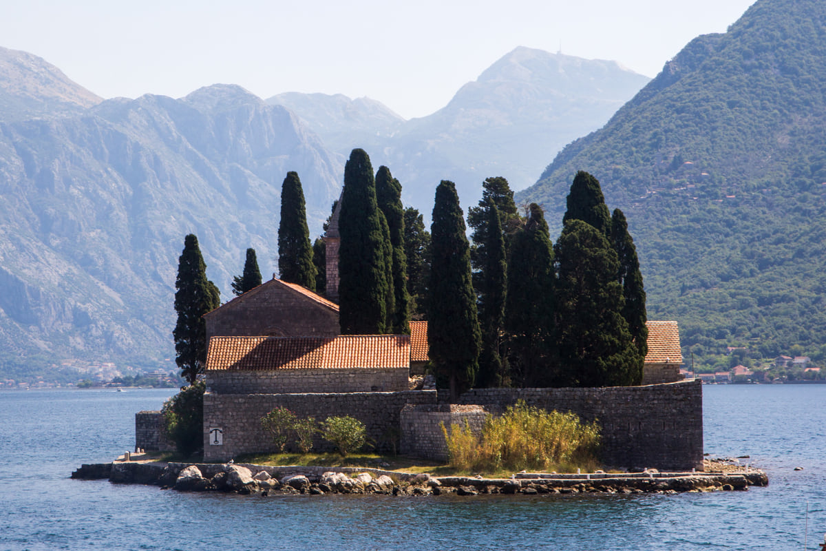
St George's Island off Perast, with the red-roofed monastery among dark cypresses and the mountains of the bay behind
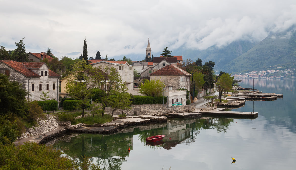
Stone houses and a church with a bell tower on the Dobrota shore, reflected in the Bay of Kotor under low cloud
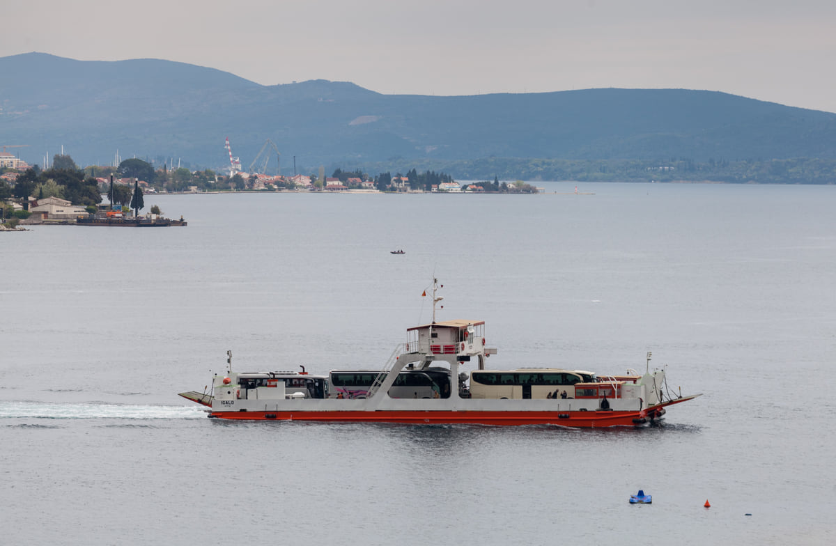
The ferry crossing the Verige strait between Kamenari and Lepetane in the Bay of Kotor, with the shore behind
The bay in numbers
| Fact | Figure | Source |
|---|---|---|
| Area | 87.3 km² | National Tourism Organisation |
| Shoreline | 105.7 km | National Tourism Organisation |
| Maximum depth | 68 m (Draža's garden) | National Tourism Organisation |
| UNESCO property | 14,600 ha plus 36,491 ha buffer zone | UNESCO |
| Surrounding mountains | Almost 1,500 m | UNESCO |
Kamenari to Lepetane ferry fares, 2026
| Vehicle | Fare |
|---|---|
| Car or pick-up | €5.00 |
| Motorbike | €2.50 |
| Passenger van | €7.50 |
| Coach | €17.50 |
| Bicycle | Free |
Public Enterprise for Coastal Zone Management, trajekt.me, fare list of September 2026. Foot passengers aren't listed.
Test yourself
True or false?
0/3 Pick before you peek.
-
The Bay of Kotor is a glacial fjord.
See the answer
False. Kotor's tourist board defines it as a submerged river canyon and says the fjord tag is a widespread error.
-
Foot passengers are listed as free on the official Kamenari ferry fare table.
See the answer
False. The 2026 fare list doesn't mention foot passengers at all; the only free category for travellers is the bicycle.
-
The bay has more than 100 km of shoreline.
See the answer
True. The National Tourism Organisation gives 105.7 km of shoreline for its 87.3 km² of water.
- Area of the bay
- 87.3 km²
- Of shoreline
- 105.7 km
- Maximum depth
- 68 m
- Kamenari ferry for a car (2026)
- €5
Map
Where Bay of Kotor is
The Adriatic coast runs from Herceg Novi to Ulcinj; the centre holds Podgorica, Cetinje and Lake Skadar, and the north, Durmitor and the Tara Canyon. Every number opens its guide.
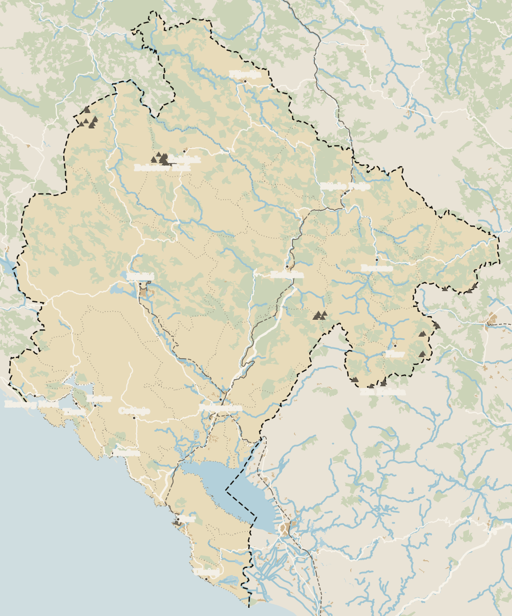 1Kotor 2Bay of Kotor 3Kotor Old Town 4Kotor city walls 5St Tryphon Cathedral 6Maritime Museum, Kotor 7Kotor viewpoints 8Kotor cruise port 9Perast 10Dobrota 11Prčanj 12Risan 13Kotor cable car
 Map data © OpenStreetMap contributors (ODbL)
- 1KotorTown on the coast
- 2Bay of KotorBoka Kotorska
- 3Kotor Old TownStari grad, inside the walls
- 4Kotor city wallsAround 1,400 steps
- 5St Tryphon CathedralSveti Tripun, since 1166
- 6Maritime Museum, KotorGrgurina Palace, Kotor Old Town
- 7Kotor viewpointsFour heights above the bay
- 8Kotor cruise portPort of Kotor, right by the walls
- 9Perast12 km from Kotor
- 10DobrotaNorth of Kotor, on the water
- 11Prčanj1,030 residents opposite Kotor
- 12RisanThe bay's most sheltered corner
- 13Kotor cable car3.9 km of cable above the bay
What to see
What to see in Bay of Kotor
0 of 278 Montenegro guides
Your next stamp
- Kotor
- Perast
- Things to do
- Dubrovnik to Kotor
- Beaches in Kotor
- Kayaking
- Sailing
- Most beautiful places
- Aman Sveti Stefan
- Budva Old Town
- Haj-Nehaj
- Lučice Beach
- Montenegro's coast
- Peaks of the Balkans
- Porto Montenegro
- Sea Dance Festival
- Splendid Conference & Spa Resort
- Stari Bar
- Ulcinj Old Town
- Budva Riviera
- Heroj submarine
- Iberostar Bellevue
- Independence Day
- Old olive tree of Mirovica
- Tivat
- Velika plaža
- Ada Bojana
- Beaches in Budva
- Eurostars Queen of Montenegro
- Herceg Novi
- Kotor Old Town
- Mount Rumija
- Igalo
- Kotor city walls
- Mogren Beach
- Montenegro Beach Resort
- Svač
- Vrmac
- Hiking
- Jaz Beach
- Kanli kula
- Luštica peninsula
- St Tryphon Cathedral
- Ulcinj salt pans
- Forte Mare
- Gornja Lastva
- Maritime Museum, Kotor
- Slovenska Beach
- Drobni Pijesak Beach
- Kotor viewpoints
- Mamula
- Žanjic beach
- Kotor cruise port
- Orjen
- Plavi horizonti beach
- Sveti Nikola Island
- Blue Cave
- Restaurants in Budva
- Restaurants in Kotor
- Canyoning
- Hotels
- Sutomore
- Sveti Stefan
- Čanj
- Luxury hotels
- Our Lady of the Rocks
- Pržno
- Activities
- All-inclusive hotels
- Bar Riviera
- Bečići
- Hotel Palma
- St George island
- Dobrota
- Hladna uvala
- Petrovac
- Crvena stijena
- Prčanj
- Prettiest villages
- Cycling
- Risan
- UNESCO sites
- Heritage Grand Perast
- Map
- Hyatt Regency Kotor Bay
- Where is it?
- Regions
- Cities
- Beaches in Bar
- Budva
- Central Montenegro
- Hotels in Budva
- Hotels in Kotor
- Iberostar Waves Herceg Novi
- Kitesurfing
- The name
- Beaches in Ulcinj
- Flag
- Hotels in Perast
- Palmon Bay Hotel & Spa
- Podgorica
- Cathedral of the Resurrection
- One&Only Portonovi
- Population
- Sandy beaches
- Azul Beach Resort Montenegro
- Naturist beaches
- Size
- Stara Varoš
- Doclea
- Language
- Mimosa Festival
- Medun
- Religion
- Zipline
- Currency
- Museums in Podgorica
- Dajbabe Monastery
- EU membership
- History
- Restaurants in Podgorica
- Hotels in Podgorica
- Public holidays
- Avala Resort & Villas
- Bar
- Birdwatching
- Hotels in Ulcinj
- Kotor carnival
- Time zone
- Tivat beaches
- Tuzi
- Boka Night
- Dukley Hotel & Resort
- Facts
- Hotels in Tivat
- Zeta
- Caves
- Herceg Novi beaches
- National parks
- Šipčanik
- Hotels in Herceg Novi
- Monasteries
- Fortresses
- Fly fishing
- Museums
- Canyons and waterfalls
- Lakes
- Mountains
- Montenegro and Croatia
- Beaches
- Boat trips
- Cetinje
- Montenegro and Albania
- Nightlife
- Ulcinj
- Weather
- Best time to visit
- Cetinje Monastery
- Montenegro and the Balkans
- How to get there
- In summer
- King Nikola's Palace
- Biljarda
- Flights
- In winter
- Airports
- Museums in Cetinje
- New Year's Eve
- Lovćen
- Paragliding
- Tivat Airport
- Njegoš Mausoleum
- Podgorica Airport
- Kotor serpentine
- Belgrade to Montenegro
- Njeguši
- Ferry to Italy
- Njeguši prosciutto
- Border crossings
- In January
- Lipa Cave
- Where to stay
- In February
- Kamenari-Lepetane ferry
- Pavlova strana
- Getting around
- In March
- Rijeka Crnojevića
- In April
- Trains
- Buses
- In May
- Car hire
- In June
- Driving
- In July
- In August
- Taxis
- Distances
- In September
- In October
- Road trip
- Food
- In November
- Lake Skadar
- Scenic drives
- In December
- Kotor cable car
- Virpazar
- Where to eat
- Budva to Kotor
- Godinje
- Wine
- Podgorica to Kotor
- Vranjina
- Besac fortress
- Prices and budget
- On a budget
- Žabljak Crnojevića
- Danilovgrad
- Entry requirements
- Ostrog Monastery
- Tourist registration
- Customs
- Nikšić
- Crvena Stijena cave
- Safety
- Events
- Healthcare
- Northern Montenegro
- Mobile and roaming
- Žabljak
- Durmitor
- Plugs
- Black Lake
- With kids
- Bobotov Kuk
- Holidays
- Day trips
- Stećci tombstones
- Hotels in Žabljak
- Three-day itinerary
- Five-day itinerary
- Skiing in Montenegro
- One-week itinerary
- Skiing in Žabljak
- Šavnik
- Ten-day itinerary
- Nevidio Canyon
- Tara Canyon
- Tara rafting
- Đurđevića Tara Bridge
- Plužine
- Lake Piva
- Piva Monastery
- Mojkovac
- Brskovo
- Pljevlja
- Husein Pasha Mosque
- Kolašin
- Hotels in Kolašin
- Skiing in Kolašin
- Biogradska Gora National Park
- Komovi
- Morača Monastery
- Morača Canyon
- Bijelo Polje
- Đalovića Cave
- Berane
- Andrijevica
- Petnjica
- Rožaje
- Plav
- Lake Plav
- Gusinje
- Vusanje
- Prokletije National Park
Frequently asked questions
Where is the Bay of Kotor?
On Montenegro's Adriatic coast, at the northern end of the country near the Croatian border. It's shared between the municipalities of Herceg Novi, Kotor and Tivat, with Kotor town at its far south-eastern corner.
Is the Bay of Kotor a fjord?
No. Kotor's tourist board describes it as a submerged river canyon and calls the fjord label a mistake, even though the National Tourism Organisation still uses it as a slogan.
What are the best things to see around the Bay of Kotor?
Kotor's old town and walls, Perast with the islands of Our Lady of the Rocks and St George, the captains' houses of Dobrota and Prčanj, the Roman mosaics at Risan and Herceg Novi's fortresses at the mouth of the bay.
Are there beaches in the Bay of Kotor?
Mostly small pebble or concrete platforms rather than long sandy beaches. The National Tourism Organisation lists Bajova kula near Kotor, where it puts loungers at around €20, and the open sea beaches are further south.
How do you get around the Bay of Kotor?
By car on the shore road, by boat from Kotor, Perast or Herceg Novi, or by combining the two with the Kamenari to Lepetane car ferry, which cuts out the drive round the inner bay.
When is the boat trip season in the Bay of Kotor?
The National Tourism Organisation gives May to November for sea excursions, with the Bay of Kotor and Budva as the main departure points.
By
Tourism graduate with a master’s in Tourism Management and Planning from the University of Málaga, who has travelled across Europe. He writes every guide from official sources and his own judgement.
Published on . Facts checked on .
Sources
Some links in this guide are affiliate links: if you book through them, the site earns a commission at no extra cost to you. Affiliate disclosure
Photos: Wolfgang Sauber (CC BY-SA 4.0); Alexey Komarov (CC BY 3.0); Diego Delso (CC BY-SA 3.0); Diego Delso (CC BY-SA 3.0), via Wikimedia Commons.