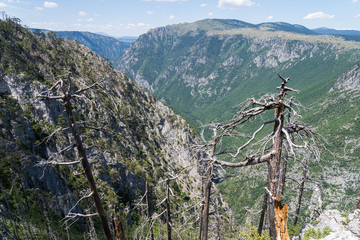
Durmitor National Park, northern Montenegro
The Tara Canyon, Europe's deepest gorge
The Tara Canyon runs 78 km from the mouth of the Bistrica to Šćepan Polje and reaches 1,333 metres deep between Obzor and Štuoc, according to the national tourist board. UNESCO describes it as Europe's deepest gorge and one of the few without dams. You see it from the Ćurevac viewpoint, from the Đurđevića Tara Bridge and from a raft.
In 30 seconds
Full read: 3 min
- The Tara Canyon is 78 km long and up to 1,333 metres deep.
- UNESCO describes it as Europe's deepest gorge.
- You see it from Ćurevac, from the Đurđevića Tara Bridge and from a raft.
- It lies within Durmitor National Park, a World Heritage Site since 1980.
The Tara makes sense from two angles. I'd look down on it first from Ćurevac, near Žabljak, to get the scale, then get on the water on a raft in July or August, when the flow is safe. The Đurđevića Tara Bridge is the easy stop if you're driving between Žabljak and Mojkovac.

Before you go
What I would keep in mind
-
01 Most beautiful
A pine forest 400 years old
At Crna Poda, between Bistrica and Dobrilovina at about 950 metres, grows a 20-hectare stand of black pine with trees around 400 years old, according to the Mojkovac tourist board.
-
02 My tip
Ćurevac, the balcony over the Tara
National Parks recommends the Ćurevac viewpoint, at 1,625 metres, a few kilometres from Žabljak. It gives you the canyon from above without going down to the river.
Žabljak -
03 Worth the splurge
Rafting through the gorge
The national tourist board puts a day's rafting at around €70 a head and two days from €90. National Parks considers July and the first half of September the safest time.
rafting on the Tara -
04 Watch out
The water never tops 15 degrees
The national tourist board warns that even in summer the Tara stays below 15 °C. If you go in, do it in a wetsuit and with an agency that supplies one.
What I would book
- Tours and ticketsGetYourGuide A Tara Canyon day trip Coming from the coast without a car, an organised trip saves you four mountain drives and usually covers the bridge and the rafting.
- Places to stayBooking.com Stay in Žabljak, next to the canyon It's the nearest base for the Ćurevac viewpoint and the rafting stretch that starts at Splavište.
The Tara is the river I find most compelling in Montenegro and, honestly, one of the most powerful landscapes in the Balkans. It has cut a 78 km canyon into the limestone which, according to the national tourist board, reaches 1,333 metres deep between Obzor and Štuoc, and UNESCO’s Durmitor listing calls it Europe’s deepest gorge. Best of all, it’s still intact. UNESCO also points out that it’s one of the few canyons in the region with no dams or roads slicing through it.
A long river and an undammed canyon
MONSTAT gives the Tara 146.4 km, 141 of them in Montenegro. It rises below the Komovi where the Opasnica and Veruša meet, flows past Kolašin and Mojkovac and enters the canyon at the mouth of the Bistrica. From there it heads north, between the Durmitor massif and Sinjajevina, to Šćepan Polje, where it joins the Piva by the Bosnian border and together they become the Drina.
The canyon is part of Durmitor National Park, which UNESCO inscribed in 1980, and UNESCO added the Tara basin to its biosphere reserve programme in the 1970s. Official sources disagree on its length, and I go with the 78 km the national tourist board gives on its rafting page, from the Bistrica to Šćepan Polje.
Where to look into the gorge
Without getting wet, the clearest spot is the Ćurevac viewpoint at 1,625 metres, recommended by National Parks, with its turning a few kilometres from Žabljak. That’s where the scale sinks in. The other must is the Đurđevića Tara Bridge, from 1940, at the junction of the Žabljak, Mojkovac and Pljevlja roads, where a zip line also crosses the canyon nearly 150 metres up.
A kilometre downstream of the bridge stands the 14th-century Monastery of the Archangel Michael, which the Žabljak tourist board says once had a copyists’ school. National Parks lists two more monasteries in the valley, St George’s at Dobrilovina and the Dormition at Dovolja.
To sleep close to everything, search places to stay in Žabljak on Expedia and filter by area before price.
Crna Poda and Đavolje lazi
Upstream, between Bistrica and Dobrilovina in Mojkovac municipality, lies Crna Poda, a 20-hectare black pine forest at about 950 metres with trees around 400 years old, according to the Mojkovac tourist board. Just below it, at Đavolje lazi, the river squeezes down to 2 or 3 metres, which the national tourist board singles out as a real test for kayakers.
The side canyons of the Sušica and the Draga
The Tara doesn’t come alone. From the left it’s joined by the Sušica, which, according to the Žabljak tourist board, cuts its own canyon 15 km long and up to 700 metres deep. Between 1919 and 1939 rails ran along its floor to haul out timber, which was then rafted all the way to the Danube, and there were eleven watermills of which only a few stone walls survive. On opposite rims sit the hamlets of Nedajno and Mala Crna Gora, in sight of each other yet 16 km apart by road.
From the right comes the Draga, an 11.2 km tributary that rises below Ljubišnja and carves a canyon up to 800 metres deep, with two waterfalls and the Turska glava spring near its mouth. Its lower stretch falls inside the national park.
To sleep close to everything, search places to stay in Žabljak on Booking.com and filter by area before price.
Going down the river
The most intense way to see it is from below. Tara rafting is run by agencies, National Parks recommends going between early July and mid-September and the national tourist board puts a day at around €70 per person. The water, it warns, stays below 15 °C even in summer.
Fishing needs a National Parks day permit. On the permitted stretches in Žabljak municipality you can fish from 8am to 5pm and keep three trout of at least 25 centimetres, and Mojkovac’s tourist board points to an 8 km fly-fishing zone further upstream.
When to go
The national tourist board places the canyon in spring and summer. In spring the snowmelt gives the river its strongest flow, while in July and August the water is calmer and rafting is safer. The board even mentions January trips with the river at 5 or 6 °C, strictly for the hardy. For a bed nearby, Žabljak and Mojkovac are the practical choices or, if you come in from Bosnia, Plužine, close to Šćepan Polje.
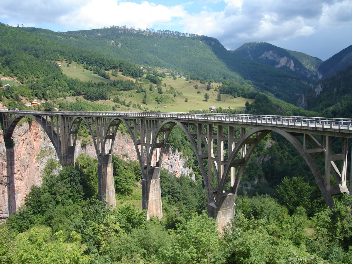
The Đurđevića Tara Bridge with its concrete arches spanning the Tara canyon, between forested slopes
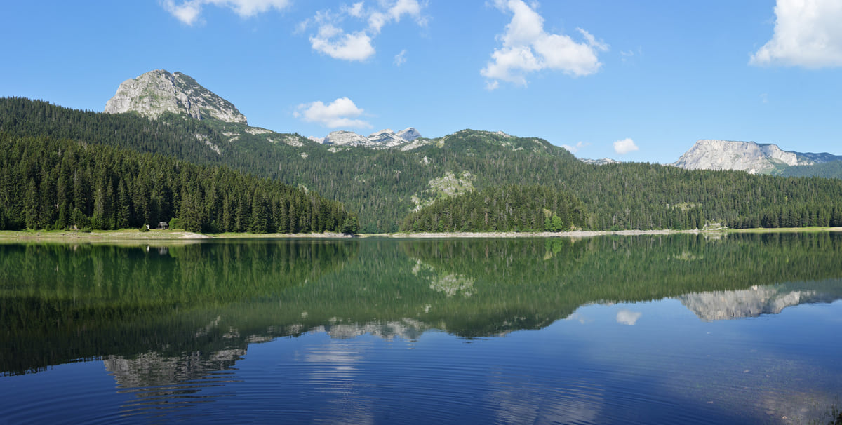
The Black Lake in Durmitor near Žabljak, ringed by conifer forest, with the mountain reflected in the still water
The Tara in figures
| Measure | Value | Source |
|---|---|---|
| River length | 146.4 km, 141 in Montenegro | MONSTAT |
| Canyon length | 78 km, Bistrica to Šćepan Polje | National Tourism Organisation |
| Greatest depth | 1,333 m, between Obzor and Štuoc | National Tourism Organisation |
| Narrowest point | Đavolje lazi, 2 to 3 m | National Tourism Organisation |
| Crna Poda pine forest | 20 ha, trees about 400 years old | Mojkovac Tourist Board |
| Confluence | Joins the Piva at Šćepan Polje to form the Drina | Žabljak Tourist Board |
Checked on 11 October 2026. Another national tourist board page gives 149 km for the canyon and Mojkovac's board 158 km for the river; MONSTAT's figures and the board's rafting page are used here.
Test yourself
True or false?
0/3 Pick before you peek.
-
The Tara is dammed along the canyon.
See the answer
False. UNESCO stresses that the Tara gorge is one of the very few in the region still unaffected by dams and roads.
-
The Tara and the Piva meet to form the Drina.
See the answer
True. The two rivers join at Šćepan Polje, by the Bosnian border, according to the Žabljak tourist board.
-
At Đavolje lazi the Tara narrows to just a few metres.
See the answer
True. The national tourist board says the riverbed shrinks to 2 or 3 metres there, below the Crna Poda pine forest.
- Canyon length
- 78 km
- Greatest depth
- 1,333 m
- River width at Đavolje lazi
- 2 to 3 m
- Top water temperature in summer
- 15 °C
Map
Where Tara Canyon is
The Adriatic coast runs from Herceg Novi to Ulcinj; the centre holds Podgorica, Cetinje and Lake Skadar, and the north, Durmitor and the Tara Canyon. Every number opens its guide.
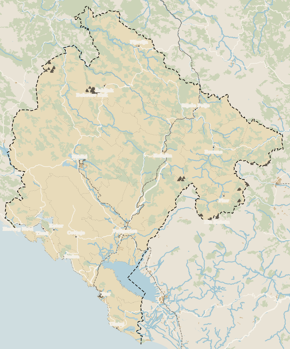 1Northern Montenegro 2Žabljak 3Šavnik 4Tara Canyon 5Plužine 6Mojkovac 7Pljevlja 8Kolašin 9Bijelo Polje 10Berane 11Andrijevica 12Petnjica 13Rožaje 14Plav 15Gusinje
 Map data © OpenStreetMap contributors (ODbL)
- 1Northern MontenegroMontenegro's northern region
- 2ŽabljakNorthern Montenegro, Žabljak municipality
- 3ŠavnikNorthern Montenegro, south of Durmitor
- 4Tara CanyonDurmitor National Park, northern Montenegro
- 5PlužineNorthern Montenegro, the Piva area
- 6MojkovacNorthern Montenegro, the Tara valley
- 7PljevljaTown in northern Montenegro
- 8KolašinNorthern Montenegro, Bjelasica
- 9Bijelo PoljeNorthern Montenegro, Lim valley
- 10BeraneNorthern Montenegro, Lim valley
- 11AndrijevicaNorthern Montenegro, upper Lim
- 12PetnjicaNorthern Montenegro, Bihor
- 13RožajeNorthern Montenegro, Ibar valley
- 14PlavNorthern Montenegro, upper Lim
- 15GusinjeNorthern Montenegro, Prokletije
What to see
What to see in Tara Canyon
0 of 278 Montenegro guides
Your next stamp
- Canyons and waterfalls
- Morača Canyon
- Durmitor
- Đurđevića Tara Bridge
- Tara rafting
- Northern Montenegro
- Activities
- Zipline
- Aman Sveti Stefan
- Budva Old Town
- Haj-Nehaj
- Kotor
- Lučice Beach
- Montenegro's coast
- Peaks of the Balkans
- Porto Montenegro
- Sea Dance Festival
- Splendid Conference & Spa Resort
- Stari Bar
- Ulcinj Old Town
- Bay of Kotor
- Budva Riviera
- Heroj submarine
- Iberostar Bellevue
- Independence Day
- Old olive tree of Mirovica
- Tivat
- Velika plaža
- Ada Bojana
- Beaches in Budva
- Eurostars Queen of Montenegro
- Herceg Novi
- Kotor Old Town
- Mount Rumija
- Igalo
- Kotor city walls
- Mogren Beach
- Montenegro Beach Resort
- Svač
- Vrmac
- Hiking
- Jaz Beach
- Kanli kula
- Luštica peninsula
- St Tryphon Cathedral
- Ulcinj salt pans
- Forte Mare
- Gornja Lastva
- Maritime Museum, Kotor
- Slovenska Beach
- Drobni Pijesak Beach
- Kotor viewpoints
- Mamula
- Žanjic beach
- Kotor cruise port
- Orjen
- Plavi horizonti beach
- Sveti Nikola Island
- Blue Cave
- Restaurants in Budva
- Restaurants in Kotor
- Canyoning
- Hotels
- Perast
- Sutomore
- Sveti Stefan
- Čanj
- Luxury hotels
- Our Lady of the Rocks
- Pržno
- Things to do
- All-inclusive hotels
- Bar Riviera
- Bečići
- Hotel Palma
- St George island
- Dobrota
- Hladna uvala
- Most beautiful places
- Petrovac
- Crvena stijena
- Prčanj
- Prettiest villages
- Cycling
- Risan
- UNESCO sites
- Heritage Grand Perast
- Map
- Hyatt Regency Kotor Bay
- Where is it?
- Regions
- Cities
- Beaches in Bar
- Budva
- Central Montenegro
- Hotels in Budva
- Hotels in Kotor
- Iberostar Waves Herceg Novi
- Kitesurfing
- The name
- Beaches in Ulcinj
- Flag
- Hotels in Perast
- Palmon Bay Hotel & Spa
- Podgorica
- Cathedral of the Resurrection
- One&Only Portonovi
- Population
- Sandy beaches
- Azul Beach Resort Montenegro
- Naturist beaches
- Size
- Stara Varoš
- Doclea
- Language
- Mimosa Festival
- Medun
- Religion
- Currency
- Museums in Podgorica
- Dajbabe Monastery
- EU membership
- History
- Restaurants in Podgorica
- Hotels in Podgorica
- Public holidays
- Avala Resort & Villas
- Bar
- Beaches in Kotor
- Birdwatching
- Hotels in Ulcinj
- Kotor carnival
- Time zone
- Tivat beaches
- Tuzi
- Boka Night
- Dukley Hotel & Resort
- Facts
- Hotels in Tivat
- Zeta
- Caves
- Herceg Novi beaches
- National parks
- Šipčanik
- Hotels in Herceg Novi
- Monasteries
- Fortresses
- Fly fishing
- Museums
- Lakes
- Mountains
- Montenegro and Croatia
- Beaches
- Boat trips
- Cetinje
- Montenegro and Albania
- Nightlife
- Ulcinj
- Weather
- Best time to visit
- Cetinje Monastery
- Kayaking
- Montenegro and the Balkans
- How to get there
- In summer
- King Nikola's Palace
- Sailing
- Biljarda
- Flights
- In winter
- Airports
- Museums in Cetinje
- New Year's Eve
- Lovćen
- Paragliding
- Tivat Airport
- Njegoš Mausoleum
- Podgorica Airport
- Dubrovnik to Kotor
- Kotor serpentine
- Belgrade to Montenegro
- Njeguši
- Ferry to Italy
- Njeguši prosciutto
- Border crossings
- In January
- Lipa Cave
- Where to stay
- In February
- Kamenari-Lepetane ferry
- Pavlova strana
- Getting around
- In March
- Rijeka Crnojevića
- In April
- Trains
- Buses
- In May
- Car hire
- In June
- Driving
- In July
- In August
- Taxis
- Distances
- In September
- In October
- Road trip
- Food
- In November
- Lake Skadar
- Scenic drives
- In December
- Kotor cable car
- Virpazar
- Where to eat
- Budva to Kotor
- Godinje
- Wine
- Podgorica to Kotor
- Vranjina
- Besac fortress
- Prices and budget
- On a budget
- Žabljak Crnojevića
- Danilovgrad
- Entry requirements
- Ostrog Monastery
- Tourist registration
- Customs
- Nikšić
- Crvena Stijena cave
- Safety
- Events
- Healthcare
- Mobile and roaming
- Žabljak
- Plugs
- Black Lake
- With kids
- Bobotov Kuk
- Holidays
- Day trips
- Stećci tombstones
- Hotels in Žabljak
- Three-day itinerary
- Five-day itinerary
- Skiing in Montenegro
- One-week itinerary
- Skiing in Žabljak
- Šavnik
- Ten-day itinerary
- Nevidio Canyon
- Plužine
- Lake Piva
- Piva Monastery
- Mojkovac
- Brskovo
- Pljevlja
- Husein Pasha Mosque
- Kolašin
- Hotels in Kolašin
- Skiing in Kolašin
- Biogradska Gora National Park
- Komovi
- Morača Monastery
- Bijelo Polje
- Đalovića Cave
- Berane
- Andrijevica
- Petnjica
- Rožaje
- Plav
- Lake Plav
- Gusinje
- Vusanje
- Prokletije National Park
Frequently asked questions
Where is the Tara Canyon in Montenegro?
In the north, inside Durmitor National Park, between Mojkovac, Žabljak, Pljevlja and Plužine. It runs from the mouth of the Bistrica to Šćepan Polje on the border with Bosnia and Herzegovina.
How deep is the Tara Canyon?
Up to 1,333 metres between Obzor and Štuoc, according to the national tourist board. UNESCO calls it Europe's deepest gorge.
Can you visit the Tara Canyon from Kotor or Budva?
You can, but it's a very long day on mountain roads. If you're driving yourself, the sensible plan is at least one night in Žabljak.
What is the best way to see the Tara Canyon?
From the Ćurevac viewpoint near Žabljak, from the Đurđevića Tara Bridge on the road between Žabljak, Mojkovac and Pljevlja, and from the river itself, rafting or kayaking with an agency.
When is the best time to visit the Tara Canyon?
The national tourist board recommends spring and summer. For rafting, National Parks gives 1 July to 15 September as the safest period.
By
Tourism graduate with a master’s in Tourism Management and Planning from the University of Málaga, who has travelled across Europe. He writes every guide from official sources and his own judgement.
Published on . Facts checked on .
Sources
Some links in this guide are affiliate links: if you book through them, the site earns a commission at no extra cost to you. Affiliate disclosure
Photos: Alexkom000 (CC BY 4.0); Cornelius Bechtler (CC BY-SA 3.0); Ingo Mehling (CC BY-SA 4.0), via Wikimedia Commons.