Four heights above the bay
Kotor's viewpoints, from the walls to Mount Lovćen
Kotor looks best from above, and there are four heights to see it from. St John's fortress, 260 m above the old town via the walls; the serpentine road towards Njeguši; Mount Vrmac between Kotor and Tivat; and Mount Lovćen, reached by a 3.9 km cable car that climbs 1,316 m from Dub in 11 minutes.
In 30 seconds
Full read: 2 min
- St John's fortress, 260 m above the old town, on foot up the walls.
- Cable car from Dub to Kuk on Mount Lovćen, 3.9 km and 1,316 m of climb in 11 minutes.
- The serpentine road towards Njeguši and Mount Vrmac, above Kotor and Tivat.
If you can only do one, make it St John's fortress, because the old town sits right beneath you. For the whole bay, and if you don't mind paying, take the cable car to Lovćen; with a car, drive the serpentine in the late afternoon.

Before you go
What I would keep in mind
-
01 Most beautiful
The old town from above
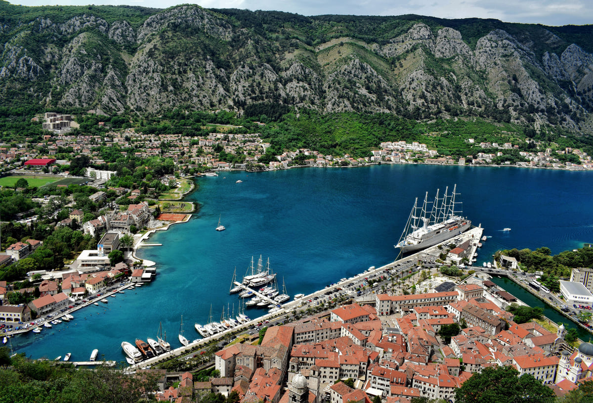
From St John's fortress, 260 m above the old town, you get the triangle of roofs, the harbour and the ships. It's the view on every postcard of Kotor.
the Kotor city walls -
02 Worth the splurge
Up to Lovćen by cable car
The cable car links Dub, near Kotor, with Kuk on Mount Lovćen in 11 minutes and 1,316 m of climb. The National Tourism Organisation doesn't publish fares or hours.
-
03 My tip
Drive the serpentine at sunset
The road up towards Njeguši doubles back on itself above the bay. Late in the day the sun is behind you and the light is at its best.
-
04 To save money
Vrmac is free and quiet
The hill between Kotor and Tivat is on Tivat tourist board's list of attractions, with an Austro-Hungarian fort on top. You walk up and pay nothing.
Mount Vrmac -
05 Most beautiful
Beyond Kotor
Outside the bay, Jezerski vrh on Lovćen and Ćurevac on Durmitor are viewpoints marked by National Parks. I gather them with the country's other beauty spots.
the most beautiful places in Montenegro
What I would book
My ranking, scored
Kotor viewpoints, ranked
My own score out of 10, weighing what you see from each spot against the effort or money it takes. Distances and heights come from the National Tourism Organisation and Kotor's tourist board.
0 of 5 seen
-
St John's fortress
The old town directly below, the harbour and the end of the bay. It costs you 1,350 steps, but no other view explains Kotor as well.
9.4 out of 10
-
Cable car to Lovćen
The whole bay from over a thousand metres, after 11 minutes in a cabin. No fares or hours on the official site.
9.0 out of 10
-
The serpentine road
Hairpin bends with the bay far below. Best enjoyed by car, pulling in only where it's safe.
8.6 out of 10
-
Mount Vrmac
The inner bay and Tivat's bay at once, with an Austro-Hungarian fort and hardly anyone about.
8.0 out of 10
-
Dobrota waterfront
Not a high viewpoint, but walking back to Kotor along the shore you see the walls climbing the mountain.
7.0 out of 10
Kotor has a perspective problem. From inside the old town you can’t see the town, only alleys, and from the quay the mountain blocks everything. To understand where you are, you have to climb, and luckily there are four different heights to do it from, each with its own cost in legs or euros. Here they are in order, from the one I wouldn’t skip to the one that’s simply a nice extra.
St John’s fortress, the postcard view
The classic viewpoint is at the top of the walls. From the old town it’s 1.2 km of steps and ramps, 1,350 steps covering 260 m of height, going by Kotor’s staircase race, and from the top you see the old town as a triangle of roofs between rock and sea. I cover it in full under the Kotor city walls, including what is and isn’t published about entry.
The cable car, for the whole bay
The National Tourism Organisation gives the figures for the cable car linking Dub, near Kotor, with the hamlet of Kuk on Mount Lovćen. That’s 3,900 m of cable, 1,316 m of climb and 11 minutes in one of 48 ten-seat cabins. At the top the bay is spread out beneath you from more than a thousand metres up. What it doesn’t publish is the fare or the timetable, so check those with the operator first.
Next to the top station, the Forza group runs a restaurant, Forza Kuk, which claims on its website to have the most enchanting views in Montenegro. I’d take the superlative with a pinch of salt, but the location speaks for itself. The rest is on the Kotor cable car page.
To sleep close to everything, search places to stay in Kotor on Expedia and filter by area before price.
The serpentine, from the driver’s seat
The road from Kotor up towards Njeguši and Cetinje coils up the slope in tight hairpins, the bay dropping further away at every turn. It’s the viewpoint for anyone with a car who’d rather not walk. Do it late in the afternoon with the sun behind you, and only pull over where there’s a safe place to stop. Kotor’s tourist board notes that this way, via Njeguši and Cetinje, Podgorica airport is 79 km away, so it may well be your route in or out anyway. More in the Kotor serpentine guide.
Vrmac, the viewpoint without the crowds
Between Kotor and Tivat rises Mount Vrmac, which Tivat’s tourist board lists among its attractions. The National Tourism Organisation counts its Austro-Hungarian fort among the best preserved in the inner bay and suggests hiking up to it. From the top you see the Bay of Kotor and Tivat’s bay at once, and it’s the only one of the four where you’ll often have it almost to yourself. See Mount Vrmac.
To sleep close to everything, search places to stay in Kotor on Booking.com and filter by area before price.
The right hour for each
My rule is simple. The walls first thing, because the bare stone slope heats up early in summer. The serpentine and Vrmac as the day ends and the light turns low and golden over the water. The cable car on a clear day at any hour, since up there visibility is everything. And if a big cruise ship is in, the walls will be busier by mid-morning, so get up before the passengers come ashore.
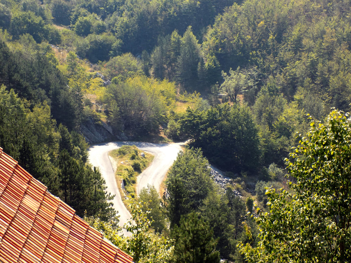
The hairpin bends of the mountain road between Kotor and Cetinje, zigzagging down through woodland and rocky slopes
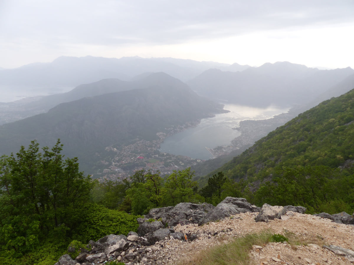
The Bay of Kotor from a mountain lookout, the water winding between green slopes under low cloud over the peaks
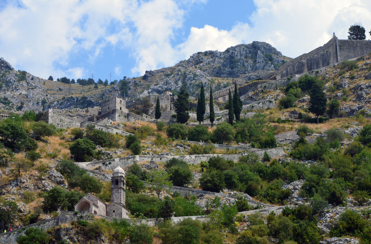
The walls of Kotor zigzagging up the rocky hillside towards St John's Fortress, between cypress trees and scrub
Kotor cable car in numbers
| Fact | Figure |
|---|---|
| Lower station | Dub, near Kotor |
| Upper station | Kuk, on Mount Lovćen |
| Length | 3,900 m |
| Height gain | 1,316 m |
| Journey time | 11 minutes |
| Cabins | 48, seating 10 each |
National Tourism Organisation, Kotor cable car page, checked on 10-10-2026. It gives no fares, opening hours or opening year.
Test yourself
True or false?
0/3 Pick before you peek.
-
The Kotor cable car climbs more than 1,000 metres.
See the answer
True. The National Tourism Organisation gives 1,316 m of height gain between Dub and Kuk on Mount Lovćen.
-
You have to pay to see Kotor from above.
See the answer
False. The serpentine road and Mount Vrmac are free. It's the walls and the cable car that have no published prices.
-
The cable car ride takes over half an hour.
See the answer
False. It's 11 minutes for 3,900 m, according to the National Tourism Organisation.
- Climb up to St John's fortress
- 260 m
- Length of the cable car
- 3,900 m
- Height gain on the cable car
- 1,316 m
- Ride in the cabin
- 11 min
Map
Where Kotor viewpoints is
The Adriatic coast runs from Herceg Novi to Ulcinj; the centre holds Podgorica, Cetinje and Lake Skadar, and the north, Durmitor and the Tara Canyon. Every number opens its guide.
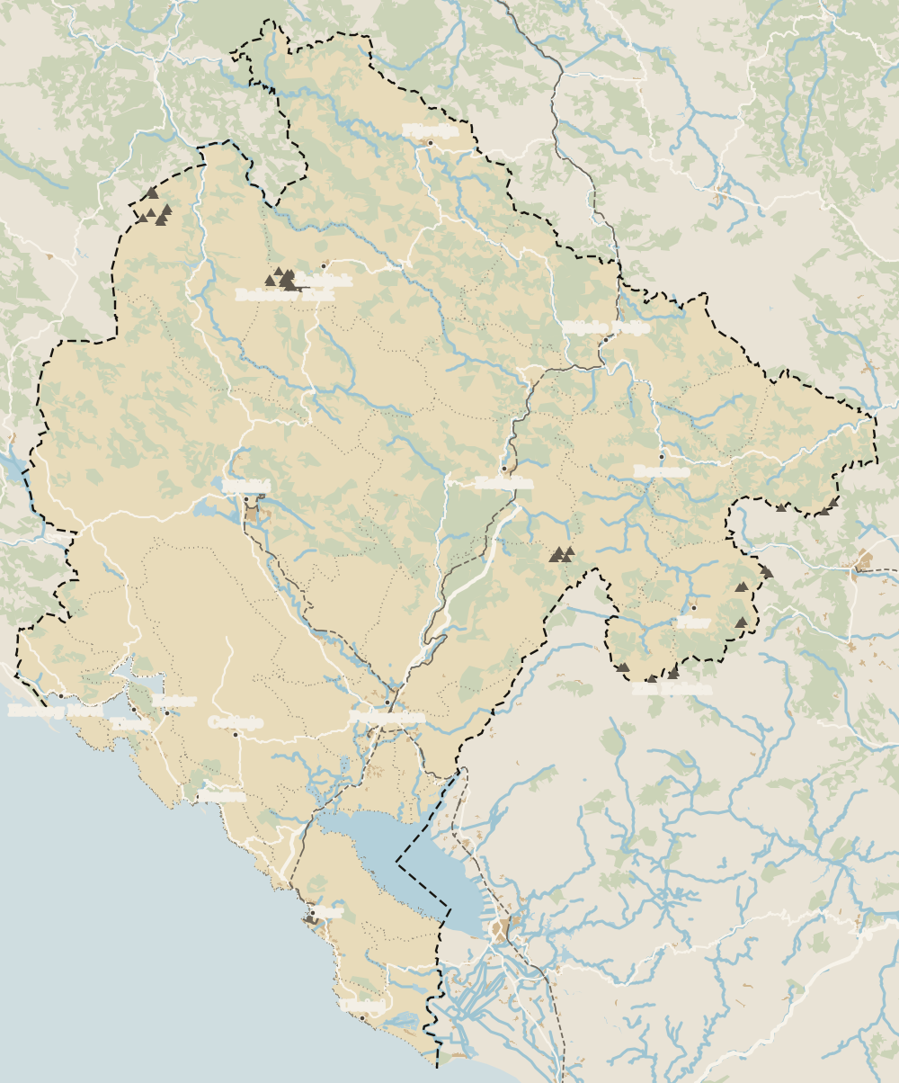 1Kotor 2Bay of Kotor 3Kotor Old Town 4Kotor city walls 5St Tryphon Cathedral 6Maritime Museum, Kotor 7Kotor viewpoints 8Kotor cruise port 9Perast 10Dobrota 11Prčanj 12Risan 13Kotor cable car
 Map data © OpenStreetMap contributors (ODbL)
- 1KotorTown on the coast
- 2Bay of KotorBoka Kotorska
- 3Kotor Old TownStari grad, inside the walls
- 4Kotor city wallsAround 1,400 steps
- 5St Tryphon CathedralSveti Tripun, since 1166
- 6Maritime Museum, KotorGrgurina Palace, Kotor Old Town
- 7Kotor viewpointsFour heights above the bay
- 8Kotor cruise portPort of Kotor, right by the walls
- 9Perast12 km from Kotor
- 10DobrotaNorth of Kotor, on the water
- 11Prčanj1,030 residents opposite Kotor
- 12RisanThe bay's most sheltered corner
- 13Kotor cable car3.9 km of cable above the bay
0 of 278 Montenegro guides
Your next stamp
- Kotor city walls
- Kotor
- Kotor cable car
- Fortresses
- Three-day itinerary
- Bay of Kotor
- Most beautiful places
- Vrmac
- Aman Sveti Stefan
- Budva Old Town
- Haj-Nehaj
- Lučice Beach
- Montenegro's coast
- Peaks of the Balkans
- Porto Montenegro
- Sea Dance Festival
- Splendid Conference & Spa Resort
- Stari Bar
- Ulcinj Old Town
- Budva Riviera
- Heroj submarine
- Iberostar Bellevue
- Independence Day
- Old olive tree of Mirovica
- Tivat
- Velika plaža
- Ada Bojana
- Beaches in Budva
- Eurostars Queen of Montenegro
- Herceg Novi
- Kotor Old Town
- Mount Rumija
- Igalo
- Mogren Beach
- Montenegro Beach Resort
- Svač
- Hiking
- Jaz Beach
- Kanli kula
- Luštica peninsula
- St Tryphon Cathedral
- Ulcinj salt pans
- Forte Mare
- Gornja Lastva
- Maritime Museum, Kotor
- Slovenska Beach
- Drobni Pijesak Beach
- Mamula
- Žanjic beach
- Kotor cruise port
- Orjen
- Plavi horizonti beach
- Sveti Nikola Island
- Blue Cave
- Restaurants in Budva
- Restaurants in Kotor
- Canyoning
- Hotels
- Perast
- Sutomore
- Sveti Stefan
- Čanj
- Luxury hotels
- Our Lady of the Rocks
- Pržno
- Things to do
- Activities
- All-inclusive hotels
- Bar Riviera
- Bečići
- Hotel Palma
- St George island
- Dobrota
- Hladna uvala
- Petrovac
- Crvena stijena
- Prčanj
- Prettiest villages
- Cycling
- Risan
- UNESCO sites
- Heritage Grand Perast
- Map
- Hyatt Regency Kotor Bay
- Where is it?
- Regions
- Cities
- Beaches in Bar
- Budva
- Central Montenegro
- Hotels in Budva
- Hotels in Kotor
- Iberostar Waves Herceg Novi
- Kitesurfing
- The name
- Beaches in Ulcinj
- Flag
- Hotels in Perast
- Palmon Bay Hotel & Spa
- Podgorica
- Cathedral of the Resurrection
- One&Only Portonovi
- Population
- Sandy beaches
- Azul Beach Resort Montenegro
- Naturist beaches
- Size
- Stara Varoš
- Doclea
- Language
- Mimosa Festival
- Medun
- Religion
- Zipline
- Currency
- Museums in Podgorica
- Dajbabe Monastery
- EU membership
- History
- Restaurants in Podgorica
- Hotels in Podgorica
- Public holidays
- Avala Resort & Villas
- Bar
- Beaches in Kotor
- Birdwatching
- Hotels in Ulcinj
- Kotor carnival
- Time zone
- Tivat beaches
- Tuzi
- Boka Night
- Dukley Hotel & Resort
- Facts
- Hotels in Tivat
- Zeta
- Caves
- Herceg Novi beaches
- National parks
- Šipčanik
- Hotels in Herceg Novi
- Monasteries
- Fly fishing
- Museums
- Canyons and waterfalls
- Lakes
- Mountains
- Montenegro and Croatia
- Beaches
- Boat trips
- Cetinje
- Montenegro and Albania
- Nightlife
- Ulcinj
- Weather
- Best time to visit
- Cetinje Monastery
- Kayaking
- Montenegro and the Balkans
- How to get there
- In summer
- King Nikola's Palace
- Sailing
- Biljarda
- Flights
- In winter
- Airports
- Museums in Cetinje
- New Year's Eve
- Lovćen
- Paragliding
- Tivat Airport
- Njegoš Mausoleum
- Podgorica Airport
- Dubrovnik to Kotor
- Kotor serpentine
- Belgrade to Montenegro
- Njeguši
- Ferry to Italy
- Njeguši prosciutto
- Border crossings
- In January
- Lipa Cave
- Where to stay
- In February
- Kamenari-Lepetane ferry
- Pavlova strana
- Getting around
- In March
- Rijeka Crnojevića
- In April
- Trains
- Buses
- In May
- Car hire
- In June
- Driving
- In July
- In August
- Taxis
- Distances
- In September
- In October
- Road trip
- Food
- In November
- Lake Skadar
- Scenic drives
- In December
- Virpazar
- Where to eat
- Budva to Kotor
- Godinje
- Wine
- Podgorica to Kotor
- Vranjina
- Besac fortress
- Prices and budget
- On a budget
- Žabljak Crnojevića
- Danilovgrad
- Entry requirements
- Ostrog Monastery
- Tourist registration
- Customs
- Nikšić
- Crvena Stijena cave
- Safety
- Events
- Healthcare
- Northern Montenegro
- Mobile and roaming
- Žabljak
- Durmitor
- Plugs
- Black Lake
- With kids
- Bobotov Kuk
- Holidays
- Day trips
- Stećci tombstones
- Hotels in Žabljak
- Five-day itinerary
- Skiing in Montenegro
- One-week itinerary
- Skiing in Žabljak
- Šavnik
- Ten-day itinerary
- Nevidio Canyon
- Tara Canyon
- Tara rafting
- Đurđevića Tara Bridge
- Plužine
- Lake Piva
- Piva Monastery
- Mojkovac
- Brskovo
- Pljevlja
- Husein Pasha Mosque
- Kolašin
- Hotels in Kolašin
- Skiing in Kolašin
- Biogradska Gora National Park
- Komovi
- Morača Monastery
- Morača Canyon
- Bijelo Polje
- Đalovića Cave
- Berane
- Andrijevica
- Petnjica
- Rožaje
- Plav
- Lake Plav
- Gusinje
- Vusanje
- Prokletije National Park
Frequently asked questions
Where is the best viewpoint in Kotor?
For me, St John's fortress above the old town, because that's the view everyone recognises. For the whole bay from high up, take the cable car to Mount Lovćen.
Where is the Kotor bay viewpoint?
There are several. The walls give you the old town and the inner bay; the serpentine road and the Lovćen cable car give you the bay from much higher; Mount Vrmac shows both the Kotor and Tivat sides.
How do you get up to the Kotor viewpoint?
St John's fortress is on foot up the walls from the old town, about 1.2 km and 1,350 steps for 260 m of climbing. Lovćen is by cable car from Dub or by road.
How much is the Kotor cable car?
The National Tourism Organisation gives the length, height gain, journey time and cabins, but not the fare or the timetable. Check with the operator before you go.
Can you see Kotor from above without hiking?
Yes. Drive the serpentine road towards Njeguši, or ride the cable car from Dub to Kuk on Mount Lovćen in 11 minutes.
By
Tourism graduate with a master’s in Tourism Management and Planning from the University of Málaga, who has travelled across Europe. He writes every guide from official sources and his own judgement.
Published on . Facts checked on .
Sources
Some links in this guide are affiliate links: if you book through them, the site earns a commission at no extra cost to you. Affiliate disclosure
Photos: Jocelyn Erskine-Kellie from London, UK (CC BY 2.0); Milica Buha (CC BY-SA 4.0); Wolfgang Sauber (CC BY-SA 4.0); Gzzz (CC BY-SA 4.0), via Wikimedia Commons.