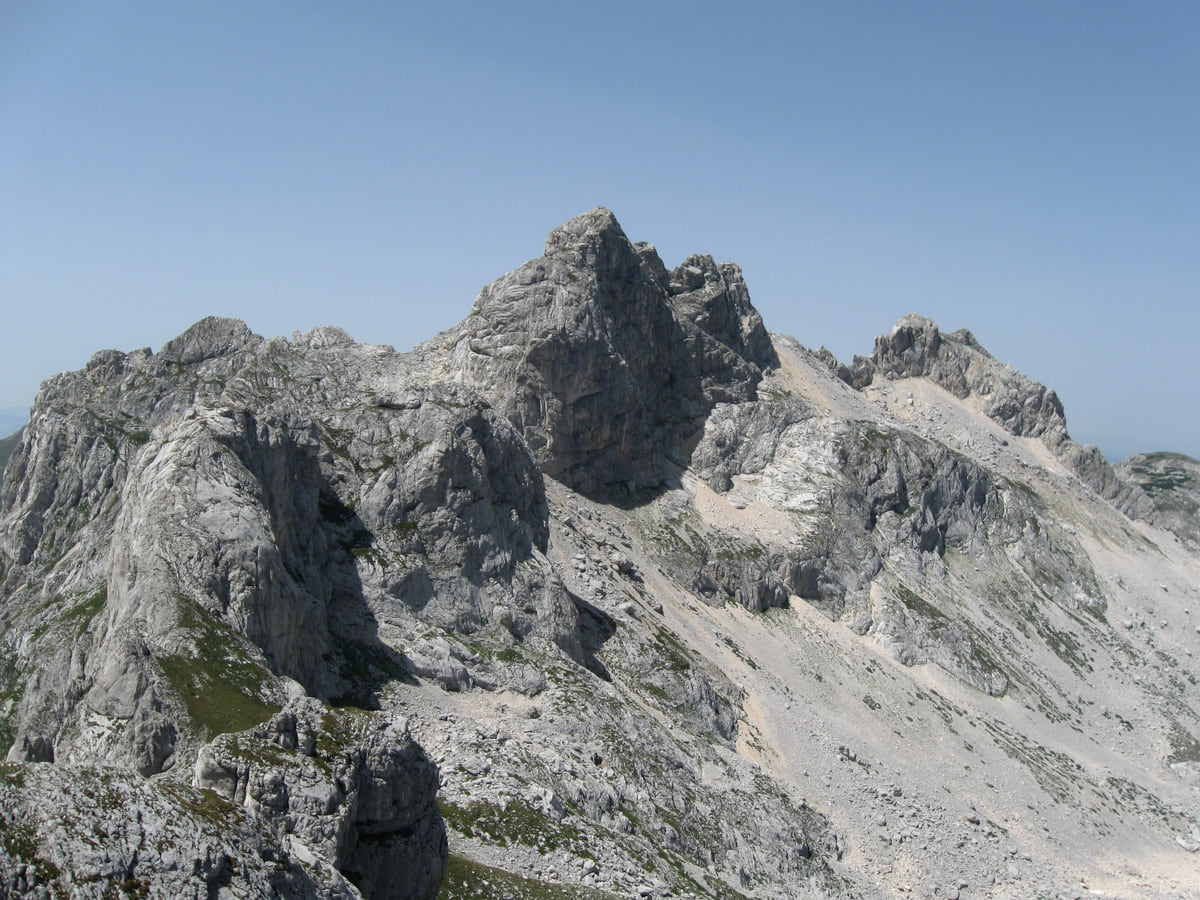
Durmitor, Prokletije, Lovćen and the coast
Hiking in Montenegro, from Durmitor to the trails above the sea
Montenegro has around 3,000 km of mountain trails, about 1,480 km of them waymarked and some 800 km inside the national parks, according to the national tourist board. The main areas are Durmitor, Prokletije, Bjelasica, Komovi and Lovćen, and on the coast the walking season runs from mid-April to the end of October.
In 30 seconds
Full read: 4 min
- Montenegro has around 3,000 km of mountain trails, 1,480 km waymarked and 800 km in national parks.
- The key areas are Durmitor, Prokletije, Bjelasica, Komovi and Lovćen.
- You can hike the coast from mid-April to October and the mountains from June to October.
- National park entry costs €3 to €5 per person per day.
- For long routes, go in a group with a licensed guide; the emergency number is 112.
For a first trip I'd pick Durmitor in July or September, based in Žabljak, and save Prokletije for a second visit or do it with a guide. In spring and autumn I'd swap the high mountains for the trails around Bar and Lake Skadar, which you can walk while there's still snow up north.

Before you go
What I would keep in mind
-
01 My tip
Take a guide on the long routes
The national tourist board advises against hiking alone and recommends a licensed mountain guide; the list is on the Mountaineering Association of Montenegro's website.
-
02 Money
What the national parks charge
Entry per person per day is €5 in Durmitor and Lake Skadar, €4 in Biogradska Gora and €3 in Lovćen and Prokletije, according to the national parks authority.
Montenegro's national parks -
03 Most beautiful
The hut between the Škrka lakes
Škrka hut, on the trail to Bobotov Kuk, opens from mid-June to the end of September and you'll need a sleeping bag, says Durmitor National Park.
Bobotov Kuk -
04 Getting there
The Peaks of the Balkans trek
Prokletije is where the Montenegrin stretch of Peaks of the Balkans begins, the route that crosses into Albania and Kosovo and needs a police permit.
Peaks of the Balkans in Montenegro -
05 To save money
Haj-Nehaj from Sutomore
The Bar tourist board lists a 2.7 km path from Sutomore up to Haj-Nehaj fortress, a short walk with sea views to fit around a beach day.
Haj-Nehaj fortress -
06 Worth the splurge
Rumija, the mountain above the lake
From Gornja Briska it's 5.1 km to the top of Rumija, and from Dobri do 4 km, according to the Bar tourist board, with the sea and Lake Skadar both in view.
Mount Rumija
What I would book
Montenegro is made for walking, and you notice it the moment you leave the coast. The national tourist board counts around 3,000 km of mountain trails, about 1,480 km of them waymarked, plus the trekking routes, and some 800 km run through the five national parks. There’s everything from a one-hour stroll to multi-day treks, and Montenegro is so compact that you can sleep by the sea and be standing beside a glacial lake the next morning.
The main hiking areas
The national tourist board singles out Durmitor, Bjelasica, Komovi, Sinjajevina, Prokletije with Visitor, Pivska planina, Maglić and Lovćen. The two highest summits are in the north. Zla Kolata in Prokletije stands at 2,534 m according to the national park, and Bobotov Kuk in Durmitor at 2,523 m. Bjelasica and Sinjajevina are the gentlest, fine for all ages between May and late October, and in winter they’re good for snowshoeing and ski touring.
Durmitor, the all-rounder
Durmitor has 25 waymarked trails adding up to about 150 km, according to its national park. The recommended ones include the nature trail around Black Lake, the route from Crno jezero to the ice cave via Lokvice and the climb from Sedlo to Bobotov Kuk. Ćurevac viewpoint, at 1,625 m, looks straight down into the Tara canyon. The tourist board suggests coming in July, August or September and doing the Durmitor Ring and Ćurevac with a group, as they call for real fitness. For nights up high there are the Škrka and Sušica huts in summer and the Lokvice and Kalice shelters all year.
To sleep close to everything, search places to stay in Žabljak on Expedia and filter by area before price.
Prokletije, Montenegro’s Alps
Prokletije has 77 peaks above 2,000 m, according to the national tourist board, and it’s the most demanding area in the country. Most routes set off from Plav, and the easier walks are in Grbaja near Gusinje, around Lake Plav and between Babino Polje and Lake Hridsko, which is a 3.1 km, one-hour walk. The national park also suggests a 10.2 km loop of about five and a half hours from Karanfili hut over Volušnica, Popadija and Talijanka, passing a prehistoric carved slab. Even in summer you might meet snow up top. This is also where the Montenegrin section of Peaks of the Balkans begins, heading on into Albania and Kosovo.
Lovćen, Biogradska Gora and Lake Skadar
Lovćen has five trails through beech woods and along old Austro-Hungarian roads built of dressed stone, each leading to a viewpoint or a cluster of vernacular buildings, with Njegoš’s mausoleum on top. Biogradska Gora has six waymarked trails climbing to Bjelasica’s summits and glacial lakes, and you can hire walking poles at the reception by the lake. Lake Skadar has nine trails through villages where traditional life carries on, with a map available at the Vranjina and Virpazar visitor centres.
If you are short on time, see the best tours in Žabljak and pick one that fits your day.
Walking by the sea
The Bar tourist board has waymarked dozens of kilometres between the coast and Lake Skadar. Easy ones include Volujica to Bigovica, 5 km, and Sutomore to Haj-Nehaj, 2.7 km. Among the moderate walks is Stari Bar to the Rikavac bridge, 6.5 km. And among the hard ones are the two climbs up Rumija, 5.1 km from Gornja Briska and 4 km from Dobri do. The national tourist board adds the Kotor walls up to St John’s fortress, heart-shaped Lake Trnovačko and the Lukavica valley to Lake Kapetanovo. The climb to St John’s is the shortest and busiest of them; Kotor’s stair race measures it at 1,350 steps, 1.2 km and 260 m of ascent from the church of Blessed Osanna, so I’d set off early, ahead of the heat and the cruise passengers.
Long-distance trails
For several days on foot, Montenegro has two transversals on its national network, the PPT “Orjen-Lovćen-Rumija”, which links the coastal ranges, and the CT-1 “Planinama Crne Gore”. The Via Dinarica runs the length of the Dinaric Alps, and the tourist board notes that National Geographic Traveler picked it as one of the world’s best hiking destinations.
To sleep close to everything, search places to stay in Žabljak on Booking.com and filter by area before price.
Safety and kit
The national tourist board advises against going alone and recommends walking in a group with a licensed mountain guide, listed on the Mountaineering Association of Montenegro’s website. You’ll need proper boots, layers and your documents, and the trails are used at your own risk. The Foreign Office adds that hikers have got lost after straying from marked paths, so tell someone your route and keep your phone charged. In an emergency, dial 112. I’d add one more thing, which is to check the forecast before any summit and turn back without a second thought if the sky turns nasty. And since Montenegro isn’t in the EU, check that your travel insurance covers mountain rescue; a GHIC only works there with a certificate from the local health fund.
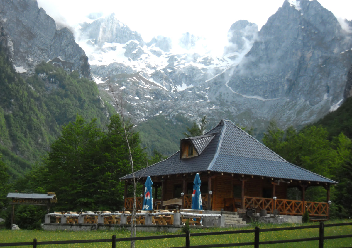
A wooden mountain hut in the Grbaja valley in Prokletije, at the foot of rocky peaks with patches of snow
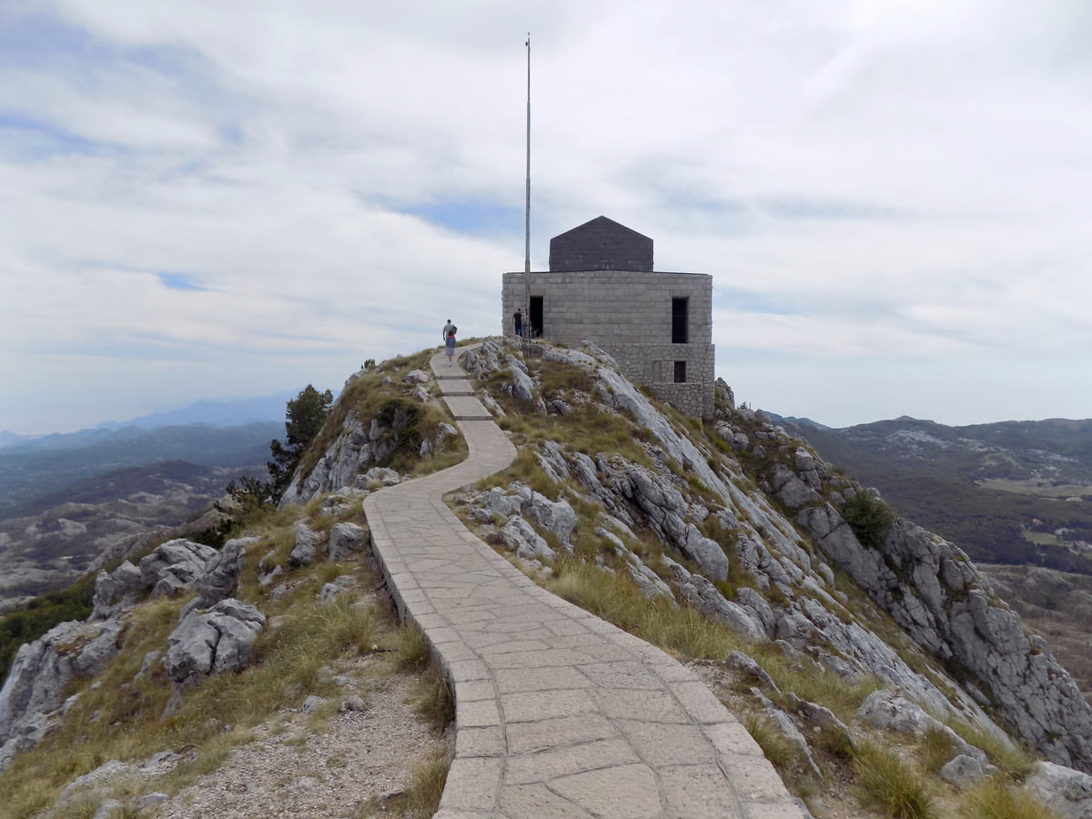
The stone path leading to Njegoš's mausoleum on the summit of Jezerski vrh, on Mount Lovćen, among rocks and mountains
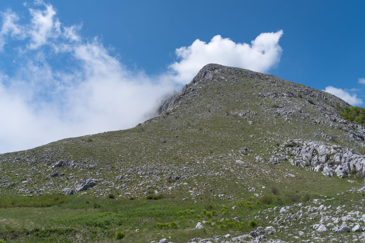
The limestone summit of Mount Rumija above green, stony meadows, under a blue sky with a cloud brushing the top
Trails in the national parks
| Park | Trails | Daily entry | Highlights |
|---|---|---|---|
| Durmitor | 25 trails, about 150 km | €5 | Black Lake, Bobotov Kuk, Ćurevac viewpoint |
| Prokletije | Grbaja and Ropojana valleys | €3 | Volušnica and Popadija loop, 10.2 km |
| Biogradska Gora | 6 waymarked trails | €4 | Glacial lakes and old-growth forest |
| Lovćen | 5 trails | €3 | Austro-Hungarian stone roads and viewpoints |
| Lake Skadar | 9 trails | €5 | Lakeside villages, map at Vranjina and Virpazar |
National Parks of Montenegro, activities and fees, checked on 11 October 2026.
Test yourself
True or false?
0/3 Pick before you peek.
-
Durmitor has more than twenty waymarked trails.
See the answer
True. Durmitor National Park has 25 waymarked trails, about 150 km in total.
-
The high-mountain hiking season starts in March.
See the answer
False. The national tourist board puts it at June to the end of October in Durmitor, Prokletije, Komovi, Maglić, Visitor and Hajla.
-
Entry to Prokletije National Park costs €3 per person per day.
See the answer
True. That's the national parks authority's fee, the same as in Lovćen.
What to see
What to see in Hiking
0 of 278 Montenegro guides
Your next stamp
- National parks
- Ten-day itinerary
- Cycling
- Activities
- Northern Montenegro
- Montenegro and Albania
- Mountains
- Prokletije National Park
- Aman Sveti Stefan
- Budva Old Town
- Haj-Nehaj
- Kotor
- Lučice Beach
- Montenegro's coast
- Peaks of the Balkans
- Porto Montenegro
- Sea Dance Festival
- Splendid Conference & Spa Resort
- Stari Bar
- Ulcinj Old Town
- Bay of Kotor
- Budva Riviera
- Heroj submarine
- Iberostar Bellevue
- Independence Day
- Old olive tree of Mirovica
- Tivat
- Velika plaža
- Ada Bojana
- Beaches in Budva
- Eurostars Queen of Montenegro
- Herceg Novi
- Kotor Old Town
- Mount Rumija
- Igalo
- Kotor city walls
- Mogren Beach
- Montenegro Beach Resort
- Svač
- Vrmac
- Jaz Beach
- Kanli kula
- Luštica peninsula
- St Tryphon Cathedral
- Ulcinj salt pans
- Forte Mare
- Gornja Lastva
- Maritime Museum, Kotor
- Slovenska Beach
- Drobni Pijesak Beach
- Kotor viewpoints
- Mamula
- Žanjic beach
- Kotor cruise port
- Orjen
- Plavi horizonti beach
- Sveti Nikola Island
- Blue Cave
- Restaurants in Budva
- Restaurants in Kotor
- Canyoning
- Hotels
- Perast
- Sutomore
- Sveti Stefan
- Čanj
- Luxury hotels
- Our Lady of the Rocks
- Pržno
- Things to do
- All-inclusive hotels
- Bar Riviera
- Bečići
- Hotel Palma
- St George island
- Dobrota
- Hladna uvala
- Most beautiful places
- Petrovac
- Crvena stijena
- Prčanj
- Prettiest villages
- Risan
- UNESCO sites
- Heritage Grand Perast
- Map
- Hyatt Regency Kotor Bay
- Where is it?
- Regions
- Cities
- Beaches in Bar
- Budva
- Central Montenegro
- Hotels in Budva
- Hotels in Kotor
- Iberostar Waves Herceg Novi
- Kitesurfing
- The name
- Beaches in Ulcinj
- Flag
- Hotels in Perast
- Palmon Bay Hotel & Spa
- Podgorica
- Cathedral of the Resurrection
- One&Only Portonovi
- Population
- Sandy beaches
- Azul Beach Resort Montenegro
- Naturist beaches
- Size
- Stara Varoš
- Doclea
- Language
- Mimosa Festival
- Medun
- Religion
- Zipline
- Currency
- Museums in Podgorica
- Dajbabe Monastery
- EU membership
- History
- Restaurants in Podgorica
- Hotels in Podgorica
- Public holidays
- Avala Resort & Villas
- Bar
- Beaches in Kotor
- Birdwatching
- Hotels in Ulcinj
- Kotor carnival
- Time zone
- Tivat beaches
- Tuzi
- Boka Night
- Dukley Hotel & Resort
- Facts
- Hotels in Tivat
- Zeta
- Caves
- Herceg Novi beaches
- Šipčanik
- Hotels in Herceg Novi
- Monasteries
- Fortresses
- Fly fishing
- Museums
- Canyons and waterfalls
- Lakes
- Montenegro and Croatia
- Beaches
- Boat trips
- Cetinje
- Nightlife
- Ulcinj
- Weather
- Best time to visit
- Cetinje Monastery
- Kayaking
- Montenegro and the Balkans
- How to get there
- In summer
- King Nikola's Palace
- Sailing
- Biljarda
- Flights
- In winter
- Airports
- Museums in Cetinje
- New Year's Eve
- Lovćen
- Paragliding
- Tivat Airport
- Njegoš Mausoleum
- Podgorica Airport
- Dubrovnik to Kotor
- Kotor serpentine
- Belgrade to Montenegro
- Njeguši
- Ferry to Italy
- Njeguši prosciutto
- Border crossings
- In January
- Lipa Cave
- Where to stay
- In February
- Kamenari-Lepetane ferry
- Pavlova strana
- Getting around
- In March
- Rijeka Crnojevića
- In April
- Trains
- Buses
- In May
- Car hire
- In June
- Driving
- In July
- In August
- Taxis
- Distances
- In September
- In October
- Road trip
- Food
- In November
- Lake Skadar
- Scenic drives
- In December
- Kotor cable car
- Virpazar
- Where to eat
- Budva to Kotor
- Godinje
- Wine
- Podgorica to Kotor
- Vranjina
- Besac fortress
- Prices and budget
- On a budget
- Žabljak Crnojevića
- Danilovgrad
- Entry requirements
- Ostrog Monastery
- Tourist registration
- Customs
- Nikšić
- Crvena Stijena cave
- Safety
- Events
- Healthcare
- Mobile and roaming
- Žabljak
- Durmitor
- Plugs
- Black Lake
- With kids
- Bobotov Kuk
- Holidays
- Day trips
- Stećci tombstones
- Hotels in Žabljak
- Three-day itinerary
- Five-day itinerary
- Skiing in Montenegro
- One-week itinerary
- Skiing in Žabljak
- Šavnik
- Nevidio Canyon
- Tara Canyon
- Tara rafting
- Đurđevića Tara Bridge
- Plužine
- Lake Piva
- Piva Monastery
- Mojkovac
- Brskovo
- Pljevlja
- Husein Pasha Mosque
- Kolašin
- Hotels in Kolašin
- Skiing in Kolašin
- Biogradska Gora National Park
- Komovi
- Morača Monastery
- Morača Canyon
- Bijelo Polje
- Đalovića Cave
- Berane
- Andrijevica
- Petnjica
- Rožaje
- Plav
- Lake Plav
- Gusinje
- Vusanje
Frequently asked questions
How many kilometres of hiking trails does Montenegro have?
The national tourist board gives around 3,000 km of mountain trails, of which about 1,480 km are waymarked and about 800 km lie inside the national parks.
When is the best time for hiking in Montenegro?
On the coast, from mid-April to the end of October; in the northern mountains, from June to the end of October. For Durmitor, the national tourist board recommends July, August and September.
What is the highest mountain in Montenegro?
Zla Kolata in Prokletije, at 2,534 m according to the national park (the tourist board's hiking page says 2,536 m). Bobotov Kuk in Durmitor is 2,523 m.
Can you hike in Montenegro without a guide?
The waymarked park trails can be walked independently, and Lake Skadar hands out a trail map at its visitor centres. For the long routes in Durmitor and Prokletije, the national tourist board advises going in a group with a licensed guide.
Are there mountain huts in Montenegro?
Yes. Durmitor has the Škrka and Sušica huts, open in summer, plus the Lokvice shelter for 20 people and the Kalice climbers' shelter, both open all year.
What is the Via Dinarica?
A long-distance trail through the Dinaric Alps linking natural and cultural sites. The national tourist board points out that National Geographic Traveler named it among the world's best hiking destinations.
By
Tourism graduate with a master’s in Tourism Management and Planning from the University of Málaga, who has travelled across Europe. He writes every guide from official sources and his own judgement.
Published on . Facts checked on .
Sources
Some links in this guide are affiliate links: if you book through them, the site earns a commission at no extra cost to you. Affiliate disclosure
Photos: Goran.Smith2 (CC BY-SA 3.0); Sigismund von Dobschütz (CC BY-SA 3.0); Milica Buha (CC BY-SA 4.0); Alexkom000 (CC BY 4.0), via Wikimedia Commons.