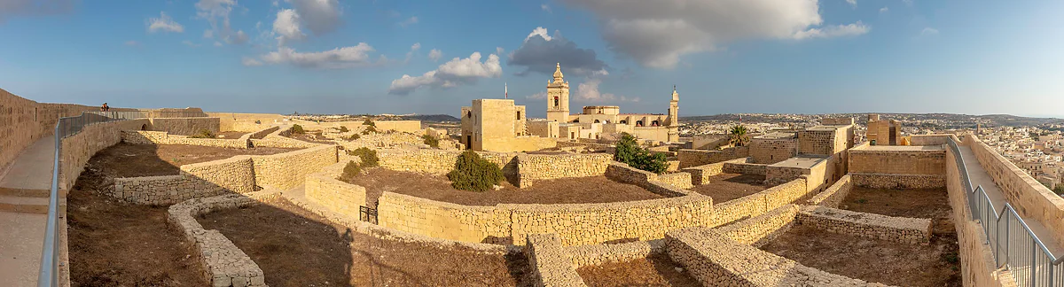
316 km², about 122 square miles
How big Malta is, in square miles and in bus hours
Malta covers 316 km², about 122 square miles, according to the Maltese government: 245 km² for the island of Malta, 67 km² for Gozo and about 3 km² for Comino, plus a handful of islets. It has 253 km of coastline, its highest point stands at 253 m, and it packs in 1,867 people per km².
In 30 seconds
Full read: 3 min
- Malta covers 316 km², about 122 square miles: 245 for Malta, 67 for Gozo and about 3 for Comino.
- It's roughly twice the size of Liechtenstein and five times San Marino.
- It has 253 km of coastline and its highest point is 253 m.
- Density is 1,867 people per km².
- The airport to the Gozo ferry takes about an hour by bus or taxi.
Don't measure Malta in miles, measure it in bus hours. The main island fits on a pocket map, but with its traffic I wouldn't plan more than one big area a day.

Before you go
What I would keep in mind
-
01 My tip
Airport to Ċirkewwa takes an hour
The Gozo tourist board reckons on roughly an hour by bus or taxi from the airport to the Ċirkewwa ferry. That's nearly the full length of the island, and it tells you how the traffic moves.
getting around Malta -
02 Getting there
Gozo is 25 minutes by ferry
Separated from Malta by about 5 km of sea, Gozo is a third the size of the main island according to its tourist board. The Ċirkewwa ferry takes around 25 minutes.
Malta to Gozo ferry -
03 Most beautiful
253 km of coast in a tiny country
Spain's foreign ministry gives 253 km of coastline for the whole archipelago. With so much shore and so little land, almost nowhere on the islands is far from the sea.
the most beautiful places in Malta
What I would book
Malta measures 316 km², which works out at roughly 122 square miles. That number doesn’t mean much until you put it next to something, and the comparison I find most useful is with other small states. Malta is about twice the size of Liechtenstein and roughly five times San Marino. The Maltese government sums it up by calling the archipelago one of the smallest in the world.
How many square kilometres is Malta?
The official figure is 316 km², given by both the Maltese government and Heritage Malta. Spain’s foreign ministry splits it by island, giving the main island 245 km², 78% of the country; Gozo, 67 km²; and Comino, 3 km². For Comino, the Gozo tourist board says 3.5 km², so the safest way to put it is about 3 km². The rest is uninhabited islets, such as Cominotto, Filfla and St Paul’s Islands, which I cover in the Maltese islands.
One thing I couldn’t track down is an official area for each locality. The NSO publishes population and density for all 68 councils, but not their square kilometres in the files I used, so I don’t quote any.
Malta alongside other small countries
This guide works through Europe’s countries from smallest to largest, and Malta comes fifth, with everything on the country gathered in my Malta travel guide. Liechtenstein covers 160 km² and San Marino 61.19 km². The difference is that Malta is an archipelago, with 253 km of coastline, and far more crowded. How its islands sit between Sicily and Libya is shown in where Malta is on the map.
That’s the other half of the story. Into 316 km² go 588,254 people, which makes 1,867 per square kilometre. On the island of Malta it rises to 2,218, and in Senglea it reaches 15,060. All the population figures are in Malta’s population.
A small island you can’t cross in ten minutes
This is where a lot of visitors get their planning wrong. On the map the main island looks like a quick hop, but the Gozo tourist board reckons on about an hour from the airport to Ċirkewwa, at the north-western tip, by bus or taxi. With so many people in so little space the traffic is heavy, and the Foreign Office describes some roads as in poor condition.
My advice is to measure distances in hours. One big area a day, whether that’s Valletta and the harbour, the interior with Mdina, the south with the temples or the north with its beaches, always from the same base. I go through each area in the island of Malta.
How big is Gozo?
Gozo covers 67 km², which the Gozo tourist board rounds to a third of Malta. Using Spain’s foreign ministry figures it’s a little over a quarter, but the point stands, and to my mind it’s an island you can drive round in a day. It’s separated from Malta by about 5 km of sea, 25 minutes by ferry, and its highest point, Ta’ Dbieġi, reaches 195 m near San Lawrenz.
Little space, little height, a lot of coast
Malta has no mountains. The highest point on the main island is Ta’ Dmejrek, at 253 m, and the cliffs at Dingli fall as much as 230 m to the water. What it does have is coast, 253 km of it for 316 km² of land, so the sea is never far away. For a visitor that’s the great advantage of such a small country, because in a single day you can see a 16th-century capital, a temple more than 5,000 years old and a cove to swim in.
Everything that fits into 316 km²
What impresses me about Malta isn’t how small it is but how much it holds. Within 316 km² there are three UNESCO World Heritage Sites, 68 local councils, an airport whose runways measure 2.4 and 3.5 km and which handled 10,061,969 passengers in 2025, and dozens of protected Natura 2000 sites. The Natura 2000 site of Comino and its islets alone covers 294.64 hectares according to the European Environment Agency, almost 1% of the country. That’s why I wouldn’t treat it as a long-weekend destination, however small it looks on the map.
For British visitors there’s one more reassuring measure of scale. English is an official language, the plugs match yours and you drive on the left, so a compact island also means a quick adjustment.
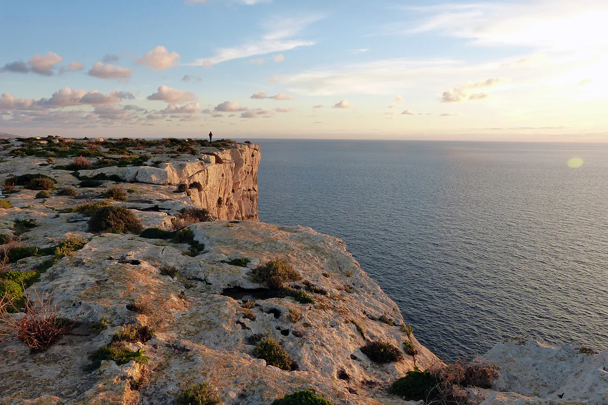
The Dingli Cliffs at sunset, the limestone dropping sheer into the Mediterranean on the south-west coast of Malta.
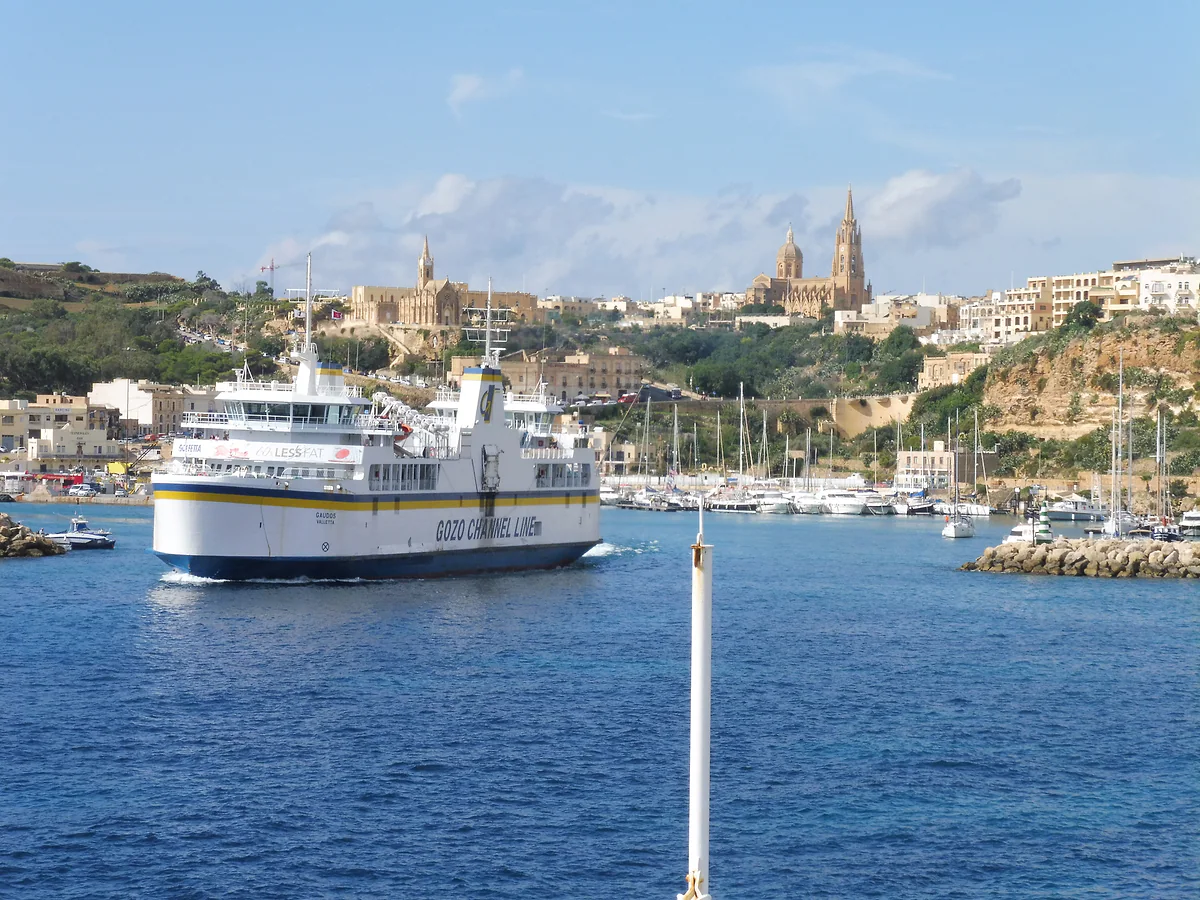
A Gozo Channel ferry leaving Mġarr harbour in Gozo, with the church of Our Lady of Lourdes high above the town behind it.
Malta's area, island by island
| Island | Area | Share of the country | People per km² |
|---|---|---|---|
| Malta | 245 km² | 78% | 2,218 |
| Gozo | 67 km² | 21% | 609 (with Comino) |
| Comino | About 3 km² (3.5 per the Gozo tourist board) | 1% | Two residents |
| Total | 316 km² | 100% | 1,867 |
Areas from Spain's foreign ministry (June 2026) and the Government of Malta; densities from the NSO (2025). Percentages are my own calculation.
Malta compared with other small states
| Country | Area | Source |
|---|---|---|
| San Marino | 61.19 km² | Government of San Marino |
| Liechtenstein | 160 km² | Liechtenstein Office of Statistics |
| Malta | 316 km² | Government of Malta |
Test yourself
True or false?
0/3 Pick before you peek.
-
Malta is bigger than Liechtenstein.
See the answer
True. Malta covers 316 km² and Liechtenstein 160 km², according to their official figures, so Malta is roughly twice the size.
-
Gozo is about a third the size of the island of Malta.
See the answer
True. That's how the Gozo tourist board puts it. Using Spain's foreign ministry figures, 67 km² against 245, it's a little over a quarter.
-
Malta's highest point is over 1,000 metres.
See the answer
False. It's Ta' Dmejrek, at 253 m, according to Spain's foreign ministry country profile.
- Area of the country
- 316 km²
- The same area in square miles
- 122 sq mi
- Coastline of the archipelago
- 253 km
- People per km²
- 1,867
0 of 279 Malta guides
Your next stamp
- Island of Malta
- Gozo
- Comino
- The Maltese islands
- Walking and hiking
- Towns and villages
- Things to do in Malta
- Most beautiful places
- Prettiest villages
- UNESCO World Heritage Sites
- Where is Malta
- Blue Lagoon
- Fort Rinella
- Fort St Angelo
- Gardjola Gardens
- Ħal Saflieni Hypogeum
- Is Malta a country?
- Popeye Village
- Tarxien Temples
- Things to do in Gozo
- Valletta
- Esplora
- Golden Bay
- Gozo day trip
- Inquisitor's Palace
- Population
- St John's Co-Cathedral
- St Mary's Tower
- Grandmaster's Palace
- Maritime Museum
- Mellieħa Bay
- Fort St Elmo
- Language
- Malta at War Museum
- Paradise Bay
- Barrakka Gardens
- Red Tower
- Religion
- Malta government
- Saluting Battery
- MUŻA
- National Museum of Archaeology
- Underground Valletta
- Lascaris War Rooms
- Casa Rocca Piccola
- Malta in one day
- Three Cities
- Victoria
- Birgu
- Manoel Theatre
- Weekend in Malta
- Xagħra
- City Gate and Parliament
- Malta in three days
- Nadur
- Senglea
- Cospicua
- Malta in four days
- Qala
- Valletta Waterfront
- Għajnsielem
- Kalkara
- Malta in five days
- Malta in a week
- Paola
- Xewkija
- Sannat
- Tarxien
- Munxar
- Żabbar
- Fgura
- Fontana
- Kerċem
- Luqa
- Floriana
- Marsa
- Mellieħa
- The Citadel, Gozo
- Żebbuġ (Gozo)
- Ġgantija Temples
- Marsalforn
- Santa Luċija
- Ramla Bay
- San Lawrenz
- Xgħajra
- Xwejni salt pans
- Calypso's Cave
- Għarb
- Żejtun
- Għasri
- Gudja
- San Blas Bay
- Għaxaq
- Ħondoq Bay
- Marsaxlokk
- Kirkop
- Marsaxlokk Fish Market
- Mqabba
- St Peter's Pool
- Marsaskala
- Qrendi
- Żurrieq
- Beaches
- Comino ferry
- EU, Schengen and the euro
- Ħaġar Qim and Mnajdra
- Mdina
- Mġarr (Gozo)
- Blue Grotto
- Diving
- Entry requirements
- Mdina Cathedral
- Xewkija Rotunda
- Birżebbuġa
- Money and payments
- Palazzo Falson
- Safi
- Shipwrecks
- Ta' Ċenċ Cliffs
- Għar Dalam
- Mdina Dungeons
- Mġarr ix-Xini
- Prices and budget
- Snorkelling
- Boat trips
- Malta on a budget
- Playmobil FunPark
- Rabat (Malta)
- Xlendi
- Dwejra
- Gozo beaches
- History
- Siġġiewi
- St Paul's Catacombs
- Tipping
- Azure Window
- Domvs Romana
- Għar Lapsi
- Great Siege of 1565
- Plugs
- Limestone Heritage Park
- Second World War
- St Paul's Grotto
- Ta' Pinu Basilica
- Time zone
- Buskett Gardens
- Knights of Malta
- Mobile and roaming
- Wied il-Għasri
- Dingli
- Maltese cross
- Dingli Cliffs
- Flag
- Żebbuġ
- Coat of arms
- Mtarfa
- Balzan
- National anthem
- Lija
- Malta facts
- Game of Thrones
- Iklin
- Attard
- Film locations
- Forts and fortifications
- San Anton Gardens
- Ta' Qali Crafts Village
- Victoria Lines
- Megalithic temples
- Catacombs
- Museums
- Where to eat
- Where to stay
- Churches
- Hotels in Valletta
- Restaurants in Valletta
- Hotels in Sliema
- Maltese food
- Restaurants in Marsaxlokk
- Viewpoints
- Hotels in St Julian's
- Pastizzi
- Hotels in Buġibba and Qawra
- Maltese rabbit stew
- Safety
- Hotels in Mellieħa
- Kinnie and Cisk
- Scams
- Gozo hotels
- Nightlife
- Tap water
- Boat parties
- Holiday packages
- Tourist tax
- All inclusive
- Gay Malta
- Sightseeing passes
- Apartments
- Malta with kids
- Public holidays
- How to get there
- Luxury
- Malta for couples
- Taxis and ride-hailing
- Weather
- Best time to visit
- Cycling
- English schools
- Flights
- Flights from Madrid
- Sea temperature
- Shopping and souvenirs
- Airport
- Free walking tours
- In winter
- Airport transfers
- Day trips and tours
- In summer
- Ferry from Sicily
- In January
- Cruise stop
- In February
- In March
- In April
- In May
- Getting around
- In June
- Buses
- July
- August
- Hop on hop off
- Gozo ferry
- September
- Gozo fast ferry
- October
- November
- Valletta ferries
- Car hire
- December
- Driving
- Events
- St Paul's Bay
- Village feasts
- Buġibba
- Christmas
- Easter
- Qawra
- Carnival
- Xemxija
- Fireworks festival
- Malta National Aquarium
- Isle of MTV
- St Paul's Islands
- Mosta
- Mosta Rotunda
- Naxxar
- Palazzo Parisio
- Għargħur
- Mġarr (Malta)
- Sliema
- Ta' Ħaġrat and Skorba Temples
- Għajn Tuffieħa Bay
- Tigné Point
- Ġnejna Bay
- St Julian's
- Paceville
- St George's Bay
- Gżira
- Msida
- Ta' Xbiex
- Pietà
- Pembroke
- Swieqi
- San Ġwann
- Birkirkara
- Ħamrun
- Santa Venera
- Qormi
Frequently asked questions
How big is Malta in square miles?
About 122 square miles. The official figure is 316 km², according to the Maltese government, split between Malta (245 km²), Gozo (67 km²) and Comino (about 3 km²).
How big is Malta compared with other small countries?
It's about twice the size of Liechtenstein, at 160 km², and roughly five times San Marino, at 61.19 km². The Maltese government calls it one of the smallest archipelagos in the world.
How big is Gozo?
67 km², according to Spain's foreign ministry. Gozo's tourist board describes it as a third the size of the island of Malta, which covers 245 km².
How long does it take to drive across Malta?
The Gozo tourist board puts the airport to Ċirkewwa, near the island's north-western tip, at roughly an hour by bus or taxi. Traffic is heavy, so allow more at busy times.
Can you see Malta in a day?
You can cross it in about an hour, but seeing it is another matter. I'd give the main island at least three days and Gozo one more.
What is the highest point in Malta?
Ta' Dmejrek, at 253 m, on the island of Malta, according to Spain's foreign ministry. On Gozo the highest point is Ta' Dbieġi, at 195 m.
By
Tourism graduate with a master’s in Tourism Management and Planning from the University of Málaga, who has travelled across Europe. He writes every guide from official sources and his own judgement.
Published on . Facts checked on .
Sources
Photos: Diego Delso (CC BY-SA 4.0); V. Epiney (CC BY-SA 2.0); HH58 (CC BY-SA 4.0), via Wikimedia Commons.