Malta's most densely packed locality
Senglea, the unconquered city staring straight at Valletta
Senglea, or L-Isla in Maltese, is one of the Three Cities, on a narrow Grand Harbour peninsula facing Valletta. Grand Master Claude de la Sengle fortified it in 1551 and it held out through the 1565 siege. It is now Malta's most densely populated locality, at 15,060 people per km², and its tip holds the Gardjola, the finest viewpoint over the capital.
In 30 seconds
Full read: 3 min
- Senglea, L-Isla in Maltese, is one of the Three Cities, facing Valletta.
- Grand Master Claude de la Sengle fortified it in 1551, and La Valette named it Città Invicta after 1565.
- At 15,060 people per km², it is Malta's most densely populated locality.
- Its tip holds the Gardjola, the watchtower with the carved eye and ear.
I'd come to Senglea for the point rather than for museums, as I have no official source for any of its own. What it does offer is the Gardjola and the best view of Valletta going, so I'd save it to round off a day in the Three Cities.

Before you go
What I would keep in mind
-
01 Most beautiful
The look-out with an eye and an ear
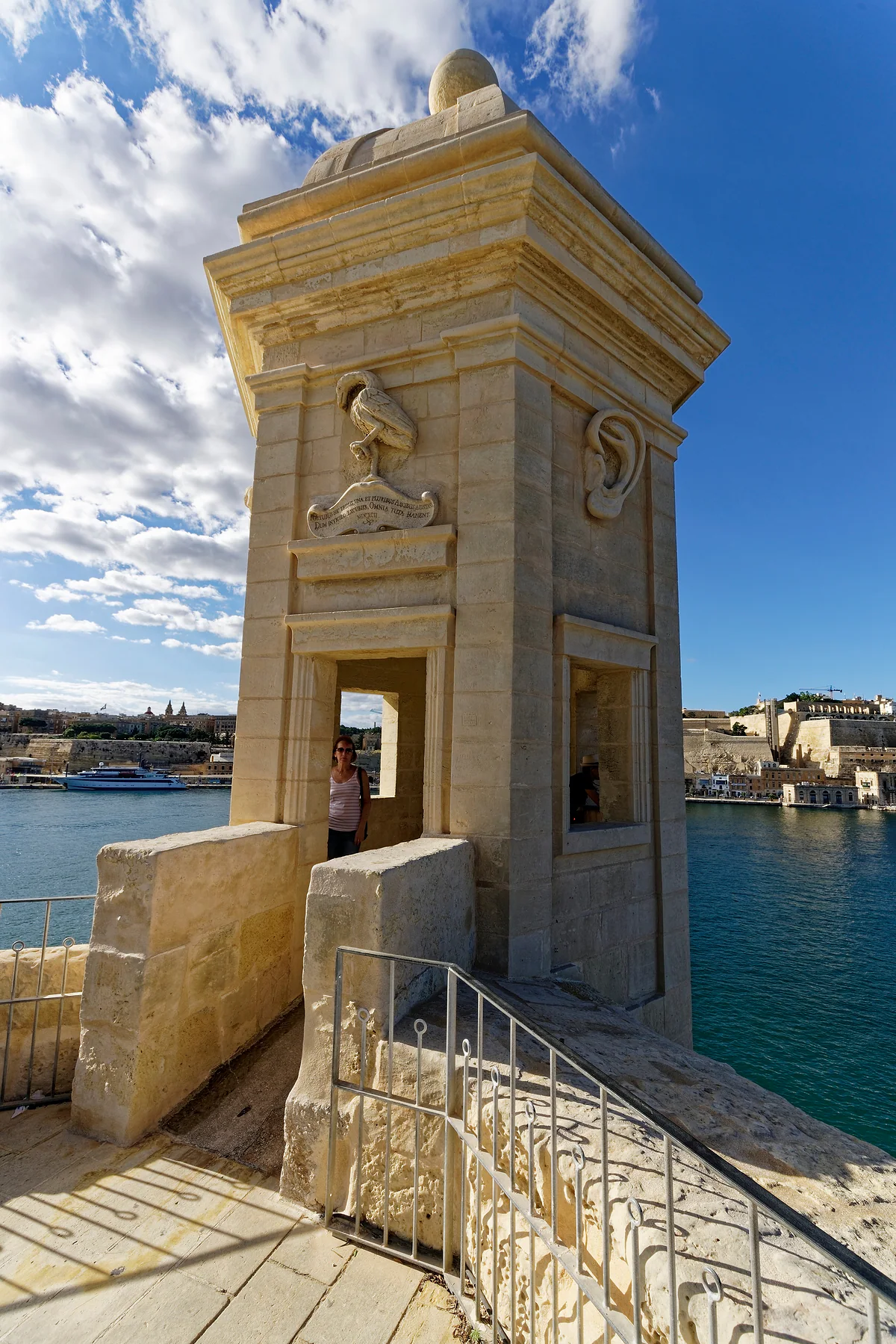
At Senglea's point, the Gardjola kept watch over the harbour mouth. Above its windows are a carved eye and ear, which the MTA reads as symbols of vigilance.
the Gardjola Gardens in Senglea -
02 Getting there
Buses 3 and 4 from Valletta
Malta Public Transport sends you to Senglea on route 3 or 4 from Valletta terminus, the same buses that carry on to Kalkara and Cospicua.
Malta buses -
03 My tip
L-Isla isn't the island of Malta
Senglea's Maltese name, L-Isla, means the island or possibly the peninsula. When searching, add Senglea so you don't end up reading about the whole island.
the island of Malta
What I would book
My ranking, scored
What I'd do in Senglea
My own scores out of 10, for an hour or two in Senglea at the end of a Three Cities day.
0 of 3 seen
-
The Gardjola and the gardens at the point
The stone watchtower, its carved symbols and Valletta across the water, with no published entry fee.
9.0 out of 10
-
Walking the length of the peninsula
Senglea is narrow and quick to cross, and walking it is the best way to grasp how tightly its people live.
7.8 out of 10
-
The Church of the Nativity
The MTA says it was rebuilt after the war and kept its artistic heritage. I have no sourced opening times.
7.0 out of 10
Senglea is the place in Malta with the most people per square metre. It sits on a narrow tongue of land reaching into the Grand Harbour, Valletta dead ahead, and ends in a point crowned by a stone look-out that, to my mind, is the defining image of this shore.
A peninsula walled in 1551
The Malta Tourism Authority says Grand Master Claude de la Sengle fortified the land in 1551, which is where the name comes from. The Maltese still use the older one, L-Isla, meaning the island or perhaps short for peninsula. It’s also the official name of the local council.
During the Great Siege of 1565, Senglea was covered by Fort St Michael on the landward side and by Fort St Angelo, at the tip of Birgu across the creek. For the part its people played, Grand Master La Valette gave it the title Città Invicta, the unconquered city. If you want to see the siege up close, Fort St Angelo is right opposite.
The Second World War was harder on Senglea than on its neighbours. The MTA puts the damage at more than 75% of its buildings destroyed. The parish church of the Nativity of Our Lady was rebuilt and, the same source says, has kept its artistic heritage.
The most crowded town in Malta
What strikes me most about Senglea is a single figure. The NSO put its population at 2,407 on 31 December 2025, not many for a town, but squeezed into so little land that the density reaches 15,060 people per km², the highest of Malta’s 68 localities. For comparison, Valletta, compact as it is, comes in at 6,170.
That number changes how I look at the place. Senglea isn’t an open-air museum, whatever it looks like from Upper Barrakka, but a neighbourhood where a great many people live in very little space. I’d walk it with that in mind rather than assuming everything is laid on for visitors.
What’s at the tip of Senglea?
The reason to come is at the far end of the peninsula. That’s where the MTA places the Safe Haven Gardens, with what it calls superb views across to Valletta, and on the bastion point the Gardjola, a stone vedette that served as a look-out over the harbour entrance. The eye and ear carved above its windows are symbols of vigilance. Malta Public Transport sells it as a quiet spot looking out over the Grand Harbour.
I’d rate it the finest place on the whole harbour to look at Valletta, with its bastions and domes straight ahead across the water. There’s more on the Gardjola Gardens in Senglea.
Senglea from Valletta, and the other way round
There’s a neat relationship between Senglea and the capital. From the Saluting Battery in Valletta and the Upper Barrakka terraces, the point of Senglea and its watchtower sit across the water like part of the scenery. It’s easy to settle for that view and never cross. I’d do both, because the view back, from the Gardjola towards Valletta, is the one you see least in photos and the one that best explains how the harbour was defended, one shore keeping watch on the other.
How long to give it depends on what you’re after. For the point and a short stroll, an hour will do. If you like wandering residential streets with no fixed plan, allow two, then walk on to Birgu or Cospicua, which are right next door. With no museum tickets or opening hours to juggle, it’s the ideal late-afternoon filler.
Getting there and fitting it in
From Valletta terminus, routes 3 and 4 run to Senglea and carry on to Kalkara and Cospicua; timetables and fares are on the Malta buses page. If you’d rather go by water, the Valletta ferry drops you in Cospicua and you walk on from there.
I’d leave it until the end of the day, after Birgu, with no bus or boat to rush for. If you can only manage one of the three, I’d choose Birgu (Vittoriosa) for its museums, but if you’ve an hour to spare, Senglea leaves the best picture in your head. The whole route is in the Three Cities of Malta.
Senglea in numbers (NSO)
| Figure | Value |
|---|---|
| Population, 31-12-2025 | 2,407 |
| Maltese nationals | 2,027 |
| Foreign residents | 380 |
| Population, 31-12-2024 | 2,389 |
| Density in 2025 | 15,060 per km² |
The highest density of Malta's 68 localities, according to the NSO.
Test yourself
True or false?
0/3 Pick before you peek.
-
Senglea is named after a Grand Master of the Order.
See the answer
True. It takes its name from Claude de la Sengle, who fortified it in 1551.
-
Senglea came through the Second World War largely intact.
See the answer
False. The MTA says more than 75% of its buildings were destroyed.
-
The eye and ear on the Gardjola stand for vigilance.
See the answer
True. That's how the MTA explains them. The look-out guarded the entrance to the harbour.
- Year Senglea was fortified
- 1551
- People per km² in 2025
- 15,060
- Of its buildings destroyed in the Second World War
- 75%+
Map
Where Senglea is
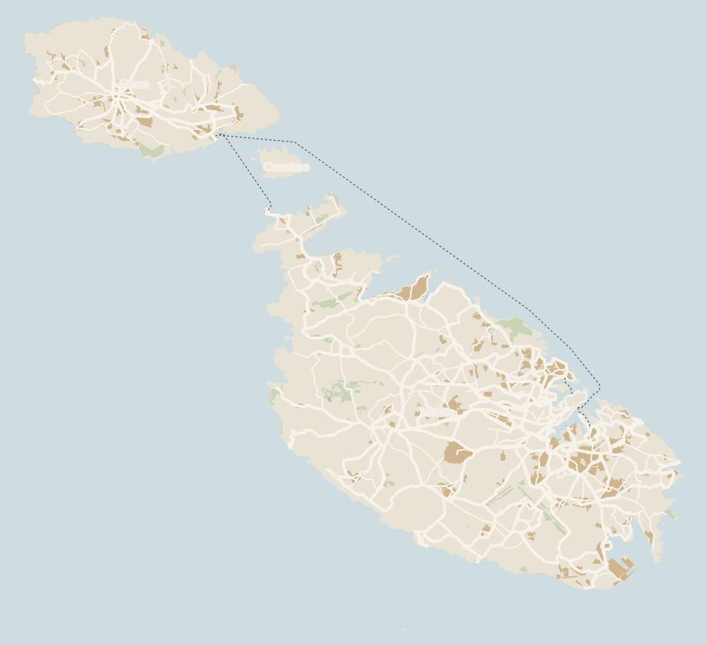
Gozo lies to the north-west, across the channel the ferry crosses from Ċirkewwa, with Comino between the two islands. Every number opens its guide.
What to see
What to see in Senglea
0 of 279 Malta guides
Your next stamp
- Gardjola Gardens
- Three Cities
- Island of Malta
- Xgħajra
- Fgura
- Żurrieq
- Żabbar
- Things to do in Malta
- Gozo
- Most beautiful places
- Comino
- Prettiest villages
- UNESCO World Heritage Sites
- Where is Malta
- The Maltese islands
- Towns and villages
- Blue Lagoon
- Fort Rinella
- Fort St Angelo
- Ħal Saflieni Hypogeum
- Is Malta a country?
- Popeye Village
- Tarxien Temples
- Things to do in Gozo
- Valletta
- Esplora
- Golden Bay
- Gozo day trip
- Inquisitor's Palace
- Population
- St John's Co-Cathedral
- St Mary's Tower
- Grandmaster's Palace
- How big is Malta
- Maritime Museum
- Mellieħa Bay
- Fort St Elmo
- Language
- Malta at War Museum
- Paradise Bay
- Barrakka Gardens
- Red Tower
- Religion
- Malta government
- Saluting Battery
- MUŻA
- National Museum of Archaeology
- Underground Valletta
- Lascaris War Rooms
- Casa Rocca Piccola
- Malta in one day
- Victoria
- Birgu
- Manoel Theatre
- Weekend in Malta
- Xagħra
- City Gate and Parliament
- Malta in three days
- Nadur
- Cospicua
- Malta in four days
- Qala
- Valletta Waterfront
- Għajnsielem
- Kalkara
- Malta in five days
- Malta in a week
- Paola
- Xewkija
- Sannat
- Tarxien
- Munxar
- Fontana
- Kerċem
- Luqa
- Floriana
- Marsa
- Mellieħa
- The Citadel, Gozo
- Żebbuġ (Gozo)
- Ġgantija Temples
- Marsalforn
- Santa Luċija
- Ramla Bay
- San Lawrenz
- Xwejni salt pans
- Calypso's Cave
- Għarb
- Żejtun
- Għasri
- Gudja
- San Blas Bay
- Għaxaq
- Ħondoq Bay
- Marsaxlokk
- Kirkop
- Marsaxlokk Fish Market
- Mqabba
- St Peter's Pool
- Marsaskala
- Qrendi
- Beaches
- Comino ferry
- EU, Schengen and the euro
- Ħaġar Qim and Mnajdra
- Mdina
- Mġarr (Gozo)
- Blue Grotto
- Diving
- Entry requirements
- Mdina Cathedral
- Xewkija Rotunda
- Birżebbuġa
- Money and payments
- Palazzo Falson
- Safi
- Shipwrecks
- Ta' Ċenċ Cliffs
- Għar Dalam
- Mdina Dungeons
- Mġarr ix-Xini
- Prices and budget
- Snorkelling
- Boat trips
- Malta on a budget
- Playmobil FunPark
- Rabat (Malta)
- Xlendi
- Dwejra
- Gozo beaches
- History
- Siġġiewi
- St Paul's Catacombs
- Tipping
- Azure Window
- Domvs Romana
- Għar Lapsi
- Great Siege of 1565
- Plugs
- Limestone Heritage Park
- Second World War
- St Paul's Grotto
- Ta' Pinu Basilica
- Time zone
- Buskett Gardens
- Knights of Malta
- Mobile and roaming
- Wied il-Għasri
- Dingli
- Maltese cross
- Dingli Cliffs
- Flag
- Żebbuġ
- Coat of arms
- Mtarfa
- Balzan
- National anthem
- Lija
- Malta facts
- Game of Thrones
- Iklin
- Attard
- Film locations
- Forts and fortifications
- San Anton Gardens
- Ta' Qali Crafts Village
- Victoria Lines
- Megalithic temples
- Catacombs
- Museums
- Where to eat
- Where to stay
- Churches
- Hotels in Valletta
- Restaurants in Valletta
- Hotels in Sliema
- Maltese food
- Restaurants in Marsaxlokk
- Viewpoints
- Hotels in St Julian's
- Pastizzi
- Walking and hiking
- Hotels in Buġibba and Qawra
- Maltese rabbit stew
- Safety
- Hotels in Mellieħa
- Kinnie and Cisk
- Scams
- Gozo hotels
- Nightlife
- Tap water
- Boat parties
- Holiday packages
- Tourist tax
- All inclusive
- Gay Malta
- Sightseeing passes
- Apartments
- Malta with kids
- Public holidays
- How to get there
- Luxury
- Malta for couples
- Taxis and ride-hailing
- Weather
- Best time to visit
- Cycling
- English schools
- Flights
- Flights from Madrid
- Sea temperature
- Shopping and souvenirs
- Airport
- Free walking tours
- In winter
- Airport transfers
- Day trips and tours
- In summer
- Ferry from Sicily
- In January
- Cruise stop
- In February
- In March
- In April
- In May
- Getting around
- In June
- Buses
- July
- August
- Hop on hop off
- Gozo ferry
- September
- Gozo fast ferry
- October
- November
- Valletta ferries
- Car hire
- December
- Driving
- Events
- St Paul's Bay
- Village feasts
- Buġibba
- Christmas
- Easter
- Qawra
- Carnival
- Xemxija
- Fireworks festival
- Malta National Aquarium
- Isle of MTV
- St Paul's Islands
- Mosta
- Mosta Rotunda
- Naxxar
- Palazzo Parisio
- Għargħur
- Mġarr (Malta)
- Sliema
- Ta' Ħaġrat and Skorba Temples
- Għajn Tuffieħa Bay
- Tigné Point
- Ġnejna Bay
- St Julian's
- Paceville
- St George's Bay
- Gżira
- Msida
- Ta' Xbiex
- Pietà
- Pembroke
- Swieqi
- San Ġwann
- Birkirkara
- Ħamrun
- Santa Venera
- Qormi
Frequently asked questions
What is there to see in Senglea?
Mainly the point, with the gardens and the Gardjola watchtower facing Valletta. The Church of the Nativity, rebuilt after the war, is the other landmark.
Are Senglea and L-Isla the same place?
Yes. L-Isla is the older Maltese name and the official name of the local council. Senglea comes from Grand Master Claude de la Sengle, who fortified it in 1551.
How do I get to Senglea from Valletta?
Take bus 3 or 4 from Valletta terminus. Or cross on the Cospicua ferry and walk on to Senglea.
Why is Senglea called the invincible city?
Grand Master La Valette gave it the title Città Invicta for the role its people played in the Great Siege of 1565, according to the Malta Tourism Authority.
How many people live in Senglea?
2,407 at the end of 2025, according to the NSO, packed into very little land. That's why it has the highest density in the country, 15,060 per km².
By
Tourism graduate with a master’s in Tourism Management and Planning from the University of Málaga, who has travelled across Europe. He writes every guide from official sources and his own judgement.
Published on . Facts checked on .
Sources
Photos: Txllxt TxllxT (CC BY-SA 4.0), via Wikimedia Commons.