Island of Malta, Northern Harbour
Ħamrun, the town the railway built and the shops kept
Ħamrun (Il-Ħamrun) is a busy shopping town just outside Valletta, with 12,386 residents at the end of 2025. It boomed from the mid-19th century thanks to the railway, which ran until around 1930, and keeps the church of Porto Salvo, built in 1736, and the chapel of Tas-Samra, with an icon brought from Spain.
In 30 seconds
Full read: 2 min
- Ħamrun has 12,386 residents and is a shopping town next to Valletta.
- It grew with the 19th-century railway, which ran until around 1930.
- The Tas-Samra chapel keeps a Madonna icon brought from Spain.
- Routes 42, 62, 74 and 122 all pass through.
I wouldn't come to Ħamrun specially, but if you're heading inland by bus I'd hop off for an hour. What draws me is the Tas-Samra chapel and its Spanish icon, and the shopping street where the Maltese actually shop.

Before you go
What I would keep in mind
-
01 Most beautiful
A dark-skinned Madonna from Spain
Visit Malta says the Tas-Samra chapel holds an icon of the Madonna with an unusually dark complexion, brought from Spain by a wealthy 16th-century merchant.
churches in Malta -
02 My tip
Shop where the locals shop
Visit Malta presents Ħamrun as a popular shopping town with a lively atmosphere. It's everyday Malta, far from the souvenir stalls.
-
03 Getting there
Four buses from Valletta
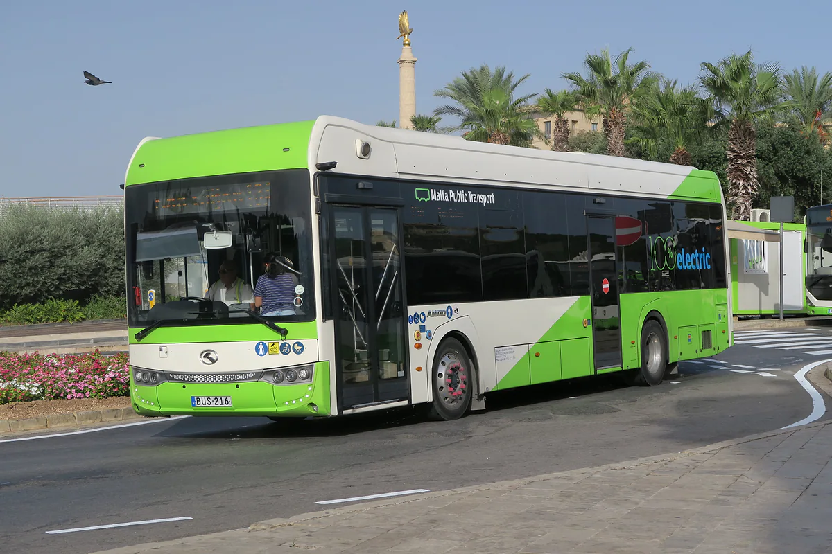
Routes 42, 62, 74 and 122 leave Valletta terminal and run through Ħamrun towards Birkirkara, Qormi, Luqa or Mater Dei.
Malta buses
What I would book
Ħamrun is what you see from the bus window as you leave Valletta for the interior, shopping streets, traffic and people running errands. It isn’t a destination, but it tells a story that explains half the island, with a small link to Spain thrown in.
The town the railway made
Visit Malta describes it as a bustling urban area that grew out of scattered hamlets. Its take-off came from the mid-19th century with the building of the railway, although it had already filled up with dockyard workers moving out of Valletta and Floriana. The line lasted only around five decades, until about 1930, but by then Ħamrun was a major centre, and it had gained its own parish in the late 19th century. At one time, Visit Malta adds, parts of Ħamrun depended on Qormi as their administrative and parish centre.
It’s one of Malta’s least-known stories. Plenty of visitors have no idea the island once had trains, and a station still survives in Birkirkara, Malta’s second largest town.
Porto Salvo, St Cajetan and Tas-Samra
Visit Malta mentions three churches. The oldest is St Mary of Porto Salvo, built in 1736 in early Baroque style, which grew like the town itself, probably from a village chapel. Today’s main parish church is dedicated to St Cajetan, San Ġejtanu in Maltese.
The third is the one that interests me most, the small chapel of Tas-Samra. It holds an icon of the Madonna brought from Spain by a wealthy 16th-century merchant, much venerated and unusual for the dark complexion of the Virgin. I don’t have visiting hours from a source, so I’d ask at the parish. If you enjoy village church stories like this, carry on with churches in Malta.
Shopping in Ħamrun
Visit Malta presents Ħamrun as a popular shopping town with a lively atmosphere. It’s workaday Malta, with shops aimed at locals rather than cruise passengers, and I find that a welcome change from Republic Street. Some 12,386 people live here, 7,800 of them Maltese, according to the NSO. There’s no official list I can point to of markets or shop hours, so I won’t send you to a particular one; walking the main road alongside the locals is the whole point.
Buses and places to stay
Four routes from Valletta terminal pass through Ħamrun, the 42 towards Birkirkara and Mosta, the 62 towards Qormi, the bread town and Żebbuġ, the 74 towards Marsa and Luqa and the 122 towards Msida and Mater Dei Hospital. Ħamrun also merges into Santa Venera, the council of the Wignacourt Aqueduct, with no visible line between them. That makes it a handy place to change for the interior, and tickets are €2.50 on the summer timetable, dropping to €2 in winter. The MTA register lists no licensed hotels, just one guesthouse and 47 holiday lets, so I’d base myself in Valletta.
Ħamrun in numbers
| Figure | Value | Source |
|---|---|---|
| Residents, 31 Dec 2025 | 12,386 | NSO |
| Maltese nationals | 7,800 | NSO |
| Foreign nationals | 4,586 | NSO |
| Density in 2025 | 11,754 per km² | NSO |
| Licensed accommodation | 1 guesthouse and 47 lets | MTA, 28 Sep 2026 |
The MTA register lists no licensed hotels in Ħamrun.
Valletta buses through Ħamrun
| Route | To | Key stops |
|---|---|---|
| 42 | Ċirkewwa | Ħamrun, Birkirkara, Mosta, Mellieħa |
| 62 | Siġġiewi | Ħamrun, Qormi, Żebbuġ |
| 74 | Żurrieq | Ħamrun, Marsa, Luqa, Mqabba |
| 122 | Mater Dei | Floriana, Ħamrun, Swatar, Msida |
Malta Public Transport, Valletta terminal, checked 28 September 2026.
Test yourself
True or false?
0/3 Pick before you peek.
-
Ħamrun grew thanks to the railway.
See the answer
True. Visit Malta says its rapid development from the mid-19th century was the result of the railway being built.
-
Malta's railway still runs today.
See the answer
False. According to Visit Malta, it lasted only about five decades, until around 1930.
-
The Tas-Samra chapel holds an icon brought from Spain.
See the answer
True. Visit Malta says a wealthy 16th-century merchant brought it from Spain.
- Residents at the end of 2025
- 12,386
- Porto Salvo church built
- 1736
- Malta's railway closes
- c. 1930
Map
Where Ħamrun is
Gozo lies to the north-west, across the channel the ferry crosses from Ċirkewwa, with Comino between the two islands. Every number opens its guide.
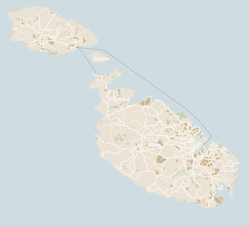 1Island of Malta 2Valletta 3Three Cities 4Kalkara 5Paola 6Tarxien 7Żabbar 8Fgura 9Luqa 10Floriana 11Marsa 12Mellieħa 13Santa Luċija 14Xgħajra 15Żejtun 16Gudja 17Għaxaq 18Marsaxlokk 19Kirkop 20Mqabba 21Marsaskala 22Qrendi 23Żurrieq 24Mdina 25Birżebbuġa 26Safi 27Rabat (Malta) 28Siġġiewi 29Dingli 30Żebbuġ 31Mtarfa 32Balzan 33Lija 34Iklin 35Attard 36Victoria Lines 37St Paul's Bay 38Mosta 39Naxxar 40Għargħur 41Mġarr (Malta) 42Sliema 43St Julian's 44Gżira 45Msida 46Ta' Xbiex 47Pietà 48Pembroke 49Swieqi 50San Ġwann 51Birkirkara 52Ħamrun 53Santa Venera 54Qormi
 Map data © OpenStreetMap contributors (ODbL)
- 1Island of Malta245 km² and 54 local councils
- 2VallettaFounded 1566, on the UNESCO list since 1980
- 3Three CitiesBirgu, Senglea and Cospicua
- 4Kalkara3,322 residents beside Birgu
- 5Paola10,064 residents above the Grand Harbour
- 6Tarxien10,266 residents and four temples
- 7ŻabbarSouthern Harbour district
- 8FguraSouthern Harbour district
- 9LuqaSouthern Harbour district
- 10Floriana2,043 residents at the capital's gates
- 11MarsaSouthern Harbour district
- 12MellieħaMalta's northern beach country
- 13Santa LuċijaSouthern Harbour district
- 14XgħajraEast coast, Southern Harbour district
- 15ŻejtunSouth Eastern district
- 16GudjaSouth Eastern district
- 17GħaxaqSouth Eastern district
- 18MarsaxlokkMalta's main fishing port
- 19KirkopSouth Eastern district
- 20MqabbaSouthern Malta, South Eastern district
- 21Marsaskala19,211 residents in the south east
- 22QrendiMalta's south coast
- 23ŻurrieqSouthern Malta, South Eastern district
- 24MdinaIsland of Malta, Western district
- 25BirżebbuġaSouth Eastern district, next to the Freeport
- 26SafiSouth Eastern district
- 27Rabat (Malta)Island of Malta, Western district
- 28SiġġiewiWestern Region, between Buskett and Għar Lapsi
- 29DingliIsland of Malta, Western district
- 30ŻebbuġWestern district, not the one on Gozo
- 31MtarfaIsland of Malta, Western district
- 32BalzanIsland of Malta, Western district
- 33LijaIsland of Malta, Western district
- 34IklinIsland of Malta, Western district
- 35AttardOne of central Malta's Three Villages
- 36Victoria LinesNamed in 1897 for Queen Victoria's Diamond Jubilee
- 37St Paul's BayLocal council in northern Malta
- 38MostaLocal council in central Malta
- 39NaxxarLocal council in northern Malta
- 40GħargħurLocal council in northern Malta
- 41Mġarr (Malta)Local council in western Malta
- 42SliemaIsland of Malta, Northern Harbour
- 43St Julian'sIsland of Malta, Northern Harbour
- 44GżiraIsland of Malta, Northern Harbour
- 45MsidaIsland of Malta, Northern Harbour
- 46Ta' XbiexIsland of Malta, Northern Harbour
- 47PietàIsland of Malta, Northern Harbour
- 48PembrokeIsland of Malta, Northern Harbour
- 49SwieqiIsland of Malta, Northern Harbour
- 50San ĠwannIsland of Malta, Northern Harbour
- 51BirkirkaraIsland of Malta, Northern Harbour
- 52ĦamrunIsland of Malta, Northern Harbour
- 53Santa VeneraIsland of Malta, Northern Harbour
- 54QormiIsland of Malta, inland from the Grand Harbour
0 of 279 Malta guides
Your next stamp
- Mosta
- Santa Venera
- Qormi
- Mdina
- Marsa
- Marsaskala
- Birkirkara
- Things to do in Malta
- Gozo
- Most beautiful places
- Comino
- Prettiest villages
- UNESCO World Heritage Sites
- Where is Malta
- The Maltese islands
- Towns and villages
- Island of Malta
- Blue Lagoon
- Fort Rinella
- Fort St Angelo
- Gardjola Gardens
- Ħal Saflieni Hypogeum
- Is Malta a country?
- Popeye Village
- Tarxien Temples
- Things to do in Gozo
- Valletta
- Esplora
- Golden Bay
- Gozo day trip
- Inquisitor's Palace
- Population
- St John's Co-Cathedral
- St Mary's Tower
- Grandmaster's Palace
- How big is Malta
- Maritime Museum
- Mellieħa Bay
- Fort St Elmo
- Language
- Malta at War Museum
- Paradise Bay
- Barrakka Gardens
- Red Tower
- Religion
- Malta government
- Saluting Battery
- MUŻA
- National Museum of Archaeology
- Underground Valletta
- Lascaris War Rooms
- Casa Rocca Piccola
- Malta in one day
- Three Cities
- Victoria
- Birgu
- Manoel Theatre
- Weekend in Malta
- Xagħra
- City Gate and Parliament
- Malta in three days
- Nadur
- Senglea
- Cospicua
- Malta in four days
- Qala
- Valletta Waterfront
- Għajnsielem
- Kalkara
- Malta in five days
- Malta in a week
- Paola
- Xewkija
- Sannat
- Tarxien
- Munxar
- Żabbar
- Fgura
- Fontana
- Kerċem
- Luqa
- Floriana
- Mellieħa
- The Citadel, Gozo
- Żebbuġ (Gozo)
- Ġgantija Temples
- Marsalforn
- Santa Luċija
- Ramla Bay
- San Lawrenz
- Xgħajra
- Xwejni salt pans
- Calypso's Cave
- Għarb
- Żejtun
- Għasri
- Gudja
- San Blas Bay
- Għaxaq
- Ħondoq Bay
- Marsaxlokk
- Kirkop
- Marsaxlokk Fish Market
- Mqabba
- St Peter's Pool
- Qrendi
- Żurrieq
- Beaches
- Comino ferry
- EU, Schengen and the euro
- Ħaġar Qim and Mnajdra
- Mġarr (Gozo)
- Blue Grotto
- Diving
- Entry requirements
- Mdina Cathedral
- Xewkija Rotunda
- Birżebbuġa
- Money and payments
- Palazzo Falson
- Safi
- Shipwrecks
- Ta' Ċenċ Cliffs
- Għar Dalam
- Mdina Dungeons
- Mġarr ix-Xini
- Prices and budget
- Snorkelling
- Boat trips
- Malta on a budget
- Playmobil FunPark
- Rabat (Malta)
- Xlendi
- Dwejra
- Gozo beaches
- History
- Siġġiewi
- St Paul's Catacombs
- Tipping
- Azure Window
- Domvs Romana
- Għar Lapsi
- Great Siege of 1565
- Plugs
- Limestone Heritage Park
- Second World War
- St Paul's Grotto
- Ta' Pinu Basilica
- Time zone
- Buskett Gardens
- Knights of Malta
- Mobile and roaming
- Wied il-Għasri
- Dingli
- Maltese cross
- Dingli Cliffs
- Flag
- Żebbuġ
- Coat of arms
- Mtarfa
- Balzan
- National anthem
- Lija
- Malta facts
- Game of Thrones
- Iklin
- Attard
- Film locations
- Forts and fortifications
- San Anton Gardens
- Ta' Qali Crafts Village
- Victoria Lines
- Megalithic temples
- Catacombs
- Museums
- Where to eat
- Where to stay
- Churches
- Hotels in Valletta
- Restaurants in Valletta
- Hotels in Sliema
- Maltese food
- Restaurants in Marsaxlokk
- Viewpoints
- Hotels in St Julian's
- Pastizzi
- Walking and hiking
- Hotels in Buġibba and Qawra
- Maltese rabbit stew
- Safety
- Hotels in Mellieħa
- Kinnie and Cisk
- Scams
- Gozo hotels
- Nightlife
- Tap water
- Boat parties
- Holiday packages
- Tourist tax
- All inclusive
- Gay Malta
- Sightseeing passes
- Apartments
- Malta with kids
- Public holidays
- How to get there
- Luxury
- Malta for couples
- Taxis and ride-hailing
- Weather
- Best time to visit
- Cycling
- English schools
- Flights
- Flights from Madrid
- Sea temperature
- Shopping and souvenirs
- Airport
- Free walking tours
- In winter
- Airport transfers
- Day trips and tours
- In summer
- Ferry from Sicily
- In January
- Cruise stop
- In February
- In March
- In April
- In May
- Getting around
- In June
- Buses
- July
- August
- Hop on hop off
- Gozo ferry
- September
- Gozo fast ferry
- October
- November
- Valletta ferries
- Car hire
- December
- Driving
- Events
- St Paul's Bay
- Village feasts
- Buġibba
- Christmas
- Easter
- Qawra
- Carnival
- Xemxija
- Fireworks festival
- Malta National Aquarium
- Isle of MTV
- St Paul's Islands
- Mosta Rotunda
- Naxxar
- Palazzo Parisio
- Għargħur
- Mġarr (Malta)
- Sliema
- Ta' Ħaġrat and Skorba Temples
- Għajn Tuffieħa Bay
- Tigné Point
- Ġnejna Bay
- St Julian's
- Paceville
- St George's Bay
- Gżira
- Msida
- Ta' Xbiex
- Pietà
- Pembroke
- Swieqi
- San Ġwann
Frequently asked questions
What is there to see in Ħamrun?
The church of St Mary of Porto Salvo, from 1736, the parish church of St Cajetan and the Tas-Samra chapel with its Madonna icon from Spain. And the shopping street.
Why did Ħamrun grow so fast?
Visit Malta puts it down to the arrival of the railway and to dockyard workers moving out of Valletta and Floriana. The railway lasted about five decades, until around 1930.
How do I get from Valletta to Ħamrun?
On bus 42, 62, 74 or 122, all of which leave Valletta terminal and pass through Ħamrun.
Are there hotels in Ħamrun?
The MTA register lists none, just one guesthouse and 47 holiday lets. It's more practical to stay in Valletta, a short bus ride away.
Did Malta have trains?
Yes. Visit Malta says the railway shaped Ħamrun from the mid-19th century and ran for about five decades until around 1930. A station survives in Birkirkara.
By
Tourism graduate with a master’s in Tourism Management and Planning from the University of Málaga, who has travelled across Europe. He writes every guide from official sources and his own judgement.
Published on . Facts checked on .
Sources