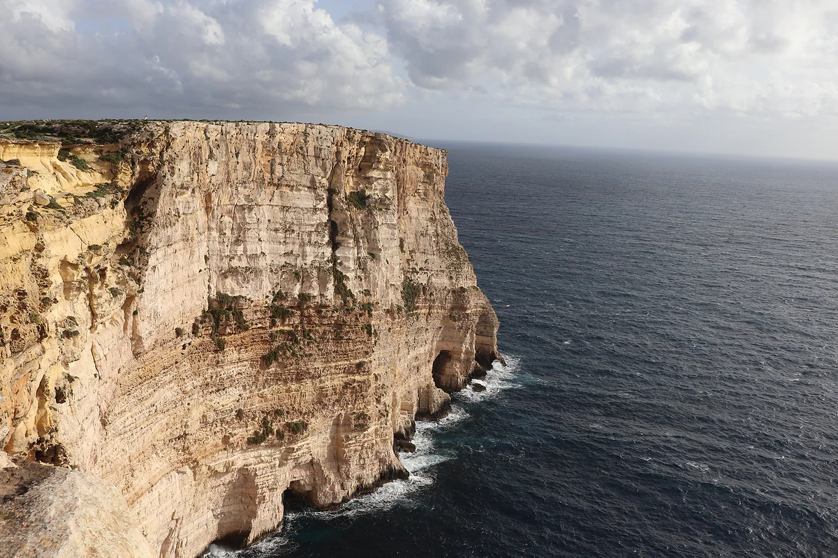
Cliffs on Gozo
Ta' Ċenċ, where the plateau simply stops at the sea
The Ta' Ċenċ cliffs mark the southern end of the Ta' Ċenċ plateau, next to the village of Sannat on Gozo. The Ministry for Gozo describes them as the island's highest. The area is protected twice over under the EU's Natura 2000 network and holds three dolmens and the remains of a prehistoric temple. There's no visitor centre and no charge.
In 30 seconds
Full read: 3 min
- The Ta' Ċenċ cliffs are on the south coast of Gozo, next to Sannat.
- The Ministry for Gozo calls them the island's highest, without giving a figure.
- The plateau is a double Natura 2000 site with three dolmens and remains of L-Imramma temple.
- Entry is free and there are no facilities, so go prepared.
Ta' Ċenċ is about as wild as Gozo still gets, and that's exactly why it needs a bit of sense. I'd go late in the afternoon when the light drops over the sea, in proper shoes and well back from the edge.

Before you go
What I would keep in mind
-
01 Most beautiful
Gozo's south coast at its rawest
Scrubby plateau, bare rock and a sheer drop into the sea. According to the Ministry for Gozo, there are no higher cliffs anywhere on the island.
-
02 My tip
See them from Xlendi too
The Xlendi Walk looks across to Ta' Ċenċ and the Sanap cliffs. It's another way to take them in, from the west.
Xlendi -
03 Getting there
You reach them from Sannat
The plateau begins at the edge of Sannat village. From there you go on foot, or drive as far as the track allows.
Sannat -
04 Worth the splurge
A five-star bolthole by the plateau
The Ta' Cenc Hotel in Sannat is one of only two five-star hotels on Gozo, with 83 rooms according to the MTA register.
Gozo hotels
What I would book
You don’t come to Ta’ Ċenċ for a monument. You come to walk the southern rim of Gozo, a scrubby plateau that ends abruptly in a vertical wall above the sea. Nobody has tamed it, and that’s the appeal, with no kiosks and no paid viewing platforms.
What exactly are the Ta’ Ċenċ cliffs?
Ta’ Ċenċ is the plateau that stretches south of Sannat, and its cliffs are where that plateau meets the Mediterranean. The Ministry for Gozo describes them as the highest on the island. It doesn’t publish a height, though, and I’d rather not quote a number without an official source behind it.
The landscape is Maltese garigue, low aromatic scrub growing on limestone with hardly any soil. The Ministry talks of rich flora and fauna, and the EU agrees twice over. Ta’ Ċenċ is a special protection area for birds covering 152 hectares and a site of community importance covering another 140, both within the Natura 2000 network.
Dolmens and a temple up on the plateau
Nature and prehistory come as a package here. The plateau holds sparse remains of the L-Imramma temple and three dolmens, which the Ministry describes as a roughly shaped limestone slab resting on blocks stood on end on three sides. There are no fences and no information boards, which is part of their charm, but it also means treating them with care. I wouldn’t climb on any of them.
From the eastern edge of the plateau you look down into the Ħanżira valley, a steep-sided ravine that separates Sannat from Xewkija and runs down to the cove at Mġarr ix-Xini. If your legs are up to it, plateau in the morning and cove in the afternoon is one of the best days out in southern Gozo.
Top or side on, from Xlendi?
Both work. From the top you feel the drop and the wind. From the west, the Xlendi Walk above Xlendi gives you views across to Ta’ Ċenċ and to the Sanap cliffs, which belong to Munxar. With only one afternoon to spare, I’d go to Xlendi, have dinner there and save the plateau for a morning on another day.
Don’t expect any facilities at all. There’s no visitor centre, no toilets, no water and no shade. The nearest help is Sannat itself, home to the Ta’ Cenc Hotel, one of Gozo’s two five-star properties.
Getting there and staying safe
You reach the plateau from Sannat, on foot or by car as far as the track allows, and there’s nothing to pay. Neither the Natura 2000 database nor the Ministry spells out what is or isn’t permitted on each patch of ground, so I’d follow the usual rules for any protected site. Stick to the paths, leave the plants alone and take everything home with you.
There are no railings along the edge. In a strong wind, with children or when the rock is wet, I’d keep well back. Spring, when the countryside is at its greenest, and autumn are the best seasons. In July and August I’d only go first thing or around sunset.
If you want more of Gozo’s coastline on the same trip, the west has Dwejra, with the Inland Sea and Fungus Rock, and on the main island there are the Dingli Cliffs.
Ta’ Ċenċ on Malta’s protected map
What I find most interesting is that this corner isn’t an isolated case. Since 1998 Malta has listed its coastal cliffs on its UNESCO Tentative List under the generic heading of ‘Coastal Cliffs’, though the entry I read doesn’t say which stretches it covers. And the EU’s Natura 2000 network protects several lengths of cliff on both Gozo and Malta, with Ta’ Ċenċ among those named individually. To me that’s the best guarantee the edge will stay as it is.
For a full day in the south, here’s how I’d string it together. Set off from Sannat across the plateau first thing, drop down the gorge to Mġarr ix-Xini for a swim, and finish at the Xewkija Rotunda in the late afternoon, by car. It’s a long day but an unhurried one, and it shows you the wildest part of the island properly.
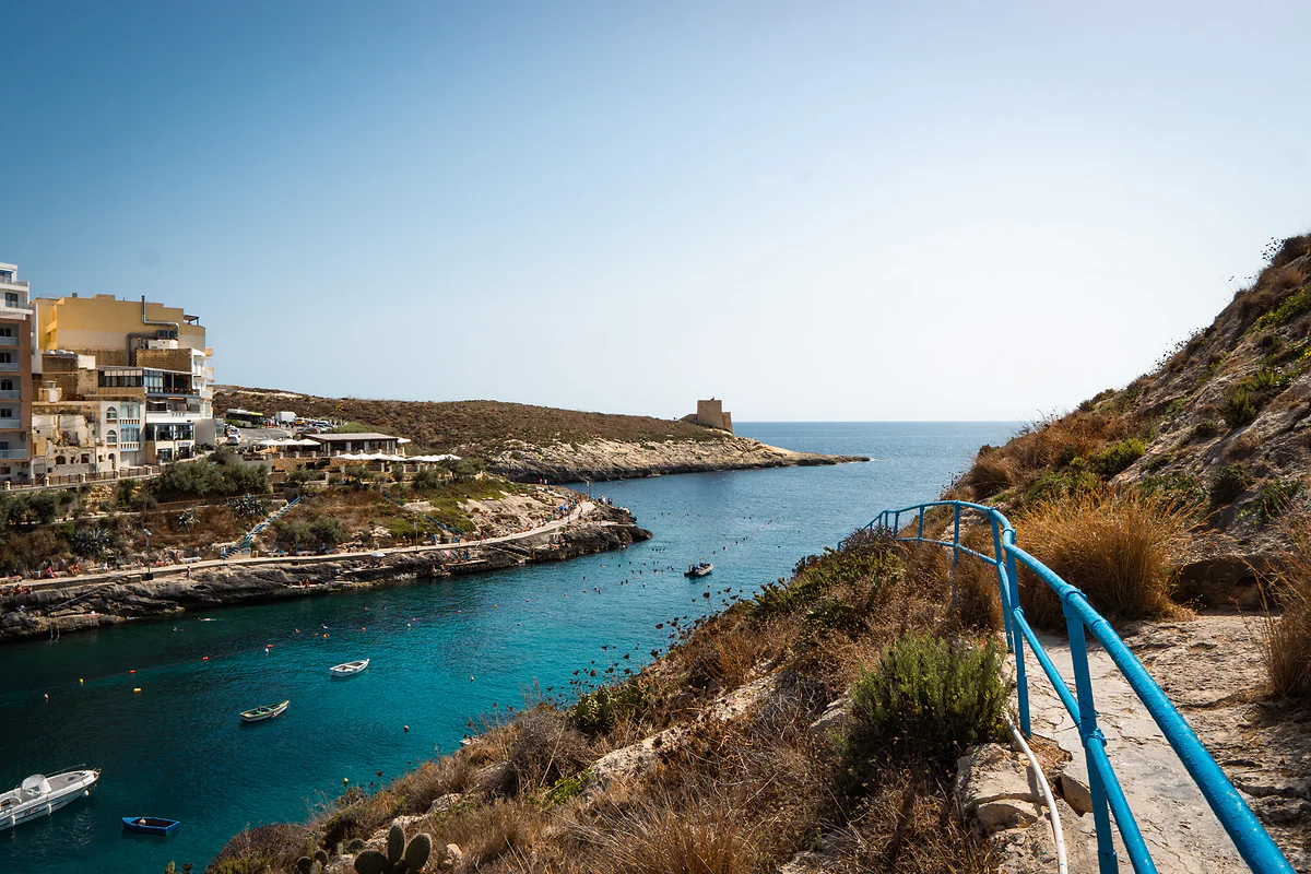
The narrow bay of Xlendi in Gozo between cliffs, with turquoise water, boats at anchor and the old watchtower on the point.
Ta' Ċenċ in the Natura 2000 network
| Code | Type | Area | Official name |
|---|---|---|---|
| MT0000027 | Special protection area (birds) | 152.06 ha | Rdumijiet ta' Għawdex: Ta' Ċenċ |
| MT0000034 | Site of community importance | 140.21 ha | L-Inħawi ta' Ta' Ċenċ |
European Environment Agency Natura 2000 database, checked on 28-09-2026. The database doesn't say what is or isn't allowed on each site.
Before you go
| Topic | What to expect |
|---|---|
| Access | From Sannat, on foot or by car as far as the track goes |
| Entry | Free |
| Facilities | None on the plateau; Sannat village is next door |
| Height | The Ministry doesn't publish a figure |
| Best time | Spring, autumn and the last hours of the day |
Test yourself
True or false?
0/3 Pick before you peek.
-
Ta' Ċenċ is protected under the EU's Natura 2000 network.
See the answer
True. Twice over, as a special protection area for birds (152 ha) and as a site of community importance (140 ha), according to the European Environment Agency.
-
You need to buy a ticket to walk at Ta' Ċenċ.
See the answer
False. It's open countryside with no ticket office or opening hours. There's no visitor centre either.
-
There are prehistoric dolmens on the plateau.
See the answer
True. The Ministry for Gozo lists three dolmens and sparse remains of the L-Imramma temple on the Ta' Ċenċ plateau.
- Ta' Ċenċ bird protection area
- 152 ha
- Ta' Ċenċ site of community importance
- 140 ha
- Dolmens on the plateau
- 3
- Entry (it's free)
- €0
Map
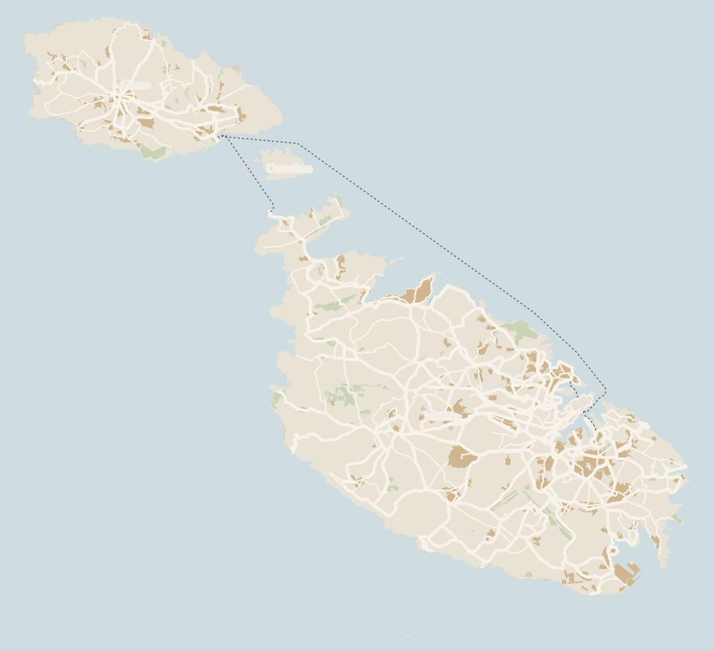
Where Ta' Ċenċ Cliffs is
Gozo lies to the north-west, across the channel the ferry crosses from Ċirkewwa, with Comino between the two islands. Every number opens its guide.
0 of 279 Malta guides
Your next stamp
- Sannat
- Viewpoints
- Gozo beaches
- Beaches
- Walking and hiking
- Mġarr ix-Xini
- Ta' Pinu Basilica
- Gozo
- Things to do in Malta
- Most beautiful places
- Comino
- Prettiest villages
- UNESCO World Heritage Sites
- Where is Malta
- The Maltese islands
- Towns and villages
- Island of Malta
- Blue Lagoon
- Fort Rinella
- Fort St Angelo
- Gardjola Gardens
- Ħal Saflieni Hypogeum
- Is Malta a country?
- Popeye Village
- Tarxien Temples
- Things to do in Gozo
- Valletta
- Esplora
- Golden Bay
- Gozo day trip
- Inquisitor's Palace
- Population
- St John's Co-Cathedral
- St Mary's Tower
- Grandmaster's Palace
- How big is Malta
- Maritime Museum
- Mellieħa Bay
- Fort St Elmo
- Language
- Malta at War Museum
- Paradise Bay
- Barrakka Gardens
- Red Tower
- Religion
- Malta government
- Saluting Battery
- MUŻA
- National Museum of Archaeology
- Underground Valletta
- Lascaris War Rooms
- Casa Rocca Piccola
- Malta in one day
- Three Cities
- Victoria
- Birgu
- Manoel Theatre
- Weekend in Malta
- Xagħra
- City Gate and Parliament
- Malta in three days
- Nadur
- Senglea
- Cospicua
- Malta in four days
- Qala
- Valletta Waterfront
- Għajnsielem
- Kalkara
- Malta in five days
- Malta in a week
- Paola
- Xewkija
- Tarxien
- Munxar
- Żabbar
- Fgura
- Fontana
- Kerċem
- Luqa
- Floriana
- Marsa
- Mellieħa
- The Citadel, Gozo
- Żebbuġ (Gozo)
- Ġgantija Temples
- Marsalforn
- Santa Luċija
- Ramla Bay
- San Lawrenz
- Xgħajra
- Xwejni salt pans
- Calypso's Cave
- Għarb
- Żejtun
- Għasri
- Gudja
- San Blas Bay
- Għaxaq
- Ħondoq Bay
- Marsaxlokk
- Kirkop
- Marsaxlokk Fish Market
- Mqabba
- St Peter's Pool
- Marsaskala
- Qrendi
- Żurrieq
- Comino ferry
- EU, Schengen and the euro
- Ħaġar Qim and Mnajdra
- Mdina
- Mġarr (Gozo)
- Blue Grotto
- Diving
- Entry requirements
- Mdina Cathedral
- Xewkija Rotunda
- Birżebbuġa
- Money and payments
- Palazzo Falson
- Safi
- Shipwrecks
- Għar Dalam
- Mdina Dungeons
- Prices and budget
- Snorkelling
- Boat trips
- Malta on a budget
- Playmobil FunPark
- Rabat (Malta)
- Xlendi
- Dwejra
- History
- Siġġiewi
- St Paul's Catacombs
- Tipping
- Azure Window
- Domvs Romana
- Għar Lapsi
- Great Siege of 1565
- Plugs
- Limestone Heritage Park
- Second World War
- St Paul's Grotto
- Time zone
- Buskett Gardens
- Knights of Malta
- Mobile and roaming
- Wied il-Għasri
- Dingli
- Maltese cross
- Dingli Cliffs
- Flag
- Żebbuġ
- Coat of arms
- Mtarfa
- Balzan
- National anthem
- Lija
- Malta facts
- Game of Thrones
- Iklin
- Attard
- Film locations
- Forts and fortifications
- San Anton Gardens
- Ta' Qali Crafts Village
- Victoria Lines
- Megalithic temples
- Catacombs
- Museums
- Where to eat
- Where to stay
- Churches
- Hotels in Valletta
- Restaurants in Valletta
- Hotels in Sliema
- Maltese food
- Restaurants in Marsaxlokk
- Hotels in St Julian's
- Pastizzi
- Hotels in Buġibba and Qawra
- Maltese rabbit stew
- Safety
- Hotels in Mellieħa
- Kinnie and Cisk
- Scams
- Gozo hotels
- Nightlife
- Tap water
- Boat parties
- Holiday packages
- Tourist tax
- All inclusive
- Gay Malta
- Sightseeing passes
- Apartments
- Malta with kids
- Public holidays
- How to get there
- Luxury
- Malta for couples
- Taxis and ride-hailing
- Weather
- Best time to visit
- Cycling
- English schools
- Flights
- Flights from Madrid
- Sea temperature
- Shopping and souvenirs
- Airport
- Free walking tours
- In winter
- Airport transfers
- Day trips and tours
- In summer
- Ferry from Sicily
- In January
- Cruise stop
- In February
- In March
- In April
- In May
- Getting around
- In June
- Buses
- July
- August
- Hop on hop off
- Gozo ferry
- September
- Gozo fast ferry
- October
- November
- Valletta ferries
- Car hire
- December
- Driving
- Events
- St Paul's Bay
- Village feasts
- Buġibba
- Christmas
- Easter
- Qawra
- Carnival
- Xemxija
- Fireworks festival
- Malta National Aquarium
- Isle of MTV
- St Paul's Islands
- Mosta
- Mosta Rotunda
- Naxxar
- Palazzo Parisio
- Għargħur
- Mġarr (Malta)
- Sliema
- Ta' Ħaġrat and Skorba Temples
- Għajn Tuffieħa Bay
- Tigné Point
- Ġnejna Bay
- St Julian's
- Paceville
- St George's Bay
- Gżira
- Msida
- Ta' Xbiex
- Pietà
- Pembroke
- Swieqi
- San Ġwann
- Birkirkara
- Ħamrun
- Santa Venera
- Qormi
Frequently asked questions
Where are the Ta' Ċenċ cliffs?
On the south coast of Gozo, at the end of the Ta' Ċenċ plateau next to Sannat. The Ħanżira valley separates them from Xewkija to the east.
Are they the highest cliffs on Gozo?
That's how the Ministry for Gozo describes them, though it doesn't give a height. I wouldn't quote a figure until an official source publishes one.
How much does it cost to visit Ta' Ċenċ?
Nothing. It's open countryside with no ticket office or set hours, inside two protected Natura 2000 sites.
What else is there to see at Ta' Ċenċ?
The garigue on the plateau, three dolmens and the scant remains of L-Imramma temple, plus views over the Ħanżira valley.
Is it safe to walk along the Ta' Ċenċ cliffs?
There are no railings and the wind can be strong. I'd stay well back from the edge, especially with children or in rough weather, and wear proper shoes.
When's the best time to go?
Spring and autumn, early or late in the day. In high summer there's no shade whatsoever on the plateau.
By
Tourism graduate with a master’s in Tourism Management and Planning from the University of Málaga, who has travelled across Europe. He writes every guide from official sources and his own judgement.
Published on . Facts checked on .
Sources
Photos: Andrzej Otrębski (CC BY-SA 4.0); PavleG97 (CC BY-SA 4.0), via Wikimedia Commons.