Commune of Mertert
Wasserbillig, Luxembourg's low corner on the German border
Wasserbillig is a village in the commune of Mertert, at Luxembourg's eastern tip, where the Sûre flows into the Moselle. Its Spatz, at 130 metres, is the lowest point in the country. It has a station on the Trier line, road and rail bridges plus a ferry to the German bank, vineyard walks and a small fresh and saltwater aquarium.
In 30 seconds
Full read: 2 min
- Wasserbillig is a village in the commune of Mertert, at Luxembourg's eastern tip.
- Its Spatz, at 130 metres, is the lowest point in the country.
- It has a station on the Luxembourg to Trier line, free as far as the border.
- Bridges and a ferry link it to the German bank.
I'd come to Wasserbillig for the geography rather than the village. Standing at the lowest point in the country, watching the Sûre slip into the Moselle and then walking over the railway bridge into Germany makes a half-day unlike anything else in the valley.

Before you go
What I would keep in mind
-
01 Most beautiful
The Spatz, where two rivers meet
At the Spatz the Sûre joins the Moselle and Luxembourg bottoms out at 130 metres above sea level, according to visitluxembourg.
-
02 Getting there
Free trains right up to the border
Wasserbillig is the last Luxembourg station on line 30 before Trier, and second-class travel is free as far as here.
Luxembourg free public transport -
03 My tip
Two loops on the heritage trail
Since 30 July 2026 the heritage trail starts outside the town hall at 1 Grand-Rue, with a 3.6 km loop and a 10.4 km loop. Follow the small red signs with a fish on them.
-
04 To save money
An aquarium for three euros
The municipal aquarium has 15 tanks holding 90,000 litres. Adults pay €3, and it's free with the LuxembourgPass.
Wasserbillig aquarium
What I would book
Wasserbillig is where Luxembourg runs out of downhill. The Sûre, having wound its way from the Ardennes, pours into the Moselle here, and the country reaches its lowest point, 130 metres at the Spatz. It’s a village in the commune of Mertert, at the far eastern end of the Luxembourg Moselle valley, and it has long been a gateway to Trier, which is why visitluxembourg calls it a large shopping centre at the junction of the two valleys.
The Spatz and the mosaic map
The geographical reason to come is the Spatz. visitluxembourg and the local tourist office both give 130 metres, while STATEC measures 140 at the village church, a different spot altogether, so don’t let the numbers throw you. At the country’s easternmost point there’s also a large mosaic of the Grand Duchy with its cantons and rivers, which I’d say is the quirkiest photo in town. To get your bearings before you go, there’s my map of Luxembourg with its regions.
Into Germany on foot
Wasserbillig has road and rail bridges and, according to the local office, a ferry to Oberbillig on the German bank, plus landing stages for river boats. The official F walk, 8.71 km, passes the Spatz, crosses the railway bridge and climbs to a viewpoint among the vines before looping back through Mesenich and Langsur. The same listing suggests a detour to Igel, the neighbouring German village, to see a 23-metre Roman funerary column that is on the World Heritage list. The E walk, 9.97 km, stays on the Luxembourg side, climbs to a viewpoint above the Sûre and returns along the river from Mertert.
If you are staying the night, see the best hotel deals in Grevenmacher for your dates: the well-placed rooms go fast.
A heritage trail with a fresh route
On 30 July 2026 the commune announced a new route for its heritage trail. It starts on the pavement outside the town hall at 1 Grand-Rue and comes in two loops, a short one of 3.6 km taking about an hour and twenty minutes and a long one of 10.4 km taking about three hours. Just follow the little red signs with a fish on them. With only an afternoon to spare, the short loop is plenty.
The aquarium and the riverbanks
The village park holds the municipal aquarium, with 15 tanks and 90,000 litres of fresh and salt water, and entry is cheap and free with the LuxembourgPass. I cover it properly in the Wasserbillig aquarium guide. Beyond that, the local office points you to the vineyards, woods and banks of both rivers, as this is where the national trails of the Lower Sûre and the Moselle begin.
If you are staying the night, see the best hotel deals in Grevenmacher for your dates: the well-placed rooms go fast.
Getting there and staying over
It’s one of the few Moselle villages you can reach by train. CFL line 30 from Luxembourg City to Trier calls here, and second class is free as far as the border. At carnival time the village puts on a night parade that’s famous across Luxembourg. For a bed, the commune has only a campsite, on the Rue de la Sûre, which also houses the local tourist office and a bike hire point.
So you do not lose the morning at the ticket office, browse tickets and tours in Grevenmacher on GetYourGuide.
If you would rather go at your own pace, see the car hire deals in Luxembourg: the earlier you book, the more cars are left to choose from.
Before you fix your dates, compare tickets to Luxembourg: the same journey can cost very different amounts from one day to the next.
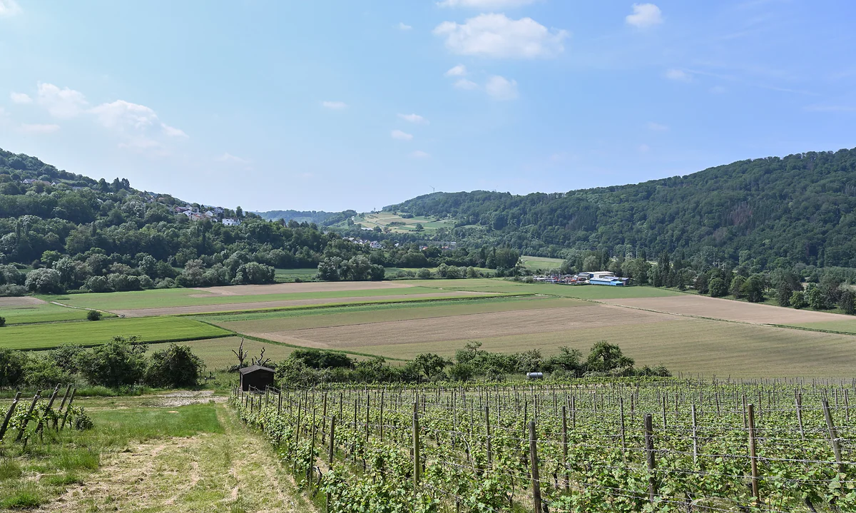
The Sûre valley near Rosport, with vines in the foreground, flat fields and wooded hills on the far side
Wasserbillig essentials
| What | Where | Detail |
|---|---|---|
| Lowest point in Luxembourg | The Spatz | 130 m |
| Heritage trail | 1 Grand-Rue (town hall) | 3.6 km and 10.4 km loops, red fish signs |
| Wasserbillig E walk | Esplanade | 9.97 km, about 2 h 50, to Mertert and back |
| Wasserbillig F walk | Crosses into Germany | 8.71 km, about 2 h 15, via Langsur |
| Syndicat d'initiative | 8 Rue de la Sûre | Local information; campsite with bike hire |
| Aquarium | Rue des Pépinières | Adults €3; free with LuxembourgPass (September 2026) |
visitluxembourg.com, visitmoselle.lu and mertert.lu, checked on 30-09-2026.
Test yourself
True or false?
0/3 Pick before you peek.
-
Luxembourg's lowest point is 130 metres above sea level, at Wasserbillig.
See the answer
True. visitluxembourg puts the Spatz, where the Sûre joins the Moselle, at 130 metres above sea level.
-
Wasserbillig is a commune in its own right.
See the answer
False. It's one of the two localities of the commune of Mertert, although the commune's administration building is on its Grand-Rue.
-
The train from Wasserbillig to Trier is free all the way.
See the answer
False. Free travel only applies inside Luxembourg. The cross-border section is paid.
- Lowest point in Luxembourg
- 130 m
- Long loop of the heritage trail
- 10.4 km
- Of water in the aquarium
- 90,000 l
- Igel's Roman column, across the border
- 23 m
Map
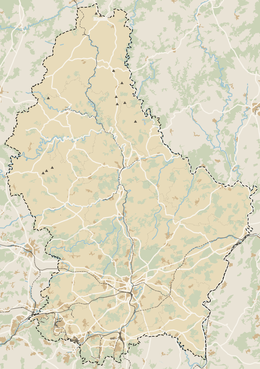
Where Wasserbillig is
The thick dashed line is the border with Belgium, France and Germany, and the fine ones divide the twelve cantons. The Éislek lies to the north and the Moselle to the east. Every number opens its guide.
What to see
What to see in Wasserbillig
0 of 425 Luxembourg guides
Your next stamp
- Mertert
- Canoeing and kayaking
- Moselle Valley
- Wasserbillig Aquarium
- Rosport-Mompach
- Kneiff
- Around Luxembourg
- Kopstal
- A Possen Museum
- American Cemetery
- Ansembourg
- Ansembourg Castles
- Asselborn
- Bascharage
- Beaufort castles
- Belval
- Belval blast furnaces
- Berg Castle
- Bernard-Massard cellars
- Bourglinster Castle
- Bourscheid Castle
- Brandenbourg
- Brandenbourg Castle
- Caves St Martin
- Christmas
- Clervaux Castle
- Echternach
- Echternach Abbey
- Ehnen
- Ehnen Wine Museum
- Esch-sur-Alzette
- Esch-sur-Sûre Castle
- European Museum Schengen
- Fond-de-Gras
- General Patton Museum
- German war cemetery
- Haff Réimech
- Hohllay
- Hollenfels Castle
- Hosingen
- Kautenbach
- Koerich Castle
- Larochette Castle
- Lasauvage
- Mersch Castle
- Military History Museum
- Moersdorf
- Mondorf Domaine Thermal
- Munsbach Castle
- National Mining Museum
- Parc Merveilleux
- Park Sënnesräich
- Places to visit
- Remich
- Rindschleiden
- Schiessentümpel
- Septfontaines Castle
- Slate Museum
- Stolzembourg
- Tudor Museum
- Useldange Castle
- Valley of the Seven Castles
- Vianden
- Vianden Castle
- Ville Haute
- Weiswampach lakes
- Wiltz Castle
- Ahn
- Berdorf
- Bourscheid-Plage
- Butterfly garden
- Clervaux
- Differdange
- Echternach lake
- Grevenmacher
- Heringer Millen
- Hollenfels
- Luxembourg City
- Luxembourg Science Center
- Meysembourg Castle
- Mullerthal
- National Day
- National Resistance Museum
- Perekop
- Remerschen
- Schoenfels Castle
- The Family of Man
- Things to do
- Upper Sûre Lake
- Vianden chairlift
- Clervaux Abbey
- Echternach Roman villa
- Éislek
- Insenborn
- Kallektuffquell
- Machtum
- Most beautiful places
- Our Nature Park
- Pétange
- Pettingen Castle
- Schueberfouer
- Schwebsingen
- Victor Hugo House
- Waldbillig
- Dudelange
- Kuelscheier
- Lultzhausen
- Octave
- Prettiest villages
- Sanem
- Schengen
- Wellenstein
- Wiltz
- Wolfsschlucht
- Beaufort
- Bech-Kleinmacher
- Éimaischen
- Gaalgebierg
- Guttland
- Marnach
- Mondorf-les-Bains
- Putscheid
- Schifflange
- UNESCO World Heritage
- Carnival
- Consdorf
- Ellergronn
- Käerjeng
- Kayl
- Map
- Minett
- Munshausen
- Tandel
- Bech
- Buergbrennen
- Esch-sur-Sûre
- Rumelange
- Where is Luxembourg
- Is it a country?
- Lac de la Haute-Sûre (commune)
- Wormeldange
- Larochette
- Mondercange
- Regions
- Bettembourg
- Bock Casemates
- Cantons
- Dancing procession
- Diekirch
- Fischbach
- Garnich
- Mersch
- Moselle wine route
- Ettelbruck
- Grund
- Heffingen
- Kehlen
- Lintgen
- Moselle river cruises
- Pétrusse Casemates
- Towns and villages
- Chemin de la Corniche
- Erpeldange-sur-Sûre
- Junglinster
- Lorentzweiler
- Nommern
- Pfaffenthal
- Population
- Bissen
- Clausen
- Grand Ducal Palace
- Koerich
- Schieren
- Size
- Vallée de l'Ernz
- Feulen
- Kirchberg
- Languages
- Notre-Dame Cathedral
- Reisdorf
- Steinfort
- Bettendorf
- Habscht
- St Michael's Church
- Helperknapp
- Luxembourgish
- Place Guillaume II
- Name
- Place d'Armes
- History
- Place de la Constitution
- Grand Duke
- Colmar-Berg
- Flaxweiler
- Gare
- Hamm
- Kirchberg funicular
- Luxembourg fortress
- Mamer
- Minett Trail
- Mullerthal Trail
- Neumünster Abbey
- Parc Hosingen
- Pfaffenthal lift
- Political system
- Redange
- The Passerelle
- Wine festivals
- Winseler
- Beckerich
- Biwer
- EU institutions
- Goesdorf
- Limpertsberg
- Mudam
- Natur Musée
- Pulvermühl
- Stadtbredimus
- Troisvierges
- Wenzel walk
- Bonnevoie
- Bous-Waldbredimus
- Ell
- Flag
- Kiischpelt
- Manternach
- Philharmonie
- Vauban circuit
- Weiswampach
- Betzdorf
- Boulaide
- Dräi Eechelen Museum
- Facts
- Hollerich
- Lenningen
- Useldange
- Wincrange
- Bourscheid
- Dalheim
- Gasperich
- Public holidays
- Red Bridge
- Saeul
- Belair
- Second World War
- Vichten
- Battle of the Bulge
- Merl
- Préizerdaul
- Cents
- EU and Schengen
- Groussbus-Wal
- Entry requirements
- Neudorf
- Rambrouch
- Currency and payments
- Mertzig
- Weimerskirch
- Adolphe Bridge
- Beggen
- Escapardenne
- How to get there
- International March of Diekirch
- MNHA (National Museum)
- Rock climbing
- Sandweiler
- Bridges
- Eich
- Flights
- Golf
- Hesperange
- Lëtzebuerg City Museum
- Dommeldange
- Luxembourg airport
- Strassen
- Villa Vauban
- Airport to city centre
- Bertrange
- Casino Luxembourg
- Mühlenbach
- Swimming pools
- From Brussels
- Pétrusse Valley
- Rollingergrund
- Walferdange
- Cessange
- Day trip from Brussels
- Municipal Park
- Steinsel
- Free walking tours
- From Paris
- Niederanven
- From Frankfurt
- Schuttrange
- Sightseeing train and bus
- By train
- Contern
- By coach
- Weiler-la-Tour
- Driving
- Luxembourg in one day
- Pretzel Sunday
- Rham Plateau
- Tour de Luxembourg
- Candlemas (Liichtmëssdag)
- Car hire
- Luxembourg in two days
- Saint-Esprit Plateau
- Luxembourg in three days
- Melusina statue
- Parking
- St Nicholas Day (Kleeschen)
- Fête de la Musique
- Luxembourg in four days
- Museums in Luxembourg
- Petrol
- Place de Clairefontaine
- A week in Luxembourg
- Getting around
- Luxembourg Marathon
- Tram and Bus Museum
- Free public transport
- Parks in Luxembourg City
- Road trip
- Belgium and Luxembourg
- Tram
- Buses
- Viewpoints
- Trains
- Luxembourg station
- Cycling
- LuxembourgPass
- Prices and budget
- On a budget
- Free things to do
- Mobile and roaming
- Healthcare
- Safety
- Scams
- Tourist information
- Packing list
- Swimming lakes
- With a dog
- Markets
- Tipping
- Shopping
- What to buy
- Shopping centres
- With kids
- For couples
- Playgrounds
- Adventure parks
- Nightlife
- Castles
- Theatres and concert venues
- Leudelange
- Nature parks
- Where to stay
- City-centre hotels
- Hiking
- Nature reserves
- Reckange-sur-Mess
- Hotels near the station
- Roeser
- Frisange
- Hotels in Kirchberg
- Airport hotels
- Dippach
- Hotels in Vianden
- Hotels in Echternach
- Hotels in Clervaux
- Hotels in Mondorf-les-Bains
- Hotels in Esch-sur-Alzette
- Hotels on the Moselle
- Mullerthal hotels
- Upper Sûre lake hotels
- Hotels in Diekirch and Ettelbruck
- Cheap hotels
- Luxury hotels
- Boutique hotels
- Spa hotels
- Family hotels
- Apartments
- Weather
- Youth hostels
- Best time to visit
- Campsites
- Holiday cottages
- In winter
- Castle hotels
- In spring
- Day trips
- In summer
- In autumn
- Ice skating
- Trier day trip
- Metz day trip
- Arlon day trip
- In January
- In February
- In March
- In April
- In May
- In June
- In July
- In August
- In September
- Food
- In October
- In November
- Where to eat
- In December
- Michelin restaurants
- Cheap eats
- Judd mat Gaardebounen
- Bouneschlupp
- Gromperekichelcher
- Kniddelen
- Quetschentaart
- Rieslingspaschtéit
- Events
- Wine
- Crémant
- Beer
Frequently asked questions
What is the lowest point in Luxembourg?
The Spatz at Wasserbillig, where the Sûre flows into the Moselle, at 130 metres above sea level according to visitluxembourg. STATEC gives 140 metres at the village church, which is a different spot.
What is there to see in Wasserbillig?
The meeting of the Sûre and the Moselle, a large mosaic map of the country at its easternmost point, the heritage trail relaunched in 2026 and the aquarium. Germany is a bridge away.
How do I get to Wasserbillig by train?
Take CFL line 30 from Luxembourg City towards Trier, which stops at Wasserbillig. Second class is free inside Luxembourg, but you pay for the stretch across the border.
Can you walk from Wasserbillig into Germany?
Yes, over the road or railway bridge, and the local tourist office also lists a ferry to Oberbillig. The official Wasserbillig F walk crosses on the railway bridge.
Is Wasserbillig a good stop on the way to Trier?
It works well as a stop. The same train carries on to Trier, and the official F walk suggests a detour to Igel, the German village next door, to see a 23-metre Roman funerary column that is a World Heritage Site.
By
Tourism graduate with a master’s in Tourism Management and Planning from the University of Málaga, who has travelled across Europe. He writes every guide from official sources and his own judgement.
Published on . Facts checked on .
Sources
Some links in this guide are affiliate links: if you book through them, the site earns a commission at no extra cost to you. Affiliate disclosure
Photos: Palauenc05 (CC BY-SA 4.0); Cayambe (CC BY-SA 4.0), via Wikimedia Commons.