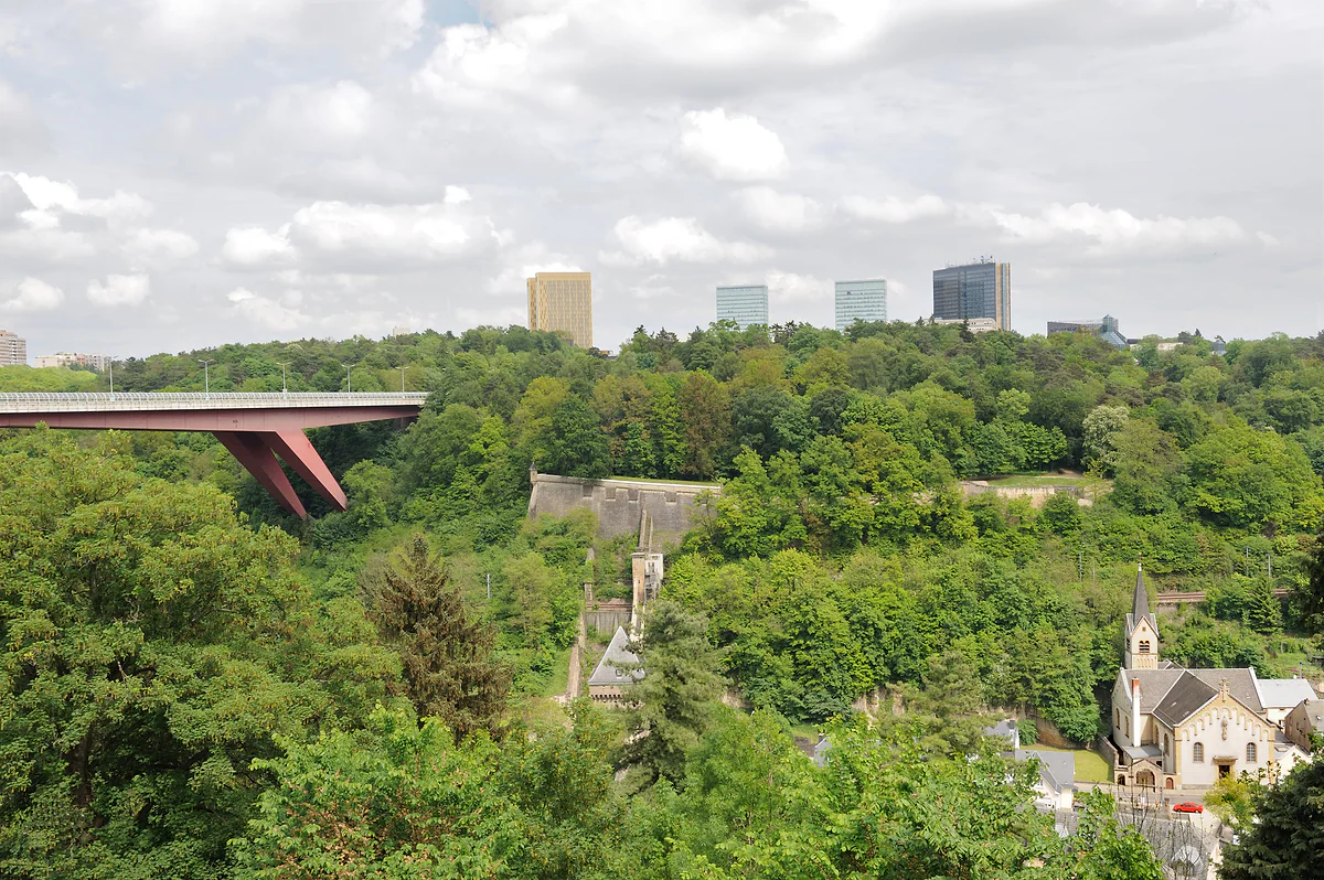
Grand Duchess Charlotte Bridge, centre to Kirchberg
The Red Bridge, the span that joined the city to Europe
The Red Bridge is the Grand Duchess Charlotte Bridge, linking Luxembourg City centre with the Kirchberg plateau high above the Alzette valley and the Pfaffenthal district. It's 355 metres long and 74 metres high, opened in 1966 and has carried the tram since 2018. It is the largest bridge in the capital.
I'd walk across it at least once rather than just riding the tram. The view down to Pfaffenthal and across to the upper town is one of the best free views in the capital, and afterwards I'd look at it from below, from the valley, to grasp the scale.

Before you go
What I would keep in mind
-
01 Most beautiful
It's even better from below
From Pfaffenthal, 74 metres down, the red span arcs over the rooftops and the Vauban towers. The classic shot is from the panoramic lift or from the ramparts.
Pfaffenthal -
02 Getting there
Tram, funicular and a stop at the end
The T1 tram crosses it between the centre and Kirchberg, stopping at Rout Bréck-Pafendall on the Kirchberg side. At the foot of the bridge are Pfaffenthal-Kirchberg station and the funicular.
Kirchberg funicular -
03 My tip
Twelve tanks before opening day
Before it opened to traffic, it was load-tested with twelve 42-tonne tanks, according to the government portal. For me that's the best story the bridge has.
-
04 To save money
Crossing it costs nothing
On foot, by bike or on the free tram, the bridge is one of those capital-city views you don't pay for.
Some bridges are just infrastructure; others are a political decision you can walk across. The Red Bridge is the second kind. When it was planned, Luxembourg was the provisional seat of the European Coal and Steel Community and wanted to become its permanent home. For that it needed space, and the space was on the Kirchberg plateau, across a valley 74 metres deep. The bridge was the answer.
For a sense of the moment, one detail says it all. Between 1952 and 1958 the ECSC Court of Justice sat in the Villa Vauban, a late 19th-century house that is now an art museum. To make a case for being the permanent seat, the government decided to develop the Kirchberg plateau and connect it to the centre, and the bridge came out of that decision.
A competition, two years of building and twelve tanks
The government launched an international competition in 1957. Work began in June 1963 and was finished two years later. Before it opened to traffic, it was put through overload tests with twelve tanks weighing 42 tonnes each, a detail from the government’s portal that I think is the bridge’s best story. It opened in 1966 and bears the name of Grand Duchess Charlotte, who inaugurated it herself. Her bronze statue has stood since 1990 in Place de Clairefontaine, beside the cathedral.
To everyone it’s the Rout Bréck, the Red Bridge, after its colour. The tourist office supplies the figures. It’s 355 metres long and 25 wide, rises 74 metres above the Alzette valley and the Pfaffenthal district, and weighs more than 4,900 tonnes. The government portal describes it as the largest bridge in the capital.
The tram and the latest overhaul
Between 2015 and 2018 the bridge had a thorough overhaul to take the tram. The cantilevers were widened, the railings replaced, the deck strengthened and the whole thing repainted to keep the colour that gives it its name. On the night of 21 May 2018 a tram crossed it for the first time on its way to the Glacis. Today the T1 line runs over it between the centre and Kirchberg, with the Rout Bréck-Pafendall stop at the Kirchberg end. If you’ve flown in from the UK and taken the tram from Findel into town, you’ve already crossed it, since the T1 runs from the airport through Kirchberg and over the bridge towards the Étoile and Hamilius. Next time, sit on the valley side and keep your eyes on the window for the whole crossing.
Once your dates are set, check which hotels are still free in Luxembourg before prices climb.
Is it worth walking across?
For me, yes. On the tram you’re over in seconds and barely look. On foot you have Pfaffenthal’s rooftops, the Vauban towers and the river beneath you, with the upper town on its rock beyond. It’s one of the best free views in the capital, and it leaves you in Kirchberg by Mudam, the Philharmonie and Fort Thüngen. If you want a photo, I’d go late in the afternoon, with low sun on the upper town’s cliff, and wait for a tram to cross for the full picture.
The other angle I’d recommend is from below. From the valley floor the bridge becomes a red stroke across the sky above the houses. The best way to get there is to ride down on the Pfaffenthal lift, whose glass cabin keeps the bridge in view as you descend.
How it fits with the funicular
At the foot of the bridge, down in the valley, sits Pfaffenthal-Kirchberg railway station, and from there the funicular climbs to the tram stop at the end of the bridge. It’s an interchange designed so that rail passengers don’t have to go through the centre. For a round trip with a difference, go up to Kirchberg by funicular and walk back to the centre over the bridge.
Once your dates are set, check which hotels are still free in Luxembourg before prices climb.
One bridge among many
The capital has plenty of other bridges with a story, from the stone arches of the Adolphe Bridge and the Passerelle over the Pétrusse to the railway viaducts across the Alzette and the little bridges of the Grund. I gather them all in bridges in Luxembourg City. The red one is the most modern of the big historic crossings and, to my mind, the one that best explains why Luxembourg City is one of the EU’s three capitals today.
If you would rather have a local show you round, book a guided tour in Red Bridge and choose by the reviews.
A car frees you from timetables: search car hire in Luxembourg on DiscoverCars and compare companies.
So you do not pay over the odds, look at trains, coaches and flights to Luxembourg on Omio and pick the one that suits you.
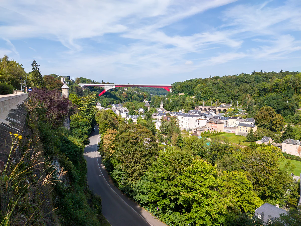
The Alzette valley at Pfaffenthal seen from the ramparts, with the red Grand Duchess Charlotte Bridge beyond
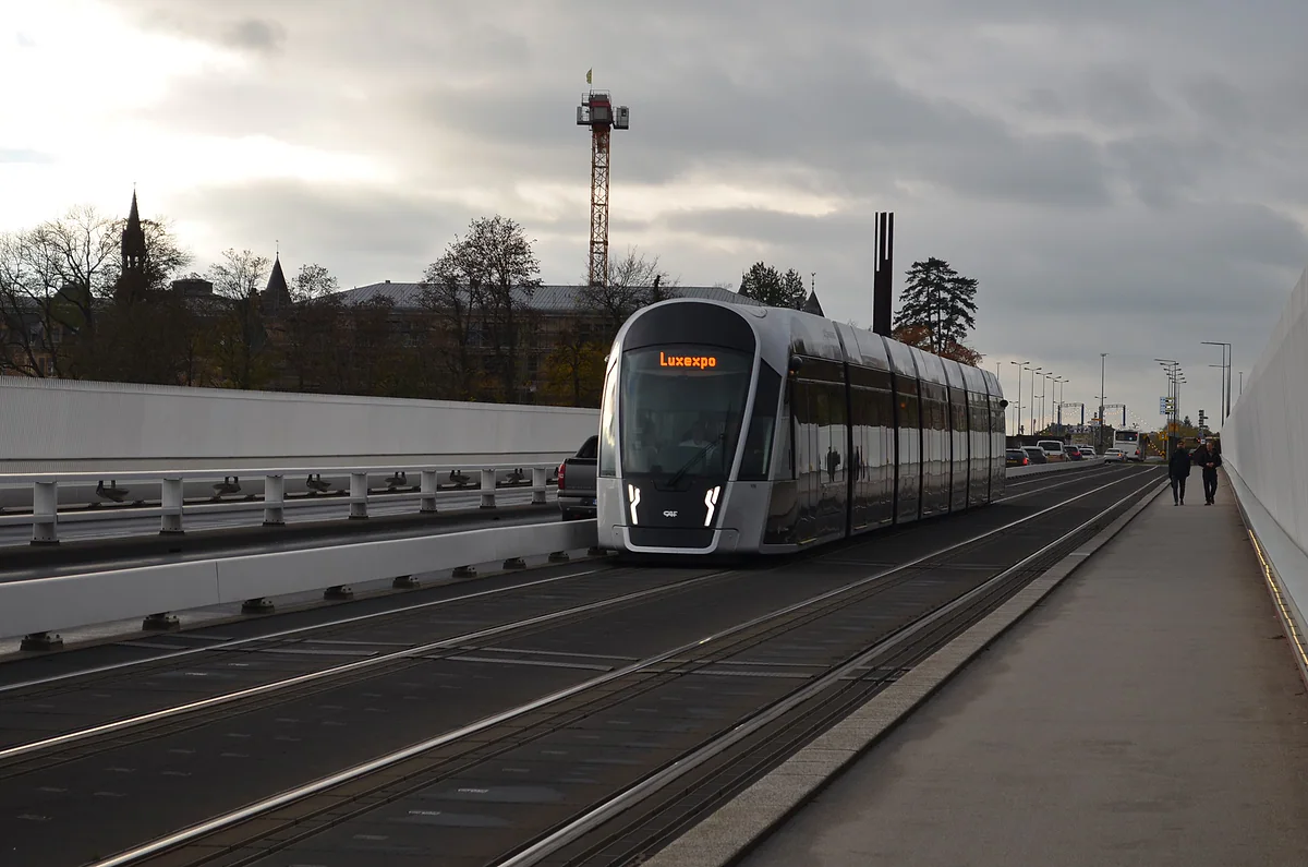
A line T1 tram bound for Luxexpo crossing the Grand Duchess Charlotte Bridge under a grey sky
The Red Bridge in numbers
| Fact | Figure |
|---|---|
| Official name | Pont Grande-Duchesse Charlotte |
| Length | 355 m |
| Height above the valley | 74 m |
| Width | 25 m |
| Weight | Over 4,900 tonnes |
| International competition | 1957 |
| Construction | June 1963 to 1965 |
| Opened | 1966 |
| Works for the tram | 2015 to 2018 |
| First tram crossing | Night of 21 May 2018 |
Sources: LCTO and luxembourg.public.lu, checked on 29-09-2026.
Test yourself
True or false?
0/3 Pick before you peek.
-
The Red Bridge was load-tested with tanks before it opened.
See the answer
True. Overload tests were carried out with twelve tanks of 42 tonnes each, according to luxembourg.public.lu.
-
The Red Bridge is longer than the Adolphe Bridge.
See the answer
True. It's 355 metres long, against 153 for the Adolphe Bridge, according to the tourist office's listings.
-
Trams have crossed the Red Bridge since it opened in 1966.
See the answer
False. Today's tram first crossed it on the night of 21 May 2018, after strengthening works.
Map
Where Red Bridge is
The thick dashed line is the border with Belgium, France and Germany, and the fine ones divide the twelve cantons. The Éislek lies to the north and the Moselle to the east. Every number opens its guide.
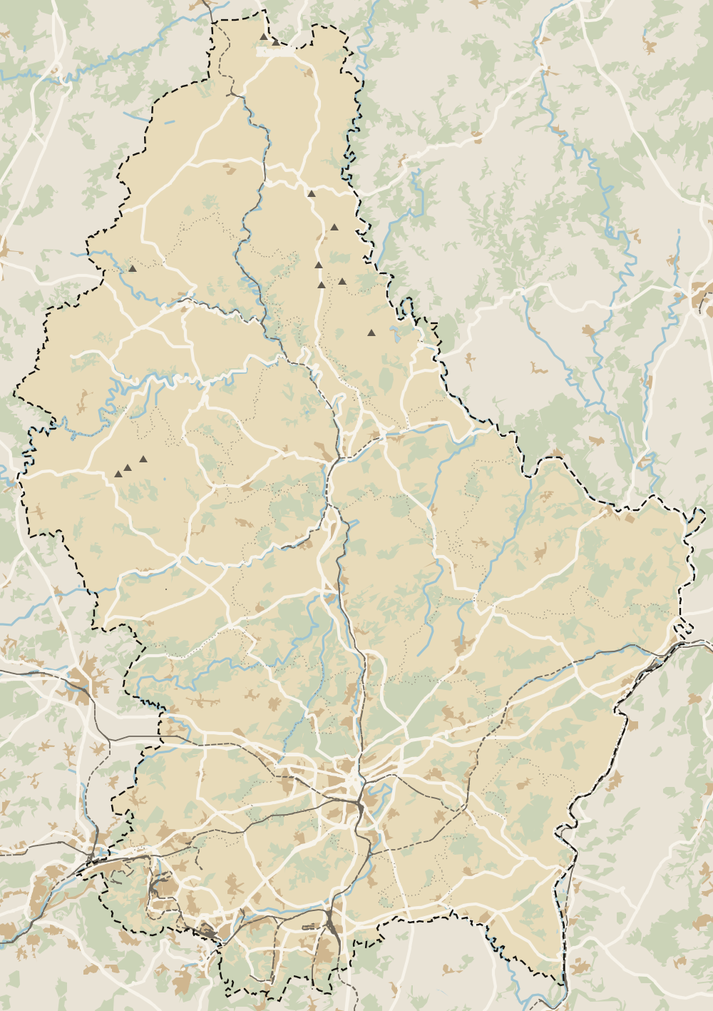 1Kirchberg 2Kirchberg funicular 3Mudam 4Philharmonie 5Dräi Eechelen Museum 6Red Bridge
 Map data © OpenStreetMap contributors (ODbL)
- 1KirchbergLuxembourg City's European and business district
- 2Kirchberg funicularThe country's only funicular, in the capital
- 3MudamGrand Duke Jean Museum of Modern Art, Kirchberg
- 4PhilharmonieGrand Duchess Joséphine-Charlotte Concert Hall, Kirchberg
- 5Dräi Eechelen MuseumHistory museum in Fort Thüngen, Kirchberg
- 6Red BridgeGrand Duchess Charlotte Bridge, centre to Kirchberg
0 of 425 Luxembourg guides
Your next stamp
- Bridges
- Adolphe Bridge
- Pfaffenthal
- Luxembourg fortress
- Grand Ducal Palace
- Place de Clairefontaine
- Kirchberg funicular
- A Possen Museum
- American Cemetery
- Ansembourg
- Ansembourg Castles
- Asselborn
- Bascharage
- Beaufort castles
- Belval
- Belval blast furnaces
- Berg Castle
- Bernard-Massard cellars
- Bourglinster Castle
- Bourscheid Castle
- Brandenbourg
- Brandenbourg Castle
- Caves St Martin
- Christmas
- Clervaux Castle
- Echternach
- Echternach Abbey
- Ehnen
- Ehnen Wine Museum
- Esch-sur-Alzette
- Esch-sur-Sûre Castle
- European Museum Schengen
- Fond-de-Gras
- General Patton Museum
- German war cemetery
- Haff Réimech
- Hohllay
- Hollenfels Castle
- Hosingen
- Kautenbach
- Kneiff
- Koerich Castle
- Larochette Castle
- Lasauvage
- Mersch Castle
- Military History Museum
- Moersdorf
- Mondorf Domaine Thermal
- Munsbach Castle
- National Mining Museum
- Parc Merveilleux
- Park Sënnesräich
- Places to visit
- Remich
- Rindschleiden
- Schiessentümpel
- Septfontaines Castle
- Slate Museum
- Stolzembourg
- Tudor Museum
- Useldange Castle
- Valley of the Seven Castles
- Vianden
- Vianden Castle
- Ville Haute
- Wasserbillig Aquarium
- Weiswampach lakes
- Wiltz Castle
- Ahn
- Berdorf
- Bourscheid-Plage
- Butterfly garden
- Clervaux
- Differdange
- Echternach lake
- Grevenmacher
- Heringer Millen
- Hollenfels
- Luxembourg City
- Luxembourg Science Center
- Meysembourg Castle
- Mullerthal
- National Day
- National Resistance Museum
- Perekop
- Remerschen
- Schoenfels Castle
- The Family of Man
- Things to do
- Upper Sûre Lake
- Vianden chairlift
- Wasserbillig
- Clervaux Abbey
- Echternach Roman villa
- Éislek
- Insenborn
- Kallektuffquell
- Machtum
- Most beautiful places
- Our Nature Park
- Pétange
- Pettingen Castle
- Schueberfouer
- Schwebsingen
- Victor Hugo House
- Waldbillig
- Dudelange
- Kuelscheier
- Lultzhausen
- Moselle Valley
- Octave
- Prettiest villages
- Sanem
- Schengen
- Wellenstein
- Wiltz
- Wolfsschlucht
- Beaufort
- Bech-Kleinmacher
- Éimaischen
- Gaalgebierg
- Guttland
- Marnach
- Mondorf-les-Bains
- Putscheid
- Schifflange
- UNESCO World Heritage
- Carnival
- Consdorf
- Ellergronn
- Käerjeng
- Kayl
- Map
- Minett
- Munshausen
- Tandel
- Bech
- Buergbrennen
- Esch-sur-Sûre
- Rumelange
- Where is Luxembourg
- Is it a country?
- Lac de la Haute-Sûre (commune)
- Rosport-Mompach
- Wormeldange
- Larochette
- Mondercange
- Regions
- Bettembourg
- Bock Casemates
- Cantons
- Dancing procession
- Diekirch
- Fischbach
- Garnich
- Mersch
- Moselle wine route
- Ettelbruck
- Grund
- Heffingen
- Kehlen
- Lintgen
- Moselle river cruises
- Pétrusse Casemates
- Towns and villages
- Chemin de la Corniche
- Erpeldange-sur-Sûre
- Junglinster
- Kopstal
- Lorentzweiler
- Nommern
- Population
- Bissen
- Clausen
- Koerich
- Schieren
- Size
- Vallée de l'Ernz
- Feulen
- Kirchberg
- Languages
- Notre-Dame Cathedral
- Reisdorf
- Steinfort
- Bettendorf
- Habscht
- St Michael's Church
- Helperknapp
- Luxembourgish
- Place Guillaume II
- Name
- Place d'Armes
- History
- Place de la Constitution
- Grand Duke
- Colmar-Berg
- Flaxweiler
- Gare
- Hamm
- Mamer
- Mertert
- Minett Trail
- Mullerthal Trail
- Neumünster Abbey
- Parc Hosingen
- Pfaffenthal lift
- Political system
- Redange
- The Passerelle
- Wine festivals
- Winseler
- Beckerich
- Biwer
- EU institutions
- Goesdorf
- Limpertsberg
- Mudam
- Natur Musée
- Pulvermühl
- Stadtbredimus
- Troisvierges
- Wenzel walk
- Bonnevoie
- Bous-Waldbredimus
- Ell
- Flag
- Kiischpelt
- Manternach
- Philharmonie
- Vauban circuit
- Weiswampach
- Betzdorf
- Boulaide
- Dräi Eechelen Museum
- Facts
- Hollerich
- Lenningen
- Useldange
- Wincrange
- Bourscheid
- Dalheim
- Gasperich
- Public holidays
- Saeul
- Belair
- Second World War
- Vichten
- Battle of the Bulge
- Merl
- Préizerdaul
- Cents
- EU and Schengen
- Groussbus-Wal
- Entry requirements
- Neudorf
- Rambrouch
- Currency and payments
- Mertzig
- Weimerskirch
- Beggen
- Escapardenne
- How to get there
- International March of Diekirch
- MNHA (National Museum)
- Rock climbing
- Sandweiler
- Eich
- Flights
- Golf
- Hesperange
- Lëtzebuerg City Museum
- Canoeing and kayaking
- Dommeldange
- Luxembourg airport
- Strassen
- Villa Vauban
- Airport to city centre
- Bertrange
- Casino Luxembourg
- Mühlenbach
- Swimming pools
- From Brussels
- Pétrusse Valley
- Rollingergrund
- Walferdange
- Cessange
- Day trip from Brussels
- Municipal Park
- Steinsel
- Free walking tours
- From Paris
- Niederanven
- From Frankfurt
- Schuttrange
- Sightseeing train and bus
- By train
- Contern
- By coach
- Weiler-la-Tour
- Driving
- Luxembourg in one day
- Pretzel Sunday
- Rham Plateau
- Tour de Luxembourg
- Candlemas (Liichtmëssdag)
- Car hire
- Luxembourg in two days
- Saint-Esprit Plateau
- Luxembourg in three days
- Melusina statue
- Parking
- St Nicholas Day (Kleeschen)
- Fête de la Musique
- Luxembourg in four days
- Museums in Luxembourg
- Petrol
- A week in Luxembourg
- Getting around
- Luxembourg Marathon
- Tram and Bus Museum
- Free public transport
- Parks in Luxembourg City
- Road trip
- Belgium and Luxembourg
- Tram
- Buses
- Viewpoints
- Trains
- Luxembourg station
- Cycling
- LuxembourgPass
- Prices and budget
- On a budget
- Free things to do
- Mobile and roaming
- Healthcare
- Safety
- Scams
- Tourist information
- Packing list
- Swimming lakes
- With a dog
- Markets
- Tipping
- Shopping
- What to buy
- Shopping centres
- With kids
- For couples
- Playgrounds
- Adventure parks
- Nightlife
- Castles
- Theatres and concert venues
- Leudelange
- Nature parks
- Where to stay
- City-centre hotels
- Hiking
- Nature reserves
- Reckange-sur-Mess
- Hotels near the station
- Roeser
- Frisange
- Hotels in Kirchberg
- Airport hotels
- Dippach
- Hotels in Vianden
- Hotels in Echternach
- Hotels in Clervaux
- Hotels in Mondorf-les-Bains
- Hotels in Esch-sur-Alzette
- Hotels on the Moselle
- Mullerthal hotels
- Upper Sûre lake hotels
- Hotels in Diekirch and Ettelbruck
- Cheap hotels
- Luxury hotels
- Boutique hotels
- Spa hotels
- Family hotels
- Apartments
- Weather
- Youth hostels
- Best time to visit
- Campsites
- Holiday cottages
- In winter
- Castle hotels
- In spring
- Day trips
- In summer
- Around Luxembourg
- In autumn
- Ice skating
- Trier day trip
- Metz day trip
- Arlon day trip
- In January
- In February
- In March
- In April
- In May
- In June
- In July
- In August
- In September
- Food
- In October
- In November
- Where to eat
- In December
- Michelin restaurants
- Cheap eats
- Judd mat Gaardebounen
- Bouneschlupp
- Gromperekichelcher
- Kniddelen
- Quetschentaart
- Rieslingspaschtéit
- Events
- Wine
- Crémant
- Beer
Frequently asked questions
What is the Red Bridge in Luxembourg called?
Its official name is the Grand Duchess Charlotte Bridge, Pont Grande-Duchesse Charlotte in French, after the sovereign who opened it in 1966. In Luxembourgish it's Rout Bréck, the red bridge, after its colour.
How long is the Red Bridge?
355 metres long, 25 metres wide and 74 metres above the Alzette valley, weighing more than 4,900 tonnes, according to the tourist office. The government portal calls it the capital's largest bridge.
What does the Red Bridge connect?
Luxembourg City centre with the Kirchberg plateau, home to the EU institutions, Mudam and the Philharmonie. It passes high over the Pfaffenthal district.
Why was the Red Bridge built?
To open up the Kirchberg plateau and link it to the city. Luxembourg was the provisional seat of the European Coal and Steel Community and wanted to become its permanent home, so the government launched an international competition in 1957.
Can you walk across the Red Bridge?
Yes. The tourist office describes it as a bridge you cross by car, tram, bike or on foot. It's free, and the view over Pfaffenthal and the upper town is one of the best in the capital.
When did the tram start crossing the Red Bridge?
The first tram crossed on the night of 21 May 2018, according to luxembourg.public.lu, after works between 2015 and 2018 that widened the cantilevers and strengthened the deck.
By
Tourism graduate with a master’s in Tourism Management and Planning from the University of Málaga, who has travelled across Europe. He writes every guide from official sources and his own judgement.
Published on . Facts checked on .
Sources
Some links in this guide are affiliate links: if you book through them, the site earns a commission at no extra cost to you. Affiliate disclosure
Photos: Cayambe (CC BY-SA 3.0); Matti Blume (CC BY-SA 4.0); Procrastineur49 (CC0), via Wikimedia Commons.