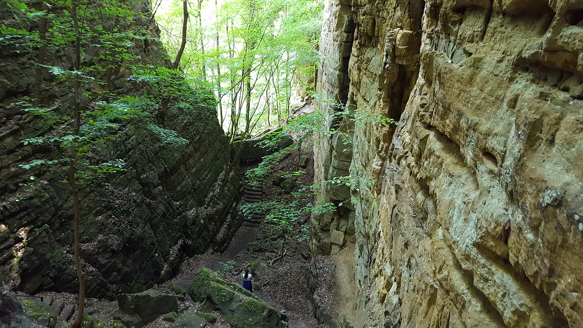
Rock gorge in the Mullerthal
The Wolfsschlucht, a sandstone cleft on Echternach's doorstep
The Wolfsschlucht (Wollefsschlucht, the Wolf's Gorge) is a Luxembourg sandstone canyon about 40 m deep just outside Echternach and one of the Mëllerdall geopark's geosites. It was formed by a huge landslip, has Cleopatra's Needle standing at its entrance and is crossed by Route 2 of the Mullerthal Trail. It's free to visit.
In 30 seconds
Full read: 3 min
- The Wolfsschlucht is a sandstone gorge about 40 m deep just outside Echternach.
- It formed when sandstone blocks slid over a layer of clay marl in a huge landslip.
- Route 2 of the Mullerthal Trail runs through it, and it's free to visit.
- Cleopatra's Needle, a tall rock spire, stands at the entrance.
It's the best short walk you can do from Echternach, and I'd go first thing, when the light slants into the cleft. If you want more, carry on along Route 2 to Berdorf and take the bus back.

Before you go
What I would keep in mind
-
01 Most beautiful
Cleopatra's Needle
A tall point of rock stands at the mouth of the gorge, which visitluxembourg calls Cleopatra's Needle. It's the photo everyone takes.
-
02 My tip
Park at Trooskneppchen
The nearest car park is at Trooskneppchen, about 900 m away. The closest bus stop, Echternach Ermesinde, is 1.2 km off.
-
03 Getting there
Keep going to Berdorf
Route 2's stretch from Echternach to Berdorf is 6.8 km, taking in the gorge, the rock labyrinth, the Perekop and the Hohllay. The trail website puts it at 2 to 2.5 hours.
Berdorf -
04 To save money
No ticket, no opening hours
It's a woodland path, so there's nothing to pay. All you need is boots with decent grip, as wet sandstone is slippery.
Mullerthal Trail
What I would book
If you’ve only got one morning in Echternach and want to see why this region is nicknamed Little Switzerland, come here. The Wolfsschlucht is on the edge of town, and in under an hour on foot you swap whitewashed houses for a corridor between two mossy sandstone walls, so tall the sky shrinks to a stripe.
A gorge that water didn’t carve
The first surprise is that no river cut it. The Mëllerdall geopark explains that it was born from a large landslip. The Sûre was eating away at the foot of the valley while sandstone debris piled up above, and groundwater acted as a lubricant on the layer of clay marl underneath. Blocks at the edge of the Érelchen plateau tilted, stayed leaning or toppled over, and the gorge opened between them.
The walls are Luxembourg sandstone with the layers clearly visible. The government portal and the geopark give the gorge a depth of 40 m, while visitluxembourg talks of walls up to 50 m high. According to the geopark, the slipped material went far enough to push the course of the Sûre northwards. In the scree on the slope grows hart’s-tongue fern, which the park singles out on its page.
One of the geopark’s 22 geosites
The Mëllerdall geopark, which UNESCO recognised in April 2022, has 22 geosites, and the government portal picks out the Wolfsschlucht as one of the most impressive. The park notes that on the 1979 topographic map you can still make out the landslip zone from the irregular contour lines, which follow the bulges the slope left as it moved. On the ground you see towers of rock shifted in different directions and big blocks broken away from the wall. If you want to understand how the landscape of the Mullerthal region was made, this is all the lesson you need.
Once your dates are set, check which hotels are still free in Echternach before prices climb.
How do you get there from Echternach?
On foot, which is how it’s best done. Route 2 of the Mullerthal Trail leaves the market square in Echternach, crosses the pedestrian zone and climbs to the Troosskneppchen viewpoint, with the town and basilica below. From there the path enters the woods and reaches the gorge. The same path also carries local route E1, 13.5 km, the Auto-Pédestre circuit, the Sentier National Maurice Cosyn, the Eifel-Ardennes trail and Felsenweg 1 of the Naturwanderpark delux.
By car, the nearest car park is Trooskneppchen, about 900 m away. By bus, the Echternach Ermesinde stop is 1.2 km off. I wouldn’t drive from the centre, because the walk in is half the fun.
Cleopatra’s Needle and the black dog
At the mouth of the gorge stands a tall spike of rock known as Cleopatra’s Needle. The name Wolfsschlucht, visitluxembourg says, was coined in 1881 by a walker from Trier. Before that, in the Echternach dialect, it was the Däiwelsschoart, the Devil’s Claw. The trail website prefers the wolves, which sheltered here when the region was dense, trackless forest.
Local legend tells of treasure hidden in the cleft, guarded by a black dog with glittering eyes, who is really a count that sold his soul to the devil for more gold. A child who throws a blessed rosary into the crack would free him and win the treasure. Two Echternach boys, the story goes, spotted the chest, ran off for a rosary and found it gone when they came back.
Once your dates are set, check which hotels are still free in Echternach before prices climb.
What comes next
The Wolfsschlucht is the first big stop on Route 2, and most people treat it as an out-and-back from town. I’d keep going. The stretch to Berdorf is 6.8 km and, according to the trail website, threads a labyrinth of boulders, follows the Aesbach stream, passes the Perekop rock with its iron ladders, crosses the Chipkapass on a footbridge and reaches the Hohllay cave and the amphitheatre. Allow two to two and a half hours, and there’s a free bus back from Berdorf, since all public transport in Luxembourg is free.
Before you go
There’s no ticket or opening time, but there is damp rock and some natural steps, so boots with a good sole are worth it. In the hunting season it’s worth looking at geoportail.lu, which maps hunting grounds, as the Mullerthal Trail website advises. And in high summer I’d set off first thing, ahead of the heat and the groups.
If you would rather have a local show you round, book a guided tour in Wolfsschlucht and choose by the reviews.
A car frees you from timetables: search car hire in Luxembourg on DiscoverCars and compare companies.
So you do not pay over the odds, look at trains, coaches and flights to Luxembourg on Omio and pick the one that suits you.
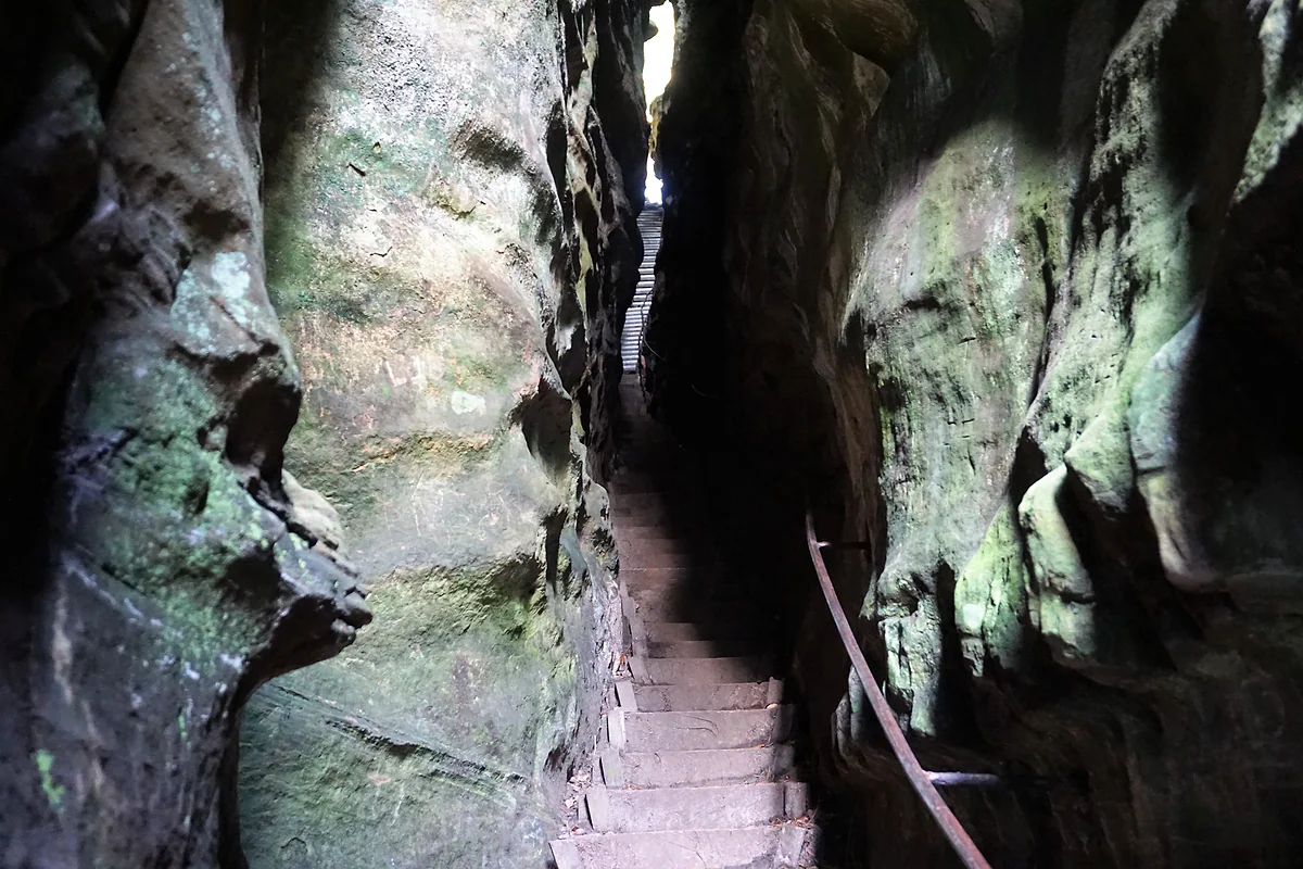
The staircase climbing through the narrow cleft of the Perekop at Berdorf, between greenish sandstone walls
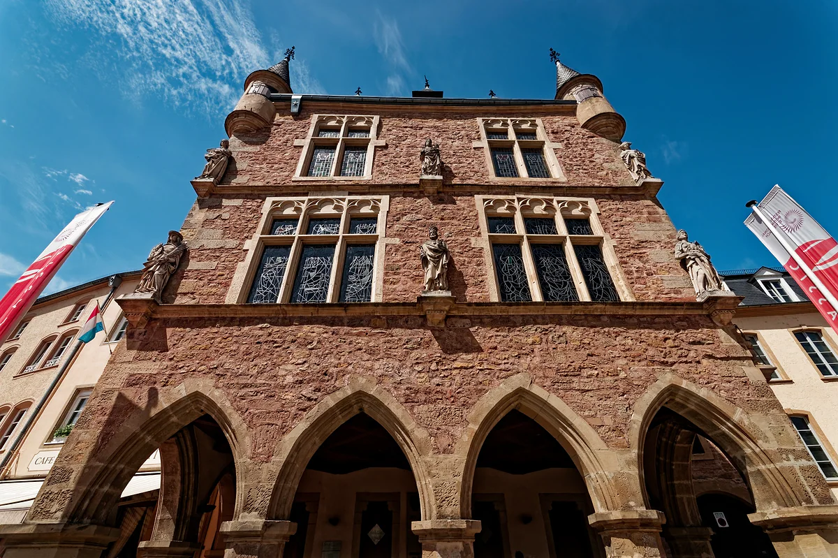
The Dënzelt, the old Gothic courthouse on Echternach's market square, with arcades, statues and turrets
Getting to the Wolfsschlucht
| From | How | Distance |
|---|---|---|
| Echternach market square | On foot via Route 2 and the Troosskneppchen viewpoint | Part of the 6.8 km stretch to Berdorf |
| Trooskneppchen car park | On foot | About 900 m |
| Echternach Ermesinde bus stop | On foot | About 1.2 km |
visitluxembourg.com and mullerthal-trail.lu, checked on 29-09-2026. Local path E1 (13.5 km) and Felsenweg 1 of the Naturwanderpark delux also run through it.
Test yourself
True or false?
0/3 Pick before you peek.
-
A river carved out the Wolfsschlucht.
See the answer
False. The geopark says it came from a huge landslip, with sandstone blocks sliding over clay marl lubricated by groundwater.
-
Before 1881 the gorge had a different name.
See the answer
True. In the Echternach dialect it was Däiwelsschoart, the Devil's Claw, according to visitluxembourg.
-
You pay to enter the Wolfsschlucht.
See the answer
False. It's a natural passage in the woods on the Mullerthal Trail and several local paths, with no ticket or opening hours.
- Depth of the gorge
- 40 m
- Year it got its present name
- 1881
- Echternach to Berdorf stretch
- 6.8 km
Map
Where Wolfsschlucht is
The thick dashed line is the border with Belgium, France and Germany, and the fine ones divide the twelve cantons. The Éislek lies to the north and the Moselle to the east. Every number opens its guide.
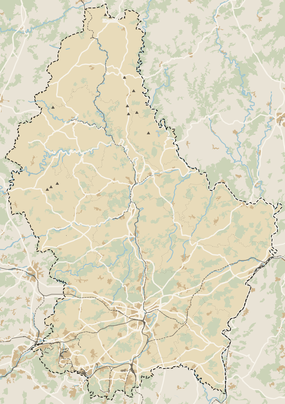 1Echternach 2Echternach Abbey 3Echternach lake 4Echternach Roman villa 5Wolfsschlucht
 Map data © OpenStreetMap contributors (ODbL)
0 of 425 Luxembourg guides
Your next stamp
- Mullerthal
- Kallektuffquell
- Mullerthal Trail
- Kuelscheier
- Schiessentümpel
- Berdorf
- Perekop
- Consdorf
- A Possen Museum
- American Cemetery
- Ansembourg
- Ansembourg Castles
- Asselborn
- Bascharage
- Beaufort castles
- Belval
- Belval blast furnaces
- Berg Castle
- Bernard-Massard cellars
- Bourglinster Castle
- Bourscheid Castle
- Brandenbourg
- Brandenbourg Castle
- Caves St Martin
- Christmas
- Clervaux Castle
- Echternach
- Echternach Abbey
- Ehnen
- Ehnen Wine Museum
- Esch-sur-Alzette
- Esch-sur-Sûre Castle
- European Museum Schengen
- Fond-de-Gras
- General Patton Museum
- German war cemetery
- Haff Réimech
- Hohllay
- Hollenfels Castle
- Hosingen
- Kautenbach
- Kneiff
- Koerich Castle
- Larochette Castle
- Lasauvage
- Mersch Castle
- Military History Museum
- Moersdorf
- Mondorf Domaine Thermal
- Munsbach Castle
- National Mining Museum
- Parc Merveilleux
- Park Sënnesräich
- Places to visit
- Remich
- Rindschleiden
- Septfontaines Castle
- Slate Museum
- Stolzembourg
- Tudor Museum
- Useldange Castle
- Valley of the Seven Castles
- Vianden
- Vianden Castle
- Ville Haute
- Wasserbillig Aquarium
- Weiswampach lakes
- Wiltz Castle
- Ahn
- Bourscheid-Plage
- Butterfly garden
- Clervaux
- Differdange
- Echternach lake
- Grevenmacher
- Heringer Millen
- Hollenfels
- Luxembourg City
- Luxembourg Science Center
- Meysembourg Castle
- National Day
- National Resistance Museum
- Remerschen
- Schoenfels Castle
- The Family of Man
- Things to do
- Upper Sûre Lake
- Vianden chairlift
- Wasserbillig
- Clervaux Abbey
- Echternach Roman villa
- Éislek
- Insenborn
- Machtum
- Most beautiful places
- Our Nature Park
- Pétange
- Pettingen Castle
- Schueberfouer
- Schwebsingen
- Victor Hugo House
- Waldbillig
- Dudelange
- Lultzhausen
- Moselle Valley
- Octave
- Prettiest villages
- Sanem
- Schengen
- Wellenstein
- Wiltz
- Beaufort
- Bech-Kleinmacher
- Éimaischen
- Gaalgebierg
- Guttland
- Marnach
- Mondorf-les-Bains
- Putscheid
- Schifflange
- UNESCO World Heritage
- Carnival
- Ellergronn
- Käerjeng
- Kayl
- Map
- Minett
- Munshausen
- Tandel
- Bech
- Buergbrennen
- Esch-sur-Sûre
- Rumelange
- Where is Luxembourg
- Is it a country?
- Lac de la Haute-Sûre (commune)
- Rosport-Mompach
- Wormeldange
- Larochette
- Mondercange
- Regions
- Bettembourg
- Bock Casemates
- Cantons
- Dancing procession
- Diekirch
- Fischbach
- Garnich
- Mersch
- Moselle wine route
- Ettelbruck
- Grund
- Heffingen
- Kehlen
- Lintgen
- Moselle river cruises
- Pétrusse Casemates
- Towns and villages
- Chemin de la Corniche
- Erpeldange-sur-Sûre
- Junglinster
- Kopstal
- Lorentzweiler
- Nommern
- Pfaffenthal
- Population
- Bissen
- Clausen
- Grand Ducal Palace
- Koerich
- Schieren
- Size
- Vallée de l'Ernz
- Feulen
- Kirchberg
- Languages
- Notre-Dame Cathedral
- Reisdorf
- Steinfort
- Bettendorf
- Habscht
- St Michael's Church
- Helperknapp
- Luxembourgish
- Place Guillaume II
- Name
- Place d'Armes
- History
- Place de la Constitution
- Grand Duke
- Colmar-Berg
- Flaxweiler
- Gare
- Hamm
- Kirchberg funicular
- Luxembourg fortress
- Mamer
- Mertert
- Minett Trail
- Neumünster Abbey
- Parc Hosingen
- Pfaffenthal lift
- Political system
- Redange
- The Passerelle
- Wine festivals
- Winseler
- Beckerich
- Biwer
- EU institutions
- Goesdorf
- Limpertsberg
- Mudam
- Natur Musée
- Pulvermühl
- Stadtbredimus
- Troisvierges
- Wenzel walk
- Bonnevoie
- Bous-Waldbredimus
- Ell
- Flag
- Kiischpelt
- Manternach
- Philharmonie
- Vauban circuit
- Weiswampach
- Betzdorf
- Boulaide
- Dräi Eechelen Museum
- Facts
- Hollerich
- Lenningen
- Useldange
- Wincrange
- Bourscheid
- Dalheim
- Gasperich
- Public holidays
- Red Bridge
- Saeul
- Belair
- Second World War
- Vichten
- Battle of the Bulge
- Merl
- Préizerdaul
- Cents
- EU and Schengen
- Groussbus-Wal
- Entry requirements
- Neudorf
- Rambrouch
- Currency and payments
- Mertzig
- Weimerskirch
- Adolphe Bridge
- Beggen
- Escapardenne
- How to get there
- International March of Diekirch
- MNHA (National Museum)
- Rock climbing
- Sandweiler
- Bridges
- Eich
- Flights
- Golf
- Hesperange
- Lëtzebuerg City Museum
- Canoeing and kayaking
- Dommeldange
- Luxembourg airport
- Strassen
- Villa Vauban
- Airport to city centre
- Bertrange
- Casino Luxembourg
- Mühlenbach
- Swimming pools
- From Brussels
- Pétrusse Valley
- Rollingergrund
- Walferdange
- Cessange
- Day trip from Brussels
- Municipal Park
- Steinsel
- Free walking tours
- From Paris
- Niederanven
- From Frankfurt
- Schuttrange
- Sightseeing train and bus
- By train
- Contern
- By coach
- Weiler-la-Tour
- Driving
- Luxembourg in one day
- Pretzel Sunday
- Rham Plateau
- Tour de Luxembourg
- Candlemas (Liichtmëssdag)
- Car hire
- Luxembourg in two days
- Saint-Esprit Plateau
- Luxembourg in three days
- Melusina statue
- Parking
- St Nicholas Day (Kleeschen)
- Fête de la Musique
- Luxembourg in four days
- Museums in Luxembourg
- Petrol
- Place de Clairefontaine
- A week in Luxembourg
- Getting around
- Luxembourg Marathon
- Tram and Bus Museum
- Free public transport
- Parks in Luxembourg City
- Road trip
- Belgium and Luxembourg
- Tram
- Buses
- Viewpoints
- Trains
- Luxembourg station
- Cycling
- LuxembourgPass
- Prices and budget
- On a budget
- Free things to do
- Mobile and roaming
- Healthcare
- Safety
- Scams
- Tourist information
- Packing list
- Swimming lakes
- With a dog
- Markets
- Tipping
- Shopping
- What to buy
- Shopping centres
- With kids
- For couples
- Playgrounds
- Adventure parks
- Nightlife
- Castles
- Theatres and concert venues
- Leudelange
- Nature parks
- Where to stay
- City-centre hotels
- Hiking
- Nature reserves
- Reckange-sur-Mess
- Hotels near the station
- Roeser
- Frisange
- Hotels in Kirchberg
- Airport hotels
- Dippach
- Hotels in Vianden
- Hotels in Echternach
- Hotels in Clervaux
- Hotels in Mondorf-les-Bains
- Hotels in Esch-sur-Alzette
- Hotels on the Moselle
- Mullerthal hotels
- Upper Sûre lake hotels
- Hotels in Diekirch and Ettelbruck
- Cheap hotels
- Luxury hotels
- Boutique hotels
- Spa hotels
- Family hotels
- Apartments
- Weather
- Youth hostels
- Best time to visit
- Campsites
- Holiday cottages
- In winter
- Castle hotels
- In spring
- Day trips
- In summer
- Around Luxembourg
- In autumn
- Ice skating
- Trier day trip
- Metz day trip
- Arlon day trip
- In January
- In February
- In March
- In April
- In May
- In June
- In July
- In August
- In September
- Food
- In October
- In November
- Where to eat
- In December
- Michelin restaurants
- Cheap eats
- Judd mat Gaardebounen
- Bouneschlupp
- Gromperekichelcher
- Kniddelen
- Quetschentaart
- Rieslingspaschtéit
- Events
- Wine
- Crémant
- Beer
Frequently asked questions
What is the Wolfsschlucht?
A narrow gorge of Luxembourg sandstone just outside Echternach, about 40 m deep. The name means wolf's gorge, and it's one of the best-known geosites of the Mëllerdall geopark.
How do you get to the Wolfsschlucht from Echternach?
On foot along Route 2 of the Mullerthal Trail, which leaves from the market square and climbs to the Troosskneppchen viewpoint. By car, the Trooskneppchen car park is about 900 m away.
How long does the Wolfsschlucht walk take?
From central Echternach and back, allow a couple of unhurried hours. If you carry on to Berdorf, the full 6.8 km stretch takes 2 to 2.5 hours.
Why is it called the Wolf's Gorge?
The trail website says wolves once sheltered there. visitluxembourg adds that a walker from Trier gave it the name in 1881; before that it was Däiwelsschoart, the Devil's Claw.
How deep is the Wolfsschlucht?
The government portal and the geopark give a depth of 40 m. visitluxembourg says the walls reach up to 50 m high.
By
Tourism graduate with a master’s in Tourism Management and Planning from the University of Málaga, who has travelled across Europe. He writes every guide from official sources and his own judgement.
Published on . Facts checked on .
Sources
Some links in this guide are affiliate links: if you book through them, the site earns a commission at no extra cost to you. Affiliate disclosure
Photos: Steffen 962 (CC BY-SA 4.0); GilPe (CC BY-SA 4.0); Txllxt TxllxT (CC BY-SA 4.0), via Wikimedia Commons.