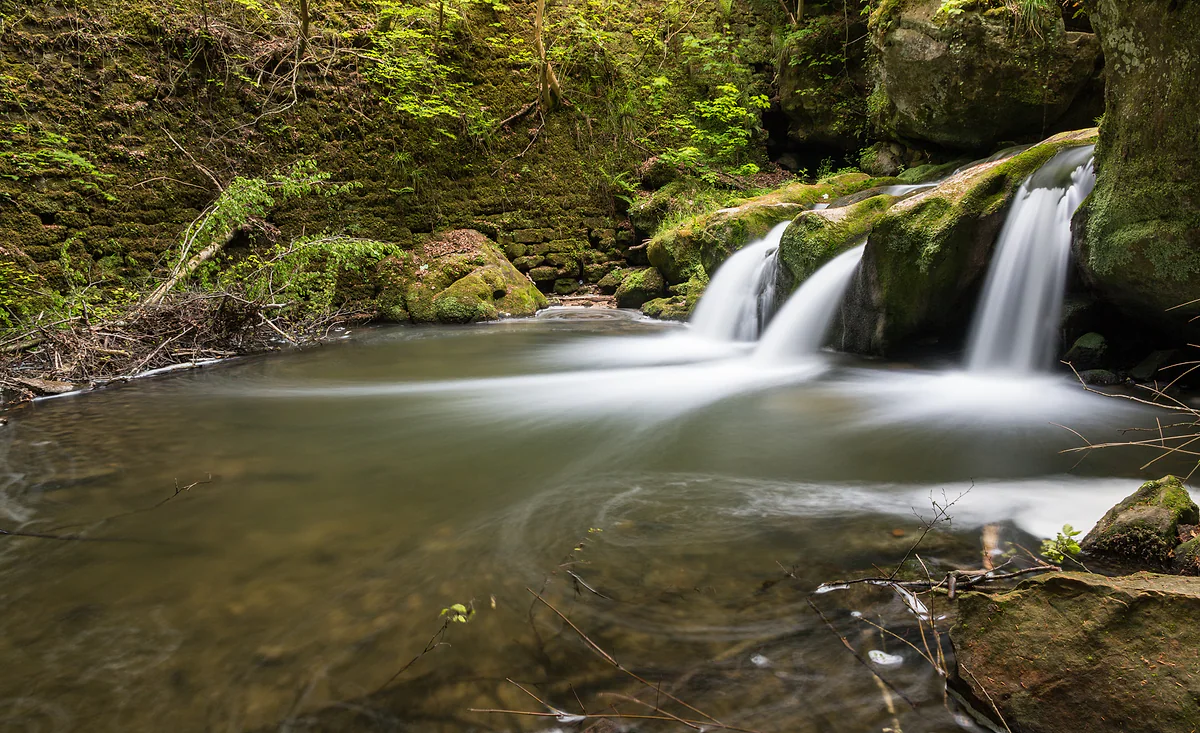
Waterfall at Müllerthal, Waldbillig
The Schiessentümpel, the little waterfall that became an emblem
The Schiessentümpel (Schéissendëmpel) is a waterfall on the Black Ernz with an 1879 sandstone bridge, next to the hamlet of Müllerthal in the commune of Waldbillig. It's the symbol of Luxembourg's Mullerthal region and, according to the regional tourist office, its most photographed spot. Routes 2 and 3 of the Mullerthal Trail pass it, a car park is 500 m away and it's free.
In 30 seconds
Full read: 3 min
- The Schiessentümpel is a waterfall on the Black Ernz with an 1879 sandstone bridge.
- It's by the hamlet of Müllerthal, on the boundary between Waldbillig and Consdorf.
- It's the Mullerthal's symbol and most photographed spot, says the regional office.
- Routes 2 and 3 of the Mullerthal Trail pass it, and there's no entry fee.
It's small, and it helps to know that so you're not disappointed. What makes it is the whole scene, bridge, little falls and moss. I'd walk in from the Heringer Millen first thing, before the car park fills.

Before you go
What I would keep in mind
-
01 Most beautiful
A bridge built in four months
Mason Jean-Pierre Prommenschenkel of Christnach built it between 20 March and 27 July 1879, using lime and sandstone. The wooden railing came later.
-
02 My tip
Two ways in on foot
From the Heringer Millen along local circuits W6 and W7, about a kilometre, or from the big car park on the CR 121, some 500 m away.
Heringer Millen -
03 Most beautiful
The staircase that seems to float
Beyond the bridge, the stage towards Blumenthal climbs a timber staircase of about 90 m, built from local forest wood processed within 20 km.
Mullerthal Trail -
04 To save money
Free, and on the bus
There's no entry fee. The Schiessentümpel (Parking) bus stop is about 500 m away and the Müllerthal stops about a kilometre, and buses are free across Luxembourg.
What I would book
Some places are famous for being big and others for being photogenic. The Schiessentümpel is the second kind. It isn’t a mighty cascade; it’s a series of small drops on the Black Ernz between mossy rocks and ferns, with a little stone bridge on top. But the combination works so well that the regional tourist office calls it the most photographed place in the Mullerthal, and visitluxembourg calls it the region’s symbol.
A bridge that goes nowhere in particular
The odd thing about the bridge is that it isn’t really for anything, in the best sense. visitluxembourg notes that, unlike other big bridges, it has no transport role in Luxembourg, and yet it’s the emblem of the region. It was built in just four months, between 20 March and 27 July 1879, by a mason from Christnach, Jean-Pierre Prommenschenkel, in lime and sandstone. The wooden railing was added later and has been restored several times.
The bridge, or the middle of the river, marks the boundary between the communes of Waldbillig and Consdorf. So technically the Schiessentümpel is in both.
From wolf country to a tourist draw
The story visitluxembourg tells about why the bridge was built is really the story of tourism here. Before 1879 the area was hard to reach and dangerous, like a jungle, and people called it the land of wolves. In 1814 Joseph von Görres of Koblenz, who wrote for the Rheinischer Merkur, visited, and the Brussels journalist Victor Joly included it in a travel notebook. Those accounts made people in neighbouring countries curious, and the state improved the roads and railway. Grundhof got a station in 1873, work on the road from Grundhof to Müllerthal began in 1877 and the road on to Breitler was finished in 1881. The bridge arrived in the middle of all that.
If you are staying the night, see the best hotel deals in Mullerthal, Waldbillig for your dates: the well-placed rooms go fast.
How do you get there?
There are two ways in on foot. From the Heringer Millen in the hamlet of Müllerthal, along local circuits W6 and W7, about a kilometre. Or from the big car park on the CR 121, between Müllerthal and the Breidweiler bridge junction, about 500 m away, either along the road or on Route 3 of the Trail heading for Müllerthal. By bus, free throughout Luxembourg, the Schiessentümpel (Parking) stop is about 500 m away, and the Mullerthal, Möllerdall and Mullerthal, Cascades stops about a kilometre.
I’d walk in from the Heringer Millen. It’s a short riverside stroll, and the waterfall appears at the end, which is the best way to see it.
On the Mullerthal Trail
Routes 2 and 3 of the Mullerthal Trail both pass here. In the operator’s six-stage plan, the waterfall opens two days. On the Müllerthal to Larochette stage, the path crosses the Black Ernz at the bridge, narrows above the stream and climbs a timber staircase of about 90 m that seems to float. visitluxembourg says the staircase was built from wood from the region’s forests, processed within 20 km, and that its railing reworks the cross pattern of the bridge. On the Müllerthal to Echternach stage, the path crosses the road by the falls and climbs into the woods towards the Eilebuerg and Goldfralee rocks.
If you are staying the night, see the best hotel deals in Mullerthal, Waldbillig for your dates: the well-placed rooms go fast.
Beyond the falls, the tufa spring
If you carry on along Route 3 a little further, it pays off. After the staircase the path leaves the stream, climbs through the Paaschent woods and drops down another flight of steps to the small pool of the Kallektuffquell, a tufa spring. The Trail website describes a moss-covered rock from which water gushes and collects in a basin, with different colours in every season, reached along a 700 m timber boardwalk that runs beside the Black Ernz and crosses it several times. Further on come the Marscherwald, a marshy beech wood, the Rippsmuer raised bog and the Sonnenauer, a sundial carved into the rock. For me it’s one of the quietest stretches in the region.
Worth knowing
It’s small. Arrive expecting an Alpine torrent and you’ll be let down; come for the whole picture of water, rock, moss and bridge and you won’t. It draws plenty of people, as the size of the car park suggests, so I’d come early or midweek. There’s no ticket or opening time, and during the hunting season the trail operator recommends a quick look at geoportail.lu for shoots nearby.
So you do not lose the morning at the ticket office, browse tickets and tours in Schiessentümpel on GetYourGuide.
If you would rather go at your own pace, see the car hire deals in Luxembourg: the earlier you book, the more cars are left to choose from.
Before you fix your dates, compare tickets to Luxembourg: the same journey can cost very different amounts from one day to the next.
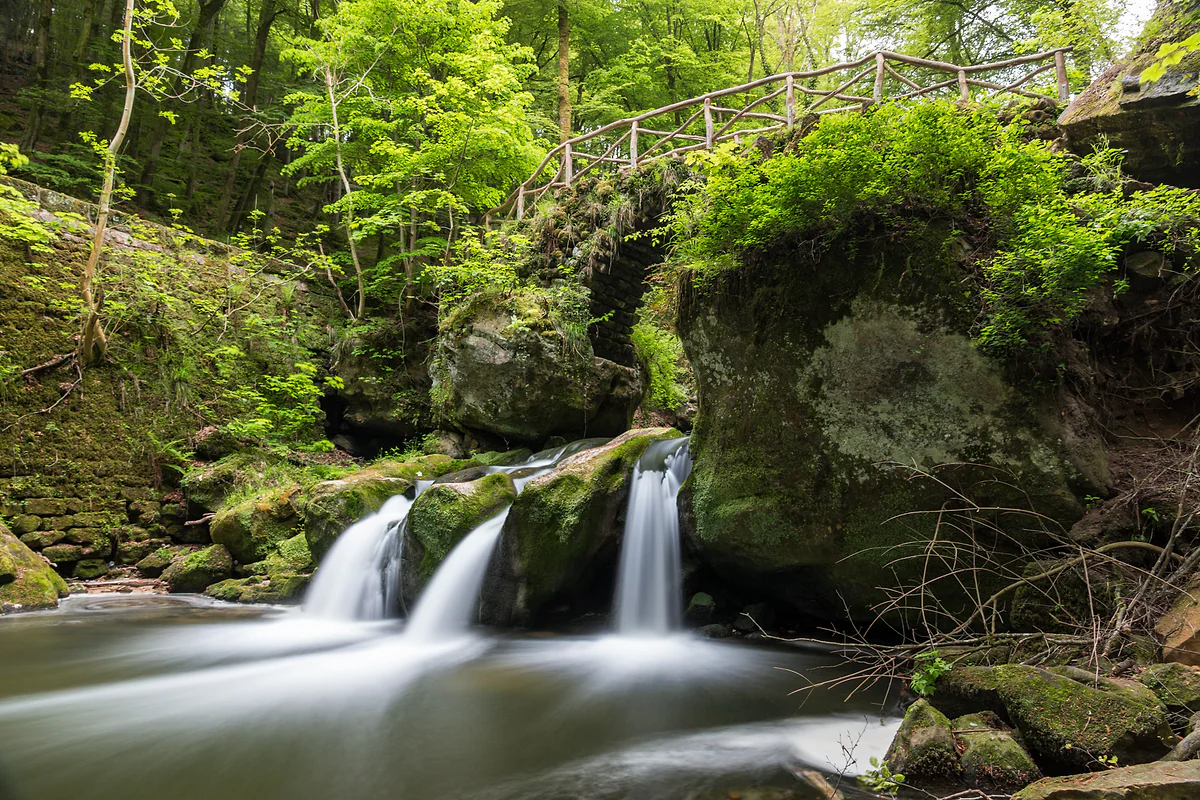
The Schiessentümpel in the Müllerthal region, with its three cascades, mossy rocks and a small stone bridge
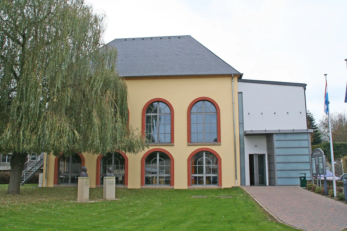
Waldbillig town hall, with large arched windows framed in red, a weeping willow and a lawn in front
Getting to the Schiessentümpel
| From | How | Distance |
|---|---|---|
| Heringer Millen (Müllerthal) | On foot via circuits W6 and W7 | About 1 km |
| CR 121 car park | On foot along the road or Trail Route 3 | About 500 m |
| Schiessentümpel (Parking) bus stop | On foot | About 500 m |
| Mullerthal, Möllerdall and Mullerthal, Cascades stops | On foot | About 1 km |
visitluxembourg.com, checked on 29-09-2026. Local circuit W7 is 10.2 km long.
Test yourself
True or false?
0/3 Pick before you peek.
-
The Schiessentümpel bridge was built to carry local traffic.
See the answer
False. visitluxembourg says it serves no transport purpose, unlike other big bridges, yet it's the symbol of the region.
-
The Schiessentümpel marks the boundary between two communes.
See the answer
True. The bridge, or the middle of the Black Ernz, divides Waldbillig from Consdorf.
-
Before 1879 the area was easy to reach.
See the answer
False. According to visitluxembourg it was hard to get to and dangerous, so much so that people called it the land of wolves.
- Year the bridge was built
- 1879
- Time it took to build
- 4 months
- Timber staircase by the falls
- 90 m
- From the CR 121 car park
- 500 m
Map
Where Schiessentümpel is
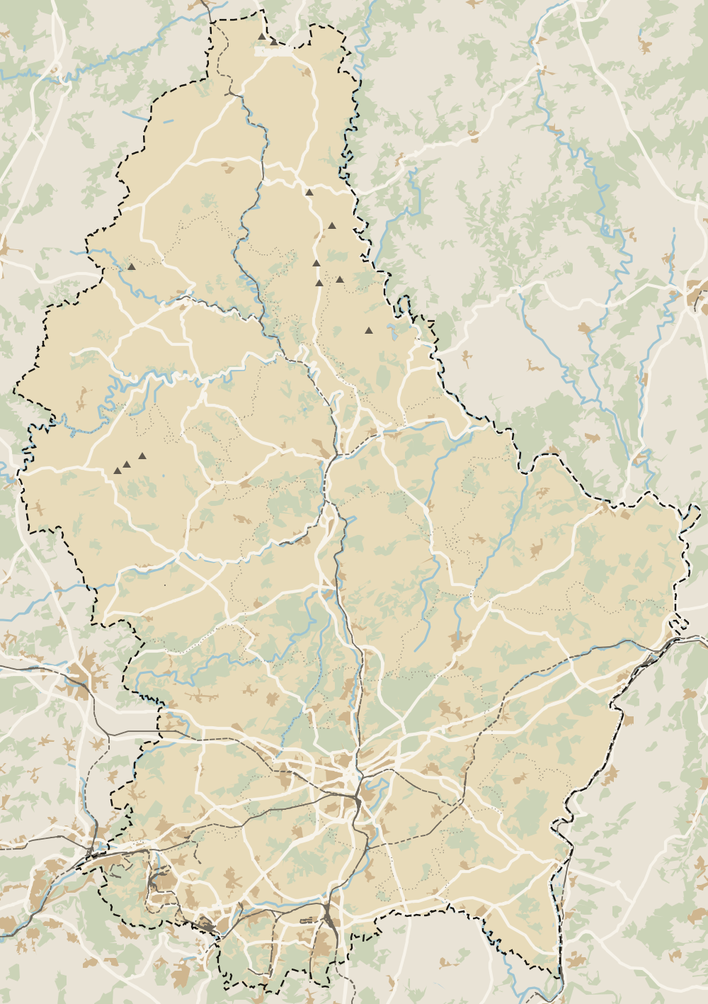
The thick dashed line is the border with Belgium, France and Germany, and the fine ones divide the twelve cantons. The Éislek lies to the north and the Moselle to the east. Every number opens its guide.
0 of 425 Luxembourg guides
Your next stamp
- Kallektuffquell
- Waldbillig
- Consdorf
- Mullerthal
- Perekop
- Vallée de l'Ernz
- Mullerthal Trail
- Berdorf
- A Possen Museum
- American Cemetery
- Ansembourg
- Ansembourg Castles
- Asselborn
- Bascharage
- Beaufort castles
- Belval
- Belval blast furnaces
- Berg Castle
- Bernard-Massard cellars
- Bourglinster Castle
- Bourscheid Castle
- Brandenbourg
- Brandenbourg Castle
- Caves St Martin
- Christmas
- Clervaux Castle
- Echternach
- Echternach Abbey
- Ehnen
- Ehnen Wine Museum
- Esch-sur-Alzette
- Esch-sur-Sûre Castle
- European Museum Schengen
- Fond-de-Gras
- General Patton Museum
- German war cemetery
- Haff Réimech
- Hohllay
- Hollenfels Castle
- Hosingen
- Kautenbach
- Kneiff
- Koerich Castle
- Larochette Castle
- Lasauvage
- Mersch Castle
- Military History Museum
- Moersdorf
- Mondorf Domaine Thermal
- Munsbach Castle
- National Mining Museum
- Parc Merveilleux
- Park Sënnesräich
- Places to visit
- Remich
- Rindschleiden
- Septfontaines Castle
- Slate Museum
- Stolzembourg
- Tudor Museum
- Useldange Castle
- Valley of the Seven Castles
- Vianden
- Vianden Castle
- Ville Haute
- Wasserbillig Aquarium
- Weiswampach lakes
- Wiltz Castle
- Ahn
- Bourscheid-Plage
- Butterfly garden
- Clervaux
- Differdange
- Echternach lake
- Grevenmacher
- Heringer Millen
- Hollenfels
- Luxembourg City
- Luxembourg Science Center
- Meysembourg Castle
- National Day
- National Resistance Museum
- Remerschen
- Schoenfels Castle
- The Family of Man
- Things to do
- Upper Sûre Lake
- Vianden chairlift
- Wasserbillig
- Clervaux Abbey
- Echternach Roman villa
- Éislek
- Insenborn
- Machtum
- Most beautiful places
- Our Nature Park
- Pétange
- Pettingen Castle
- Schueberfouer
- Schwebsingen
- Victor Hugo House
- Dudelange
- Kuelscheier
- Lultzhausen
- Moselle Valley
- Octave
- Prettiest villages
- Sanem
- Schengen
- Wellenstein
- Wiltz
- Wolfsschlucht
- Beaufort
- Bech-Kleinmacher
- Éimaischen
- Gaalgebierg
- Guttland
- Marnach
- Mondorf-les-Bains
- Putscheid
- Schifflange
- UNESCO World Heritage
- Carnival
- Ellergronn
- Käerjeng
- Kayl
- Map
- Minett
- Munshausen
- Tandel
- Bech
- Buergbrennen
- Esch-sur-Sûre
- Rumelange
- Where is Luxembourg
- Is it a country?
- Lac de la Haute-Sûre (commune)
- Rosport-Mompach
- Wormeldange
- Larochette
- Mondercange
- Regions
- Bettembourg
- Bock Casemates
- Cantons
- Dancing procession
- Diekirch
- Fischbach
- Garnich
- Mersch
- Moselle wine route
- Ettelbruck
- Grund
- Heffingen
- Kehlen
- Lintgen
- Moselle river cruises
- Pétrusse Casemates
- Towns and villages
- Chemin de la Corniche
- Erpeldange-sur-Sûre
- Junglinster
- Kopstal
- Lorentzweiler
- Nommern
- Pfaffenthal
- Population
- Bissen
- Clausen
- Grand Ducal Palace
- Koerich
- Schieren
- Size
- Feulen
- Kirchberg
- Languages
- Notre-Dame Cathedral
- Reisdorf
- Steinfort
- Bettendorf
- Habscht
- St Michael's Church
- Helperknapp
- Luxembourgish
- Place Guillaume II
- Name
- Place d'Armes
- History
- Place de la Constitution
- Grand Duke
- Colmar-Berg
- Flaxweiler
- Gare
- Hamm
- Kirchberg funicular
- Luxembourg fortress
- Mamer
- Mertert
- Minett Trail
- Neumünster Abbey
- Parc Hosingen
- Pfaffenthal lift
- Political system
- Redange
- The Passerelle
- Wine festivals
- Winseler
- Beckerich
- Biwer
- EU institutions
- Goesdorf
- Limpertsberg
- Mudam
- Natur Musée
- Pulvermühl
- Stadtbredimus
- Troisvierges
- Wenzel walk
- Bonnevoie
- Bous-Waldbredimus
- Ell
- Flag
- Kiischpelt
- Manternach
- Philharmonie
- Vauban circuit
- Weiswampach
- Betzdorf
- Boulaide
- Dräi Eechelen Museum
- Facts
- Hollerich
- Lenningen
- Useldange
- Wincrange
- Bourscheid
- Dalheim
- Gasperich
- Public holidays
- Red Bridge
- Saeul
- Belair
- Second World War
- Vichten
- Battle of the Bulge
- Merl
- Préizerdaul
- Cents
- EU and Schengen
- Groussbus-Wal
- Entry requirements
- Neudorf
- Rambrouch
- Currency and payments
- Mertzig
- Weimerskirch
- Adolphe Bridge
- Beggen
- Escapardenne
- How to get there
- International March of Diekirch
- MNHA (National Museum)
- Rock climbing
- Sandweiler
- Bridges
- Eich
- Flights
- Golf
- Hesperange
- Lëtzebuerg City Museum
- Canoeing and kayaking
- Dommeldange
- Luxembourg airport
- Strassen
- Villa Vauban
- Airport to city centre
- Bertrange
- Casino Luxembourg
- Mühlenbach
- Swimming pools
- From Brussels
- Pétrusse Valley
- Rollingergrund
- Walferdange
- Cessange
- Day trip from Brussels
- Municipal Park
- Steinsel
- Free walking tours
- From Paris
- Niederanven
- From Frankfurt
- Schuttrange
- Sightseeing train and bus
- By train
- Contern
- By coach
- Weiler-la-Tour
- Driving
- Luxembourg in one day
- Pretzel Sunday
- Rham Plateau
- Tour de Luxembourg
- Candlemas (Liichtmëssdag)
- Car hire
- Luxembourg in two days
- Saint-Esprit Plateau
- Luxembourg in three days
- Melusina statue
- Parking
- St Nicholas Day (Kleeschen)
- Fête de la Musique
- Luxembourg in four days
- Museums in Luxembourg
- Petrol
- Place de Clairefontaine
- A week in Luxembourg
- Getting around
- Luxembourg Marathon
- Tram and Bus Museum
- Free public transport
- Parks in Luxembourg City
- Road trip
- Belgium and Luxembourg
- Tram
- Buses
- Viewpoints
- Trains
- Luxembourg station
- Cycling
- LuxembourgPass
- Prices and budget
- On a budget
- Free things to do
- Mobile and roaming
- Healthcare
- Safety
- Scams
- Tourist information
- Packing list
- Swimming lakes
- With a dog
- Markets
- Tipping
- Shopping
- What to buy
- Shopping centres
- With kids
- For couples
- Playgrounds
- Adventure parks
- Nightlife
- Castles
- Theatres and concert venues
- Leudelange
- Nature parks
- Where to stay
- City-centre hotels
- Hiking
- Nature reserves
- Reckange-sur-Mess
- Hotels near the station
- Roeser
- Frisange
- Hotels in Kirchberg
- Airport hotels
- Dippach
- Hotels in Vianden
- Hotels in Echternach
- Hotels in Clervaux
- Hotels in Mondorf-les-Bains
- Hotels in Esch-sur-Alzette
- Hotels on the Moselle
- Mullerthal hotels
- Upper Sûre lake hotels
- Hotels in Diekirch and Ettelbruck
- Cheap hotels
- Luxury hotels
- Boutique hotels
- Spa hotels
- Family hotels
- Apartments
- Weather
- Youth hostels
- Best time to visit
- Campsites
- Holiday cottages
- In winter
- Castle hotels
- In spring
- Day trips
- In summer
- Around Luxembourg
- In autumn
- Ice skating
- Trier day trip
- Metz day trip
- Arlon day trip
- In January
- In February
- In March
- In April
- In May
- In June
- In July
- In August
- In September
- Food
- In October
- In November
- Where to eat
- In December
- Michelin restaurants
- Cheap eats
- Judd mat Gaardebounen
- Bouneschlupp
- Gromperekichelcher
- Kniddelen
- Quetschentaart
- Rieslingspaschtéit
- Events
- Wine
- Crémant
- Beer
Frequently asked questions
What is the Schiessentümpel?
A waterfall on the Black Ernz with a small 1879 sandstone bridge, in the hamlet of Müllerthal in the commune of Waldbillig. It's the tourism symbol of the Mullerthal region.
How do you get to the Schiessentümpel waterfall?
On foot from the Heringer Millen along circuits W6 and W7, about a kilometre, or from the big car park on the CR 121, between Müllerthal and the Breidweiler bridge junction, about 500 m away.
Where do you park for the Schiessentümpel?
At the large car park on the CR 121, between Müllerthal and the Breidweiler bridge junction. From there it's about 500 m along the road or on Route 3 of the Mullerthal Trail.
Which Mullerthal Trail route passes the waterfall?
Routes 2 and 3. In the operator's six-stage plan it comes at the start of the Müllerthal to Larochette stage and the start of the Müllerthal to Echternach stage.
Who built the Schiessentümpel bridge?
Mason Jean-Pierre Prommenschenkel of Christnach, between 20 March and 27 July 1879. He used lime and sandstone, and the wooden railing was added later.
Is the Schiessentümpel in Waldbillig or Consdorf?
Both. visitluxembourg explains that the bridge, or the middle of the Black Ernz, forms the boundary between the communes of Waldbillig and Consdorf.
By
Tourism graduate with a master’s in Tourism Management and Planning from the University of Málaga, who has travelled across Europe. He writes every guide from official sources and his own judgement.
Published on . Facts checked on .
Sources
Some links in this guide are affiliate links: if you book through them, the site earns a commission at no extra cost to you. Affiliate disclosure
Photos: Dietmar Rabich (CC BY-SA 4.0); Dietmar Rabich (CC BY-SA 4.0); Cornischong (CC BY-SA 3.0), via Wikimedia Commons.