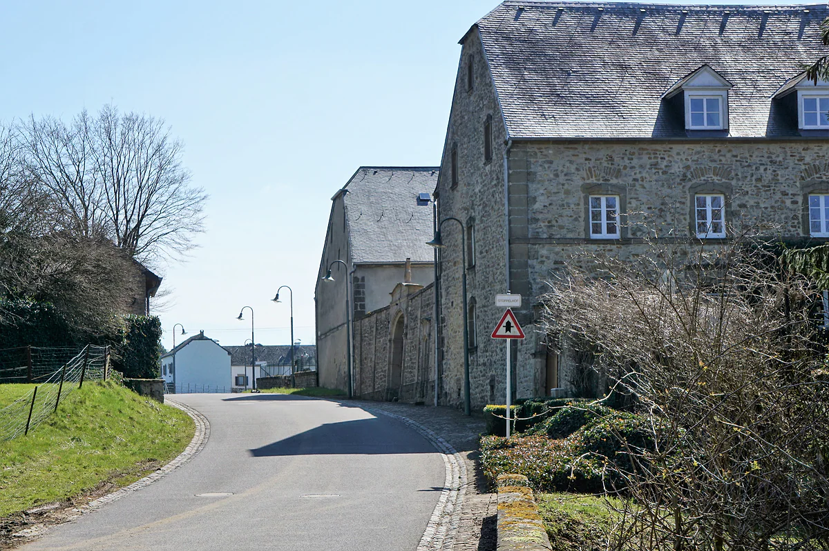
Commune in the canton of Echternach
Consdorf, where the Mullerthal's rocks open into tunnels
Consdorf is a Mullerthal commune of 2,093 people with seven localities, among them Scheidgen, Breidweiler, Colbette and Marscherwald. It's known for sandstone clefts you walk through, above all the Kuelscheier, a roofed passage about 100 m long in total darkness, plus the Rittergang and the Déiwepëtz, all on Route 2 of the Mullerthal Trail.
In 30 seconds
Full read: 2 min
- Consdorf is a Mullerthal commune of 2,093 people with seven localities.
- Its Kuelscheier is a pitch-dark rock passage about 100 m long, with the Rittergang and Déiwepëtz nearby.
- Route 2 of the Mullerthal Trail runs through it, and a 9.3 km circuit leads to the Schiessentümpel.
Pack a torch even if you're only out for a day walk. The Kuelscheier sits right on Route 2, and you can't get through it without light, because it's a corridor with a rock roof.

Before you go
What I would keep in mind
-
01 Most beautiful
A tunnel with no daylight
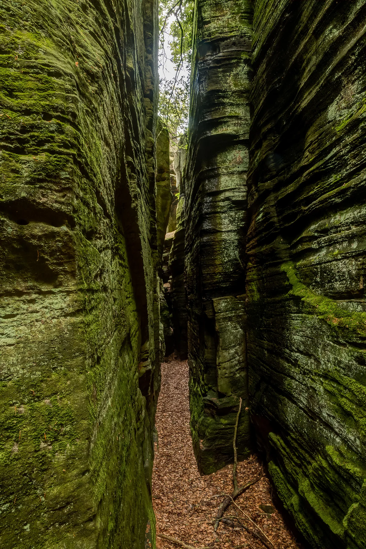
The Kuelscheier is a roughly 100 m passage between sandstone blocks, roofed over and so narrow in places that it's single file only.
-
02 My tip
No way round two of the squeezes
The Mullerthal Trail website warns that the Rittergang and the Déiwepëtz can't be bypassed. If anyone in your party dislikes tight spaces, plan another stretch.
Mullerthal Trail -
03 Getting there
Mill to mill via the waterfall
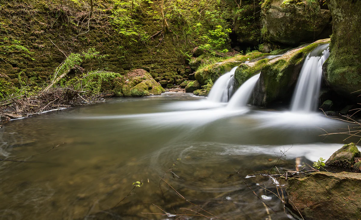
The 9.3 km local circuit links the Konsdrëfermillen in Consdorf with the Heringer Millen in Müllerthal, passing the Schiessentümpel waterfall.
Schiessentümpel waterfall
What I would book
On the map Consdorf is just a quiet village ringed by forest. What earns it a place on a Mullerthal itinerary is hidden a short walk from the houses, and visitluxembourg counts it among the region’s main hiking bases for one reason. Here you don’t only look at the rocks, you walk through them.
Seven localities on the edge of the rock country
Consdorf’s 2,093 residents in January 2026, as STATEC counts them, live in seven localities, Consdorf, Breidweiler, Colbette, Marscherwald, Michelshof, Scheidgen and Wolper. Walkers will hear most about Scheidgen, because Route 2 of the Mullerthal Trail goes right through the village and the Trail website suggests it as a base with accommodation.
Why the Kuelscheier is worth a detour
It’s a corridor about 100 m long that opened up when blocks of sandstone split away from the cliff along cracks. The roof is rock, the inside is dark, and some sections are so tight that only one-way traffic works. Below the rocks a spring rises exactly where porous sandstone sits on clay-rich marl, which is the geological secret of the whole Mullerthal. The name means coal barn, since visitluxembourg says coal from the area was probably kept here for a while. It has its own page, the Kuelscheier, with how to get there and what to bring.
The Rittergang and the Déiwepëtz are two more squeezes nearby. The Trail website warns that neither can be bypassed, which is worth knowing before you set off with anyone who hates confined spaces.
If you are staying the night, see the best hotel deals in Berdorf for your dates: the well-placed rooms go fast.
Walking to the Schiessentümpel
Consdorf’s local circuit, 9.3 km and around four hours, links two old mills, the Konsdrëfermillen in Consdorf and the Heringer Millen in Müllerthal. On the way it passes rocks named from legends, such as Goldkaul, Goldfralee, Eilebuerg, Schelmelee and Ramelee, and the Schiessentümpel waterfall, whose bridge marks the boundary with Waldbillig. If the Kuelscheier is all you want, path C2 covers it in 4.2 km.
I’d walk it from Consdorf towards Müllerthal and stop for lunch at the Heringer Millen at the far end.
There’s one corner of the commune few people place in Consdorf. The Kallektuffquell, the limestone tufa spring of the Black Ernz valley, lies within Breidweiler, and you reach it on the timber boardwalk of Trail Route 3 or along path W7 from the Heringer Millen. If you’ve had lunch there, it makes the best end to the afternoon in my view.
With children
This is one of the more family-minded corners of the region. visitluxembourg lists a guided children’s hike to the Kuelscheier and a family discovery trail at the same spot, and there’s a crazy golf course beside the tourist office. For primary-age kids a torchlit trip through the Kuelscheier is a proper adventure that doesn’t take long, and path C2 is short enough to end without complaints.
If you are staying the night, see the best hotel deals in Berdorf for your dates: the well-placed rooms go fast.
Getting there and staying
You can reach Consdorf from the capital, or from Findel airport, on buses that charge no fare. The tourist office is at 33 rue Burgkapp, beside La Pinède campsite. STATEC counted one hotel and two campsites in 2025. For more choice, Berdorf is next door on Route 2, and for a gentler, more farmland side of the Mullerthal, look at Bech.
So you do not lose the morning at the ticket office, browse tickets and tours in Berdorf on GetYourGuide.
If you would rather go at your own pace, see the car hire deals in Luxembourg: the earlier you book, the more cars are left to choose from.
Before you fix your dates, compare tickets to Luxembourg: the same journey can cost very different amounts from one day to the next.
Consdorf in figures
| Item | Figure |
|---|---|
| Residents on 1-1-2026 | 2,093 |
| Residents on 1-1-2025 | 2,108 |
| Official localities | Breidweiler, Colbette, Consdorf, Marscherwald, Michelshof, Scheidgen and Wolper |
| Area (own calculation) | About 25.7 km² |
| Hotels and campsites in 2025 | 1 and 2 |
STATEC (population and accommodation) and the national CACLR register of localities. Area worked out from population and density.
Walks from Consdorf
| Route | Length | Highlights |
|---|---|---|
| Local path C2 | 4.2 km | The Kuelscheier |
| Consdorf to Müllerthal circuit | 9.3 km, about 4 h | Named rocks, the Schiessentümpel, the Heringer Millen |
| Mullerthal Trail Route 2 | 39.7 km in all | Kuelscheier, Rittergang, Déiwepëtz |
visitluxembourg.com and mullerthal-trail.lu, checked on 29-09-2026.
Test yourself
True or false?
0/3 Pick before you peek.
-
Daylight filters into the Kuelscheier from above, so no torch is needed.
See the answer
False. It's roofed over and dark. Both visitluxembourg and the Trail website tell you to bring a torch.
-
Scheidgen is part of Consdorf commune.
See the answer
True. It's one of the seven official localities and a stop on Route 2 of the Mullerthal Trail.
-
There's an easy detour around the Rittergang.
See the answer
False. The Trail website says neither the Rittergang nor the Déiwepëtz can be bypassed.
- Residents on 1-1-2026
- 2,093
- Rough length of the Kuelscheier
- 100 m
- Circuit to Müllerthal
- 9.3 km
Map
Where Consdorf is
The thick dashed line is the border with Belgium, France and Germany, and the fine ones divide the twelve cantons. The Éislek lies to the north and the Moselle to the east. Every number opens its guide.
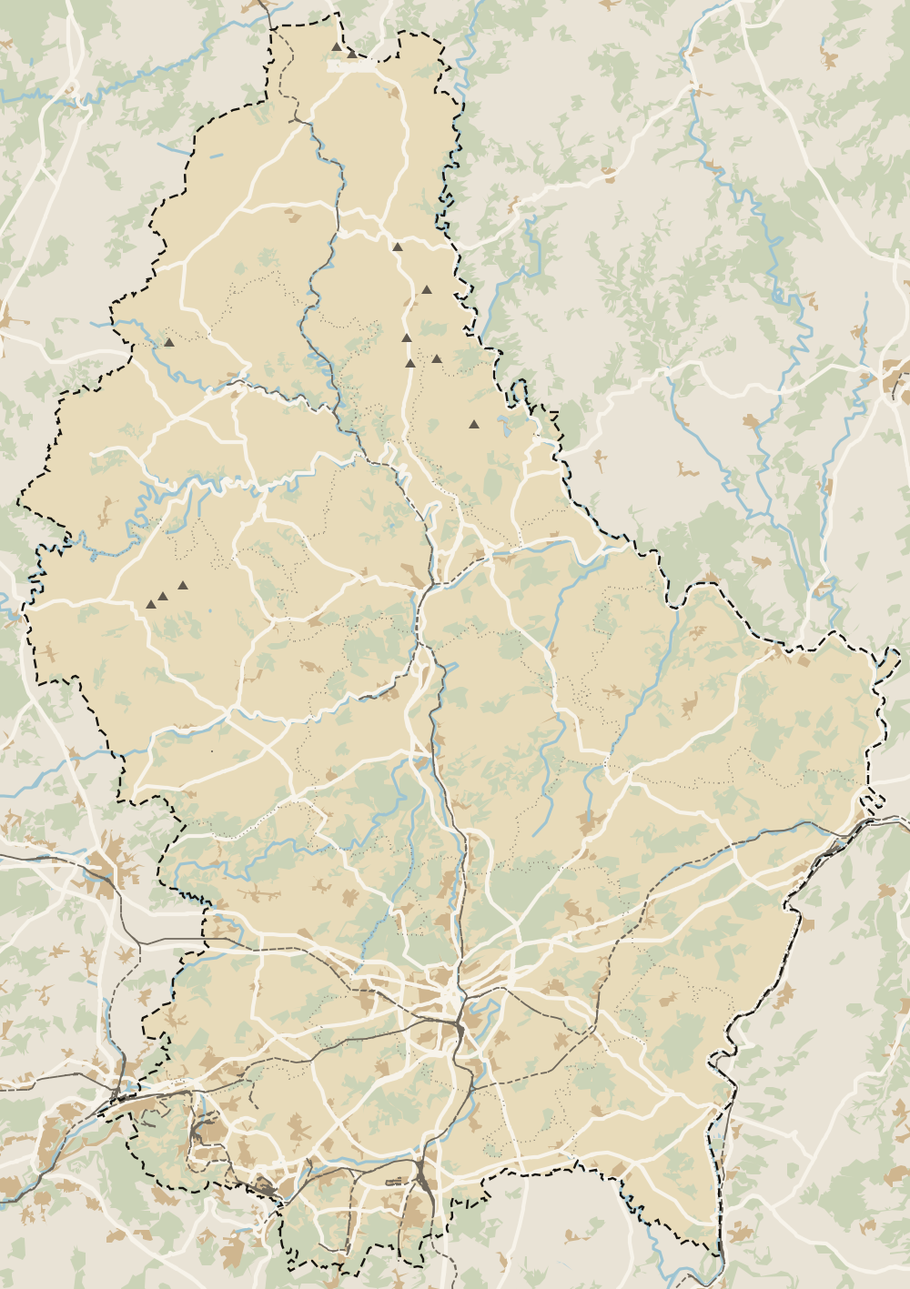 1Echternach 2Berdorf 3Mullerthal 4Waldbillig 5Beaufort 6Consdorf 7Bech 8Rosport-Mompach 9Larochette 10Fischbach 11Heffingen 12Junglinster 13Nommern 14Vallée de l'Ernz 15Reisdorf
 Map data © OpenStreetMap contributors (ODbL)
- 1EchternachMain town of the Mullerthal region
- 2BerdorfCommune in the canton of Echternach
- 3MullerthalTourist region in eastern Luxembourg
- 4WaldbilligCommune in the canton of Echternach
- 5BeaufortCommune in the canton of Echternach
- 6ConsdorfCommune in the canton of Echternach
- 7BechCommune in the canton of Echternach
- 8Rosport-MompachCommune in the canton of Echternach
- 9LarochetteCommune in the canton of Mersch, Mullerthal region
- 10FischbachCommune in the canton of Mersch, Mullerthal region
- 11HeffingenCommune in the canton of Mersch, Mullerthal region
- 12JunglinsterMullerthal municipality, canton of Grevenmacher
- 13NommernCommune in the canton of Mersch, Mullerthal region
- 14Vallée de l'ErnzCommune in the canton of Diekirch, Mullerthal region
- 15ReisdorfCommune in the canton of Diekirch, Mullerthal region
What to see
What to see in Consdorf
0 of 425 Luxembourg guides
Your next stamp
- Kuelscheier
- Mullerthal
- Mullerthal Trail
- Berdorf
- Junglinster
- Beaufort
- Moersdorf
- Schiessentümpel
- A Possen Museum
- American Cemetery
- Ansembourg
- Ansembourg Castles
- Asselborn
- Bascharage
- Beaufort castles
- Belval
- Belval blast furnaces
- Berg Castle
- Bernard-Massard cellars
- Bourglinster Castle
- Bourscheid Castle
- Brandenbourg
- Brandenbourg Castle
- Caves St Martin
- Christmas
- Clervaux Castle
- Echternach
- Echternach Abbey
- Ehnen
- Ehnen Wine Museum
- Esch-sur-Alzette
- Esch-sur-Sûre Castle
- European Museum Schengen
- Fond-de-Gras
- General Patton Museum
- German war cemetery
- Haff Réimech
- Hohllay
- Hollenfels Castle
- Hosingen
- Kautenbach
- Kneiff
- Koerich Castle
- Larochette Castle
- Lasauvage
- Mersch Castle
- Military History Museum
- Mondorf Domaine Thermal
- Munsbach Castle
- National Mining Museum
- Parc Merveilleux
- Park Sënnesräich
- Places to visit
- Remich
- Rindschleiden
- Septfontaines Castle
- Slate Museum
- Stolzembourg
- Tudor Museum
- Useldange Castle
- Valley of the Seven Castles
- Vianden
- Vianden Castle
- Ville Haute
- Wasserbillig Aquarium
- Weiswampach lakes
- Wiltz Castle
- Ahn
- Bourscheid-Plage
- Butterfly garden
- Clervaux
- Differdange
- Echternach lake
- Grevenmacher
- Heringer Millen
- Hollenfels
- Luxembourg City
- Luxembourg Science Center
- Meysembourg Castle
- National Day
- National Resistance Museum
- Perekop
- Remerschen
- Schoenfels Castle
- The Family of Man
- Things to do
- Upper Sûre Lake
- Vianden chairlift
- Wasserbillig
- Clervaux Abbey
- Echternach Roman villa
- Éislek
- Insenborn
- Kallektuffquell
- Machtum
- Most beautiful places
- Our Nature Park
- Pétange
- Pettingen Castle
- Schueberfouer
- Schwebsingen
- Victor Hugo House
- Waldbillig
- Dudelange
- Lultzhausen
- Moselle Valley
- Octave
- Prettiest villages
- Sanem
- Schengen
- Wellenstein
- Wiltz
- Wolfsschlucht
- Bech-Kleinmacher
- Éimaischen
- Gaalgebierg
- Guttland
- Marnach
- Mondorf-les-Bains
- Putscheid
- Schifflange
- UNESCO World Heritage
- Carnival
- Ellergronn
- Käerjeng
- Kayl
- Map
- Minett
- Munshausen
- Tandel
- Bech
- Buergbrennen
- Esch-sur-Sûre
- Rumelange
- Where is Luxembourg
- Is it a country?
- Lac de la Haute-Sûre (commune)
- Rosport-Mompach
- Wormeldange
- Larochette
- Mondercange
- Regions
- Bettembourg
- Bock Casemates
- Cantons
- Dancing procession
- Diekirch
- Fischbach
- Garnich
- Mersch
- Moselle wine route
- Ettelbruck
- Grund
- Heffingen
- Kehlen
- Lintgen
- Moselle river cruises
- Pétrusse Casemates
- Towns and villages
- Chemin de la Corniche
- Erpeldange-sur-Sûre
- Kopstal
- Lorentzweiler
- Nommern
- Pfaffenthal
- Population
- Bissen
- Clausen
- Grand Ducal Palace
- Koerich
- Schieren
- Size
- Vallée de l'Ernz
- Feulen
- Kirchberg
- Languages
- Notre-Dame Cathedral
- Reisdorf
- Steinfort
- Bettendorf
- Habscht
- St Michael's Church
- Helperknapp
- Luxembourgish
- Place Guillaume II
- Name
- Place d'Armes
- History
- Place de la Constitution
- Grand Duke
- Colmar-Berg
- Flaxweiler
- Gare
- Hamm
- Kirchberg funicular
- Luxembourg fortress
- Mamer
- Mertert
- Minett Trail
- Neumünster Abbey
- Parc Hosingen
- Pfaffenthal lift
- Political system
- Redange
- The Passerelle
- Wine festivals
- Winseler
- Beckerich
- Biwer
- EU institutions
- Goesdorf
- Limpertsberg
- Mudam
- Natur Musée
- Pulvermühl
- Stadtbredimus
- Troisvierges
- Wenzel walk
- Bonnevoie
- Bous-Waldbredimus
- Ell
- Flag
- Kiischpelt
- Manternach
- Philharmonie
- Vauban circuit
- Weiswampach
- Betzdorf
- Boulaide
- Dräi Eechelen Museum
- Facts
- Hollerich
- Lenningen
- Useldange
- Wincrange
- Bourscheid
- Dalheim
- Gasperich
- Public holidays
- Red Bridge
- Saeul
- Belair
- Second World War
- Vichten
- Battle of the Bulge
- Merl
- Préizerdaul
- Cents
- EU and Schengen
- Groussbus-Wal
- Entry requirements
- Neudorf
- Rambrouch
- Currency and payments
- Mertzig
- Weimerskirch
- Adolphe Bridge
- Beggen
- Escapardenne
- How to get there
- International March of Diekirch
- MNHA (National Museum)
- Rock climbing
- Sandweiler
- Bridges
- Eich
- Flights
- Golf
- Hesperange
- Lëtzebuerg City Museum
- Canoeing and kayaking
- Dommeldange
- Luxembourg airport
- Strassen
- Villa Vauban
- Airport to city centre
- Bertrange
- Casino Luxembourg
- Mühlenbach
- Swimming pools
- From Brussels
- Pétrusse Valley
- Rollingergrund
- Walferdange
- Cessange
- Day trip from Brussels
- Municipal Park
- Steinsel
- Free walking tours
- From Paris
- Niederanven
- From Frankfurt
- Schuttrange
- Sightseeing train and bus
- By train
- Contern
- By coach
- Weiler-la-Tour
- Driving
- Luxembourg in one day
- Pretzel Sunday
- Rham Plateau
- Tour de Luxembourg
- Candlemas (Liichtmëssdag)
- Car hire
- Luxembourg in two days
- Saint-Esprit Plateau
- Luxembourg in three days
- Melusina statue
- Parking
- St Nicholas Day (Kleeschen)
- Fête de la Musique
- Luxembourg in four days
- Museums in Luxembourg
- Petrol
- Place de Clairefontaine
- A week in Luxembourg
- Getting around
- Luxembourg Marathon
- Tram and Bus Museum
- Free public transport
- Parks in Luxembourg City
- Road trip
- Belgium and Luxembourg
- Tram
- Buses
- Viewpoints
- Trains
- Luxembourg station
- Cycling
- LuxembourgPass
- Prices and budget
- On a budget
- Free things to do
- Mobile and roaming
- Healthcare
- Safety
- Scams
- Tourist information
- Packing list
- Swimming lakes
- With a dog
- Markets
- Tipping
- Shopping
- What to buy
- Shopping centres
- With kids
- For couples
- Playgrounds
- Adventure parks
- Nightlife
- Castles
- Theatres and concert venues
- Leudelange
- Nature parks
- Where to stay
- City-centre hotels
- Hiking
- Nature reserves
- Reckange-sur-Mess
- Hotels near the station
- Roeser
- Frisange
- Hotels in Kirchberg
- Airport hotels
- Dippach
- Hotels in Vianden
- Hotels in Echternach
- Hotels in Clervaux
- Hotels in Mondorf-les-Bains
- Hotels in Esch-sur-Alzette
- Hotels on the Moselle
- Mullerthal hotels
- Upper Sûre lake hotels
- Hotels in Diekirch and Ettelbruck
- Cheap hotels
- Luxury hotels
- Boutique hotels
- Spa hotels
- Family hotels
- Apartments
- Weather
- Youth hostels
- Best time to visit
- Campsites
- Holiday cottages
- In winter
- Castle hotels
- In spring
- Day trips
- In summer
- Around Luxembourg
- In autumn
- Ice skating
- Trier day trip
- Metz day trip
- Arlon day trip
- In January
- In February
- In March
- In April
- In May
- In June
- In July
- In August
- In September
- Food
- In October
- In November
- Where to eat
- In December
- Michelin restaurants
- Cheap eats
- Judd mat Gaardebounen
- Bouneschlupp
- Gromperekichelcher
- Kniddelen
- Quetschentaart
- Rieslingspaschtéit
- Events
- Wine
- Crémant
- Beer
Frequently asked questions
What is there to see in Consdorf, Luxembourg?
The sandstone clefts and passages, especially the Kuelscheier, the Rittergang and the Déiwepëtz, and the woodland on Route 2 of the Mullerthal Trail. You can also walk to the Schiessentümpel waterfall.
What is the Kuelscheier?
A natural passage about 100 m long between sandstone blocks split apart along cracks. It has a rock roof, it's completely dark, and in places it's single file only, so you need a torch.
How do I get to Consdorf from Luxembourg City?
By bus, which is free throughout Luxembourg, or by car. For the Kuelscheier, the nearest stop is Consdorf Konsdrëfermillen, 1.6 km away, and local path C2 takes you through it.
What does Kuelscheier mean?
Coal barn. visitluxembourg says coal from the area was probably stored in the rock clefts for a time, hence the name.
Is Consdorf good for families?
Yes. visitluxembourg lists a guided hike to the Kuelscheier for children and a family discovery trail there, and there's a crazy golf course next to the tourist office.
By
Tourism graduate with a master’s in Tourism Management and Planning from the University of Málaga, who has travelled across Europe. He writes every guide from official sources and his own judgement.
Published on . Updated on . Facts checked on .
Sources
Some links in this guide are affiliate links: if you book through them, the site earns a commission at no extra cost to you. Affiliate disclosure
Photos: GilPe (CC BY-SA 4.0), via Wikimedia Commons.