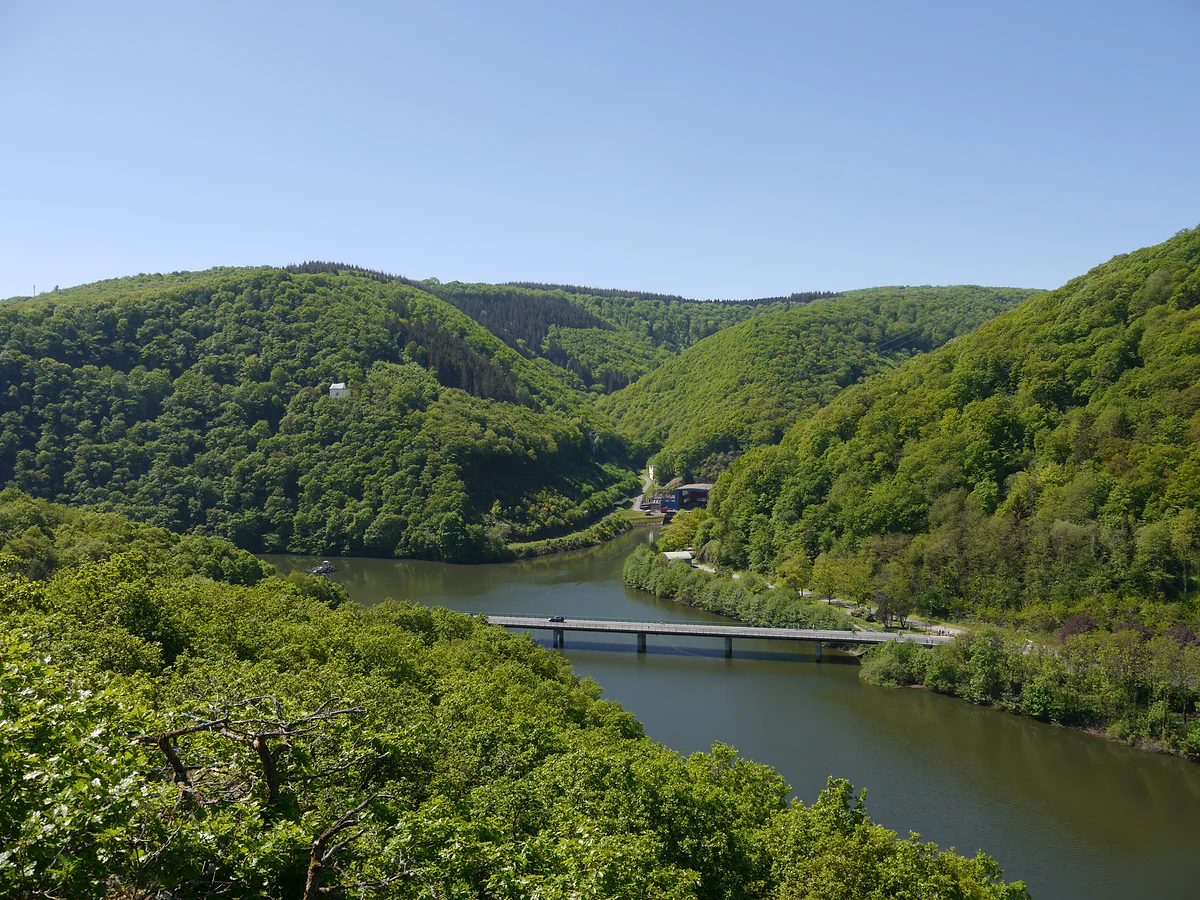
2,586 km², no mountains and plenty of forest
How big Luxembourg really is
Luxembourg covers 2,586 km², according to STATEC, just under 1,000 square miles. It measures 82 km from north to south and 57 km from east to west, with 356 km of border. The northern Éislek takes up 828 km² and the southern Guttland 1,758. The highest point is the Kneiff at 560 m, in the commune of Troisvierges, and the lowest is 130 m at Wasserbillig.
Don't let the size fool you. 2,586 km² holds landscapes as different as the northern plateaux, the Mullerthal rocks and the Moselle vineyards, and I'd give the country at least four days to see them properly.

Before you go
What I would keep in mind
-
01 My tip
The highest point is under 600 metres
The Kneiff at Wilwerdange is 560 m and the Buurgplaatz at Huldange 559 m. Both are in the commune of Troisvierges, at the country's northern tip, and there's nothing remotely alpine about them.
highest point in Luxembourg -
02 Most beautiful
A third of the country is the Éislek
The Luxembourg Ardennes cover 828 km², 32% of the territory, with high plateaux and deep valleys. That's where you'll find Vianden, Clervaux and the Upper Sûre lake.
Luxembourg Ardennes -
03 Getting there
82 km from top to bottom
From Huldange in the north to Rumelange in the south is 82 km, and public transport costs nothing. I'd use that to sleep in two different places rather than one.
getting around Luxembourg
What I would book
Luxembourg is small, but it isn’t a microstate. At 2,586 km² it’s more than five times Andorra and about eight times Malta, and on my list of Europe’s 47 countries ranked by area it comes seventh, right behind the six microstates. Here are the official measurements and what they mean on the ground.
2,586 km², end to end
STATEC, the national statistics office, gives a total area of 2,586 km², just under 1,000 square miles. North to south it’s 82 km, from Huldange in the north to Rumelange in the south, and east to west 57 km, from Rosport to Perlé. The border adds up to 356 km, 148 with Belgium, 135 with Germany and 73 with France. To see it all placed in Europe, there’s the map of Luxembourg.
The extreme points are well spread. The northernmost lies in the commune of Troisvierges, the southernmost in Rumelange, the easternmost in Rosport and the westernmost in Boulaide.
Two very unequal halves
The country splits into two natural zones that look nothing alike. The Éislek in the north covers 828 km², 32% of the total, and is the continuation of the Ardennes, with high plateaux and deeply cut rivers. The Guttland in the south takes 1,758 km², or 68%, and is softer country of fields and hills that includes the capital and the Moselle valley. The difference between the two is explained in regions of Luxembourg.
If you are staying the night, see the best hotel deals in Luxembourg for your dates: the well-placed rooms go fast.
Does Luxembourg have mountains?
Not as a Scot or a Welshman would understand the word. The highest point in Luxembourg is the Kneiff, at 560 m, at Wilwerdange in the commune of Troisvierges. Next to it the Buurgplaatz at Huldange reaches 559 m, and out west the Napoleonsgaard in Rambrouch makes 547. These are plateau heights, not summits. Put another way, Place d’Armes in the capital, at 304 m, sits only about 256 m below the country’s highest point. A curious detail for scale, the River Our rises in Belgium near Manderfeld at 653 m, almost a hundred metres above the highest point anywhere in Luxembourg, before running down the border to join the Sûre.
The lowest point is 130 m, at the Spatz in Wasserbillig, where the Sûre meets the Moselle. The capital sits at about 300 m, although within the city there’s nearly 180 m of difference between Beggen, at 232, and the Dommeldange plateau, at 408. That’s why Luxembourg City has public lifts and a funicular.
A well-wooded country
STATEC breaks down land use like this, with 2021 figures. 51.7% is farmland and vineyards, 36.1% woodland and natural areas, 11.8% built-up land and just 0.4% water. Much of the natural land is protected. The Our Nature Park covers 420 km² and the Upper Sûre Nature Park 200, both created in 2005, and the Mëllerdall geopark another 256 in the Mullerthal. The water is concentrated in one place. The Upper Sûre lake, held back by a 1961 dam, covers about 380 hectares, and no other body of water in Luxembourg is bigger. The Sûre runs 136 km inside Luxembourg, the Moselle forms the border in the south-east and the Alzette crosses the capital. The lake and its beaches are in the Upper Sûre lake.
If you are staying the night, see the best hotel deals in Luxembourg for your dates: the well-placed rooms go fast.
A country that used to be much bigger
Today’s Luxembourg is what’s left of a far larger territory. After buying the county of Chiny in 1364, the old duchy reached around 10,000 km², nearly four times today’s size. It lost land in three blows. In 1659, under the Treaty of the Pyrenees, Thionville went to France. In 1815, at the Congress of Vienna, lands in the Eifel went to Prussia. And in 1839, under the Treaty of London, the western part became the Belgian province of Luxembourg. The borders haven’t moved since, so an outline of the country drawn in 1840 would still match today’s.
What it means for your trip
With these dimensions, Luxembourg can be covered without rushing and without leaving the country. North to south is under 100 km, and public transport is free. I’d base myself in the capital and add one or two nights in the north, and in four days you’d see the best of both halves. To place it against its neighbours, carry on to where is Luxembourg.
So you do not lose the morning at the ticket office, browse tickets and tours in Luxembourg on GetYourGuide.
If you would rather go at your own pace, see the car hire deals in Luxembourg: the earlier you book, the more cars are left to choose from.
Before you fix your dates, compare tickets to Luxembourg: the same journey can cost very different amounts from one day to the next.
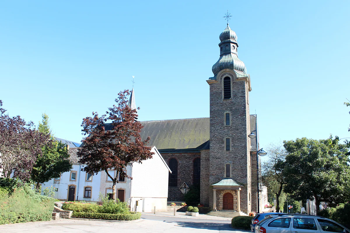
St Andrew's Church in Troisvierges, built in stone with an onion-domed bell tower, beside white houses
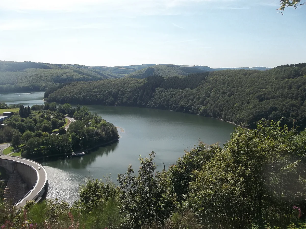
The Upper Sûre Lake winding between forests and the curve of the Esch-sur-Sûre dam, seen from a hill
Luxembourg against the other microstates in this guide
| Country | Area | Note |
|---|---|---|
| Luxembourg | 2,586 km² | Country 7 of 47 by size |
| Andorra | 468 km² | Luxembourg is more than five times bigger |
| Malta | 316 km² | Luxembourg is about eight times bigger |
| Liechtenstein | 160 km² | Luxembourg is about sixteen times bigger |
| San Marino | 61 km² | |
| Monaco | 2.02 km² | |
| Vatican City | 0.44 km² |
Altitudes and land use
| Fact | Figure |
|---|---|
| Kneiff (Wilwerdange) | 560 m |
| Buurgplaatz (Huldange) | 559 m |
| Napoleonsgaard (Rambrouch) | 547 m |
| Luxembourg City | 300 m (304 m at Place d'Armes) |
| Wasserbillig | 130 m |
| Farmland and vineyards | 51.7% |
| Woodland and natural areas | 36.1% |
| Built-up land | 11.8% |
| Water | 0.4% |
Area, altitudes and 2021 land use from STATEC; the capital's altitude from the Ville de Luxembourg; other countries' areas from this guide's country files. Checked on 29-09-2026.
Test yourself
True or false?
0/3 Pick before you peek.
-
Luxembourg is bigger than Andorra and Malta combined.
See the answer
True. Luxembourg covers 2,586 km², while Andorra (468) and Malta (316) add up to 784. It's bigger than all six microstates put together.
-
Luxembourg's highest point is over 1,000 metres.
See the answer
False. It's the Kneiff, 560 m, at Wilwerdange, according to STATEC. The nearby Buurgplaatz reaches 559 m.
-
More than a third of Luxembourg is woodland or natural land.
See the answer
True. STATEC gives 36.1% woodland and natural areas in 2021, against 51.7% farmland and vineyards and 11.8% built-up land.
0 of 425 Luxembourg guides
Your next stamp
- Kneiff
- Where is Luxembourg
- Map
- Towns and villages
- Hiking
- Road trip
- A Possen Museum
- American Cemetery
- Ansembourg
- Ansembourg Castles
- Asselborn
- Bascharage
- Beaufort castles
- Belval
- Belval blast furnaces
- Berg Castle
- Bernard-Massard cellars
- Bourglinster Castle
- Bourscheid Castle
- Brandenbourg
- Brandenbourg Castle
- Caves St Martin
- Christmas
- Clervaux Castle
- Echternach
- Echternach Abbey
- Ehnen
- Ehnen Wine Museum
- Esch-sur-Alzette
- Esch-sur-Sûre Castle
- European Museum Schengen
- Fond-de-Gras
- General Patton Museum
- German war cemetery
- Haff Réimech
- Hohllay
- Hollenfels Castle
- Hosingen
- Kautenbach
- Koerich Castle
- Larochette Castle
- Lasauvage
- Mersch Castle
- Military History Museum
- Moersdorf
- Mondorf Domaine Thermal
- Munsbach Castle
- National Mining Museum
- Parc Merveilleux
- Park Sënnesräich
- Places to visit
- Remich
- Rindschleiden
- Schiessentümpel
- Septfontaines Castle
- Slate Museum
- Stolzembourg
- Tudor Museum
- Useldange Castle
- Valley of the Seven Castles
- Vianden
- Vianden Castle
- Ville Haute
- Wasserbillig Aquarium
- Weiswampach lakes
- Wiltz Castle
- Ahn
- Berdorf
- Bourscheid-Plage
- Butterfly garden
- Clervaux
- Differdange
- Echternach lake
- Grevenmacher
- Heringer Millen
- Hollenfels
- Luxembourg City
- Luxembourg Science Center
- Meysembourg Castle
- Mullerthal
- National Day
- National Resistance Museum
- Perekop
- Remerschen
- Schoenfels Castle
- The Family of Man
- Things to do
- Upper Sûre Lake
- Vianden chairlift
- Wasserbillig
- Clervaux Abbey
- Echternach Roman villa
- Éislek
- Insenborn
- Kallektuffquell
- Machtum
- Most beautiful places
- Our Nature Park
- Pétange
- Pettingen Castle
- Schueberfouer
- Schwebsingen
- Victor Hugo House
- Waldbillig
- Dudelange
- Kuelscheier
- Lultzhausen
- Moselle Valley
- Octave
- Prettiest villages
- Sanem
- Schengen
- Wellenstein
- Wiltz
- Wolfsschlucht
- Beaufort
- Bech-Kleinmacher
- Éimaischen
- Gaalgebierg
- Guttland
- Marnach
- Mondorf-les-Bains
- Putscheid
- Schifflange
- UNESCO World Heritage
- Carnival
- Consdorf
- Ellergronn
- Käerjeng
- Kayl
- Minett
- Munshausen
- Tandel
- Bech
- Buergbrennen
- Esch-sur-Sûre
- Rumelange
- Is it a country?
- Lac de la Haute-Sûre (commune)
- Rosport-Mompach
- Wormeldange
- Larochette
- Mondercange
- Regions
- Bettembourg
- Bock Casemates
- Cantons
- Dancing procession
- Diekirch
- Fischbach
- Garnich
- Mersch
- Moselle wine route
- Ettelbruck
- Grund
- Heffingen
- Kehlen
- Lintgen
- Moselle river cruises
- Pétrusse Casemates
- Chemin de la Corniche
- Erpeldange-sur-Sûre
- Junglinster
- Kopstal
- Lorentzweiler
- Nommern
- Pfaffenthal
- Population
- Bissen
- Clausen
- Grand Ducal Palace
- Koerich
- Schieren
- Vallée de l'Ernz
- Feulen
- Kirchberg
- Languages
- Notre-Dame Cathedral
- Reisdorf
- Steinfort
- Bettendorf
- Habscht
- St Michael's Church
- Helperknapp
- Luxembourgish
- Place Guillaume II
- Name
- Place d'Armes
- History
- Place de la Constitution
- Grand Duke
- Colmar-Berg
- Flaxweiler
- Gare
- Hamm
- Kirchberg funicular
- Luxembourg fortress
- Mamer
- Mertert
- Minett Trail
- Mullerthal Trail
- Neumünster Abbey
- Parc Hosingen
- Pfaffenthal lift
- Political system
- Redange
- The Passerelle
- Wine festivals
- Winseler
- Beckerich
- Biwer
- EU institutions
- Goesdorf
- Limpertsberg
- Mudam
- Natur Musée
- Pulvermühl
- Stadtbredimus
- Troisvierges
- Wenzel walk
- Bonnevoie
- Bous-Waldbredimus
- Ell
- Flag
- Kiischpelt
- Manternach
- Philharmonie
- Vauban circuit
- Weiswampach
- Betzdorf
- Boulaide
- Dräi Eechelen Museum
- Facts
- Hollerich
- Lenningen
- Useldange
- Wincrange
- Bourscheid
- Dalheim
- Gasperich
- Public holidays
- Red Bridge
- Saeul
- Belair
- Second World War
- Vichten
- Battle of the Bulge
- Merl
- Préizerdaul
- Cents
- EU and Schengen
- Groussbus-Wal
- Entry requirements
- Neudorf
- Rambrouch
- Currency and payments
- Mertzig
- Weimerskirch
- Adolphe Bridge
- Beggen
- Escapardenne
- How to get there
- International March of Diekirch
- MNHA (National Museum)
- Rock climbing
- Sandweiler
- Bridges
- Eich
- Flights
- Golf
- Hesperange
- Lëtzebuerg City Museum
- Canoeing and kayaking
- Dommeldange
- Luxembourg airport
- Strassen
- Villa Vauban
- Airport to city centre
- Bertrange
- Casino Luxembourg
- Mühlenbach
- Swimming pools
- From Brussels
- Pétrusse Valley
- Rollingergrund
- Walferdange
- Cessange
- Day trip from Brussels
- Municipal Park
- Steinsel
- Free walking tours
- From Paris
- Niederanven
- From Frankfurt
- Schuttrange
- Sightseeing train and bus
- By train
- Contern
- By coach
- Weiler-la-Tour
- Driving
- Luxembourg in one day
- Pretzel Sunday
- Rham Plateau
- Tour de Luxembourg
- Candlemas (Liichtmëssdag)
- Car hire
- Luxembourg in two days
- Saint-Esprit Plateau
- Luxembourg in three days
- Melusina statue
- Parking
- St Nicholas Day (Kleeschen)
- Fête de la Musique
- Luxembourg in four days
- Museums in Luxembourg
- Petrol
- Place de Clairefontaine
- A week in Luxembourg
- Getting around
- Luxembourg Marathon
- Tram and Bus Museum
- Free public transport
- Parks in Luxembourg City
- Belgium and Luxembourg
- Tram
- Buses
- Viewpoints
- Trains
- Luxembourg station
- Cycling
- LuxembourgPass
- Prices and budget
- On a budget
- Free things to do
- Mobile and roaming
- Healthcare
- Safety
- Scams
- Tourist information
- Packing list
- Swimming lakes
- With a dog
- Markets
- Tipping
- Shopping
- What to buy
- Shopping centres
- With kids
- For couples
- Playgrounds
- Adventure parks
- Nightlife
- Castles
- Theatres and concert venues
- Leudelange
- Nature parks
- Where to stay
- City-centre hotels
- Nature reserves
- Reckange-sur-Mess
- Hotels near the station
- Roeser
- Frisange
- Hotels in Kirchberg
- Airport hotels
- Dippach
- Hotels in Vianden
- Hotels in Echternach
- Hotels in Clervaux
- Hotels in Mondorf-les-Bains
- Hotels in Esch-sur-Alzette
- Hotels on the Moselle
- Mullerthal hotels
- Upper Sûre lake hotels
- Hotels in Diekirch and Ettelbruck
- Cheap hotels
- Luxury hotels
- Boutique hotels
- Spa hotels
- Family hotels
- Apartments
- Weather
- Youth hostels
- Best time to visit
- Campsites
- Holiday cottages
- In winter
- Castle hotels
- In spring
- Day trips
- In summer
- Around Luxembourg
- In autumn
- Ice skating
- Trier day trip
- Metz day trip
- Arlon day trip
- In January
- In February
- In March
- In April
- In May
- In June
- In July
- In August
- In September
- Food
- In October
- In November
- Where to eat
- In December
- Michelin restaurants
- Cheap eats
- Judd mat Gaardebounen
- Bouneschlupp
- Gromperekichelcher
- Kniddelen
- Quetschentaart
- Rieslingspaschtéit
- Events
- Wine
- Crémant
- Beer
Frequently asked questions
How big is Luxembourg in square miles?
STATEC gives 2,586 km², which works out at just under 1,000 square miles. The northern Éislek accounts for 828 km² and the southern Guttland for 1,758 km².
How far is it across Luxembourg?
It's 82 km from north to south, Huldange to Rumelange, and 57 km from east to west, Rosport to Perlé. Distance-wise it's a short hop, and public transport across the whole country is free.
Is Luxembourg bigger than other small European countries?
It's more than five times the size of Andorra, at 468 km², and about eight times Malta, at 316. In my list of 47 European countries ranked by area, it's the seventh smallest, right after the six microstates.
Does Luxembourg have mountains?
Not in the alpine sense. The highest point is the Kneiff, 560 m, in the north. What the Éislek does have is high plateau cut by deep valleys, and the Mullerthal has its sandstone rocks.
What is the altitude of Luxembourg City?
About 300 m, with Place d'Armes at 304 m. Within the city the altitude varies a lot, from 232 m at Beggen by the Alzette to 408 m on the Dommeldange plateau.
Has Luxembourg always been this size?
No. After buying the county of Chiny in 1364, the old duchy reached around 10,000 km². It lost land in 1659, in 1815 and above all in 1839, when the western part went to Belgium.
By
Tourism graduate with a master’s in Tourism Management and Planning from the University of Málaga, who has travelled across Europe. He writes every guide from official sources and his own judgement.
Published on . Facts checked on .
Sources
Some links in this guide are affiliate links: if you book through them, the site earns a commission at no extra cost to you. Affiliate disclosure
Photos: Sergei Tikhomirov (CC BY 2.0); Zinneke (CC BY-SA 3.0 lu); Nikilux (CC BY-SA 3.0 lu), via Wikimedia Commons.