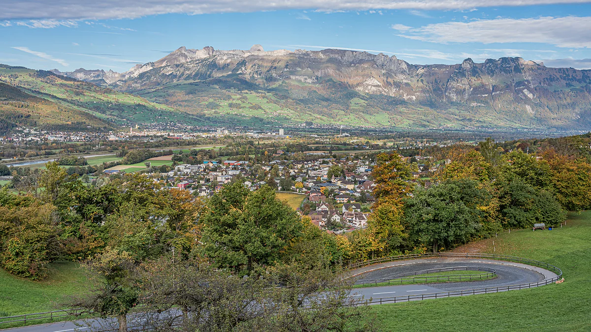
Europe's fourth-smallest state
How big Liechtenstein is, in kilometres and by comparison
Liechtenstein covers 160 km², about 62 square miles, according to the Office of Statistics. It measures 24.7 km at its longest and 12.4 km at its widest, and it's the fourth-smallest state in Europe after Vatican City, Monaco and San Marino. Switzerland is about 260 times bigger. Its highest point, the Grauspitz, reaches about 2,600 m.
In 30 seconds
Full read: 3 min
- Liechtenstein covers 160 km², about 62 square miles, 24.7 km long and 12.4 km wide.
- It's Europe's fourth-smallest state, after Vatican City, Monaco and San Marino, and the sixth-smallest in the world.
- It has 41.3 km of border with Switzerland and 36.6 km with Austria, and no coastline.
- Forest covers 42.2% of the country and only 11.3% is built up.
The numbers mislead in both directions. On a map it looks like a country you can cross in no time, and driving along the valley that's true, but half of it is mountain and a path like the Fürstensteig takes a whole day. I'd measure it in height gained, not in kilometres.

Before you go
What I would keep in mind
-
01 Most beautiful
From 430 to 2,600 metres in 160 km²
The lowest point is the Ruggeller Riet, a protected fen at 430 m, and the highest is the Grauspitz at about 2,600 m. That's over 2,000 metres of difference in a very small country.
mountains in Liechtenstein -
02 My tip
Half the country is mountain
The official portal says roughly half of Liechtenstein lies in the mountains. You can't tell from the Rhine valley, which is why I'd go up to Malbun or Gaflei at least once.
Malbun -
03 Getting there
End to end by bus
The LIEmobil network reaches all eleven municipalities, from Balzers in the south to Ruggell and Schellenberg in the north. A single for three zones or more is valid for two hours.
Liechtenstein's buses -
04 To save money
One day pass to cross the whole country
A day pass for three zones or more costs CHF 9 and covers the whole country plus Sargans, Buchs and central Feldkirch. To travel it from south to north, that's the ticket I'd buy.
getting around Liechtenstein
What I would book
160 km², or roughly 62 square miles. That’s the official figure from the Office of Statistics, and it sounds tiny until you set it against the other microstates. I like to explain it differently, because in Liechtenstein square kilometres say less than metres of altitude. Half the country is mountain, and that completely changes how big it feels.
How big is Liechtenstein?
The official area is 160 km². Add up the eleven municipalities in the Office of Statistics table one by one and you get 160.5 km², but the office itself rounds to 160 in its text, and that’s the figure I’d use. From north to south it stretches 24.7 km at its longest, about 15 miles, and from east to west 12.4 km at its widest.
That makes it the fourth-smallest state in Europe and the sixth-smallest in the world. In Europe only Vatican City, at 0.44 km², Monaco, at 2.08, and San Marino, at 61.19, are smaller. Put another way, you could fit about 77 Monacos into Liechtenstein, or two and a half San Marinos. And the other way round, Switzerland, its western neighbour, is around 260 times bigger. Small as it is, it’s fully sovereign, which I explain in is Liechtenstein a country? What to do with so little space and so much mountain is gathered in my Liechtenstein travel guide.
Long, wide and high
What really makes Liechtenstein feel large is height. The lowest point is in the north, in the Ruggeller Riet, a protected fen at 430 m. The highest is the Grauspitz, at the southern end, which the Office of Statistics puts at 2,600 m and the tourist board at 2,599. Between them lie more than 2,000 metres of ascent in a country you can cross from north to south in under 25 km.
The country’s official portal goes further, saying roughly half of Liechtenstein is mountainous and that it’s the only country lying entirely within the Alpine massif. I quote that last claim as the portal’s own words, because the floor of the Rhine valley and the Unterland are fairly flat. The peaks, including the Grauspitz and the Drei Schwestern, are gathered on the mountains of Liechtenstein.
A country that’s nearly half forest
The figure that gets mentioned least is land use. Forest covers 68 km², 42.2% of the country. Farmland accounts for another 52 km², or 32.2%, and unproductive land, mostly rock and water, 23 km². Built-up land comes to just 18 km², a mere 11.3%. For me that neatly undoes the image of a country made of banks and offices, because from above it’s mainly trees, meadows and rock.
Two very unequal halves
Inside, Liechtenstein divides into two historic regions. The Oberland in the south covers 125.5 km², nearly four fifths of the country, and holds Vaduz, the mountains and Malbun. The Unterland in the north measures 35 km² and is mostly low-lying, with the Eschnerberg as its only real hill. I go into more detail on the Oberland of Liechtenstein.
Among the municipalities, the largest is Triesenberg at 29.7 km², which is also the highest, and the smallest is Schellenberg at 3.6 km². The capital, Vaduz, covers 17.3 km² and has the quirk of six exclaves, detached pieces of its territory that include forests and mountain pastures. The complete list is on the municipalities of Liechtenstein.
How long does it take to cross?
That depends on how you measure it. By bus, line 11 links Sargans in the south with Feldkirch in the north via Vaduz, and the Feldkirch to Vaduz leg takes 45 minutes. Climbing from Vaduz to Malbun, on the far side of the ridge, takes half an hour. On foot it’s another matter entirely. The Liechtenstein Trail, which passes through every village, runs to about 75 km split into five stages plus two loops, and it’s the best answer I know to anyone who claims the country can be seen in an afternoon. Its five stages alone add up to about 21 hours of walking by the tourist board’s own timings.
No sea, and no neighbours with one
Liechtenstein has no coastline, and neither do its two neighbours. Switzerland and Austria are both landlocked, so Liechtenstein is one of the world’s two doubly landlocked states, along with Uzbekistan. The border runs to 77.9 km in total, 41.3 km with Switzerland, much of it along the Rhine, and 36.6 km with Austria, according to the Office of Statistics. Where each stretch lies is shown on the map of Liechtenstein.
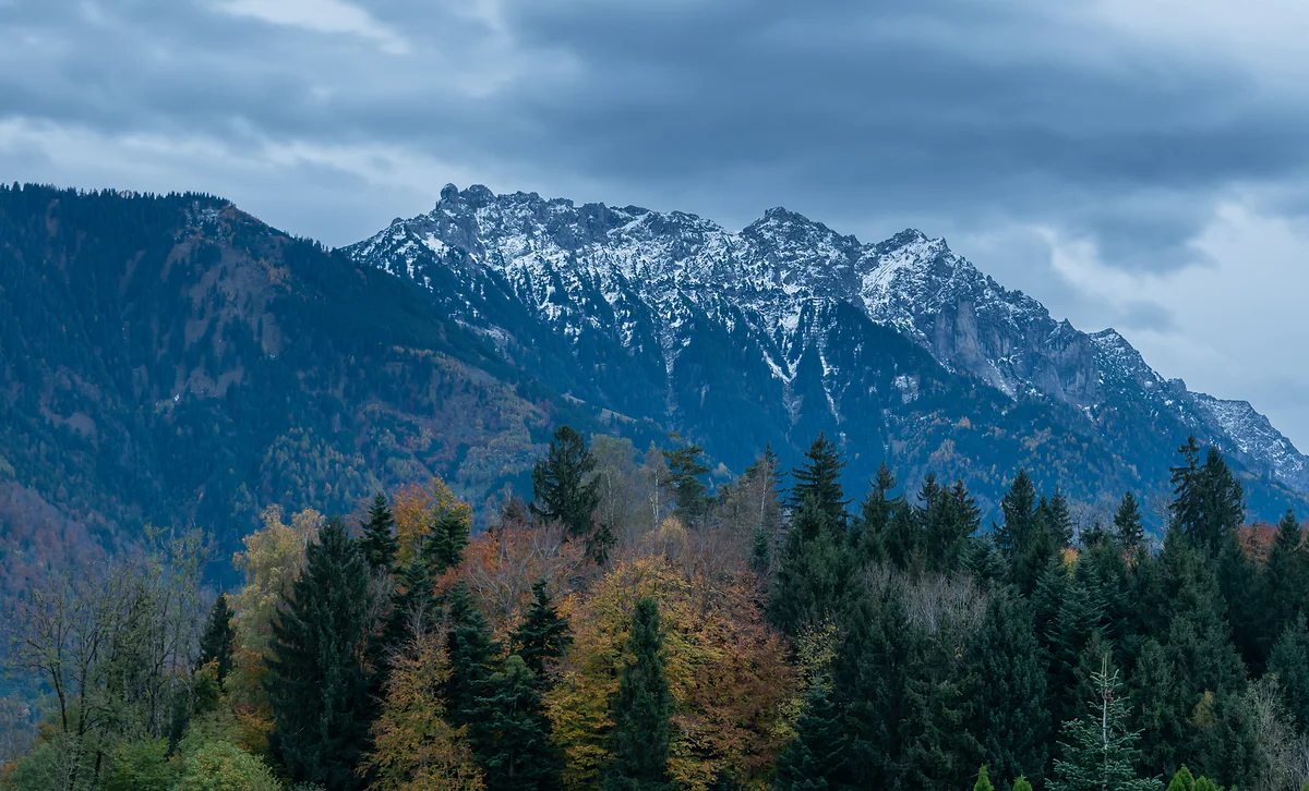
The Three Sisters, rocky snow-dusted peaks above the autumn forest, under grey clouds.
Liechtenstein against the other microstates
| Country | Area | Times it fits into Liechtenstein |
|---|---|---|
| Vatican City | 0.44 km² | About 364 |
| Monaco | 2.08 km² | About 77 |
| San Marino | 61.19 km² | About 2.6 |
| Liechtenstein | 160 km² | 1 |
Areas from the Office of Statistics (Liechtenstein), the Governorate (Vatican City), IMSEE (Monaco) and the Government of San Marino. The ratios are my own calculation.
How the land is used
| Use | Area | Share of the country |
|---|---|---|
| Forest | 68 km² | 42.2% |
| Farmland | 52 km² | 32.2% |
| Unproductive (rock, water) | 23 km² | 14.3% |
| Built-up | 18 km² | 11.3% |
Office of Statistics, Liechtenstein in Zahlen 2026, p. 4.
The largest and smallest municipalities
| Municipality | Area | Region |
|---|---|---|
| Triesenberg | 29.7 km² | Oberland |
| Schaan | 26.9 km² | Oberland |
| Triesen | 26.5 km² | Oberland |
| Gamprin | 6.2 km² | Unterland |
| Planken | 5.3 km² | Oberland |
| Schellenberg | 3.6 km² | Unterland |
Office of Statistics, Liechtenstein in Zahlen 2026, p. 5. The municipal figures add up to 160.5 km²; the official text rounds to 160.
Test yourself
True or false?
0/4 Pick before you peek.
-
Liechtenstein is bigger than San Marino.
See the answer
True. It covers 160 km² against San Marino's 61.19 km², roughly 2.6 times as much. In Europe only Vatican City, Monaco and San Marino are smaller.
-
Most of Liechtenstein's land is built up.
See the answer
False. Only 11.3% is built-up land. Forest covers 42.2% and farmland 32.2%.
-
Liechtenstein is surrounded only by countries without a coastline.
See the answer
True. Both its neighbours, Switzerland and Austria, are landlocked, which makes it one of two doubly landlocked countries in the world, along with Uzbekistan.
-
Liechtenstein's lowest point is at sea level.
See the answer
False. It's at 430 m, in the Ruggeller Riet, a protected fen in the north of the country.
- Official area of the country
- 160 km²
- Greatest length, north to south
- 24.7 km
- Times Switzerland is larger than Liechtenstein
- 260
- Share of the country under forest
- 42.2%
0 of 168 Liechtenstein guides
Your next stamp
- Getting around
- Hiking
- Mountains
- Map
- Liechtenstein Trail
- Schellenberg
- Things to do
- One day
- Two days
- Municipalities
- Oberland
- Unterland
- Vaduz
- Städtle
- Mitteldorf
- Vaduz Castle
- Vaduz Cathedral
- Parliament
- Government Building
- Vaduz Town Hall
- Red House
- Prince's Winery
- Old Rhine Bridge
- Schaan
- Schalun Castle Ruin
- Balzers
- Citytrain
- Triesen
- Triesenberg
- Walser Museum
- Planken
- Gutenberg Castle
- The Rhine
- Schaan Roman fort
- Dux
- St Mamertus chapel
- Lawena valley
- Mäls
- DoMuS
- TAK Theatre
- Castles
- Churches and chapels
- Viewpoints
- Museums
- Kunstmuseum
- Mountain huts
- Hilti Art Foundation
- Pfälzerhütte
- Gafadura hut
- National Museum
- Treasure Chamber
- Postage Stamp Museum
- Kunstraum Engländerbau
- Eschen
- Masescha
- Gaflei
- Nendeln
- Mauren
- Silum
- Rotenboden
- Schaanwald
- Gamprin
- Wangerberg
- Bendern
- Steg
- Ruggell
- Samina valley
- Schellenberg Farmhouse Museum
- Cross-country skiing at Steg
- Küefer-Martis-Huus
- Ruggeller Riet
- Hinterschellenberg
- Fürstensteig
- Is it a country?
- Malbun
- Schellenberg castles
- Eschnerberg
- Malbun in summer
- Population
- Stage 1: Balzers - Triesenberg
- Lakes
- Sareis
- Stage 2: Triesenberg - Vaduz
- Malbun Peace Chapel
- Political system
- Stage 3: Vaduz - Nendeln
- Swimming pools
- Language
- Skiing in Malbun
- Stage 4: Nendeln - Ruggell
- Dialect
- Malbun ski pass
- Stage 5: Ruggell - Schaanwald
- Hotels in Malbun
- Stamps
- Princess Gina Trail
- Hut-to-hut Route 66
- Getting there
- In winter
- Weather
- Airport
- Best time to visit
- In summer
- Events
- With kids
- Zurich to Liechtenstein
- National day
- Sargans to Vaduz
- Christmas
- Feldkirch to Vaduz
- By train
- Traditions
- Carnival
- Buses
- Funken Sunday
- Alpine cattle drive
- Driving and vignette
- Parking
- Bike hire
- Cycling
- EU and Schengen
- Entry requirements
- Borders and customs
- The prince
- The princely house
- The flag
- The coat of arms
- The national anthem
- History
- Second World War
- No army
- Facts
- Why so rich?
- Banks and tax haven
- Where to stay
- Hilti
- Hotels in Vaduz
- False teeth
- Hostel and camping
- Rent the country?
- Where to eat
- Restaurants in Vaduz
- Swiss invasions
- Bars and nightlife
- Food
- Käsknöpfle
- Wine
- Casinos
- Adventure Pass
- Rainy days
- Guided tours
- Tourist office
- Day trips
- Passport stamp
- Music festivals
- Phone and roaming
- Currency and payments
- Prices and budget
- Tipping
- Plugs and sockets
- Tap water
- Opening hours
- Public holidays
- Safety
- Accessibility
- With a dog
- Shopping and souvenirs
Frequently asked questions
How big is Liechtenstein in square miles?
About 62 square miles, converting the official 160 km² from the Office of Statistics. It's 24.7 km (about 15 miles) at its longest and 12.4 km (under 8 miles) at its widest.
Is Liechtenstein the smallest country in Europe?
No. It's the fourth-smallest in Europe and the sixth-smallest in the world, according to the Office of Statistics. Only Vatican City, Monaco and San Marino are smaller in Europe.
Is Liechtenstein landlocked?
Yes, and doubly so. Both its neighbours, Switzerland and Austria, are landlocked too, which makes it one of only two doubly landlocked countries in the world. The other is Uzbekistan.
How long is Liechtenstein's border?
77.9 km in total, 41.3 km with Switzerland and 36.6 km with Austria, according to the Office of Statistics. The tourist board quotes slightly different figures, and I go with the official statistics.
What is the highest point in Liechtenstein?
The Grauspitz, at about 2,600 m, in the south of the country within Triesen. The Office of Statistics gives 2,600 m and the tourist board 2,599. The lowest point is the Ruggeller Riet at 430 m.
Which is the largest municipality in Liechtenstein?
Triesenberg, at 29.7 km², which is also the highest. The smallest is Schellenberg, at 3.6 km². The capital, Vaduz, covers 17.3 km².
By
Tourism graduate with a master’s in Tourism Management and Planning from the University of Málaga, who has travelled across Europe. He writes every guide from official sources and his own judgement.
Published on . Facts checked on .
Sources
Photos: A.Savin (FAL); Tournasol7 (CC BY 4.0), via Wikimedia Commons.