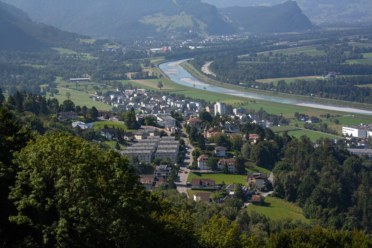
The only high valley facing the Rhine
Lawena, the high valley that looks down on the Rhine
Lawena is an alp belonging to Triesen, 743.8 hectares with its hut at 1,525 m, set in a bowl-shaped valley. According to the Historisches Lexikon it is the only high valley in Liechtenstein that runs straight down into the Rhine valley, and its name comes from an old Romansh word for avalanche. It's a refuge for alpine plants and wildlife.
In 30 seconds
Full read: 3 min
- Lawena is a Triesen alp of 743.8 hectares, with its hut at 1,525 m.
- It's the only high valley in Liechtenstein that drains straight into the Rhine valley.
- Its name comes from the Romansh for avalanche, and avalanches have shaped its history.
- The Lexikon describes it as a refuge for alpine plants and wildlife.
Lawena isn't a spare-afternoon job. I'd give it a summer day with a good forecast, carry the official trail map on my phone and food in my pack, and I wouldn't count on the hut serving anything without confirming first.

Before you go
What I would keep in mind
-
01 Most beautiful
A mountain bowl open to the valley
The Lexikon describes a bowl-shaped valley of geological interest and a refuge for alpine plants and animals. It's the wildest corner of Triesen's land.
mountains in Liechtenstein -
02 My tip
Don't mix up Lawena and Valüna
Both are Triesen alps, but Lawena faces the Rhine while Valüna lies over the ridge in the Samina valley, where you can go cross-country skiing in winter.
the Samina valley -
03 My tip
Avalanche country, as the name says
Lawena comes from the Romansh for avalanche. One destroyed the hut in the winter of 1923 to 1924 and another swept away a cowshed in 1966. It's no winter stroll.
is Liechtenstein safe -
04 Getting there
The way in is via Triesen
The valley drains to the Rhine through the Lawena gorge, south of Triesen, where the hamlet of Säga stands. The road up to the alp was built between 1882 and 1900.
Triesen, chapels and old village
Mention Liechtenstein’s mountains and almost everyone thinks of Malbun and Steg, tucked behind the ridge. Lawena is something else. It’s a high valley that looks out towards the Rhine, reached from Triesen, with a history of herders, loggers, avalanches and water. Here’s what the sources say and how I’d approach it, without promising anything the sources don’t back up.
A high valley that drains straight to the Rhine
Lawena is an alp belonging to Triesen, 743.8 hectares of which 209 are productive pasture, with its hut at 1,525 m. The Historisches Lexikon describes a bowl-shaped valley and says it’s the only high valley in Liechtenstein that runs into the Rhine valley. The others, the Samina, Valüna and Malbun, sit on the far side of the ridge.
That position is what interests me. From Vaduz or Triesen you can see the hillside but not the valley, which hides behind the Lawena gorge. At the mouth of that gorge, south of the village, is the hamlet of Säga, which grew up from the 1860s.
A name that’s a warning
Lawena comes from the old Romansh word lavé(g)na, meaning avalanche, and the name doesn’t exaggerate. According to the Lexikon, in the winter of 1923 to 1924 an avalanche destroyed the alp hut along with its inn, and in 1966 a powder avalanche swept away the Säss cowshed. The hut rebuilt on the same spot in 1967 and 1968 is considered avalanche-safe.
So my view is clear. Lawena is a summer and early autumn outing, with settled weather and proper boots. In winter it’s no stroll, and if you want the basics, I cover them in safety in Liechtenstein.
A feud that lasted decades
Lawena already belonged to Triesen when it was first recorded, around 1509 or 1517, and the village rules of 1595 split the high pastures. The upper village got Lawena and the lower village got Valüna. Things went wrong in the second half of the 17th century, when storms and a rockfall in 1659 wrecked part of the grazing. According to the Lexikon, decades of lawsuits followed between the two halves of the village until the split was scrapped in 1718. From 1778 the alp is known to have been leased out, and until 1873 the tenants came from the neighbouring Swiss villages.
Herders, loggers and gentian diggers
What I like most about Lawena is that its history is written in the place names. The Lexikon records «Kalchofa», recalling a lime kiln, «Kolplätzli», where charcoal was made, and «Branntawiilöcher», the holes left by people digging gentian roots to distil schnapps.
Timber was the big earner. From the 18th century until 1947 the valley was logged, and the trunks were floated down the gorge using a dam, the «Klus», built around 1770. Livestock has always been there. In 1809 the alp was allowed 60 cows and cattle and 1,000 sheep, and as late as 1962 some 740 sheep went up. Cheesemaking stopped at the end of the 1950s, and since then it’s been grazed mainly by young and dry cattle.
Lawena’s water lights up the valley
There’s a chapter hardly anyone knows. In 1915 Triesen handed the state the rights to the upper valley’s springs in exchange for 20,000 crowns and upkeep of the road, and by 1927 the state had built the Lawena power plant. It’s a neat example of how a tiny country made use of every valley it had.
The alp stayed with the village. In 2004 it passed from the municipality to the Bürgergenossenschaft Triesen, the corporation of long-established local families.
How would I tackle it?
Carefully. The road up to the alp was built between 1882 and 1900, and by 1901 the hut had a station for walkers, but no official source I’ve seen gives a waymarked route and timings, nor whether the hut serves food today, nor when it opens. I’d use the country’s official geoportal for the route, take plenty of water and food, and treat it as a full-day outing.
The reward, according to the Lexikon, is a geologically interesting valley and a refuge for alpine plants and animals, inside a 1,307-hectare high-mountain hunting area. To me that means going quietly and taking binoculars. If you’d rather have mountains with lifts and facilities, head for the Samina valley and Malbun, and the full picture of the peaks is in mountains in Liechtenstein.
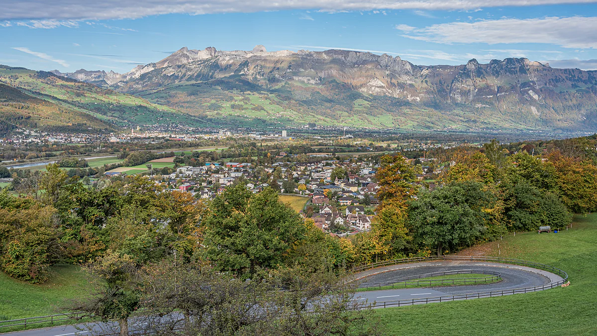
The Rhine valley seen from Vaduz Castle, with the town among autumn trees and the Swiss mountains on the horizon.
Lawena in figures
| Figure | Value |
|---|---|
| Area of the alp | 743.8 ha |
| Productive pasture | 209 ha |
| Altitude of the hut | 1,525 m |
| High-mountain hunting area | 1,307 ha, with Münz, Platta, Gasenza and Wang |
| First record | Around 1509/17, already owned by Triesen |
Figures from the Historisches Lexikon, last revised in 2011.
The alp through time
| Date | What happened |
|---|---|
| 1595 | Village rules assign it to Triesen's upper village |
| 1659 | A rockfall destroys part of the pasture |
| 1882 to 1900 | A road is built up to the alp |
| 1901 | The hut adds a station for walkers |
| 1923/24 | An avalanche destroys the hut and its inn |
| 1927 | The state's Lawena power plant is completed |
| 1966 | A powder avalanche sweeps away the Säss cowshed |
| 1967/68 | New hut built, considered avalanche-safe |
| 2004 | Passes to the Bürgergenossenschaft Triesen |
According to the Historisches Lexikon.
Test yourself
True or false?
0/4 Pick before you peek.
-
Lawena is the only high valley in Liechtenstein that drains straight into the Rhine valley.
See the answer
True. That's how the Historisches Lexikon describes it. The other high valleys, such as the Samina and Malbun, lie behind the ridge.
-
The name Lawena means sunny meadow.
See the answer
False. It comes from the old Romansh lavé(g)na, meaning avalanche.
-
Water from Lawena is used to generate electricity.
See the answer
True. In 1915 Triesen ceded the rights to the upper valley's springs to the state, which built the Lawena power plant by 1927.
-
Cheese is still made up on the Lawena alp.
See the answer
False. According to the Lexikon, cheesemaking on the alp stopped at the end of the 1950s. Today it's used mainly for young and dry cattle.
- Area of the alp
- 743.8 ha
- Altitude of the hut
- 1,525 m
- High-mountain hunting area
- 1,307 ha
- Lawena power plant completed
- 1927
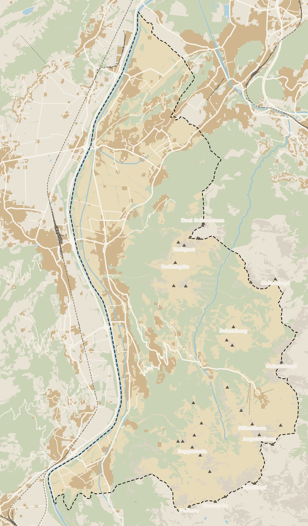
Map
Where Lawena valley is
The dashed line is the border: Switzerland across the Rhine, Austria to the north and east. Every number opens its guide.
0 of 168 Liechtenstein guides
Your next stamp
- Triesen
- Triesenberg
- Samina valley
- Gaflei
- Silum
- Hostel and camping
- In summer
- Stage 1: Balzers - Triesenberg
- Things to do
- One day
- Two days
- Municipalities
- Oberland
- Unterland
- Map
- Vaduz
- Städtle
- Mitteldorf
- Vaduz Castle
- Vaduz Cathedral
- Parliament
- Government Building
- Vaduz Town Hall
- Red House
- Prince's Winery
- Old Rhine Bridge
- Schaan
- Schalun Castle Ruin
- Balzers
- Citytrain
- Walser Museum
- Planken
- Gutenberg Castle
- The Rhine
- Schaan Roman fort
- Dux
- St Mamertus chapel
- Mäls
- DoMuS
- TAK Theatre
- Castles
- Churches and chapels
- Viewpoints
- Mountains
- Museums
- Kunstmuseum
- Mountain huts
- Hilti Art Foundation
- Pfälzerhütte
- Gafadura hut
- National Museum
- Treasure Chamber
- Postage Stamp Museum
- Kunstraum Engländerbau
- Eschen
- Masescha
- Nendeln
- Mauren
- Rotenboden
- Schaanwald
- Gamprin
- Wangerberg
- Bendern
- Steg
- Ruggell
- Schellenberg Farmhouse Museum
- Cross-country skiing at Steg
- Küefer-Martis-Huus
- Ruggeller Riet
- Schellenberg
- Hinterschellenberg
- Fürstensteig
- Is it a country?
- Liechtenstein Trail
- Malbun
- Schellenberg castles
- Eschnerberg
- Malbun in summer
- Population
- Lakes
- Sareis
- Size
- Stage 2: Triesenberg - Vaduz
- Malbun Peace Chapel
- Political system
- Stage 3: Vaduz - Nendeln
- Swimming pools
- Language
- Skiing in Malbun
- Stage 4: Nendeln - Ruggell
- Dialect
- Malbun ski pass
- Stage 5: Ruggell - Schaanwald
- Hotels in Malbun
- Stamps
- Princess Gina Trail
- Hut-to-hut Route 66
- Hiking
- Getting there
- In winter
- Weather
- Airport
- Best time to visit
- Events
- With kids
- Zurich to Liechtenstein
- National day
- Sargans to Vaduz
- Christmas
- Feldkirch to Vaduz
- By train
- Traditions
- Carnival
- Getting around
- Buses
- Funken Sunday
- Alpine cattle drive
- Driving and vignette
- Parking
- Bike hire
- Cycling
- EU and Schengen
- Entry requirements
- Borders and customs
- The prince
- The princely house
- The flag
- The coat of arms
- The national anthem
- History
- Second World War
- No army
- Facts
- Why so rich?
- Banks and tax haven
- Where to stay
- Hilti
- Hotels in Vaduz
- False teeth
- Rent the country?
- Where to eat
- Restaurants in Vaduz
- Swiss invasions
- Bars and nightlife
- Food
- Käsknöpfle
- Wine
- Casinos
- Adventure Pass
- Rainy days
- Guided tours
- Tourist office
- Day trips
- Passport stamp
- Music festivals
- Phone and roaming
- Currency and payments
- Prices and budget
- Tipping
- Plugs and sockets
- Tap water
- Opening hours
- Public holidays
- Safety
- Accessibility
- With a dog
- Shopping and souvenirs
Frequently asked questions
What is the Lawena valley?
An alp belonging to Triesen, 743.8 hectares in a bowl-shaped valley. According to the Historisches Lexikon, it's the only high valley in the country that runs straight into the Rhine valley.
Where is Lawena in Liechtenstein?
In the south of the Oberland, above Triesen. It drains towards the Rhine through the Lawena gorge, at the mouth of which is the hamlet of Säga, south of the village.
What does Lawena mean?
It comes from the old Romansh lavé(g)na, meaning avalanche. That's no idle name, since an avalanche destroyed the hut in the winter of 1923 to 1924 and another carried off a cowshed in 1966.
Is there a hut in the Lawena valley?
Yes, the alp hut is at 1,525 m, and the present one, from 1967 to 1968, is considered safe from avalanches. I couldn't find an official source on whether it serves food or when, so I'd check before going up.
Can you see wildlife in Lawena?
The Lexikon calls the valley a refuge for alpine plants and animals, and it's part of a 1,307-hectare high-mountain hunting area. I'd take binoculars and stick to the paths.
By
Tourism graduate with a master’s in Tourism Management and Planning from the University of Málaga, who has travelled across Europe. He writes every guide from official sources and his own judgement.
Published on . Facts checked on .
Photos: Lucas Kendall (CC BY-SA 4.0); A.Savin (FAL), via Wikimedia Commons.