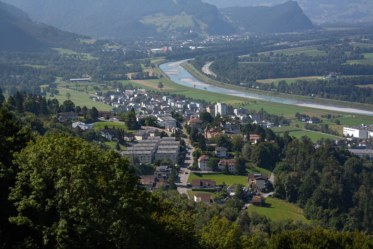
The former county of Vaduz
The Oberland, Liechtenstein's southern half
The Oberland is Liechtenstein's southern region, the former county of Vaduz. It groups six municipalities, Vaduz, Schaan, Triesen, Balzers, Triesenberg and Planken, across 125.5 km², nearly four fifths of the country, with 26,263 residents. It holds the capital, almost all the museums, Gutenberg Castle and every mountain, Malbun included.
In 30 seconds
Full read: 3 min
- The Oberland is Liechtenstein's southern region, the former county of Vaduz.
- It has six municipalities, 125.5 km² and 26,263 residents, and elects 15 of the 25 MPs.
- It holds the capital, nearly all the museums, Gutenberg, Malbun and the Fürstensteig.
- The name comes from the Rhine, which flows from south to north.
Visit Liechtenstein without thinking about regions and you'll spend nearly all your time in the Oberland without noticing. I find it worth knowing for a practical reason, because it's where everything in the guidebooks is, and because on a spare day the Unterland is waiting just across the wetlands.

Before you go
What I would keep in mind
-
01 Most beautiful
From the Rhine to 2,600 metres in one region
The Oberland runs from the Rhine bank, around 460 m, up to the Grauspitz at about 2,600 m, the country's highest point, which lies within Triesen.
mountains in Liechtenstein -
02 Getting there
Bus 11 runs through the Oberland south to north
Line 11 goes from Sargans to Feldkirch via Vaduz, and the 21 climbs from Vaduz to Triesenberg and Malbun. In summer, lines 21 and 22 carry bike racks.
Liechtenstein's buses -
03 Worth the splurge
Sleep up in the Oberland's mountains
Triesenberg, including Malbun and Steg, logged 51,991 hotel nights in 2025, more than Vaduz. With two days, I'd spend one night up there.
hotels in Malbun -
04 My tip
They speak differently here from the Unterland
The Oberland says «Stää» for stone and the Unterland «Stoo». And Triesenberg keeps the dialect of the Walser, who arrived around 1280.
the Liechtenstein dialect
What I would book
Hardly anyone visiting Liechtenstein realises they’ve spent the day in the Oberland, yet that’s where nearly everything is. The capital, the museums, both castles you can see from the road and every mountain sit in this southern half of the country. I think it’s worth understanding, because it explains why the north feels so different and why the country has voted in two halves since 1878.
What the Oberland is
The 1921 constitution defines Liechtenstein as a union of two «Landschaften», and the first it names is the «Landschaft Vaduz (Oberland)». It covers the old county of Vaduz, founded in 1342, answerable directly to the emperor from 1396 and joined to the lordship of Schellenberg between 1434 and 1437. The Liechtenstein family bought it in 1712, thirteen years after buying the north, and in 1719 the two became the principality.
Those thirteen years are my favourite part of the story. Between 1699 and 1712 the Unterland already belonged to the Liechtensteins while the Oberland was still owned by the Counts of Hohenems. It was the only time since the 15th century that the two halves had different masters. Every date is laid out in the history of Liechtenstein.
Six municipalities and most of the country
The Oberland brings together six municipalities, Vaduz, Schaan, Triesen, Balzers, Triesenberg and Planken. It spans 125.5 km², about 78% of Liechtenstein, and had 26,263 residents at the end of 2025. On the Rhine plain sit the capital, Vaduz, and Schaan, the most populous municipality. Further south come Triesen, with its old centre among vineyards, and Balzers, at the foot of Gutenberg Castle.
The mountains belong entirely to the Oberland. Triesenberg climbs the slope with its Walser hamlets, and over the ridge it has Steg and Malbun in the Samina valley. Planken, the smallest village in the country, sits on a terrace beneath the Drei Schwestern. And Liechtenstein’s highest point, the Grauspitz at about 2,600 m, lies within Triesen, as does the Lawena valley, which the Historisches Lexikon describes as the only high valley in the country draining into the Rhine valley. Another southern quirk is that Balzers owns the Grafenberg castle ruin even though it stands in Fläsch, across the Swiss border. It’s one of several places where property lines and national borders don’t quite match, along with the alp that Gamprin owns in Austria’s Vorarlberg.
Why is it called the Oberland?
Not because of altitude, as you might think, but because of the Rhine. The Historisches Lexikon explains that the names follow the direction of the river, which flows from south to north, so the south lies upstream, «ober», and the north downstream, «unter». It’s a common way of naming land across the German-speaking world.
What surprises me is how late the names arrived. They don’t appear in Peter Kaiser’s chronicle of 1847, nor in the 1862 constitution. They first turn up, in brackets, in the electoral law of 1878, which created two separate constituencies to settle a political crisis between north and south. That story is told on the Unterland of Liechtenstein.
Where the south stops and the north begins
The boundary between the halves is the Scheidgraben, an old ditch already recorded as the «fridtgraben» in a register of 1617-1619. It crosses the great Riet from east to west between Schaan and Eschen, down to the inland canal. Today you’d barely spot it, but you do notice the separation, because a flat stretch without houses lies between the two settled areas.
A half with its own vote and its own accent
The division is still very much alive. The Oberland elects 15 of the Landtag’s 25 MPs, and the constitution requires each half to have at least two of the government’s five members. You can hear it too. The Oberland says «Stää» for stone where the Unterland says «Stoo», and the speech of Balzers has quirks of its own even within the south. I give more examples on the Liechtenstein dialect.
For visitors, the Oberland is also where you sleep. In 2025 Triesenberg, including Malbun and Steg, logged 51,991 hotel nights and Vaduz 39,461, against 46,484 for the whole Unterland. I’d base myself in Vaduz for the valley and in Malbun if the plan is mountains.
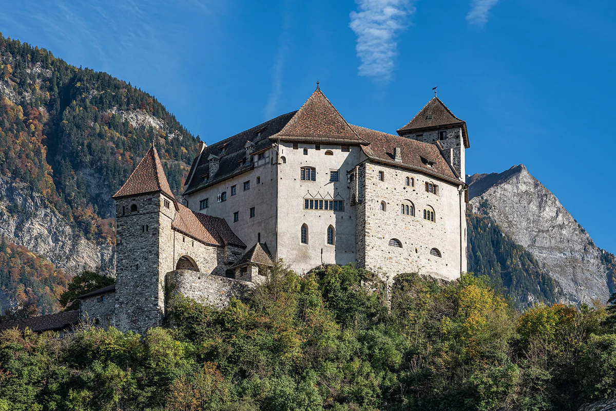
Gutenberg Castle in Balzers, with its towers and white walls on the wooded hill and a rocky peak behind.
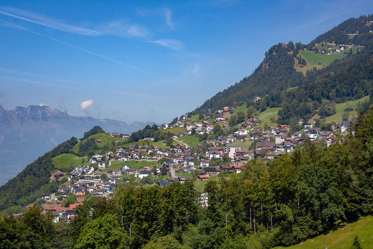
The houses of Triesenberg scattered across the green hillside above the Rhine valley, under a blue sky.
The Oberland's six municipalities
| Municipality | Residents (2025) | Area | What I'd go to see |
|---|---|---|---|
| Schaan | 6,294 | 26.9 km² | Roman fort and Dux chapel |
| Vaduz | 6,108 | 17.3 km² | Städtle, museums, castle and the Prince's winery |
| Triesen | 5,785 | 26.5 km² | St Mamertus chapel and the Lawena valley |
| Balzers | 4,835 | 19.7 km² | Gutenberg Castle and Mäls |
| Triesenberg | 2,742 | 29.7 km² | Walser Museum, Gaflei, Steg and Malbun |
| Planken | 499 | 5.3 km² | Drei Schwestern and the Gafadurahütte |
Population at 31-12-2025 (Office of Statistics); area from Liechtenstein in Zahlen 2026. Oberland total 26,263 residents and 125.5 km² (78% of the country).
Where visitors sleep in the Oberland (2025)
| Area | Hotel nights | Average hotels open in summer |
|---|---|---|
| Triesenberg (with Malbun and Steg) | 51,991 | 8.0 |
| Vaduz | 39,461 | 5.0 |
| Schaan and Planken | 17,247 | 4.0 |
| Balzers and Triesen | 10,138 | 3.0 |
Office of Statistics, Tourismus 2025 and the official statistics tourism page.
Test yourself
True or false?
0/4 Pick before you peek.
-
The Oberland gets its name from being the most mountainous part of the country.
See the answer
False. It comes from the Rhine, which flows south to north. The south lies upstream (ober) and the north downstream (unter), according to the Historisches Lexikon.
-
The Oberland covers nearly four fifths of Liechtenstein.
See the answer
True. It takes up 125.5 of the country's 160 km², about 78%.
-
The Oberland and Unterland have always had the same owner since the 15th century.
See the answer
False. Between 1699 and 1712 the Unterland already belonged to the Liechtensteins while the Oberland was still held by the Counts of Hohenems. They were apart for 13 years.
-
The Oberland elects more than half the members of the Landtag.
See the answer
True. It elects 15 of the 25, with the Unterland choosing the other 10, under Article 46 of the constitution.
- Municipalities in the Oberland
- 6
- Area, 78% of the country
- 125.5 km²
- Residents at 31-12-2025
- 26,263
- Year the Liechtensteins bought the county of Vaduz
- 1712
Map
All 11 municipalities, from the Rhine to Malbun
The dashed line is the border: Switzerland across the Rhine, Austria to the north and east. Every number opens its guide.
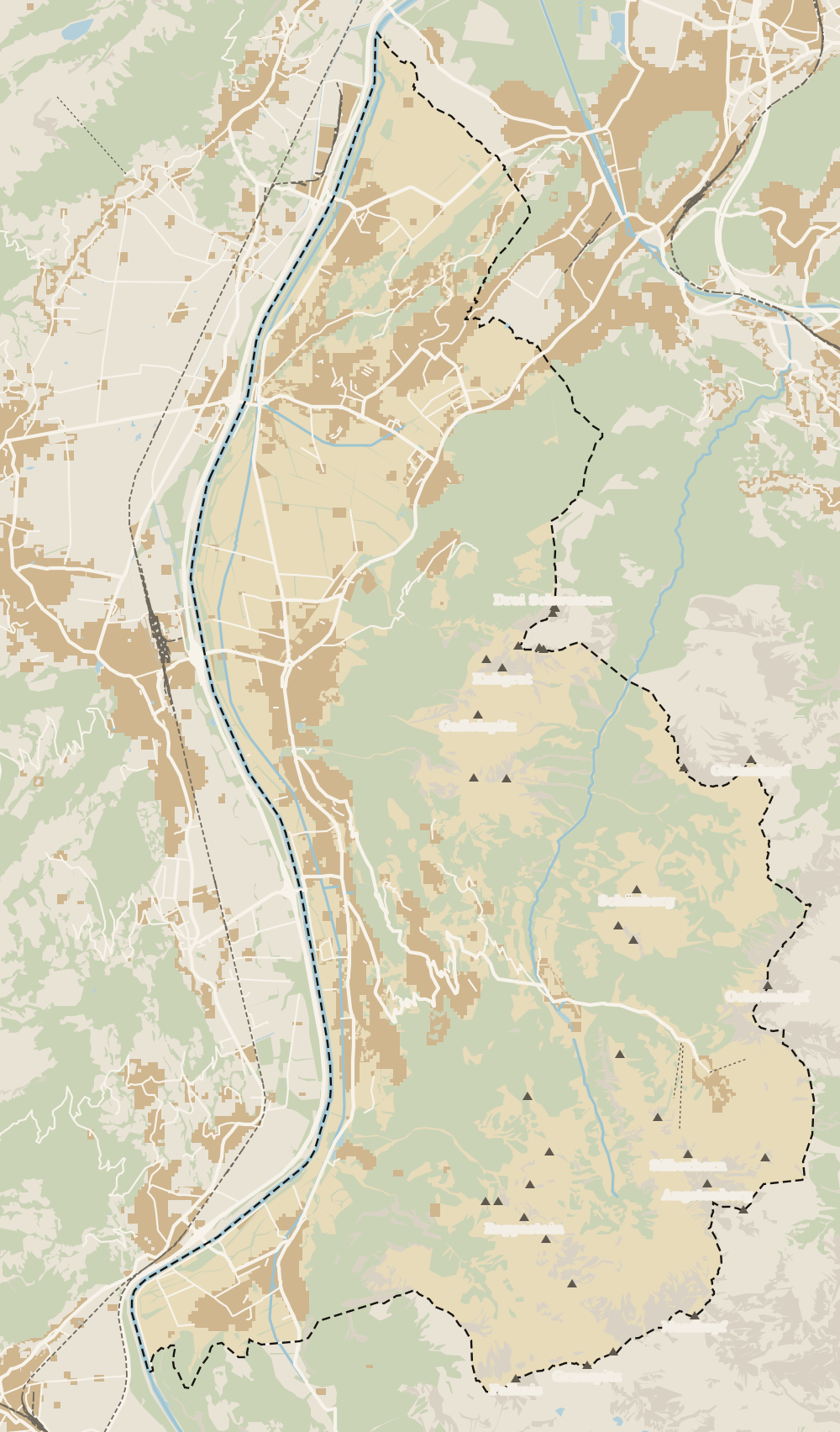 1Vaduz 2Städtle 3Mitteldorf 4Schaan 5Balzers 6Triesen 7Triesenberg 8Planken 9Mäls 10Eschen 11Masescha 12Gaflei 13Nendeln 14Mauren 15Silum 16Rotenboden 17Schaanwald 18Gamprin 19Wangerberg 20Bendern 21Steg 22Ruggell 23Schellenberg 24Hinterschellenberg 25Malbun
 Map data © OpenStreetMap contributors (ODbL)
- 1VaduzA capital since 1719, home to 6,108 people
- 2StädtleCar-free since 28 June 2004
- 3MitteldorfVineyards protected until 2081
- 4Schaan6,294 residents, 186 more than Vaduz
- 5BalzersThe southernmost municipality
- 6TriesenThe highest peak belongs to Triesen too
- 7TriesenbergLargest and highest municipality in the country
- 8Planken499 residents at 786 metres
- 9MälsOlder than Balzers, say the locals
- 10EschenThe Unterland's most populous municipality
- 11MaseschaTriesenberg hamlet at 1,250 m
- 12GafleiHome of the country's first spa hotel, in 1875
- 13NendelnEschen's hamlet below the Drei Schwestern
- 14MaurenLiechtenstein's most densely populated municipality
- 15SilumWalser alp between 1,400 and 1,700 m
- 16RotenbodenTriesenberg hamlet, Rotaboda in dialect
- 17SchaanwaldMauren's hamlet on the Austrian border
- 18GamprinThe village with the bathing lake
- 19WangerbergTriesenberg hamlet, Wangerbärg in dialect
- 20BendernGamprin's hamlet above the Rhine
- 21StegTriesenberg summer pasture at about 1,300 m
- 22RuggellThe country's northernmost municipality
- 23SchellenbergThe country's smallest municipality
- 24HinterschellenbergSchellenberg's hamlet on the Austrian border
- 25MalbunAt 1,600 m, with an hourly bus from Vaduz
0 of 168 Liechtenstein guides
Your next stamp
- Unterland
- Municipalities
- Vaduz
- Things to do
- Population
- Balzers
- Where to stay
- One day
- Two days
- Map
- Städtle
- Mitteldorf
- Vaduz Castle
- Vaduz Cathedral
- Parliament
- Government Building
- Vaduz Town Hall
- Red House
- Prince's Winery
- Old Rhine Bridge
- Schaan
- Schalun Castle Ruin
- Citytrain
- Triesen
- Triesenberg
- Walser Museum
- Planken
- Gutenberg Castle
- The Rhine
- Schaan Roman fort
- Dux
- St Mamertus chapel
- Lawena valley
- Mäls
- DoMuS
- TAK Theatre
- Castles
- Churches and chapels
- Viewpoints
- Mountains
- Museums
- Kunstmuseum
- Mountain huts
- Hilti Art Foundation
- Pfälzerhütte
- Gafadura hut
- National Museum
- Treasure Chamber
- Postage Stamp Museum
- Kunstraum Engländerbau
- Eschen
- Masescha
- Gaflei
- Nendeln
- Mauren
- Silum
- Rotenboden
- Schaanwald
- Gamprin
- Wangerberg
- Bendern
- Steg
- Ruggell
- Samina valley
- Schellenberg Farmhouse Museum
- Cross-country skiing at Steg
- Küefer-Martis-Huus
- Ruggeller Riet
- Schellenberg
- Hinterschellenberg
- Fürstensteig
- Is it a country?
- Liechtenstein Trail
- Malbun
- Schellenberg castles
- Eschnerberg
- Malbun in summer
- Stage 1: Balzers - Triesenberg
- Lakes
- Sareis
- Size
- Stage 2: Triesenberg - Vaduz
- Malbun Peace Chapel
- Political system
- Stage 3: Vaduz - Nendeln
- Swimming pools
- Language
- Skiing in Malbun
- Stage 4: Nendeln - Ruggell
- Dialect
- Malbun ski pass
- Stage 5: Ruggell - Schaanwald
- Hotels in Malbun
- Stamps
- Princess Gina Trail
- Hut-to-hut Route 66
- Hiking
- Getting there
- In winter
- Weather
- Airport
- Best time to visit
- In summer
- Events
- With kids
- Zurich to Liechtenstein
- National day
- Sargans to Vaduz
- Christmas
- Feldkirch to Vaduz
- By train
- Traditions
- Carnival
- Getting around
- Buses
- Funken Sunday
- Alpine cattle drive
- Driving and vignette
- Parking
- Bike hire
- Cycling
- EU and Schengen
- Entry requirements
- Borders and customs
- The prince
- The princely house
- The flag
- The coat of arms
- The national anthem
- History
- Second World War
- No army
- Facts
- Why so rich?
- Banks and tax haven
- Hilti
- Hotels in Vaduz
- False teeth
- Hostel and camping
- Rent the country?
- Where to eat
- Restaurants in Vaduz
- Swiss invasions
- Bars and nightlife
- Food
- Käsknöpfle
- Wine
- Casinos
- Adventure Pass
- Rainy days
- Guided tours
- Tourist office
- Day trips
- Passport stamp
- Music festivals
- Phone and roaming
- Currency and payments
- Prices and budget
- Tipping
- Plugs and sockets
- Tap water
- Opening hours
- Public holidays
- Safety
- Accessibility
- With a dog
- Shopping and souvenirs
Frequently asked questions
What is the Oberland in Liechtenstein?
The country's southern region, matching the old county of Vaduz. The constitution calls it «Landschaft Vaduz (Oberland)», and together with the Unterland it's one of the two parts that make up the state.
Which municipalities are in the Oberland?
Six: Vaduz, Schaan, Triesen, Balzers, Triesenberg and Planken. Together they cover 125.5 km² and had 26,263 residents at the end of 2025.
Why is it called the Oberland?
Because of the Rhine. The river flows from south to north, so the south is «upper», upstream, and the north «lower». The names Oberland and Unterland first appear in writing in the electoral law of 1878.
Where does the Oberland end and the Unterland begin?
At the Scheidgraben, an old boundary ditch running east to west across the great Riet between Schaan and Eschen. It's barely visible today, but you do notice the empty stretch that separates the two halves.
How many MPs does the Oberland elect?
Fifteen of the Landtag's twenty-five, under Article 46 of the constitution. The Oberland and Unterland have been separate constituencies since 1878.
What is there to see in the Oberland?
Almost everything in the country's guidebooks. The Städtle in Vaduz and its museums, Vaduz Castle from outside, Gutenberg Castle in Balzers, the Walser Museum in Triesenberg, Malbun and the Fürstensteig.
By
Tourism graduate with a master’s in Tourism Management and Planning from the University of Málaga, who has travelled across Europe. He writes every guide from official sources and his own judgement.
Published on . Facts checked on .
Sources
Photos: Lucas Kendall (CC BY-SA 4.0); A.Savin (FAL); Lucas Kendall (CC BY-SA 4.0), via Wikimedia Commons.