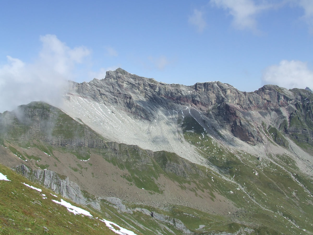
2,570 m, three borders and a sunrise
The Naafkopf, the summit where three countries meet

- Height
- 2,570 m (Alpine Club)
- Borders
- Liechtenstein, Switzerland, Austria
- From the Pfälzerhütte
- About 1 hour up
The Naafkopf hike tops out on a 2,570 m peak in the Rätikon where the borders of Liechtenstein, Switzerland and Austria meet. Most people sleep at the Pfälzerhütte, at 2,108 m, and climb for sunrise in about an hour; as a single day, the tourist board lists 19 km, 8 hours 30 minutes and 1,258 m of ascent. The hut closed on 11 October 2026.
I'd do it over two days, not one. Walk up to the Pfälzerhütte in the afternoon, have dinner there and set off in the dark to watch the sun rise over three countries. Doing it in one push from the valley means eight and a half hours on your feet, and that takes the shine off the moment at the top.
Naafkopf: the quick answer
Full read: 4 min
- The 2,570 m Naafkopf is where Liechtenstein, Switzerland and Austria meet.
- It's about an hour up from the Pfälzerhütte, best at sunrise.
- As a day hike from the valley it's 19 km and eight and a half hours of walking.
- The Pfälzerhütte ended its 2026 summer season on 11 October.
Naafkopf, step by step
-
Get to Malbun
On bus 21 from Vaduz. The paths to the hut start there.
Route 21
-
Walk to the Pfälzerhütte
About three hours over the Augstenberg or through the Vaduzer Täli, on white-red-white marked paths.
About 3 h
-
Sleep at the hut
Booked ahead and paid in cash, in the summer season. Outside it, only the Adlerhorst winter room.
Cash only
-
Climb to the summit at dawn
An hour from the hut to 2,570 m, where three countries meet.
1 h
My key points
My notes on Naafkopf
-
01 Most beautiful
Sunrise with a foot in each country
The tourist board picks out sunrise as the Naafkopf's big moment and suggests sleeping at the Pfälzerhütte the night before so you're up in time. From the hut it's about an hour to the top.
the Pfälzerhütte -
02 Money
Up there, it's cash or nothing
The Pfälzerhütte only takes cash, in francs or in euros at the day's rate. Half board costs CHF 75 if you're not a member of an Alpine club.
Liechtenstein's currency -
03 To save money
The chairlift saves you the first climb
If you walk to the hut over the Augstenberg, the Sareis chairlift lifts you to 2,000 m for CHF 11. In 2026 it ran in summer until 18 October.
Sareis chairlift -
04 My tip
Check the date before you book
The hut ended its 2026 summer season on 11 October, with the last night 10 to 11 October. Until 2027 only the Adlerhorst self-service shelter is open, with no meals.
What I would book
If I had to pick one summit in Liechtenstein, I wouldn’t pick the highest. I’d pick the Naafkopf, because from the top you’ve got Liechtenstein on one side, Switzerland on another and Austria on the third, and because the tourist board is right when it says the best way to arrive is with the sun coming up.
The Naafkopf, a 2,570 m summit shared by three countries
The Naafkopf sits in the Rätikon, the range that forms the border between Austria’s Vorarlberg, Switzerland’s Prättigau and the south of Liechtenstein. The Historisches Lexikon describes it as the tripoint of that range, a few kilometres from the Grauspitz, which at about 2,600 metres is the country’s highest point. The Alpine Club gives the Naafkopf 2,570 metres. You’ll see 2,571 on other lists, and the difference won’t change a thing underfoot.
What does change is the view. To the north lie the Malbun valley and the rest of the mountains in Liechtenstein, to the south the Swiss massif and to the east the valleys of the Vorarlberg. There aren’t many Alpine summits where it’s this easy to explain to someone what they’re looking at.
The Naafkopf in one day, or a night at the hut?
You can do it two ways, and I know which I’d choose. The tourist board’s choice is a night at the Pfälzerhütte, the hut on the Bettlerjoch saddle just north of the summit, then an early start in the dark. From the door it’s about an hour up, so you reach the top just as the sun rises. That’s my pick.
The other is to do it in one go. Liechtenstein Marketing publishes it as a 19-kilometre route with eight and a half hours of walking, 1,258 metres of ascent and nearly as much descent, with its lowest point at 1,303 metres, which is roughly the height of Steg. Those are the numbers of a long mountain day. If you’re very fit it’s doable, but you’ll reach the top around midday, in flat light with the cloud building, which is exactly the opposite of what makes this place special.
If you are staying the night, see the best hotel deals in Malbun for your dates: the well-placed rooms go fast.
Getting to the Pfälzerhütte
The Alpine Club lists four ways up, all mountain paths waymarked white-red-white. My favourite starts in Malbun, climbs to the Sareiserhöhi and follows the ridge of the Princess Gina Trail to the 2,359-metre Augstenberg before dropping to the hut. It takes about three hours, and the Sareis chairlift saves you the first climb for CHF 11. In 2026 it ran in summer until 18 October.
The shortest also starts in Malbun, through the Vaduzer Täli and the Gritsch alp, in about two hours. From Steg you walk up the Valüna valley in two to three hours, and there’s a path that branches off into the Naaftal at around 1,650 metres and heads straight for the pass. The fourth comes up from the Austrian side, from the Nenzinger Himmel, in about two hours.
My combination would be to go up over the Augstenberg the afternoon before, sleep at the hut, climb at sunrise and come down through the Täli. It makes a full loop and you don’t repeat a single metre.
What you need to know about the hut
The Pfälzerhütte belongs to the Liechtenstein Alpine Club and is booked through its online system. With a three-course vegetarian dinner and breakfast, a night comes to CHF 75, or CHF 68 for members of a partner Alpine club, and you pay in notes, francs or euros.
The date matters. In 2026 the hut ended its summer season on 11 October, with the last night 10 to 11 October, and until the 2027 season, still without dates, the only bed is the Adlerhorst winter room next door, 21 bunks at CHF 20 with firewood and a stove, but nobody to cook for you and no phone for emergencies. If you’re torn between this hut and the one at Gafadura, I set them side by side in mountain huts in Liechtenstein.
Before you fix your dates, compare train and coach tickets to Vaduz: the same journey can cost very different amounts from one day to the next.
The last hour to the summit
Just above the hut, on the way to the Naafkopf, the Alpine Club points out a small climbing garden with routes from grade 4 to grade 7. There’s no gear to hire, so it’s only for people who bring their own. The rest is the climb itself, an hour according to the tourist board, which in the dark is best done with a head torch and without rushing.
With a bit of luck, says Liechtenstein Marketing, you’ll see ibex along the way. Dawn is when your chances are best, so I’d keep quiet for the final half hour.
Turning it into something longer
The Naafkopf is the second morning of the hut-to-hut Route 66, the three-day traverse the tourist board puts together. That day you climb for sunrise and then drop via the Gritsch alp and the Valüna valley to the lake at Steg. If your legs have more in them, the Liechtensteiner Höhenweg also leaves from the hut towards the Mannheimer Hütte and the Schesaplana, over in Austria.
To weigh this up against the country’s other routes, I compare them all in hiking in Liechtenstein.
So you do not lose the morning at the ticket office, browse tickets and tours in Naafkopf on GetYourGuide.
If you would rather go at your own pace, see the car hire deals in Zurich: the earlier you book, the more cars are left to choose from.
If you are staying the night, see the best hotel deals in Malbun for your dates: the well-placed rooms go fast.
Two ways up
| Plan | Distance and time | Climb | Who it suits |
|---|---|---|---|
| Night at the Pfälzerhütte, summit at sunrise | About 2-3 h to the hut, then 1 h to the top | Split over two days | Anyone who wants the sunrise |
| Up and back in a day from the valley | 19 km, 8:30 h walking | +1,258 m / −1,256 m | Very fit mountain walkers |
Day route, high point 2,570 m and low point 1,303 m, from Liechtenstein Marketing (archive.org copy of 10 May 2026). Hut-to-summit time from its top five hikes page (copy of 6 August 2026).
Paths to the Pfälzerhütte
| Start | Route | Time |
|---|---|---|
| Malbun (1,600 m) | Sareiserhöhi, Princess Gina Trail and Augstenberg (2,359 m) | About 3 h, less with the chairlift |
| Malbun (1,600 m) | Vaduzer Täli, Tälihöhi and Gritsch alp | About 2 h |
| Steg (1,300 m) | Valüna valley and Gritsch alp, or the Naaftal | 2 to 3 h |
| Nenzinger Himmel (1,370 m, Austria) | Güfelalpe | About 2 h |
Times and heights from the Liechtenstein Alpine Club, checked on 3 October 2026. All are mountain paths waymarked white-red-white.
Pfälzerhütte, 2026 summer season
| What | Alpine club members | Non-members | Children up to 12 |
|---|---|---|---|
| Half board | CHF 68 | CHF 75 | CHF 40 |
| Bed and breakfast | CHF 38 | CHF 45 | CHF 20 |
2026 season closed on 11 October, with the last night 10 to 11 October; 2027 dates not yet published. Cash only. In winter, the Adlerhorst self-service shelter, 21 places, CHF 20 a night.
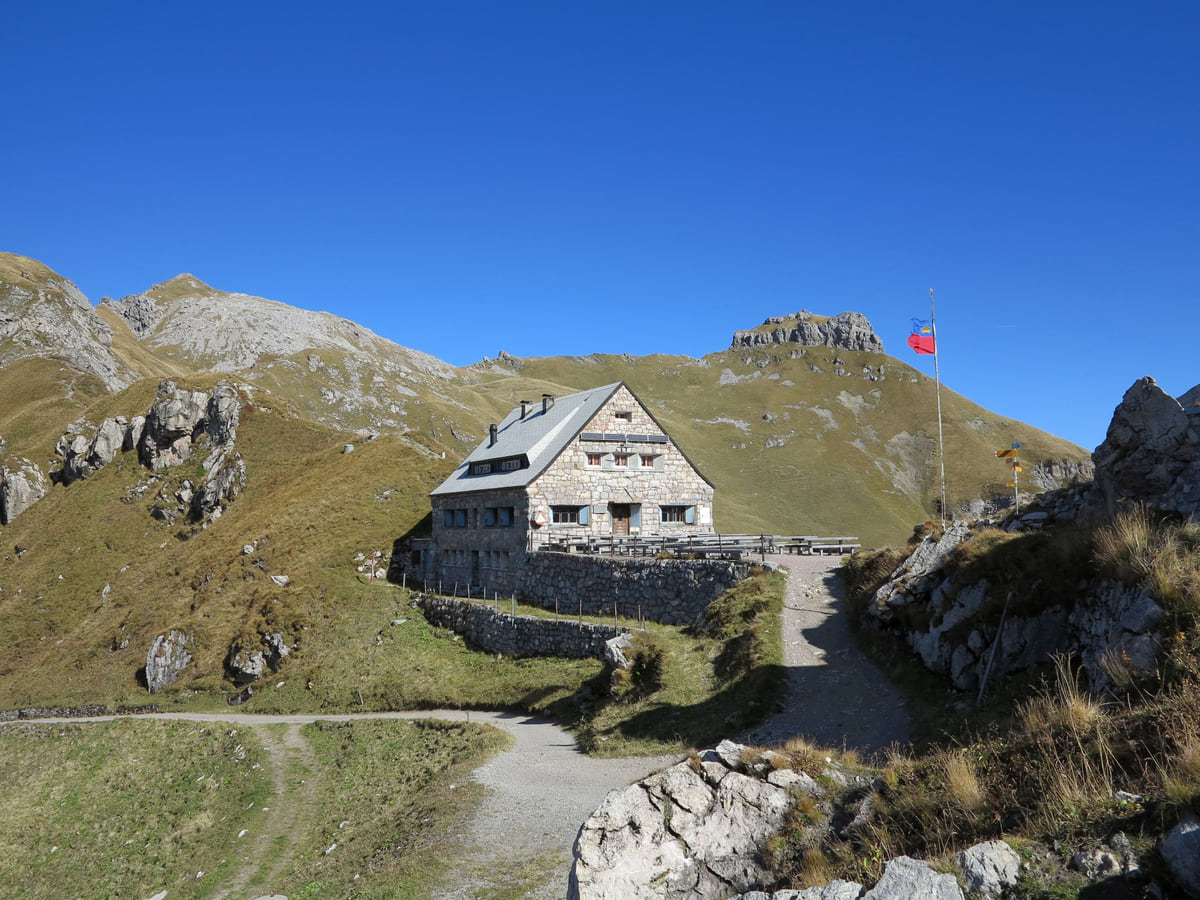
The stone Pfälzerhütte mountain hut on the pass among alpine meadows and rocks, with the Liechtenstein flag.
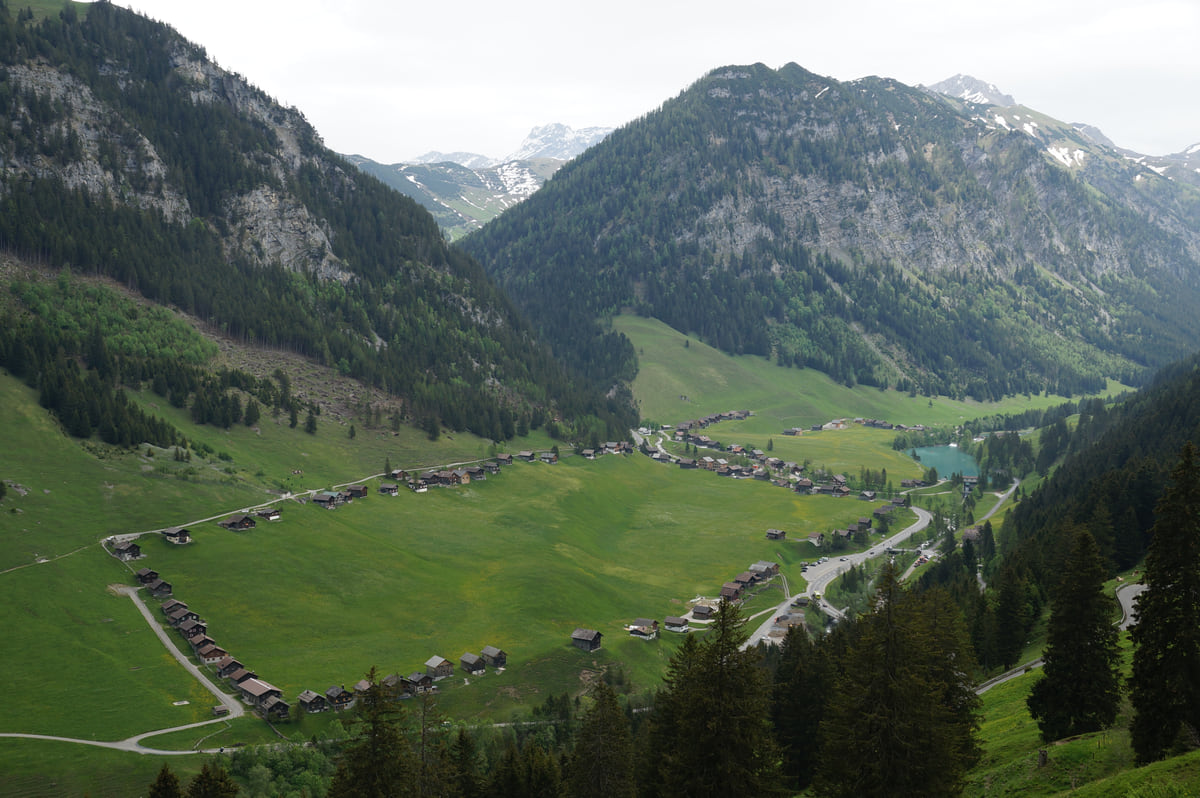
The Steg valley with its rows of wooden huts on the meadow, the reservoir at the far end and the mountains all around.
Test yourself
True or false?
0/3 Pick before you peek.
-
Liechtenstein, Switzerland and Austria meet on the summit of the Naafkopf.
See the answer
True. It's the tripoint of the three countries, according to the tourist board and the Historisches Lexikon, which places it in the Rätikon next to the Grauspitz.
-
The Naafkopf is Liechtenstein's highest point.
See the answer
False. That's the Grauspitz, at about 2,600 m. The 2,570 m Naafkopf is lower but far more visited.
-
The Pfälzerhütte takes cards.
See the answer
False. Cash only, in francs or in euros at the day's rate, according to the Liechtenstein Alpine Club.
Map
Where Naafkopf is
The dashed line is the border: Switzerland across the Rhine, Austria to the north and east. Every number opens its guide.
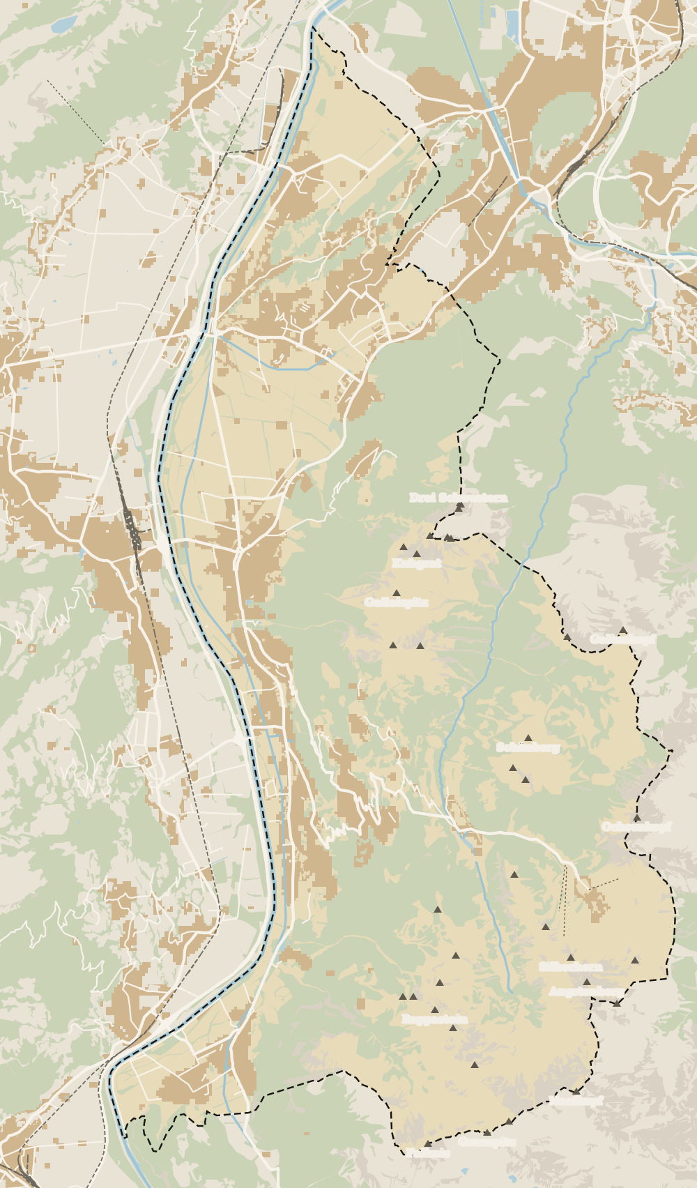 1Fürstensteig 2Liechtenstein Trail 3Princess Gina Trail 4Naafkopf
Map data © OpenStreetMap contributors (ODbL)
- Height of the summit
- 2,570 m
- Countries that meet at the top
- 3
- Official day route
- 19 km
- From the hut to the summit
- 1 h
Quick questions about Naafkopf
Where is the Naafkopf?
In the south of Liechtenstein, in the Rätikon range, above the Bettlerjoch pass and the Pfälzerhütte. Its 2,570 m summit, the Alpine Club's figure, is where the borders of Liechtenstein, Switzerland and Austria meet.
How long does it take to climb the Naafkopf?
About an hour from the Pfälzerhütte, according to the tourist board. As a day hike from the valley it's 19 km and eight and a half hours of walking, with 1,258 m of ascent, not counting stops.
Is the Naafkopf the highest mountain in Liechtenstein?
No. The highest is the Grauspitz, at about 2,600 m, in the same Rätikon range. The Naafkopf is the better-known summit because three countries meet on it.
Do I need to stay at the Pfälzerhütte?
It isn't compulsory, but it's what the tourist board recommends if you want the sunrise, and it's what I'd do. You need to book, pay in cash and bear in mind that the 2026 season ended on 11 October and 2027 has no dates yet.
Will I see wildlife on the Naafkopf?
The tourist board says that with a bit of luck you'll spot ibex on the way. I'd bring binoculars and keep quiet for the last half hour.
Can you climb the Naafkopf in winter?
The Pfälzerhütte closes in winter and only the Adlerhorst self-service shelter stays open, with no food and no emergency phone. Outside the summer season I wouldn't try it without winter mountain experience.
0 of 170 Liechtenstein guides
Your next stamp
- Mountain huts
- Hut-to-hut Route 66
- Pfälzerhütte
- Mountains
- Hiking
- Planken
- Viewpoints
- Things to do
- One day
- Two days
- Municipalities
- Oberland
- Unterland
- Map
- Vaduz
- Städtle
- Mitteldorf
- Vaduz Castle
- Vaduz Cathedral
- Parliament
- Government Building
- Vaduz Town Hall
- Red House
- Prince's Winery
- Old Rhine Bridge
- Schaan
- Schalun Castle Ruin
- Balzers
- Citytrain
- Triesen
- Triesenberg
- Walser Museum
- Gutenberg Castle
- The Rhine
- Schaan Roman fort
- Dux
- St Mamertus chapel
- Lawena valley
- Mäls
- DoMuS
- TAK Theatre
- Castles
- Churches and chapels
- Museums
- Kunstmuseum
- Hilti Art Foundation
- Gafadura hut
- National Museum
- Treasure Chamber
- Postage Stamp Museum
- Kunstraum Engländerbau
- Eschen
- Masescha
- Gaflei
- Nendeln
- Mauren
- Silum
- Rotenboden
- Schaanwald
- Gamprin
- Wangerberg
- Bendern
- Steg
- Ruggell
- Samina valley
- Schellenberg Farmhouse Museum
- Cross-country skiing at Steg
- Küefer-Martis-Huus
- Ruggeller Riet
- Schellenberg
- Hinterschellenberg
- Fürstensteig
- Is it a country?
- Liechtenstein Trail
- Malbun
- Schellenberg castles
- Eschnerberg
- Malbun in summer
- Population
- Stage 1: Balzers - Triesenberg
- Lakes
- Sareis
- Size
- Stage 2: Triesenberg - Vaduz
- Malbun Peace Chapel
- Political system
- Stage 3: Vaduz - Nendeln
- Swimming pools
- Language
- Skiing in Malbun
- Stage 4: Nendeln - Ruggell
- Dialect
- Malbun ski pass
- Stage 5: Ruggell - Schaanwald
- Hotels in Malbun
- Stamps
- Princess Gina Trail
- Getting there
- In winter
- Weather
- Airport
- Best time to visit
- In summer
- Events
- Is it worth it?
- With kids
- Zurich to Liechtenstein
- National day
- Sargans to Vaduz
- Christmas
- Feldkirch to Vaduz
- By train
- Traditions
- Carnival
- Getting around
- Buses
- Funken Sunday
- Alpine cattle drive
- Driving and vignette
- Parking
- Bike hire
- Cycling
- EU and Schengen
- Entry requirements
- Borders and customs
- The prince
- The princely house
- The flag
- The coat of arms
- The national anthem
- History
- Second World War
- No army
- Facts
- Why so rich?
- Banks and tax haven
- Where to stay
- Hilti
- Hotels in Vaduz
- False teeth
- Hostel and camping
- Rent the country?
- Where to eat
- Restaurants in Vaduz
- Swiss invasions
- Bars and nightlife
- Food
- Käsknöpfle
- Wine
- Casinos
- Adventure Pass
- Rainy days
- Guided tours
- Tourist office
- Day trips
- Passport stamp
- Music festivals
- Phone and roaming
- Currency and payments
- Prices and budget
- Tipping
- Plugs and sockets
- Tap water
- Opening hours
- Public holidays
- Safety
- Accessibility
- With a dog
- Shopping and souvenirs

Questions about Naafkopf? Write to me
I read every email. If a fact is wrong or missing, tell me and I will check it.
My email sergiolepone@gmail.com
By
Tourism graduate with a master’s in Tourism Management and Planning from the University of Málaga, who has travelled across Europe. He writes every guide from official sources and his own judgement.
Published on . Updated on . Facts checked on .
Sources
Some links in this guide are affiliate links: if you book through them, the site earns a commission at no extra cost to you. Affiliate disclosure
Photos: JMiall (CC BY-SA 3.0); 1-Byte (CC BY-SA 4.0); albinfo (CC0), via Wikimedia Commons.