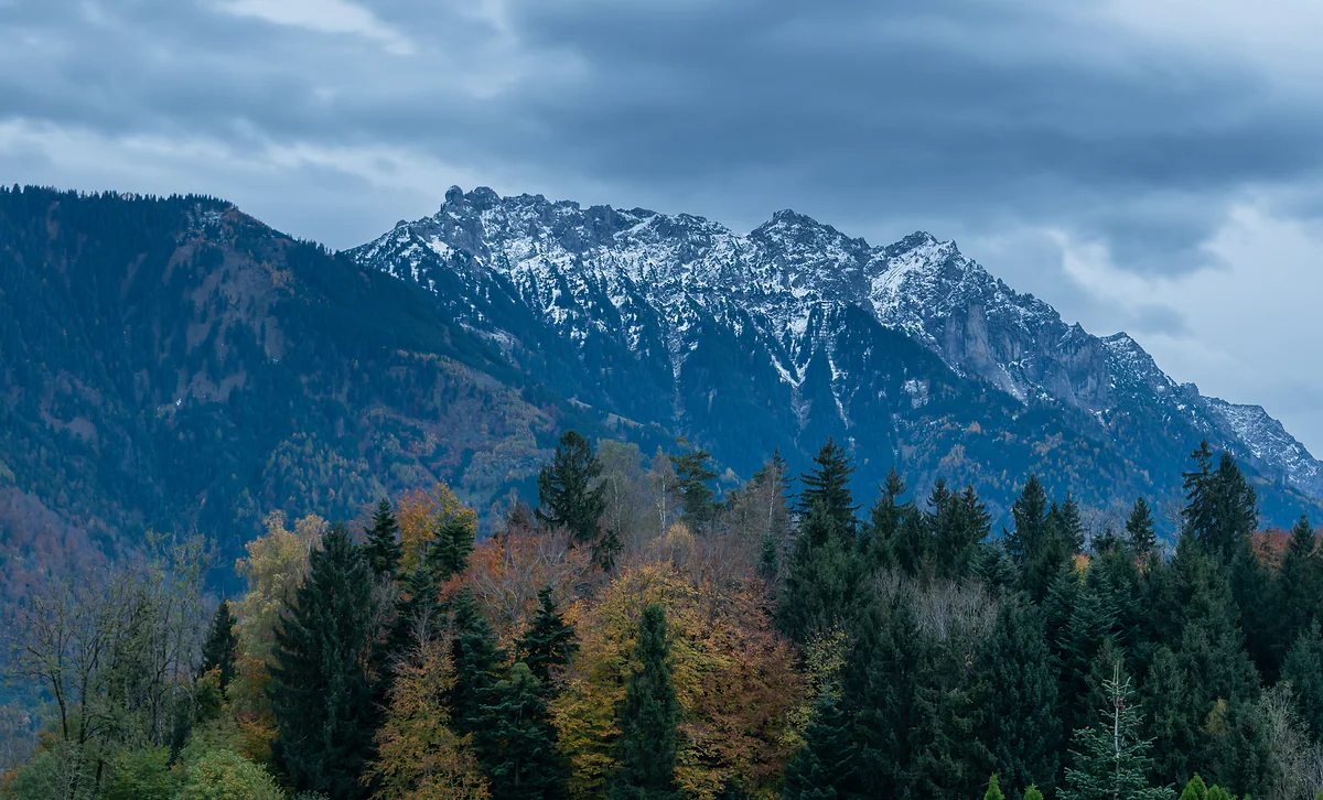
About 2,600 m on the Grauspitz, 430 m at the Riet
Mountains in Liechtenstein, from the Grauspitz to the Drei Schwestern
The highest mountain in Liechtenstein is the Grauspitz, at about 2,600 m in the Rätikon range, and the lowest point is the Ruggeller Riet at 430 m. According to the country's official portal, roughly half of its territory is mountainous. The best-known peaks are the Naafkopf, where three countries meet, the Drei Schwestern and the Falknis.
In 30 seconds
Full read: 3 min
- Liechtenstein's highest mountain is the Grauspitz, at about 2,600 m in the Rätikon.
- The lowest point is the Ruggeller Riet, at 430 m.
- The Naafkopf, 2,570 m, is the tripoint with Switzerland and Austria.
- According to the official portal, around half the country is mountainous.
- There are about 400 km of waymarked trails, says the tourist board.
If you're here for one summit and one chance, I wouldn't go for the highest, I'd go for the Naafkopf. It's about two hours there and back from the Pfälzerhütte and puts you with a foot in three countries.

Before you go
What I would keep in mind
-
01 Most beautiful
Three countries from one summit
The Naafkopf, at 2,570 m, is where Liechtenstein, Switzerland and Austria meet. The Alpine Club suggests it from the Pfälzerhütte in about two hours there and back.
the Pfälzerhütte -
02 My tip
Learn the waymark colours
Yellow is a footpath; white-red-white, a mountain path; white-blue-white, an alpine route. The Fürstensteig and the Drei Schwestern include sections of the last kind.
the Fürstensteig and the Drei Schwestern -
03 Getting there
The bus takes you to 1,600 m
Route 21 runs from Vaduz to Malbun in about 30 minutes and route 22 from Triesenberg to Gaflei. A lot of the routes start where the bus stops.
Liechtenstein's buses -
04 Money
Cash only up top
The Liechtenstein Alpine Club's huts only take cash, in francs or euros. No cards at the Pfälzerhütte or the Gafadura hut.
mountain huts in Liechtenstein
What I would book
My ranking, scored
The summits I'd look at
My own marks out of 10. I've weighed what the top offers, whether there's a route documented by the Alpine Club or the tourist board, and whether it links up with a hut or a bus.
0 of 5 seen
-
Naafkopf (2,570 m)
The tripoint with Switzerland and Austria. About two hours there and back from the Pfälzerhütte, according to the Alpine Club.
9.0 out of 10
-
Drei Schwestern (2,053 m)
The three pinnacles you see from all over the valley, with the Fürstensteig and a legend attached. Sure-footed walkers only.
8.8 out of 10
-
Augstenberg (2,359 m)
Reached on the Princess Gina Trail from Sareis. A 2024 tourist board page calls it the country's highest summit that isn't on the border.
8.4 out of 10
-
Schönberg (2,104 m)
One of the tourist board's featured walks from Malbun, without leaving the country.
7.8 out of 10
-
Grauspitz (about 2,600 m)
The roof of Liechtenstein. I haven't read an official route up it, so to me it's one for experienced mountaineers with a guide.
7.0 out of 10
From the Städtle in Vaduz, Liechtenstein’s mountains look like a wall. Behind that wall is a whole landscape of summits that hardly anyone on a day trip ever sees. Here’s what they are, how high they are depending on who’s measuring, and where I’d start.
How much of Liechtenstein is mountain?
Far more than it seems from the valley. The country’s official portal says roughly half the territory is mountainous and describes Liechtenstein as the only country that lies entirely within the Alps; that’s its view, and I’m quoting it as such. The statistics office puts it another way. The lowest point is the Ruggeller Riet at 430 m and the highest is the Grauspitz at about 2,600 m, in a country of 160 km².
All of that relief belongs to the Rätikon, the range between Swiss Graubünden, Austria’s Vorarlberg and Liechtenstein. According to the Historisches Lexikon, its main ridge forms the frontier, runs from the Falknis in the west to the Silvretta in the east, and on its southern side, in Switzerland, has dolomite walls that climbers rave about. The name has its own tale. A Roman geographer mentioned a mountain called Retico, and in 1518 the humanist Vadian wrongly pinned the name on this range, which has kept it ever since.
The roof of the country and the peaks with a name
The Grauspitz is the highest summit. The statistics office gives it 2,600 m, while the Liechtenstein Alpine Club and the Lexikon say 2,599, so I’ll call it about 2,600 and leave it there. It lies in Triesen’s territory. So does the Lawena valley, an alp of 743.8 hectares whose name comes from an old Romansh word for avalanche. I haven’t read an official route up it, which is why it sits on my list as one for experienced mountaineers.
The one I’d climb is the Naafkopf, at 2,570 m, because Liechtenstein, Switzerland and Austria meet on its summit. The Alpine Club suggests it from the Pfälzerhütte in about two hours there and back, and the tourist board includes a sunrise ascent in its three-day hut tour. To the west, the Falknis, at about 2,560 m, is where the Rätikon begins, according to the Lexikon.
Then there are the ones you see from everywhere. The Drei Schwestern, 2,053 m according to the Alpine Club, are the three pinnacles towering over Planken and Schaan. Their name comes from a legend that the municipality of Planken tells on its website, and the path along them, with the Fürstensteig, is one of the five routes the tourist board features on its list of top walks.
Mountains by municipality
The high ground is shared out in odd ways. Triesenberg is the largest and highest municipality and owns the whole Samina valley and Malbun behind the Kulm ridge. Vaduz, the capital down on the plain, has exclaves up in the mountains, and its highest point is the Silberhorn at 2,150 m. Schaan reaches all the way to the Bettlerjoch, where the Pfälzerhütte stands, and Planken sits at the foot of the Drei Schwestern. A 2024 tourist board page also points out the Augstenberg, at 2,359 m, as the highest summit in the country that isn’t on the border.
A country that organised itself to climb
The enthusiasm goes back a long way. According to the Historisches Lexikon, the idea of an Alpine club was born in 1897-1898, when the Drei Schwestern path was built, and on 25 March 1909 twenty-seven people met in Vaduz to found a Liechtenstein branch of the German-Austrian Alpine Club. It went independent as the Liechtensteiner Alpenverein in 1946, bought the Pfälzerhütte in 1950 and set up its mountain rescue service in 1954.
Getting around the mountains sensibly
The tourist board talks of about 400 km of waymarked trails. The first thing to learn is the colours. According to the Alpine Club, yellow is an ordinary footpath, white-red-white is a mountain path and white-blue-white is an alpine route that needs kit and experience. Some of the country’s finest routes, like the Fürstensteig, include sections of that last kind, and the tourist board warns of snowfields well into spring.
Altitude changes the weather. The statistics office says the valley rarely drops below minus 10 degrees in winter, but Steg sits between 1,310 and 1,450 m, Malbun at about 1,600 and the Sareis terrace at 2,000, so it’s a different climate up there. At the huts, bring cash, because they don’t take cards. Every hut in the country is on my Liechtenstein mountain huts page.
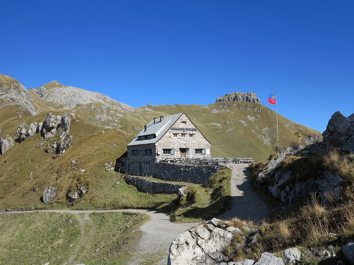
The stone Pfälzerhütte mountain hut on the pass among alpine meadows and rocks, with the Liechtenstein flag.
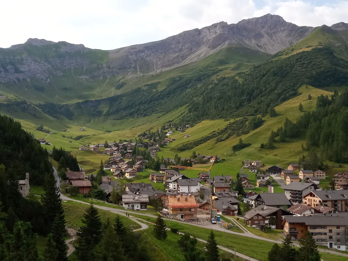
Malbun in summer, with the chalet village on the valley floor, green meadows and rocky peaks above.
Liechtenstein's peaks, according to the Alpine Club
| Summit | Height |
|---|---|
| Grauspitz | 2,599 m |
| Naafkopf | 2,570 m |
| Falknis | 2,560.4 m |
| Augstenberg | 2,358 m |
| Plasteikopf | 2,356 m |
| Gorfion | 2,308 m |
| Ochsenkopf | 2,286 m |
| Rappenstein | 2,221 m |
| Galinakopf | 2,198 m |
| Silberhorn | 2,150 m |
| Kuegrat | 2,123 m |
| Schönberg | 2,104 m |
| Drei Schwestern | 2,053 m |
| Gafleispitz | 2,000 m |
A selection from the Liechtenstein Alpine Club's list. The statistics office rounds the Grauspitz to 2,600 m, and sources differ slightly on the Augstenberg, the Naafkopf and the Falknis.
Heights that change the trip
| Place | Altitude |
|---|---|
| Ruggeller Riet, lowest point | 430 m |
| Vaduz | 460 m |
| Triesenberg, parish church | 886 m |
| Steg | 1,310-1,450 m |
| Malbun | About 1,600 m |
| Sareis | 2,000 m |
Liechtenstein in Zahlen 2026, Verein Valünalopp and Bergbahnen Malbun.
Test yourself
True or false?
0/3 Pick before you peek.
-
Liechtenstein's highest mountain is over 3,000 m.
See the answer
False. The country's roof is the Grauspitz, at about 2,600 m. The statistics office gives 2,600 m and the Alpine Club 2,599.
-
Liechtenstein, Switzerland and Austria meet on the summit of the Naafkopf.
See the answer
True. The Historisches Lexikon calls it the Rätikon tripoint, at 2,570 m, and the tourist board suggests climbing it at sunrise from the Pfälzerhütte.
-
The Romans gave the Rätikon its name.
See the answer
False. According to the Lexikon, a Roman geographer mentioned a mountain called Retico, but it was the humanist Vadian who wrongly attached the name to this range in 1518, and it stuck.
- Grauspitz, per the statistics office
- 2,600 m
- Ruggeller Riet, the lowest point
- 430 m
- Naafkopf, where three countries meet
- 2,570 m
- Of waymarked trails
- 400 km
0 of 168 Liechtenstein guides
Your next stamp
- Size
- Viewpoints
- Hiking
- Malbun
- Triesenberg
- Pfälzerhütte
- Things to do
- Mountain huts
- One day
- Two days
- Municipalities
- Oberland
- Unterland
- Map
- Vaduz
- Städtle
- Mitteldorf
- Vaduz Castle
- Vaduz Cathedral
- Parliament
- Government Building
- Vaduz Town Hall
- Red House
- Prince's Winery
- Old Rhine Bridge
- Schaan
- Schalun Castle Ruin
- Balzers
- Citytrain
- Triesen
- Walser Museum
- Planken
- Gutenberg Castle
- The Rhine
- Schaan Roman fort
- Dux
- St Mamertus chapel
- Lawena valley
- Mäls
- DoMuS
- TAK Theatre
- Castles
- Churches and chapels
- Museums
- Kunstmuseum
- Hilti Art Foundation
- Gafadura hut
- National Museum
- Treasure Chamber
- Postage Stamp Museum
- Kunstraum Engländerbau
- Eschen
- Masescha
- Gaflei
- Nendeln
- Mauren
- Silum
- Rotenboden
- Schaanwald
- Gamprin
- Wangerberg
- Bendern
- Steg
- Ruggell
- Samina valley
- Schellenberg Farmhouse Museum
- Cross-country skiing at Steg
- Küefer-Martis-Huus
- Ruggeller Riet
- Schellenberg
- Hinterschellenberg
- Fürstensteig
- Is it a country?
- Liechtenstein Trail
- Schellenberg castles
- Eschnerberg
- Malbun in summer
- Population
- Stage 1: Balzers - Triesenberg
- Lakes
- Sareis
- Stage 2: Triesenberg - Vaduz
- Malbun Peace Chapel
- Political system
- Stage 3: Vaduz - Nendeln
- Swimming pools
- Language
- Skiing in Malbun
- Stage 4: Nendeln - Ruggell
- Dialect
- Malbun ski pass
- Stage 5: Ruggell - Schaanwald
- Hotels in Malbun
- Stamps
- Princess Gina Trail
- Hut-to-hut Route 66
- Getting there
- In winter
- Weather
- Airport
- Best time to visit
- In summer
- Events
- With kids
- Zurich to Liechtenstein
- National day
- Sargans to Vaduz
- Christmas
- Feldkirch to Vaduz
- By train
- Traditions
- Carnival
- Getting around
- Buses
- Funken Sunday
- Alpine cattle drive
- Driving and vignette
- Parking
- Bike hire
- Cycling
- EU and Schengen
- Entry requirements
- Borders and customs
- The prince
- The princely house
- The flag
- The coat of arms
- The national anthem
- History
- Second World War
- No army
- Facts
- Why so rich?
- Banks and tax haven
- Where to stay
- Hilti
- Hotels in Vaduz
- False teeth
- Hostel and camping
- Rent the country?
- Where to eat
- Restaurants in Vaduz
- Swiss invasions
- Bars and nightlife
- Food
- Käsknöpfle
- Wine
- Casinos
- Adventure Pass
- Rainy days
- Guided tours
- Tourist office
- Day trips
- Passport stamp
- Music festivals
- Phone and roaming
- Currency and payments
- Prices and budget
- Tipping
- Plugs and sockets
- Tap water
- Opening hours
- Public holidays
- Safety
- Accessibility
- With a dog
- Shopping and souvenirs
Frequently asked questions
What is the highest mountain in Liechtenstein?
The Grauspitz, at about 2,600 m. The statistics office gives 2,600 m and the Alpine Club and Historisches Lexikon 2,599. It's in the Rätikon, in the south of the country.
Is Liechtenstein in the Alps?
Yes. According to the country's official portal, around half of the territory is mountainous, and the same portal describes Liechtenstein as the only country lying entirely within the Alps. Its range is the Rätikon.
Where do Liechtenstein, Switzerland and Austria meet?
On the summit of the Naafkopf, at 2,570 m, according to the Historisches Lexikon and the tourist board. It's about two hours there and back from the Pfälzerhütte.
Which mountains can you climb in Liechtenstein?
The usual ones are the Naafkopf from the Pfälzerhütte, the Augstenberg on the Princess Gina Trail, the Drei Schwestern via the Fürstensteig and the Schönberg from Malbun. Several need a sure foot and a head for heights.
How many kilometres of hiking trails does Liechtenstein have?
The tourist board talks of about 400 km of waymarked trails leading to mountains of up to 2,600 m, in a country of 160 km².
What are the Drei Schwestern?
A three-peaked massif above Planken, 2,053 m high according to the Alpine Club. The name comes from a legend published by the municipality of Planken, and the Fürstensteig path runs along it.
By
Tourism graduate with a master’s in Tourism Management and Planning from the University of Málaga, who has travelled across Europe. He writes every guide from official sources and his own judgement.
Published on . Facts checked on .
Sources
Photos: Tournasol7 (CC BY 4.0); 1-Byte (CC BY-SA 4.0); Mislep (CC BY 4.0), via Wikimedia Commons.