The country's northernmost municipality
Ruggell, Liechtenstein's flat north
Ruggell is Liechtenstein's northernmost municipality, with 2,568 residents on 31 December 2025 in 7.4 km². It's the only village in the country that lies entirely on the Rhine plain, which is why it calls itself the cycling village, and it holds the Ruggeller Riet, a protected fen marking the country's lowest point at 430 metres. Its 1730 house, the Küefer-Martis-Huus, is a museum of water.
In 30 seconds
Full read: 3 min
- Ruggell is the northernmost municipality, with 2,568 residents at the end of 2025.
- It's almost entirely flat and calls itself the cycling village.
- The Ruggeller Riet, at 430 metres, is Liechtenstein's lowest point.
- The 1730 Küefer-Martis-Huus opens on Friday, Saturday and Sunday afternoons.
I'd come to Ruggell by bike, which is exactly what the village suggests, and in May, when the irises in the Riet are out. If it's a Friday, Saturday or Sunday afternoon, I'd call in at the Küefer-Martis-Huus for its exhibition. In the depths of winter, though, I wouldn't make the detour.

On the calendar
The dates at a glance
-
Maggy Mauritz, «… und ich bin auch Malerin!»
Küefer-Martis-Huus, Ruggell
-
Village People. Photographs by Peter Klaunzer
Küefer-Martis-Huus, Ruggell
Before you go
What I would keep in mind
-
01 Most beautiful
Irises in May at the lowest point
The municipality recommends a walk or ride through the Ruggeller Riet in May, when the irises flower. It's the protected fen in the north, at 430 metres, the country's lowest point.
the Ruggeller Riet and its May irises -
02 To save money
Dead flat, ideal for shared bikes
Ruggell has had a LIEbike station since 2022. Half an hour costs CHF 2 and a day CHF 20, and in a village without hills it's the easiest way to get around.
bike hire in Liechtenstein -
03 My tip
The museum opens three afternoons a week
The Küefer-Martis-Huus opens Friday, Saturday and Sunday from 14:00 to 17:00, or by appointment. If you drive, use the car park opposite the Gasthaus Rössle.
the Küefer-Martis-Huus in Ruggell -
04 Getting there
Four bus routes
Routes 31 and 32 come from Eschen, route 36 from Vaduz, Schaan and Bendern, and route 37 links Bendern, Ruggell and Sennwald, over in Switzerland.
Liechtenstein's buses
What I would book
My ranking, scored
What I'd do in Ruggell
My score out of 10 based on how unique each place is within the country and how well it fits a visit by bike or on foot.
0 of 4 seen
-
Ruggeller Riet in May
A 90.86-hectare fen, protected since 1978 and a Ramsar site since 1991, that fills with irises in May. There's nothing like it elsewhere in the country.
8.9 out of 10
-
Küefer-Martis-Huus
A listed house from 1730 turned into a cultural centre and museum devoted mainly to water, with changing exhibitions.
7.8 out of 10
-
St Fridolin's church
Neo-Gothic, from 1897-1903, by the same Viennese architect as the Government Building in Vaduz, with a Gothic altarpiece given by Prince Johann II.
7.0 out of 10
-
A bike ride across the plain
The village bills itself as the cycling village, and fairly so, it's flat all the way between the Rhine, the Riet and the Eschnerberg.
7.4 out of 10
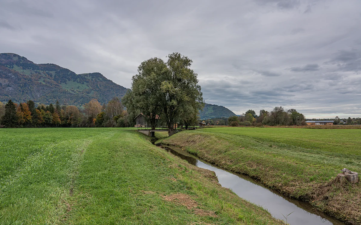
Ruggell is horizontal Liechtenstein. While the south clambers up the mountains, this village at the country’s northern tip spreads across the Rhine plain, between the river, a vast fen and the foot of the Eschnerberg. The upshot is a place you can cycle round without effort, with the Swiss border on one side and the Austrian one on the other.
The cycling village
The municipal website presents Ruggell as Liechtenstein’s cycling village, because it’s the only municipality that’s almost completely flat. It even prints a dialect slogan on the bike bags it hands out, saying roughly that what people in Ruggell like best is cycling from morning till night. The Historisches Lexikon adds the geography, Ruggell is the only village in the country that lies entirely on the Rhine’s floodplain.
It has had a LIEbike station since 2022, and if you bring your own bike you can link up with the valley routes. The country’s cycling options are gathered on cycling in Liechtenstein.
What is there to see in Ruggell?
First, the Ruggeller Riet. It’s a 90.86-hectare fen north of the village, protected since 1978, and the Office of Statistics lists it as the lowest point in the country, at 430 metres. The municipality recommends coming in May, when the irises flower. It has so much natural and human history that I’ve given it a page of its own, the Ruggeller Riet.
Second, the Küefer-Martis-Huus, a listed house from 1730 that the village opened in September 2002 as a cultural centre and museum devoted mainly to water, which makes sense for a place that always lived with one eye on the Rhine. It opens Friday, Saturday and Sunday from 14:00 to 17:00, or by appointment, and runs temporary exhibitions. Until 25 October 2026 it shows work by Maggy Mauritz, and from 22 November to 14 March 2027 a series of photographs by Peter Klaunzer. There’s more detail on the Küefer-Martis-Huus.
St Fridolin’s church is neo-Gothic, from 1897-1903, designed by Gustav Ritter von Neumann, the Viennese architect of the Government Building in Vaduz. Prince Johann II paid 60% of the cost and donated the Gothic winged altarpiece in the baptism chapel, with figures from around 1490. A chapel to the same saint stood here from 1614, and Ruggell only became a parish in its own right in 1874.
A village that lived by the river, and against it
The name comes from the Romansh runcaglia, a clearing, land won from the forest, and the first certain record is from 1347 as «Runggælle». For centuries Ruggell had a ferry across to Salez in Switzerland, a customs post and cattle and horse markets. The ferry stopped in 1918, and the Lexikon says it was the last on Liechtenstein’s stretch of the river. The village’s isolation eased with the Rhine bridge of 1929.
The borders still shape the map. To the west lies the Swiss canton of St Gallen, and to the north Austria’s Vorarlberg, which the Lexikon describes as an EU external border. How to cross each is on Liechtenstein’s borders and customs.
Ruggell also features in the country’s most novel-like 20th-century episode. In May 1945, when what was left of a Russian army that had fought alongside the Wehrmacht crossed the border at Hinterschellenberg, the soldiers spent their first nights in the school buildings of the two northern villages, and the national archive holds a photo of the priest and government councillor Anton Frommelt addressing the internees in the Ruggell camp, with locals watching over the fence.
A village of young families, with a new quarter
Ruggell has grown a lot and it shows. In September 2018 it became the first municipality in the country to receive UNICEF’s child-friendly label, renewed in 2022, and it has ten playgrounds spread around its neighbourhoods. In its business district, well connected to the motorway, the municipal website describes a new quarter with hotels, restaurants, bars and a gym with a spa. Next to it is the Freizeitpark Widau, with football pitches, beach volleyball, an exercise park and a barbecue spot.
Getting there and the Liechtenstein Trail
By bus, routes 31 and 32 come from Eschen, route 36 from Vaduz, Schaan and Bendern, and route 37 crosses to Sennwald. The Liechtenstein Trail ends its fourth stage here, arriving from Nendeln via the Grossabünt bathing lake, and starts its fifth, which leaves the Küefer-Martis-Huus for the Riet and the ruins of Schellenberg.
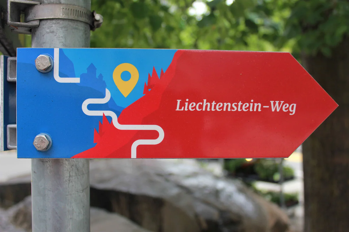
The red and blue signpost of the Liechtenstein-Weg, the trail that runs through all eleven municipalities of the country.
Ruggell in figures
| Fact | Figure |
|---|---|
| Residents on 31-12-2025 | 2,568 |
| Area | 7.4 km² |
| Altitude of the centre | 433 m |
| Lowest point in the country | 430 m, in the Ruggeller Riet |
| First certain record | 1347, as «Runggælle» |
Population and area from the Office of Statistics; altitudes and dates from the Historisches Lexikon.
Küefer-Martis-Huus, dated exhibitions
| Exhibition | Dates |
|---|---|
| Maggy Mauritz, «… und ich bin auch Malerin!» | 16-08 to 25-10-2026 |
| «Village People», photographs by Peter Klaunzer | 22-11-2026 to 14-03-2027 |
Küefer-Martis-Huus website. Usual hours Friday, Saturday and Sunday 14:00-17:00, or by appointment.
Test yourself
True or false?
0/4 Pick before you peek.
-
Ruggell is the only village in Liechtenstein lying entirely on the Rhine plain.
See the answer
True. The Historisches Lexikon says exactly that, it's the only one sitting wholly on the Rhine's flood-prone plain.
-
The last Rhine ferry in Liechtenstein was Ruggell's.
See the answer
True. The ferry between Ruggell and Salez stopped in 1918, the last on Liechtenstein's stretch, and a bridge arrived in 1929.
-
The Küefer-Martis-Huus is open every day.
See the answer
False. It opens Friday, Saturday and Sunday from 14:00 to 17:00, or by appointment.
-
Ruggell was the first municipality in the country to receive UNICEF's child-friendly label.
See the answer
True. It received it in September 2018 and renewed it in 2022 for another four years, according to the municipality.
- Residents on 31-12-2025
- 2,568
- Country's lowest point, in the Riet
- 430 m
- Year of the Küefer-Martis-Huus
- 1730
- First Rhine bridge at Ruggell
- 1929
Map
Where Ruggell is
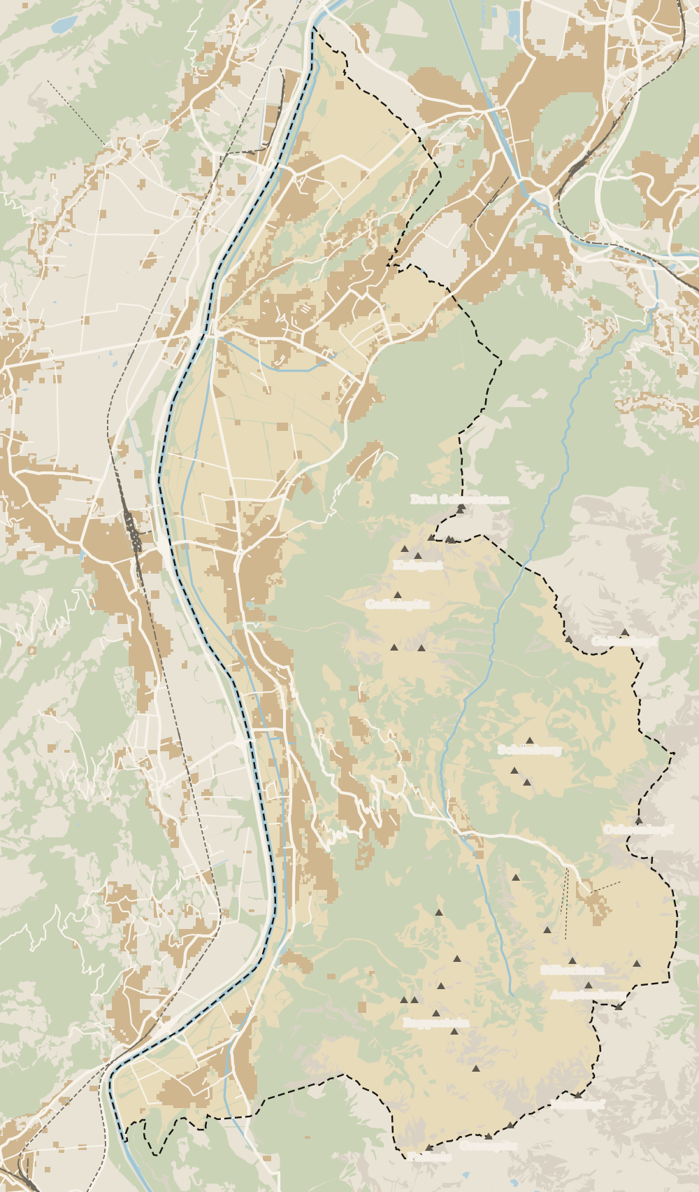
The dashed line is the border: Switzerland across the Rhine, Austria to the north and east. Every number opens its guide.
What to see
What to see in Ruggell
0 of 168 Liechtenstein guides
Your next stamp
- Ruggeller Riet
- Stage 4: Nendeln - Ruggell
- Stage 5: Ruggell - Schaanwald
- Schellenberg
- Eschen
- Küefer-Martis-Huus
- Mauren
- Triesen
- Things to do
- One day
- Two days
- Municipalities
- Oberland
- Unterland
- Map
- Vaduz
- Städtle
- Mitteldorf
- Vaduz Castle
- Vaduz Cathedral
- Parliament
- Government Building
- Vaduz Town Hall
- Red House
- Prince's Winery
- Old Rhine Bridge
- Schaan
- Schalun Castle Ruin
- Balzers
- Citytrain
- Triesenberg
- Walser Museum
- Planken
- Gutenberg Castle
- The Rhine
- Schaan Roman fort
- Dux
- St Mamertus chapel
- Lawena valley
- Mäls
- DoMuS
- TAK Theatre
- Castles
- Churches and chapels
- Viewpoints
- Mountains
- Museums
- Kunstmuseum
- Mountain huts
- Hilti Art Foundation
- Pfälzerhütte
- Gafadura hut
- National Museum
- Treasure Chamber
- Postage Stamp Museum
- Kunstraum Engländerbau
- Masescha
- Gaflei
- Nendeln
- Silum
- Rotenboden
- Schaanwald
- Gamprin
- Wangerberg
- Bendern
- Steg
- Samina valley
- Schellenberg Farmhouse Museum
- Cross-country skiing at Steg
- Hinterschellenberg
- Fürstensteig
- Is it a country?
- Liechtenstein Trail
- Malbun
- Schellenberg castles
- Eschnerberg
- Malbun in summer
- Population
- Stage 1: Balzers - Triesenberg
- Lakes
- Sareis
- Size
- Stage 2: Triesenberg - Vaduz
- Malbun Peace Chapel
- Political system
- Stage 3: Vaduz - Nendeln
- Swimming pools
- Language
- Skiing in Malbun
- Dialect
- Malbun ski pass
- Hotels in Malbun
- Stamps
- Princess Gina Trail
- Hut-to-hut Route 66
- Hiking
- Getting there
- In winter
- Weather
- Airport
- Best time to visit
- In summer
- Events
- With kids
- Zurich to Liechtenstein
- National day
- Sargans to Vaduz
- Christmas
- Feldkirch to Vaduz
- By train
- Traditions
- Carnival
- Getting around
- Buses
- Funken Sunday
- Alpine cattle drive
- Driving and vignette
- Parking
- Bike hire
- Cycling
- EU and Schengen
- Entry requirements
- Borders and customs
- The prince
- The princely house
- The flag
- The coat of arms
- The national anthem
- History
- Second World War
- No army
- Facts
- Why so rich?
- Banks and tax haven
- Where to stay
- Hilti
- Hotels in Vaduz
- False teeth
- Hostel and camping
- Rent the country?
- Where to eat
- Restaurants in Vaduz
- Swiss invasions
- Bars and nightlife
- Food
- Käsknöpfle
- Wine
- Casinos
- Adventure Pass
- Rainy days
- Guided tours
- Tourist office
- Day trips
- Passport stamp
- Music festivals
- Phone and roaming
- Currency and payments
- Prices and budget
- Tipping
- Plugs and sockets
- Tap water
- Opening hours
- Public holidays
- Safety
- Accessibility
- With a dog
- Shopping and souvenirs
Frequently asked questions
What is there to see in Ruggell, Liechtenstein?
The Ruggeller Riet, best in May when the irises bloom, the Küefer-Martis-Huus, a 1730 house that's now a museum of water, and the neo-Gothic St Fridolin's church. And the plain itself, which you tour by bike.
Why is Ruggell called the cycling village?
Because it's the only municipality that's almost completely flat, sitting on the Rhine floodplain. The municipal website calls it that and even prints a dialect slogan on its bike bags.
What is the lowest point in Liechtenstein?
The Ruggeller Riet, at 430 metres, according to the Office of Statistics. It lies north of Ruggell village, on the Austrian border.
How many people live in Ruggell?
2,568 residents on 31 December 2025, according to the Office of Statistics.
How do you get to Ruggell from Vaduz?
On bus route 36, which runs from Vaduz to Schaan, Bendern and Ruggell. You could also take a LIEbike e-bike, as nearly the whole way is flat.
When is the Küefer-Martis-Huus open?
Friday, Saturday and Sunday from 14:00 to 17:00, or by appointment. In 2026 it has a Maggy Mauritz exhibition until 25 October.
By
Tourism graduate with a master’s in Tourism Management and Planning from the University of Málaga, who has travelled across Europe. He writes every guide from official sources and his own judgement.
Published on . Facts checked on .
Sources
Photos: A.Savin (FAL); Pakeha (CC BY-SA 4.0), via Wikimedia Commons.