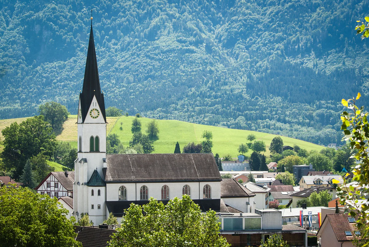
An 8 km island hill from Bendern to Feldkirch
The Eschnerberg, the hill that made the Unterland
The Eschnerberg is an isolated hill in the Rhine valley, 440 to 650 metres high, stretching about 8 km from Bendern to Nofels in Feldkirch and touching all five municipalities of Liechtenstein's Unterland. People have lived on it since the Neolithic, it holds the Schellenberg ruins and several archaeological sites, and a historic ridge path with 45 information panels runs along it.
In 30 seconds
Full read: 3 min
- The Eschnerberg is an isolated hill of 440 to 650 m, about 8 km long, in the Unterland.
- It touches all five northern municipalities and was the heart of the lordship of Schellenberg.
- People have lived on it since the Middle Neolithic, around 4700-4000 BC.
- The Historischer Höhenweg runs along it, with 45 panels.
The Eschnerberg is for unhurried walking. I'd pick up the historic ridge path at Schellenberg, see the two ruins, follow the panels to the Rofenberg in Eschen and drop down to the village for lunch. It isn't high mountain country, it's a long walk full of history, so comfortable shoes are plenty.

Before you go
What I would keep in mind
-
01 Most beautiful
Nearly seven thousand years of people on one hill
The Historisches Lexikon dates the earliest finds on the Eschnerberg to the Middle Neolithic, around 4700-4000 BC. It's one of the earliest settled places in Liechtenstein.
-
02 My tip
The panels have QR codes
Gamprin municipality explains that the historic ridge path is well signposted and that each panel carries a QR code and a map so you know where you are.
-
03 Getting there
Buses climb it from every side
Route 33 climbs to Schellenberg from Mauren and route 35 reaches Hinterschellenberg via Bendern and Gamprin. Eschen and Mauren sit at the foot of the hill.
Liechtenstein's buses -
04 Worth the splurge
Wine from the hill itself
The country's official portal mentions small wineries «from the Eschnerberg to Gutenberg», and Eschen municipality says its restaurants pour wine from the hill's own growers.
Liechtenstein wine
What I would book
My ranking, scored
What I'd see on the Eschnerberg
My score out of 10 for someone walking up for a morning, based on what you can actually see on the ground and what it tells you about the Unterland's past.
0 of 4 seen
-
Obere Burg, Schellenberg
The most complete ruin on the hill, at 668 metres, with ditch, keep and cistern. The tourist board counts it among the country's favourite outings.
8.7 out of 10
-
Bendern church hill
The south-western tip of the hill, where allegiance was sworn to the Prince in 1699, with a church that shows off its foundations.
8.5 out of 10
-
Rofenberg chapel
An early 16th-century chapel on a junction of the old pilgrim route, where the lordship's court sat until 1808.
7.6 out of 10
-
Schneller and Malanser
Two prehistoric sites on the Eschen side. Little to see with the naked eye, plenty to read on the panels.
6.8 out of 10
Look at the Unterland from Vaduz and what you see isn’t a village but a hill. The Eschnerberg rises out of the Rhine plain like an island, and around it five villages have shared its woods, meadows and even its ruins for centuries. To me the best way to understand the north of the country is to walk it.
An island hill in the Rhine valley
The Historisches Lexikon describes it as an isolated hill in the Rhine valley, 440 to 650 metres high, stretching about 8 km from Bendern in the south-west to Nofels, a district of Feldkirch, in the north-east. Most of it belongs to Liechtenstein and it touches all five municipalities of the Unterland, Eschen, Gamprin, Mauren, Ruggell and Schellenberg, with some rather tangled boundaries.
It has rounded tops, gentle hills to the south-east and rock faces to the north-east, on the Gantenstein. The elongated hills on the south-eastern flank, up to 1,600 metres long, are drumlins, mounds of debris the glacier left under the ice. Geologically it belongs to the Helvetic nappe, the one found in the Western Alps.
Why does it matter so much to the Unterland?
Because historically the Unterland is the Eschnerberg. The communities on its slopes formed the lordship of Schellenberg from the 15th century, and in the 15th and 16th centuries saying «on the Eschnerberg» meant the same as the lordship. Even the Landammann, the top local official, was styled Landammann of the Eschnerberg. The Prince bought the lordship in 1699, and the oath of allegiance was sworn at its south-western tip, on the hill at Bendern.
Nearly seven thousand years of history
The Eschnerberg is one of the earliest inhabited places in Liechtenstein. Finds go back to the Middle Neolithic, around 4700-4000 BC, and there are several sites on its summits and plateaux. On the Eschen side is the Malanser, at 651 metres, a small settlement between three rocky knolls where a grey stone adze from the late 6th or early 5th millennium BC was found, among the earliest evidence of the Neolithic in Liechtenstein. In the Bronze Age, the Lexikon says, the Alpine Laugen-Melaun culture reached the western edge of its range here.
Close by is the Schneller, at 630 metres, a small plateau of 10 by 20 metres that served in the Iron Age as a burnt offering site, with a black layer up to a metre deep packed with pottery and bone. That pottery gave its name to a whole culture of the Rhine valley. The historical society first probed the site in 1943 and David Beck excavated it in 1949-50, the same archaeologist who later uncovered the upper castle at Schellenberg. Gamprin has the Lutzengüetle and Bendern’s hill, and Schellenberg the Borscht, with traces of a Bronze Age settlement. In fairness, there’s little to see with the naked eye, and the interest lies in the panels.
The historic ridge path
Between 1972 and 1974 the Unterland tourist association and the country’s historical society laid out the Historischer Höhenweg, a circular path over the hill with 45 panels on local and natural history. Gamprin municipality explains that it runs along both sides of the ridge, is well signposted and that each panel has a QR code and a map. It passes the ruins of the Schellenberg castles, the Holy Cross chapel on the Rofenberg in Eschen and the sites at Borscht and Lutzengüetle.
Built in the early 1500s, the Rofenberg chapel marks the spot where the old pilgrim route from Vorarlberg to Einsiedeln and Santiago met other paths. Until 1808 the lordship’s court met before the chapel or at the neighbouring inn. The village itself is covered on Eschen.
Wine and footpaths
The hill makes wine too. The country’s official portal mentions small wineries «from the Eschnerberg to Gutenberg», and in 1784 Bendern was said to produce the best wine in the lordship. If the liquid side interests you, it’s on Liechtenstein wine.
For easy walking, the Liechtenstein Trail crosses the hill on its last two stages, and buses 33 and 35 climb to Schellenberg from Mauren and from Bendern. That way you can start on one side and finish on the other without retracing your steps. The rest of the country’s routes are gathered on hiking in Liechtenstein.
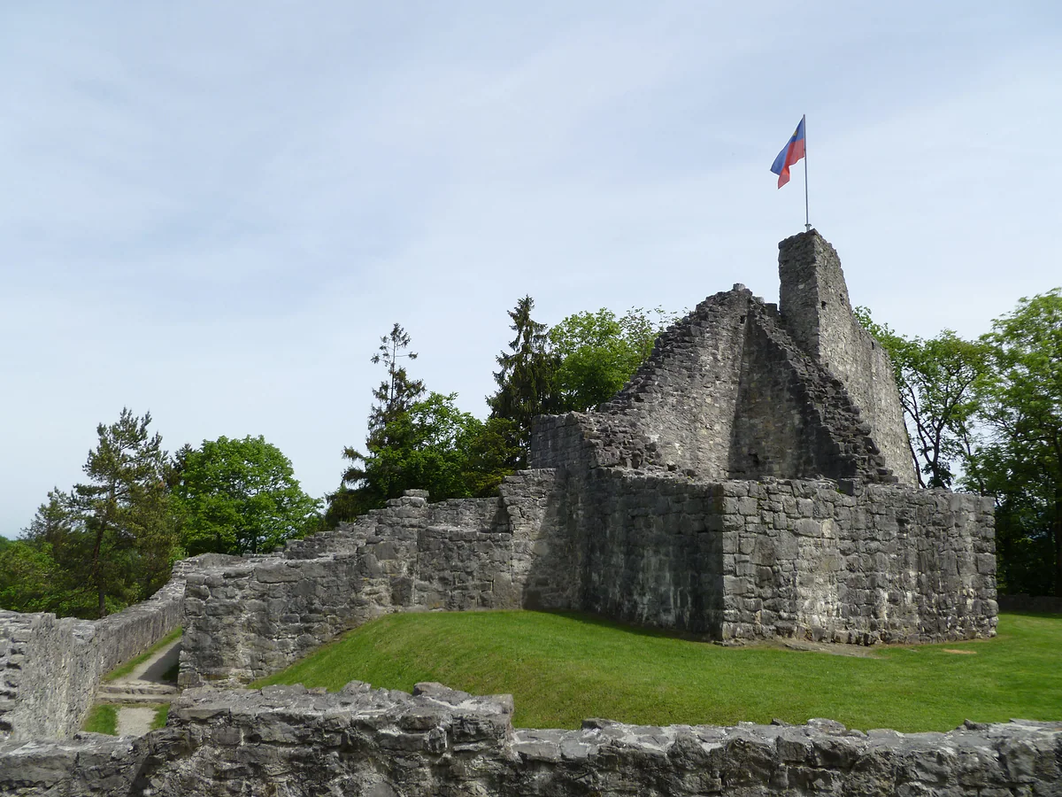
The stone ruins of the upper castle of Schellenberg, with the Liechtenstein flag on top of the tower.
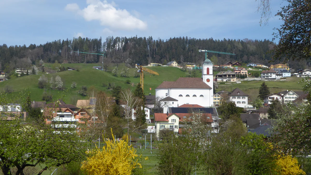
Mauren seen from the south, with the white church on the hill, the houses among the trees and the forest behind.
Archaeological sites on the Eschnerberg
| Site | Municipality | What was found |
|---|---|---|
| Malanser (651 m) | Eschen | Small settlement; Neolithic adze from around 5000 BC |
| Schneller (630 m) | Eschen | Iron Age burnt offering site |
| Kirchhügel | Gamprin (Bendern) | Bronze Age pottery, 6th-7th-century manor, church |
| Lutzengüetle | Gamprin | Neolithic settlement |
| Borscht | Schellenberg | Pits and hearths of an Early Bronze Age settlement |
Historisches Lexikon, entries «Eschnerberg», «Malanser», «Schneller», «Bendern (Kirchhügel)» and «Schellenberg (Gemeinde)».
Test yourself
True or false?
0/3 Pick before you peek.
-
The Eschnerberg lies entirely within Liechtenstein.
See the answer
False. Most of it does, but it runs on to Nofels, part of Feldkirch in Austria.
-
The long hills on the south-eastern side are glacial drumlins.
See the answer
True. The Lexikon explains they're drumlins, rounded mounds of debris laid down under the ice, up to 1,600 metres long.
-
There are Neolithic remains on the Eschnerberg.
See the answer
True. Finds go back to the Middle Neolithic, around 4700-4000 BC, and an adze from the late 6th or early 5th millennium BC turned up at the Malanser.
- Length of the hill, roughly
- 8 km
- Top height of the hill
- 650 m
- Panels on the historic path
- 45
- Municipalities it touches
- 5
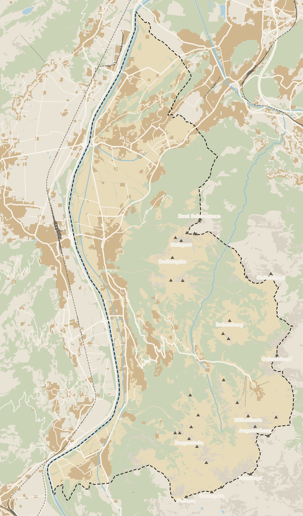
Map
Where Eschnerberg is
The dashed line is the border: Switzerland across the Rhine, Austria to the north and east. Every number opens its guide.
0 of 168 Liechtenstein guides
Your next stamp
- Unterland
- Schellenberg castles
- Schellenberg
- Eschen
- Stage 4: Nendeln - Ruggell
- The Rhine
- Schalun Castle Ruin
- Stage 2: Triesenberg - Vaduz
- Things to do
- One day
- Two days
- Municipalities
- Oberland
- Map
- Vaduz
- Städtle
- Mitteldorf
- Vaduz Castle
- Vaduz Cathedral
- Parliament
- Government Building
- Vaduz Town Hall
- Red House
- Prince's Winery
- Old Rhine Bridge
- Schaan
- Balzers
- Citytrain
- Triesen
- Triesenberg
- Walser Museum
- Planken
- Gutenberg Castle
- Schaan Roman fort
- Dux
- St Mamertus chapel
- Lawena valley
- Mäls
- DoMuS
- TAK Theatre
- Castles
- Churches and chapels
- Viewpoints
- Mountains
- Museums
- Kunstmuseum
- Mountain huts
- Hilti Art Foundation
- Pfälzerhütte
- Gafadura hut
- National Museum
- Treasure Chamber
- Postage Stamp Museum
- Kunstraum Engländerbau
- Masescha
- Gaflei
- Nendeln
- Mauren
- Silum
- Rotenboden
- Schaanwald
- Gamprin
- Wangerberg
- Bendern
- Steg
- Ruggell
- Samina valley
- Schellenberg Farmhouse Museum
- Cross-country skiing at Steg
- Küefer-Martis-Huus
- Ruggeller Riet
- Hinterschellenberg
- Fürstensteig
- Is it a country?
- Liechtenstein Trail
- Malbun
- Malbun in summer
- Population
- Stage 1: Balzers - Triesenberg
- Lakes
- Sareis
- Size
- Malbun Peace Chapel
- Political system
- Stage 3: Vaduz - Nendeln
- Swimming pools
- Language
- Skiing in Malbun
- Dialect
- Malbun ski pass
- Stage 5: Ruggell - Schaanwald
- Hotels in Malbun
- Stamps
- Princess Gina Trail
- Hut-to-hut Route 66
- Hiking
- Getting there
- In winter
- Weather
- Airport
- Best time to visit
- In summer
- Events
- With kids
- Zurich to Liechtenstein
- National day
- Sargans to Vaduz
- Christmas
- Feldkirch to Vaduz
- By train
- Traditions
- Carnival
- Getting around
- Buses
- Funken Sunday
- Alpine cattle drive
- Driving and vignette
- Parking
- Bike hire
- Cycling
- EU and Schengen
- Entry requirements
- Borders and customs
- The prince
- The princely house
- The flag
- The coat of arms
- The national anthem
- History
- Second World War
- No army
- Facts
- Why so rich?
- Banks and tax haven
- Where to stay
- Hilti
- Hotels in Vaduz
- False teeth
- Hostel and camping
- Rent the country?
- Where to eat
- Restaurants in Vaduz
- Swiss invasions
- Bars and nightlife
- Food
- Käsknöpfle
- Wine
- Casinos
- Adventure Pass
- Rainy days
- Guided tours
- Tourist office
- Day trips
- Passport stamp
- Music festivals
- Phone and roaming
- Currency and payments
- Prices and budget
- Tipping
- Plugs and sockets
- Tap water
- Opening hours
- Public holidays
- Safety
- Accessibility
- With a dog
- Shopping and souvenirs
Frequently asked questions
What is the Eschnerberg?
An isolated hill in the Rhine valley, 440 to 650 metres high, running about 8 km from Bendern to Nofels. It touches all five Unterland municipalities and was the heart of the old lordship of Schellenberg.
What is there to see on the Eschnerberg?
The two Schellenberg castle ruins, Bendern's church hill, the Rofenberg chapel in Eschen and the prehistoric sites of Malanser and Schneller, all linked by a historic ridge path.
Is there a waymarked route over the Eschnerberg?
Yes, the Historischer Höhenweg, laid out in 1972-74 by the Unterland tourist association and the historical society. It has 45 panels on history, nature, place names and legends.
How high is the Eschnerberg?
Between 440 and 650 metres according to the Historisches Lexikon. The highest point in Schellenberg municipality, on the Gantenstein, reaches 698 metres.
Where does the name Eschnerberg come from?
From Eschen, the main village at its foot. In the 15th and 16th centuries, saying «on the Eschnerberg» meant the same as the lordship of Schellenberg.
By
Tourism graduate with a master’s in Tourism Management and Planning from the University of Málaga, who has travelled across Europe. He writes every guide from official sources and his own judgement.
Published on . Facts checked on .
Sources
Photos: Clemens v. Vogelsang from Liechtenstein (CC BY 2.0); SchuetzeZH (CC BY-SA 4.0); Plutowiki (CC0), via Wikimedia Commons.