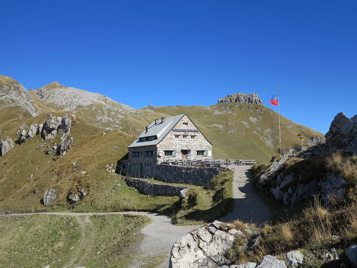
30.3 km in three stages, Malbun to Planken
Route 66, three days hut to hut across Liechtenstein's mountains
Route 66 is the Liechtensteiner Panoramaweg, a mountain traverse waymarked with the number 66 that crosses the country in three stages and 30.3 km, from Malbun to Planken. You sleep at the Pfälzerhütte and in Gaflei or Triesenberg and finish over the Fürstensteig and the Drei Schwestern. In 2026 the tourist board sold it as a CHF 339 package, from mid-June to early October.
In 30 seconds
Full read: 3 min
- Route 66 is the Liechtensteiner Panoramaweg, 30.3 km in three stages.
- It runs from Malbun to Planken via the Pfälzerhütte, Gaflei and the Fürstensteig.
- It totals 1,833 m of ascent and 2,652 m of descent.
- In 2026 it was sold as a CHF 339 package, mid-June to early October.
I'd do it as the official package the first time, because it sorts both beds, the packed lunches and the transport. And I wouldn't set off without checking the forecast for all three days, because the last stage over the Fürstensteig is no place for wet rock.

Before you go
What I would keep in mind
-
01 Worth the splurge
The package takes care of everything
For CHF 339 in 2026 it included two nights' half board, two packed lunches, a three-day pass with buses and chairlift, and a 1:25,000 map. Single room CHF 50 extra.
the Liechtenstein Adventure Pass -
02 Money
Cash for the Pfälzerhütte
At the Pfälzerhütte drinks are cash only, in francs or euros. It's the first thing the tourist board reminds you about in its kit list.
the Pfälzerhütte -
03 Getting there
Free parking in Malbun
The tourist board lets you leave your car free in the P1 to P4 car parks in Malbun for the whole trek, then bus back from Planken.
Liechtenstein's buses -
04 My tip
Sleeping-bag liner and earplugs
A liner is compulsory at the Pfälzerhütte, you sleep in bunks and there are no showers. The tourist board also suggests earplugs, as it's a hut where you hear everything.
What I would book
My ranking, scored
The moments of the trek I rate highest
My own scores out of 10 for each part of the route, for scenery and for how unusual it is, based on the official programme.
0 of 5 seen
-
Fürstensteig and Drei Schwestern
The country's most spectacular stretch, high above the Rhine valley. Also the toughest.
9.6 out of 10
-
Sunrise on the Naafkopf
Three countries at your feet in the first light. Only possible if you sleep at the Pfälzerhütte.
9.2 out of 10
-
Augstenberg ridge
Day one, with flowers and views to the Falknis. A perfect opening.
9.0 out of 10
-
A night at the Pfälzerhütte
A stone hut on the Austrian border, bunks and dinner at 18:00. Part of the charm.
8.4 out of 10
-
Valüna valley
The gentlest day, downhill between alpine pastures to the lake at Steg.
7.8 out of 10
3 days and 2 nights
The trek, day by day
- Day 1
Malbun, Sareis and the Pfälzerhütte
Up to Sareis by chairlift or on foot, along the Princess Gina Trail ridge to the 2,358 m Augstenberg and down to the hut in about four hours. Dinner at 18:00.
- Day 2
Naafkopf sunrise and the Valüna valley
Early risers climb the 2,570 m Naafkopf, about two and a half hours there and back. Then via the Gritsch alp and the Valünatal to the Gänglesee lake at Steg, about four hours.
Day 2
- afternoon
On to Gaflei or Triesenberg
On foot, another hour and a half, or bus 21 from Steg, Tunnel to Triesenberg and bus 22 to Gaflei, Matu. Overnight at the MATU or a hotel in Triesenberg.
- Day 3
Fürstensteig, Drei Schwestern and Planken
The big day, over the protected rock paths of the Fürstensteig and the 2,053 m Drei Schwestern, with a stop at the Gafadurahütte. Arrival in Planken after about five hours.
Times are a guide, based on the official opening hours checked for this guide.
Liechtenstein is small, but its mountains still ask for three days. Route 66 is the way to do them properly, hut to hut, from Malbun to Planken and over the best stretches the country has. Here are the stages, what the package costs and what I’d weigh up before signing on.
What Route 66 is
The name is misleading. According to the tourist board, it’s the Liechtensteiner Panoramaweg, a trail waymarked with the number 66 within a network of more than 400 km, and over three days it strings together two of the country’s star walks. The first stage is the Princess Gina Trail and the last is the Fürstensteig with the Drei Schwestern. In all it’s 30.3 km, 1,833 metres up and 2,652 down, between a high point of 2,360 metres and 780 at the finish. It drops more than it climbs because it starts in Malbun and ends in Planken, close to the Rhine valley.
The stages, one by one
The first leaves Malbun and heads up to Sareis by chairlift or on foot (check first, as Bergbahnen Malbun posts each day whether the chairlift is running), runs along the ridge to the 2,358 m Augstenberg before descending to the hut. Officially it’s 6.1 km, and the programme allows about four hours. Dinner is at 18:00.
The second starts with a treat for early risers. From the hut you climb the 2,570 m Naafkopf, where Liechtenstein, Switzerland and Austria meet, about two and a half hours there and back, to watch the sunrise. Then you descend past the Gritsch alp and through the Valüna valley to the Gänglesee lake at Steg, in about four hours. From there it’s another hour and a half on foot, or bus 21 and then bus 22 up to Gaflei, where you sleep at the MATU, or at a hotel in Triesenberg.
The third is the big one. It leaves Gaflei along the protected rock paths of the Fürstensteig, continues over the 2,053 m Drei Schwestern, stops at the Gafadurahütte at 1,428 m and ends in Planken after about five hours. The tourist board’s stage table says six, and I’d plan on that.
Is it for me?
The tourist board asks for mountain experience, good fitness, sure footing and a head for heights, plus boots with a decent tread. It isn’t exaggerating. The Fürstensteig has protected rock passages and is no place for hesitation or wet rock. The tourist board also warns that snow can linger on that stretch until late spring, so in early June I’d ask about conditions first. If you’ve never done a multi-day trek, I’d start with the Princess Gina Trail on its own and save the full route for another summer.
Package or independent
In 2026 the tourist board sold the trek from mid-June to early October for CHF 339 per person. That covered the night at the Pfälzerhütte with vegetarian half board, the second night at the MATU or at the Kulm or Oberland hotels in Triesenberg, also half board, two packed lunches, the three-day pass with buses and chairlift, and the map. A single room was CHF 50 extra, and a guided small-group version was also announced. You can do it independently too, booking each night yourself. The Pfälzerhütte takes bookings through the Alpine Club’s Hut Reservation system.
What to pack
The official list is short and sensible. A sleeping-bag liner, compulsory at the Pfälzerhütte, earplugs, because it’s a hut where you hear everything, a travel towel, since there are no showers, a head torch, a waterproof, water, some food and cash, because drinks up there are paid in notes only. There’s no wifi. Dogs sleep in the Adlerhorst annexe for CHF 10 a night.
Getting there and back
The tourist board lets you park for nothing in Malbun’s P1 to P4 for all three days, or in the Marktplatz garage in Vaduz, which you pay for. Without a car, bus 21 takes you from Vaduz to Malbun. From Planken, at the end, a bus drops you down to Schaan, and from there you head back to Vaduz or Malbun. Every route is in my guide to buses, and the timetables are worth checking the night before, because in the mountains buses run hourly at best. If you only want one night up high rather than three days, the other options are in mountain huts.
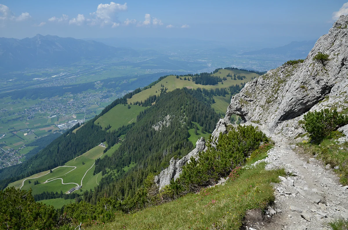
The Fürstensteig path skirting the rock face, with the wooded ridge and the Rhine valley far below.
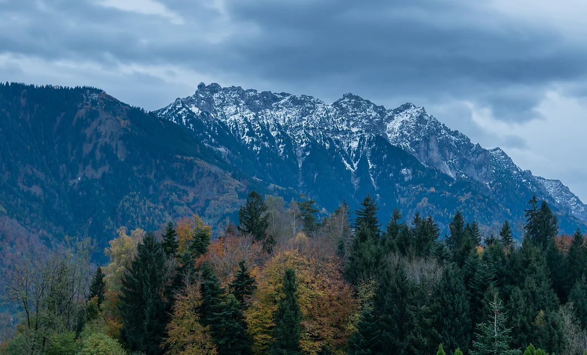
The Three Sisters, rocky snow-dusted peaks above the autumn forest, under grey clouds.
The three official stages
| Stage | Section | Distance | Time | Up / down |
|---|---|---|---|---|
| 1 | Malbun to the Pfälzerhütte | 6.1 km | 3:10 h | +761 / −250 m |
| 2 | Pfälzerhütte to Gaflei | 12.6 km | 3:50 h | +333 / −986 m |
| 3 | Gaflei to Planken | 12.5 km | 6:00 h | +828 / −1,636 m |
| Total | Malbun to Planken | 30.3 km | 17:00 h | +1,833 / −2,652 m |
Figures from the tourist board (archive.org copy of 6 Aug 2026). The stage times don't add up to the published total. The package itinerary says about 4 h on day one and about 5 h on day three.
What the 2026 package included
| Included | Detail |
|---|---|
| First night | Pfälzerhütte, bunks, vegetarian half board |
| Second night | Berggasthaus MATU in Gaflei or Hotel Kulm or Oberland in Triesenberg, half board |
| Trail food | Two packed lunches |
| Transport | Three-day ALL INCLUSIVE Erlebnispass, with buses and the Sareis chairlift |
| Map | 1:25,000, collected at the Malbun Center 9:00 to 17:00 |
Liechtenstein Marketing package, CHF 339 per person; single room CHF 50 extra.
Test yourself
True or false?
0/4 Pick before you peek.
-
Liechtenstein's Route 66 is named after the American highway.
See the answer
False. According to the tourist board it's the Liechtensteiner Panoramaweg, waymarked with the number 66. I haven't found any other official explanation of the number.
-
Route 66 goes down more than it goes up.
See the answer
True. It totals 1,833 m of ascent and 2,652 m of descent, because it starts in Malbun at about 1,600 m and ends lower down, in Planken.
-
The Pfälzerhütte has showers.
See the answer
False. The tourist board warns there are no showers and suggests bringing a travel towel for the washroom.
-
Dogs can stay overnight at the Pfälzerhütte.
See the answer
True. For CHF 10 a night, in the Adlerhorst annexe, according to the tourist board.
- Total distance
- 30.3 km
- Stages
- 3
- Highest point
- 2,360 m
- Official 2026 package
- CHF 339
Map
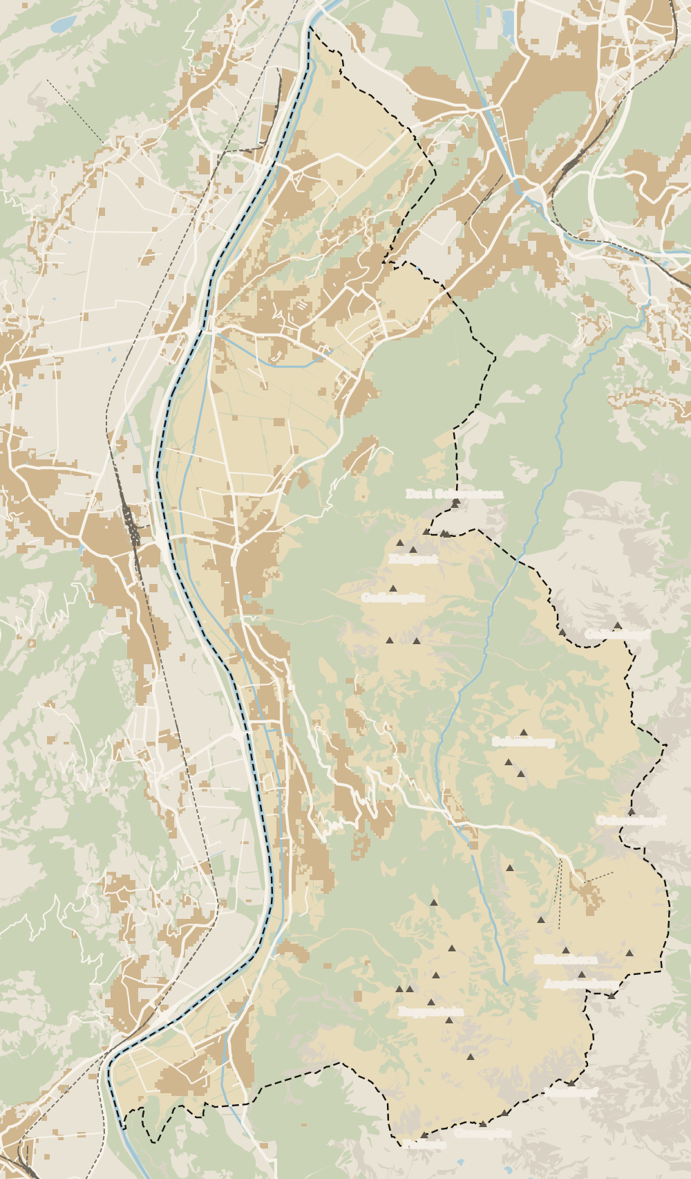
Where Hut-to-hut Route 66 is
The dashed line is the border: Switzerland across the Rhine, Austria to the north and east. Every number opens its guide.
0 of 168 Liechtenstein guides
Your next stamp
- Fürstensteig
- Mountain huts
- Malbun
- Pfälzerhütte
- Things to do
- Princess Gina Trail
- Hiking
- Stage 1: Balzers - Triesenberg
- One day
- Two days
- Municipalities
- Oberland
- Unterland
- Map
- Vaduz
- Städtle
- Mitteldorf
- Vaduz Castle
- Vaduz Cathedral
- Parliament
- Government Building
- Vaduz Town Hall
- Red House
- Prince's Winery
- Old Rhine Bridge
- Schaan
- Schalun Castle Ruin
- Balzers
- Citytrain
- Triesen
- Triesenberg
- Walser Museum
- Planken
- Gutenberg Castle
- The Rhine
- Schaan Roman fort
- Dux
- St Mamertus chapel
- Lawena valley
- Mäls
- DoMuS
- TAK Theatre
- Castles
- Churches and chapels
- Viewpoints
- Mountains
- Museums
- Kunstmuseum
- Hilti Art Foundation
- Gafadura hut
- National Museum
- Treasure Chamber
- Postage Stamp Museum
- Kunstraum Engländerbau
- Eschen
- Masescha
- Gaflei
- Nendeln
- Mauren
- Silum
- Rotenboden
- Schaanwald
- Gamprin
- Wangerberg
- Bendern
- Steg
- Ruggell
- Samina valley
- Schellenberg Farmhouse Museum
- Cross-country skiing at Steg
- Küefer-Martis-Huus
- Ruggeller Riet
- Schellenberg
- Hinterschellenberg
- Is it a country?
- Liechtenstein Trail
- Schellenberg castles
- Eschnerberg
- Malbun in summer
- Population
- Lakes
- Sareis
- Size
- Stage 2: Triesenberg - Vaduz
- Malbun Peace Chapel
- Political system
- Stage 3: Vaduz - Nendeln
- Swimming pools
- Language
- Skiing in Malbun
- Stage 4: Nendeln - Ruggell
- Dialect
- Malbun ski pass
- Stage 5: Ruggell - Schaanwald
- Hotels in Malbun
- Stamps
- Getting there
- In winter
- Weather
- Airport
- Best time to visit
- In summer
- Events
- With kids
- Zurich to Liechtenstein
- National day
- Sargans to Vaduz
- Christmas
- Feldkirch to Vaduz
- By train
- Traditions
- Carnival
- Getting around
- Buses
- Funken Sunday
- Alpine cattle drive
- Driving and vignette
- Parking
- Bike hire
- Cycling
- EU and Schengen
- Entry requirements
- Borders and customs
- The prince
- The princely house
- The flag
- The coat of arms
- The national anthem
- History
- Second World War
- No army
- Facts
- Why so rich?
- Banks and tax haven
- Where to stay
- Hilti
- Hotels in Vaduz
- False teeth
- Hostel and camping
- Rent the country?
- Where to eat
- Restaurants in Vaduz
- Swiss invasions
- Bars and nightlife
- Food
- Käsknöpfle
- Wine
- Casinos
- Adventure Pass
- Rainy days
- Guided tours
- Tourist office
- Day trips
- Passport stamp
- Music festivals
- Phone and roaming
- Currency and payments
- Prices and budget
- Tipping
- Plugs and sockets
- Tap water
- Opening hours
- Public holidays
- Safety
- Accessibility
- With a dog
- Shopping and souvenirs
Frequently asked questions
What is Route 66 in Liechtenstein?
It's the Liechtensteiner Panoramaweg, a mountain trail waymarked with the number 66 that crosses the country in three stages from Malbun to Planken, with nights at the Pfälzerhütte and in Gaflei or Triesenberg.
How long is Liechtenstein's Route 66?
30.3 km in total, with 1,833 m of ascent and 2,652 m of descent, according to the tourist board. The longest stage in time is the third, over the Fürstensteig.
How much is the Route 66 package?
In 2026 the tourist board sold it for CHF 339 per person, with two nights' half board, two packed lunches, the three-day pass and the map. A single room cost CHF 50 extra.
Is Route 66 difficult?
Yes. The tourist board asks for mountain experience, good fitness, sure footing and a head for heights. The third stage crosses the protected rock sections of the Fürstensteig.
Can you do Route 66 independently?
Yes, the trail is waymarked and you can book each night separately. The Pfälzerhütte takes bookings through the Alpine Club's Hut Reservation system and only accepts cash.
When can you walk Route 66?
The 2026 package ran from mid-June to early October. The Alpine Club doesn't publish the Pfälzerhütte's opening dates, so confirm them when you book.
By
Tourism graduate with a master’s in Tourism Management and Planning from the University of Málaga, who has travelled across Europe. He writes every guide from official sources and his own judgement.
Published on . Updated on . Facts checked on .
Sources
Photos: 1-Byte (CC BY-SA 4.0); Pavel Špindler (CC BY 3.0); Tournasol7 (CC BY 4.0), via Wikimedia Commons.