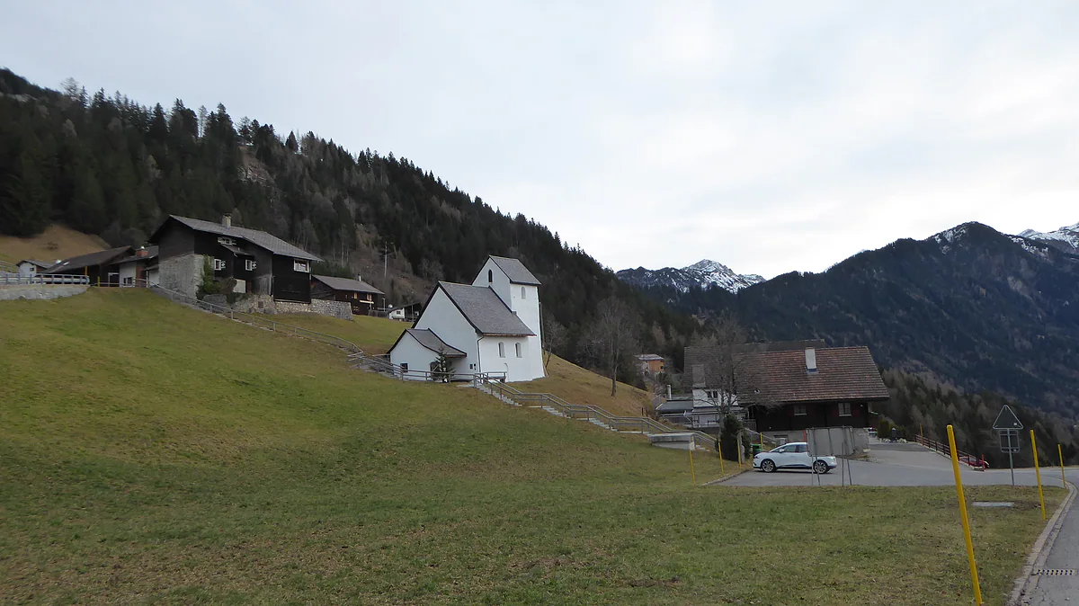
Walser alp between 1,400 and 1,700 m
Silum, the summer terrace above Masescha
Silum is a Triesenberg alp between 1,400 and 1,700 m, just above Masescha, looking over both the Rhine and the Samina valleys. It was a Walser middle pasture, has been a summer retreat since the late 19th century, and in the 1930s it sheltered around 85 Hutterites who had fled Germany.
In 30 seconds
Full read: 3 min
- Silum is a Triesenberg alp between 1,400 and 1,700 m, above Masescha.
- It was a Walser middle pasture and has been a summer retreat since the late 19th century.
- Between 1934 and 1938 it sheltered around 85 German Hutterites.
- There's no bus stop; the nearest is Masescha, Foppa.
Silum has no monument to tick off, which is exactly why I like it. I'd walk up from Masescha at an easy pace to get a feel for how the Walser lived between the village and the high alps.

Before you go
What I would keep in mind
-
01 Most beautiful
A terrace facing two valleys
The alp spreads over both the Rhine and the Samina sides of the ridge. The Historisches Lexikon says the terrace was formed by a slope subsidence between 12,000 and 8,500 BC.
the Samina valley -
02 Getting there
No bus stop of its own
Routes 21 and 22 don't stop at Silum. The nearest stop is Masescha, Foppa on route 22, about 800 m away in a straight line going by the stops' coordinates, and uphill.
Liechtenstein's buses -
03 My tip
Walk it from Masescha
Silum sits right above Masescha, and the 1880-1881 road carries on from there. It's the natural way to link the Walser chapel with the alp in a single morning.
Masescha and its Walser chapel
What I would book
Silum is one of those places that never makes it onto a signpost yet packs in half a century of the country’s history. It’s an alp on a terrace above Masescha, with meadows, wooden chalets and views into two valleys. I’d walk up, and I wouldn’t rush it.
A terrace between two valleys
Silum lies between 1,400 and 1,700 m and covers 40.7 hectares, 24 of them productive pasture. According to the Historisches Lexikon it sits north-east of Triesenberg centre, directly above Masescha, and spreads over both the Rhine and the Samina sides, with the Bargälla alp to the north and Sücka to the east. The terrace itself was created by the slope slumping between 12,000 and 8,500 BC.
The name comes from the Romansh sulam or sulom, meaning a plot of ground. It appears around 1509/17 as Salum, already described as a Walser alp, and in 1611 five Triesenberg men bought it from the people of Triesen. Today it belongs to a cooperative, the Alpgenossenschaft Silum, which holds 56 grazing rights, and since 1997 it has been capped at 20 livestock units.
The halfway step of the Walser year
To understand Silum you need to know how the Walser farmed. Between the village and the high alps they had an intermediate stage, the maiensäss, and Silum was one of them, along with Steg. The Lexikon explains that in late May the herds came up here, three weeks later they moved on to the high alps, and in September they came back down through the same step. Silum was sometimes even called the Aprilsäss, the April pasture.
From alp to summer retreat
The road from Triesenberg to Masescha was extended to Silum in 1880-1881, and the summer visitors followed. In 1912 Franz Xaver Beck opened a tavern with beds, the Silumer Hütte, and between 1914 and 1919 he replaced it with the Alpenkurhaus Silum, with room for 55 guests, which also ran a grocery from 1950 to 1970. The first holiday chalets appeared around 1930, some of them converted alp huts.
The mountain has taken its toll as well. In June 1910, after torrential rain, 25 landslides tore through Silum, and in 1968 avalanche barriers went up on the Samina side.
Hutterite refugees and a count’s title
What surprised me most when reading about Silum is what happened in the 1930s. Swiss border guards lived here from 1924 to 1929, and from 1934 to 1938 there was the Almbruderhof, where around 85 Hutterites, an Anabaptist community driven out of Nazi Germany, lived and worked. The Lexikon’s article on Triesenberg adds that in 1935 some villagers launched a motion to expel them, which narrowly failed at the municipal assembly. From 1939 to 1964, Caritas brought children in need up here every summer for a holiday.
And there’s a story that sounds like something from a novel. In 1939 Prince Franz Josef II made a German, Heinrich Georg von Stahmer, Count of Silum.
Silum’s neighbours
Silum borders two alps worth knowing by name. To the north is Bargälla, straddling the Kulm ridge between 1,100 and 1,960 m and covering 243.7 hectares; its name comes from a Romansh word for a hay barn, and the Lexikon suggests it may have been the first alp to pass into Triesenberg hands. To the east, on the Samina side, is Sücka, whose Berggasthaus at 1,402 m was one of the country’s first mountain inns. Silum itself once paid its dues to the lord in kind, two pounds of butterfat and four of cheese a year, a levy that wasn’t bought out until 1861. Small details, but they show how tightly every patch of grass up here was counted.
Getting there, and what not to count on
Silum has no bus stop. The nearest is Masescha, Foppa on route 22, about 800 m away in a straight line going by the stops’ coordinates, and uphill, so allow a decent walk. By car you follow the Silumstrasse up from Masescha.
What I can’t promise you is lunch. The Lexikon, with data to 2011, listed the old spa house as Berggasthaus Silum, but I haven’t found a current source confirming it’s still trading. I’d pack something and eat properly back down in Masescha. If you fancy more mountains afterwards, the Samina valley lies over the Kulm ridge, with Steg and the Sücka alp.
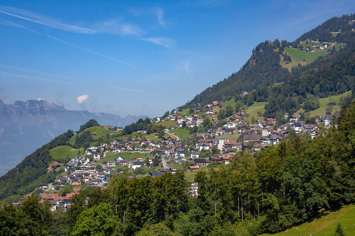
The houses of Triesenberg scattered across the green hillside above the Rhine valley, under a blue sky.
Silum at a glance
| Fact | Figure | Source |
|---|---|---|
| Altitude | 1,400-1,700 m | Historisches Lexikon |
| Area | 40.7 ha, 24 ha of productive pasture | Historisches Lexikon |
| Grazing rights | 56, held by the Alpgenossenschaft Silum | Historisches Lexikon |
| Maximum stock since 1997 | 20 livestock units | Historisches Lexikon |
| First record | Around 1509/17, Salum | Historisches Lexikon |
A century at Silum
| Years | What happened |
|---|---|
| 1880-1881 | The road arrives from Masescha |
| 1914-1919 | The Alpenkurhaus Silum is built, for 55 guests |
| 1924-1929 | Swiss border guards live here |
| 1934-1938 | The Almbruderhof, home to around 85 German Hutterites |
| 1939-1964 | Caritas summer holidays for children in need |
| 1968 | Avalanche barriers and mains water |
From the Historisches Lexikon, whose articles run to 31 December 2011.
Test yourself
True or false?
0/3 Pick before you peek.
-
Silum has its own stop on bus route 22.
See the answer
False. The official 2026 timetable has no stop called Silum. The nearest is Masescha, Foppa, about 800 m away in a straight line.
-
In 1939 the prince gave a German the title Count of Silum.
See the answer
True. According to the Historisches Lexikon, Franz Josef II granted the title Graf von Silum to Heinrich Georg von Stahmer that year.
-
Silum was a Walser middle pasture.
See the answer
True. It was one of their maiensäss, the intermediate pastures the cattle moved to in late May before heading up to the high alps.
- Altitude of the alp
- 1,400-1,700 m
- Grazing rights held by the cooperative
- 56
- Hutterite refugees between 1934 and 1938
- 85
- Five Triesenberg villagers buy Silum
- 1611
Map
Where Silum is
The dashed line is the border: Switzerland across the Rhine, Austria to the north and east. Every number opens its guide.
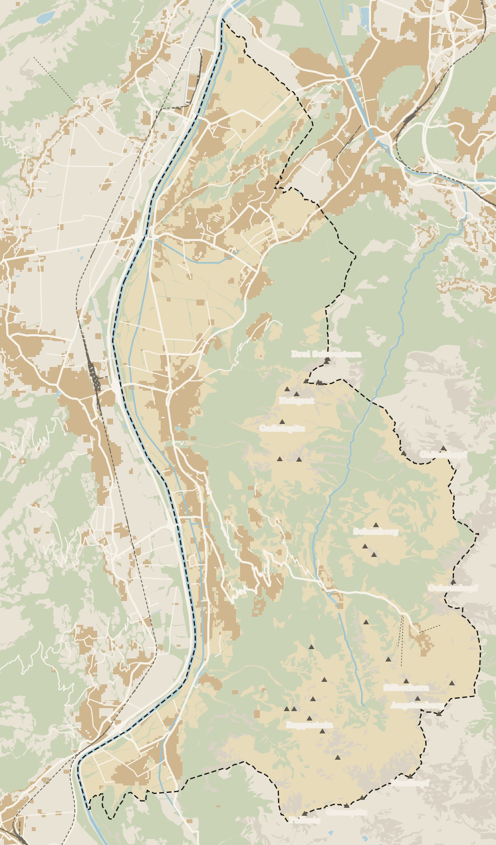 1Triesenberg 2Walser Museum 3Masescha 4Gaflei 5Silum 6Rotenboden 7Wangerberg 8Steg 9Samina valley 10Malbun
 Map data © OpenStreetMap contributors (ODbL)
- 1TriesenbergLargest and highest municipality in the country
- 2Walser MuseumClosed from 12:00 to 15:00
- 3MaseschaTriesenberg hamlet at 1,250 m
- 4GafleiHome of the country's first spa hotel, in 1875
- 5SilumWalser alp between 1,400 and 1,700 m
- 6RotenbodenTriesenberg hamlet, Rotaboda in dialect
- 7WangerbergTriesenberg hamlet, Wangerbärg in dialect
- 8StegTriesenberg summer pasture at about 1,300 m
- 9Samina valleyThe inner valley behind the Kulm ridge
- 10MalbunAt 1,600 m, with an hourly bus from Vaduz
0 of 168 Liechtenstein guides
Your next stamp
- Masescha
- Wangerberg
- Triesen
- Malbun
- Two days
- Stage 1: Balzers - Triesenberg
- Triesenberg
- Things to do
- One day
- Municipalities
- Oberland
- Unterland
- Map
- Vaduz
- Städtle
- Mitteldorf
- Vaduz Castle
- Vaduz Cathedral
- Parliament
- Government Building
- Vaduz Town Hall
- Red House
- Prince's Winery
- Old Rhine Bridge
- Schaan
- Schalun Castle Ruin
- Balzers
- Citytrain
- Walser Museum
- Planken
- Gutenberg Castle
- The Rhine
- Schaan Roman fort
- Dux
- St Mamertus chapel
- Lawena valley
- Mäls
- DoMuS
- TAK Theatre
- Castles
- Churches and chapels
- Viewpoints
- Mountains
- Museums
- Kunstmuseum
- Mountain huts
- Hilti Art Foundation
- Pfälzerhütte
- Gafadura hut
- National Museum
- Treasure Chamber
- Postage Stamp Museum
- Kunstraum Engländerbau
- Eschen
- Gaflei
- Nendeln
- Mauren
- Rotenboden
- Schaanwald
- Gamprin
- Bendern
- Steg
- Ruggell
- Samina valley
- Schellenberg Farmhouse Museum
- Cross-country skiing at Steg
- Küefer-Martis-Huus
- Ruggeller Riet
- Schellenberg
- Hinterschellenberg
- Fürstensteig
- Is it a country?
- Liechtenstein Trail
- Schellenberg castles
- Eschnerberg
- Malbun in summer
- Population
- Lakes
- Sareis
- Size
- Stage 2: Triesenberg - Vaduz
- Malbun Peace Chapel
- Political system
- Stage 3: Vaduz - Nendeln
- Swimming pools
- Language
- Skiing in Malbun
- Stage 4: Nendeln - Ruggell
- Dialect
- Malbun ski pass
- Stage 5: Ruggell - Schaanwald
- Hotels in Malbun
- Stamps
- Princess Gina Trail
- Hut-to-hut Route 66
- Hiking
- Getting there
- In winter
- Weather
- Airport
- Best time to visit
- In summer
- Events
- With kids
- Zurich to Liechtenstein
- National day
- Sargans to Vaduz
- Christmas
- Feldkirch to Vaduz
- By train
- Traditions
- Carnival
- Getting around
- Buses
- Funken Sunday
- Alpine cattle drive
- Driving and vignette
- Parking
- Bike hire
- Cycling
- EU and Schengen
- Entry requirements
- Borders and customs
- The prince
- The princely house
- The flag
- The coat of arms
- The national anthem
- History
- Second World War
- No army
- Facts
- Why so rich?
- Banks and tax haven
- Where to stay
- Hilti
- Hotels in Vaduz
- False teeth
- Hostel and camping
- Rent the country?
- Where to eat
- Restaurants in Vaduz
- Swiss invasions
- Bars and nightlife
- Food
- Käsknöpfle
- Wine
- Casinos
- Adventure Pass
- Rainy days
- Guided tours
- Tourist office
- Day trips
- Passport stamp
- Music festivals
- Phone and roaming
- Currency and payments
- Prices and budget
- Tipping
- Plugs and sockets
- Tap water
- Opening hours
- Public holidays
- Safety
- Accessibility
- With a dog
- Shopping and souvenirs
Frequently asked questions
What is Silum in Liechtenstein?
An alp in the municipality of Triesenberg between 1,400 and 1,700 m, above Masescha. It was a Walser middle pasture and has been a summer retreat since the late 19th century, with holiday chalets and an old spa guesthouse.
How do I get to Silum?
By the road that climbs from Triesenberg to Masescha and has continued to Silum since 1880-1881. By public transport, the nearest stop is Masescha, Foppa on route 22, about 800 m away in a straight line and uphill.
What does the name Silum mean?
According to the Historisches Lexikon it comes from the Romansh sulam or sulom, meaning a building plot or piece of ground. It appears around 1509/17 as Salum, already listed as a Walser alp.
Who lived at the Almbruderhof in Silum?
Around 85 German Hutterites, an Anabaptist community driven out of Nazi Germany, between 1934 and 1938. In 1935 some villagers tried to have them expelled, and the motion narrowly failed at a municipal assembly.
Is there anywhere to eat at Silum?
The Historisches Lexikon, with data to 2011, lists the old spa house as Berggasthaus Silum. I couldn't confirm from a current source that it's still open, so I wouldn't go up relying on it.
How high is Silum?
Between 1,400 and 1,700 m, according to the Historisches Lexikon, above Masescha at 1,250 m.
By
Tourism graduate with a master’s in Tourism Management and Planning from the University of Málaga, who has travelled across Europe. He writes every guide from official sources and his own judgement.
Published on . Facts checked on .
Sources
Photos: Plutowiki (CC0); Lucas Kendall (CC BY-SA 4.0), via Wikimedia Commons.