The flattest stage, with a swimming lake halfway
Liechtenstein Trail stage 4, village to village across the Unterland
The fourth stage of the Liechtenstein Trail runs from Nendeln station to Ruggell, 14.8 km and about 3 hours 55 minutes with only 252 m of ascent. It passes Eschen, the historic path over the Eschnerberg, the church hill at Bendern, the Grossabünt bathing lake in Gamprin and the Kratzera woods before reaching the centre of Ruggell.
In 30 seconds
Full read: 3 min
- Stage 4 runs from Nendeln to Ruggell, 14.8 km in just under four hours.
- It's the flattest, with 252 m of ascent and a high point of 543 m.
- It passes Eschen, the Eschnerberg, the church hill at Bendern and Gamprin.
- It includes a stop at the Grossabünt bathing lake.
This is the stage I'd use to rest my legs and buy time for sightseeing. In summer I'd pack swimming things, because the midday stop at the Grossabünt is one of the best moments on the whole route.

Before you go
What I would keep in mind
-
01 Most beautiful
Where today's Liechtenstein began
On the church hill at Bendern, allegiance was sworn to the prince on 16 March 1699. The tourist board says the spot symbolises the beginning of present-day Liechtenstein.
Bendern and its 1699 oath hill -
02 Most beautiful
A swim halfway along
The Grossabünt in Gamprin is a 4.5-hectare leisure area with a bathing lake, playground and beach volleyball court, open daily from 06:00 to 23:00.
lakes in Liechtenstein -
03 Getting there
Getting to Nendeln and back from Ruggell
Route 14 runs from Vaduz to Nendeln via Schaan. From Ruggell, routes 31, 32 and 36 connect with Eschen, Bendern and Schaan.
Liechtenstein's buses -
04 My tip
Ruggell's museum at the finish
The Küefer-Martis-Huus, opened in 2002, is Ruggell's museum and cultural centre and marks the end of the stage. Check its opening times before you set off.
the Küefer-Martis-Huus in Ruggell
What I would book
After three days of climbing and dropping along hillsides, the fourth stage of the Liechtenstein Trail is almost a stroll. It crosses the Unterland, the northern part of the country, village by village and with barely any gradient. What it lacks in mountain scenery it makes up for in history, because it passes the spot where, according to the tourist board, today’s Liechtenstein began. And there’s a lake for a swim halfway.
Setting off from Nendeln station
The stage starts at Nendeln station, where the previous one finished, so if you’re coming from Vaduz it’s just route 14 via Schaan. The tourist board gives 14.8 km and 3 hours 55 minutes of walking, with 252 m up and 271 m down. The highest point is 543 m and the lowest 433 m. On paper, it’s the easiest of the five.
You soon reach Eschen, whose emblem, according to the tourist board, is the Pfrundbauten, the old presbytery and chaplain’s house beside St Martin’s church, now used for cultural events. If you like village architecture, it’s worth a slow lap round them before moving on. I’d give them a good ten minutes, as this stage is short enough to allow for lingering and there are no big climbs waiting to punish you for it later.
The historic path over the Eschnerberg
From Eschen the route follows a stretch of the Historischer Höhenweg, the historic path along the Eschnerberg, the ridge that separates the Unterland villages. The municipality of Gamprin says it was laid out between 1972 and 1975, runs along both sides of the ridge and is well signposted, with panels carrying QR codes. Nothing explains the Unterland better than this stretch, because from up there you see the Rhine valley and the villages at the same time.
Along the way, the tourist board also points out a maize mill where you can learn about centuries-old milling technology and the history of the trade. It’s a short, rather charming stop.
Why does the church hill at Bendern matter?
The stage’s most meaningful moment comes at Bendern, a village within Gamprin. Its church hill is counted by the tourist board among the oldest settled places in the country, and it’s where the oath was sworn. On 16 March 1699 allegiance to the prince was pledged on that hill, and the tourist board presents it as the symbolic birthplace of present-day Liechtenstein.
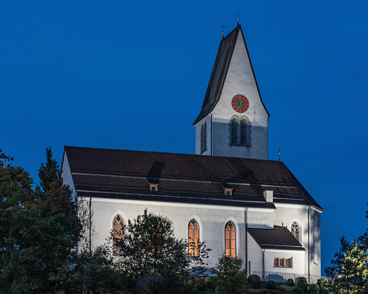
Today the hilltop holds the parish church and the Liechtenstein-Institut. It isn’t a showy monument, but I find it one of the most significant places on the whole trail, because it explains why there’s a country here at all.
A swim at the Grossabünt
Around midday comes the stop you’ll be most grateful for in summer. The Grossabünt in Gamprin is a 4.5-hectare leisure area with a bathing lake, fitness trail, pump track, beach volleyball court and playground, open daily from 06:00 to 23:00. The tourist board sells it as the place for a summer swim in Liechtenstein, and I’ve put it alongside the other options in my guide to lakes in Liechtenstein.
I’d make this the long break of the day, with a sandwich and a dip if the weather plays along. Less than half the stage is left and it’s all flat, so there’s no hurry to lace your boots back up.
Through the woods to Ruggell
The final stretch crosses the Kratzera woods, which the tourist board describes as quiet, and comes into the centre of Ruggell, right up in the north of the country by the Rhine. The natural finishing line is the Küefer-Martis-Huus, opened in 2002 as the municipal museum and cultural centre, and the starting point for the final stage.
Heading back to Vaduz, Ruggell has LIEmobil routes 31, 32 and 36. Route 36 runs via Bendern to Schaan, where you change for the capital. Cards or the app only on board.
My take on this stage
It’s the least dramatic stage of the Liechtenstein Trail, and I still wouldn’t skip it. You get the country’s founding story, a ridge walk with views along the Eschnerberg and the handiest swimming stop on the route, with the lake right beside the path. If you’re walking with children or tired legs, it’s the perfect stage to do in full.
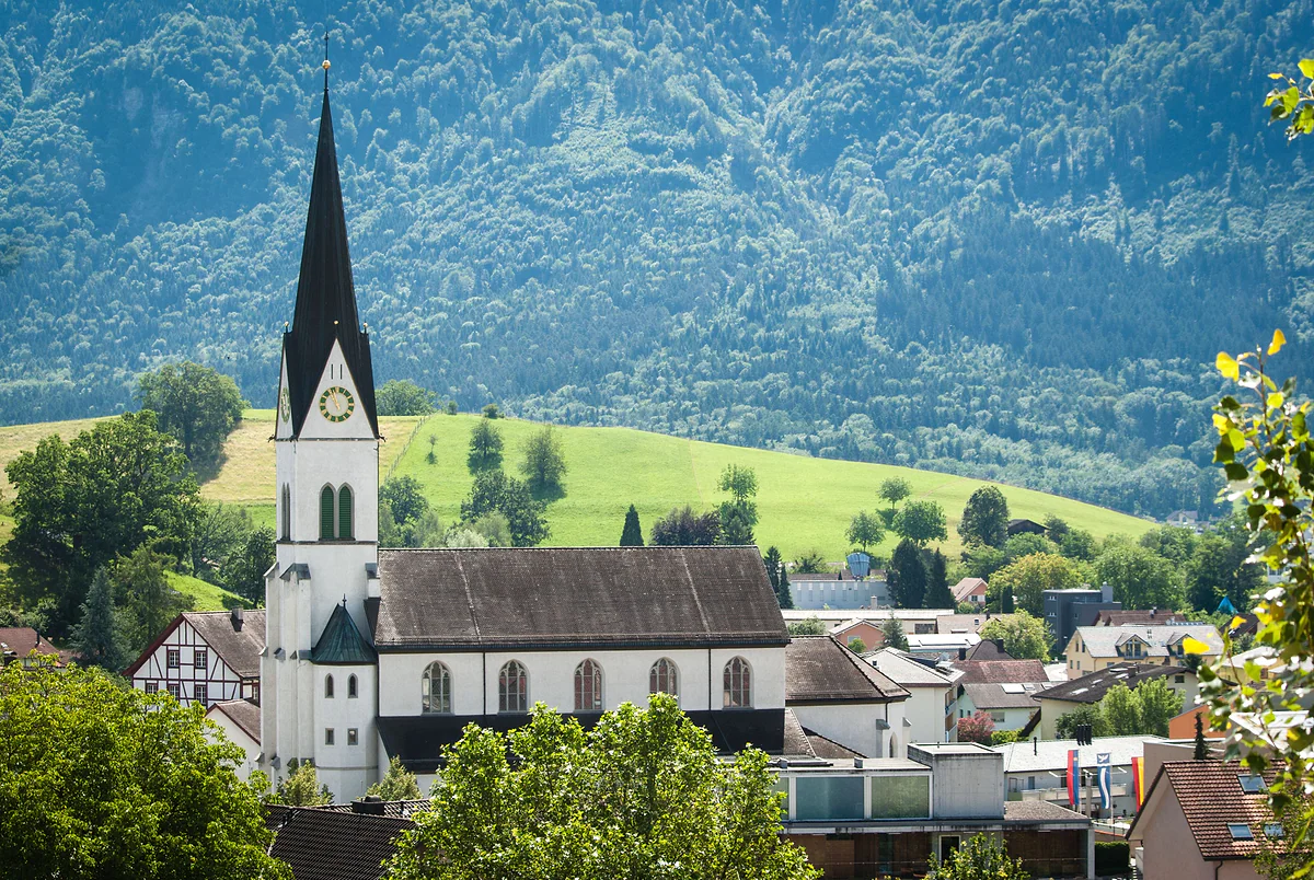
St Martin Church in Eschen, with its black spire, among houses and trees with the green mountain behind.
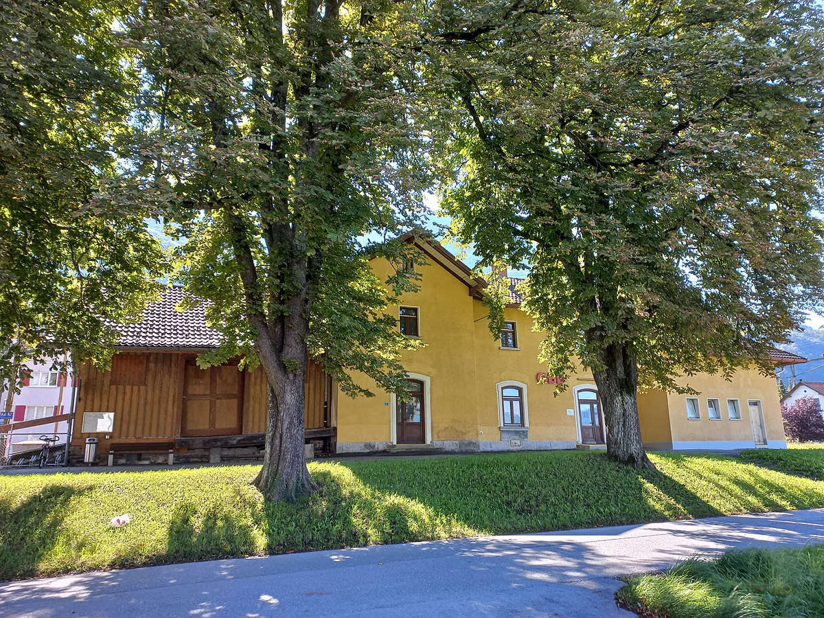
The old Nendeln railway station, with its yellow façade, in the shade of two large trees.
Official card for stage 4
| Fact | Figure |
|---|---|
| Start | Nendeln station |
| Finish | Ruggell village centre |
| Distance | 14.8 km |
| Walking time | 3 h 55 min |
| Ascent and descent | +252 m and -271 m |
| Highest and lowest point | 543 m and 433 m |
Tourist board figures (archive.org copy, 16-06-2026).
Stops along the stage, in order
| Stop | Municipality | What it is |
|---|---|---|
| Pfrundbauten | Eschen | Old presbytery, the village's emblem |
| Historischer Höhenweg | Eschnerberg | Historic ridge path with information panels |
| Maize mill | On the route | Centuries-old milling technology |
| Kirchhügel | Bendern (Gamprin) | Church hill and site of the 1699 oath |
| Grossabünt | Gamprin | Leisure area with a bathing lake |
| Küefer-Martis-Huus | Ruggell | Museum and cultural centre |
Test yourself
True or false?
0/3 Pick before you peek.
-
Stage 4 has the least climbing on the whole Liechtenstein Trail.
See the answer
True. It climbs 252 m, less than any of the other four stages.
-
Allegiance to the prince was sworn at Bendern in 1699.
See the answer
True. It happened on 16 March 1699 on the church hill. The tourist board says it symbolises the start of present-day Liechtenstein.
-
Ruggell's Küefer-Martis-Huus is a 19th-century museum.
See the answer
False. It opened in 2002 as the museum and cultural centre of the municipality of Ruggell.
- Length of the stage
- 14.8 km
- Ascent, the lowest of the five
- 252 m
- Oath of allegiance at Bendern
- 1699
Map
Where Stage 4: Nendeln - Ruggell is
The dashed line is the border: Switzerland across the Rhine, Austria to the north and east. Every number opens its guide.
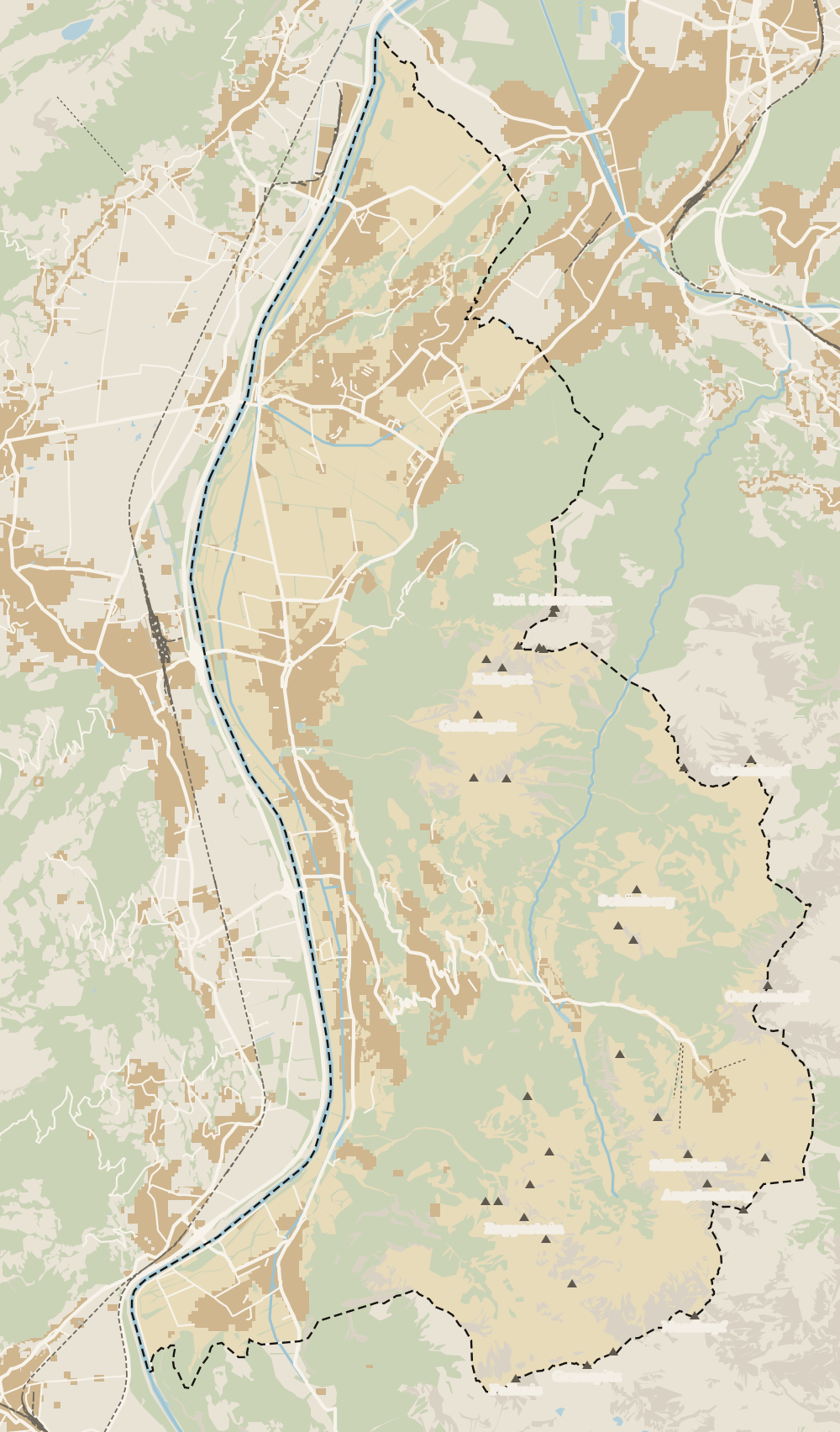 1Liechtenstein Trail 2Stage 1: Balzers - Triesenberg 3Stage 2: Triesenberg - Vaduz 4Stage 3: Vaduz - Nendeln 5Stage 4: Nendeln - Ruggell 6Stage 5: Ruggell - Schaanwald
 Map data © OpenStreetMap contributors (ODbL)
- 1Liechtenstein TrailSwiss border to Austrian border in five days
- 2Stage 1: Balzers - Triesenberg15.7 km and the longest climb on the route
- 3Stage 2: Triesenberg - VaduzThe short stage with the route's highest point
- 4Stage 3: Vaduz - NendelnVineyards, Romans and the steepest descent
- 5Stage 4: Nendeln - RuggellThe flattest stage, with a swimming lake halfway
- 6Stage 5: Ruggell - SchaanwaldThe longest stage ends at a customs post
0 of 168 Liechtenstein guides
Your next stamp
- Stage 5: Ruggell - Schaanwald
- Liechtenstein Trail
- Stage 3: Vaduz - Nendeln
- Nendeln
- Ruggell
- Eschen
- Stage 1: Balzers - Triesenberg
- Hiking
- Things to do
- One day
- Two days
- Municipalities
- Oberland
- Unterland
- Map
- Vaduz
- Städtle
- Mitteldorf
- Vaduz Castle
- Vaduz Cathedral
- Parliament
- Government Building
- Vaduz Town Hall
- Red House
- Prince's Winery
- Old Rhine Bridge
- Schaan
- Schalun Castle Ruin
- Balzers
- Citytrain
- Triesen
- Triesenberg
- Walser Museum
- Planken
- Gutenberg Castle
- The Rhine
- Schaan Roman fort
- Dux
- St Mamertus chapel
- Lawena valley
- Mäls
- DoMuS
- TAK Theatre
- Castles
- Churches and chapels
- Viewpoints
- Mountains
- Museums
- Kunstmuseum
- Mountain huts
- Hilti Art Foundation
- Pfälzerhütte
- Gafadura hut
- National Museum
- Treasure Chamber
- Postage Stamp Museum
- Kunstraum Engländerbau
- Masescha
- Gaflei
- Mauren
- Silum
- Rotenboden
- Schaanwald
- Gamprin
- Wangerberg
- Bendern
- Steg
- Samina valley
- Schellenberg Farmhouse Museum
- Cross-country skiing at Steg
- Küefer-Martis-Huus
- Ruggeller Riet
- Schellenberg
- Hinterschellenberg
- Fürstensteig
- Is it a country?
- Malbun
- Schellenberg castles
- Eschnerberg
- Malbun in summer
- Population
- Lakes
- Sareis
- Size
- Stage 2: Triesenberg - Vaduz
- Malbun Peace Chapel
- Political system
- Swimming pools
- Language
- Skiing in Malbun
- Dialect
- Malbun ski pass
- Hotels in Malbun
- Stamps
- Princess Gina Trail
- Hut-to-hut Route 66
- Getting there
- In winter
- Weather
- Airport
- Best time to visit
- In summer
- Events
- With kids
- Zurich to Liechtenstein
- National day
- Sargans to Vaduz
- Christmas
- Feldkirch to Vaduz
- By train
- Traditions
- Carnival
- Getting around
- Buses
- Funken Sunday
- Alpine cattle drive
- Driving and vignette
- Parking
- Bike hire
- Cycling
- EU and Schengen
- Entry requirements
- Borders and customs
- The prince
- The princely house
- The flag
- The coat of arms
- The national anthem
- History
- Second World War
- No army
- Facts
- Why so rich?
- Banks and tax haven
- Where to stay
- Hilti
- Hotels in Vaduz
- False teeth
- Hostel and camping
- Rent the country?
- Where to eat
- Restaurants in Vaduz
- Swiss invasions
- Bars and nightlife
- Food
- Käsknöpfle
- Wine
- Casinos
- Adventure Pass
- Rainy days
- Guided tours
- Tourist office
- Day trips
- Passport stamp
- Music festivals
- Phone and roaming
- Currency and payments
- Prices and budget
- Tipping
- Plugs and sockets
- Tap water
- Opening hours
- Public holidays
- Safety
- Accessibility
- With a dog
- Shopping and souvenirs
Frequently asked questions
How long does stage 4 of the Liechtenstein Trail take?
The tourist board gives 3 hours 55 minutes for 14.8 km. With a long break at the Grossabünt, I'd allow five or six hours.
Is this the easiest stage of the Liechtenstein Trail?
In terms of climbing, yes. It only goes up 252 m and down 271 m, and the highest point is 543 m. It's a village-to-village walk across the Unterland.
Can you swim on stage 4?
Yes, in the bathing lake at the Grossabünt in Gamprin, a 4.5-hectare leisure area the tourist board promotes as the place for a summer swim.
What happened on the church hill at Bendern?
On 16 March 1699 allegiance was sworn to the prince there, and the tourist board presents the spot as the symbolic birthplace of present-day Liechtenstein. It's also one of the oldest settled sites in the country.
How do I get to the start in Nendeln?
Take LIEmobil route 14 from Vaduz, which runs via Schaan. The stage sets off from Nendeln station.
How do I get back from Ruggell?
Ruggell is served by LIEmobil routes 31, 32 and 36. Route 36 runs via Bendern to Schaan, where you change for Vaduz.
By
Tourism graduate with a master’s in Tourism Management and Planning from the University of Málaga, who has travelled across Europe. He writes every guide from official sources and his own judgement.
Published on . Facts checked on .
Sources
Photos: A.Savin (FAL); Clemens v. Vogelsang from Liechtenstein (CC BY 2.0); Asurnipal (CC BY-SA 4.0), via Wikimedia Commons.