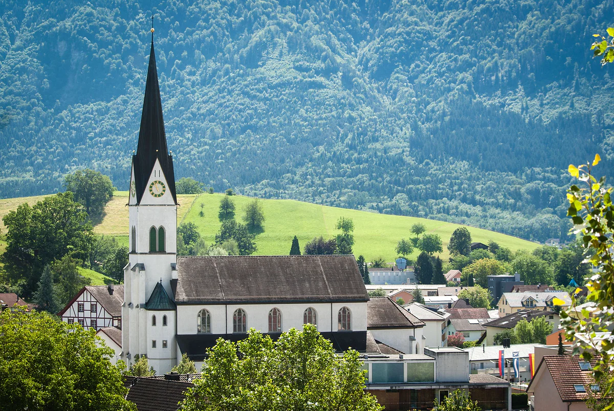
The former lordship of Schellenberg
The Unterland, the northern half hardly anyone visits
The Unterland is Liechtenstein's northern region, the old lordship of Schellenberg and the first land the princes bought, in 1699. It gathers five municipalities around the Eschnerberg, Eschen, Mauren, Gamprin, Ruggell and Schellenberg, with 14,965 residents in 35 km². It has castle ruins, Roman remains, a protected fen and hardly any tourists.
In 30 seconds
Full read: 3 min
- The Unterland is Liechtenstein's northern region, the old lordship of Schellenberg, bought by the princes in 1699.
- It has five municipalities around the Eschnerberg, 35 km² and 14,965 residents.
- It elects 10 of the 25 MPs and has voted separately since the currency crisis of 1877-1878.
- The Schellenberg ruins, Bendern's church hill and the Ruggeller Riet are what I'd go to see.
I'd come to the Unterland with different expectations. There's no princely castle and no mountains, but there's an isolated hill with two ruins, a mound where the country began and a meadow of irises in May. It makes a peaceful half-day, perfect by bike or on foot, and the best antidote to a coach-packed Städtle.

Before you go
What I would keep in mind
-
01 Most beautiful
The hill where modern Liechtenstein was born
On 16 March 1699 the people of the lordship swore allegiance to the Prince on the church hill at Bendern. The tourist board says the spot symbolises the start of today's country.
Bendern and its 1699 oath hill -
02 To save money
A free museum in a house from 1518
Schellenberg's farmhouse museum opens from April to October on the first and last Sunday of each month, 14:00 to 17:00, at no charge. In October 2026 that means the 4th and the 25th.
the Schellenberg farmhouse museum (Bäuerliches WohnMuseum) -
03 Getting there
Buses that climb the hill
Line 33 climbs from Mauren to Schellenberg and the 35 runs via Bendern and Gamprin to Hinterschellenberg. Lines 31 and 32 link Eschen with Ruggell.
Liechtenstein's buses -
04 My tip
Here the Prince is the «Füerscht»
The Unterland speaks a different dialect from the south. It says «Stoo» for stone, «Blooma» for flower and «Füerscht» for prince, where the Oberland says «Stää», «Bluema» and «Förscht».
the Liechtenstein dialect
What I would book
If the Oberland is postcard Liechtenstein, the Unterland is where people simply get on with living. Five villages around an isolated hill, cut off from the south by a flat band of meadows, with more history than it lets on and barely a tour coach in sight. I recommend it to repeat visitors or anyone with half a day to spare and an urge to walk without hurrying.
The first piece of the country
The Unterland is the old lordship of Schellenberg, and it was the first thing the Liechtenstein family bought. Prince Johann Adam Andreas acquired it in 1699, and on 16 March that year the locals swore allegiance to him on the church hill at Bendern. The tourist board says the spot symbolises the start of today’s Liechtenstein, and to me it’s the best place to begin making sense of the country. The hill has its own page under Bendern.
The constitution calls this half «Landschaft Schellenberg (Unterland)». It brings together five municipalities, Eschen, Mauren, Gamprin, Ruggell and Schellenberg, with 14,965 residents at the end of 2025 across 35 km², barely a fifth of the country. It’s smaller than the south but noticeably more crowded, above all in Mauren and Schaanwald, the most densely packed municipality of all.
An island hill in the middle of the plain
The whole Unterland revolves around the Eschnerberg, an isolated hill between 440 and 650 metres that stretches for about 8 km from Bendern to Nofels, already part of Feldkirch, and touches all five municipalities. It was the heart of the old lordship, and a historic ridge path still runs along it. I describe it, archaeology and all, on the Eschnerberg.
Up on the hill stand the two ruins of the lords of Schellenberg, built from the late 12th century. The upper one is a short stroll away and, according to the tourist board, one of the country’s favourite outings. They’re covered on the Schellenberg castles. North of the hill, the Ruggeller Riet drops to 430 metres, Liechtenstein’s lowest point, and fills with Siberian irises in May.
What I’d see in half a day
With a morning free, I’d head up to Schellenberg for the ruins and, if it’s an opening Sunday, the rural museum in a log house from 1518, which is free. Then I’d drop down to Bendern and its church hill, and finish in the Ruggell fen if it’s spring. With more time, the 1778 mill at Eschen and the Roman villa remains at Nendeln and Schaanwald round off the day. The Gampriner Seelein, the country’s largest natural lake, was formed in the Rhine flood of 1927 and has been protected since 1961, and I cover it with the others on the lakes of Liechtenstein.
The Liechtenstein Trail has two stages in this half. Stage four runs from Nendeln to Ruggell via Bendern and the Küefer-Martis-Huus, and stage five leaves Ruggell through the Riet and past the Schellenberg ruins to the customs post at Schaanwald. The last one is described in full on stage 5 of the Liechtenstein Trail.
Why does the Unterland vote separately?
Because of a row about money. In the 1870s the Austrian gulden, then the country’s currency, lost value, and the Oberland, which traded with Switzerland, wanted to move to gold. The Unterland traded with Vorarlberg and saw no reason to change. When the Landtag passed the gold standard in December 1876, the northern MPs had already resigned, and on 13 January 1877 between 300 and 600 Unterlanders marched into Vaduz threatening to take their region over to Austria.
The Prince dissolved parliament, and the compromise came the following year with two separate constituencies. Ever since, the Unterland has elected its own MPs, now 10 of 25, and it’s guaranteed at least two of the five government seats. The Historisches Lexikon notes this gives it a blocking minority it has never used. The southern half is covered on the Oberland of Liechtenstein.
A different accent a few miles away
You can hear the difference. The Unterland says «Stoo» for stone, «Blooma» for flower and «Füerscht» for prince, where the south says «Stää», «Bluema» and «Förscht». And even within the Unterland, Eschen and Mauren call a part a «Taal», whereas in Gamprin, Schellenberg and Ruggell it becomes a «Tool». For a country this size, I find that variety one of its most surprising features.
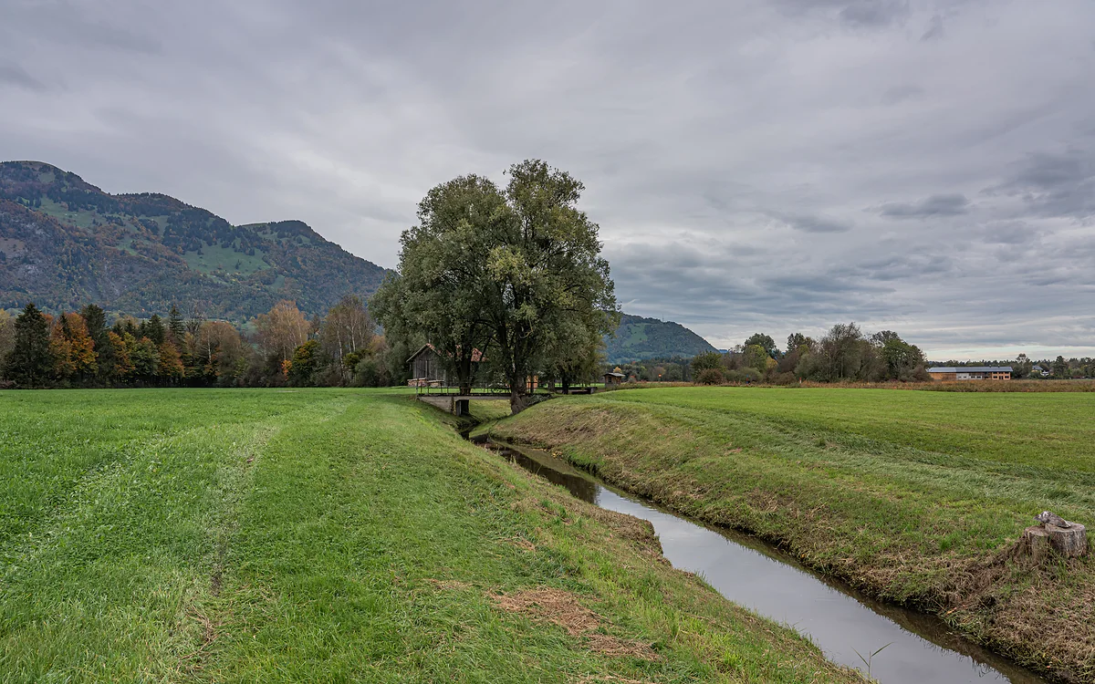
The Ruggeller Riet, with a ditch between meadows, a large tree and the mountains under a grey sky.
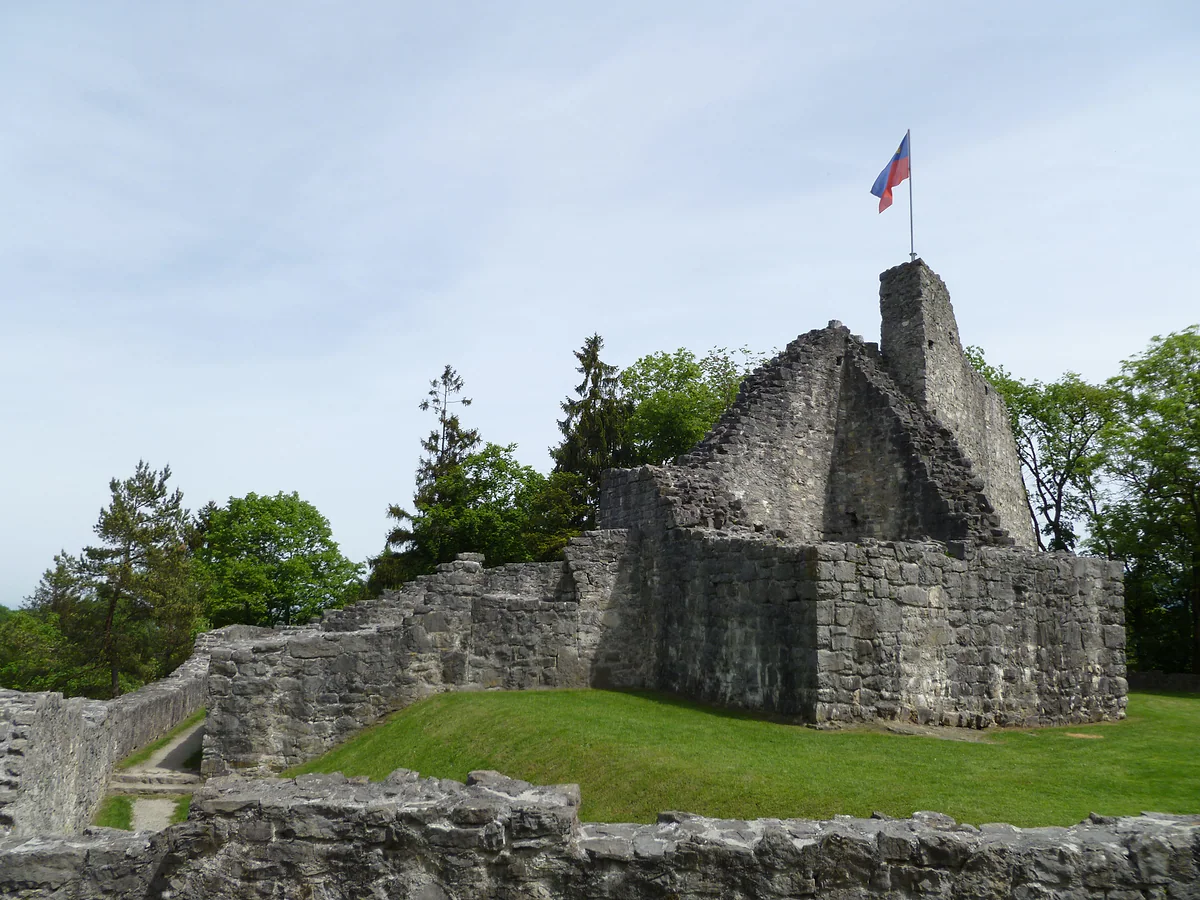
The stone ruins of the upper castle of Schellenberg, with the Liechtenstein flag on top of the tower.
The Unterland's five municipalities
| Municipality | Residents (2025) | Area | What I'd go to see |
|---|---|---|---|
| Eschen (with Nendeln) | 4,781 | 10.4 km² | Pfrundbauten, the 1778 mill and Nendeln's Roman villa |
| Mauren (with Schaanwald) | 4,663 | 7.5 km² | Herb garden and Schaanwald's Roman villa |
| Ruggell | 2,568 | 7.4 km² | Ruggeller Riet and the Küefer-Martis-Huus |
| Gamprin (with Bendern) | 1,773 | 6.2 km² | Bendern church hill and the Gampriner Seelein |
| Schellenberg | 1,180 | 3.6 km² | Castle ruins and the farmhouse museum |
Population at 31-12-2025 (Office of Statistics); area from Liechtenstein in Zahlen 2026. Unterland total 14,965 residents and 35 km², 21.8% of the country.
Crisis and compromise, 1876-1878
| Date | What happened |
|---|---|
| 23-12-1876 | The Landtag adopts the gold standard; the Unterland's MPs had already resigned in protest |
| 13-01-1877 | Between 300 and 600 Unterlanders demonstrate in Vaduz and threaten to join Austria |
| 18-01-1877 | Prince Johann II dissolves parliament and suspends the currency law |
| 15-05-1878 | First election with two constituencies, Oberland (7 MPs) and Unterland (5) |
Historisches Lexikon, «Münzwirren». Today the split is 15 and 10 MPs (Constitution, art. 46).
Test yourself
True or false?
0/4 Pick before you peek.
-
The Unterland was the first part of the country the Princes of Liechtenstein bought.
See the answer
True. Prince Johann Adam Andreas bought the lordship of Schellenberg in 1699, thirteen years before the county of Vaduz.
-
In 1877 some Unterlanders threatened to join Austria.
See the answer
True. On 13 January 1877 between 300 and 600 people from the Unterland demonstrated in Vaduz against the gold standard and threatened to annex their region to Austria.
-
The Unterland is larger than the Oberland.
See the answer
False. It covers 35 km² against the Oberland's 125.5, though it's more densely populated.
-
The Unterland has used its blocking minority in national politics.
See the answer
False. The Historisches Lexikon says its guaranteed share of MPs and ministers gives it a blocking minority it has never actually used.
- Municipalities in the Unterland
- 5
- Area, 21.8% of the country
- 35 km²
- Residents at 31-12-2025
- 14,965
- Year allegiance was sworn to the Prince at Bendern
- 1699
Map
All 11 municipalities, from the Rhine to Malbun
The dashed line is the border: Switzerland across the Rhine, Austria to the north and east. Every number opens its guide.
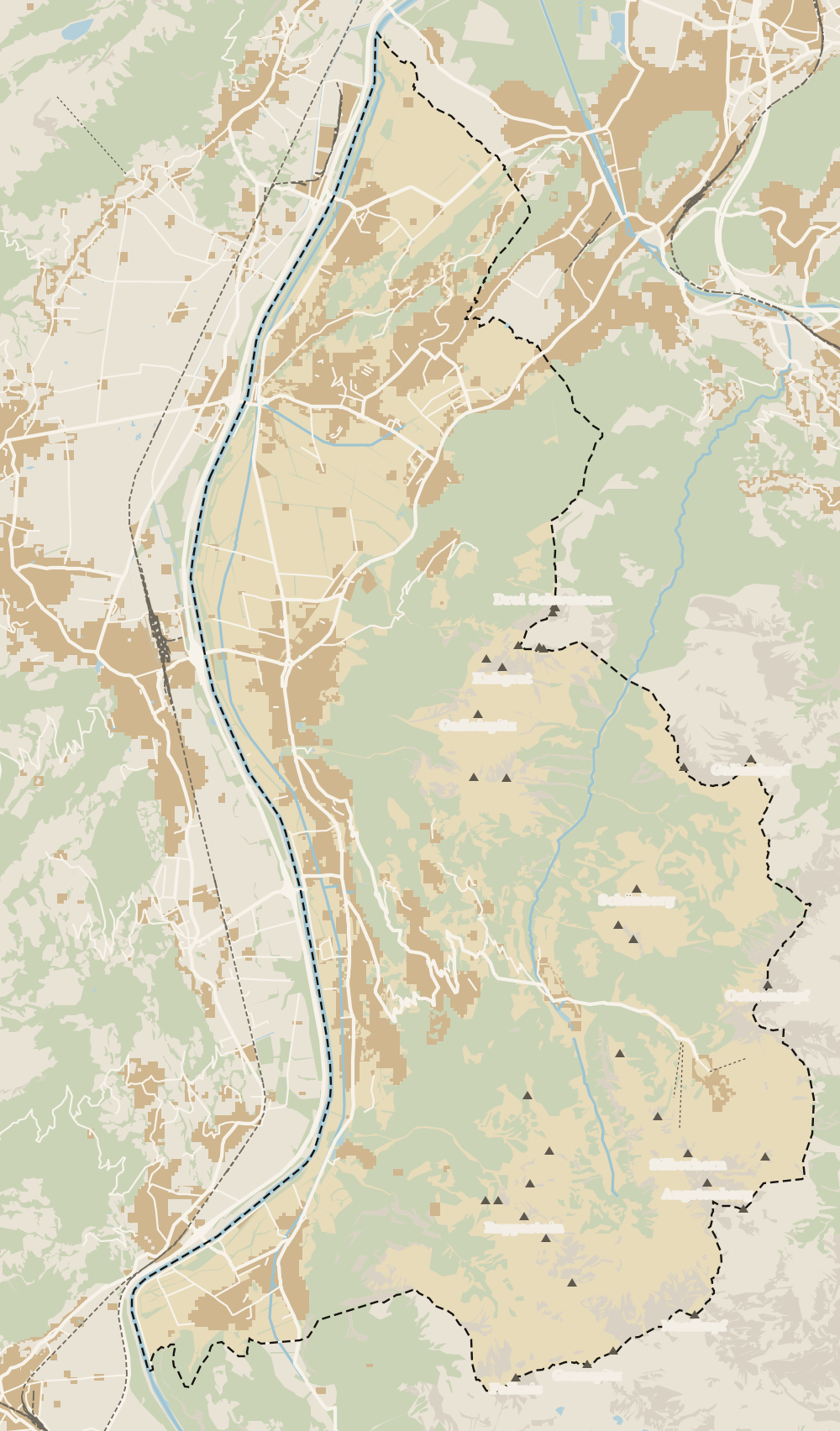 1Vaduz 2Städtle 3Mitteldorf 4Schaan 5Balzers 6Triesen 7Triesenberg 8Planken 9Mäls 10Eschen 11Masescha 12Gaflei 13Nendeln 14Mauren 15Silum 16Rotenboden 17Schaanwald 18Gamprin 19Wangerberg 20Bendern 21Steg 22Ruggell 23Schellenberg 24Hinterschellenberg 25Malbun
 Map data © OpenStreetMap contributors (ODbL)
- 1VaduzA capital since 1719, home to 6,108 people
- 2StädtleCar-free since 28 June 2004
- 3MitteldorfVineyards protected until 2081
- 4Schaan6,294 residents, 186 more than Vaduz
- 5BalzersThe southernmost municipality
- 6TriesenThe highest peak belongs to Triesen too
- 7TriesenbergLargest and highest municipality in the country
- 8Planken499 residents at 786 metres
- 9MälsOlder than Balzers, say the locals
- 10EschenThe Unterland's most populous municipality
- 11MaseschaTriesenberg hamlet at 1,250 m
- 12GafleiHome of the country's first spa hotel, in 1875
- 13NendelnEschen's hamlet below the Drei Schwestern
- 14MaurenLiechtenstein's most densely populated municipality
- 15SilumWalser alp between 1,400 and 1,700 m
- 16RotenbodenTriesenberg hamlet, Rotaboda in dialect
- 17SchaanwaldMauren's hamlet on the Austrian border
- 18GamprinThe village with the bathing lake
- 19WangerbergTriesenberg hamlet, Wangerbärg in dialect
- 20BendernGamprin's hamlet above the Rhine
- 21StegTriesenberg summer pasture at about 1,300 m
- 22RuggellThe country's northernmost municipality
- 23SchellenbergThe country's smallest municipality
- 24HinterschellenbergSchellenberg's hamlet on the Austrian border
- 25MalbunAt 1,600 m, with an hourly bus from Vaduz
0 of 168 Liechtenstein guides
Your next stamp
- Schellenberg
- Oberland
- Eschnerberg
- Eschen
- Municipalities
- Stage 4: Nendeln - Ruggell
- Where to stay
- Things to do
- One day
- Two days
- Map
- Vaduz
- Städtle
- Mitteldorf
- Vaduz Castle
- Vaduz Cathedral
- Parliament
- Government Building
- Vaduz Town Hall
- Red House
- Prince's Winery
- Old Rhine Bridge
- Schaan
- Schalun Castle Ruin
- Balzers
- Citytrain
- Triesen
- Triesenberg
- Walser Museum
- Planken
- Gutenberg Castle
- The Rhine
- Schaan Roman fort
- Dux
- St Mamertus chapel
- Lawena valley
- Mäls
- DoMuS
- TAK Theatre
- Castles
- Churches and chapels
- Viewpoints
- Mountains
- Museums
- Kunstmuseum
- Mountain huts
- Hilti Art Foundation
- Pfälzerhütte
- Gafadura hut
- National Museum
- Treasure Chamber
- Postage Stamp Museum
- Kunstraum Engländerbau
- Masescha
- Gaflei
- Nendeln
- Mauren
- Silum
- Rotenboden
- Schaanwald
- Gamprin
- Wangerberg
- Bendern
- Steg
- Ruggell
- Samina valley
- Schellenberg Farmhouse Museum
- Cross-country skiing at Steg
- Küefer-Martis-Huus
- Ruggeller Riet
- Hinterschellenberg
- Fürstensteig
- Is it a country?
- Liechtenstein Trail
- Malbun
- Schellenberg castles
- Malbun in summer
- Population
- Stage 1: Balzers - Triesenberg
- Lakes
- Sareis
- Size
- Stage 2: Triesenberg - Vaduz
- Malbun Peace Chapel
- Political system
- Stage 3: Vaduz - Nendeln
- Swimming pools
- Language
- Skiing in Malbun
- Dialect
- Malbun ski pass
- Stage 5: Ruggell - Schaanwald
- Hotels in Malbun
- Stamps
- Princess Gina Trail
- Hut-to-hut Route 66
- Hiking
- Getting there
- In winter
- Weather
- Airport
- Best time to visit
- In summer
- Events
- With kids
- Zurich to Liechtenstein
- National day
- Sargans to Vaduz
- Christmas
- Feldkirch to Vaduz
- By train
- Traditions
- Carnival
- Getting around
- Buses
- Funken Sunday
- Alpine cattle drive
- Driving and vignette
- Parking
- Bike hire
- Cycling
- EU and Schengen
- Entry requirements
- Borders and customs
- The prince
- The princely house
- The flag
- The coat of arms
- The national anthem
- History
- Second World War
- No army
- Facts
- Why so rich?
- Banks and tax haven
- Hilti
- Hotels in Vaduz
- False teeth
- Hostel and camping
- Rent the country?
- Where to eat
- Restaurants in Vaduz
- Swiss invasions
- Bars and nightlife
- Food
- Käsknöpfle
- Wine
- Casinos
- Adventure Pass
- Rainy days
- Guided tours
- Tourist office
- Day trips
- Passport stamp
- Music festivals
- Phone and roaming
- Currency and payments
- Prices and budget
- Tipping
- Plugs and sockets
- Tap water
- Opening hours
- Public holidays
- Safety
- Accessibility
- With a dog
- Shopping and souvenirs
Frequently asked questions
What is the Unterland in Liechtenstein?
The country's northern region, matching the old lordship of Schellenberg. The constitution calls it «Landschaft Schellenberg (Unterland)», and it forms the state together with the Oberland.
Which municipalities make up the Unterland?
Five: Eschen, Mauren, Gamprin, Ruggell and Schellenberg, all around the Eschnerberg. They cover 35 km² and had 14,965 residents at the end of 2025.
What is there to see in the Unterland?
The Schellenberg castle ruins, the church hill at Bendern, the Ruggeller Riet with its May irises, the Schellenberg farmhouse museum and the remains of Roman villas at Nendeln and Schaanwald.
How many MPs does the Unterland elect?
Ten of the Landtag's twenty-five. The constitution also requires at least two of the government's five members to come from each region.
Why does the Unterland vote separately?
Because of the currency crisis of 1876-1878. The Unterland opposed the gold standard the south wanted, and the compromise was two constituencies, which voted for the first time on 15 May 1878.
Can you stay in the Unterland?
Yes. In summer 2025 an average of 9.3 hotels were open in the Unterland, more than in any other part of the country, according to the Office of Statistics. As a visitor I'd only choose it with a car or if the north is the plan.
By
Tourism graduate with a master’s in Tourism Management and Planning from the University of Málaga, who has travelled across Europe. He writes every guide from official sources and his own judgement.
Published on . Updated on . Facts checked on .
Sources
Photos: Clemens v. Vogelsang from Liechtenstein (CC BY 2.0); A.Savin (FAL); SchuetzeZH (CC BY-SA 4.0), via Wikimedia Commons.