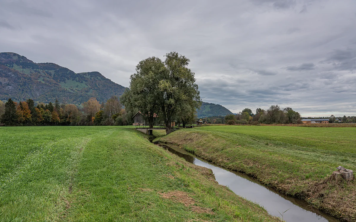
Nature reserve and Ramsar site since 1991
The Ruggeller Riet, the country's most studied fen
The Ruggeller Riet is a protected 90.86-hectare fen between Ruggell and Schellenberg, on the Austrian border, and at 430 metres it's the lowest point in Liechtenstein. It has been a nature reserve since 1978 and a wetland of international importance under the Ramsar Convention since 1991. The municipality recommends coming in May, when the irises bloom.
In 30 seconds
Full read: 3 min
- The Ruggeller Riet is a protected 90.86 ha fen between Ruggell and Schellenberg.
- At 430 metres it's the lowest point in Liechtenstein.
- It has been a reserve since 1978 and a Ramsar site since 1991.
- The best month to go is May, when the irises flower.
For me the Riet is a May outing or nothing. I'd cycle out from Ruggell in the morning, sticking to the paths because it's a reserve and the ground is peat, and link it with the climb to the Schellenberg ruins along the last stage of the Liechtenstein Trail.

Before you go
What I would keep in mind
-
01 Most beautiful
The irises of May
Ruggell municipality recommends a walk or ride through the Riet in May, when the irises come out. That's when the fen changes most.
-
02 My tip
An airport nearly went here
In 1964-65 there was talk of building an international airport for Vorarlberg on the Riet, with buildings on Liechtenstein soil. A radio station and a mud spa were floated too.
-
03 Getting there
You cross it on the final stage
Stage 5 of the Liechtenstein Trail sets off from Ruggell's Küefer-Martis-Huus, crosses the Riet and climbs to the Schellenberg ruins on the way to Schaanwald.
stage 5 of the Liechtenstein Trail, Ruggell to Schaanwald -
04 To save money
Open country, and flat
The Riet is open country and completely flat. With the Ruggell LIEbike, at CHF 2 per half hour, you can ride all of it in a morning.
bike hire in Liechtenstein
What I would book
Liechtenstein’s lowest point isn’t a valley or a lake, it’s a fen. The Ruggeller Riet fills the country’s northern tip, between the village of Ruggell and the Austrian border, and it’s the most unusual landscape you’ll see anywhere in the principality, flat, damp and teeming with life. To me it’s the best reason to head up to the Unterland in spring.
What the Riet is
Riet comes from Old High German and means marshy ground grown with reeds. The Ruggeller Riet is a low-lying fen of 90.86 hectares at 430 metres, shared between Ruggell and Schellenberg. A third of the land belongs to the state, and the rest to Ruggell municipality, a farming cooperative from Altenstadt in Vorarlberg and private owners. Back in the village, the Küefer-Martis-Huus in Ruggell holds a museum devoted mainly to water, which pairs well with the fen.
Its story begins when the Rhine glacier melted around 16,500 years ago. Still water was left between the Rhine and the Ill, gradually silting up, and over some 10,000 years a layer of peat almost nine metres thick built up on top, which the Historisches Lexikon rates as the thickest anywhere in Vorarlberg or Liechtenstein.
When should you visit the Ruggeller Riet?
In May. The municipality says so itself, recommending a walk or ride through the Riet that month, when the irises flower. Outside May you get a quiet landscape of peat meadows, ditches and scrub, pretty but less striking. If you like birdwatching there’s something in every season, and in winter the Gampriner Seelein, over in Gamprin, welcomes great egrets, as I explain on the lakes of Liechtenstein.
As it’s a reserve and the ground is peat, I’d always stay on the paths. The Lexikon itself lists leisure activities among the threats to the reserve, alongside farm fertiliser and drying out.
Offerings, coins and peat
The Riet holds thousands of years of history underfoot. Pollen cores taken in 1990 contain cereal from the start of the fourth millennium BC, proof that people in the Rhine valley were already farming in the Neolithic. When peat was cut in the 19th and 20th centuries, ornaments and weapons from the Bronze and Iron Ages kept turning up, usually about two metres down, probably sunk as offerings. Around 1883 a hoard of 25 Roman coins hidden in the 4th century came to light. The first pieces ended up in the museum in Bregenz, as Liechtenstein had nowhere to keep them yet.
For centuries it was common land for Ruggell and Schellenberg, whose villagers grazed it and mowed it for litter in late autumn, until the two divided it in 1794 with a ditch. Between 1831 and 1843 Ruggell’s 88 households were each given four plots, and those strips can still be picked out 73 times on the ground. Peat was cut for fuel because firewood was scarce. In 1947 there were 101 huts for drying it and by 2019 eight remained. The last cutting took place in 1992.
The airport that never was
What surprised me most is that in 1964-65 there was serious talk of building an international airport for Vorarlberg here, with its terminal buildings on Liechtenstein soil. There were also plans for a radio station and a mud spa. None of them happened, and things went the other way.
In 1970 a regional botanical and zoological society was founded right here in the open air, and it commissioned the first vegetation map. In 1976 WWF recognised the site’s international importance, on 17 October 1978 the government declared it a reserve, and in 1991 it joined the list of Ramsar wetlands. Across the border, Vorarlberg had protected the Bangser Riet in 1974, so between the two countries about 155 hectares are safeguarded.
The best-studied patch of the country
By 1990, 1,631 animal species and 448 vascular plant species had been recorded here, and the Lexikon calls it the best-studied area in Liechtenstein. The protection campaign’s figurehead was the curlew, which hasn’t bred here since 1991. Its successor is a butterfly endangered across Europe, the false ringlet.
Not all the news is good. Measurements in 2019 found nitrogen inputs four times above critical levels, mainly from farming, and the Riet is slowly drying out. In 1982 a pond was dug to replace the pools lost when peat cutting ended. How the Liechtenstein Trail crosses it is set out on stage 5 of the Liechtenstein Trail.
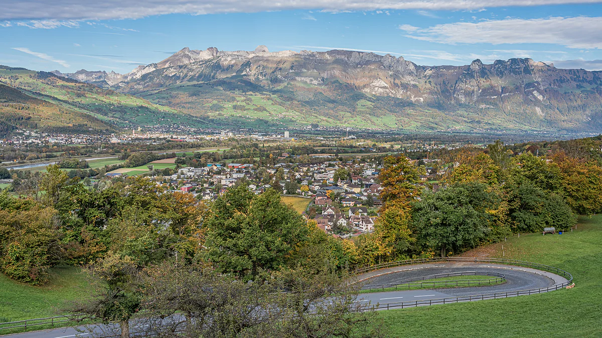
The Rhine valley seen from Vaduz Castle, with the town among autumn trees and the Swiss mountains on the horizon.
The Riet in numbers
| Fact | Figure |
|---|---|
| Protected area in Liechtenstein | 90.86 ha |
| With the Austrian Bangser Riet | About 155 ha protected |
| Peat depth | Almost 9 metres |
| Species recorded by 1990 | 1,631 animals and 448 vascular plants |
| Peat huts | 101 in 1947, 8 in 2019 |
| Last peat cutting | 1992 |
Historisches Lexikon, entry «Ruggeller Riet» (2023).
How it came to be protected
| Year | Step |
|---|---|
| 1974 | Vorarlberg protects 64 ha of the Bangser Riet across the border |
| 1976 | WWF recognises it as internationally important |
| 17-10-1978 | The government declares it a nature reserve |
| 1986 | A 2.34 ha extension east of the road |
| 1991 | Ramsar site |
Historisches Lexikon, entry «Ruggeller Riet» (2023).
Test yourself
True or false?
0/4 Pick before you peek.
-
The Ruggeller Riet is Liechtenstein's lowest point.
See the answer
True. It sits at 430 metres according to the Office of Statistics, compared with around 2,600 metres for the Grauspitz, the highest.
-
Peat is still cut in the Riet.
See the answer
False. The last cutting was in 1992. There were 101 peat huts in 1947 and eight were left in 2019.
-
A hoard of Roman coins was found in the Riet.
See the answer
True. Around 1883 a stash of 25 coins buried in the 4th century turned up. The first finds went to the museum in Bregenz because Liechtenstein had nowhere to keep them.
-
Curlews still breed in the Riet.
See the answer
False. The curlew was the face of the protection campaign, but it hasn't bred here since 1991. A butterfly, the false ringlet, has taken its place as emblem.
- Protected area
- 90.86 ha
- Lowest point in the country
- 430 m
- Depth of peat, almost
- 9 m
- Animal species recorded by 1990
- 1,631
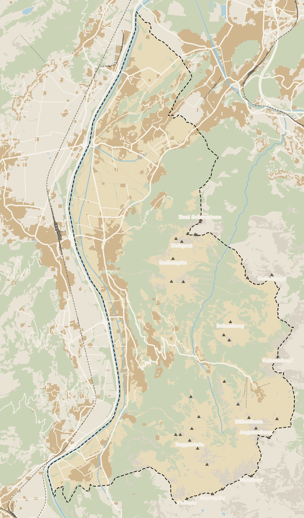
Map
Where Ruggeller Riet is
The dashed line is the border: Switzerland across the Rhine, Austria to the north and east. Every number opens its guide.
0 of 168 Liechtenstein guides
Your next stamp
- Ruggell
- Stage 5: Ruggell - Schaanwald
- Stage 4: Nendeln - Ruggell
- Hiking
- Day trips
- Best time to visit
- Schellenberg
- Things to do
- One day
- Two days
- Municipalities
- Oberland
- Unterland
- Map
- Vaduz
- Städtle
- Mitteldorf
- Vaduz Castle
- Vaduz Cathedral
- Parliament
- Government Building
- Vaduz Town Hall
- Red House
- Prince's Winery
- Old Rhine Bridge
- Schaan
- Schalun Castle Ruin
- Balzers
- Citytrain
- Triesen
- Triesenberg
- Walser Museum
- Planken
- Gutenberg Castle
- The Rhine
- Schaan Roman fort
- Dux
- St Mamertus chapel
- Lawena valley
- Mäls
- DoMuS
- TAK Theatre
- Castles
- Churches and chapels
- Viewpoints
- Mountains
- Museums
- Kunstmuseum
- Mountain huts
- Hilti Art Foundation
- Pfälzerhütte
- Gafadura hut
- National Museum
- Treasure Chamber
- Postage Stamp Museum
- Kunstraum Engländerbau
- Eschen
- Masescha
- Gaflei
- Nendeln
- Mauren
- Silum
- Rotenboden
- Schaanwald
- Gamprin
- Wangerberg
- Bendern
- Steg
- Samina valley
- Schellenberg Farmhouse Museum
- Cross-country skiing at Steg
- Küefer-Martis-Huus
- Hinterschellenberg
- Fürstensteig
- Is it a country?
- Liechtenstein Trail
- Malbun
- Schellenberg castles
- Eschnerberg
- Malbun in summer
- Population
- Stage 1: Balzers - Triesenberg
- Lakes
- Sareis
- Size
- Stage 2: Triesenberg - Vaduz
- Malbun Peace Chapel
- Political system
- Stage 3: Vaduz - Nendeln
- Swimming pools
- Language
- Skiing in Malbun
- Dialect
- Malbun ski pass
- Hotels in Malbun
- Stamps
- Princess Gina Trail
- Hut-to-hut Route 66
- Getting there
- In winter
- Weather
- Airport
- In summer
- Events
- With kids
- Zurich to Liechtenstein
- National day
- Sargans to Vaduz
- Christmas
- Feldkirch to Vaduz
- By train
- Traditions
- Carnival
- Getting around
- Buses
- Funken Sunday
- Alpine cattle drive
- Driving and vignette
- Parking
- Bike hire
- Cycling
- EU and Schengen
- Entry requirements
- Borders and customs
- The prince
- The princely house
- The flag
- The coat of arms
- The national anthem
- History
- Second World War
- No army
- Facts
- Why so rich?
- Banks and tax haven
- Where to stay
- Hilti
- Hotels in Vaduz
- False teeth
- Hostel and camping
- Rent the country?
- Where to eat
- Restaurants in Vaduz
- Swiss invasions
- Bars and nightlife
- Food
- Käsknöpfle
- Wine
- Casinos
- Adventure Pass
- Rainy days
- Guided tours
- Tourist office
- Passport stamp
- Music festivals
- Phone and roaming
- Currency and payments
- Prices and budget
- Tipping
- Plugs and sockets
- Tap water
- Opening hours
- Public holidays
- Safety
- Accessibility
- With a dog
- Shopping and souvenirs
Frequently asked questions
What is the Ruggeller Riet?
A protected low-lying fen of 90.86 hectares north of Ruggell, on the Austrian border. It has been a nature reserve since 1978 and a Ramsar site since 1991.
When do the irises flower in the Ruggeller Riet?
In May. Ruggell municipality recommends it as the best month to walk or cycle through the Riet.
Is the Ruggeller Riet the lowest point in Liechtenstein?
Yes. The Office of Statistics gives the Ruggeller Riet, at 430 metres, as the country's lowest point. The highest is the Grauspitz, at around 2,600 metres.
How do you get to the Ruggeller Riet?
From the centre of Ruggell, on foot or by bike, as it lies just north of the village. Bus routes 31, 32, 36 and 37 all serve Ruggell.
What wildlife lives in the Ruggeller Riet?
By 1990, 1,631 animal species had been recorded. The reserve's emblem today is a butterfly endangered across Europe, the false ringlet, after the curlew stopped breeding here in 1991.
By
Tourism graduate with a master’s in Tourism Management and Planning from the University of Málaga, who has travelled across Europe. He writes every guide from official sources and his own judgement.
Published on . Facts checked on .
Sources
Photos: A.Savin (FAL); A.Savin (FAL), via Wikimedia Commons.