The short stage with the route's highest point
Liechtenstein Trail stage 2, down to the capital past the castle
The second stage of the Liechtenstein Trail runs from Triesenberg to Vaduz, 10.4 km and about 3 hours 5 minutes. It first climbs to 1,109 m, the highest point of the whole route, then drops 699 m past the Prufatscheng farmstead, the Schalun ruin and Vaduz Castle into the Städtle, the street where the museums are.
In 30 seconds
Full read: 3 min
- Stage 2 runs from Triesenberg to Vaduz, 10.4 km in about three hours.
- It includes the highest point of the whole route, 1,109 m.
- It passes Prufatscheng, the Schalun ruin and Vaduz Castle.
- It finishes in the Städtle, next to the four museums in the centre.
If you only walk one day in Liechtenstein, make it this one. I'd leave Triesenberg mid-morning, have lunch in Vaduz and give the afternoon to the Städtle museums, which close at 17:00 except the Kunstmuseum on Thursdays and the LandesMuseum on Wednesdays, both open until 20:00.

Before you go
What I would keep in mind
-
01 Most beautiful
The Rhine valley at your feet
The tourist board singles out the Prufatscheng farmstead for its striking view over the Rhine valley. For me it's the finest balcony on the whole trail.
viewpoints in Liechtenstein -
02 Watch out
You'll see Vaduz Castle, not go inside
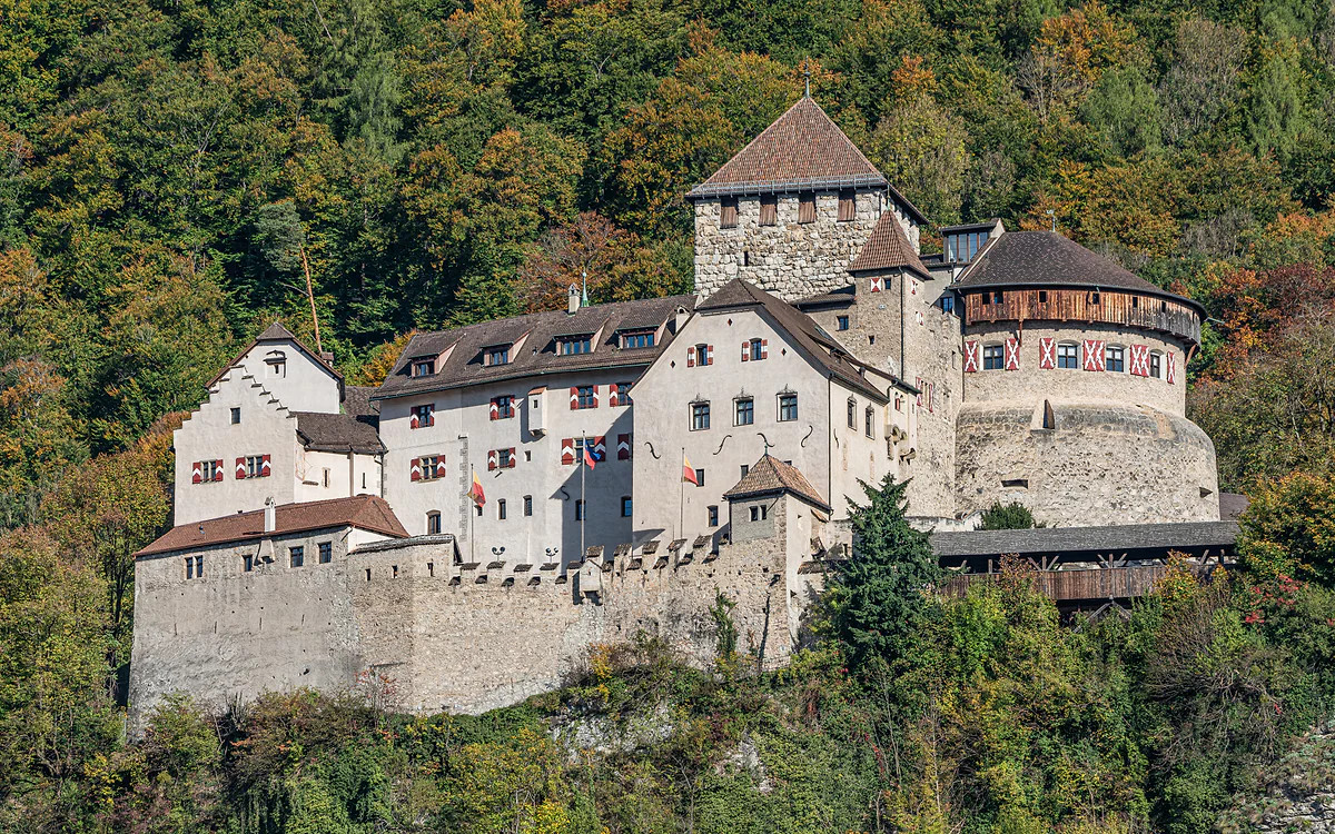
The trail passes right by the castle, but it's the prince's home and isn't open to the public. Don't climb up expecting a ticket office.
Vaduz Castle -
03 To save money
Wednesdays, the Kunstmuseum is free
The Kunstmuseum charges nothing on Wednesdays and the PostMuseum is free every day. If the stage falls on a Wednesday, you can end with modern art without paying.
museums in Liechtenstein -
04 Getting there
Bus up, walk down
Route 21 takes you from Vaduz up to Triesenberg. The stage ends in central Vaduz, so there's no bus to catch at the end of the day.
Liechtenstein's buses
What I would book
If I had to pick one stage of the Liechtenstein Trail, it would be this one. In barely ten kilometres it takes you from the Walser village to the capital, via a farmstead with the best view of the valley, a ruined castle clinging to the rock and the prince’s own castle. And it finishes on the museum street, which is exactly where you want to be by mid-afternoon.
Up first, then a long way down
The stage has an odd shape. It leaves Triesenberg, where stage 1 ended, and before it starts dropping it climbs to 1,109 m, the highest point on the entire route. That’s 256 m up and, more to the point, 699 m down, because it finishes on the valley floor at 456 m. The tourist board gives 3 hours 5 minutes of walking for 10.4 km, which makes it the shortest of the five.
To reach the start, route 21 climbs from Vaduz to Triesenberg. I’d take it mid-morning with no need for an early alarm, because this is a day designed to end gently in town.
Prufatscheng, a balcony over the Rhine
The first big moment is the old Prufatscheng farmstead, a spot steeped in history that the tourist board praises for its sweeping view of the Rhine valley. From up there the whole layout of the country clicks into place, with the river marking the Swiss border, the valley villages below and the mountains opposite. For me it’s the finest viewpoint on the trail and where I’d stop to eat if I’d packed a sandwich.
So what is the Schalun ruin?
Further down comes the Schalun ruin, also called the Wildschloss. It’s what’s left of a castle on an exposed rocky ridge between Schaan and Vaduz, and the tourist board describes it with a word that suits it, mystical. Wrapped in woodland, it’s nothing like the country’s restored castles, which is why I like it. No detour needed, as the stage goes right past.
Vaduz Castle and the viewing platform
Next up is Vaduz Castle, the capital’s emblem, visible from miles away. Be clear about this to avoid disappointment, as it’s the prince’s home and can’t be visited. The trail takes you close enough for a good look, which is already quite something.
About 25 minutes’ walk from the castle there’s also a viewing platform over the Rhine valley that the tourist board highlights on this stage. If you’ve got energy to spare, it’s the last detour I’d make before the final descent.
Arriving in the Städtle
The stage ends in the Städtle, the traffic-free street in central Vaduz and home to what the tourist board calls the museum mile. If you plan to go in, work around the opening times. The Kunstmuseum, which shares its entrance with the Hilti Art Foundation, stays open late on Thursdays, until 20:00, and charges 15 francs except on Wednesdays, when it’s free. The LandesMuseum also opens Tuesday to Sunday, until 20:00 on Wednesdays, and costs 10 francs, or 13 with the SchatzKammer. The PostMuseum is free and opens every day.
Watch out for Mondays, when both the Kunstmuseum and the LandesMuseum are shut. I’d try to have this stage fall on a Wednesday or Thursday to make the most of the late opening. I’ve set them all out in my guide to museums in Liechtenstein.
To refuel without leaving the street, head for the café inside the Kunstmuseum, which has a meat-free Japanese menu of sushi, maki and soups. It opens Wednesday to Friday 9:00 to 21:00 and the other days 9:00 to 18:00, so it works even if you arrive late. I’d pick it over the first terrace you pass in the Städtle, because after 700 m of descent something light goes down well and it’s the calmest spot on the street.
Fitting it into the full route
If you’re walking the whole trail, this stage drops you in the capital by mid-afternoon, and the next one, stage 3 to Nendeln, starts from the same spot in central Vaduz. Stay there and it’s the only day on the route when you don’t need a bus home.
And if you only have one day for walking, this is the one I’d choose, because it sums up the country in just over three hours. Walser hillsides, a ruin in the woods, the prince’s castle and the museums, with the Rhine in view the whole way.
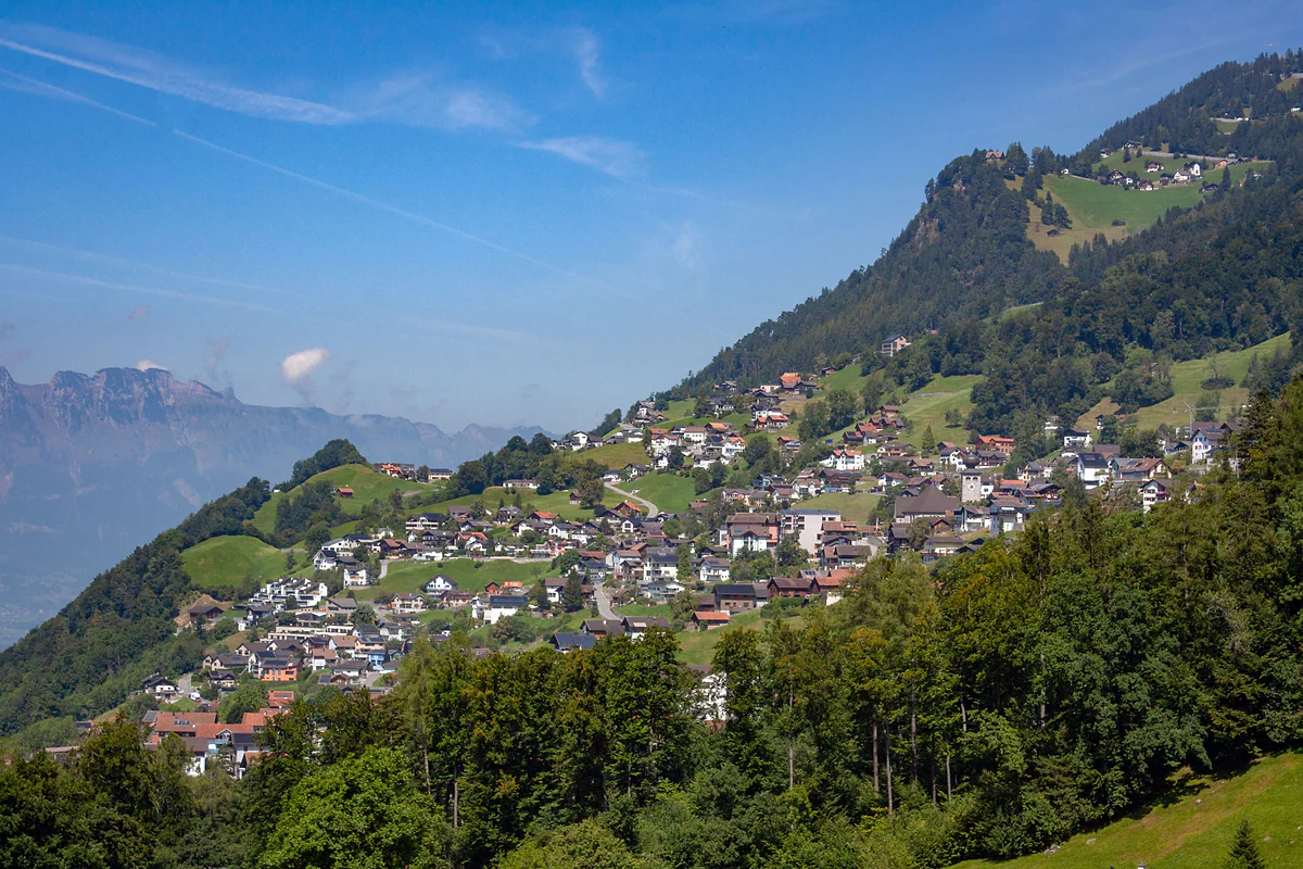
The houses of Triesenberg scattered across the green hillside above the Rhine valley, under a blue sky.
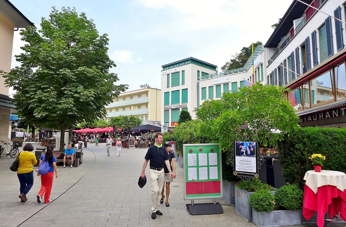
The pedestrian Städtle in Vaduz with strollers, trees, terraces and modern buildings at the foot of the slope.
Official card for stage 2
| Fact | Figure |
|---|---|
| Start | Triesenberg |
| Finish | Städtle, Vaduz |
| Distance | 10.4 km |
| Walking time | 3 h 05 min |
| Ascent and descent | +256 m and -699 m |
| Highest and lowest point | 1,109 m and 456 m |
Tourist board figures (archive.org copy, 17-04-2026).
The museums at the end of the stage
| Museum | Opening hours | Admission |
|---|---|---|
| Kunstmuseum and Hilti Art Foundation | Tue-Sun 10:00-17:00, Thu until 20:00; closed Mon | CHF 15, concessions 10; free on Wednesdays |
| LandesMuseum | Tue-Sun 10:00-17:00, Wed until 20:00; closed Mon | CHF 10, concessions 7 |
| SchatzKammer | Daily 10:00-17:00 | With the LandesMuseum, CHF 13 (concessions 10) |
| PostMuseum | Daily 10:00-17:00 | Free |
Test yourself
True or false?
0/4 Pick before you peek.
-
Stage 2 is the shortest on the Liechtenstein Trail.
See the answer
True. It's 10.4 km long, against 13.4 to 19.4 km for the others.
-
This stage goes down more than it goes up.
See the answer
True. It climbs 256 m and descends 699 m, because it runs from a hillside village to the capital on the valley floor.
-
As you pass Vaduz Castle you can buy a ticket to see inside.
See the answer
False. The castle is the prince's residence and isn't open to the public.
-
The PostMuseum in the Städtle is free.
See the answer
True. It opens daily from 10:00 to 17:00 and charges no admission, according to the LandesMuseum, which runs it.
- Distance, the shortest of the five
- 10.4 km
- Highest point on the whole trail
- 1,109 m
- Total descent
- 699 m
Map
Where Stage 2: Triesenberg - Vaduz is
The dashed line is the border: Switzerland across the Rhine, Austria to the north and east. Every number opens its guide.
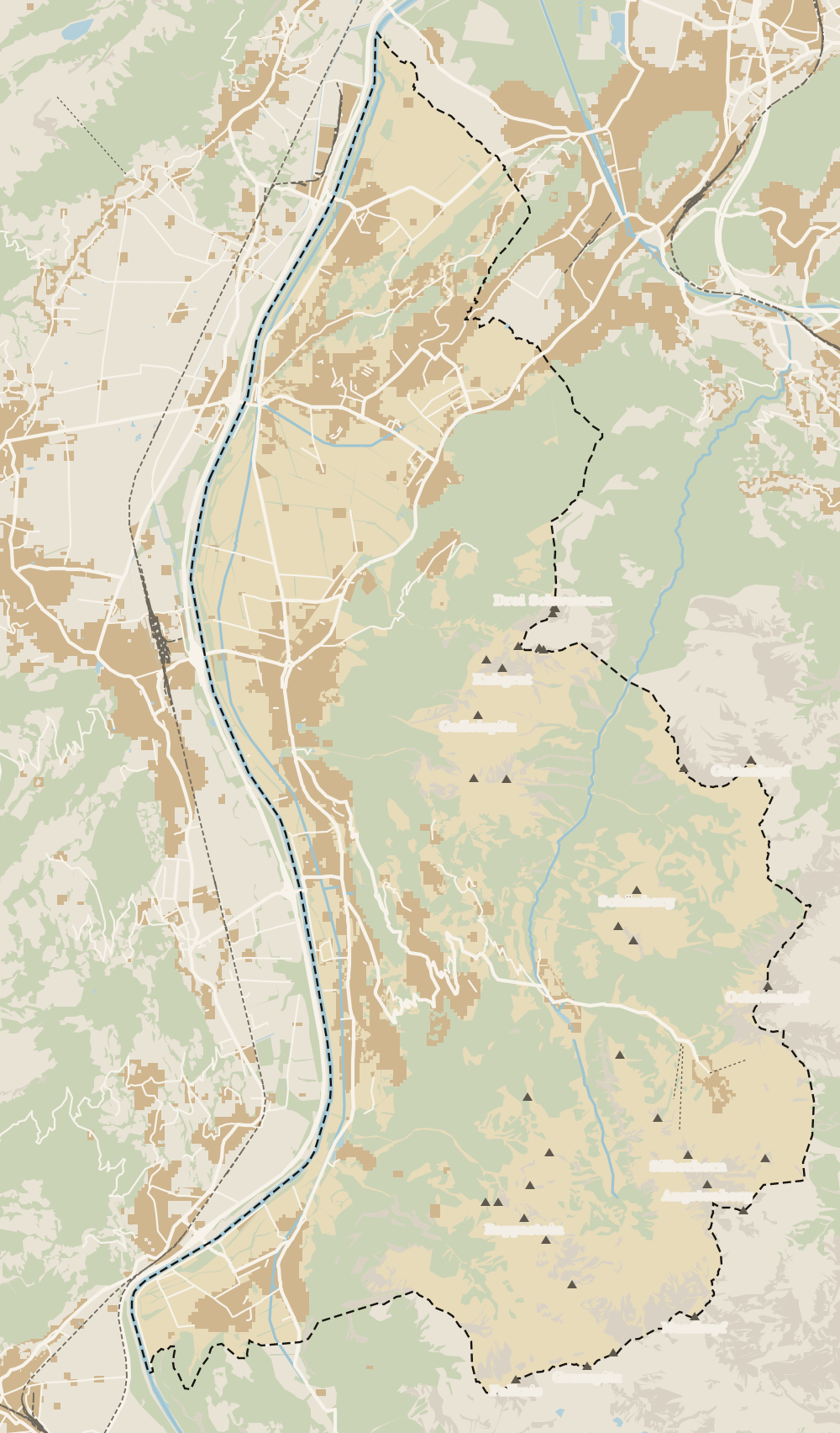 1Liechtenstein Trail 2Stage 1: Balzers - Triesenberg 3Stage 2: Triesenberg - Vaduz 4Stage 3: Vaduz - Nendeln 5Stage 4: Nendeln - Ruggell 6Stage 5: Ruggell - Schaanwald
 Map data © OpenStreetMap contributors (ODbL)
- 1Liechtenstein TrailSwiss border to Austrian border in five days
- 2Stage 1: Balzers - Triesenberg15.7 km and the longest climb on the route
- 3Stage 2: Triesenberg - VaduzThe short stage with the route's highest point
- 4Stage 3: Vaduz - NendelnVineyards, Romans and the steepest descent
- 5Stage 4: Nendeln - RuggellThe flattest stage, with a swimming lake halfway
- 6Stage 5: Ruggell - SchaanwaldThe longest stage ends at a customs post
0 of 168 Liechtenstein guides
Your next stamp
- Stage 3: Vaduz - Nendeln
- Stage 1: Balzers - Triesenberg
- Schalun Castle Ruin
- Two days
- Things to do
- Liechtenstein Trail
- Stage 5: Ruggell - Schaanwald
- Castles
- One day
- Municipalities
- Oberland
- Unterland
- Map
- Vaduz
- Städtle
- Mitteldorf
- Vaduz Castle
- Vaduz Cathedral
- Parliament
- Government Building
- Vaduz Town Hall
- Red House
- Prince's Winery
- Old Rhine Bridge
- Schaan
- Balzers
- Citytrain
- Triesen
- Triesenberg
- Walser Museum
- Planken
- Gutenberg Castle
- The Rhine
- Schaan Roman fort
- Dux
- St Mamertus chapel
- Lawena valley
- Mäls
- DoMuS
- TAK Theatre
- Churches and chapels
- Viewpoints
- Mountains
- Museums
- Kunstmuseum
- Mountain huts
- Hilti Art Foundation
- Pfälzerhütte
- Gafadura hut
- National Museum
- Treasure Chamber
- Postage Stamp Museum
- Kunstraum Engländerbau
- Eschen
- Masescha
- Gaflei
- Nendeln
- Mauren
- Silum
- Rotenboden
- Schaanwald
- Gamprin
- Wangerberg
- Bendern
- Steg
- Ruggell
- Samina valley
- Schellenberg Farmhouse Museum
- Cross-country skiing at Steg
- Küefer-Martis-Huus
- Ruggeller Riet
- Schellenberg
- Hinterschellenberg
- Fürstensteig
- Is it a country?
- Malbun
- Schellenberg castles
- Eschnerberg
- Malbun in summer
- Population
- Lakes
- Sareis
- Size
- Malbun Peace Chapel
- Political system
- Swimming pools
- Language
- Skiing in Malbun
- Stage 4: Nendeln - Ruggell
- Dialect
- Malbun ski pass
- Hotels in Malbun
- Stamps
- Princess Gina Trail
- Hut-to-hut Route 66
- Hiking
- Getting there
- In winter
- Weather
- Airport
- Best time to visit
- In summer
- Events
- With kids
- Zurich to Liechtenstein
- National day
- Sargans to Vaduz
- Christmas
- Feldkirch to Vaduz
- By train
- Traditions
- Carnival
- Getting around
- Buses
- Funken Sunday
- Alpine cattle drive
- Driving and vignette
- Parking
- Bike hire
- Cycling
- EU and Schengen
- Entry requirements
- Borders and customs
- The prince
- The princely house
- The flag
- The coat of arms
- The national anthem
- History
- Second World War
- No army
- Facts
- Why so rich?
- Banks and tax haven
- Where to stay
- Hilti
- Hotels in Vaduz
- False teeth
- Hostel and camping
- Rent the country?
- Where to eat
- Restaurants in Vaduz
- Swiss invasions
- Bars and nightlife
- Food
- Käsknöpfle
- Wine
- Casinos
- Adventure Pass
- Rainy days
- Guided tours
- Tourist office
- Day trips
- Passport stamp
- Music festivals
- Phone and roaming
- Currency and payments
- Prices and budget
- Tipping
- Plugs and sockets
- Tap water
- Opening hours
- Public holidays
- Safety
- Accessibility
- With a dog
- Shopping and souvenirs
Frequently asked questions
How long does stage 2 of the Liechtenstein Trail take?
The tourist board reckons 3 hours 5 minutes for 10.4 km. It's the shortest of the five stages, which leaves the afternoon free for the Vaduz museums.
What is the highest point of the Liechtenstein Trail?
It's on this stage, at 1,109 m, between Triesenberg and the descent to Vaduz. No other stage climbs above 905 m.
Can you visit Vaduz Castle from the trail?
No. The route passes beside it, but it's the princely family's residence and isn't open to visitors. You see it from outside and from the nearby viewing platform.
What is the Schalun ruin?
The remains of a castle on an exposed rocky ridge between Schaan and Vaduz, also known as the Wildschloss. The stage goes past it before dropping down to Vaduz Castle.
Is the descent into Vaduz steep?
It adds up to 699 m of descent. Nothing tricky, but your knees will know about it, so I'd bring poles if you use them.
Where does stage 2 finish?
In the Städtle in Vaduz, the traffic-free street in the centre, home to the Kunstmuseum, the LandesMuseum, the SchatzKammer and the PostMuseum.
By
Tourism graduate with a master’s in Tourism Management and Planning from the University of Málaga, who has travelled across Europe. He writes every guide from official sources and his own judgement.
Published on . Facts checked on .
Sources
Photos: A.Savin (FAL); Lucas Kendall (CC BY-SA 4.0); Bahnfrend (CC BY-SA 4.0), via Wikimedia Commons.