The village with the bathing lake
Gamprin, the field by the Rhine
Gamprin is a municipality in Liechtenstein's Unterland with 1,773 residents on 31 December 2025 in 6.2 km². It's made up of Gamprin village, with the town hall, and the hamlet of Bendern, with the church and the hill where allegiance was sworn to the Prince in 1699. It has the Gampriner Seelein, the country's largest natural lake, and the Grossabünt bathing lake.
In 30 seconds
Full read: 3 min
- Gamprin has 1,773 residents and consists of Gamprin village and the hamlet of Bendern.
- Allegiance was sworn to the Prince on Bendern's hill on 16 March 1699.
- The Gampriner Seelein, formed in 1927, is the country's largest natural lake.
- The Grossabünt has a natural bathing lake open daily, with no lifeguard.
If you're here in a hot July or August, Gamprin is my answer. The Grossabünt has a natural bathing lake with over 3,500 m² of swimming water and a bistro open every day, and the Seelein and Bendern's church hill are a few minutes' walk away for some culture. In winter, though, I'd only go up the hill.

Before you go
What I would keep in mind
-
01 Most beautiful
A lake created by a flood
The Gampriner Seelein formed in the Rhine flood of autumn 1927 and has been a nature reserve since 1961. With 1.37 ha of water it's Liechtenstein's largest natural lake.
lakes in Liechtenstein -
02 My tip
Leave the car at home for the Grossabünt
The municipality advises against driving because parking is limited. There's a LIEbike station at the Grossabünt itself, and the council says it's easy to reach by bus, bike or on foot.
swimming pools in Liechtenstein -
03 My tip
No lifeguard on duty
The municipality warns that it provides no lifeguard or supervision at the bathing lake, and that swimming is only allowed from sunrise to sunset. Keep an eye on children.
-
04 Getting there
Buses 32 and 35
Route 32 links Eschen, Gamprin and Ruggell, and route 35 runs from Nendeln to Hinterschellenberg via Bendern and Gamprin.
Liechtenstein's buses
What I would book
My ranking, scored
What I'd do in Gamprin
My scores out of 10 for a day visitor, weighted towards anything you can't find elsewhere in the country.
0 of 4 seen
-
Bendern church hill
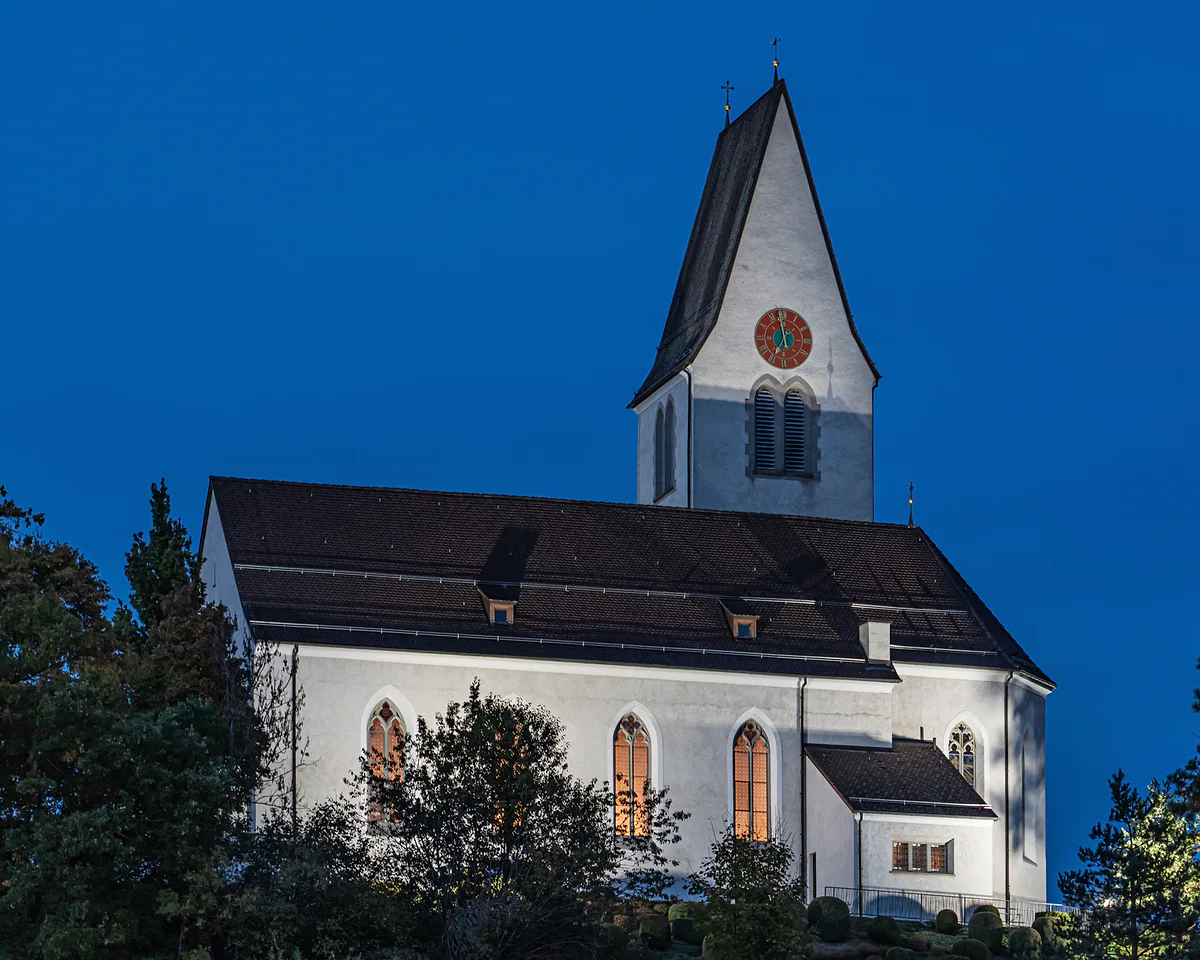
Where the Unterland swore allegiance to the Prince on 16 March 1699, with a church whose basement shows the foundations of its predecessors.
8.8 out of 10
-
Grossabünt bathing lake
A natural bathing lake with over 3,500 m² to swim in, a diving bay and 2,700 m² of lawns. In summer there's no better plan in the Unterland.
8.2 out of 10
-
Gampriner Seelein
The country's largest natural lake, formed in 1927, with great egrets in winter. It's a reserve, so you look and stroll.
7.8 out of 10
-
Bike-Fun-Kratzera
A mountain-bike skills trail with wooden and stone obstacles in Kratzera forest, helmets compulsory. One for kids with bikes.
6.5 out of 10
Gamprin is a small village with two things nobody else in Liechtenstein has, the hill where the country as we know it began and the only natural lake that really deserves the name. Add a bathing lake for summer and you have a very full half day in the Unterland.
One municipality, two places
Gamprin is split between Gamprin village, home to the town hall and school, and the hamlet of Bendern, where the parish church sits on top of its hill. The Historisches Lexikon traces the name to the Romansh camp Rin, the field by the Rhine, and the first record dates from around 1150 as «Camporin». The village is scattered, with old quarters such as Au, Bühl, Badäl, Salums and Gölla, and to the west the Rhine forms the border with the canton of St Gallen.
There’s one fact I love. Since 1915 Gamprin has owned the Rauz alp in Austria’s Vorarlberg, which covers 7.02 km², more than the 6.2 km² of the municipality itself.
At the end of 2025 it had 1,773 residents, and on that year’s provisional figures it was the only municipality to shrink, by 0.6%.
The hill where the country begins
The municipality calls Bendern’s hill the birthplace of Liechtenstein. On 16 March 1699, after the Prince bought the lordship of Schellenberg, its subjects swore allegiance to him on the square now called Bongertplatz. The council’s website also notes that the Neolithic site of Lutzengüetle holds the oldest recorded life in the country’s territory. The hill, its church with exposed foundations and the 1898 Lourdes grotto are covered on the Bendern page.
Which is the largest lake in Liechtenstein?
The Gampriner Seelein. It formed in autumn 1927, when the great Rhine flood scoured out part of the plain at the narrow point between the Eschnerberg and the river. It has been a nature reserve since 1961 and holds 1.37 hectares of water, enough to make it the largest natural lake in the country. In 1979-80 it was cleaned up and topped up with water from the inland canal so it wouldn’t dry out, and in 1980 noble crayfish, which had vanished from the country, were reintroduced.
It’s a place to walk and watch, not to swim. I’d come in winter, when great egrets spend October to April here. I compare it with the country’s other waters on the lakes of Liechtenstein.
The Grossabünt bathing lake
For a swim there’s the Grossabünt, a leisure park the municipality opened in 2011 on land bought in 2000. At its heart is a natural bathing lake with over 3,500 m² of swimming water, 3.80 metres at the deepest, a bay for jumping off a rock and a separate shallow area, plus 2,700 m² of lawns, changing rooms, showers and toilets. It’s fed with groundwater of drinking quality and cleans itself, without chemicals, through a planted regeneration pond.
Three rules are worth knowing. There’s no lifeguard, swimming is only allowed from sunrise to sunset, and dogs aren’t allowed in the bathing area or on the lawns. The municipal website doesn’t mention an entry fee, so I can’t tell you whether you pay. The bistro opens daily from 09:00 to 20:00 in June, July and August, and closes when it rains. I set it alongside the country’s pools on where to swim in Liechtenstein.
Around it there’s a pump track, beach volleyball, pitches and a playground, and a bridge links the grounds with the walking area along the Rhine embankment. The Liechtenstein Trail passes through on stage four, with a pause at the lake before crossing Kratzera forest towards Ruggell. The forest also has a mountain-bike skills trail with natural obstacles, helmets compulsory.
The day Gamprin was guest of honour
At the national day on 15 August 2026, the guest municipality was Gamprin, which made its entrance in Vaduz at 14:00. How the day unfolds is on Liechtenstein’s National Day.
Getting there
Route 32 links Eschen, Gamprin and Ruggell, and route 35 runs from Nendeln to Bendern, Gamprin and Hinterschellenberg. There’s a LIEbike station at the Grossabünt, right by the lake. For drivers, the municipality points to the signed car parks off the Ruggeller Strasse and those by the town hall, but it recommends leaving the car behind.
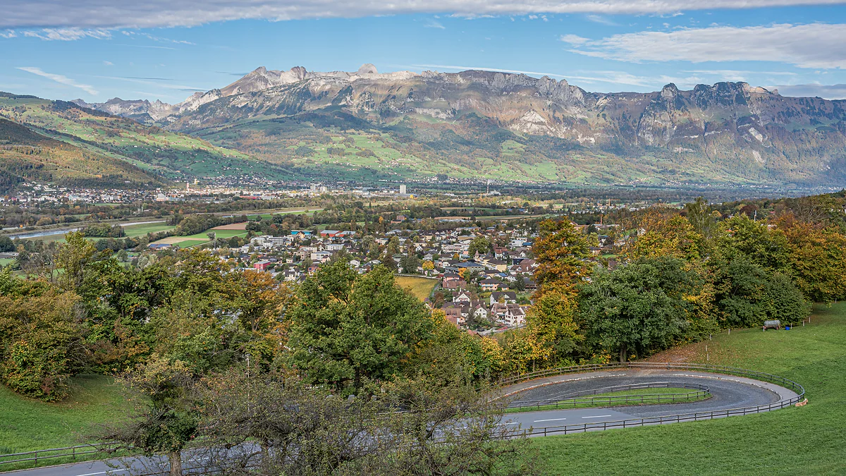
The Rhine valley seen from Vaduz Castle, with the town among autumn trees and the Swiss mountains on the horizon.
Gamprin in figures
| Fact | Figure |
|---|---|
| Residents on 31-12-2025 | 1,773 |
| Area in Liechtenstein | 6.2 km² |
| Rauz Alp, in Vorarlberg (since 1915) | 7.02 km² |
| Parish church (Bendern) | 468 m |
| First recorded | Around 1150, as «Camporin» |
Population and area from the Office of Statistics; the alp and dates from the Historisches Lexikon.
Grossabünt, opening times
| What | When |
|---|---|
| Grounds | Daily, 06:00-23:00 |
| Swimming in the lake | Sunrise to sunset |
| Bistro, June to August | Daily, 09:00-20:00 |
| Bistro, April, May and to mid-September | Wednesday, Friday, Saturday and Sunday, 12:00-18:00 |
Gamprin municipality. The bistro shuts in wet weather and the lake is drained every autumn for maintenance.
Test yourself
True or false?
0/4 Pick before you peek.
-
Gamprin owns an alp in Austria that's bigger than the municipality itself.
See the answer
True. Rauz Alp in Vorarlberg has belonged to it since 1915 and measures 7.02 km². The municipality covers 6.2 km².
-
Gamprin's church is in Gamprin village.
See the answer
False. The parish church is in the hamlet of Bendern, up on the hill. Gamprin has the town hall and school.
-
The Gampriner Seelein is a glacial lake thousands of years old.
See the answer
False. It formed in autumn 1927, when the swollen Rhine scoured out part of the plain between the Eschnerberg and the river.
-
The Grossabünt bathing lake is cleaned with chemicals.
See the answer
False. The municipality explains that the water is filtered naturally through a planted regeneration pond, with no chemicals added.
- Residents on 31-12-2025
- 1,773
- Rauz Alp, bigger than the municipality itself
- 7.02 km²
- Swimming area at the Grossabünt
- 3,500 m²
- Flood that created the Seelein
- 1927
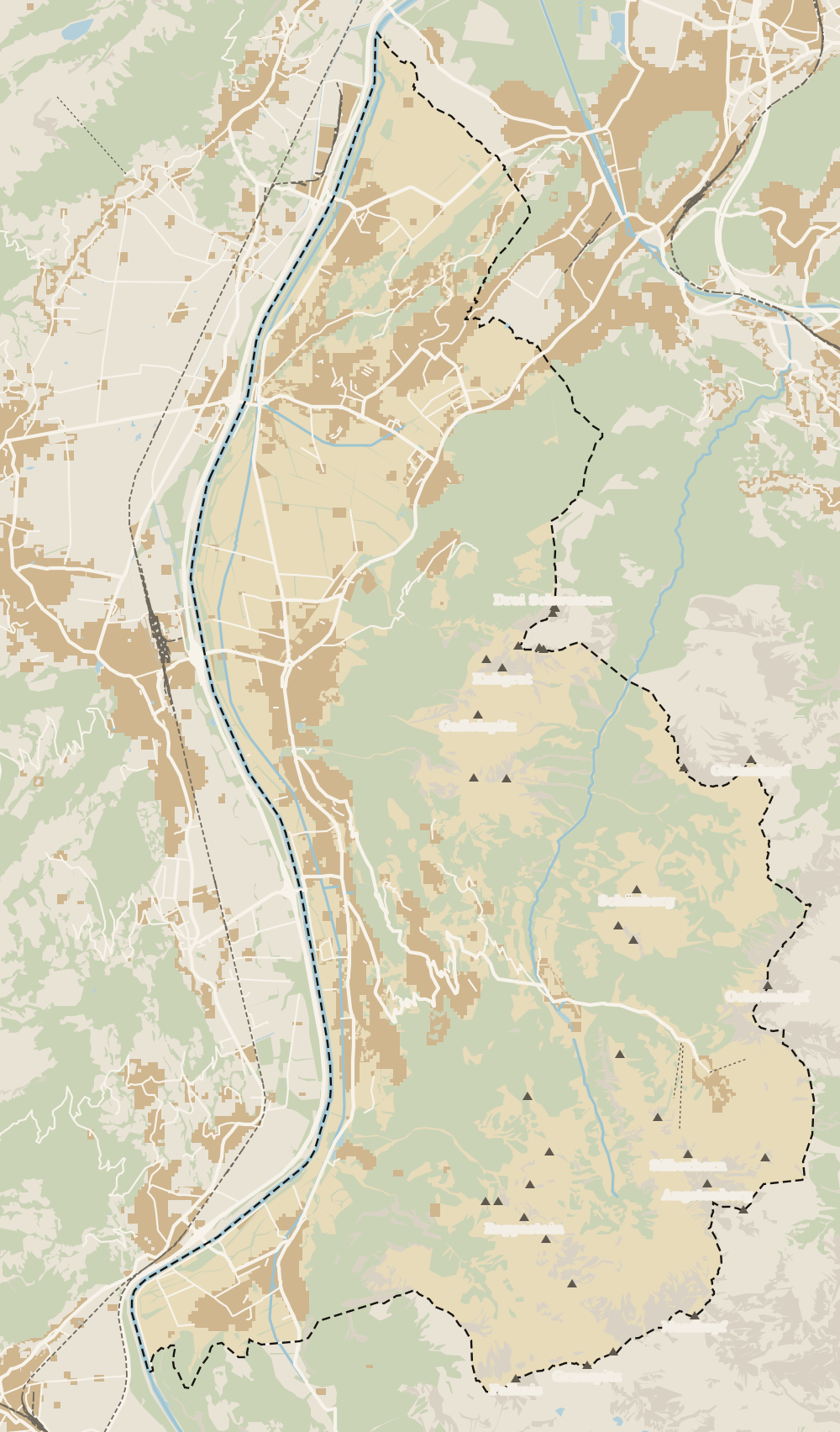
Map
Where Gamprin is
The dashed line is the border: Switzerland across the Rhine, Austria to the north and east. Every number opens its guide.
What to see
What to see in Gamprin
0 of 168 Liechtenstein guides
Your next stamp
- Lakes
- Swimming pools
- Stage 4: Nendeln - Ruggell
- With kids
- Mountain huts
- Triesenberg
- Where to stay
- Mountains
- Things to do
- One day
- Two days
- Municipalities
- Oberland
- Unterland
- Map
- Vaduz
- Städtle
- Mitteldorf
- Vaduz Castle
- Vaduz Cathedral
- Parliament
- Government Building
- Vaduz Town Hall
- Red House
- Prince's Winery
- Old Rhine Bridge
- Schaan
- Schalun Castle Ruin
- Balzers
- Citytrain
- Triesen
- Walser Museum
- Planken
- Gutenberg Castle
- The Rhine
- Schaan Roman fort
- Dux
- St Mamertus chapel
- Lawena valley
- Mäls
- DoMuS
- TAK Theatre
- Castles
- Churches and chapels
- Viewpoints
- Museums
- Kunstmuseum
- Hilti Art Foundation
- Pfälzerhütte
- Gafadura hut
- National Museum
- Treasure Chamber
- Postage Stamp Museum
- Kunstraum Engländerbau
- Eschen
- Masescha
- Gaflei
- Nendeln
- Mauren
- Silum
- Rotenboden
- Schaanwald
- Wangerberg
- Bendern
- Steg
- Ruggell
- Samina valley
- Schellenberg Farmhouse Museum
- Cross-country skiing at Steg
- Küefer-Martis-Huus
- Ruggeller Riet
- Schellenberg
- Hinterschellenberg
- Fürstensteig
- Is it a country?
- Liechtenstein Trail
- Malbun
- Schellenberg castles
- Eschnerberg
- Malbun in summer
- Population
- Stage 1: Balzers - Triesenberg
- Sareis
- Size
- Stage 2: Triesenberg - Vaduz
- Malbun Peace Chapel
- Political system
- Stage 3: Vaduz - Nendeln
- Language
- Skiing in Malbun
- Dialect
- Malbun ski pass
- Stage 5: Ruggell - Schaanwald
- Hotels in Malbun
- Stamps
- Princess Gina Trail
- Hut-to-hut Route 66
- Hiking
- Getting there
- In winter
- Weather
- Airport
- Best time to visit
- In summer
- Events
- Zurich to Liechtenstein
- National day
- Sargans to Vaduz
- Christmas
- Feldkirch to Vaduz
- By train
- Traditions
- Carnival
- Getting around
- Buses
- Funken Sunday
- Alpine cattle drive
- Driving and vignette
- Parking
- Bike hire
- Cycling
- EU and Schengen
- Entry requirements
- Borders and customs
- The prince
- The princely house
- The flag
- The coat of arms
- The national anthem
- History
- Second World War
- No army
- Facts
- Why so rich?
- Banks and tax haven
- Hilti
- Hotels in Vaduz
- False teeth
- Hostel and camping
- Rent the country?
- Where to eat
- Restaurants in Vaduz
- Swiss invasions
- Bars and nightlife
- Food
- Käsknöpfle
- Wine
- Casinos
- Adventure Pass
- Rainy days
- Guided tours
- Tourist office
- Day trips
- Passport stamp
- Music festivals
- Phone and roaming
- Currency and payments
- Prices and budget
- Tipping
- Plugs and sockets
- Tap water
- Opening hours
- Public holidays
- Safety
- Accessibility
- With a dog
- Shopping and souvenirs
Frequently asked questions
What is there to see in Gamprin, Liechtenstein?
Bendern's church hill, where allegiance was sworn to the Prince in 1699, the Gampriner Seelein and the Grossabünt bathing lake. For young cyclists there's the mountain-bike trail in Kratzera forest.
Where can you swim in a lake in Liechtenstein?
At the Grossabünt in Gamprin, a natural bathing lake filled with groundwater of drinking quality, with a diving bay and a shallow area. There's no lifeguard and swimming is allowed from sunrise to sunset.
Can you swim in the Gampriner Seelein?
It's been a nature reserve since 1961 and I haven't found anything official inviting you to swim there. For a dip, the Grossabünt is less than a kilometre away.
Are Gamprin and Bendern the same place?
They're one municipality. Gamprin is the village, with the town hall and school, and Bendern is the hamlet with the parish church.
What does Gamprin mean?
The Historisches Lexikon traces it to the Romansh camp Rin, the field by the Rhine. It was first recorded around 1150 as «Camporin».
How many people live in Gamprin?
1,773 residents on 31 December 2025. In 2025 it was the only municipality to lose population, down 0.6% on the Office of Statistics' provisional figures.
By
Tourism graduate with a master’s in Tourism Management and Planning from the University of Málaga, who has travelled across Europe. He writes every guide from official sources and his own judgement.
Published on . Facts checked on .
Sources
Photos: A.Savin (FAL); A.Savin (FAL), via Wikimedia Commons.