400 km of paths in a 160 km² country
Hiking in Liechtenstein, the walks I'd choose and how to pick yours
Liechtenstein has around 400 km of waymarked footpaths in 160 km², according to the tourist board, and mountains up to about 2,600 m. The headline hikes are the Fürstensteig with the Drei Schwestern, the Princess Gina Trail from Malbun, the Naafkopf, the Schönberg and the three-day Route 66, and to cross the country on foot there's the Liechtenstein Trail, about 75 km long.
In 30 seconds
Full read: 4 min
- Liechtenstein has about 400 km of waymarked footpaths in 160 km².
- The headline hikes are the Fürstensteig, the Princess Gina Trail, the Naafkopf, the Schönberg and Route 66.
- The Liechtenstein Trail crosses the country in about 75 km and five stages.
- The mountain huts take cash only.
With one day and good legs, I'd do the Princess Gina Trail from Malbun. With a steady head and no rush, the Fürstensteig. And with children, Malbun's swing trail, which is short and sticks in the memory.

Before you go
What I would keep in mind
-
01 Most beautiful
A lot of mountain in very little country
The tourist board boasts of 400 km of paths in 160 km² and calls it Europe's densest network. I couldn't verify the second claim, but you feel the first in every valley.
-
02 Getting there
Every hike starts with a bus
Bus 21 climbs to Malbun and bus 22 to Gaflei, the two mountain bases, and in summer both carry bikes. Half an hour and you're above 1,500 m without a car.
Liechtenstein's buses -
03 Money
Cash at the huts
The Pfälzerhütte and the Gafadurahütte only take cash, francs or euros. Don't head up with a card as your only way to pay.
mountain huts in Liechtenstein -
04 My tip
Learn the waymark colours
According to the Alpine Club, yellow marks an ordinary footpath, white-red-white a mountain path and white-blue-white an alpine route. The Fürstensteig is the last kind.
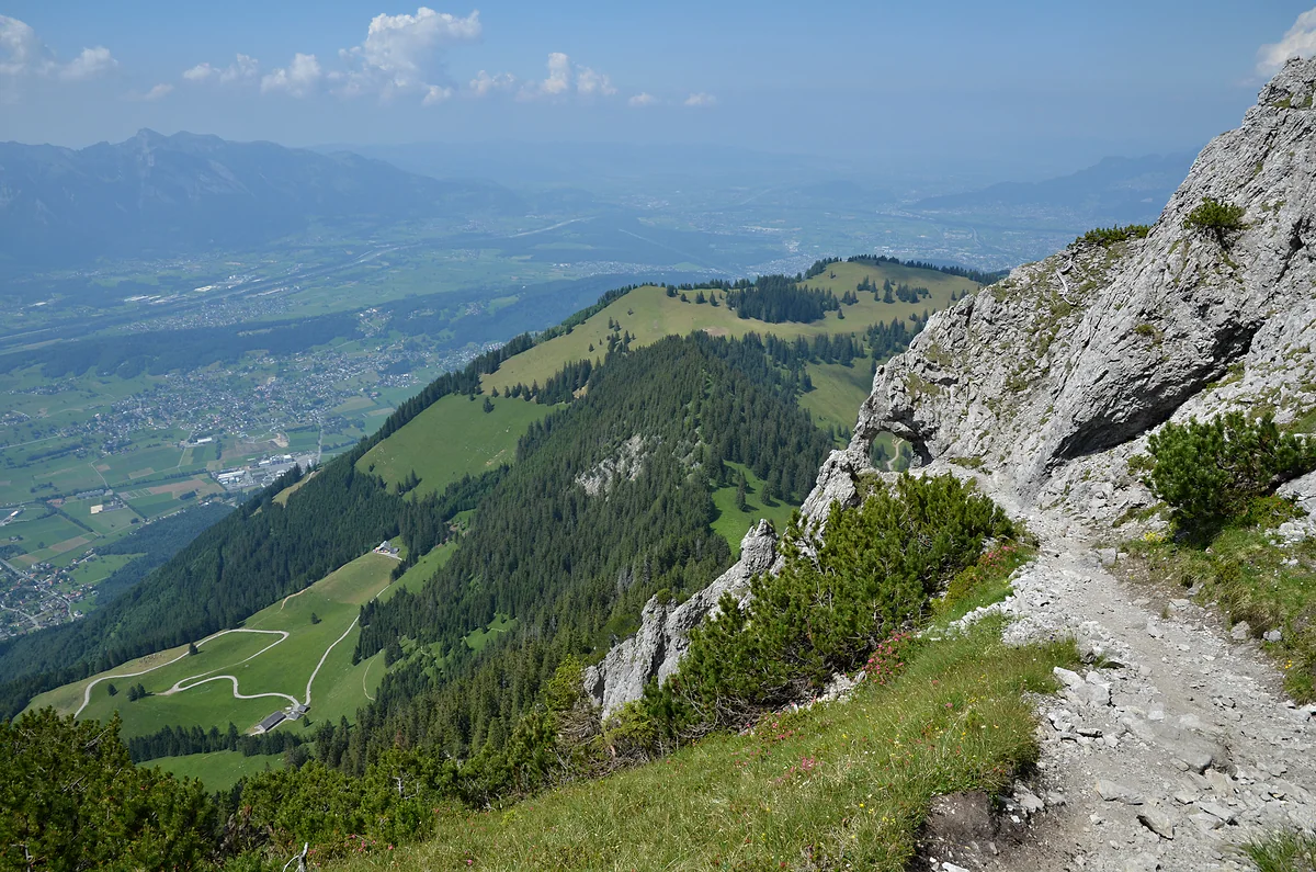
the Fürstensteig and the Drei Schwestern
What I would book
My ranking, scored
The hikes I'd do, in order
My own scores out of 10 for scenery against effort and for how special each is to the country, based on the official route sheets. These aren't reviews of walks I've done myself.
0 of 5 seen
-
Princess Gina Trail
A flowery ridge, the Augstenberg and the Pfälzerhütte in one day from Malbun. The best reward for the effort.
9.4 out of 10
-
Fürstensteig and Drei Schwestern
The country's most dramatic path, hanging above the Rhine valley. Only with a steady head and good weather.
9.3 out of 10
-
Route 66
The two above stitched together over three days hut to hut, with a Naafkopf sunrise.
9.0 out of 10
-
Schönberg
A 2,104 m summit with a gentle climb, says the tourist board. Ideal in June and July, when it's in flower.
8.2 out of 10
-
Liechtenstein Trail
Less mountain, more country, from Balzers to Schaanwald through all eleven municipalities. Doable a stage at a time.
8.0 out of 10
Plenty of people come to Liechtenstein for the passport stamp and leave without realising they’ve been in one of the most walkable corners of the Alps. Half the country is mountain, the buses climb to 1,600 metres and the paths are waymarked with almost Swiss precision. Here’s how the routes stack up and which I’d pick for your level.
A country made for walking
The tourist board talks of 400 km of footpaths across 160 km² and summits of up to about 2,600 metres, and claims the densest network in Europe. I couldn’t check that comparison, so I’ll stick to the figure. To find your way, watch the colours. According to the Alpine Club, the country’s mountaineering club, yellow signs mean an ordinary footpath, red-striped ones a mountain path and blue-striped ones an alpine route, the kind that needs hands and a cool head.
The mountains have two front doors. Malbun, at the head of the high valley, on bus 21, and Gaflei, above Triesenberg, on bus 22. Both routes carry bikes in summer. A quieter third option is the Lawena valley above Triesen, a bowl-shaped alp whose hut stands at 1,525 m.
The five headline hikes
The tourist board singles out five. The Fürstensteig with the Drei Schwestern starts at Gaflei, covers 11.9 km in five and a half hours and crosses protected rock passages above the Rhine valley. The Princess Gina Trail is a loop from Malbun along the Augstenberg ridge and past the Pfälzerhütte, 11.9 km in five hours. The Schönberg, 2,104 metres, is a 12.5 km, four-and-a-half-hour loop that the official site describes as an easy-going climb, with flowers in June and July. The Naafkopf, 2,570 metres, is where three countries meet; in a single day it’s 19 km and eight and a half hours, so most people climb it from the Pfälzerhütte at dawn. And Route 66 joins the first two over three days, hut to hut.
Walking across the whole country
The Liechtenstein Trail is a different beast. It isn’t after summits but after all eleven municipalities, and the tourist board describes it as about 75 km in five stages and two loops, one in Malbun and one in Vaduz. It’s usually walked south to north, from Balzers to Schaanwald, but you can start in any village, and an app called LIstory tells stories along the way. I cover it in my guide to the Liechtenstein Trail.
Easy walks and family routes
If you’re not after climbing, there’s room for you too. The tourist board suggests the ten-swing trail in Malbun, the pushchair-friendly walk from the Gänglesee lake at Steg to the Valüna alp, the Sass path with its little lake and the Sägaweiher loop, with a waterfall, in the Nendeln woods.
Autumn, the season nobody mentions
In September and October I’d head down to the valley. The tourist board suggests five autumn strolls, and three stand out for me. The Historischer Höhenweg runs 16 km along the Eschnerberg in the Unterland, past archaeological sites and in short stages. In Triesen, a path through the Röfiwald leads to the Badegg viewpoint and the remains of the old Vogelsang spa. And the Ruggeller Riet, some 90 hectares of protected fen at the northern tip, is walked on the flat. They’re afternoon walks, with no early start and no anxious glances at the sky.
What should I know before setting off?
Three things. First, money. The Pfälzerhütte and the Gafadurahütte only take cash, and there are no cash machines up there. Second, cows. The tourist board asks walkers to keep well away from cows with calves, keep dogs on a short lead and leave pasture gates as they found them. Third, weather. Snow can linger on the Fürstensteig into late spring, and summer storms roll in fast on a ridge. Fill your bottle before setting off, because tap water in Liechtenstein is safe, although a fountain marked «Kein Trinkwasser» isn’t. If your dog is coming too, the rules for buses and the Sareis chairlift are in Liechtenstein with a dog.
Guides and where to sleep
If you’d rather have company, the tourist board lists mountain guides with their qualifications. Its winter pages name three of them, Nikolaus Büchel, Katharina Link and Thomas Tichy, all qualified as international mountain leaders, which tells you guided walking here is a serious trade. To sleep up high there’s the Pfälzerhütte, the Gafadurahütte and guesthouses such as the MATU at Gaflei or the one on Sareis, all covered in mountain huts. If you’re coming in summer, I round things off in Liechtenstein in summer.
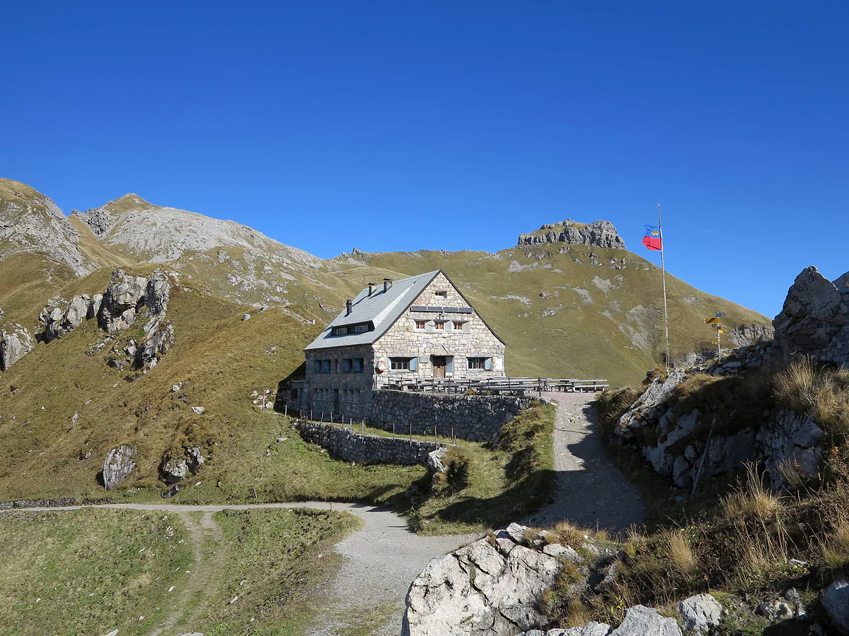
The stone Pfälzerhütte mountain hut on the pass among alpine meadows and rocks, with the Liechtenstein flag.
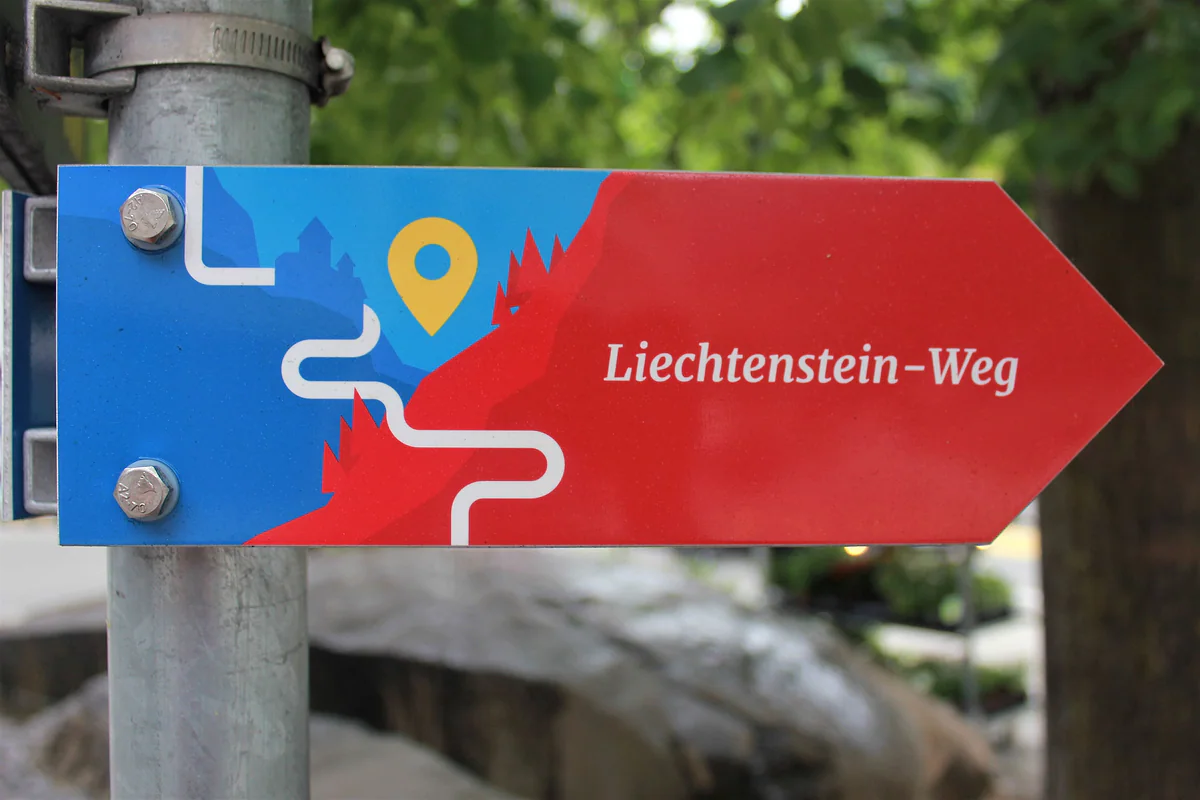
The red and blue signpost of the Liechtenstein-Weg, the trail that runs through all eleven municipalities of the country.
The tourist board's five headline hikes
| Route | Start | Distance | Time | Ascent |
|---|---|---|---|---|
| Fürstensteig and Drei Schwestern | Gaflei | 11.9 km | 5:30 h | 819 m |
| Princess Gina Trail | Malbun | 11.9 km | 5 h | 892 m |
| Schönberg | Malbun | 12.5 km | 4:30 h | 670 m |
| Naafkopf | Valley, from 1,303 m | 19 km | 8:30 h | 1,258 m |
| Route 66, three days | Malbun | 30.3 km | 17 h | 1,833 m |
Liechtenstein Marketing figures from 2026 archive.org copies. Many walkers climb the Naafkopf from the Pfälzerhütte instead of in one long day.
Footpath waymarks
| Colour | Type of path |
|---|---|
| Yellow | Footpath (Wanderweg) |
| White, red and white | Mountain path (Bergwanderweg) |
| White, blue and white | Alpine route (Alpinwanderweg) |
According to the Liechtenstein Alpine Club.
Test yourself
True or false?
0/4 Pick before you peek.
-
Liechtenstein has about 400 km of waymarked footpaths.
See the answer
True. So says the tourist board, which talks of 400 km of paths across the country's 160 km².
-
A white, blue and white waymark means an easy stroll.
See the answer
False. According to the Alpine Club, white-blue-white marks an alpine route, the most demanding category. Yellow is the ordinary footpath.
-
Three countries meet on the summit of the Naafkopf.
See the answer
True. At 2,570 m the borders of Liechtenstein, Switzerland and Austria come together, according to the tourist board.
-
The Liechtenstein Trail can only be started in Balzers.
See the answer
False. The tourist board says it's usually walked south to north but can be started in any municipality.
- Of waymarked paths
- 400 km
- Liechtenstein Trail
- 75 km
- Naafkopf, where three countries meet
- 2,570 m
- Headline hikes from the tourist board
- 5
What to see
What to see in Hiking
0 of 168 Liechtenstein guides
Your next stamp
- Liechtenstein Trail
- Getting around
- Size
- Fürstensteig
- Hut-to-hut Route 66
- Things to do
- Princess Gina Trail
- One day
- Two days
- Municipalities
- Oberland
- Unterland
- Map
- Vaduz
- Städtle
- Mitteldorf
- Vaduz Castle
- Vaduz Cathedral
- Parliament
- Government Building
- Vaduz Town Hall
- Red House
- Prince's Winery
- Old Rhine Bridge
- Schaan
- Schalun Castle Ruin
- Balzers
- Citytrain
- Triesen
- Triesenberg
- Walser Museum
- Planken
- Gutenberg Castle
- The Rhine
- Schaan Roman fort
- Dux
- St Mamertus chapel
- Lawena valley
- Mäls
- DoMuS
- TAK Theatre
- Castles
- Churches and chapels
- Viewpoints
- Mountains
- Museums
- Kunstmuseum
- Mountain huts
- Hilti Art Foundation
- Pfälzerhütte
- Gafadura hut
- National Museum
- Treasure Chamber
- Postage Stamp Museum
- Kunstraum Engländerbau
- Eschen
- Masescha
- Gaflei
- Nendeln
- Mauren
- Silum
- Rotenboden
- Schaanwald
- Gamprin
- Wangerberg
- Bendern
- Steg
- Ruggell
- Samina valley
- Schellenberg Farmhouse Museum
- Cross-country skiing at Steg
- Küefer-Martis-Huus
- Ruggeller Riet
- Schellenberg
- Hinterschellenberg
- Is it a country?
- Malbun
- Schellenberg castles
- Eschnerberg
- Malbun in summer
- Population
- Stage 1: Balzers - Triesenberg
- Lakes
- Sareis
- Stage 2: Triesenberg - Vaduz
- Malbun Peace Chapel
- Political system
- Stage 3: Vaduz - Nendeln
- Swimming pools
- Language
- Skiing in Malbun
- Stage 4: Nendeln - Ruggell
- Dialect
- Malbun ski pass
- Stage 5: Ruggell - Schaanwald
- Hotels in Malbun
- Stamps
- Getting there
- In winter
- Weather
- Airport
- Best time to visit
- In summer
- Events
- With kids
- Zurich to Liechtenstein
- National day
- Sargans to Vaduz
- Christmas
- Feldkirch to Vaduz
- By train
- Traditions
- Carnival
- Buses
- Funken Sunday
- Alpine cattle drive
- Driving and vignette
- Parking
- Bike hire
- Cycling
- EU and Schengen
- Entry requirements
- Borders and customs
- The prince
- The princely house
- The flag
- The coat of arms
- The national anthem
- History
- Second World War
- No army
- Facts
- Why so rich?
- Banks and tax haven
- Where to stay
- Hilti
- Hotels in Vaduz
- False teeth
- Hostel and camping
- Rent the country?
- Where to eat
- Restaurants in Vaduz
- Swiss invasions
- Bars and nightlife
- Food
- Käsknöpfle
- Wine
- Casinos
- Adventure Pass
- Rainy days
- Guided tours
- Tourist office
- Day trips
- Passport stamp
- Music festivals
- Phone and roaming
- Currency and payments
- Prices and budget
- Tipping
- Plugs and sockets
- Tap water
- Opening hours
- Public holidays
- Safety
- Accessibility
- With a dog
- Shopping and souvenirs
Frequently asked questions
What are the best hikes in Liechtenstein?
The tourist board picks five, the Fürstensteig with the Drei Schwestern, the Princess Gina Trail, the Naafkopf, the Schönberg and Route 66. To cross the country there's the Liechtenstein Trail.
Can you hike across Liechtenstein?
Yes, on the Liechtenstein Trail, about 75 km in five stages plus two loops, which the tourist board suggests walking south to north, from Balzers to Schaanwald.
When is the best time for hiking in Liechtenstein?
June to October for the high mountains. The Fürstensteig can hold snow until late spring, and June and July are the flower months. The valley paths work most of the year.
Do you need experience for the Fürstensteig?
Yes. The tourist board recommends it for sure-footed walkers because of its protected rock passages, and the Alpine Club marks it as a white-blue alpine route.
Is there a Liechtenstein hiking map?
The tourist board publishes a footpath map and a free walking brochure, and the Route 66 package includes a 1:25,000 map of the country, collected at the Malbun Center.
Are there easy walks in Liechtenstein?
Yes. For families the tourist board suggests Malbun's swing trail, the pushchair-friendly walk from Steg to the Valüna alp and the Sägaweiher loop in the Nendeln woods.
By
Tourism graduate with a master’s in Tourism Management and Planning from the University of Málaga, who has travelled across Europe. He writes every guide from official sources and his own judgement.
Published on . Facts checked on .
Sources
Photos: Pavel Špindler (CC BY 3.0); 1-Byte (CC BY-SA 4.0); Pakeha (CC BY-SA 4.0), via Wikimedia Commons.